
The Allegheny Trail is a 311-mile north-south trail with its northern terminus on the Mason-Dixon Line at the Pennsylvania-West Virginia border near Bruceton Mills. It winds its way south until it meets the Appalachian Trail on Peters Mountain at the Virginia-West Virginia border. Volunteer workers (with crucial assistance from U.S. Forest Service and State Park staff) maintain all sections of the Allegheny Trail, which is marked by 2″x 6″ yellow blazes.
20% off for our Hiking Season Kick-off SALE! The Mid State Trail is now $8.99.
30% off for our Small Business Saturday SALE! The Mid State Trail is now $7.99.
West Virginia, Allegheny Trail
4.8 ★★★★★ | 17K+ Reviews
Allegheny Trail
311 miles • West Virginia
Official App of The West Virginia Scenic Trails Association
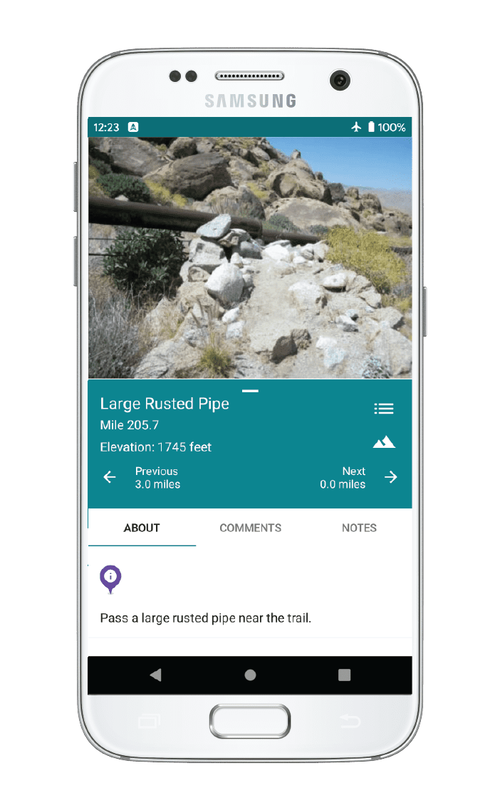
Download our guide to access the Allegheny Trail map, tracks, waypoints, and comments! The Allegheny Trail is a 311-mile north-south trail with its northern terminus on the Mason-Dixon Line at the Pennsylvania-West Virginia border near Bruceton Mills. It winds its way south until it meets the Appalachian Trail on Peters Mountain at the Virginia-West Virginia border. Volunteer workers (with crucial assistance from U.S. Forest Service and State Park staff) maintain all sections of the Allegheny Trail, which is marked by 2"x 6" yellow blazes.
$12.99 full guide
$12.99 full guide


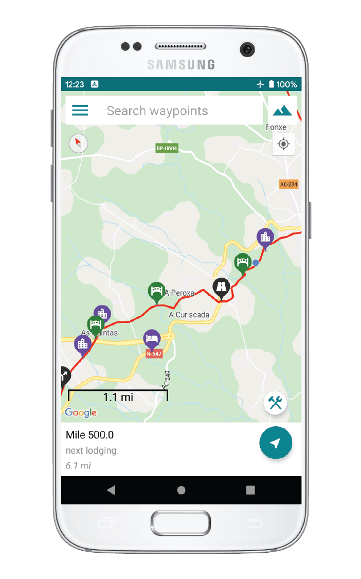
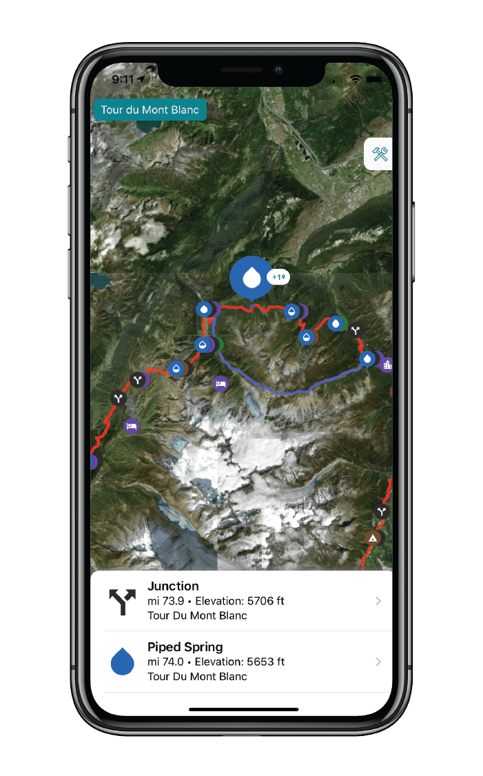
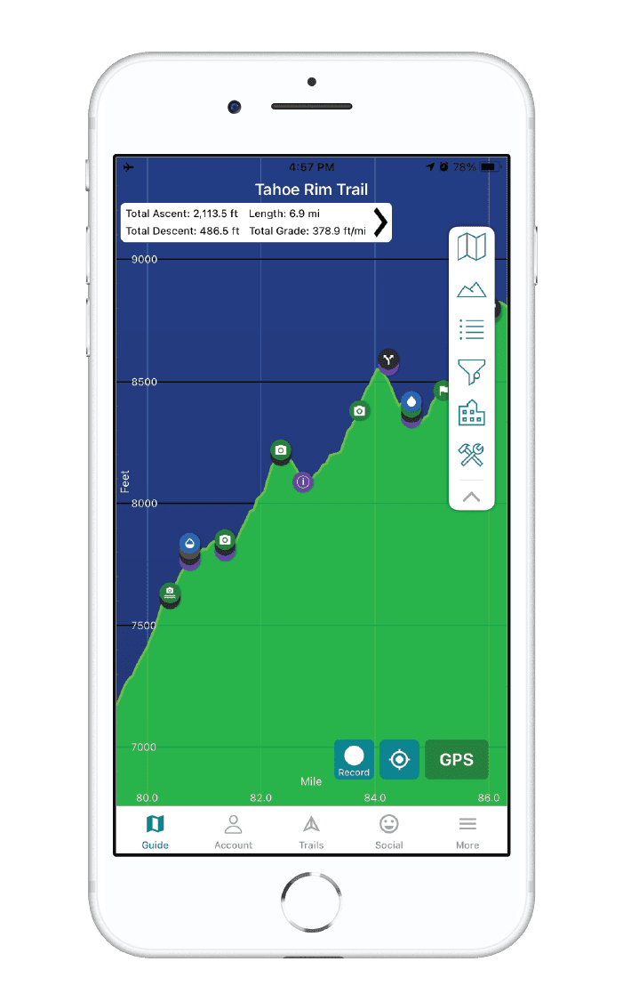
Allegheny Trail Map


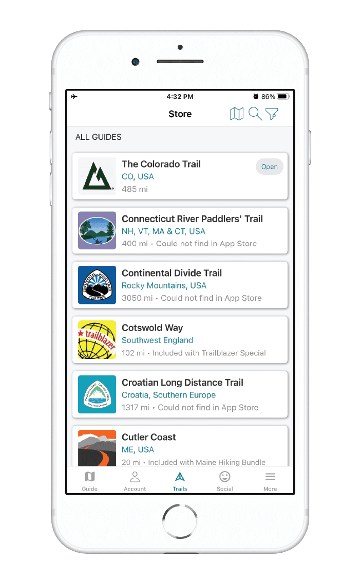
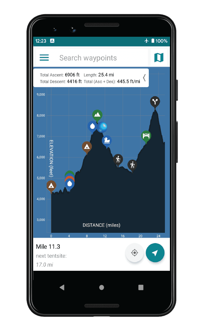
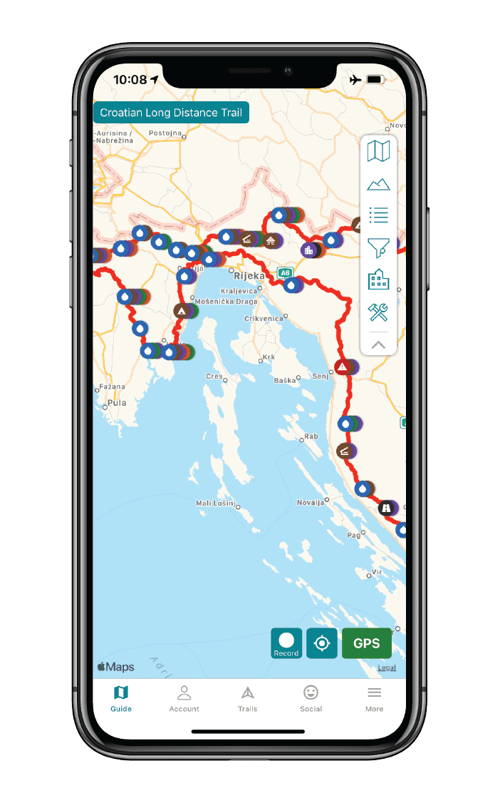
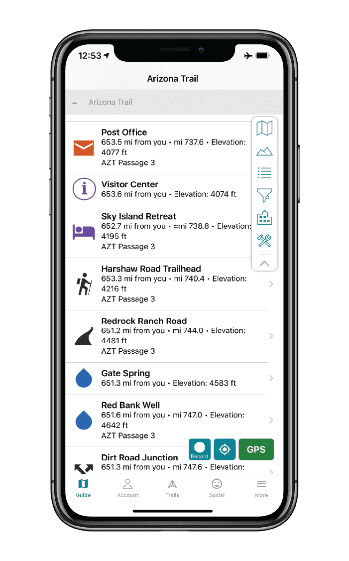
How can I get it?
The Allegheny Trail map is available as an in-app purchase in our Guthook Guides app, a free download from the Apple App Store or the Google Play Store.
Our iOS and Android apps do differ slightly in their appearance. However, the majority of their features remain the same, and they access the same trail guide data.
The Allegheny Trail is a 311-mile north-south trail with its northern terminus on the Mason-Dixon Line at the Pennsylvania-West Virginia border near Bruceton Mills. It winds its way south until it meets the Appalachian Trail on Peters Mountain at the Virginia-West Virginia border. Volunteer workers (with crucial assistance from U.S. Forest Service and State Park staff) maintain all sections of the Allegheny Trail, which is marked by 2″x 6″ yellow blazes.
$12.99
Cheers to giving back! Part of your purchase of the Allegheny Trail goes to support the The West Virginia Scenic Trails Association to preserve and maintain the trail.


Hike more.
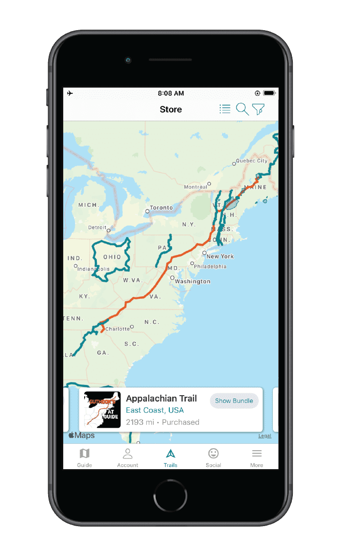
Check out some of the other trail guides we offer!
About our partner
West Virginia Scenic Trails Association
West Virginia Scenic Trails Association (WVSTA) is an all-volunteer, nonprofit organization serving the outdoor community through its stewardship and development of the Allegheny Trail and the Mary Draper Ingles Trail. WVSTA works in partnership and cooperation with state and federal land managers, private landowners, and others to build, maintain, and promote the 311-mile Allegheny Trail, which runs from the Mason-Dixon line at the PA border through the Allegheny Highlands of WV and VA to meet the Appalachian Trail atop beautiful Peters Mountain. Through its stewardship of the Allegheny Trail, WVSTA furthers the conservation of wild lands and wildlife and protects areas of natural beauty and historic interest.
WVSTA’s values are respect of land manager and landowner interests; adding value to the community; access to natural beauty, wildlife, and economic history; human connection to the land, flora, and fauna; sustainability and sound principles of conservation; and inclusiveness by welcoming all who desire to participate.
Atlas Guides has partnered with the West Virginia Scenic Trails Association to create, improve, and update the official Allegheny Trail app.