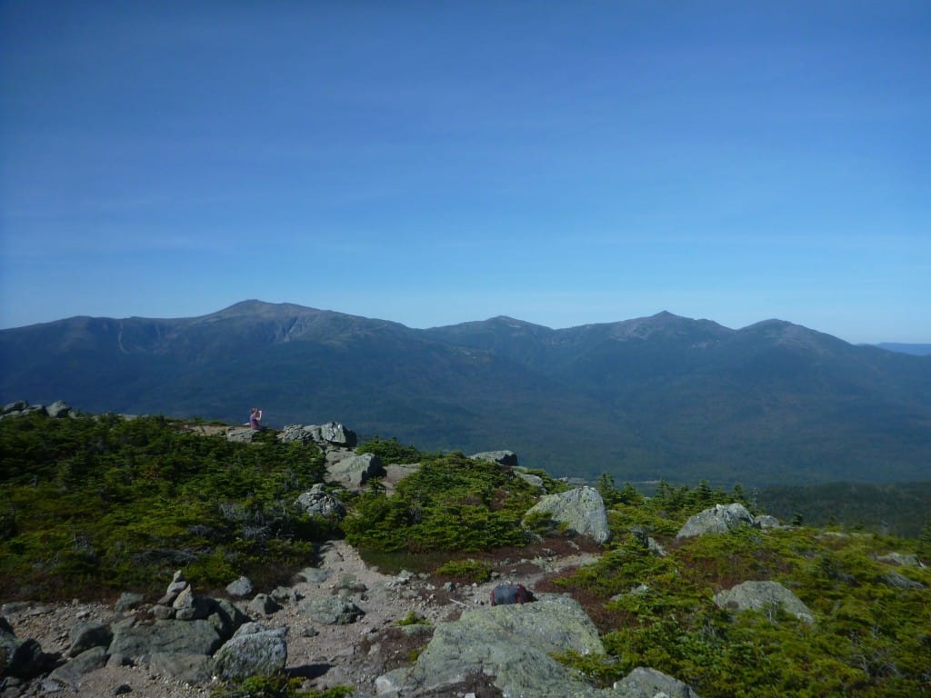
Mount Tom & Mount Field
Planning an adventure? Check out our popular trail guides! 4.8 stars (17K+ ratings)
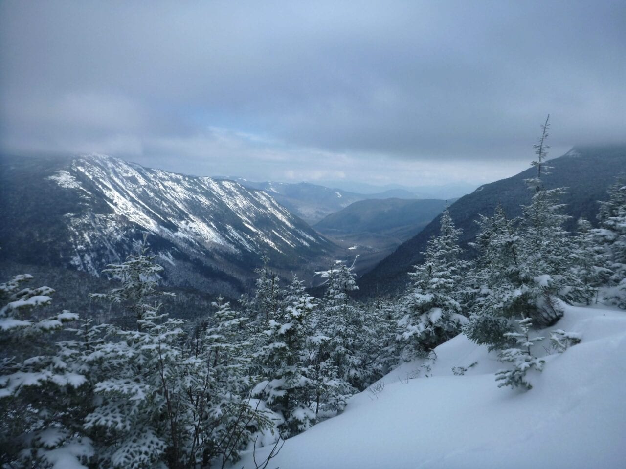
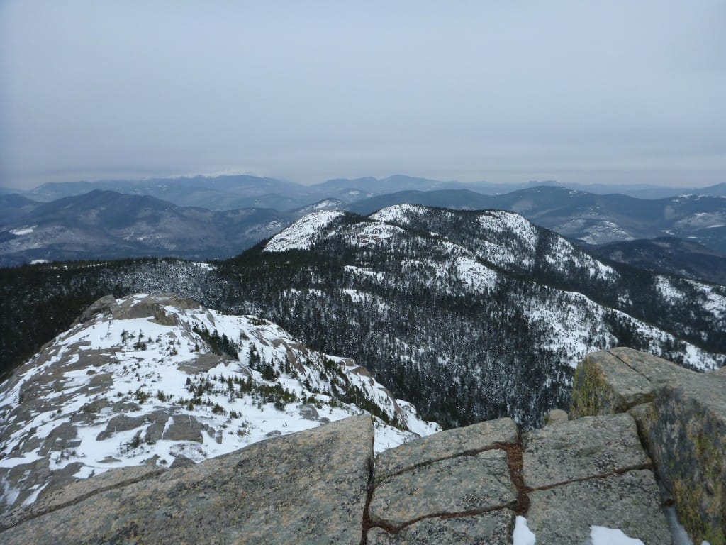
Looking down Crawford Notch from Mt. Avalon.
Photo by Ryan Linn
Mount Tom & Mount Field
For Sunday’s hike, Siren and I headed to Crawford Notch and the Mt Willey Range. Siren has been living deep in the mountains of western New Hampshire, checking off 4000 Footers in the White Mountains, one snow-covered trip at a time.
Ryan Linn Trip Report 02/24/2015
Ryan Linn
Trip Report
02/24/2015
For Sunday’s hike, Siren and I headed to Crawford Notch and the Mt Willey Range. Siren has been living deep in the mountains of western New Hampshire for the winter, before she heads west to hike the Pacific Crest Trail (which you’ll be able to read about at her blog!).
In the meantime, she’s checking off 4000 Footers in the White Mountains, one snow-covered trip at a time.
It’s more snow, now, than tree…
Photo by Ryan Linn
Such smooth ground cover, it’s like walking on clouds.
Photo by Ryan Linn
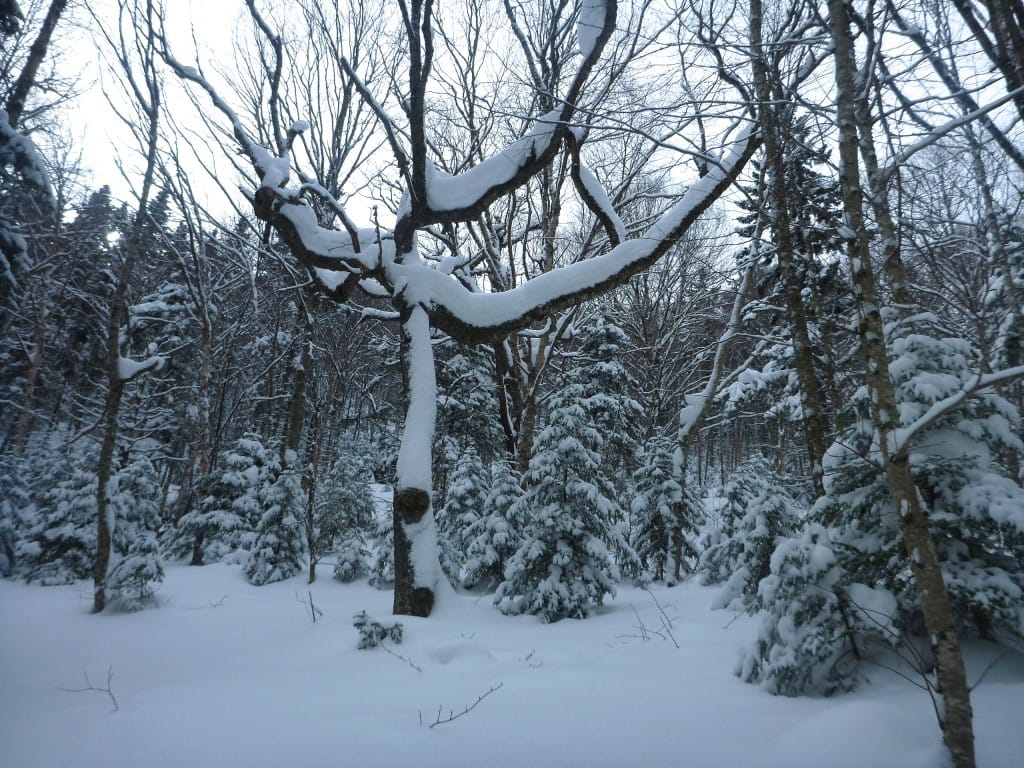
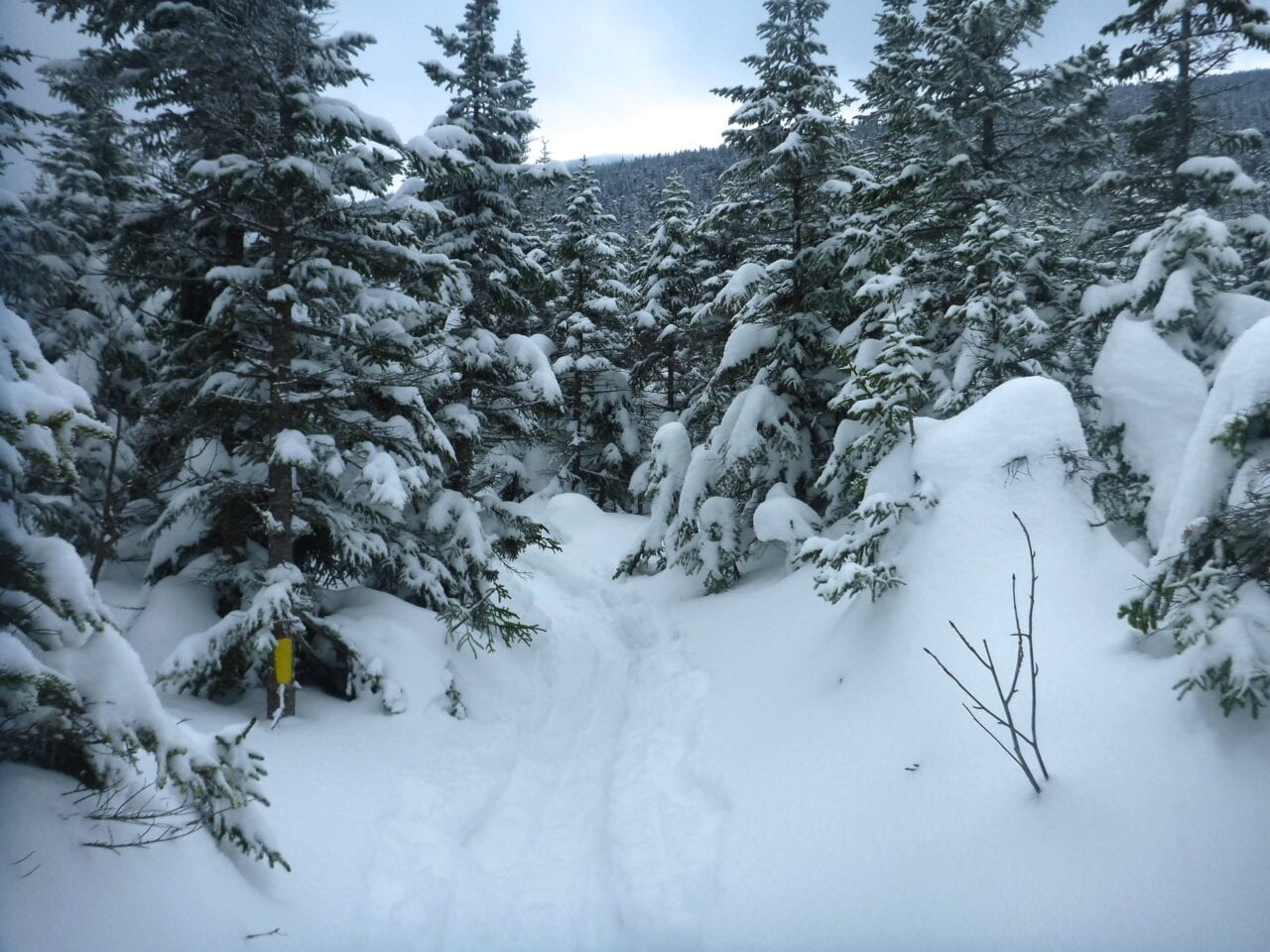
Another three to six inches had fallen in the mountains overnight, giving us yet more deep powder to trudge through right out of the parking lot, and coating the trees so thickly that they often resembled strange creatures from a Tim Burton film.
I guess there had been relatively little wind around there recently, because many trees had tall snow piles balanced precariously on top of long branches. Occasionally a brush of a backpack on a low-hanging branch would send snow falling from the trees in such large dumps that our entire snowshoe track would be obliterated.
I can’t remember the last time I had such wonderful snow conditions in the White Mountains.
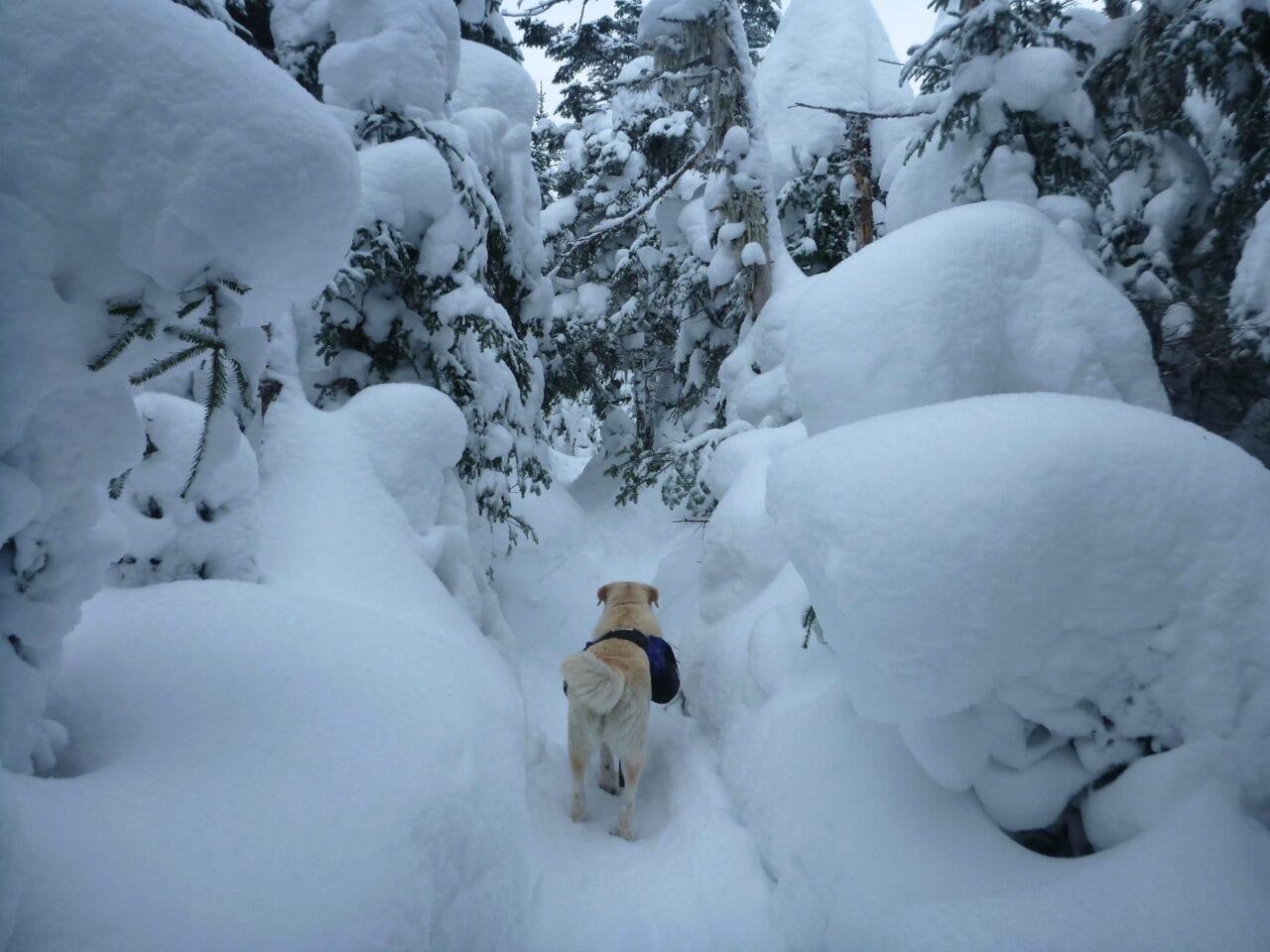
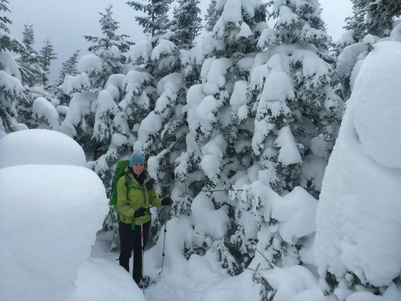
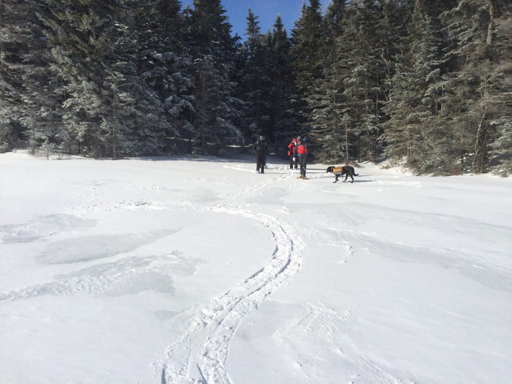
Foster the Mountain Dog, through the marshmallow forest.
Photo by Ryan Linn
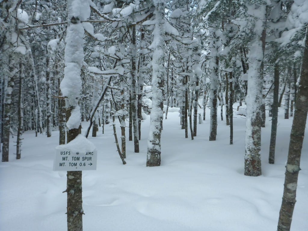
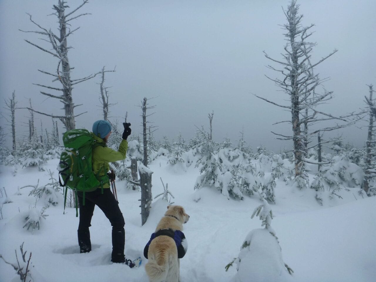
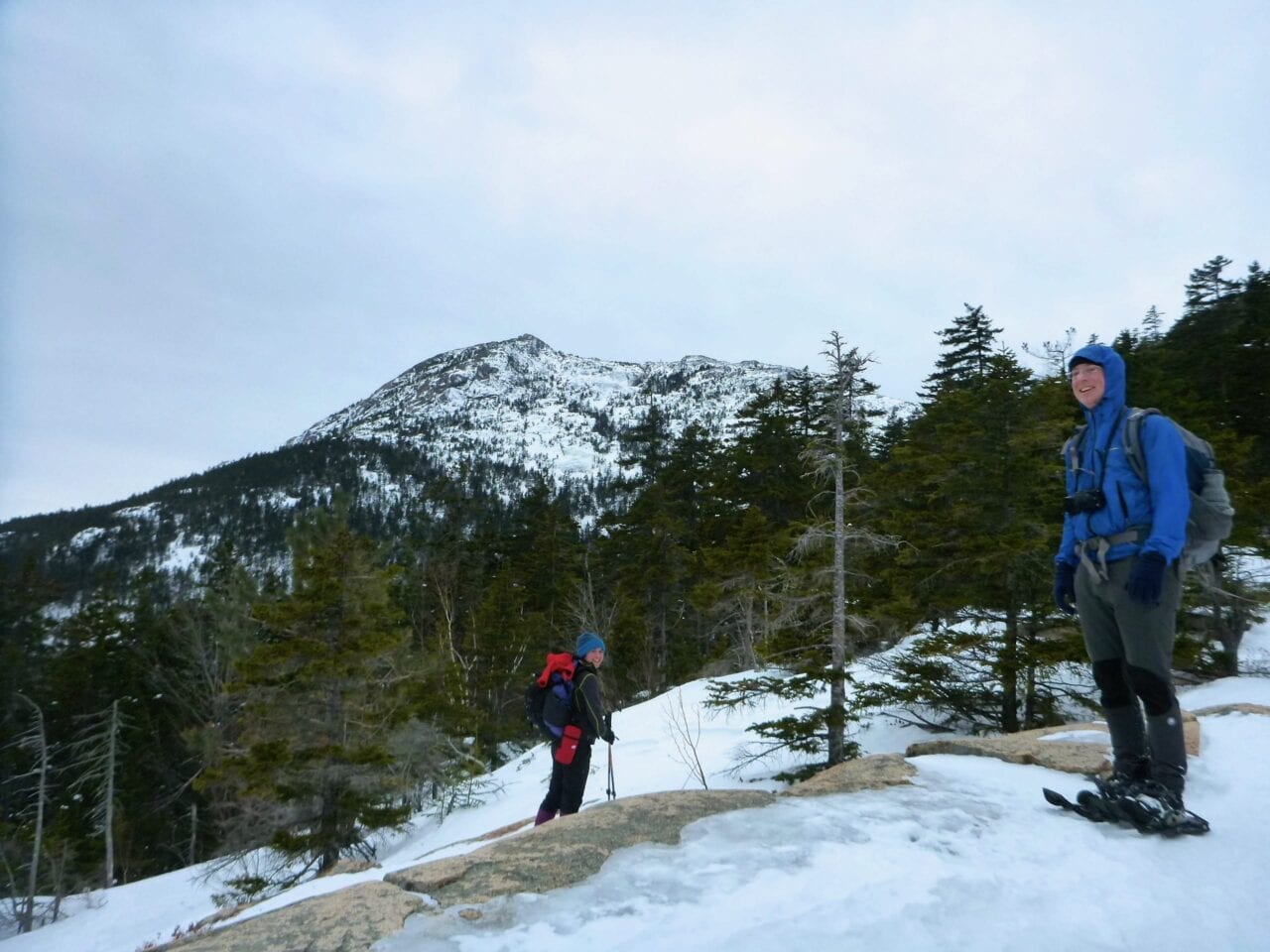
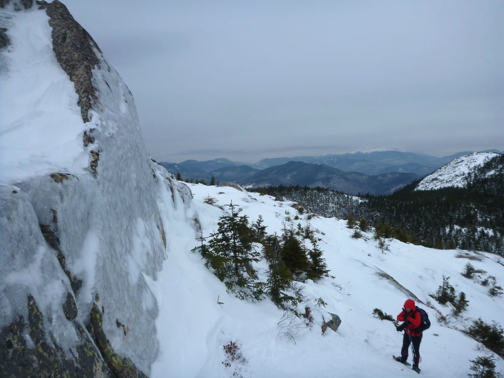
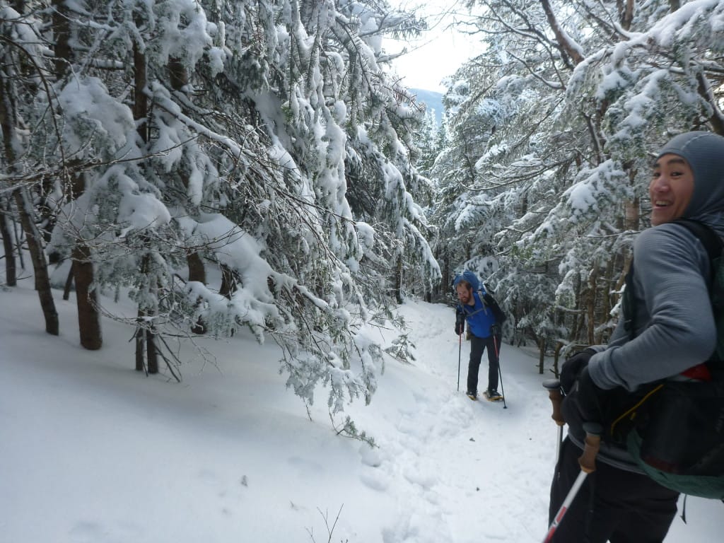
The climb to Mount Tom, the northernmost of the three peaks of the Willey Range, is a mellow hike by local standards, but we saw no one until we neared the summit. Signs and blazes on the trees were set low to the ground, giving a good impression of the snow’s depth, but otherwise there was little sign of humanity.
Just the way I like it.
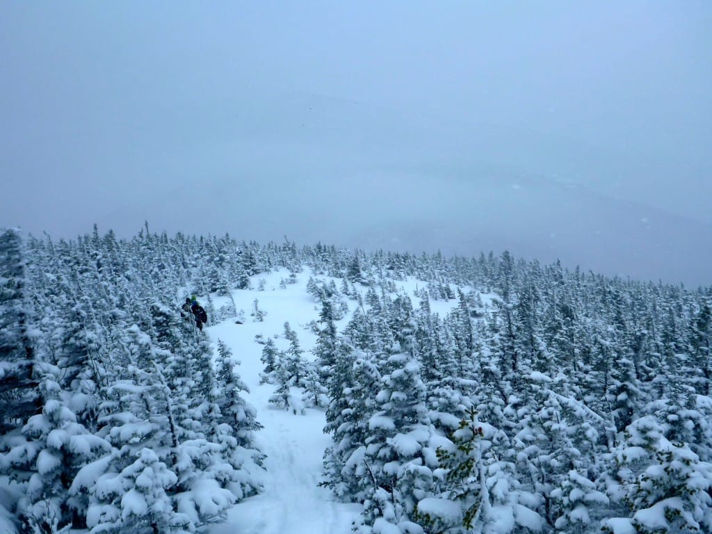
As we traversed between Mount Tom and Mount Field, the snow covering the trees became denser, like we were walking through a garden of giant marshmallows.
With the corridor of the trail mostly below our feet, the marshmallow trees squeezed into the trail much tighter than one would be used to in summer, and breaking trail in the virtually untouched ground cover slowed us to a fairly slow pace. But there’s nothing to complain about in that.
This was some of the most beautiful hiking I’ve had in a long time. With the mountains in the clouds, we could focus on closer views of snow mounds.
Siren threads the needle through precariously perched snow piles.
Photo by Ryan Linn
On Mount Tom, walking in the clouds.
Photo by Ryan Linn
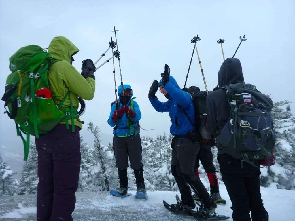
Atop Mount Field, the sky cleared a little bit and we ran into a few other hikers. For such a nice day on a fairly popular mountain, I was surprised to see so few people on the trail, but certainly not disappointed.
There’s something of an enchanted forest feel to the mountain when it’s so quiet and buried like this. We may have never been more than three miles from the nearest road, but it never felt like we were anywhere near civilization.
On the descent. Notice the height of the blaze, which is normally about eye-level.
Photo by Ryan Linn
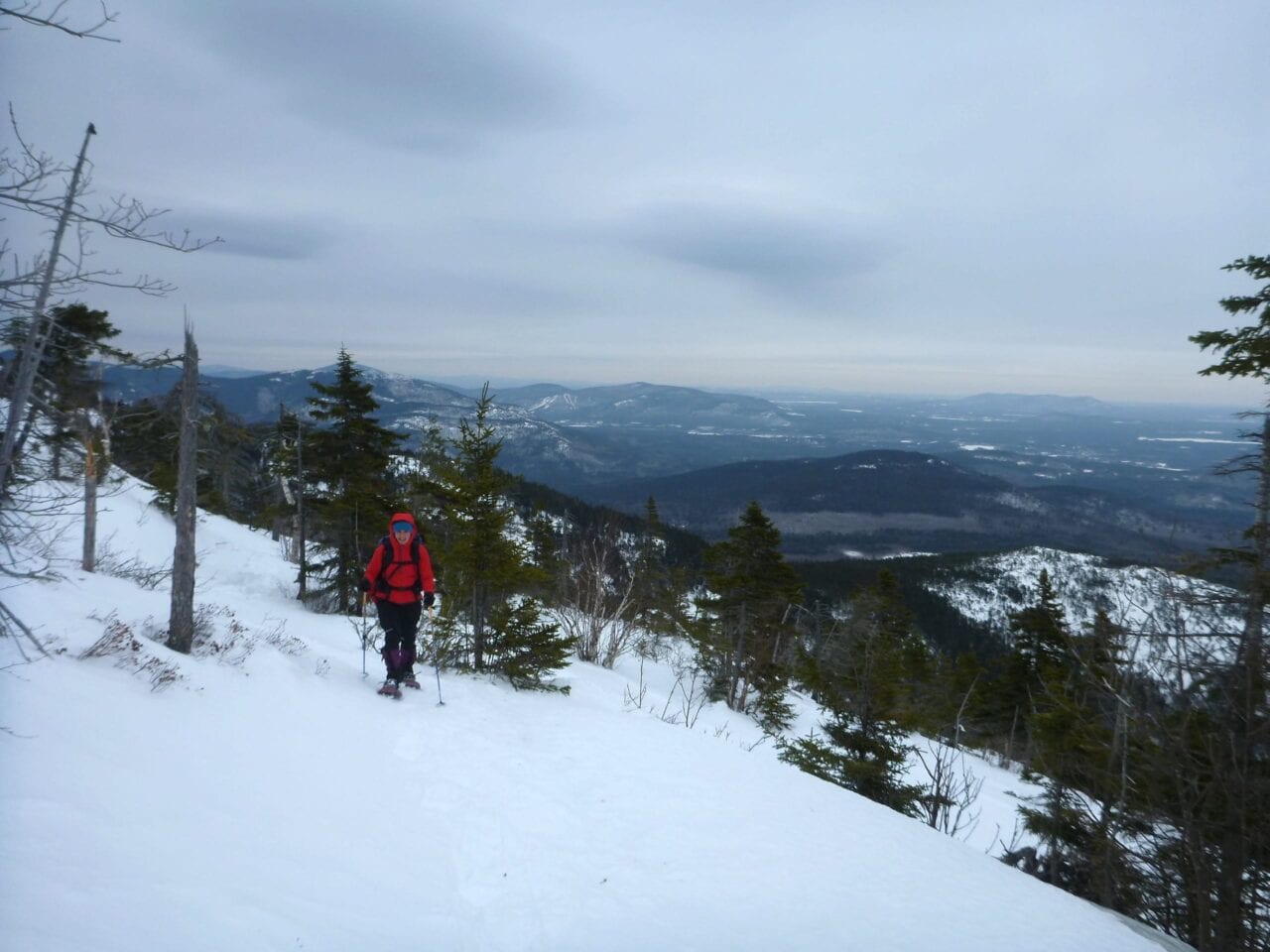
After Mt Field, we decided that two peaks were good enough for the day (it was a long drive back for each of us), and so we descended along the Avalon Trail, with a brief stop for the only views of the day on Mt Avalon. Though it’s the shortest peak we hit that day, I often get the best views from there because it is short enough to keep its head out of the clouds, unlike the higher peaks of the range.
As an added bonus, the steepness of the trail heading down allowed for some long and exciting butt-sledding– the icing on an already wonderful cake of a day.
Want to keep up with all that’s going on at Atlas Guides? Sign up for our newsletter!
Read more!
Check out some related blog posts!
Get our trail guide for this area!
White Mountain National Forest
White Mountain National Forest is home to New Hampshire’s highest peaks and over a thousand miles of hiking trails!
250+ miles of trail (400 km) $29.99 full guide
Presidential Range, White Mountain National Forest, New Hampshire
Photo by Ryan Linn
Presidential Range, White Mountain National Forest, New Hampshire
Photo by Ryan Linn
White Mountain National Forest
White Mountain National Forest is home to New Hampshire’s highest peaks and over a thousand miles of hiking trails!
250+ miles of trail (400 km)
$29.99 full guide
Get our trail guide for this area!
About the Author

Ryan Linn
Ryan is also known as “Guthook”, which is where our apps get their name. Already an avid hiker, he hiked the Appalachian Trail, New England Trail, and Pacific Crest Trail before joining forces with Paul to create the Guthook Guides apps. Ryan handles iOS development for our apps from his office in Maine, and usually runs away to the forests and mountains throughout New England. He also volunteers with the Maine Appalachian Trail Club and the Natural Resources Council of Maine. Baxter State Park in Maine is his happy place.
Mt. Chocorua
Planning an adventure? Check out our popular trail guides! 4.8 stars (17K+ ratings)
From the summit, looking north to the Presidential Range and the Carter-Moriah Range.
Photo by Ryan Linn
Mt. Chocorua
Last weekend had much better conditions than the previous one, so I tried to make up for the few days I’d taken off in the poorer conditions by doing two great day hikes. The first was a late start to the iconic (and difficult to pronounce) Mt. Chocorua.
Ryan Linn Trip Report 02/23/2015
Ryan Linn
Trip Report
02/23/2015
Last weekend had much better conditions than the previous one, so I tried to make up for the few days I’d taken off in the poorer conditions by doing two great day hikes. The first was a late start to the iconic (and difficult to pronounce) Mt Chocorua.
Chocorua is one of the southernmost peaks in the White Mountains, and not particularly tall at only 3500 feet, but it has one of the most distinctive shapes in the area, with a snaggle-tooth rocky peak jutting up from the ridge. That rocky peak, battered by high winds and totally exposed, is similar to many much higher summits, which makes it a great place for epic views and some exciting scrambles.
The first open ledge with a clear view to the summit.
Photo by Ryan Linn
Hiker Box, Badass, Siren and I set out late in the morning on the Piper Trail, which is one of the more popular trails up the mountain. For winter, the trailhead isn’t plowed, but an old couple who share a driveway with the trailhead allow hikers to park in their yard for $3 per car.
I’m happy to pay the small price, since they’re friendly folks and seem perpetually amused by the crazy people walking up the mountain behind their home.
Despite the clearly broken-out trail, the low temperatures and frequent powdery snow from this winter kept the ground soft, making snowshoes a must for the entire ascent.
In most winters, microspikes would have been more than sufficient, but they work best after a few freeze/thaw cycles turn the packed trail into something between ice and snow. There hasn’t been any thawing this winter, which is just the way I like it.
Arriving at the tree line, with North Conway in the background (Cranmore Ski Area is an easily visible landmark).
Photo by Ryan Linn
Walking through the woods for most of the approach, we could see the jagged summit through the trees most of the way. The sky was mostly overcast, but once we broke above tree line the clouds proved to be just high enough to allow some grey views of several mountain ranges, from the Sandwich Range to the Presidentials.
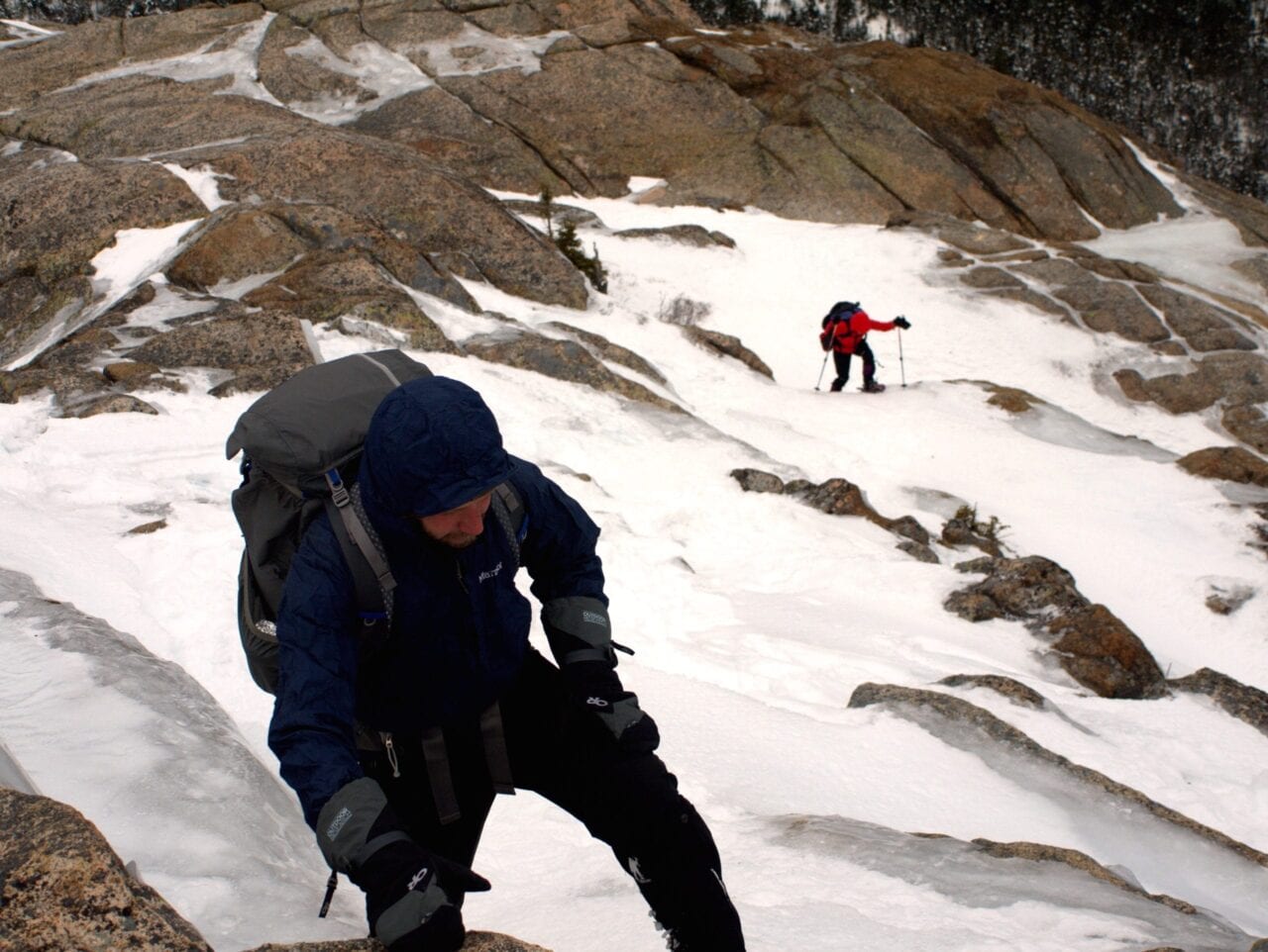
The last half mile to the summit is entirely exposed ridgeline, walking on rock and ice. We probably should have switched to microspikes or crampons for this section, but rugged snowshoes worked well enough if we slowed down and took care in our footing.
There were plenty of other hikers out this day, though no one spent more than a few minutes getting buffeted by wind on the summit.
We snapped a few pictures, then booked it down the trail for dinner at the Yankee Smokehouse in West Ossipee. It was a late night once we included the drive back from the trail, but even with a 11 AM start on the trail, we managed not to hike in the dark at all. A great start to a great weekend!
Beginning the walk along the cliffs and ledges near the summit.
Photo by Ryan Linn
Want to keep up with all that’s going on at Atlas Guides? Sign up for our newsletter!
Read more!
Check out some related blog posts!
Get our trail guide for this area!
White Mountain National Forest
White Mountain National Forest is home to New Hampshire’s highest peaks and over a thousand miles of hiking trails!
250+ miles of trail (400 km) $29.99 full guide
Presidential Range, White Mountain National Forest, New Hampshire
Photo by Ryan Linn
Presidential Range, White Mountain National Forest, New Hampshire
Photo by Ryan Linn
White Mountain National Forest
White Mountain National Forest is home to New Hampshire’s highest peaks and over a thousand miles of hiking trails!
250+ miles of trail (400 km)
$29.99 full guide
Get our trail guide for this area!
About the Author
Ryan Linn
Ryan is also known as “Guthook”, which is where our apps get their name. Already an avid hiker, he hiked the Appalachian Trail, New England Trail, and Pacific Crest Trail before joining forces with Paul to create the Guthook Guides apps. Ryan handles iOS development for our apps from his office in Maine, and usually runs away to the forests and mountains throughout New England. He also volunteers with the Maine Appalachian Trail Club and the Natural Resources Council of Maine. Baxter State Park in Maine is his happy place.
Mt. Moriah
Planning an adventure? Check out our popular trail guides! 4.8 stars (17K+ ratings)
Descending into the ice and fog.
Photo by Ryan Linn
Mt. Moriah
Another week of heavy snow in New England meant the mountains were ripe for exploration. My friend, Hikerbox, had one 4000 Footer left on his peakbagging list before he heads out west, so he proposed an overnight hike to Mt Moriah for last weekend.
Ryan Linn Trip Report 02/10/2015
Ryan Linn
Trip Report
02/10/2015
Another week of heavy snow in New England meant the mountains were ripe for exploration. My friend, Hikerbox, had one 4000 Footer left on his peakbagging list before he heads out west, so he proposed an overnight hike to Mt Moriah for last weekend. Philip and I gladly joined in for the opportunity to do some alpine snow camping.
Philip starts the day with a climb into the new powder.
Photo by Ryan Linn
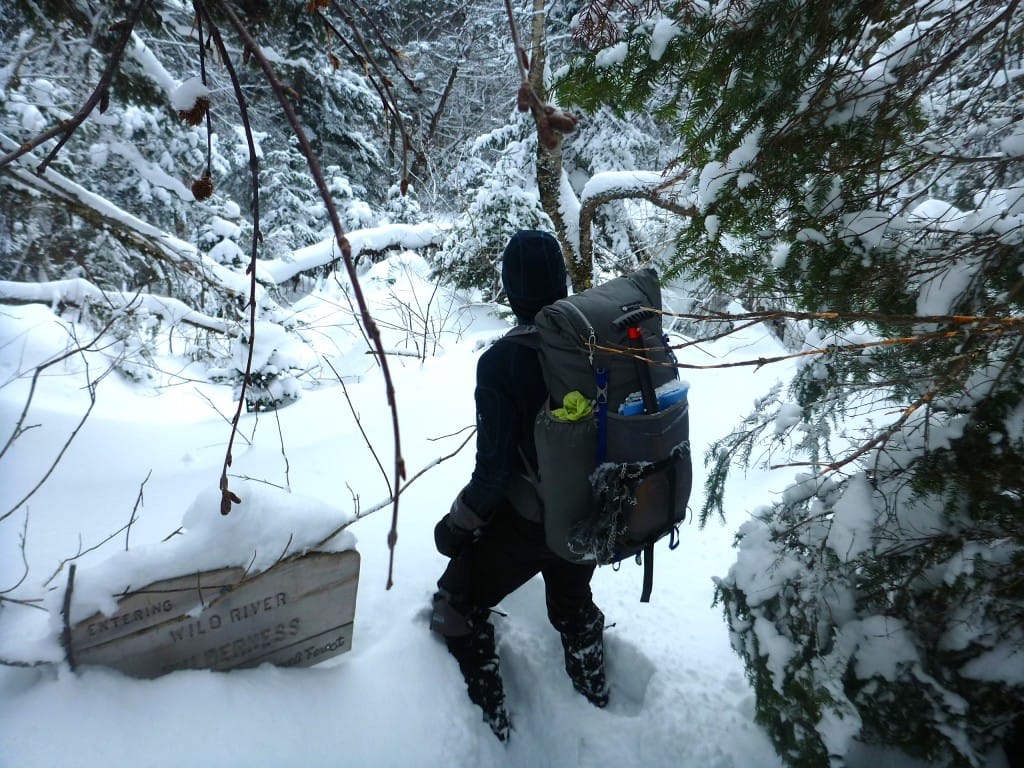
Entering the Wild River Wilderness, the trail disappeared into the snow within 100 ft.
Photo by Ryan Linn
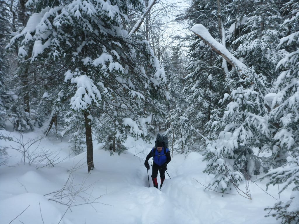
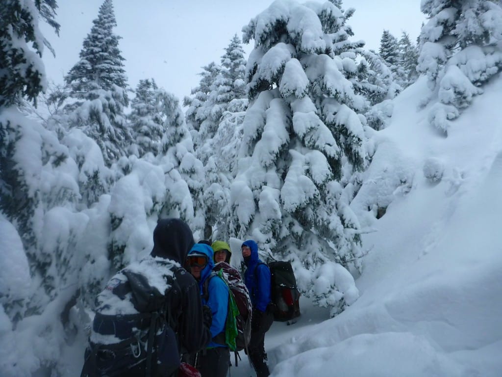
Though the trail up to the Carter-Moriah Range’s ridge was broken out by a few sets of snowshoes before us, the snow was still so fresh and fluffy that we needed snowshoes the entire way.
I find this to be a rare luxury in the White Mountains, where for the past several winters I’ve seen only snow that’s so packed down by hundreds of pairs of feet that snowshoes become nearly useless. Once the snow falls in the Whites, the trails get packed so quickly that most people leave their snowshoes in the car and go out with just Microspikes or similar light traction.
With a couple hours listening to the soft swishing of our snowshoes, we were at the top of the Stony Brook Trail, where all previous tracks turned north toward Mt Moriah. Instead, we took the path not traveled at all, and dropped down the Moriah Brook Trail, wading through several feet of soft powder until we decided we’d had enough and stopped to make camp.
Squint real hard and you can imagine granite countertops and stainless steel appliances.
Photo by Ryan Linn
This was only around 12:30 in the afternoon, so we used the time to dig a kitchen pit, gather firewood, and build ourselves a nice home for the afternoon and evening.
One of many great things about winter camping is that you can build as elaborate a camp as you like without as much worry about Leave No Trace as summer.
We dug down close to five feet into the snow to make a fire pit, added benches, a counter, and a wind wall before we were finished. When we left camp the next morning, we knocked much of the snow wall down into the pit, and by summertime there will be no evidence we were ever there.
We had a long, relaxing evening with plenty of hot cocoa and snow melting, and a late winter bedtime of 8 PM.
I especially love backpacking in winter with fresh snow because of how wild and lonely the world becomes. The snow mutes all sound, and the blackness of the forest closes in around you in ways that you don’t get in other environments. It’s as peaceful as can be, and in many ways the most remote you can get.
Home sweet home for the night.
Photo by Ryan Linn
One of many great things about winter camping is that you can build as elaborate a camp as you like without as much worry about Leave No Trace as summer.
We dug down close to five feet into the snow to make a fire pit, added benches, a counter, and a wind wall before we were finished. When we left camp the next morning, we knocked much of the snow wall down into the pit, and by summertime there will be no evidence we were ever there.
We had a long, relaxing evening with plenty of hot cocoa and snow melting, and a late winter bedtime of 8 PM.
I especially love backpacking in winter with fresh snow because of how wild and lonely the world becomes. The snow mutes all sound, and the blackness of the forest closes in around you in ways that you don’t get in other environments. It’s as peaceful as can be, and in many ways the most remote you can get.
Beginning the ridgewalk along the Carter-Moriah Range.
Photo by Ryan Linn
Sheltered below the summit of Moriah.
Photo by Ryan Linn
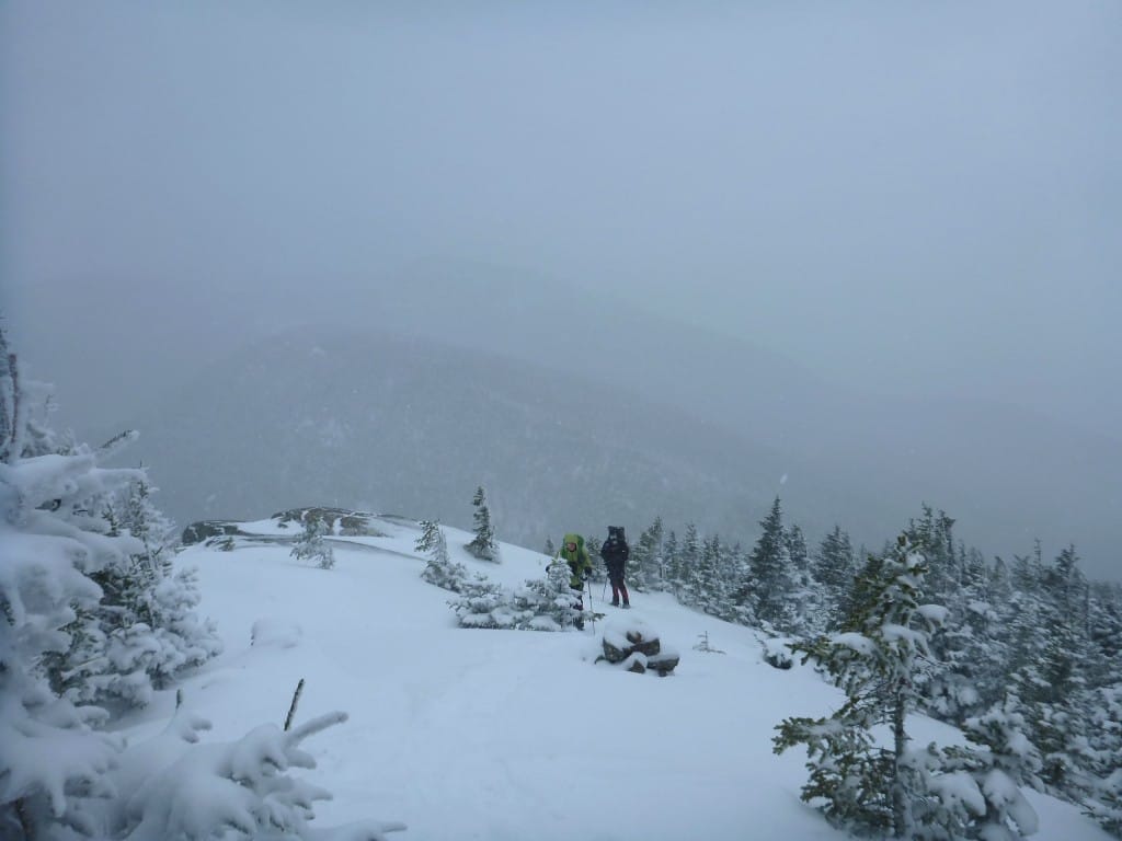
In the morning, with a few new inches of snow and more coming down, we met the rest of our group back at the trail junction, and proceeded to hike through the snow and clouds to Moriah. There were few, if any, views from the open ledges on the way up the mountain, but that didn’t make the trek any less delightful.
We pushed through deep snow drifts, and into marshmallow forests, occasionally blasted by a bitter east wind. The summit was too windy for lengthy celebrations when Hikerbox finished his final NH4K summit, but the trudge back to the cars was reward enough.
With more snow falling throughout the week, it looks like this delightful winter will continue. I’m hoping for many more overnight trips in the near future.
Hikerbox celebrates quickly on the summit.
Photo by Ryan Linn
Want to keep up with all that’s going on at Atlas Guides? Sign up for our newsletter!
Read more!
Check out some related blog posts!
Get our trail guide for this area!
White Mountain National Forest
White Mountain National Forest is home to New Hampshire’s highest peaks and over a thousand miles of hiking trails!
250+ miles of trail (400 km) $29.99 full guide
Presidential Range, White Mountain National Forest, New Hampshire
Photo by Ryan Linn
Presidential Range, White Mountain National Forest, New Hampshire
Photo by Ryan Linn
White Mountain National Forest
White Mountain National Forest is home to New Hampshire’s highest peaks and over a thousand miles of hiking trails!
250+ miles of trail (400 km)
$29.99 full guide
Get our trail guide for this area!
About the Author
Ryan Linn
Ryan is also known as “Guthook”, which is where our apps get their name. Already an avid hiker, he hiked the Appalachian Trail, New England Trail, and Pacific Crest Trail before joining forces with Paul to create the Guthook Guides apps. Ryan handles iOS development for our apps from his office in Maine, and usually runs away to the forests and mountains throughout New England. He also volunteers with the Maine Appalachian Trail Club and the Natural Resources Council of Maine. Baxter State Park in Maine is his happy place.
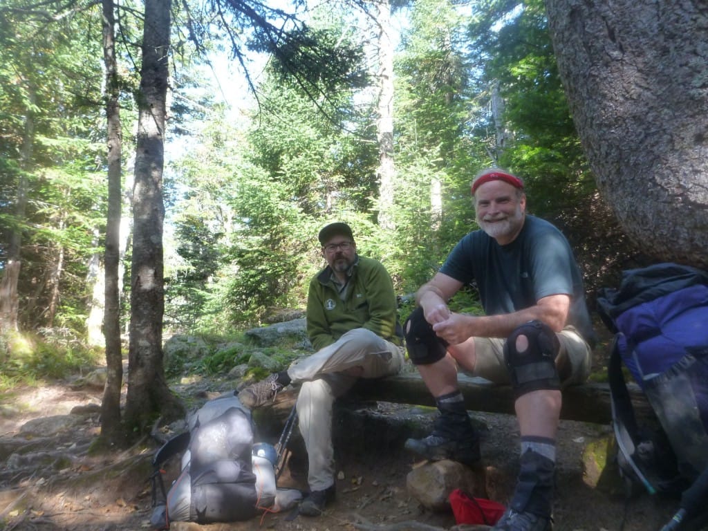
Cabot Mtn Winter Backpacking Trip
Planning an adventure? Check out our popular trail guides! 4.8 stars (17K+ ratings)
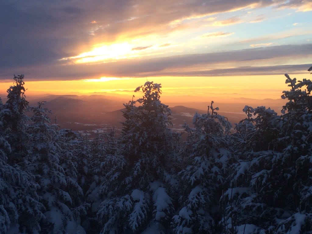
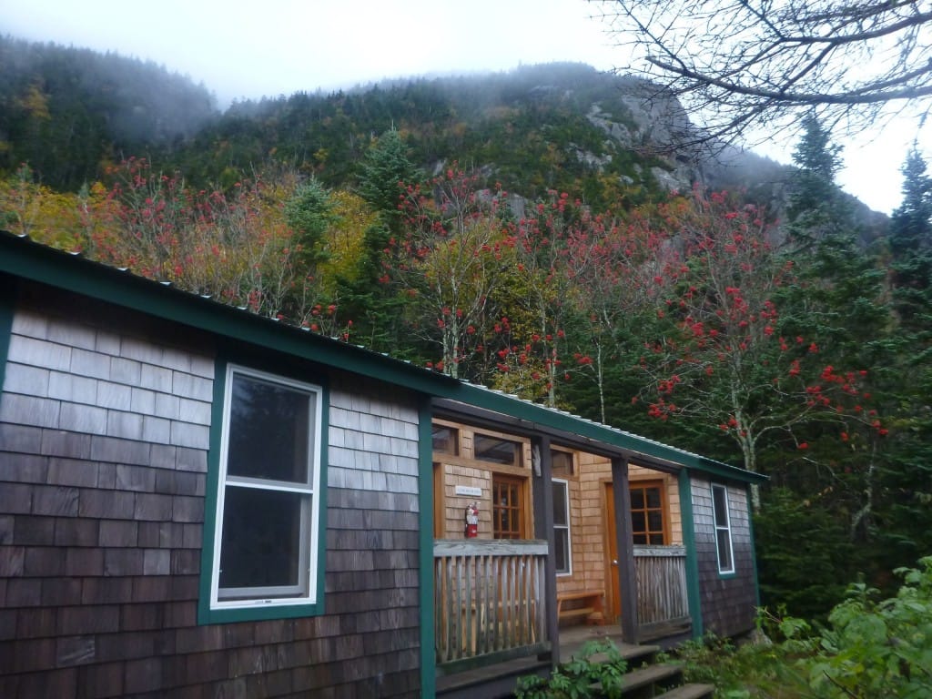
Sunset from the front porch of the cabin.
Photo by Ryan Linn
Cabot Mtn Winter Backpacking Trip
Not long after the balmy 50 degree days in Utah, I ventured into the northernmost part of the White Mountain National Forest in New Hampshire for a weekend of serious winter backpacking.
Ryan Linn Trip Report 01/27/2015
Ryan Linn
Trip Report
01/27/2015
Not long after the balmy 50 degree days in Utah, I ventured into the northernmost part of the White Mountain National Forest in New Hampshire for a weekend of serious winter backpacking.
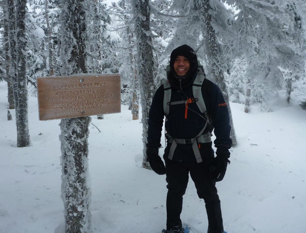
This would be a practice run, since I hadn’t been on a winter overnight trip in a few years, so we picked something moderately difficult– First, climbing to Mt Cabot via Bunnell Notch Trail, where many peak-bagging day-hikers go, then continuing along the Kilkenny Ridge Trail to Unknown Pond, and down the Unknown Pond Trail to complete the loop.
Everything after Mt Cabot was barely traveled, and would be much more difficult.
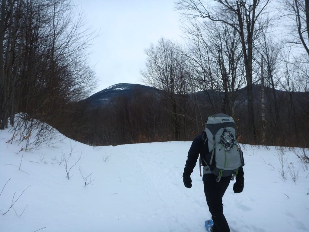
The first view of Cabot, from down near the Berlin Fish Hatchery.
Photo by Ryan Linn
Since Cabot is the most remote of New Hampshire’s 4000-footers (at least the furthest in driving time from Boston), I wasn’t sure how well-traveled the trail would be.
It turned out to be packed into the snow pretty well, but since it was so far north the snow still had the texture of freshly trod powder rather than a solid crust highway. We had easy walking on snowshoes up to Bunnell Notch, then a steeper climb along the south slope of Cabot to reach the old fire warden’s cabin near the summit.
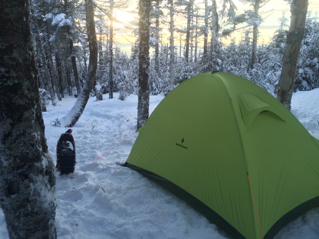
There were five of us, plus one dog, with varying degrees of winter backpacking experience, so camping accommodations varied as well.
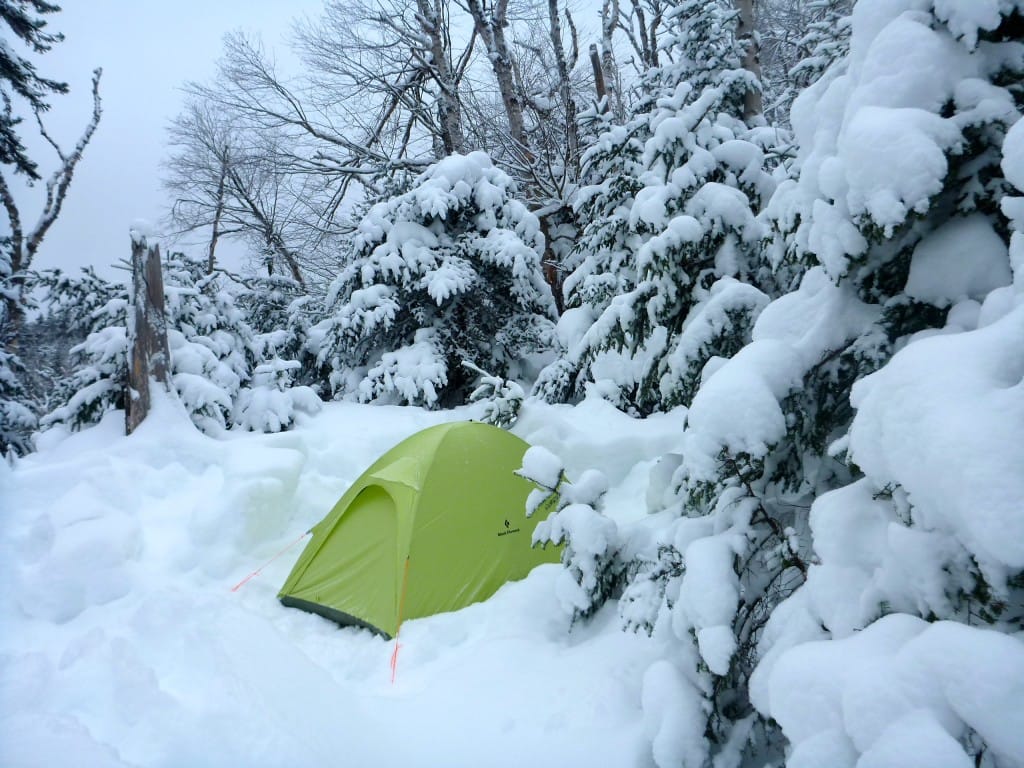
Steve, whose first deep-winter overnighter was with me a few years ago, had a new single-wall tent, and I had a new Black Diamond Firstlight tent, so we set up nearby. The others occupied the bunks in the little cabin, and we all gathered inside for dinner and sunset.
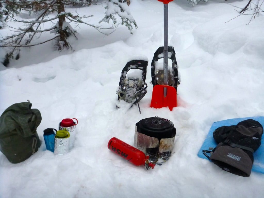
There was no liquid water near the cabin, so we had two MSR Whisperlite stoves running full force for over three hours to melt snow, boil water, and cook dinner.
Getting into the thicker snow near the summit.
Photo by Ryan Linn
Camped near the Cabot Cabin, with a good view into Vermont.
Photo by Ryan Linn
The daytime temperatures on Saturday were balmy mid-20s, so we had to be careful not to sweat too much on the hike up. We knew the nighttime temperatures were supposed to be quite low, with extra wind chill to boot.
And boy, did the mountains deliver. High winds blasted all night, coating the tents and cabin with new rime ice. We forgot to check the thermometer when we left the cabin in the morning, but by noon the temperature had dropped down to -10F, while the wind continued to blow a steady 10 to 20 mph.
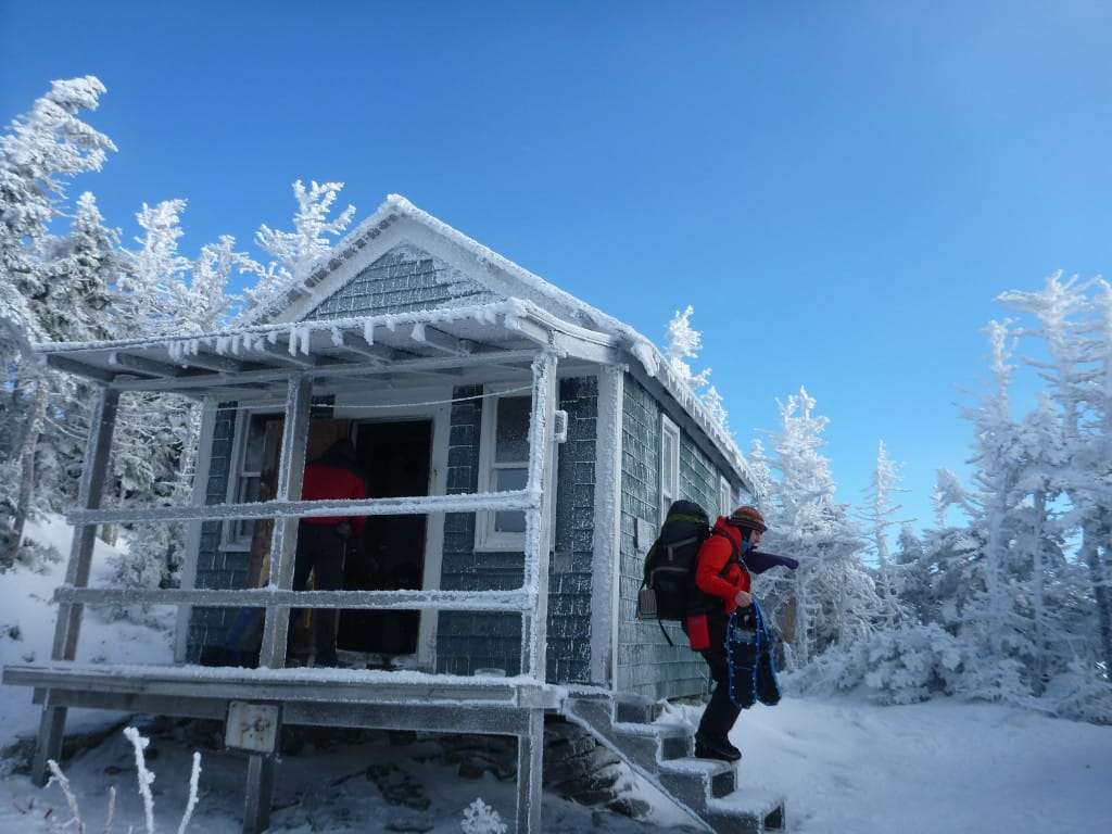
A frosty morning at Cabot Cabin.
Photo by Ryan Linn
After leaving the cabin, it was a short trek to the top of Cabot, then the trail got a little sketchy.
The day before, six Canadians had continued past Cabot (according to day-hikers heading back down the Bunnell Notch Trail), but other than that group I doubt anybody had traveled the ridge for many months. The Canadian Trail, as we began to call the snowshoe path we followed most of the day, shifted in and out of existence depending on how wind-sheltered the area was.
Often, the track would split into many tracks that spiraled and circled, trying to find the Kilkenny Ridge Trail amid the deep snow. At one point, the Canadian Trail headed off into a long bushwhack near Unknown Pond that seemed to reach a dead end.
We searched for a good half hour to find the actual trail, which the Canadians had found almost half a mile later at the end of their epic bushwhack. This was not easy going. We pushed to make a one mile per hour pace.
Gian tags the summit for one of his NH 4Ks.
Photo by Ryan Linn
With the temperature as low as it was, we could barely stop for more than a few minutes at a time, and nobody wanted to stop walking any longer than was necessary, so eating and bathroom breaks took a backseat to just getting off the mountain.
Steve and the rest of the crew had to be back in Boston that night, but even without the long drive we were battling exhaustion all the way down to the car. Keeping your body warm in such cold conditions, breaking trail through deep snow, and carrying a heavier-than-usual pack load will beat you down fast.
Once we finally arrived at the car we rejoiced a little, then got moving as quickly as we could for home. We stopped for burgers in Bethel, where we learned that the Northeast will soon be demolished by a “crippling and potentially historic” blizzard (according to CNN), so we kept ourselves awake by debating who gets to decide what is “potentially historic”, and “shouldn’t ‘potentially’ be applied to crippling as well as historic?” Very important things to think about.
I was asleep by 8 PM, while the others had their drive further to Boston. A successful weekend indeed!
The sun finally comes out in midafternoon, but it’s still too cold to stop moving.
Photo by Ryan Linn
Unknown Pond. Why isn’t anyone following me out here?
Photo by Ryan Linn
Want to keep up with all that’s going on at Atlas Guides? Sign up for our newsletter!
Read more!
Check out some related blog posts!
Get our trail guide for this area!
White Mountain National Forest
White Mountain National Forest is home to New Hampshire’s highest peaks and over a thousand miles of hiking trails!
250+ miles of trail (400 km) $29.99 full guide
Presidential Range, White Mountain National Forest, New Hampshire
Photo by Ryan Linn
Presidential Range, White Mountain National Forest, New Hampshire
Photo by Ryan Linn
White Mountain National Forest
White Mountain National Forest is home to New Hampshire’s highest peaks and over a thousand miles of hiking trails!
250+ miles of trail (400 km)
$29.99 full guide
Get our trail guide for this area!
About the Author
Ryan Linn
Ryan is also known as “Guthook”, which is where our apps get their name. Already an avid hiker, he hiked the Appalachian Trail, New England Trail, and Pacific Crest Trail before joining forces with Paul to create the Guthook Guides apps. Ryan handles iOS development for our apps from his office in Maine, and usually runs away to the forests and mountains throughout New England. He also volunteers with the Maine Appalachian Trail Club and the Natural Resources Council of Maine. Baxter State Park in Maine is his happy place.
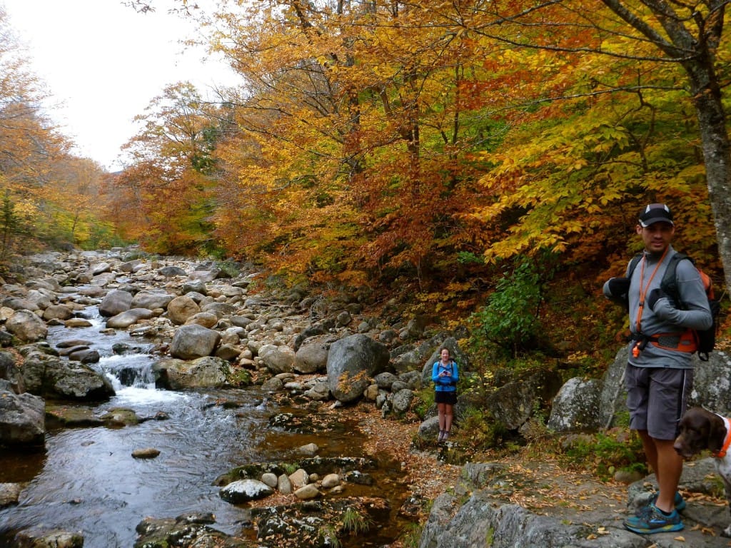
Rivers and Brooks and Leaves, Oh My!
Planning an adventure? Check out our popular trail guides! 4.7 stars (14K+ ratings)
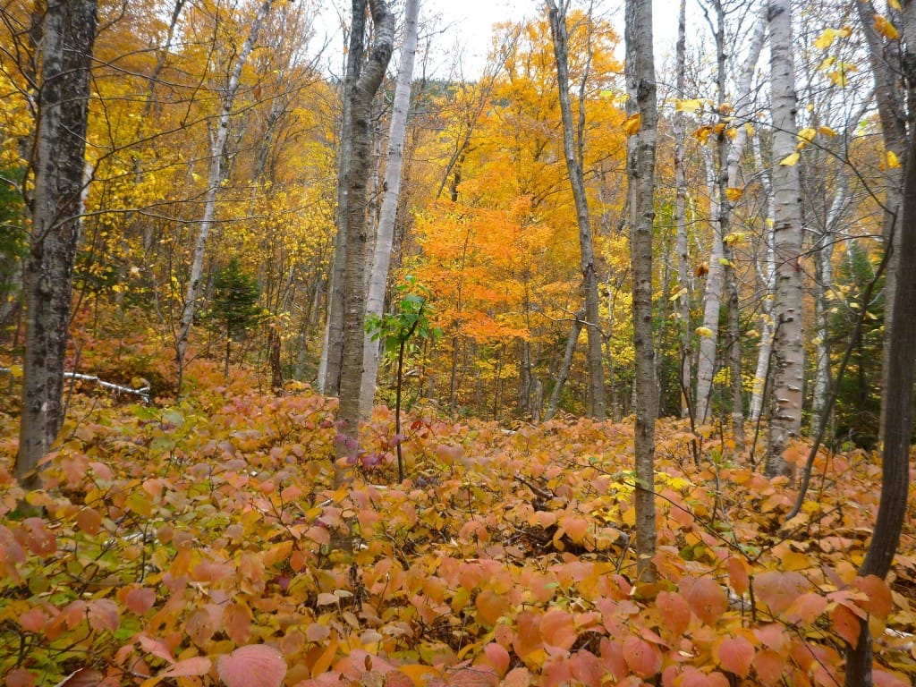
Fall colors.
Photo by Ryan Linn
Rivers and Brooks and Leaves, Oh My!
Last weekend wasn’t the best weekend for getting distant views from mountaintops in New England, but I found some hikes in the White Mountains that proved that even in the dense “green tunnel” you can find a totally satisfying wilderness trip.
Ryan Linn Trip Report 10/08/2013
Ryan Linn
Trip Report
10/08/2013
Last weekend wasn’t the best weekend for getting distant views from mountaintops in New England, but I found some hikes in the White Mountains that proved that even in the dense “green tunnel” you can find a totally satisfying wilderness trip.
I had climbed a few mountains on Friday and Saturday, with few views up top and plenty of views down low, but I’ll leave those stories for another day. Here’s how it went down on Sunday.
My high-school classmate, Cass, and her fiance, Mark, had just finished a through-hike of the Pacific Crest Trail a few weeks earlier (they have a wonderful trail journal).
We had reconnected when Cass found out about my Pacific Crest Trail apps before their hike, which I thought was a pretty cool coincidence. My high school has less than 300 students, so chance meetings between students aren’t very common, let alone chance meetings by Pacific Crest Trail hikers.
Cass and Mark had returned to Maine only a few days earlier, so we all got together for some classic foliage hiking near the Wild River.
The forecast called for almost certain rain, and chilly autumn temperatures. We figured any mountaintop views would be blocked by clouds, and it would be cold enough that we wouldn’t want to hang around in exposed areas, anyway.
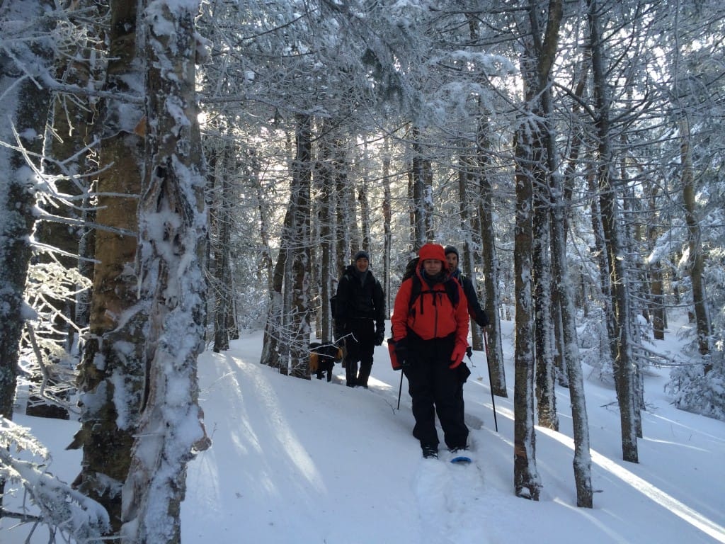
With that in mind, we started up the Stony Brook Trail near Gorham, NH, walking along the brook through deep woods for several miles. The leaves of the forest canopy were just at the right level of color to make the overcast sky seem as bright as a sunny day.
What leaves had already fallen added extra color to the brook beside us, and kept our footsteps nice and loud, shuffling and crunching over the trail.
We did have one open view at the crest of the Carter-Moriah range, where the Stony Brook Trail crosses the Carter-Moriah Trail (the Appalachian Trail, also) and the Moriah Brook Trail continues down the other side.
We could only stay on the ledge for a minute, since the wind was biting cold, but we did get a nice look at the overcast sky, with Caribou Mountain and the Moriah Brook valley below us.
From there, we dropped down into the Wild River Wilderness on the Moriah Brook Trail, which bore some similarities to the Black Angel Trail I’d been on in the same wilderness area only a few weeks earlier.
Maybe it was the foliage, but I have to say the Moriah Brook Trail was one of the most beautiful trails I’ve walked along all year.
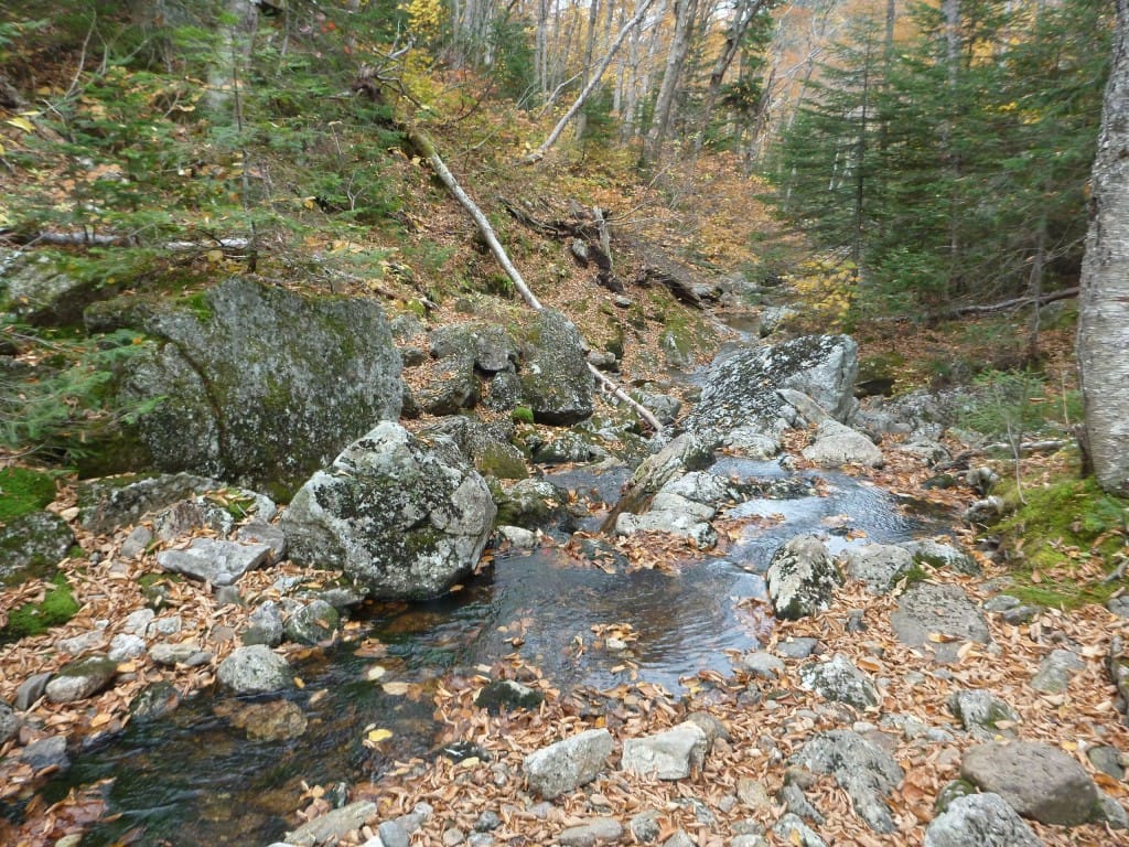
Heading down the trail, we immediately began to follow Moriah Brook, which started out in a pleasantly moss-covered spruce forest with giant boulders choking the waterway.
The trail had some tricky footing, due to hidden mud under the leaves, but considering the condition of many Wilderness trails in the Whites, we did pretty well. Just as many wet feet came about as a result of gawking at the foliage as came from well-hidden mud puddles.
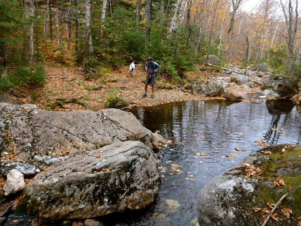
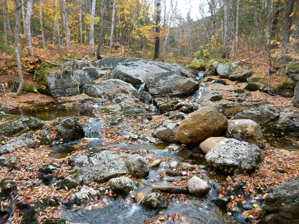
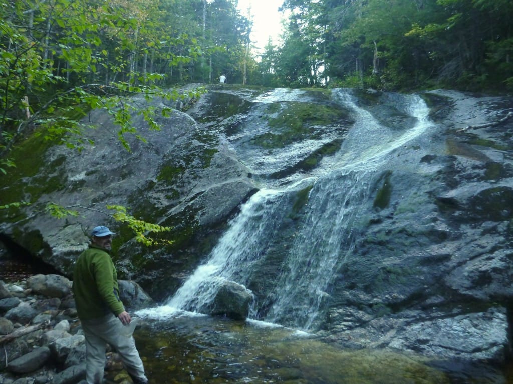
As we wound our way down along Moriah Brook, it went from a tight, jumbled mountain brook to a wide, rocky river. We passed too many fine swimming holes to count (not in this weather, though. We’ll have to come back in the summer), cascading waterfalls, and river-smoothed boulders that would make for dozens of amazing picnic spots.
After many miles of steady descent along the brook, the trail joined with the Highwater Trail, which runs along the west banks of the Wild River all the way from Evan’s Notch into the heart of the Wild River Wilderness.
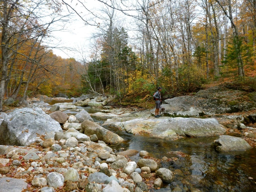
Where we joined the trail, the Wild River was many times larger than Moriah Brook, and it still showed signs of wear from the flooding in 2011. In a few places, the Highwater Trail disappeared over the banks of the river, forcing us on short (and pretty easy) bushwhacking adventures.
No complaints here, though. The giant, rocky river is a beauty.
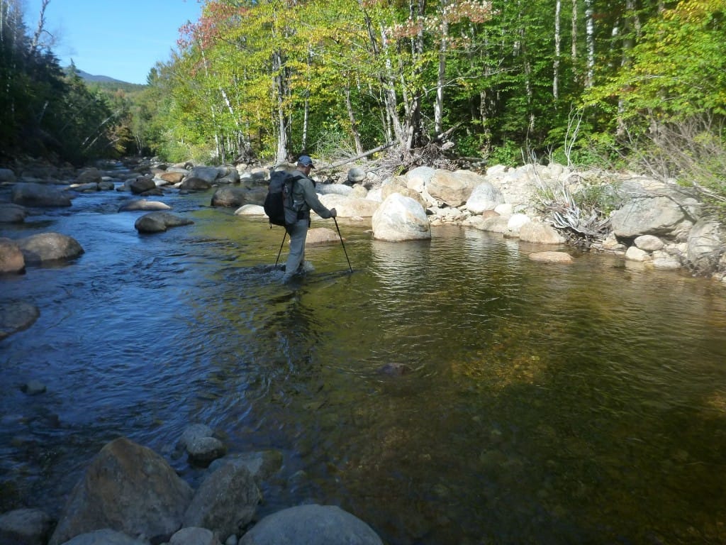
We decided to cut the hike short by a few miles, as it was getting pretty late in the day, so we forded the river at the Shelburne Trail and walked along the Wild River Road back to the second car.
Our timing was impeccable– a bitter cold rain started to fall just as we climbed into the car, and didn’t let up much until Monday night. It’s hard to imagine a better autumn foliage hike than this one, and we timed everything just right.
Want to keep up with all that’s going on at Atlas Guides? Sign up for our newsletter!
Read more!
Check out some related blog posts!
Get our trail guide for this area!
White Mountain National Forest
White Mountain National Forest is home to New Hampshire’s highest peaks and over a thousand miles of hiking trails!
250+ miles of trail (400 km) $29.99 full guide
Presidential Range, White Mountain National Forest, New Hampshire
Photo by Ryan Linn
Presidential Range, White Mountain National Forest, New Hampshire
Photo by Ryan Linn
White Mountain National Forest
White Mountain National Forest is home to New Hampshire’s highest peaks and over a thousand miles of hiking trails!
250+ miles of trail (400 km)
$29.99 full guide
Get our trail guide for this area!
About the Author
Ryan Linn
Ryan is also known as “Guthook”, which is where our apps get their name. Already an avid hiker, he hiked the Appalachian Trail, New England Trail, and Pacific Crest Trail before joining forces with Paul to create the Guthook Guides apps. Ryan handles iOS development for our apps from his office in Maine, and usually runs away to the forests and mountains throughout New England. He also volunteers with the Maine Appalachian Trail Club and the Natural Resources Council of Maine. Baxter State Park in Maine is his happy place.
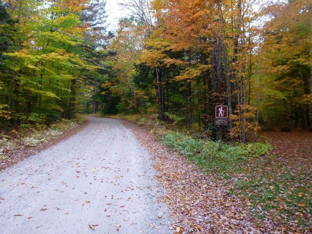
Wild River Wilderness Backpacking Loop
Planning an adventure? Check out our popular trail guides! 4.8 stars (17K+ ratings)
From Mt Hight, looking at the Presidential Range.
Photo by Ryan Linn
Wild River Wilderness Backpacking Loop
Over the weekend, I met up with Philip (of Sectionhiker.com) and Steve, both Appalachian Mountain Club trip leaders, for a two-night backpacking trip through one of the wildest regions of the White Mountains.
Ryan Linn Trip Report 10/25/2013
Ryan Linn
Trip Report
10/25/2013
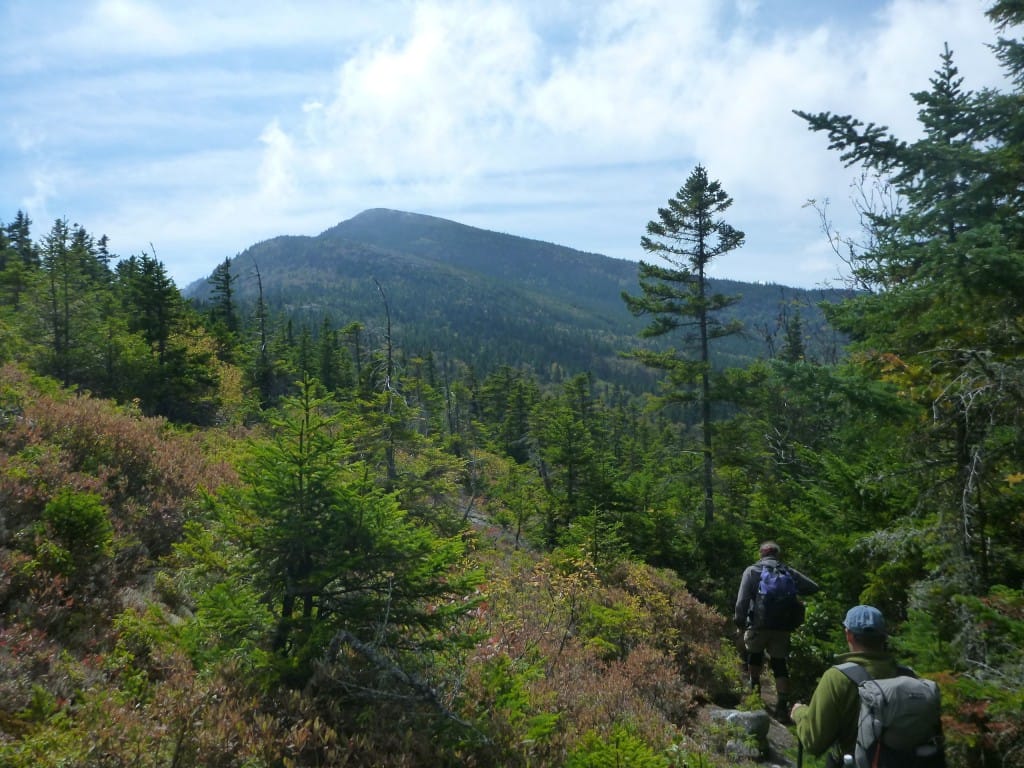
Over the weekend, I met up with Philip (of Sectionhiker.com) and Steve, both Appalachian Mountain Club trip leaders, for a two-night backpacking trip through one of the wildest regions of the White Mountains.
The Wild River Wilderness is one of my favorite parts of the National Forest, though I spend very little time there. The Wilderness is a densely vegetated valley around the Wild River, walled in by the Carter-Moriah Range to the west, and the Baldface-Royce Range to the east. Both of these ranges are very popular with peak-baggers and day hikers, but deeper into the middle it gets wild in a hurry.
Steve and Philip at Zeta Pass.
Photo by Ryan Linn
We started on Friday morning at the trailhead for the Nineteen Mile Brook trail, one of the most popular trails in the Whites since it leads directly to Carter Notch Hut.
We had an early start on a sunny, cool day, but it was still a weekday, so the crowds were small. Most of the people we passed on the way up to the Carter-Moriah Range were peak-baggers, probably heading up to Carter Dome rather than Mount Hight, which was our destination. Hight, technically a shoulder of Carter Dome, doesn’t count as a 4000-footer, though the views from the peak are the best in the entire range.
Steve and Philip at Zeta Pass.
Photo by Ryan Linn
From Hight, we walked up the Carter-Moriah Trail a short distance and then started down the Black Angel Trail. Black Angel goes all the way down to the Wild River, then back up to the other side of the Wilderness toward Meader Mountain.
As soon as we turned off of the Carter-Moriah Trail (which is also the Appalachian Trail) it was obvious that we’d entered a more wild area. The trail was less eroded, thick with duff and soil, choked with roots and fallen twigs, surrounded by dense moss beds– everything felt more like a wild forest than like a well-trodden hiking trail.
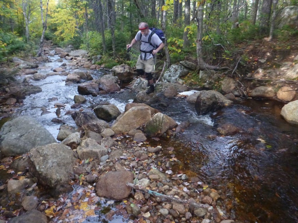
Philip fords the Wild River.
Photo by Ryan Linn
Philip getting water at Blue Brook (with Steve up top).
Photo by Ryan Linn
Philip fords the Wild River.
Photo by Ryan Linn
Philip getting water at Blue Brook (with Steve up top).
Photo by Ryan Linn
Being three well-heeled hikers, we made faster time than expected, even with a ford of the Wild River. We pushed a few miles beyond our planned to camp, ending up for the day at the Blue Brook Campsite high on the shoulder of Mount Meader.
Blue Brook, along with several other campsites in the Wild River Wilderness, once housed a lean-to, but has now been converted to a tenting site that I think is a lovely little area. The fifteen foot waterfall for a water source sure doesn’t hurt. We had an early evening, and I was asleep by 8 PM– I especially love backpacking in the fall, since early sundown means more sleep.
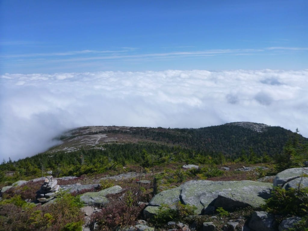
Undercast clouds hugging the Royce Range.
Photo by Ryan Linn
Undercast clouds hugging the Royce Range.
Photo by Ryan Linn
Being three well-heeled hikers, we made faster time than expected, even with a ford of the Wild River. We pushed a few miles beyond our planned to camp, ending up for the day at the Blue Brook Campsite high on the shoulder of Mount Meader.
Blue Brook, along with several other campsites in the Wild River Wilderness, once housed a lean-to, but has now been converted to a tenting site that I think is a lovely little area. The fifteen foot waterfall for a water source sure doesn’t hurt. We had an early evening, and I was asleep by 8 PM– I especially love backpacking in the fall, since early sundown means more sleep.
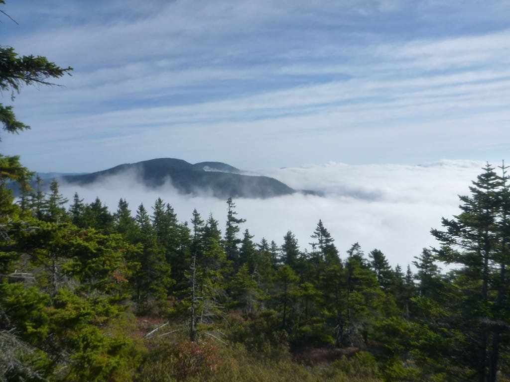
On Saturday morning, we awoke to a misty trail. We quickly gained the Rim Trail near Mount Meader, and walked the ridge along to Eagle Crag, then North and South Baldface, returning to Eagle Crag for the descent.
As we walked along the ridge, the thick clouds broke, showing a welcome sight: to the east, as far as the eye could see, dense clouds hugged the ground below, while the land and sky to the west were perfectly clear. As we walked across the open saddle between the Baldfaces, the clouds shifted and swirled around us, but generally left a beautiful view all around. I’ll let the pictures do the rest of the talking, but they don’t do the views the least bit of justice.

Steve on Eagle Crag heading to North Baldface.
Photo by Ryan Linn
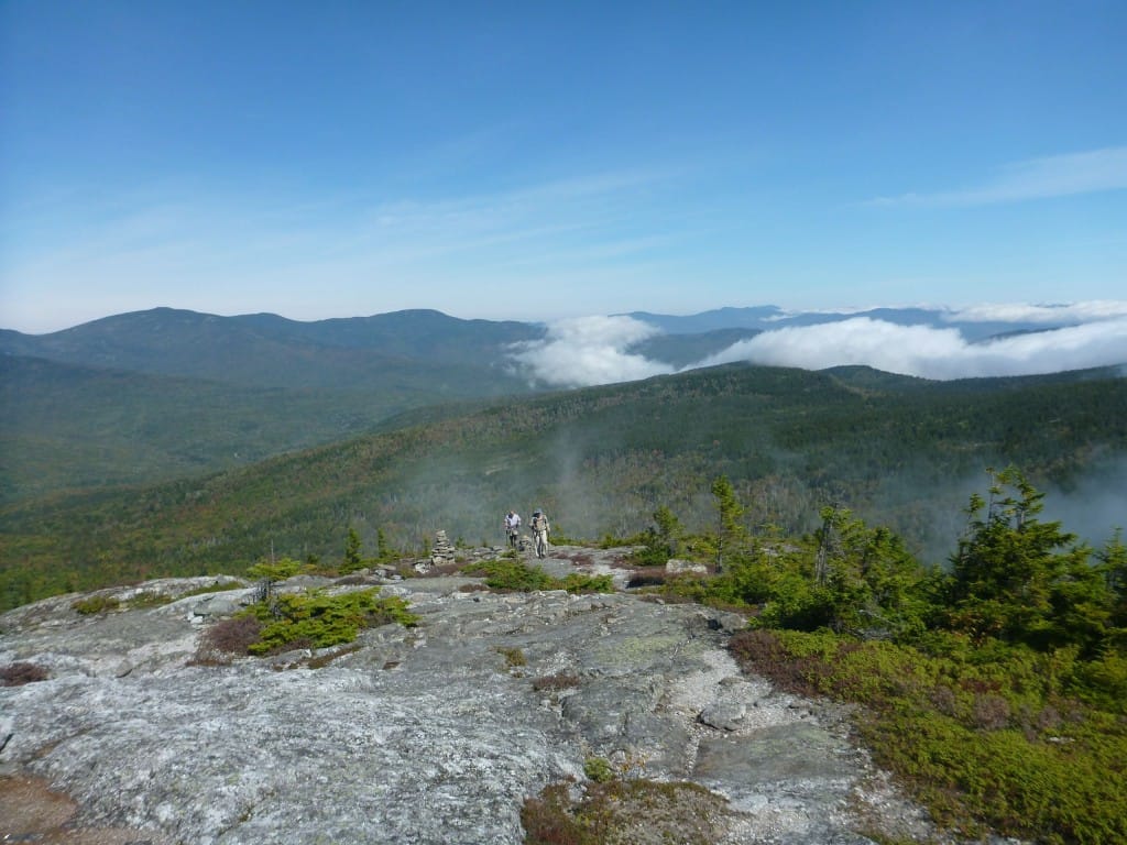
Steve and Philip climb North Baldface. The Carter Moriah Range and Mahoosuc Mountains in the background.
Photo by Ryan Linn
Steve on Eagle Crag heading to North Baldface.
Photo by Ryan Linn
Steve and Philip climb North Baldface. The Carter Moriah Range and Mahoosuc Mountains in the background.
Photo by Ryan Linn
After the Baldfaces, we dropped into the Wilderness once again, this time on the Eagle Link Trail. Just like all the trails from the rim of the Wilderness, the Eagle Link heads down to the river, through dense vegetation with little sign of humanity.
This time, rather than continuing across the Wild River back up to the mountains, we turned south on the Wild River Trail, walking along the headwaters of the river, crossing many heavily eroded tributaries. Part of the erosion and overgrowth is due to damage from Irene a few years ago, but there’s also a lack of trail maintenance here. Most people say that as a negative thing, but a place that gets little traffic and maintenance is great as far as I’m concerned (lots of traffic with little maintenance is the bad thing). Like I said before, it just feels more wild.
Looking down the ridge of South Baldface, into the sea of fog.
Photo by Ryan Linn
Looking down the ridge of South Baldface, into the sea of fog.
Photo by Ryan Linn
After the Baldfaces, we dropped into the Wilderness once again, this time on the Eagle Link Trail. Just like all the trails from the rim of the Wilderness, the Eagle Link heads down to the river, through dense vegetation with little sign of humanity.
This time, rather than continuing across the Wild River back up to the mountains, we turned south on the Wild River Trail, walking along the headwaters of the river, crossing many heavily eroded tributaries. Part of the erosion and overgrowth is due to damage from Irene a few years ago, but there’s also a lack of trail maintenance here. Most people say that as a negative thing, but a place that gets little traffic and maintenance is great as far as I’m concerned (lots of traffic with little maintenance is the bad thing). Like I said before, it just feels more wild.
We moved on to Perkins Notch for the night, another campsite on the site of a removed shelter. I’d stayed at Perkins Notch in winter a few years ago, so the terrain looked familiar, but things are very different in summer. Perkins Notch is a beautiful spot, but not so great as a campsite. The campsite is a wind funnel, and the water source requires a swampy bushwhack.
Luckily, we arrived just minutes before the rain started, so I was able to pitch my tarp in a decent spot. Philip and Steve, having more experience tenting in this area, warned me against pitching on the official tent pads. In the morning, they looked like swimming pools, so I was glad for that advice.
A friend in Conway described the rain on Saturday night as “epic,” and I’m willing to agree. It rained hard throughout the night, and for the first time in eight years my silnylon tarp didn’t hold up.
Part of that was my own fault, for not getting up in the middle of the night to tighten the guylines– silnylon stretches when it gets cold and wet. After tightening the lines a little too late, a stake pulled out due to softening ground, and some of the saturated ground flooded beneath my ground sheet. Still, I got enough sleep and stayed dry enough that I could have stayed out another night if I’d needed to.
Descending into the wilderness again.
Photo by Ryan Linn
Descending into the wilderness again.
Photo by Ryan Linn
A friend in Conway described the rain on Saturday night as “epic,” and I’m willing to agree. It rained hard throughout the night, and for the first time in eight years my silnylon tarp didn’t hold up.
Part of that was my own fault, for not getting up in the middle of the night to tighten the guylines– silnylon stretches when it gets cold and wet. After tightening the lines a little too late, a stake pulled out due to softening ground, and some of the saturated ground flooded beneath my ground sheet. Still, I got enough sleep and stayed dry enough that I could have stayed out another night if I’d needed to.
In the morning, we got an early start toward Carter Notch, stopping at the AMC Hut for a quick snack. It turned out to be the final day of the season for the crew, so we helped get blankets and food stores ready for helicopter pickup in exchange for leftover pancakes and good conversation. It turns out I’d even met the hut master on my AT hike in 2007, which was a big surprise.
The rest of the hike out was a mellow walk down the 19 Mile Brook trail, passing the turnoff where we’d headed up to Mt Hight two days earlier. By noon, it was another cool, sunny day with a brisk wind. I dried out some of my equipment in the parking lot, then headed home with my sanity-recharge (aka backpacking trip) complete.
Steve crossing one of many tributaries to the Wild River.
Photo by Ryan Linn
A wet morning at Carter Notch Hut.
Photo by Ryan Linn
Steve crossing one of many tributaries to the Wild River.
Photo by Ryan Linn
A wet morning at Carter Notch Hut.
Photo by Ryan Linn
Want to keep up with all that’s going on at Atlas Guides? Sign up for our newsletter!
Read more!
Check out some related blog posts!
Get our trail guide for this area!
White Mountain National Forest
White Mountain National Forest is home to New Hampshire’s highest peaks and over a thousand miles of hiking trails!
250+ miles of trail (400 km) $29.99 full guide
Presidential Range, White Mountain National Forest, New Hampshire
Photo by Ryan Linn
Presidential Range, White Mountain National Forest, New Hampshire
Photo by Ryan Linn
White Mountain National Forest
White Mountain National Forest is home to New Hampshire’s highest peaks and over a thousand miles of hiking trails!
250+ miles of trail (400 km)
$29.99 full guide
Get our trail guide for this area!
About the Author
Ryan Linn
Ryan is also known as “Guthook”, which is where our apps get their name. Already an avid hiker, he hiked the Appalachian Trail, New England Trail, and Pacific Crest Trail before joining forces with Paul to create the Guthook Guides apps. Ryan handles iOS development for our apps from his office in Maine, and usually runs away to the forests and mountains throughout New England. He also volunteers with the Maine Appalachian Trail Club and the Natural Resources Council of Maine. Baxter State Park in Maine is his happy place.