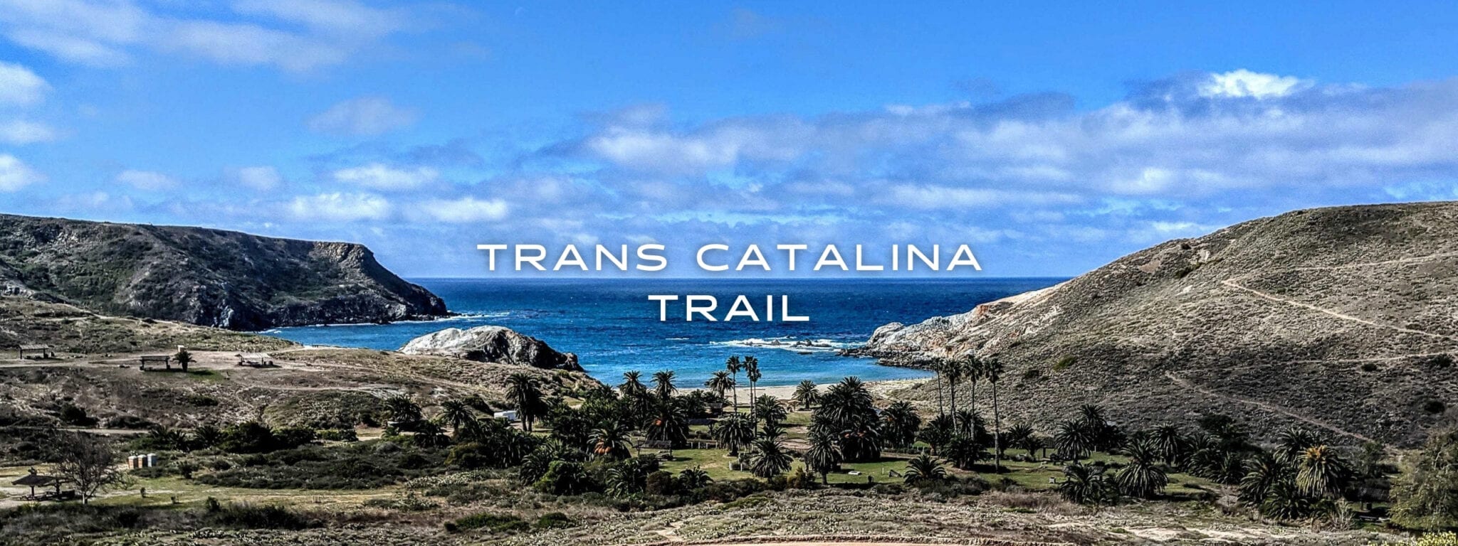
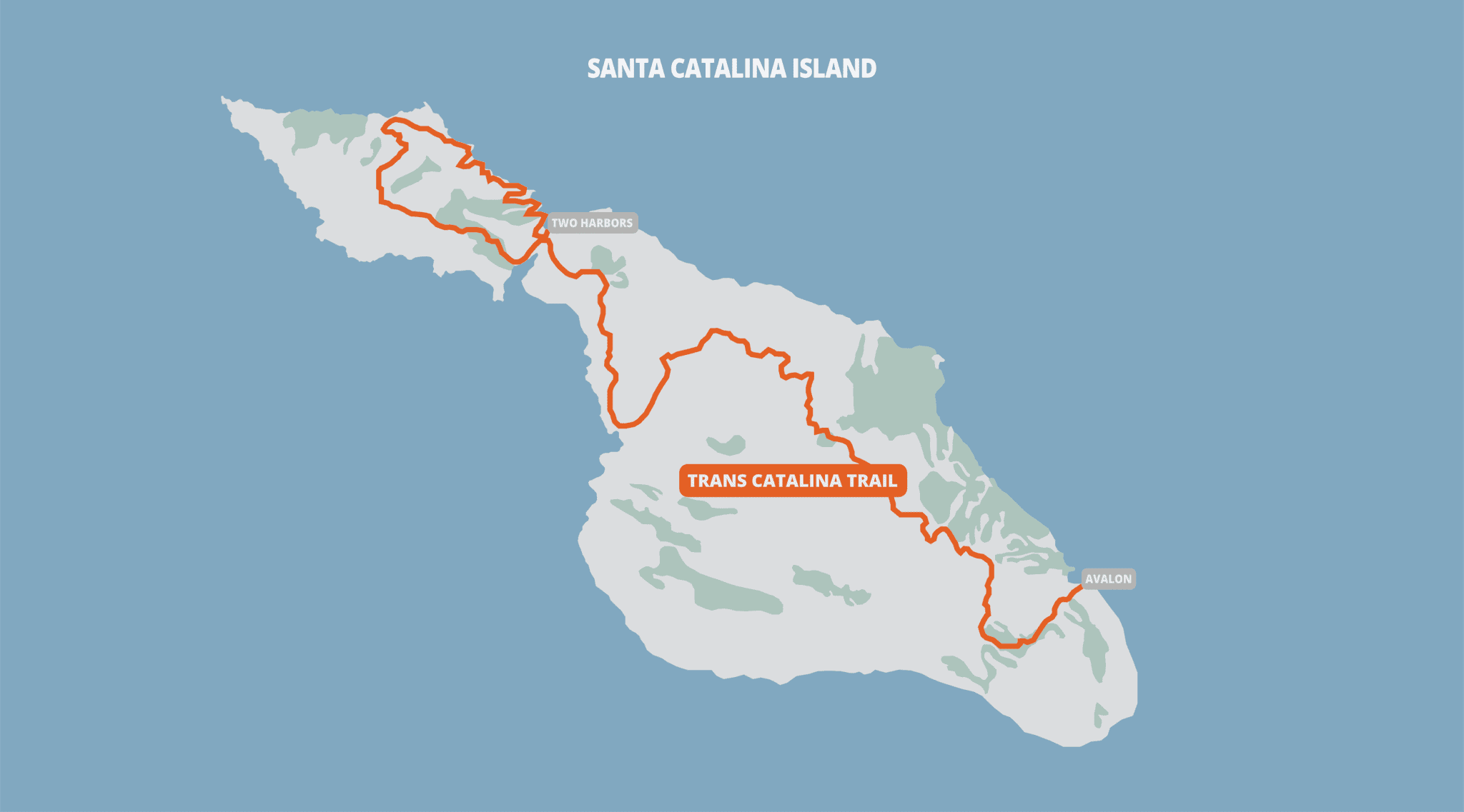
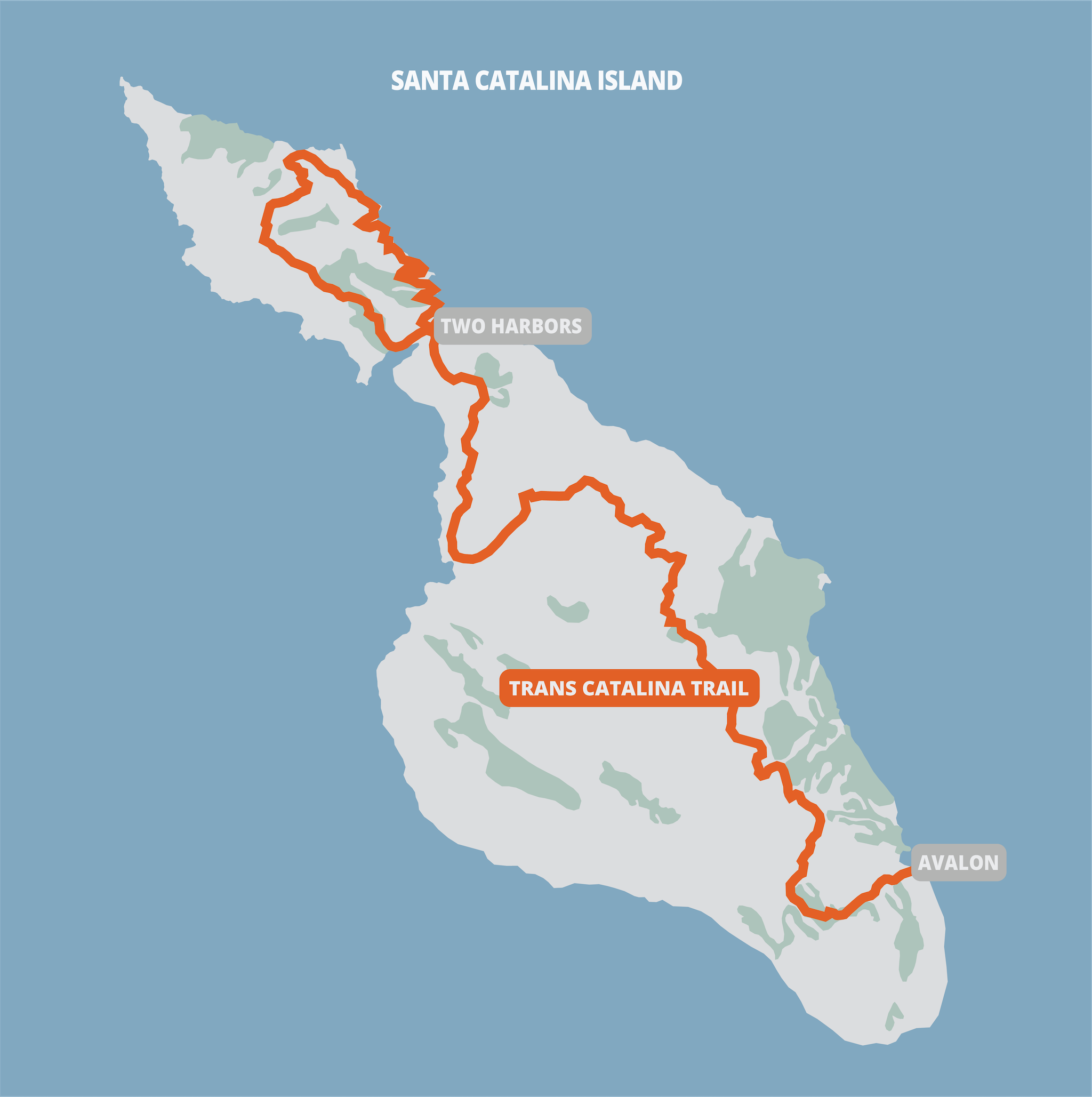
Trans Catalina Trail

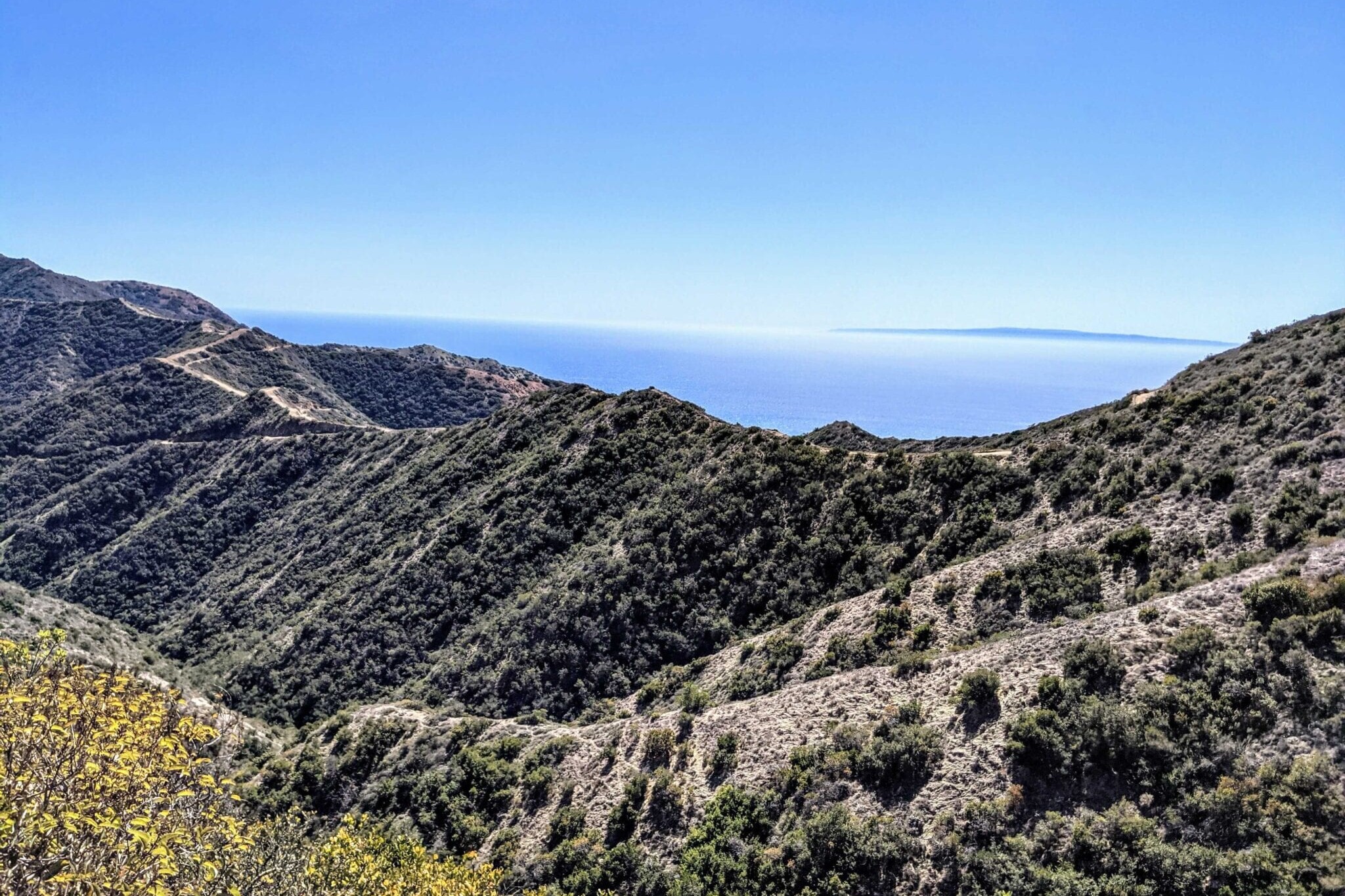
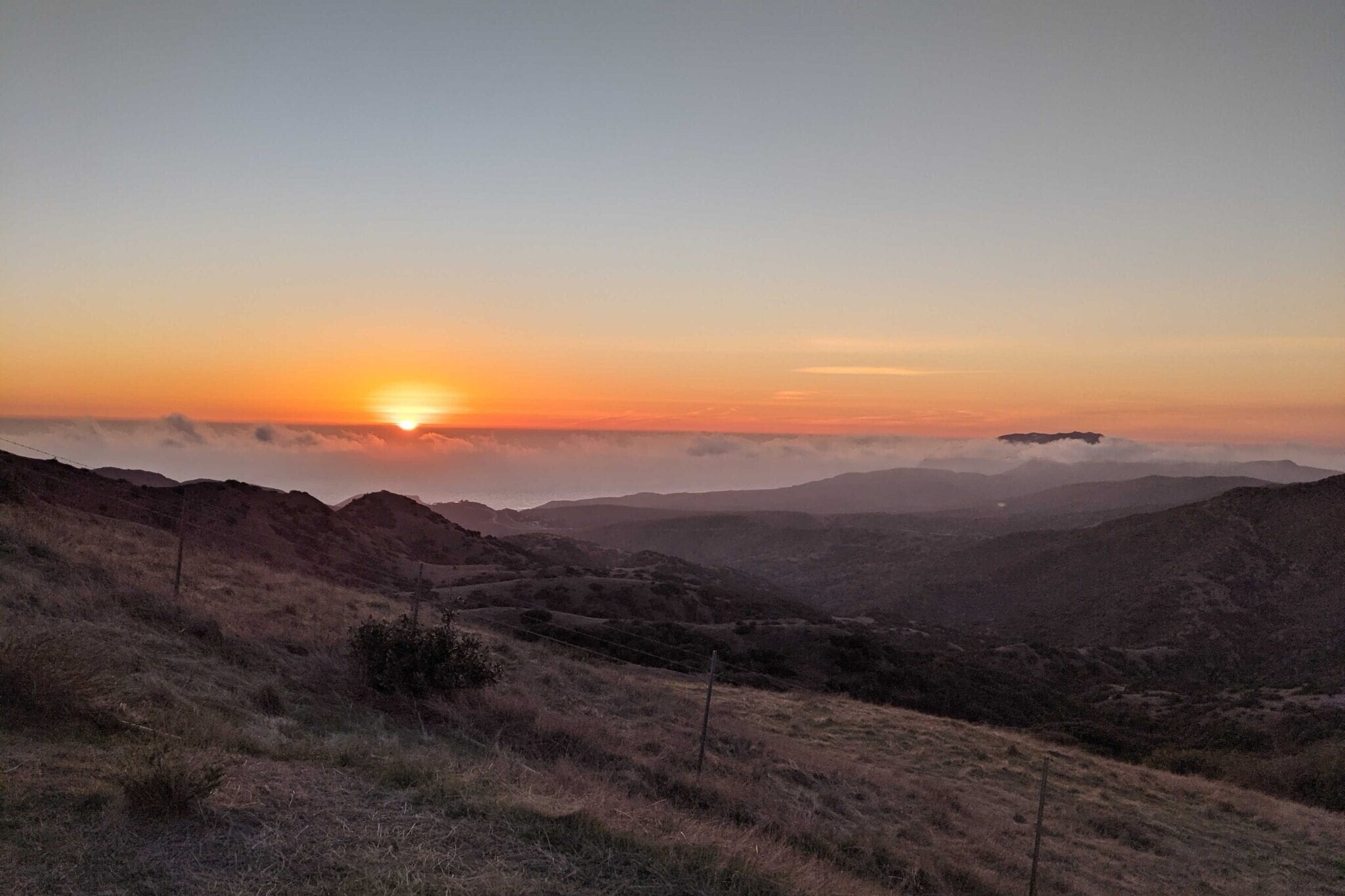
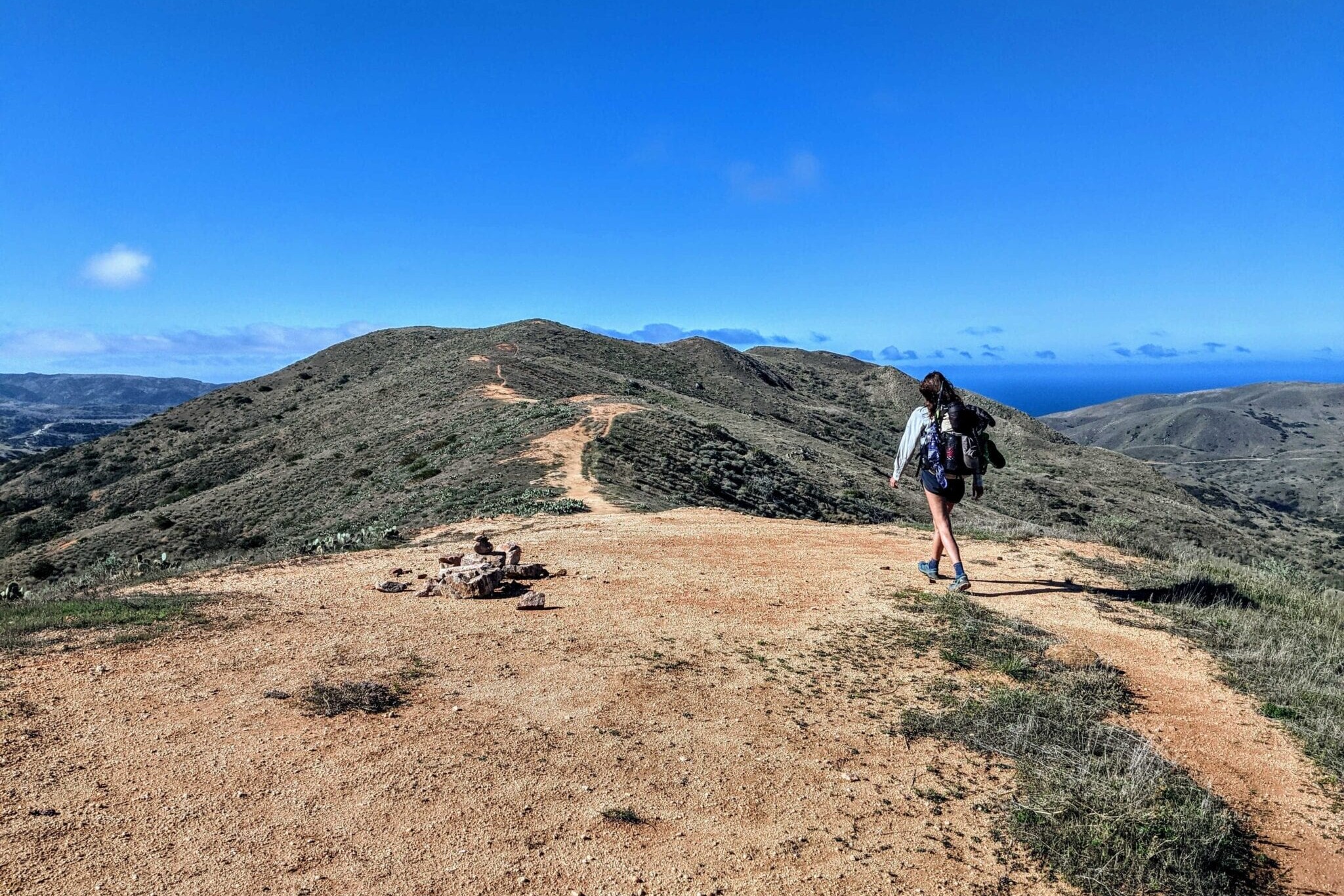
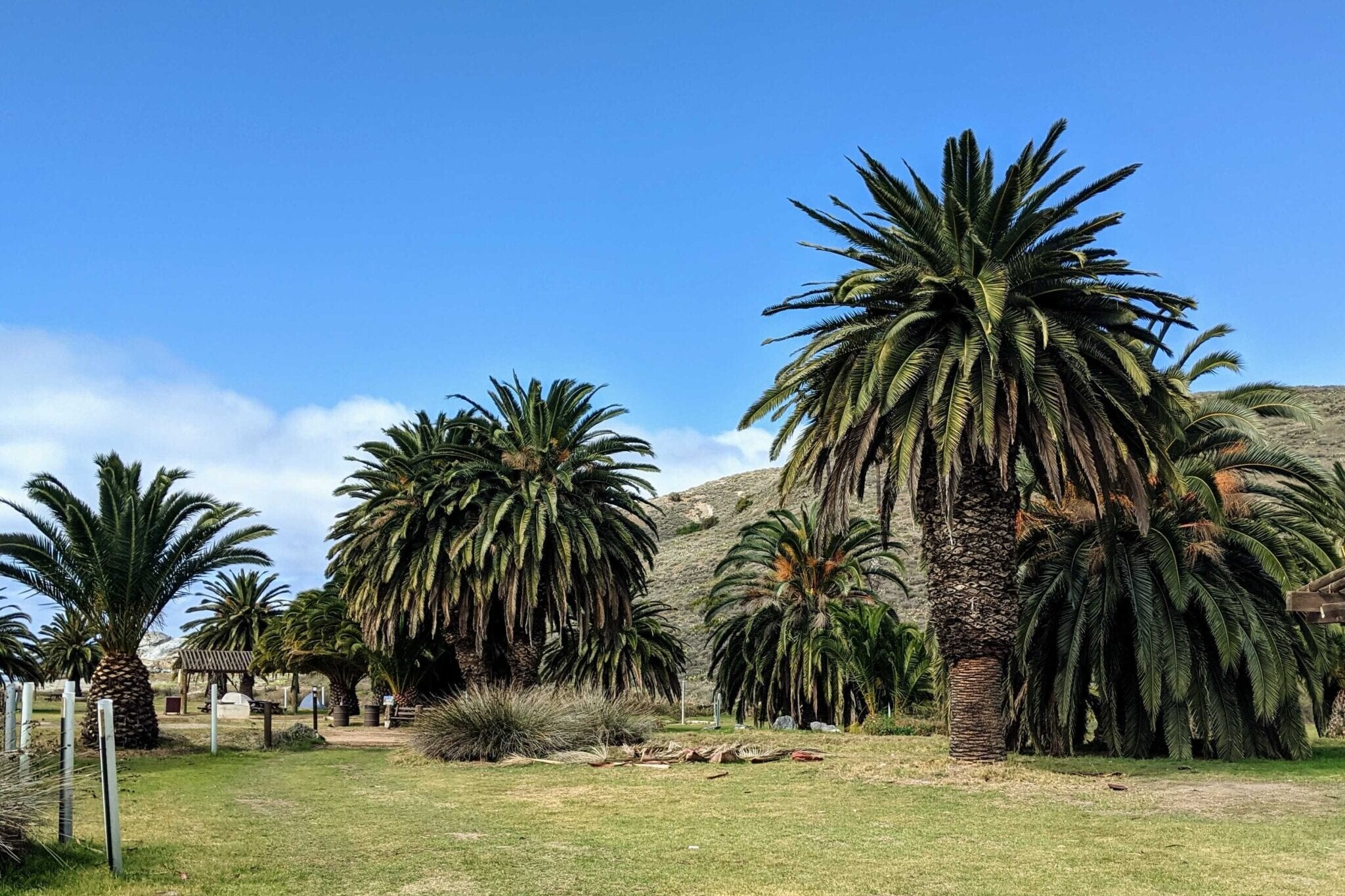
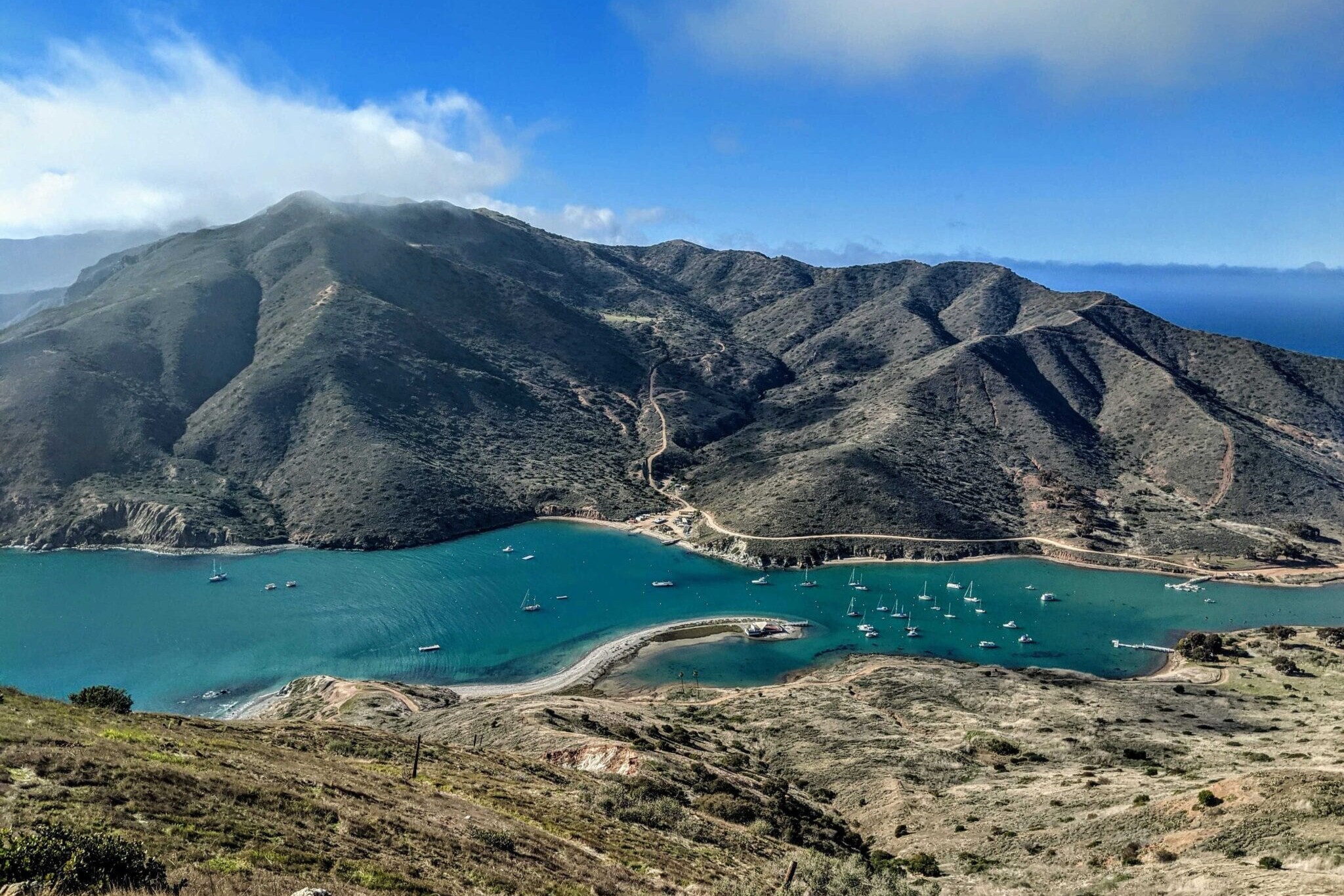
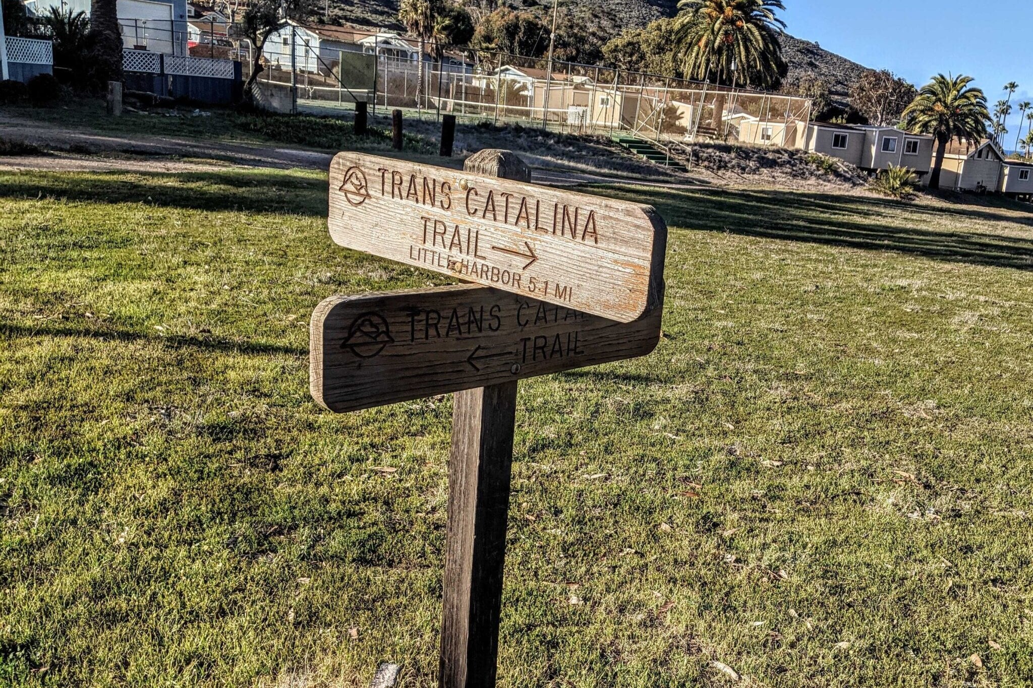
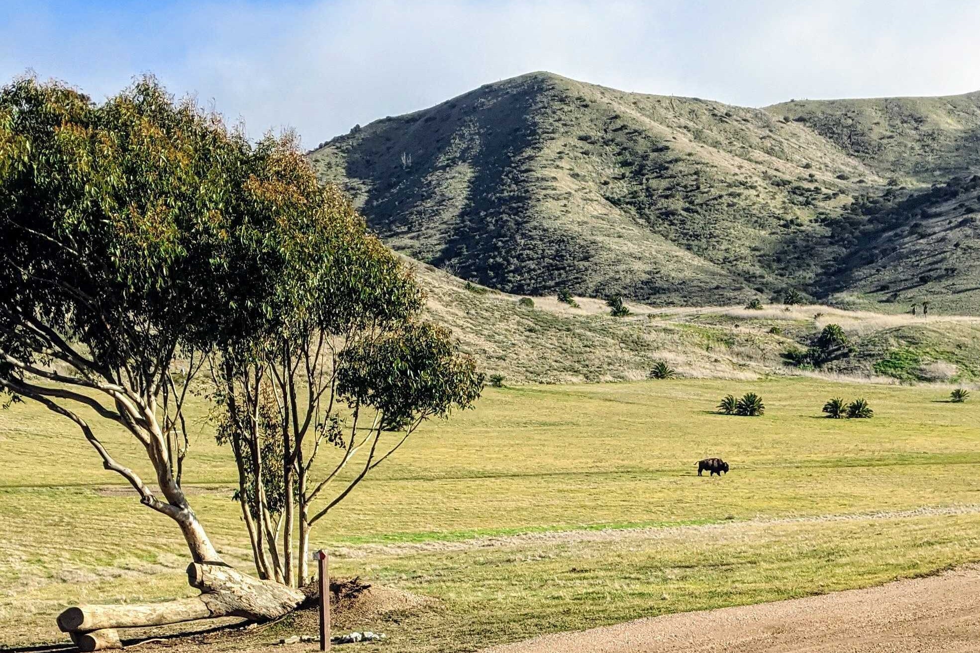
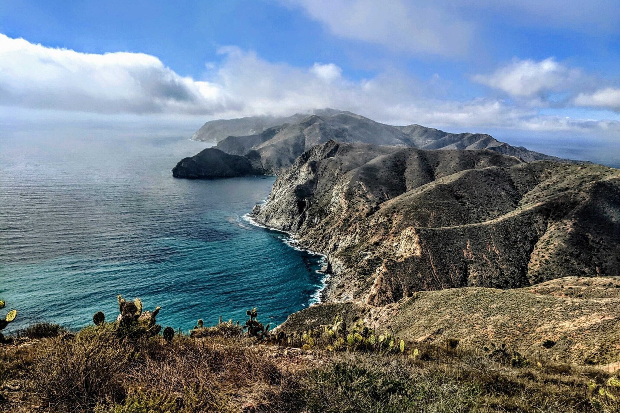
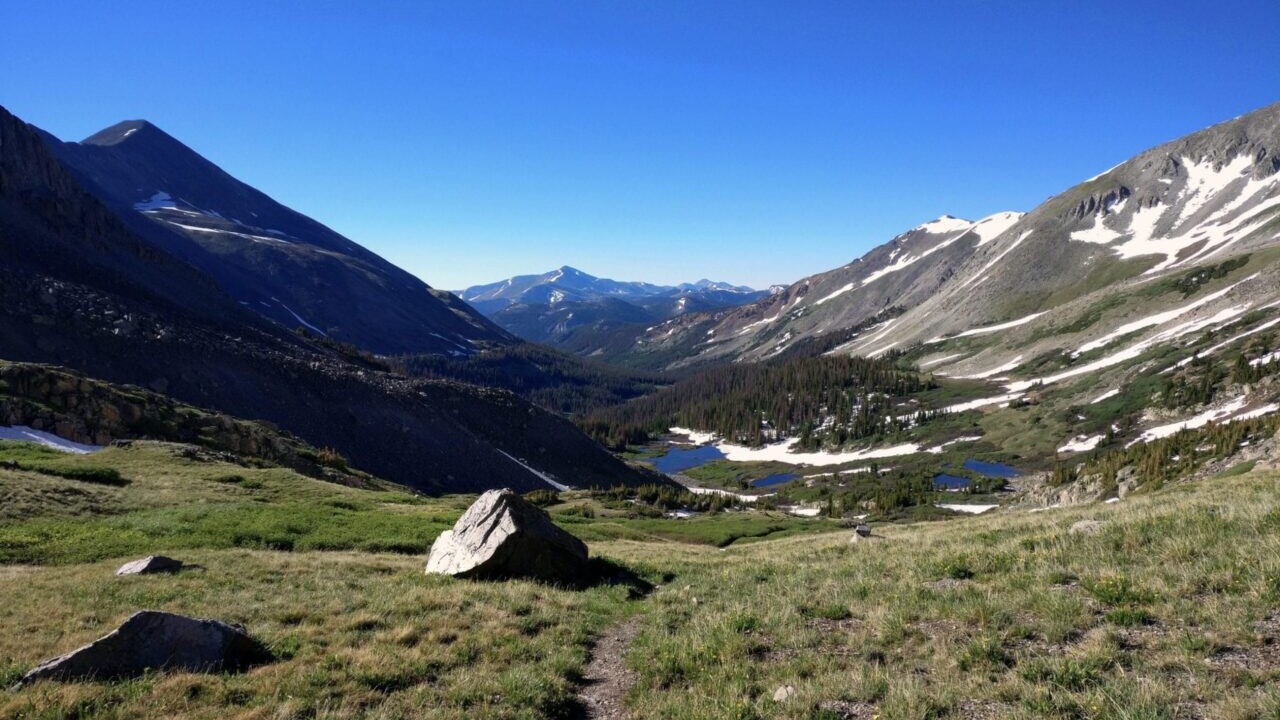
The Trans Catalina Trail is a 39 mile hike, traversing Santa Catalina Island off the coast of southern California. From the eastern terminus in Avalon to Parson’s Landing on the West end, then looping back to Two Harbors, the trail explores flora and fauna unique to Catalina Island while offering exceptional coastal views.
20% off for our Hiking Season Kick-off SALE! The Wonderland Trail is now $11.99 and the Western Hiker Special is now $39.99.
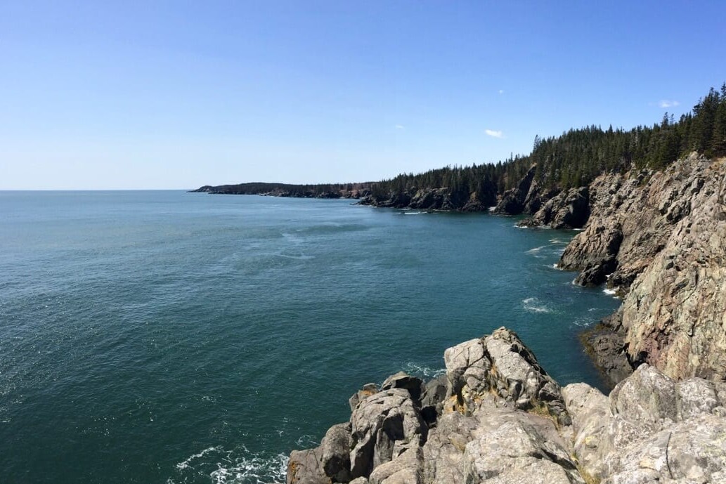
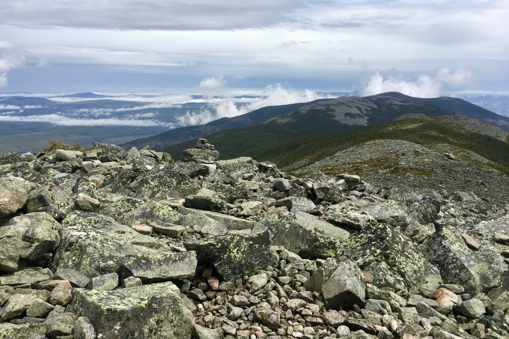
Photo courtesy of Dahn Pratt
4.8 ★★★★★ | 17K+ Reviews
Trans Catalina Trail
39 miles (63 km) • Southern California, USA
Download our guide to access the Trans Catalina Trail map, tracks, waypoints, and comments! The Trans Catalina Trail is a 39 mile hike, traversing Santa Catalina Island off the coast of southern California. From the eastern terminus in Avalon to Parson's Landing on the West end, then looping back to Two Harbors, the trail explores flora and fauna unique to Catalina Island while offering exceptional coastal views.
$4.99 full guide
39 mi (63 km)
$4.99 full guide


Trans Catalina Trail Map


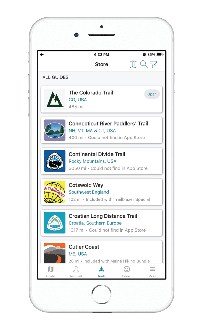
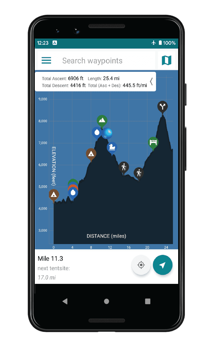
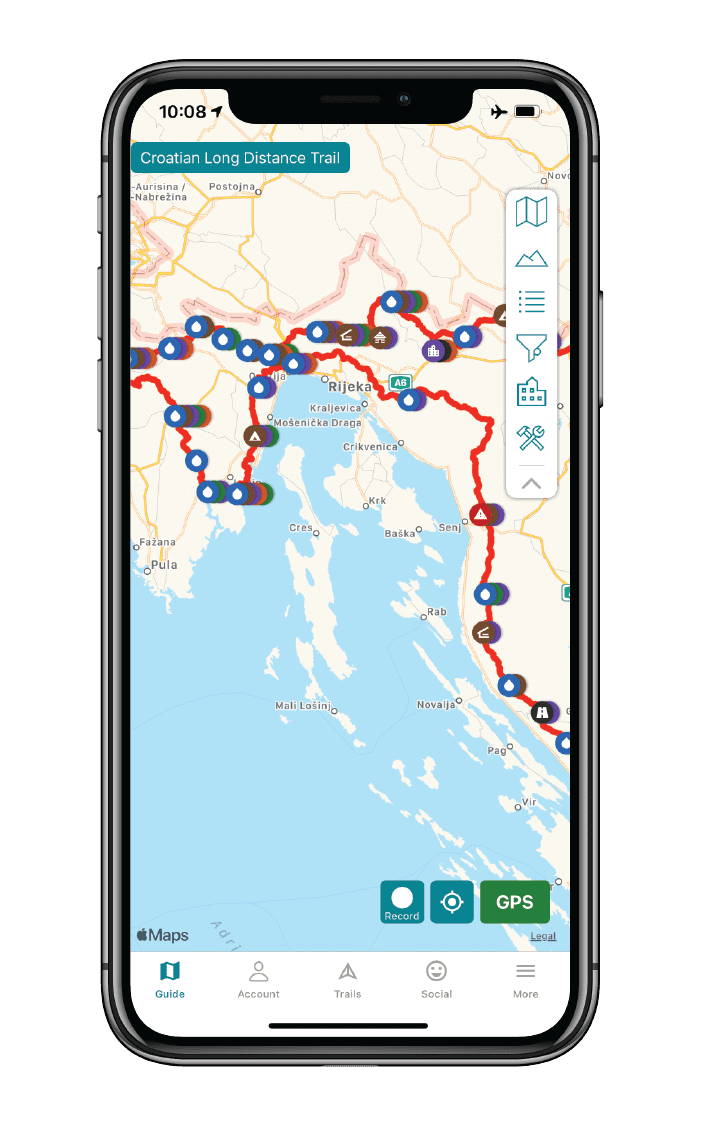
How can I get it?
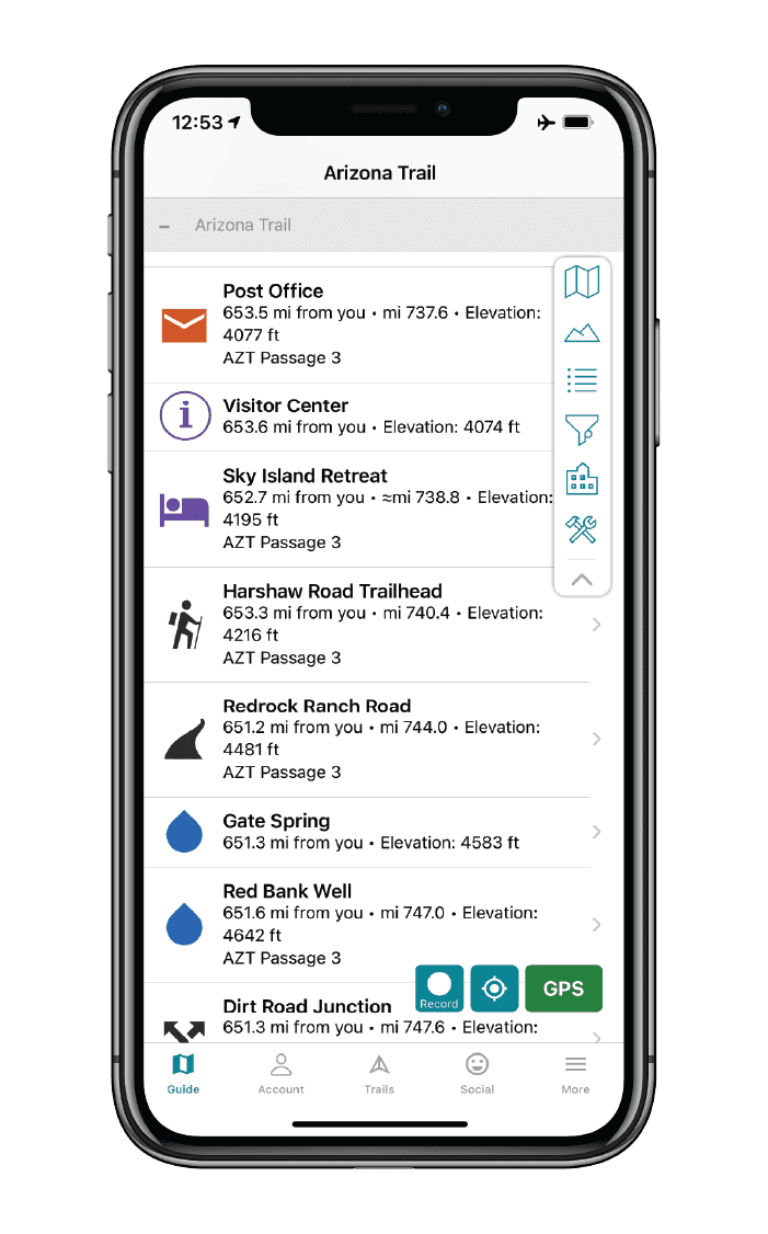
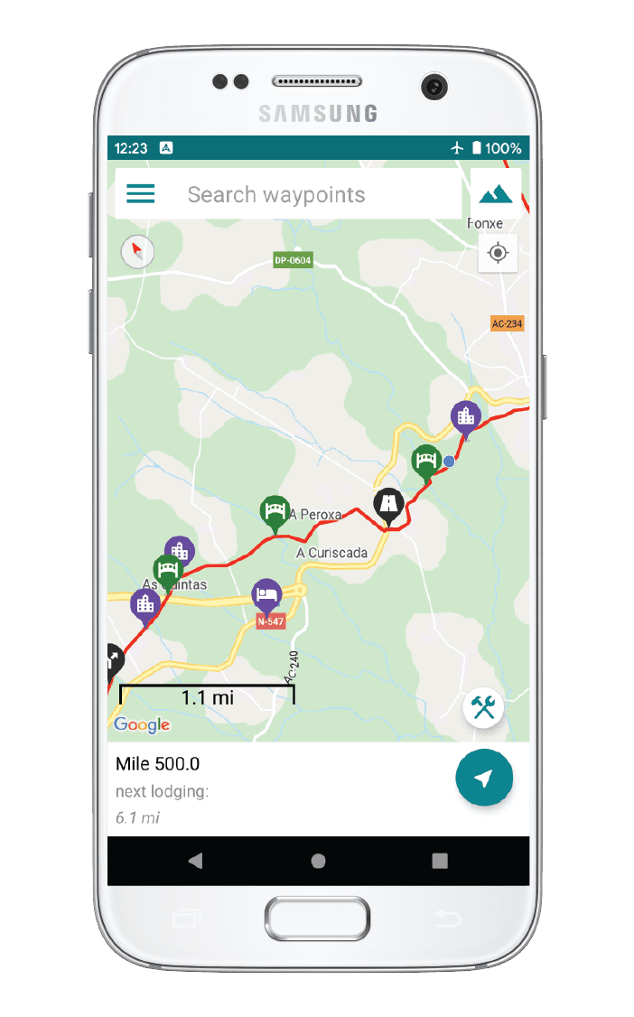
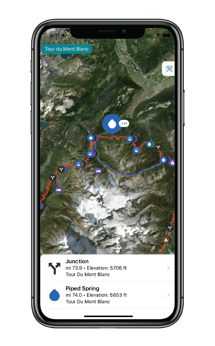
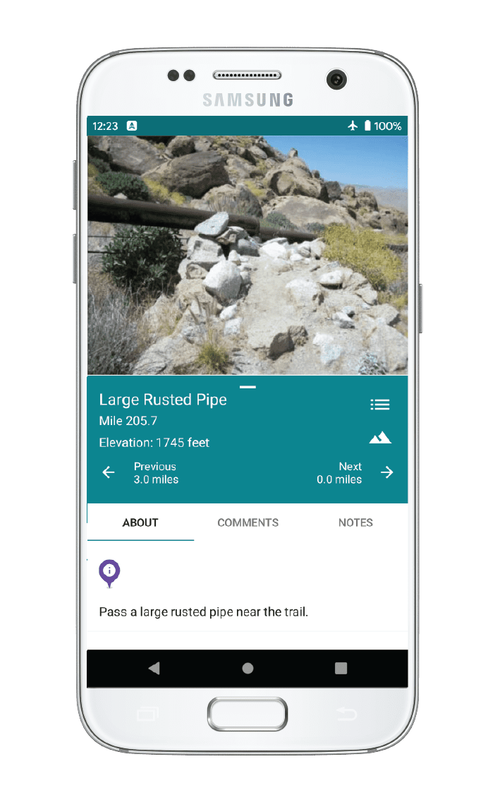
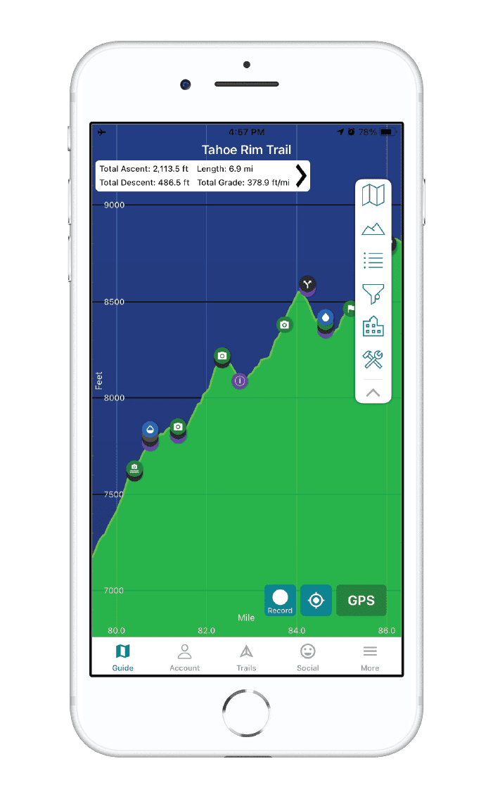
The Trans Catalina Trail map is available as an in-app purchase in our Guthook Guides app, a free download from the Apple App Store or the Google Play Store.
Our iOS and Android apps do differ slightly in their appearance. However, the majority of their features remain the same, and they access the same trail guide data.
The Trans Catalina Trail is a 39 mile hike, traversing Santa Catalina Island off the coast of southern California. From the eastern terminus in Avalon to Parson’s Landing on the West end, then looping back to Two Harbors, the trail explores flora and fauna unique to Catalina Island while offering exceptional coastal views.
$4.99
Photos of the Trans Catalina Trail
Hike more.
Check out some of the other trail guides we offer!
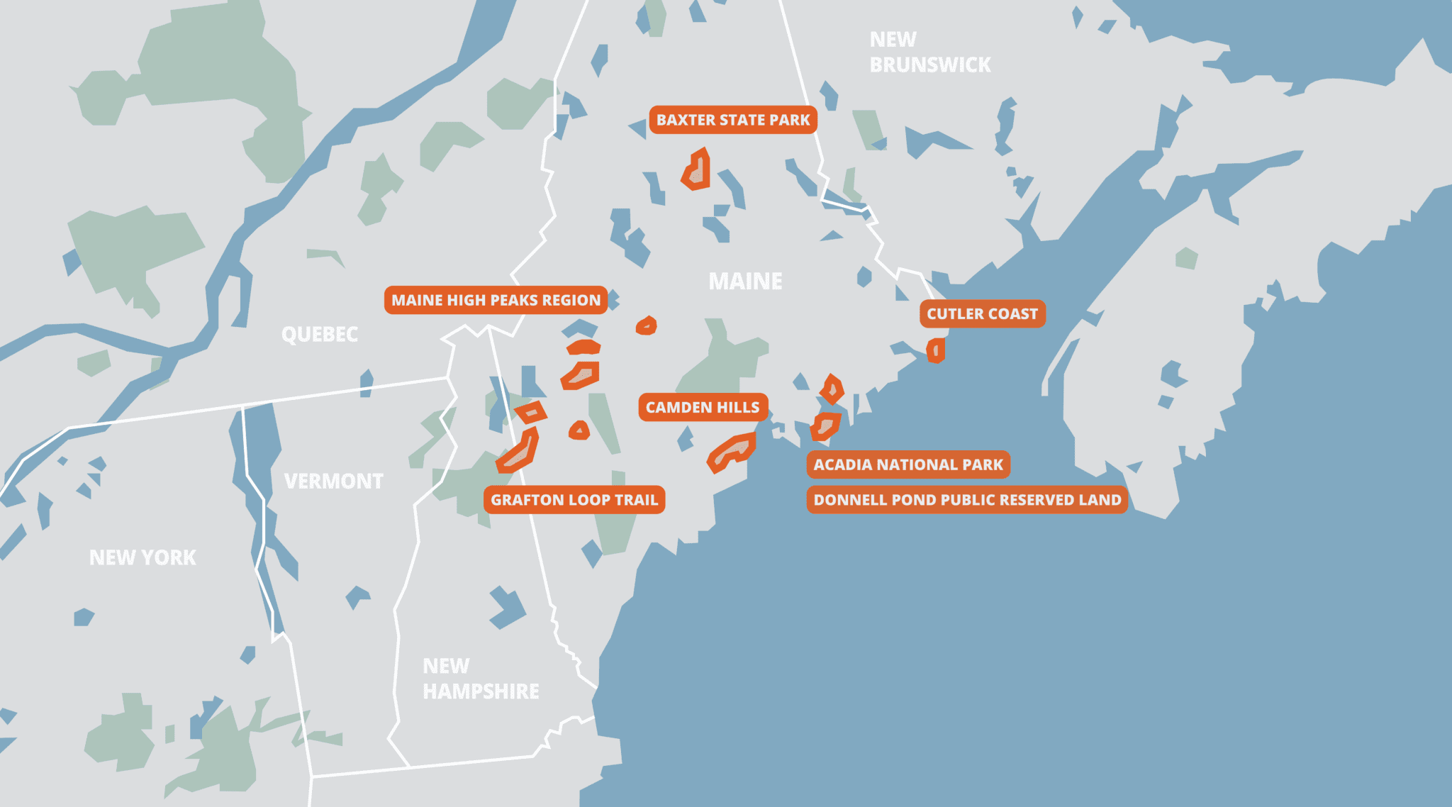
Maine Hiking Bundle
With the mountains in the west and north, the rugged coastline, and the rivers and lakes in between, Maine can be a hiker’s paradise if you take a little time to explore. Mighty peaks like Katahdin and the Bigelows offer up dramatic views atop rugged climbs, while the coastal hills can be just as wild and beautiful, a little closer to villages and towns.
This bundle includes all of our guides to Maine’s State Parks, Public Reserved Lands, and Acadia National Park.
20% off for our Hiking Season Kick-off SALE! The White Mountain National Forest Bundle is now $23.99.
30% off for our Small Business Saturday SALE! The White Mountain National Forest Bundle is now $20.99.
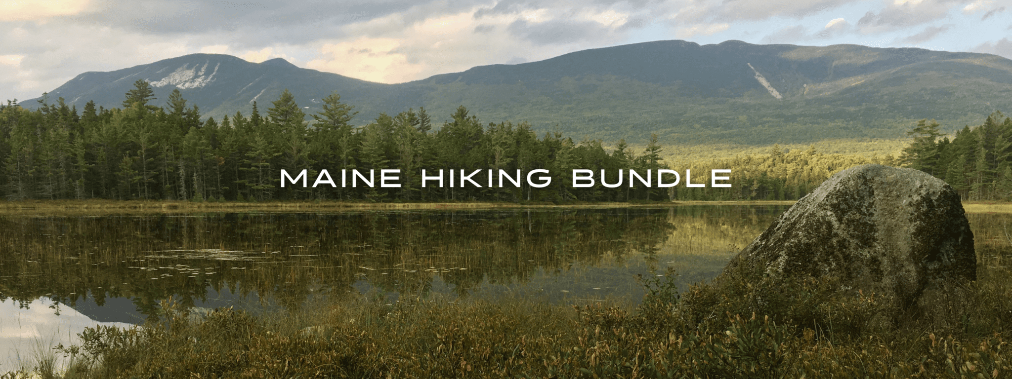
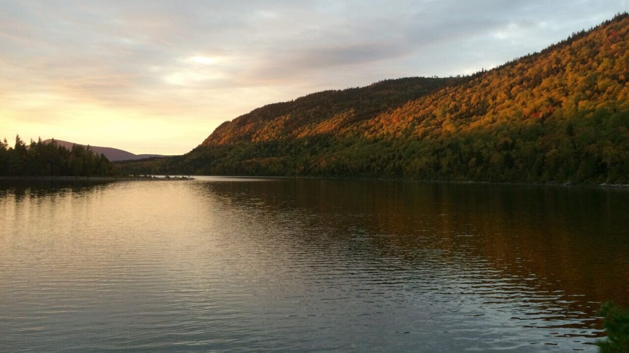
Elbow Pond, Baxter State Park, Maine
Photo by Ryan Linn
4.8 ★★★★★ | 17K+ Reviews
Maine Hiking Bundle
440+ miles of trails • Maine
Download our guide to access the Maine Hiking Bundle maps, tracks, waypoints, and comments! This bundle includes all of our guides to Maine’s State Parks, Public Reserved Lands, and Acadia National Park.
With the mountains in the west and north, the rugged coastline, and the rivers and lakes in between, Maine can be a hiker’s paradise if you take a little time to explore. Mighty peaks like Katahdin and the Bigelows offer up dramatic views atop rugged climbs, while the coastal hills can be just as wild and beautiful, a little closer to villages and towns.
$29.99 full guide 7 sections ($2.99 to $9.99 each)
$29.99 full guide
7 sections ($2.99 to $9.99 each)
Maine Hiking Bundle Map


How can I get it?
The Maine Hiking Bundle map is available as an in-app purchase in our Guthook Guides app, a free download from the Apple App Store or the Google Play Store.
Our iOS and Android apps do differ slightly in their appearance. However, the majority of their features remain the same, and they access the same trail guide data.
This bundle includes all of our guide sections to Maine’s State Parks and Public Reserved Lands: Acadia National Park, Baxter State Park, Camden Hills, Cutler Coast, Donnell Pond Public Reserved Land, Grafton Loop Trail, Gulf Hagas, Maine High Peaks Region, and Mt Abraham.
$29.99
Acadia National Park is the first National Park east of the Mississippi, Acadia is a paradise for hikers, bikers, and sightseers on the low mountains of Mt Desert Island. This guide includes all hiking trails and carriage roads within the park, plus some trails that stretch outside the park.
$7.99
One of the crown jewels of Maine’s outdoors, Baxter State Park is home to the state’s highest peak, Mt Katahdin, as well as several other rugged mountains, dozens of lakes and ponds, several major streams, and some of the deepest wilderness in the state. Most visitors come to either camp in the pristine campgrounds around the park, or to climb Katahdin (which is also the northern terminus of the Appalachian Trail). Whatever your plan, the Park is worth as much time as you can afford to spend there.
NOTE: The trails of the Scientific Forest Management Area, and for the Katahdin Lake area, have not been added to this guide yet. All other trails are available.
ALSO: This app is not affiliated with Baxter State Park in any way. Please visit www.baxterstatepark.org for more details on visiting the Park before you go.
$9.99
The rocky, coastal mountains of the Camden Hills form a beautiful backdrop to the towns of Camden, Rockport, and Lincolnville on Penobscot Bay. The Camden Hills State Park, which encompasses most of the mountainous area, boasts over 30 miles of hiking trails on five prominent peaks, while the George’s Highland Path provides another set of trails on three more mountains. Despite providing extraordinary views over the ocean and several nearby lakes, the crowds on the mountaintops here are much smaller than similar coastal mountains in Acadia National Park, making the Camden Hills one of the highlights of Maine’s State Parks system.
The State Park is also home to a very nice campground, which provides a peaceful and inexpensive alternative to the fine lodging along much of the rest of the Midcoast region.
$2.99
One of the highlights of the Maine Public Reserved Lands system, the Cutler Coast Unit is a 12,000 acre coastal forest that includes a 10-mile loop trail and primitive campsites on the rocky ocean shore. Visitors can take a short day hike to the tall cliffs over the Bay of Fundy, or walk several miles along the ledges and coves. The inland part of the loop trail also features blueberry barrens and peat bogs, providing a scenic and tranquil walk through the Downeast coastal forest.
$3.99
The Donnell Pond unit is one of the highlights of Maine’s Public Reserve Lands, and is a less busy alternative to the nearby Acadia National Park trails. An 8-mile loop trail over two mountains, and two out-and-back mountain trails, along with several ponds and three large lakes, all combine to make this a hidden gem in Downeast Maine. This guide only covers the hiking trails of the public land, as well as the campsites connected by them, but there are also several canoeing options in the area as well (see Maine Bureau of Public Lands’ website for more details).
$3.99
A joint effort between the Appalachian Mountain Club and the Maine Appalachian Trail Club, the Grafton Loop Trail was completed around 2007 as an approximately 40 mile backpacking loop trail on either side of Grafton Notch State Park in Maine. The trail is extremely rugged, but offers some of the finest scenery in New England, climbing over four open peaks, several more open ledges, and crossing several woodland creeks. More than half a dozen backcountry campsites allow backpackers to split the trip up in many different ways.
Though the trail is a long loop, there are several options for hiking trips here. Two trailheads allow backpackers to split the loop into two halves, while several shorter day-hike options reach the many fine peaks.
$4.99
The Grand Canyon of Maine, Gulf Hagas (pronounced “hay-gus”) is a series of deep gorges and waterfalls along the West Branch of the Pleasant River. While many Appalachian Trail hikers stop to see one or two scenic waterfalls, day-hikers can access more than half a dozen with a good day’s hike.
FREE
The area between Rangeley, Stratton, and Kingfield is home to ten of Maine’s fourteen 4000-Foot peaks, and a huge array of hiking, mountain biking, paddling, and skiing opportunities. Hiking trails on 9 of the ten major peaks are included in this guide (Mt Redington has no official trail to the top, so we leave it to the hardiest adventurers to find). The area has long been known as a winter recreation mecca, with the Sugarloaf ski resort drawing skiers from all over the world. More recently, the Appalachian Trail, the Bigelow Preserve, and the Maine Huts and Trails network have all added to the appeal.
Trail systems currently found in this app are as follows:
-The Appalachian Trail from ME Route 4 to Long Falls Dam Road
-The hiking trails of the Bigelow Preserve
-The Berry Picker’s Trail on Saddleback Mountain
-The Fire Warden’s Trail on Mt Abraham
More will be added in the future!
$5.99
Mt Abraham is one of Maine’s highest peaks, and also boasts the state’s second largest alpine zone, which means it has an extensive summit above tree line. The mountain is less easily accessed than some other nearby mountains, but the Fire Warden’s Trail is a good day hike with amazing rewards.
FREE
Stories from the trails of Maine!
Check out our most recent blog posts about hiking in Maine.
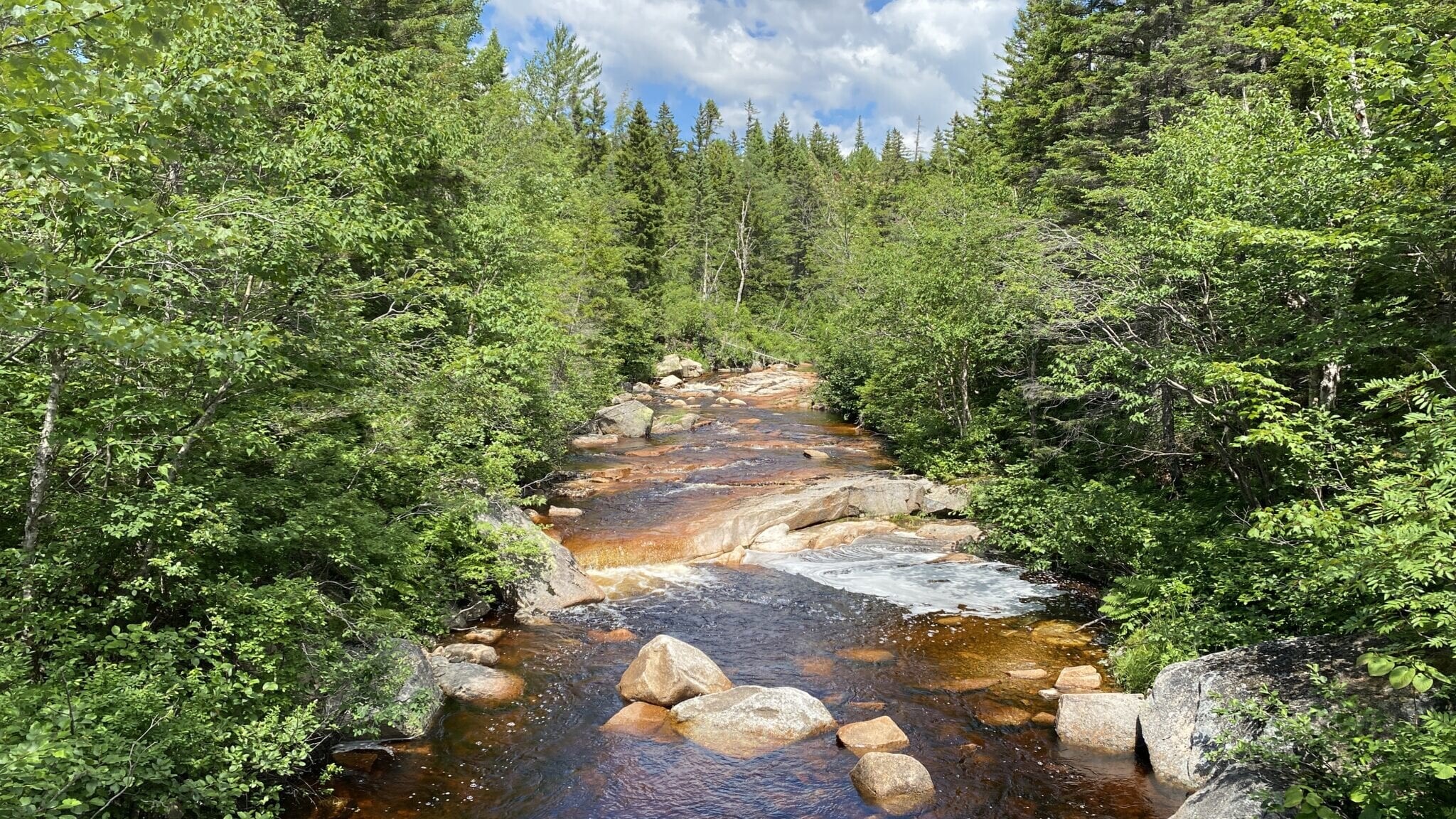
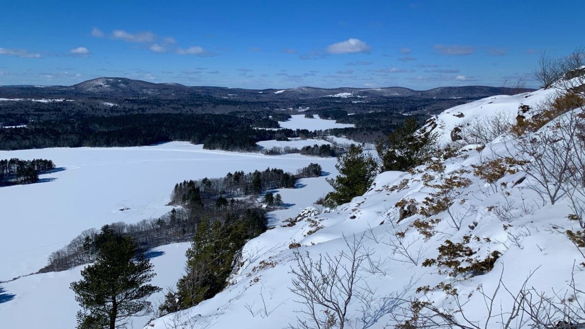
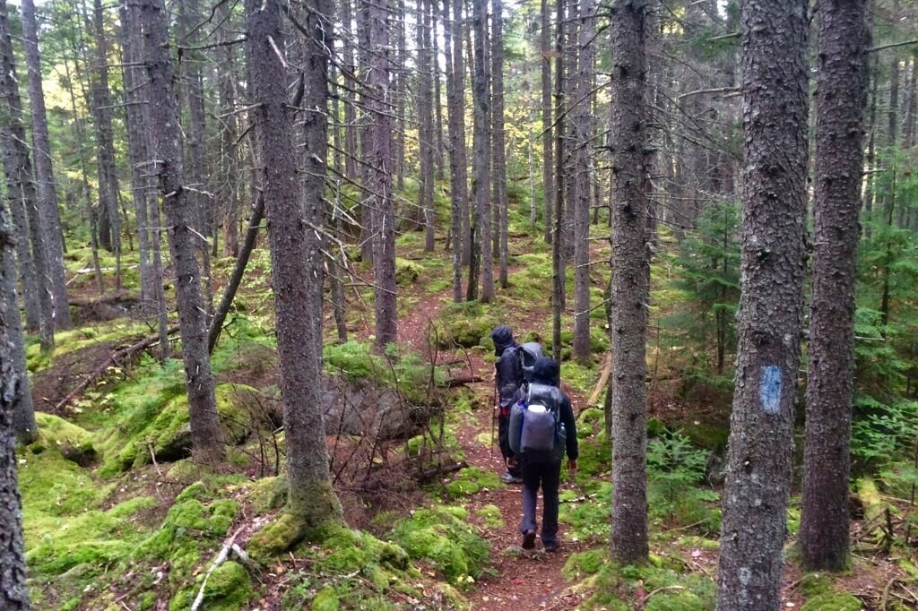
Photos from the Maine Hiking Bundle
Hike more.
Check out some of the other trail guides we offer!

Thru-hiking Gear Review - SlingFin SplitWing UL Tarp
Planning an adventure? Check out our popular trail guides! 4.8 stars (17K+ ratings)
Photo provided by Dahn Pratt
SlingFin SplitWing UL Tarp Review
The SlingFin SplitWing UL Tarp provides a unique value proposition. Lightweight glory without the price-tag heartache!
Dahn Pratt Gear Review 07/10/2020
Dahn Pratt
Gear Review
07/10/2020
SlingFin SplitWing UL Tarp Review
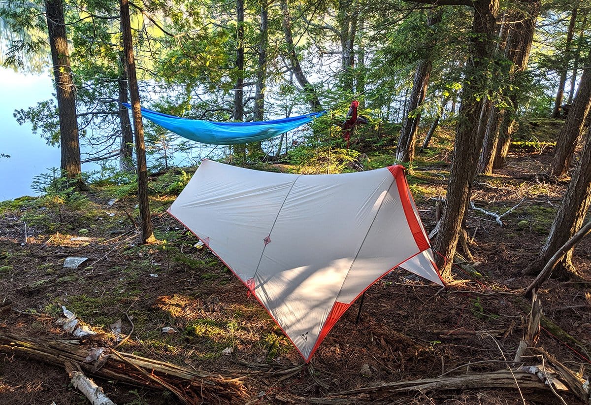
SlingFin recently introduced a new tarp to its offering of shelters. I got to try out the Splitwing UL Tarp for the last two months and have been pretty impressed with its weight to cost ratio, as well as its weather worthiness.
First some specs:
My SplitWing tarp was a scant 7.9 oz (as advertised) and with all guylines, stakes, and stuff sack weighed just 11.3 oz, a bit more than the advertised 11.1 oz on the website, but a negligible difference. *Please note this is for the tarp and the weight does not include the modular components that can work with the tarp (foot print, mesh, vestibule beak).
The tarp is made out of 10D Nylon 66 Ripstop Sil/Sil with a 30D weight at the tarp’s reinforcements points. SlingFin claims that this fabric,
“…[W]on’t hydrolyze like PU coated fabrics and absorbs less water so it doesn’t sag as much as PU coated fabrics and makes it resistant to mold and mildew growth.”
I’m not really sure what hydrolyzation is but sounds good to me!
What I like about the Splitwing UL Tarp

Photo by Dahn Pratt
Lightweight & reasonable price – I was especially impressed with the weight for a non-Dyneema shelter, not to mention the MSRP (cost) of the SplitWing of $164.99. For reference, comparably weighted shelters can be in the $400 – $600+ range when Dyneema Composite is the textile of choice.
Super packable – I was also impressed with how packable the Nylon66 fabric is. I often baby my Dyneema gear when putting it in my pack for fear of damaging the fabric. As most long distance hikers know, Dyneema is not very abrasion resistant. On a long hike, holes and degraded fabric are a foregone conclusion. It’s still too soon to speak to the longevity of my SplitWing Tarp, but I am optimistic to this end as repeatedly stuffing it in the tiny stuff sack is no problem and folding is not necessary.
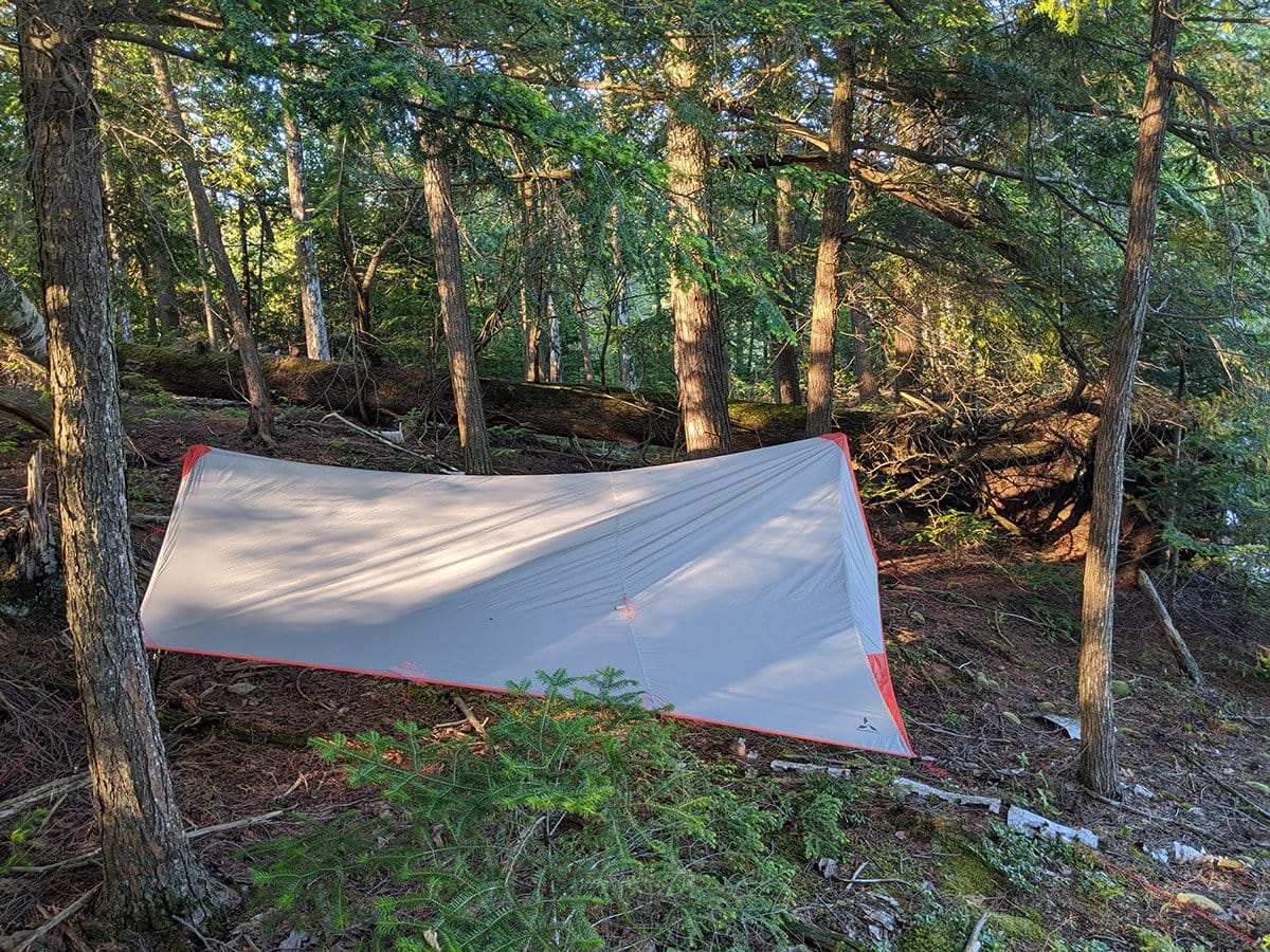
Photo by Dahn Pratt
Versatile – When temperatures soared, I pitched the tarp high for maximum ventilation; and when I was concerned about the potential for inclement weather, I pitched it low to the ground. The SplitWing can also be used (and indeed was used) as a hammock tarp with a ridgeline. I especially liked the ability of the tarp to pitch in precarious places e.g. on the edge of a lake near some heavily beaver chewed Birch trees.
Sets up taut – The tarp was very sturdy even without staking down all the extra guy-out-points. I have lots of confidence in the tarp in adverse weather conditions. Luckily for me, I have yet to experience such weather.
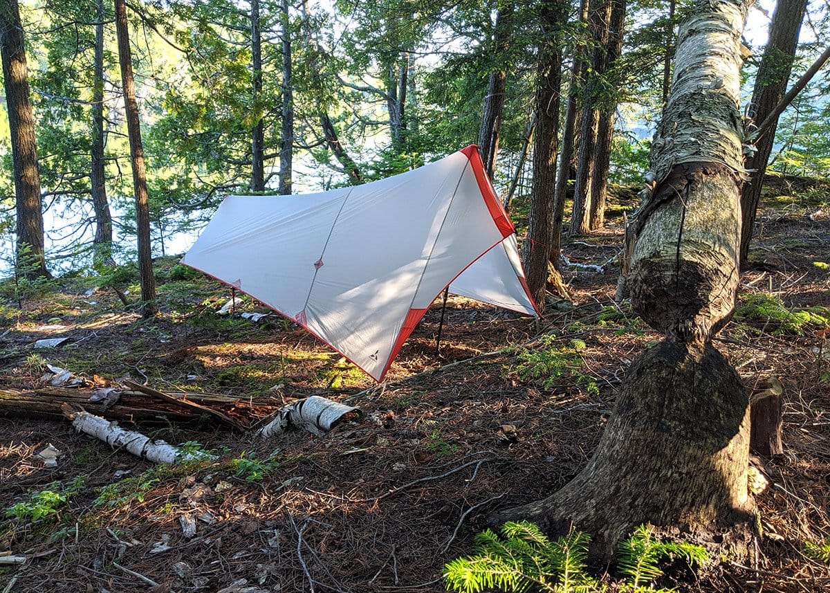
Photo by Dahn Pratt
Things to note:
Practice before you leave — in terms of setting up, at first I found it rather confusing, even after using tarps for thousands of trail miles. Perhaps I’ve forgotten a bit of geometry or need to cut my teeth some more on tarp pitches but it took a bit of head scratching as well as trial and error to get the pitch taut the first time around. All of that being said, the consecutive pitches afterwards were much faster and less confusing. Understanding how your gear works beforehand is one of the many pre-hike rituals I try to undertake to ensure a more pleasant outing — maybe I should heed my own advice more often.
After my initial confusion, and if we’re being honest, mild frustration, I realized I didn’t give the SplitWing a fair-shake having haphazardly set it up as fast as possible so I could escape the mosquito horde in favor of a swim in the northern Ontario lake that I chose as my basecamp.
It’s also worth mentioning that I mistakenly placed the bottom trekking pole (where my feet would go) UNDER the tarp instead of using the tie out and affixing the trekking pole TO the tarp.
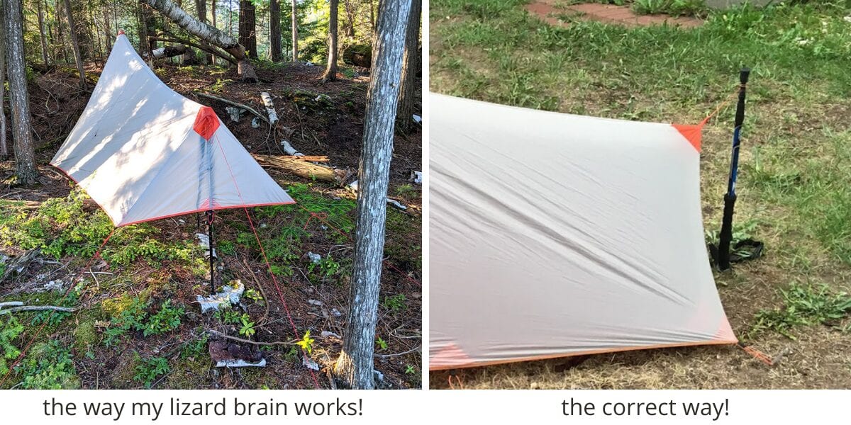
Photo by Dahn Pratt
Either way the tarp pitched exceptional well, even in the face of my obvious faux pas (a definite feather in the cap for SlingFin and a question mark for my mental capacities).
Another user error I ran into without instructions was guying out the wrong tie out points for the front end of the tarp. Instead of using guylines for the vestibule carabiners, I just attached them together. This made me question the weather-worthiness of the tarp (but in retrospect this was completely my fault).

Leaves you somewhat exposed – My one reservation is that the SplitWing Tarp (sans mesh, vestibule beak, footprint) may not protect from all the elements. At the very least I would recommend getting the vestibule beak as well to cover the tarp opening. However, us hikers are cheap, and creative. If you carry an umbrella, I believe it would be a great replacement to the vestibule beak with a similar effect, albeit a less form-factor-fitting component.
The Verdict:
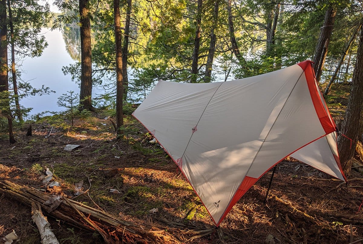
Photo by Dahn Pratt
Overall, I think this is an amazing value when considering cost, weight, performance, packability, protection from elements, and longevity. I’m looking forward to putting more miles on the SplitWing but for now I’ll enjoy my lake-side digs.
Author’s disclaimer: This tarp was given to me by Garage Grown Gear for the purpose of reviewing.
This article was originally written for Garage Grown Gear and can be found here.
Want to keep up with all that’s going on at Atlas Guides? Sign up for our newsletter!
Read more!
Check out some related blog posts!

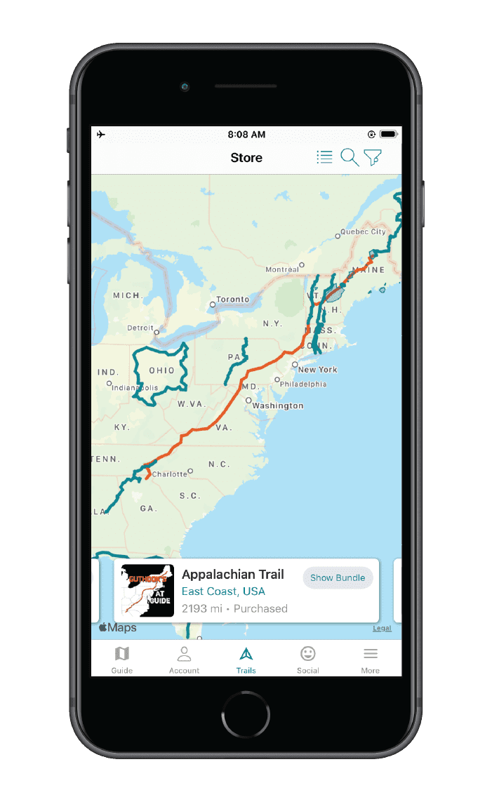
Download our popular hiking and biking guides!

Trail guides that get you to places you’ve dreamed of.
As the makers of Guthook Guides, Bikepacking Guides, and Cyclewayz, we help you navigate the most popular trails around the world on your smartphone. Our hiking guides and biking guides work completely offline. Let Guthook guide your next adventure!
Showers Lake Vista, Tahoe Rim Trail
Photo courtesy of the Tahoe Rim Trail Association
About the Author

Dahn Pratt
Dahn is an avid taker-of-walks. He has hiked the Triple Crown of National Scenic Trails in the United States, Te Araroa in New Zealand, the Peace Trail through Jordan and Israel, and various other routes and trails around the world. His most recent escapades called “Chasing Summer” had him hiking long distance trails, oscillating between North and South Hemispheres in perpetual summer.
Embrace the Punctuality: Thru-hiking the CDT on a time-crunch
Planning an adventure? Check out our popular trail guides! 4.7 stars (12K+ ratings)
Photo provided by Dahn Pratt
Embrace the Punctuality: Thru-Hiking the CDT on a Time-Crunch
Dahn thru-hiked the CDT in 95 days in between spending six weeks off-trail at four different weddings.
Dahn Pratt Trip Report 06/05/2020
Dahn Pratt
Trip Report
06/05/2020
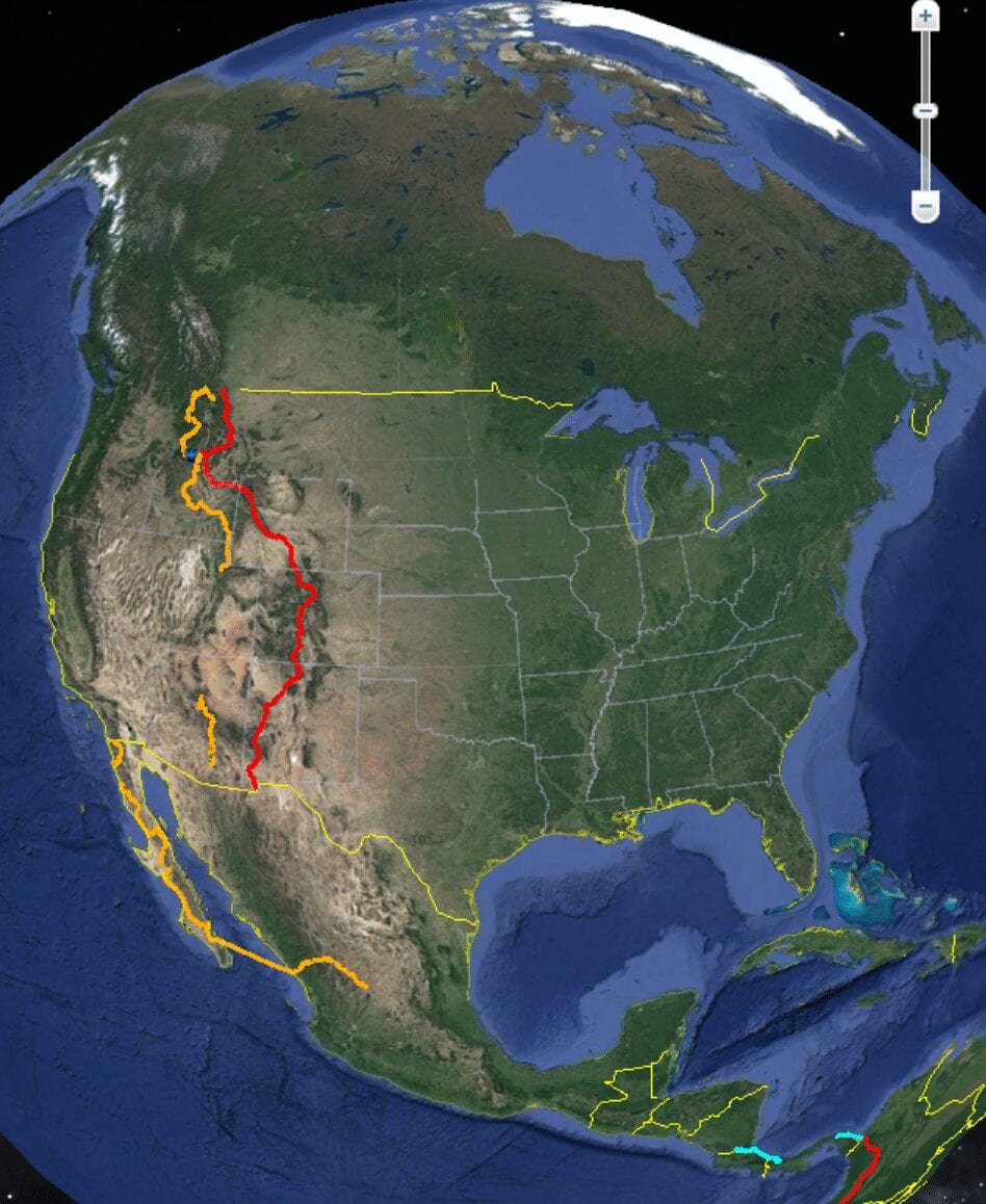
From late June to early November 2019 I thru-hiked the Continental Divide Trail from Canada to Mexico. Although the time frame of six months looks rather ordinary, I only spent 95 days on-trail, spending six weeks off-trail at four weddings. Getting off the trail for two major breaks made for an interesting and unconventional thru-hiking experience. I learned a lot about myself and my hiking preference from this frenzied hike.
The CDT has a reputation for being a suffer-fest in comparison to other national scenic trails in the United States, often referred to as the PhD of thru-hiking. To complete the trail in under 100 days necessitated averaging over 32 miles a day through often challenging terrain and weather conditions. Perhaps the most difficult part was spending a majority of the time completely alone. Solid weeks would go by of seeing perhaps one or two people, mostly in passing. Some days I would see no one at all.

A rare human sighting in Glacier National Park, MT.
The most difficult part of the hike was not the physical challenges, of which the CDT has plenty, but rather the mental obstacles that are rarely prevalent in our sedentary lives. Lack of comradery for months can really take its toll on you. Humans are social creatures after-all. The ability to commensurate about a harrowing weather experience, atrocious trail conditions, or lack of peanut butter, and celebrate triumphs, gorgeous sunsets, or a really nice spring are part of our shared human experience. The severing of this interaction is very surreal for a mind not adept to seclusion from society.

A brooding sky presents a light show. With no one around to share its beauty, I simply had to smile in silence. Central New Mexico.
Moreover when on a major time crunch, relying solely on yourself for motivation becomes an increasing implausibility. When the weight, magnitude, and sheer length of walking the length of the United States starts to settle in, a dull, but ever present anxiety hovers over every wa(l)king minute, you start to lose your marbles. Perhaps this self-flagellation can be entirely avoided. It is voluntary after-all, or perhaps this is all part of the process of a long walk.
All that being said, this type of self imposed isolation can also be very beneficial. A long distance thru-hike gave me the opportunity to fully immerse into myself, a unique chance to truly get to know oneself.
SOME OTHER BENEFITS OF A FAST THRU-HIKE:
Less time in town
- Increasingly I find myself attempting to escape the grinding banality of modern civilization by retreating into the wilderness. One of the caveats is the necessity of replenishing food, gear, or sleep in towns along the way. On a serious deadline, time not spent hiking looms over you as a wasted opportunity or a potential reason you do not accomplish your end goal.
- Limiting time spent in town is hard on the mind but can greatly increase your daily average mileage.
- Most people are familiar with a “zero” (a day of no mileage, usually spent in town) or a “nero” (a short day into or out of town). On the CDT I tried a first for me, a “hero” (hiking into town, doing necessary town chores, and hiking out), essentially a full day of hiking with a brief town stop. This eliminated the need to linger in town, with all of its temptations, and allowed my mileage average to hardly fluctuate.
Less money spent
- More time spent on trail equates to less opportunity to spend money. I was able to stay solvent during my thru-hike despite a limited budget by never spending a night in town and avoiding restaurants in favor of supermarkets.
More immersed
- Extending time outside the comforts of modern civilization allowed for a more holistic experience of nature.
- Limiting distractions allowed for a level of introspection I seldom have with the chaotic and interconnected “inside” world.
- This immersion allowed and even necessitated a trust of self, as there was no one else to rely on. This made me fundamentally optimistic — you have to be when you’re completely isolated from the rest of society.
- Immersion also exposed the true scale of one’s surroundings. A recurring thought was, “it’s so vast out here that my problems don’t take up any space.”
- Taken as a whole, this immersion peels back the layers of self defense mechanisms and societal conformities to reveal that the mask disappears and you transform into your true self. A powerful understanding of your own identity.

Fully immersed while sauntering through the jaw-dropping Wind River Range of Wyoming.
Goal oriented
- Being on a tight hiking timeline necessitates great discipline. Everyday is an exercise in fighting off the ideas of futility. Being able to self motivate and actualize are skill sets that are transferable but can also be honed while hiking a long trail.
- The routine one creates while on a trail — waking up early, limiting breaks, pushing the pace — are a constant act of discipline. Aristotle famously said, “We are what we repeatedly do. Excellence then, is not an act, but a habit.”

Walking by sun-up ensured I had a minimum of 12-14 hours of moving time. Wyoming/Colorado Border.
All of that being said, my big epiphany from this long walk was that true appreciation of the enormity and beauty I was privileged to explore was not fully maximized with my constraints of arbitrary timephrames. I am reminded of a powerful saying from an old and rarely explored Camino (pilgrimage trail) called Via Francigena:
The route, like life, is not a competition. Never get seized by the wish to do too much: your body will soon demand an explanation. Look around, observe, stop and taste. That’s what the route will teach out.

Taking a chance to “stop and taste” some foraged wild morels from a wildfire burn area in Idaho.

Sometimes you have to stop and smell the sulfur. Yellowstone National Park, WY.
Taken as a whole, hiking with a time constraint has some definite beneficial qualities, but if your purpose and passion for recreating in the outdoors is to immerse, explore, and be unhindered from the chaotic society you’ve momentarily escaped from, the idea of a deadline is detrimental to the experience. More often, I find myself suggesting the idea of section hiking, where time and distance play a much smaller role in the adventure you choose to take. Big miles and aggressive hiking is a great bragging right but it’s not the only way to Hike Your Own Hike.
Want to keep up with all that’s going on at Atlas Guides? Sign up for our newsletter!
Read more!
Check out some related blog posts!

Get our trail guide for this area!
Continental Divide Trail
Considered by many to be the most remote and challenging of the triple crown trails, the Continental Divide Trail is a 3100 mile adventure through five western states.
3100 mi (4980 km) $39.99 full guide
Colorado, Continental Divide Trail
Photo by David Getchel
Colorado, Continental Divide Trail
Photo by David Getchel
Continental Divide Trail
Considered by many to be the most remote and challenging of the triple crown trails, the Continental Divide Trail is a 3100 mile adventure through five western states.
3100 mi (4980 km)
$39.99 full guide
Get our trail guide for this area!
About the Author
Dahn Pratt
Dahn was a 2019 Data Fellow for the CDTC, collecting trail data while thru-hiking from Canada to Mexico. Hiking the CDT was part of a larger project, “Chasing Summer”, a 10,000 mile journey through various national scenic trails all over the world.
(Don't) Hike for Change featuring Fidgit
Planning an adventure? Check out our popular trail guides! 4.7 stars (14K+ ratings)
Photo provided by Bethany Hughes
(Don't) Hike for Change
Fidgit examines decisions to postpone or cancel a long distance hike through the lens of ancient Central and South American mythology and a 20,000 mile trans-American journey.
Bethany Hughes My (Postponed) Trail Story 04/20/2020
Bethany Hughes
My (Postponed) Trail Story
04/20/2020
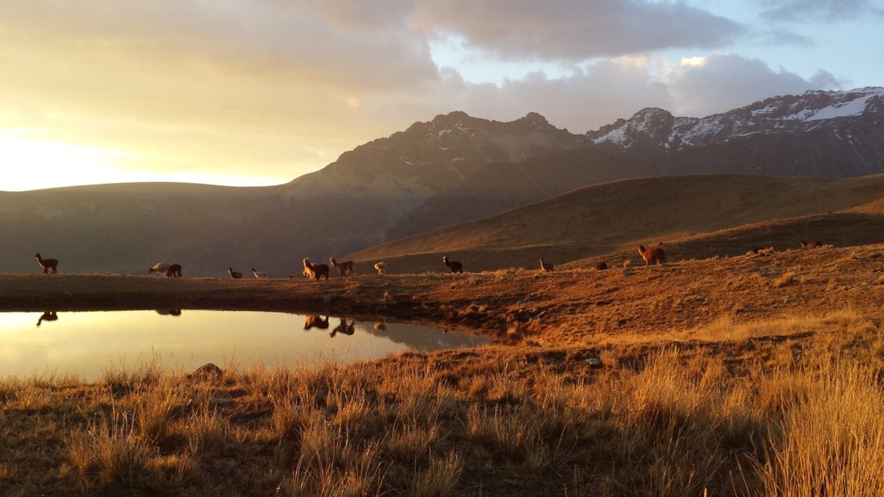
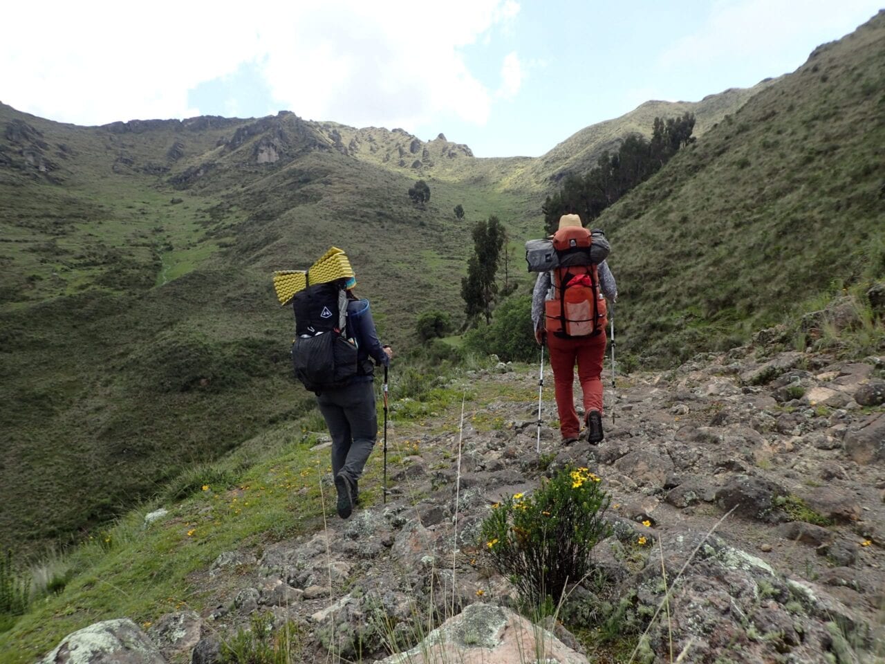
Alpacas at sunset in the Huayhash range. Photo by Bethany Hughes
(Don’t) Hike for Change
By: Bethany ‘Fidgit’ Hughes
Do you remember when people thought the world was going to end in 2012? The idea stemmed from the end of several Mesoamerican calendars. What the frenzy failed to do was what most frenzies fail at: following the information all the way through. The conclusion of the calendars marked transitions in eras, not the end of the world. As I look around now and back over the past few years, the changes and stressors are notable but nothing unexpected if we perceive this as a time of change.
Everyone goes to Machu Picchu, yet we had the entire grounds of the Inca ruins at El Shincal in Argentina to ourselves and the groundskeepers even let us sleep on their porch.
The end of the Mayan and Incan calendars marked the end of protracted cycles. For the Mayans it was one of 7 Ages of Man. For the Incas it was the end of an era ruled by “masculine energy” and the beginning of an era of “feminine energy.” That these transitions happened around December 21 makes sense since both cultures, like many around the world and across the ages, track the solstices. For example, even among the thru-hiking community, we ceremoniously engage in Hike Naked Day every June 21st.
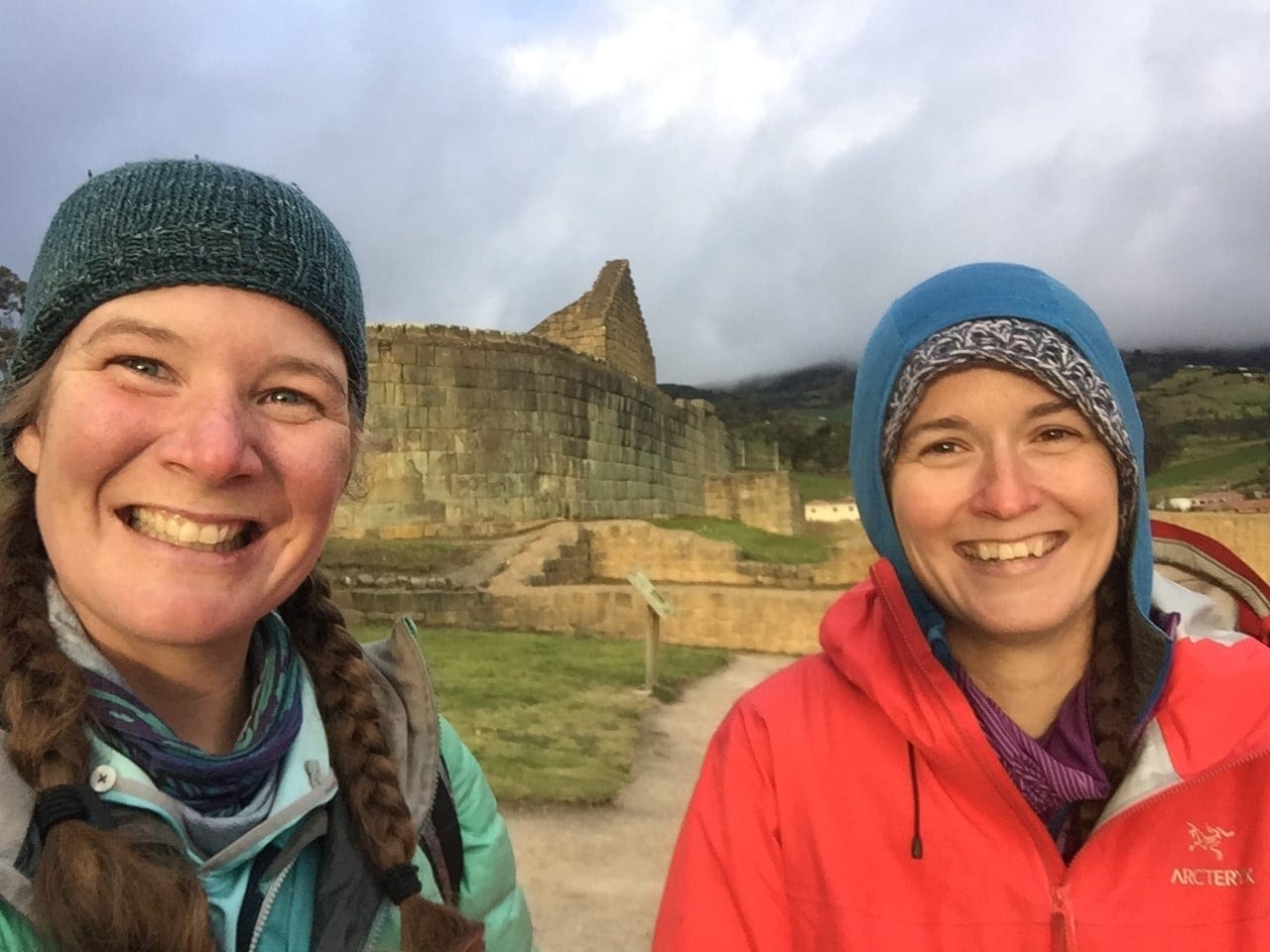
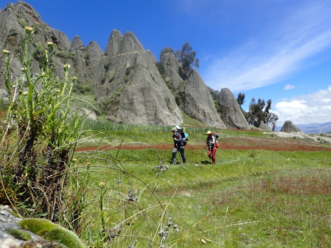
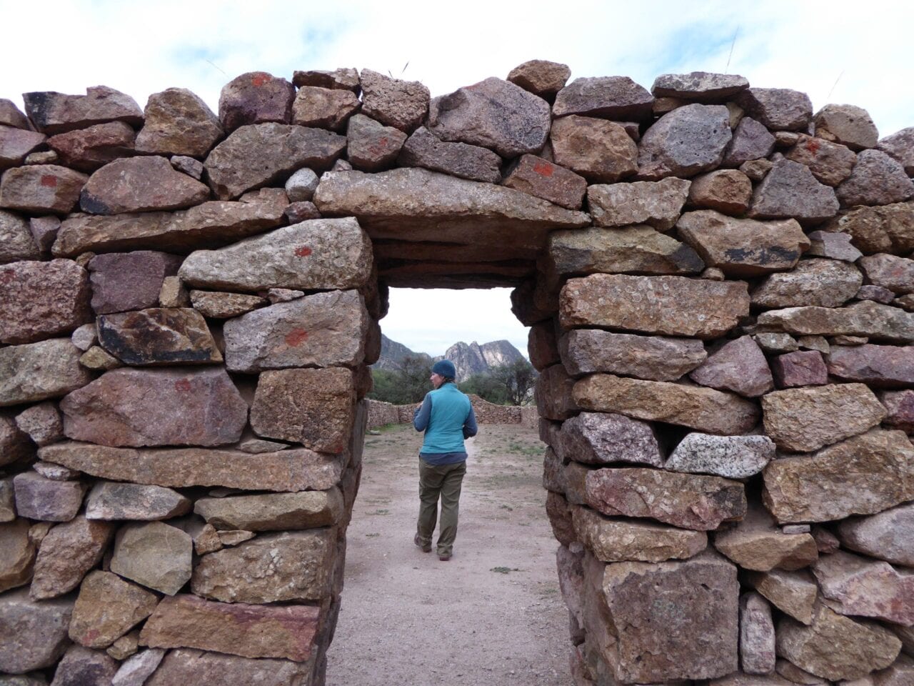
Fidgit (left) and Neon (right) at the Ingapirca ruins in Ecuador which are ceremonial grounds for two different cultures: the Cañari who worshiped the moon, and the Inca who worshiped the sun. There is an incredibly well preserved and largely ignored multi-day stretch of the Qhapaq Nan which begins at this site.
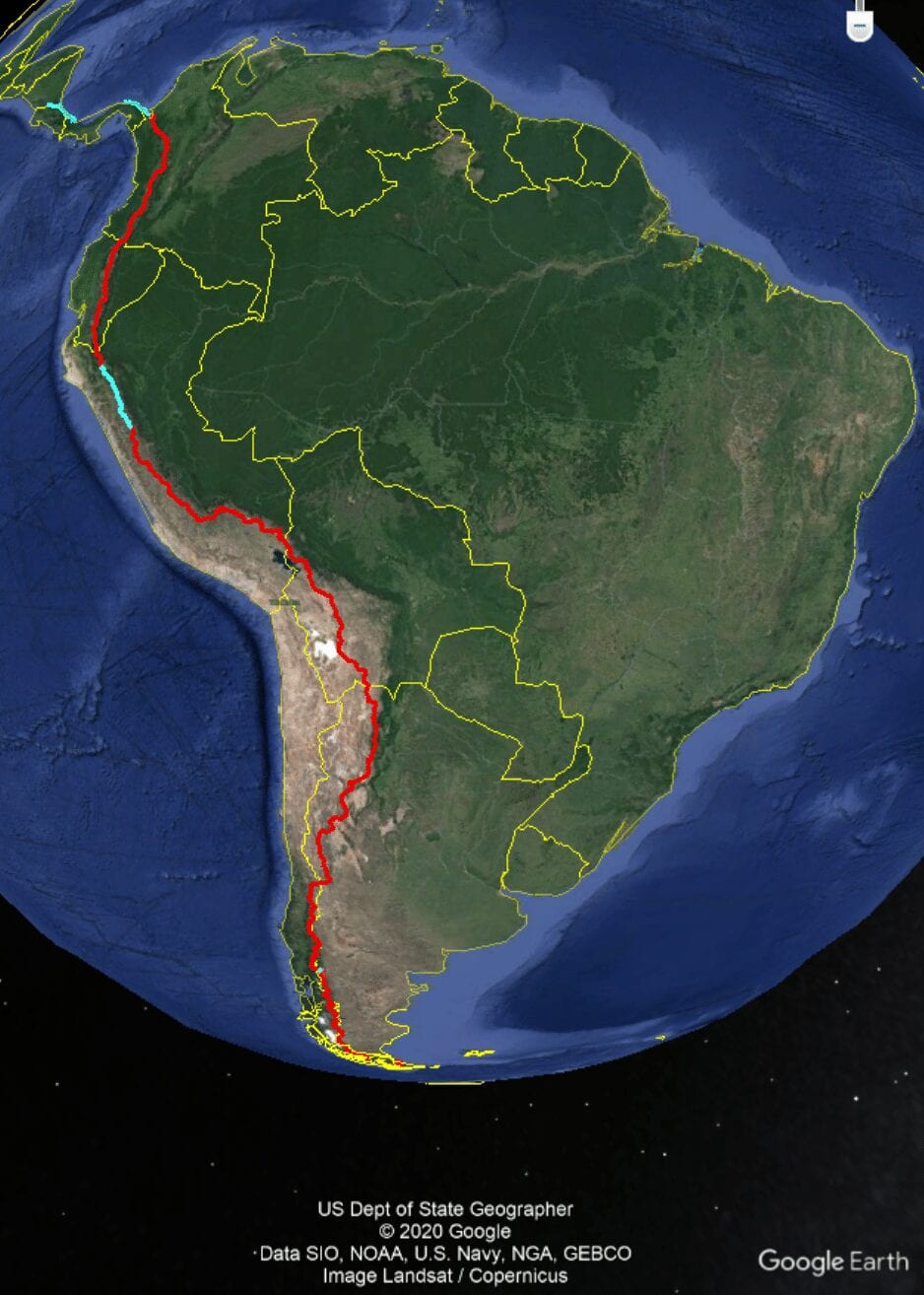
My sources on that aren’t of an academic nature, they come from three years of walking across South America. They are stories and explanations from a grandmother at the foot of Ollantaytambo, Peru who, when I picked up one small rock from her table, carefully selected and insisted I take a second one, to balance their male and female energies. Or from days of walking and talking with chaskis (during the Incan Empire chaskis were runners who carried messages from the capital[s] to the far flung corners of the empire. The men I spoke with were modern day guides and unofficial guardians of segments of what remains of the Qhapaq Ñan) along the 3,000 miles of the Inca Trail we followed. Complemented this with some Googling. That and a lot of miles of walking, thinking, and watching as we strive to create a non-motorized route connecting the Americas.
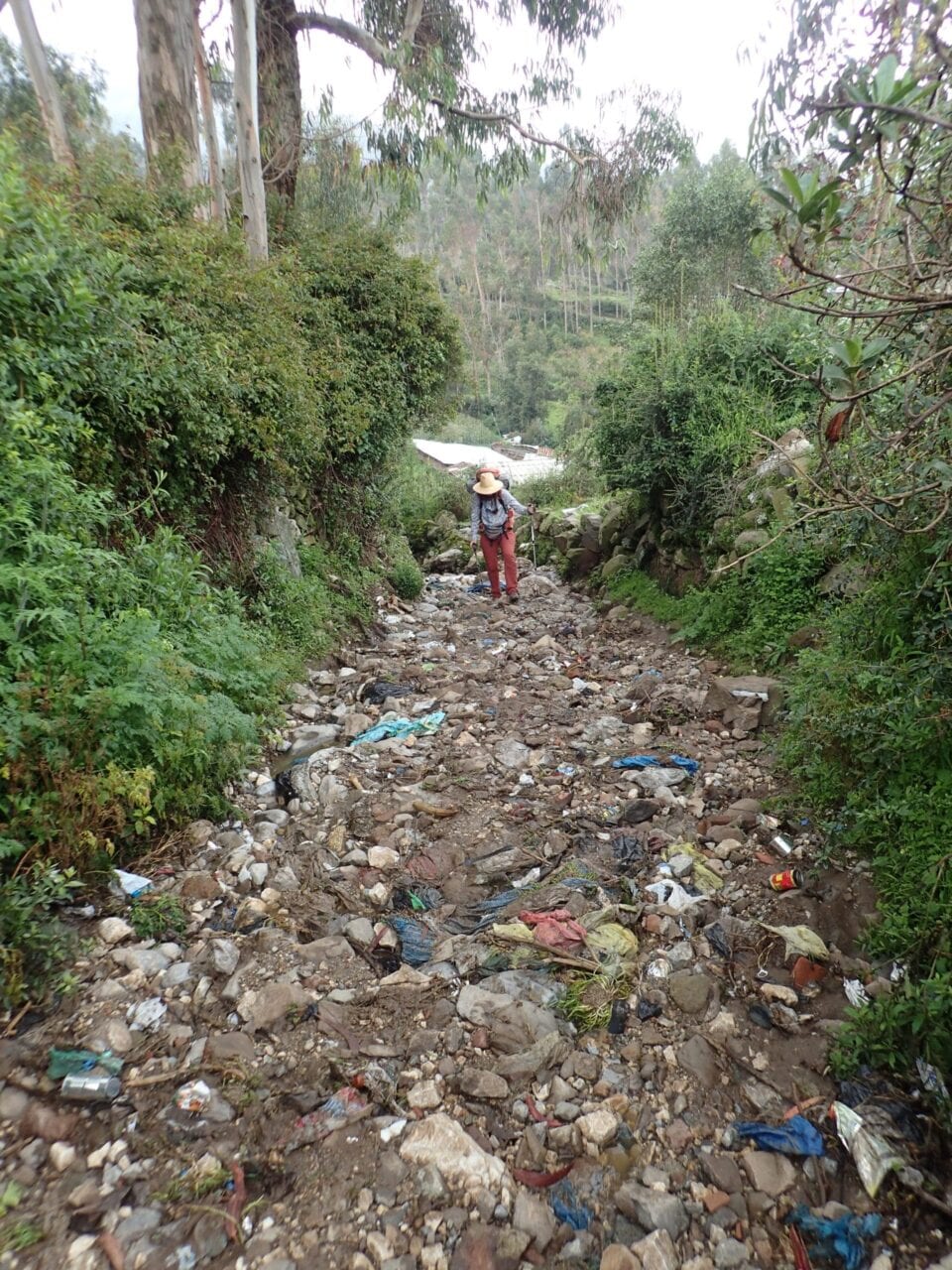
Because of being such a deeply entrenched footpath after centuries of use and despite being a UNESCO designated World Heritage Site, outside of cities and towns the Qhapaq Nan is most often used as a dump site.
In my final days of completing the Continental Divide Trail last summer, I crossed paths with Dahn, a fellow long traveler. We had been following one another’s international hiking adventures and had been trying to meet up, so of course it didn’t happen until the last 100 miles. In the few hours we walked together, we had one of those conversations that only happen on trail: diving straight into debating ethics and what kind of faces we make at cars on road walks.
I told him about the Incan idea of the calendar shift of power from masculine to feminine. He began to speak passionately about the rise of women, saying it was time for things to change! Frustrated that we haven’t had a woman President in the USA. There was a fervent bounce in his stride as he talked about it. If it’s our time, we need to rise up, RIGHT NOW and seize control.
The best things take time and immense pressure and sudden changes leave beautiful marks.
We sat in front of Saucedo’s Market in Lordsburg taking swigs off a jug of orange juice and eating bananas. I appreciated his vehemence and commitment to pursuing equal rights. I just did not agree with his perception that the change needed to happen abruptly. Rather, I thought our having that conversation was a significant indicator that things are changing. In fact, several times along the CDT I was impressed and inspired by the men I hiked and talked with who were reflecting on their personal roles and seemed genuinely committed to growing and changing, even where it meant questioning familiar structures designed to benefit them.
In our earliest roles, men were successful as hunters because of: having singular focus, designating a leader, and tracking, attacking, and conquering game. Meanwhile the women were primarily gatherers and were successful because of observing surroundings as a whole, following growth cycles, and working as a collective to gather foods. It does not serve to pick a berry before its time. We grow humans within our wombs. These processes cannot be rushed.
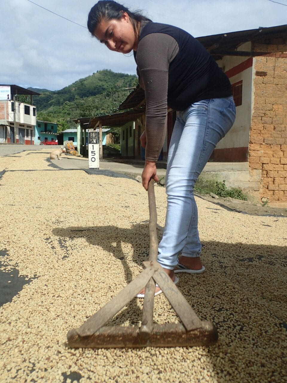
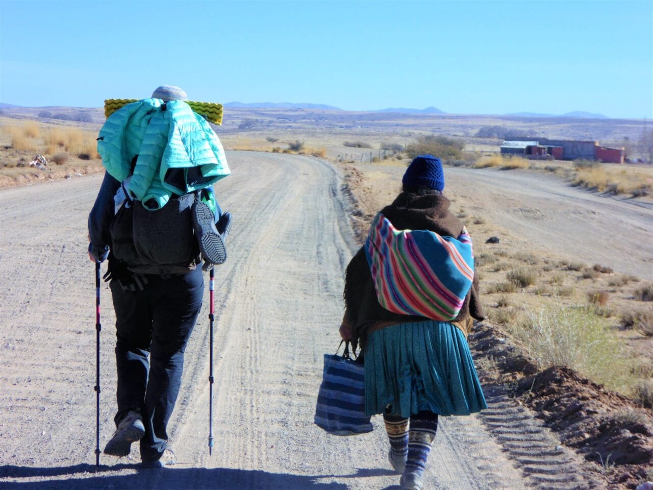
Chatting with a local woman who was caring for her coffee beans during the multi-day drying process. Coffee is a major industry, much like quinoa, throughout this region of Peru.
The geopolitical and economic structures today are geared toward the hunter, big dog on top, thinking. We have been raised with scripts of:
“if you want it, grab it.”
“You have to want it more than the next guy.”
“Don’t let anything stand between you and your goals.”
Now more and more of us are looking around and acknowledging that this is not working. Not for our planet and not for us.
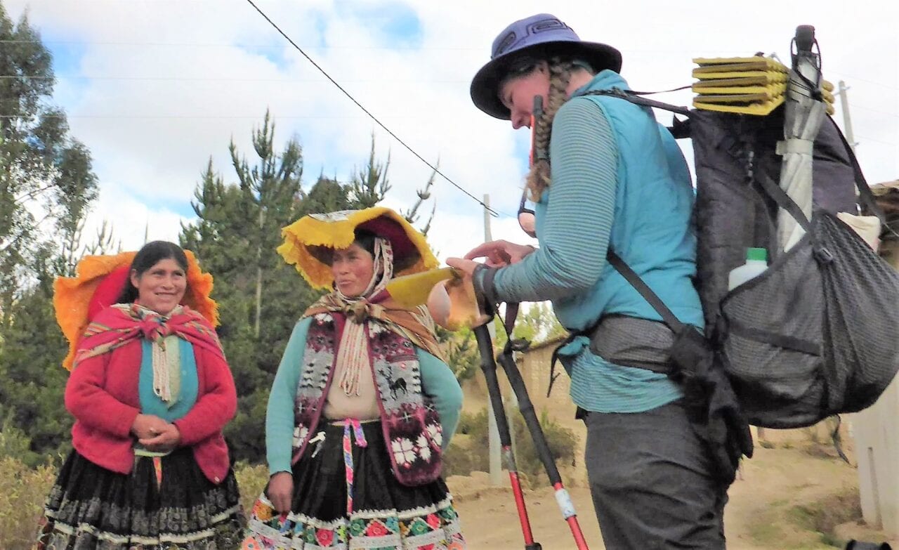
Learning bits of Quichua from cholitas in the Cusco region.
This is the end of the era of conquistadors and Victorian explorer thinking. Being first or fastest is less a matter of dominating one another and the land, than it is about expanding the bounds of what we can achieve when we work with each other and the environment. Minorities are stepping forward and making their voices heard in communities and conversations across the board. I am encouraged to begin seeing people of privilege supporting this and amplifying the message. Underneath the ills of our systems, down here at the dirt sitting hiker trash level, many people are making an effort to hear one another and are considering different perspectives. That is a big deal and a good start.
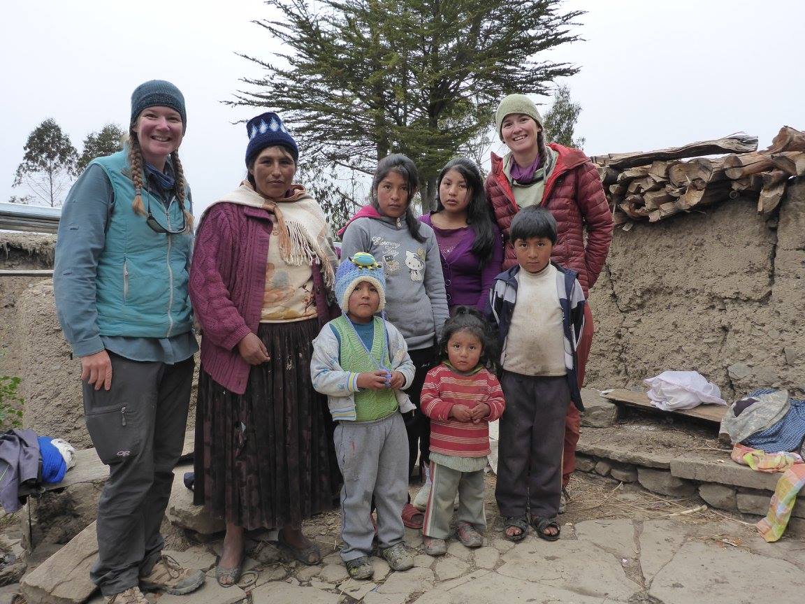
Fidgit (left) and Neon (right) with one of the many families who invited us in and insisted on sharing everything they had.
In the thru-hiking community, we identify by our determination, overcoming challenges, and pushing limits in pursuit of the coveted thru. The current state of human affairs, and in a larger perspective, the planet, are a mighty invitation to rewrite that narrative. Flip flopping because the snow in Colorado says “no.” Taking an alternate or following a reroute because of a forest fire. Changing our plans from a thru-hike to smaller adventures closer to home because of a virulent virus. Nature is pushing us, not to give up, but to reframe our identity to another critical strength: flexibility.
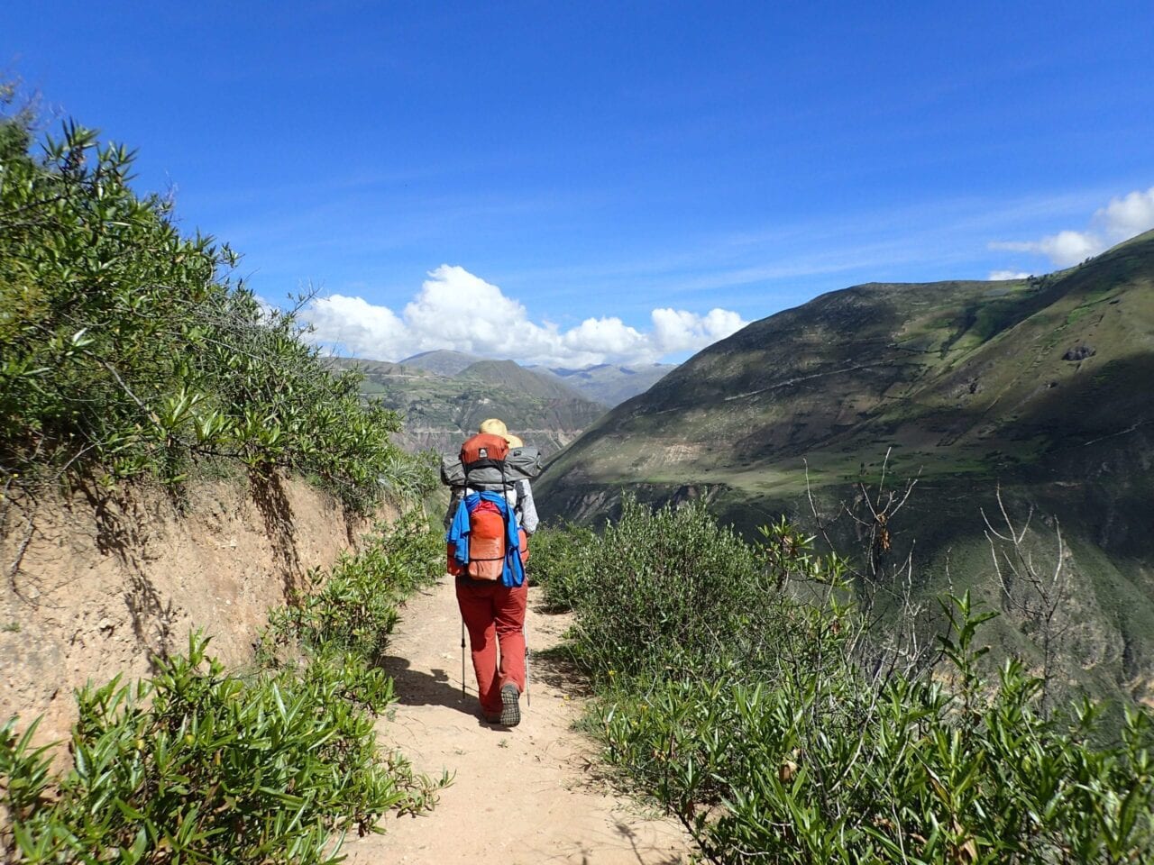
Neon following the Qhapaq Nan along the contour of the Andes.
That same demand to drastically change plans and let go of ego is at play this season with the quarantine efforts which, for many of us, are a direct call to set aside our wants and goals in the interest of others. As the call goes out to stay off the trails to honor our trail communities, thousands of us have made difficult decisions and huge sacrifices in our hiking plans. My travel partner and I made the choice to pull off mid-route in Mexico. Sure, there are yet a few who, for reasons of their own, are out there anyway. Rather than give our collective time and energy to being upset about them, let’s acknowledge and celebrate the fact that the majority of us opted to sacrifice. That means something.
While the theatrics of social media are particularly alluring when you are frustrated to be stuck staring at a screen instead of climbing a mountain, this is yet another chance to change the narrative by not giving in to the bickering and the bitterness. The information, reasons, and requests to stay off the trail are out there. Hounding each other does not add anything to the conversation.
The ancient road was so well developed and traveled that in many areas beyond the reaches of the cities, the road continues clearly and follow toward beautiful passes. Fidgit (left) Neon (right)
Amidst the mess: politics, climate change, and the global responses to this virus, I see the power shifting from conqueror to community. Let’s not underrate that just because it isn’t happening in the same way or at the same pace as our history books have seen change of power before. Women and minorities in general are not weaker because we approach things differently. We are not passive, fragile, or fearful. We know trauma and physical hardship beyond what any trail can wrought. We are determined, adamant, and we are rising.
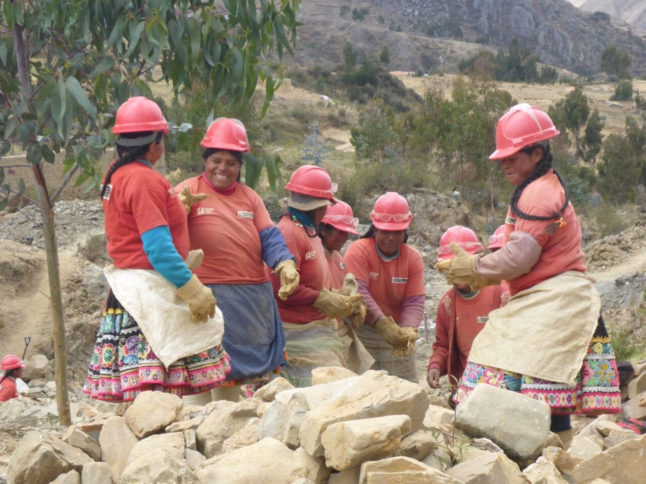
A section of road had been obstructed by a landslide and outside help was not coming so the local women organized themselves. There was a lot of laughter and tittering as they worked.
I see a fit for the Incan dichotomy of a shift in the balance between masculine and feminine energies. I see harbingers of change between lines of thinking and how we approach one another. Do not be ruled by fear nor anger and do not rush but let us hurry into the work of our lives. We may not be thru-hiking at the moment but change is afoot.
“We’re all just walking each other home.” Ram Dass
Want to keep up with all that’s going on at Atlas Guides? Sign up for our newsletter!
Read more!
Check out some related blog posts!
Get our trail guide for this area!
Continental Divide Trail
Considered by many to be the most remote and challenging of the triple crown trails, the Continental Divide Trail is a 3100 mile adventure through five western states.
3100 mi (4980 km) $39.99 full guide
Colorado, Continental Divide Trail
Photo by David Getchel
Colorado, Continental Divide Trail
Photo by David Getchel
Continental Divide Trail
Considered by many to be the most remote and challenging of the triple crown trails, the Continental Divide Trail is a 3100 mile adventure through five western states.
3100 mi (4980 km)
$39.99 full guide
Get our trail guide for this area!
About the Author

Bethany ‘Fidgit’ Hughes
Bethany ‘Fidgit’ Hughes is one half of the Her Odyssey duo. She and Neon have covered 13,000 of the proposed 20,000 mile journey crossing the Americas by non-motorized means. They would love to have you join the journey on any of the platforms below:
YouTube- https://www.youtube.com/channel/UCrSuZIGMOsyZILcYtR1bcRA
Instagram- https://www.instagram.com/_herodyssey_/?hl=en
Facebook- https://www.facebook.com/herodyssey/
Hiking in New Zealand: Te Araroa Trail Culture
Planning an adventure? Check out our popular trail guides! 4.7 stars (14K+ ratings)
Photo by Dahn Pratt
Hiking in New Zealand: Te Araroa Trail Culture
Dahn Pratt shares practical advice on hiking and trail culture along New Zealand's Te Araroa.
Dahn Pratt Te Araroa Trail Culture 04/14/2020
Dahn Pratt
Te Araroa Trail Culture
04/14/2020
Hiking in New Zealand: Te Araroa Trail Culture
By: Dahn Pratt
Hiking (or tramping as it’s called in New Zealand) has a distinct flavor in contrast to its North American counterpart. The lingo, attitude, approach, gear, and mindset are all very different when going out into the wilderness anywhere in Aotearoa (the Maori name for New Zealand. Literal translation: “land of the long white cloud”). North American and European hikers may find some surprising nuance in the Kiwi trail culture, none of which should discourage hopeful trampers along NZ’s 3,000 km/1,800 mile Te Araroa (Maori for “the long pathway”).
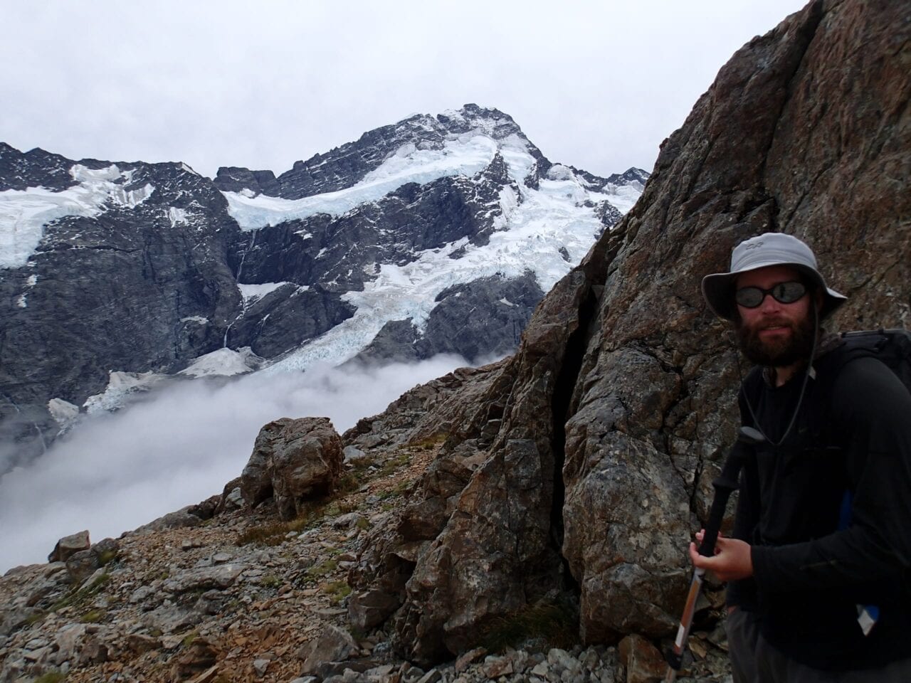
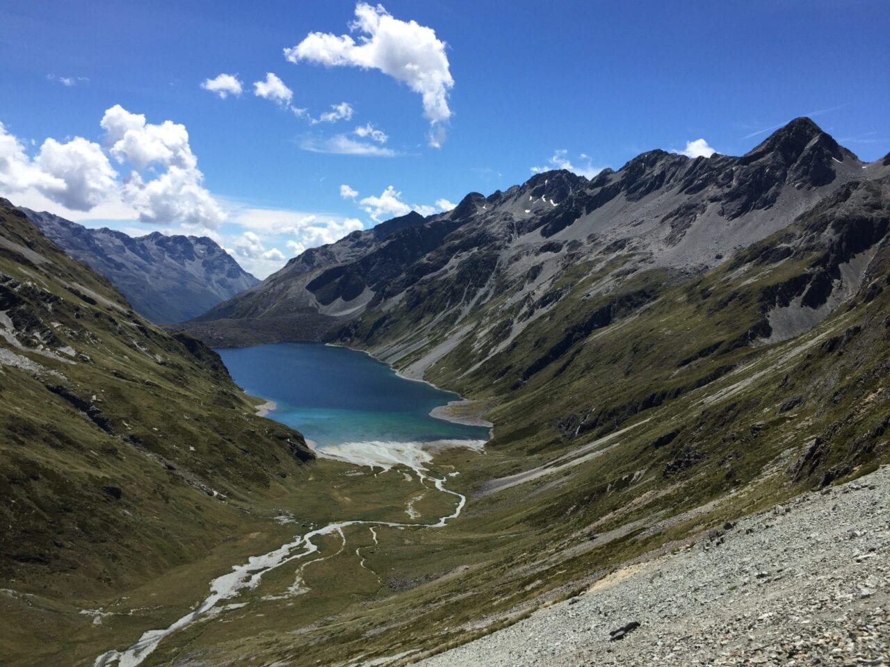
A long pathway leading up to Lake Constance in the Nelson Lakes region of the South Island.
After spending six months in New Zealand’s bush — an Oceania euphemism for backcountry, I have come to the conclusion that the local customs of outdoor recreation are an amalgamation of both North American (wild camping) and European (hut-to-hut) trail cultures.
Many people have inquired about the modus operandi of a Te Araroa (TA for short) thru-hike so here are some common questions and answers:
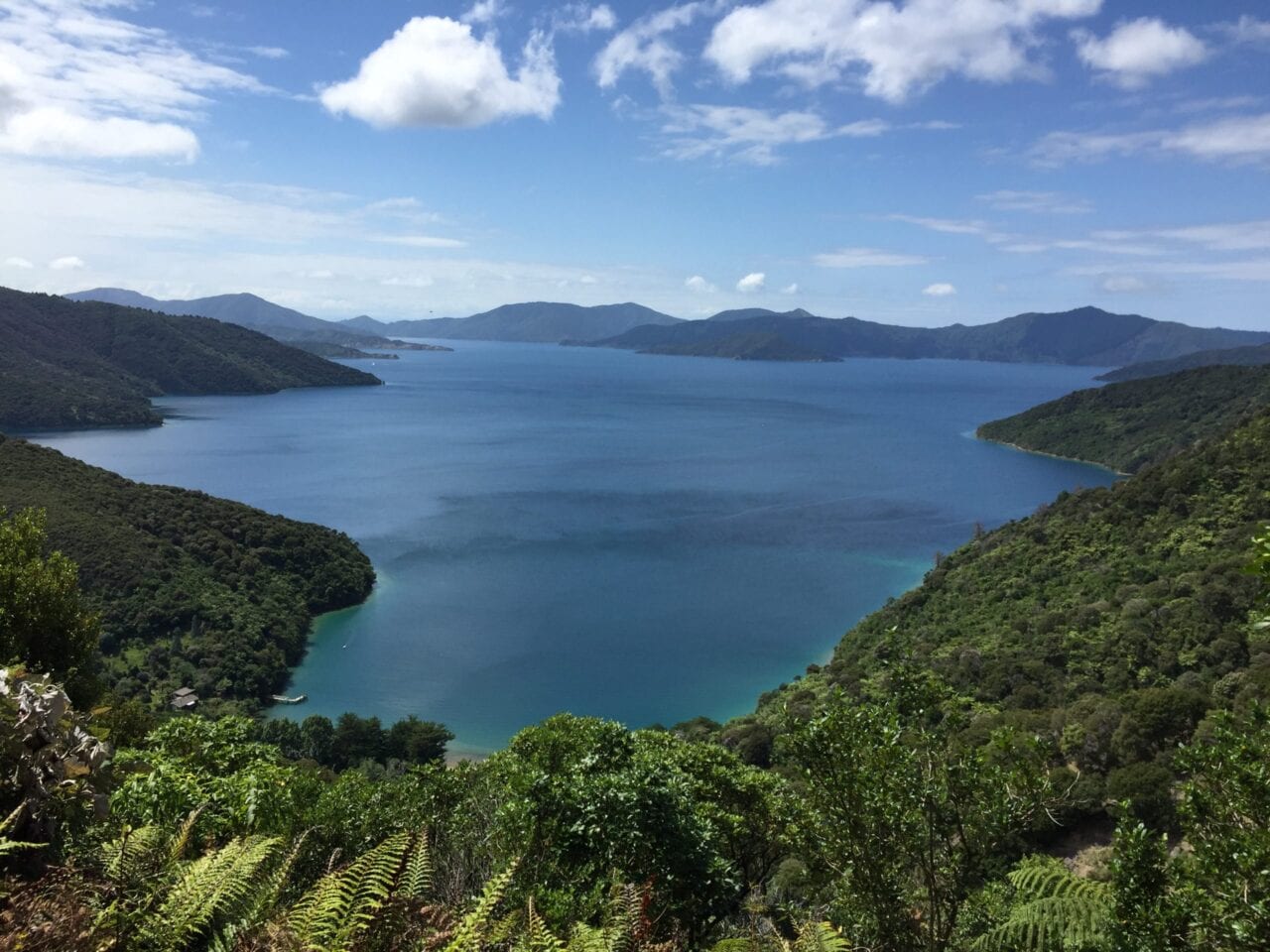
A view from the Queen Charlotte Track in the South Island
Photo by Dahn Pratt
Question: I’m wondering whether hikers are absolutely required to stay in huts, or is “freedom camping” allowed in appropriate places along the trail? Staying in huts would be a deal-breaker for me; just not the experience I’m looking for in the woods.
Answer: You are by no means required to stay in the Department of Conservation (DOC) huts along your thru-tramp of the TA, in fact for nearly half of the journey huts are not available as there are none on most of the North Island portion of the trail. That being said, the price for 6 and 12 month hut passes ($92 and $122 respectively) are negligible when considering what you get; a sheltered place with beds, oftentimes a faucet connected to a water catchment system, and fire place in the middle of the bush. Although hardy walkers may be reluctant to indulge in such luxuries, having a dry place to hunker down during a storm is almost a necessity in New Zealand’s backcountry. Notoriously moody and rapidly changing weather systems in the region ensure that at some point you’ll want to wait out less than ideal situations. And besides paying for a hut pass is a definitive way to support DOC, which maintains almost the entirety of the trail as well as the huts, long drops (pit toilets), and other trail amenities.
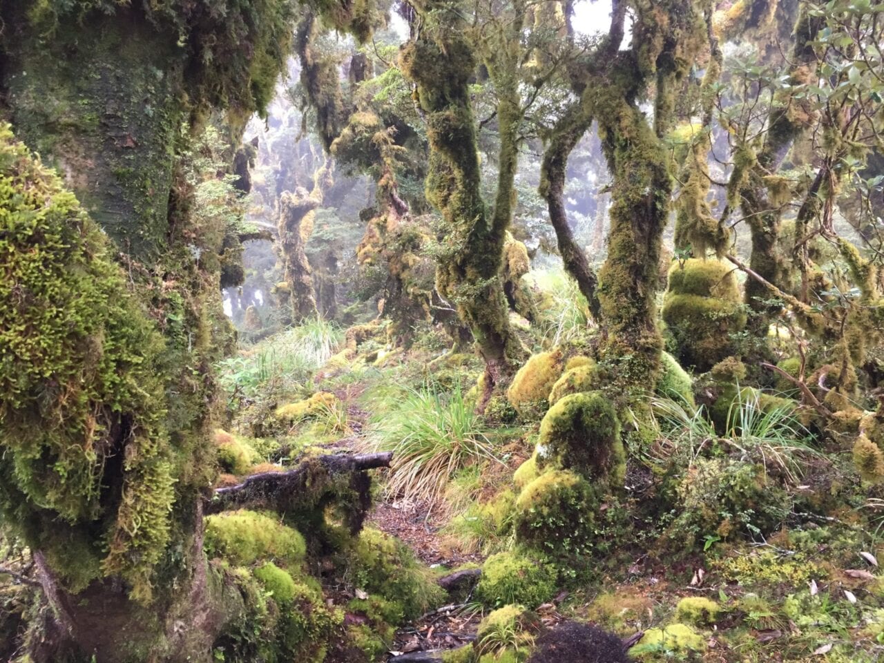
Some sections of trail simply had nowhere to camp, e.g. the character building Tararua Range, North Island.
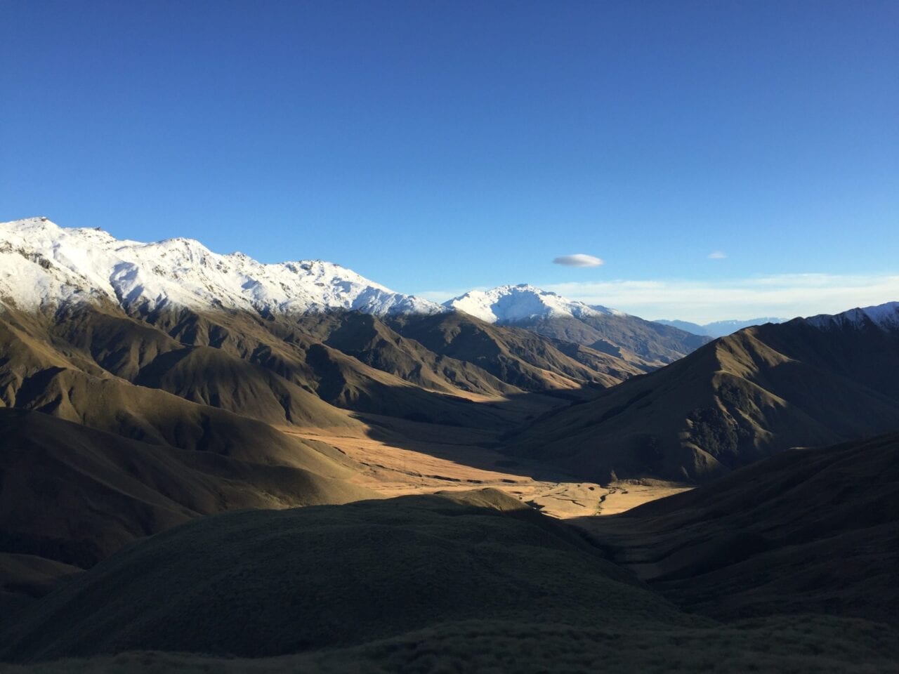
A cyclone brought the snow level down to 3,000 ft, Much of the trail was above the snowline making camping unrealistic. Near Wanaka, NZ.
Question: The TA Trust doesn’t want cheapskates on the trail:
Those trying to walk Te Araroa on a very small budget are creating unease and annoyance in some areas by free camping where not welcome and/or not supporting enterprise along the Te Araroa route. If you wish to walk a trail on a very small budget (ie less than NZD$5000-7000) we’d respectfully suggest that Te Araroa may not be appropriate for you.
This language on the trail association website can be pretty off-putting: How hostile is the environment along the trail for low-budget hikers like me who aren’t going to throw a lot of money around in trail towns (staying at motels very rarely, very few restaurant meals, etc).
Answer: New Zealand can be an expensive place to visit. Accomodations, food, and transportation (especially getting to NZ) are all cost-prohibitive. That being said, the TA is not exceptionally more expensive than a thru-hike on any of the national scenic trails of the United States. Budget varies widely depending on what kind of splurges one wants to take or part-take in (here is a good cost breakdown). The biggest resentment echoed by Kiwis about travelers, especially of the dirt-bag variety (think hiker trash), is that they do not follow local etiquettes and try to cut corners, e.g. not paying for holiday parks (paid campgrounds). A big sticking point for locals has been that foreign travelers come into their communities, use up the resources and leave without contributing. This has caused a tension between outspoken Kiwis but is mostly relegated to the vanlife crowd, for which New Zealand is a popular destination. Nearly every interaction I had with locals was pleasant, Kiwis are generally gregarious and generous people. I’ve had more spontaneous trail magic on the TA than anywhere else and nearly all the trail angels that spoiled me didn’t even know the trail existed prior to our encounter! All of that being said, it is important to respect local’s wishes and play by the rules, whether that means paying for accomodations when hiking through private property or supporting small isolated communities that have set up amenities specifically for thru-trampers, similar to trail towns on the AT or PCT.
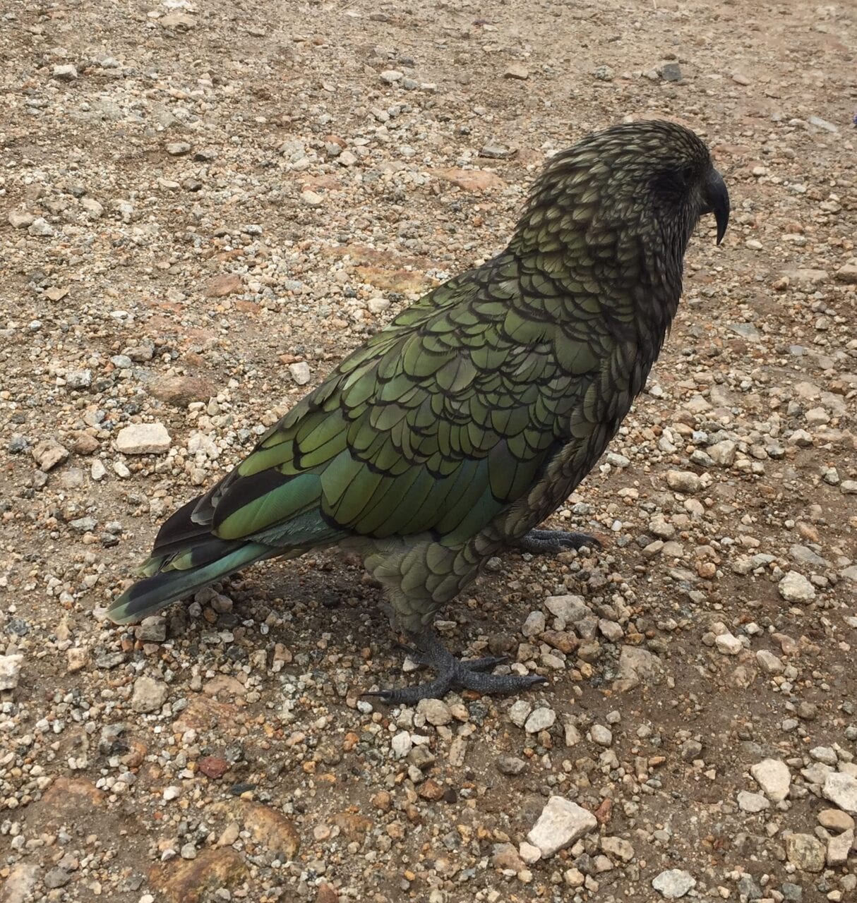
The only not-so-friendly local is the endangered Kea, the world’s only alpine parrot, renowned for its mischievousness.
*A note on freedom camping: Freedom camping is permitted on DOC land, which comprises a majority of the trail. In 2011, New Zealand has passed laws restricting freedom camping; these changes are directed towards car campers and vandwellers on holiday, not thru-hikers, but you should still read up on what’s allowed beforehand. In general, Kiwis are very welcoming and will let you camp on their land if you ask. In some places the Te Araroa Trust has negotiated easements over private property with the condition that camping is not permitted. Respect the signs, as these are essential connector stretches of trail; it would be a shame to lose access due to the selfish decisions of a few bad apples. Be a good steward so the trail continues to exist for years to come!
Question: I’m not a hiking “purist”, is it possible to pick and choose sections? Will I be ostracized for not hiking the trail in its entirety?

Crossing a tide-dependent estuary near Auckland, NZ.
Answer: The TA is a relatively new trail, formally opening in 2011. Most trampers take a much less “purist” approach to thru-hiking. A majority of the trampers on the trail are non-American and generally have not done a long-distance trail in the States. As such the focus is not on a continuous footpath but rather the experience. Indeed most people hitchhike through long road walk sections, of which Te Araroa has many. Trampers will also take alternates or even rent bikes in sections where more interesting or shorter points of interest exist. In fact, the TA Trust even says that some sections are downright impassable on foot:
The Rakaia is a large braided river with an unsettled shingle bed. Even in low flows it is not possible to safely ford this river on foot anywhere near Te Araroa’s trailhead on the north bank. As a result, Te Araroa Trust has declared the Rakaia a hazard zone which does not form part of the trail. Instead it marks a natural break in the continuum, just like Cook Strait. The trailheads on either side of the Rakaia make natural beginning or end points for Te Araroa section trampers and it is really only through-trampers that have to deal with the issue of getting from one trailhead to the other. Don’t risk a foot crossing. Instead go around the road in a vehicle. Doing so will not compromise the integrity of a through-tramp.
There are several of these “natural breaks” along the TA including the Cook Strait (separating the North and South Islands of New Zealand) as well as a river journey along the Whanganui River, which is to say a continuous footpath is not possible on Te Araroa. None of this should discourage hikers from walking the roads but it may be hard to find willing participants, during my thru-tramp in 2017-2018 I only knew of approximately 5 people, myself included, who walked the seemingly endless roads.
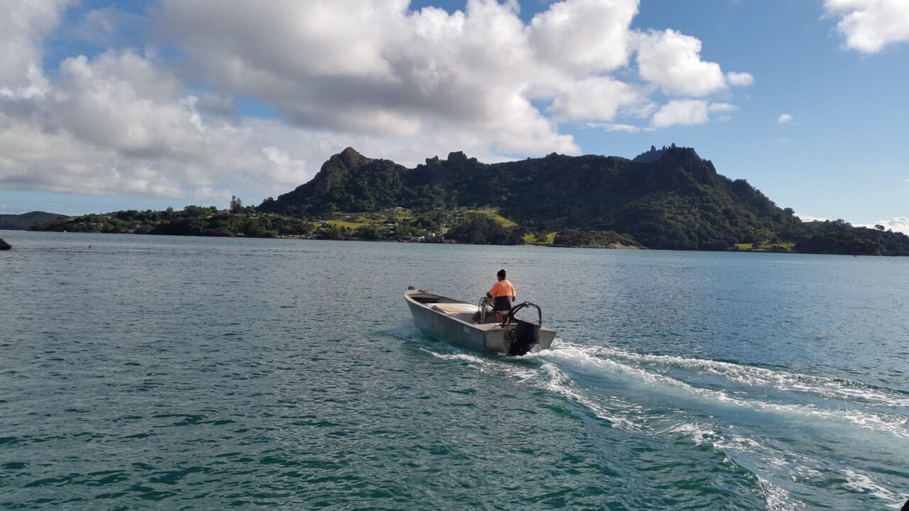
Getting a boathitch across Whangarei Heads through a natural break in the trail
In the same vein, hiking Te Araroa takes you through incredibly breathtaking landscapes and topographies but one constant criticism is that the TA bypasses or outrightly omits New Zealand’s “best parts”. This is a conscious decision by the TA Trust to limit excessive environmental strain on very popular places but by no means limits intrepid travelers from seeking out these highlights. A good outlook is to view the TA as a highway that gets you to an ultimate destination but one you can hop on and off of to see other attractions (e.g. Great Walks, other scenic pathways, famous landmarks and towns).
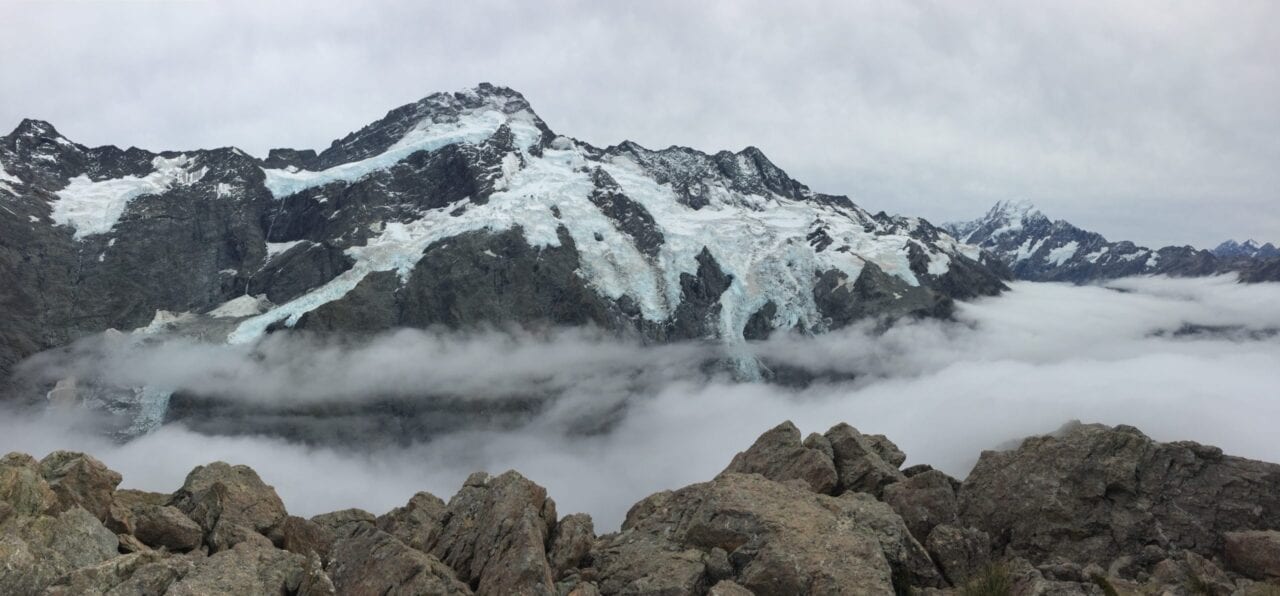
Speechless on the way up to Mueller Hut in the shadows of Aoraki/Mount Cook.
Final Thoughts on Etiquette:
It may be common knowledge but worth mentioning, the trail is new, and relies largely upon the generosity of locals to work. You are a representative of the broader community; make sure to be kind and respectful so that others can have the same opportunity. Remember that thru-hiking is a privilege, not a right.
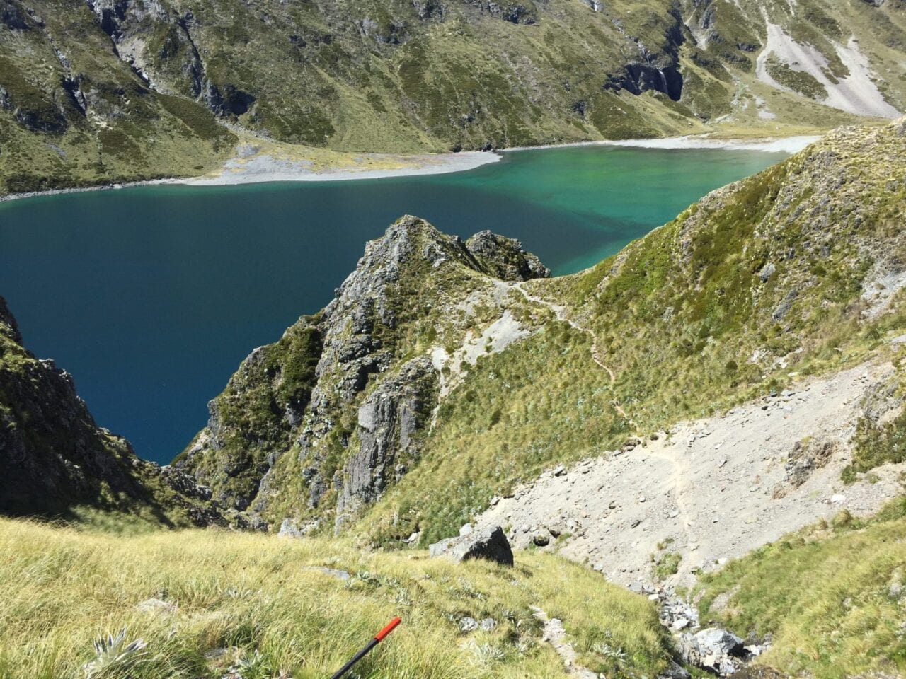
Waiau Pass in the Richmond Range of the South Island.
All photos by Dahn Pratt
Want to keep up with all that’s going on at Atlas Guides? Sign up for our newsletter!
Read more!
Check out some related blog posts!
Get our trail guide for this area!
Te Araroa
Te Araroa is a long distance hiking trail in New Zealand, stretching 3000 km across the country’s two main islands. The trail travels from Cape Reinga to Bluff.
3000 km (1860 mi) $39.99 full guide
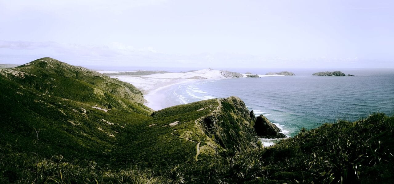
Cape Reinga, North Island, New Zealand, Te Araroa
Photo by T L
Cape Reinga, North Island, New Zealand, Te Araroa
Photo by T L
Te Araroa
Te Araroa is a long distance hiking trail in New Zealand, stretching 3000 km across the country’s two main islands. The trail travels from Cape Reinga to Bluff.
3000 km (1860 mi)
$39.99 full guide
Get our trail guide for this area!
About the Author

Dahn Pratt
Dahn has been collecting trail data for Atlas Guides for more than two years across thousands of miles. His most recent journey was a 10,000 mile project called Chasing Summer. When he is not hiking he can be found camping, or making bad jokes.