Understanding Lightning & Thunder on the Trail
Planning an adventure? Check out our popular trail guides! 4.8 stars (17K+ ratings)
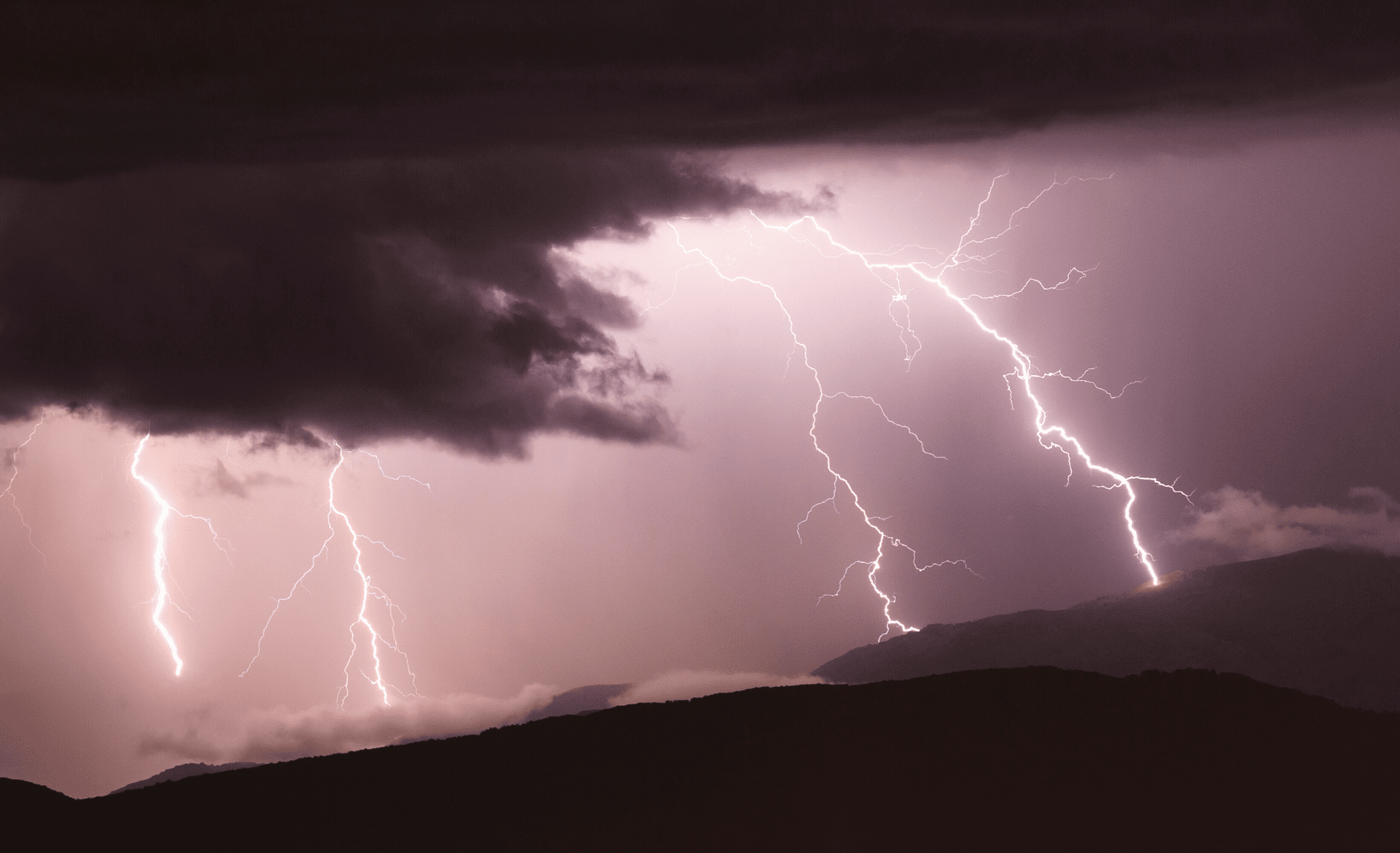
Understanding Lightning & Thunder on the Trail
When hiking, particularly above treeline, the importance of lightning awareness cannot be understated. Understanding more about lightning and thunder can help keep you and your trail family safe.
Paul Bodnar Educational 7/14/2020
The (Quick & Dirty) Science Behind Lightning
The speed of light is 670,616,629 mph (299,792,458 meters/second), so when you see a lightning strike you’re perceiving it practically instantaneously. Every strike heats up the surrounding air to between 18,000 to 60,000 degrees Fahrenheit (two to six times the temperature of the surface of the sun), which causes the surrounding air to rapidly expand and then suddenly contract, resulting in a sound wave – thunder.

Distance of a Storm
If you don’t hear any thunder but see a lightning strike, the lightning is likely over 10 miles away from you, as the sound wave is being absorbed before reaching out. As such, if you see a lightning strike but don’t hear the corresponding thunder you are likely not in immediate danger. Storms move quickly, however, and it’s important to hike off of exposed ridges, passes, and summits and to prepare for the storm to potentially reach you soon.
If you do hear thunder, you are within about 10 miles of the lightning strike and should seek immediate protection from a lightning strike.
The American Hiking Society has a downloadable pdf titled Lightning Safety that outlines specific precautions that should be taken.
Lightning Safety Guidelines
Always check the weather forecast before leaving town, if conditions are not safe on trail find a safe place to shelter in town.
Always descend from peaks, ridges or elevated areas when in a storm or when one is approaching.
A safe structure is a building that is fully enclosed and has electricity and plumbing. A public library would be a great place to temporarily shelter in town if you can’t find a hostel or motel. Structures like trail shelters, patios, tents, or sheds are not safe during a lightning storm.
If you can not find a suitable shelter on trail seek protection by immediately reducing elevation, find a valley or depression in the area and avoid isolated trees or tall structures.
Never lie flat on the ground during a lightning storm. You should crouch on the ground with your feet together and with your weight on the balls of your feet.
The tips above are not comprehensive. Please review detailed information from the National Oceanic and Atmospheric Administration (NOAA) and the American Hiking Society before your next outdoor adventure.


To determine the approximate distance (in miles) of lightning from you, count the number of seconds between the observed lightning flash and the sound of thunder, then divide this number by five. (See equation below.)
Approximate Distance Away (miles) = number of seconds between flash and sound / 5
Use the above equation to calculate a series of distances from a few different strikes and you will be able to determine if the thunderstorm is stationary, moving toward you or away from you. If the calculated distance doesn’t change between lightning strikes you can assume the storm is stationary. If the calculated distance gets larger between lightning strikes you can assume the storm is moving away from you. If the distance gets shorter between lightning strikes the storm is moving closer to you and storm precautions should be observed.
Real Trail Story: Safety Over Miles
By Dahn Pratt
While hiking on the Continental Divide, I was on a major time crunch and often found myself on exposed ridge-lines during thunderstorms. This arbitrary time-frame forced me into dangerous situations that I’ll never repeat again. On the Montana/Idaho border I was “threading the needle” through multiple thunderstorms trying to make forward progress without considering my safety. As thunder shattered all around me, I ran for hours trying to avoid the ominous clouds shooting off lightning every couple of seconds. Being up high, above treeline, was very stupid as it began to hail furiously. The lightning and thunder were milliseconds apart and I felt an electric surge up my legs from a ground strike a stone’s throw away. The experience caused some major post traumatic stress for me on the hike and forced me to adopt a motto, “safety over miles” when approaching a climb, especially later in the day and when there were less than ideal conditions. Never jeopardize your safety for the sake of forward progress!

Download our popular hiking and biking guides!

Trail guides that get you to places you’ve dreamed of.
As the makers of Guthook Guides, Bikepacking Guides, and Cyclewayz, we help you navigate the most popular trails around the world on your smartphone. Our hiking guides and biking guides work completely offline. Let Guthook guide your next adventure!
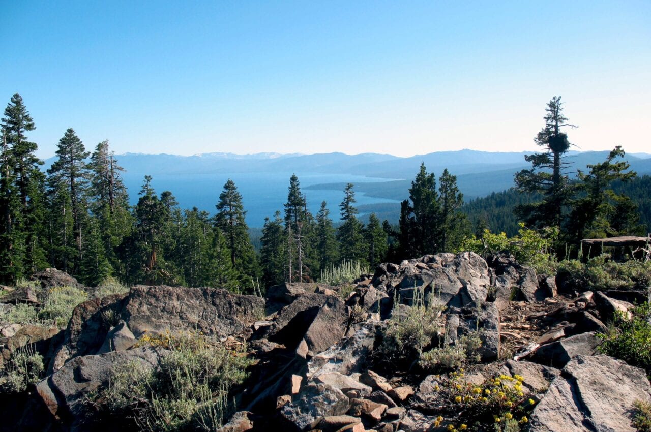
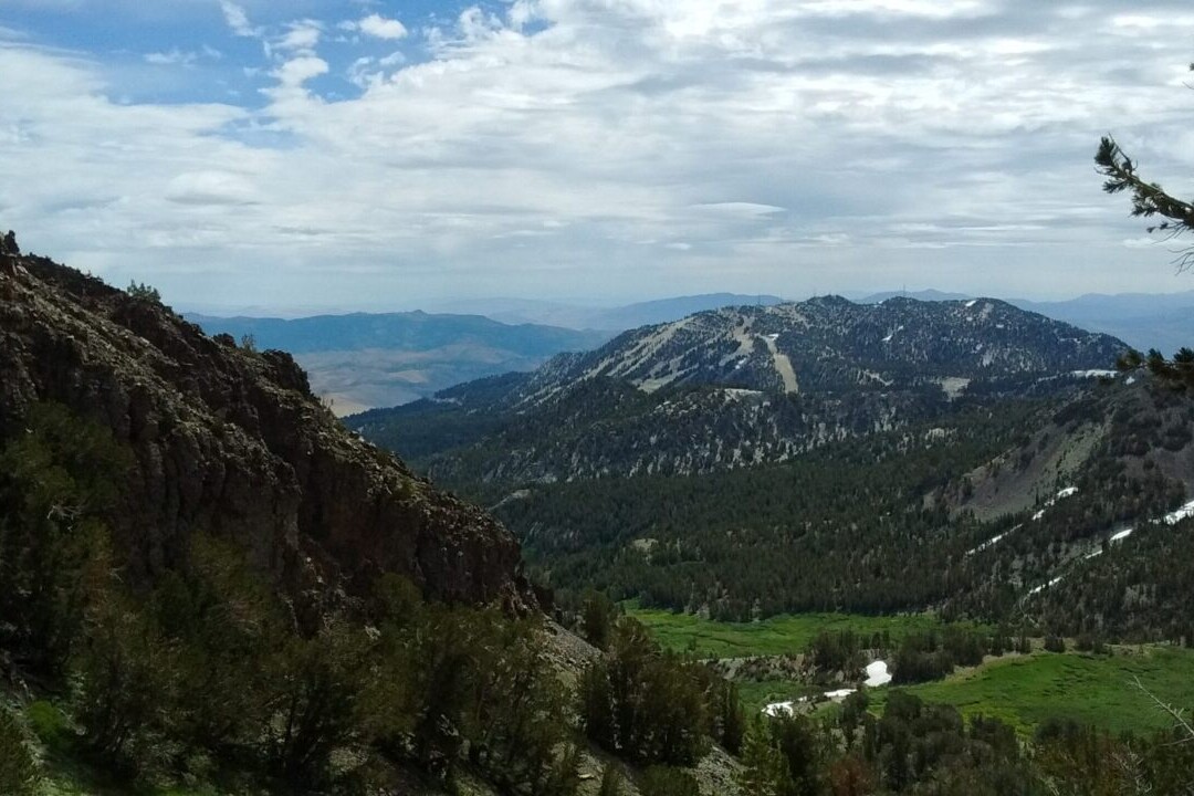
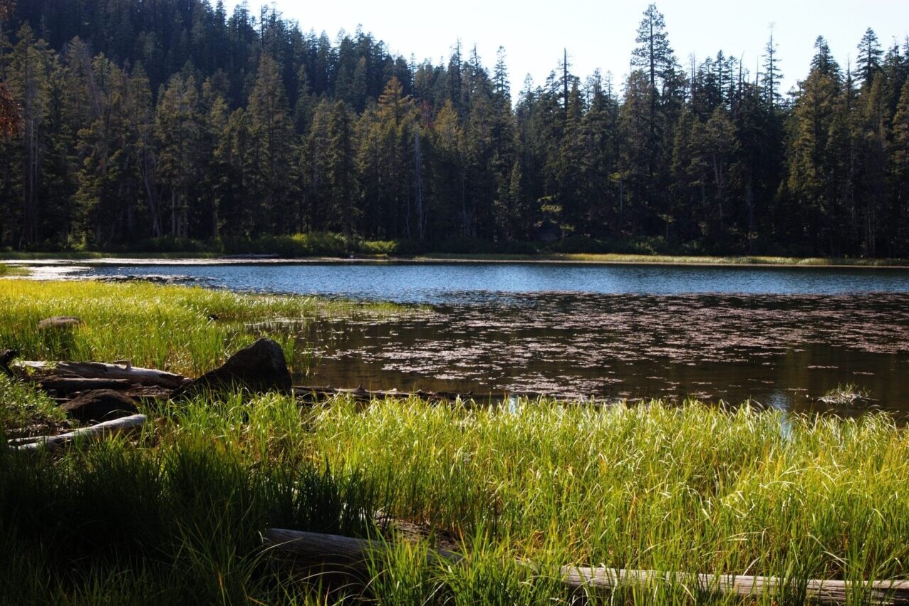
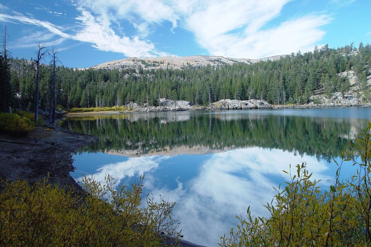
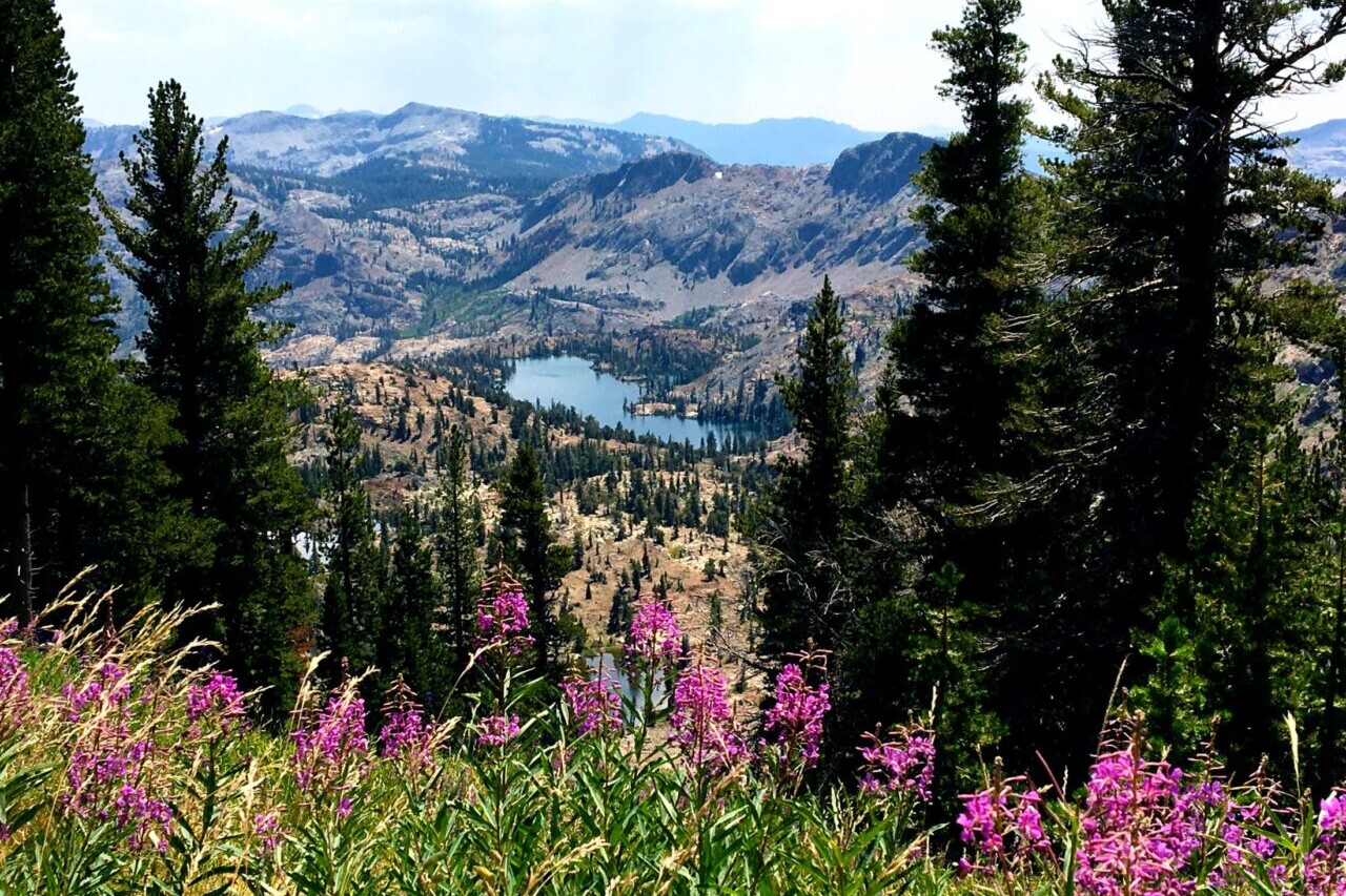
Showers Lake Vista, Tahoe Rim Trail
Photo courtesy of the Tahoe Rim Trail Association

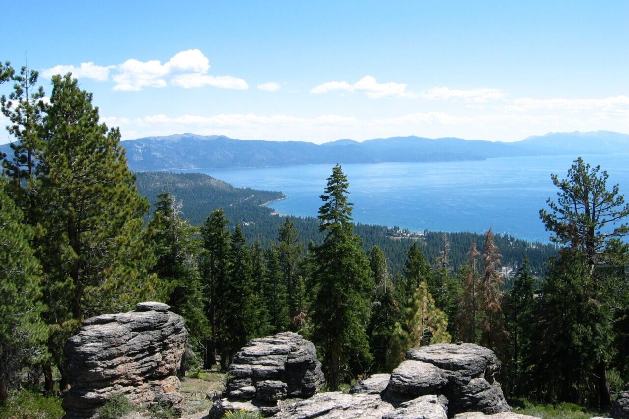
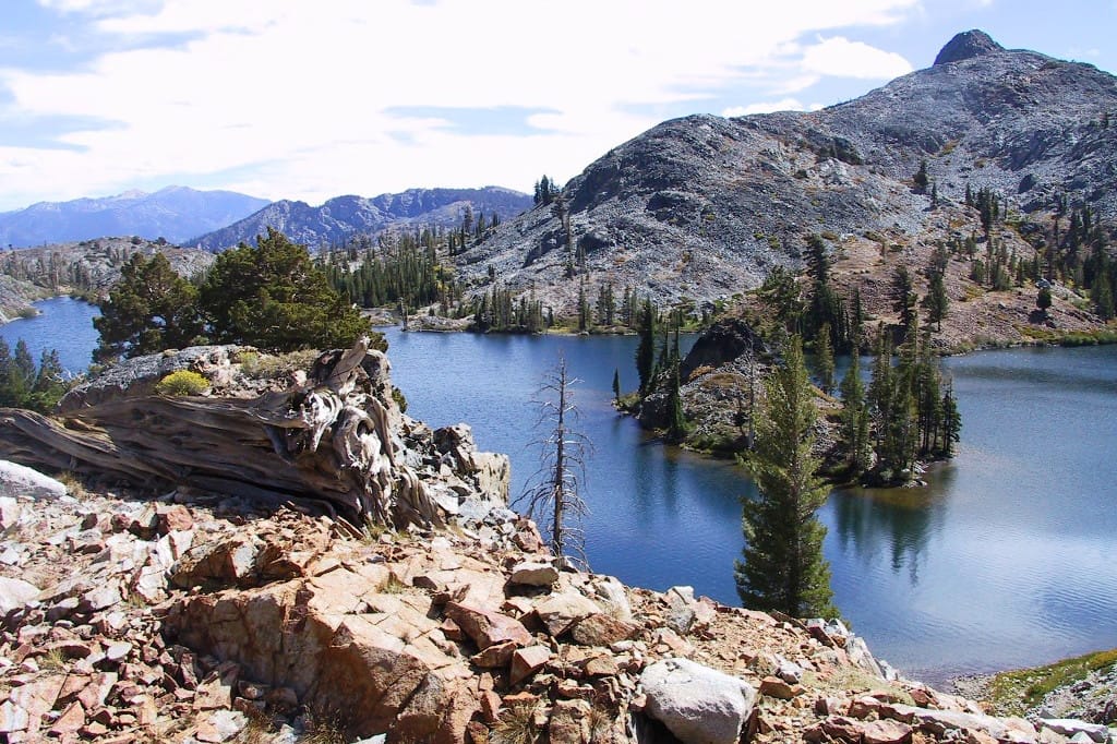
Showers Lake Vista, Tahoe Rim Trail
Photo courtesy of the Tahoe Rim Trail Association
Trail guides that get you to places you’ve dreamed of.
As the makers of Guthook Guides, Bikepacking Guides, and Cyclewayz, we help you navigate the most popular trails around the world on your smartphone. Our hiking guides and biking guides work completely offline. Let Guthook guide your next adventure!
Download our popular hiking and biking guides!
About the Authors

Paul Bodnar
Paul has always liked hiking and thru-hiked the Pacific Crest Trail in 1997 after college. After years of working in chemistry, he wanted to create a career involving the outdoors, so he hiked the Pacific Crest Trail again in 2010 to do research for his guide book Pocket PCT. He realized that creating a smartphone app for navigating the outdoors would make it easier to keep the data current and provide a better way to navigate. While hiking with Ryan (aka Guthook) in 2010, they decided to work together to create the first comprehensive smartphone guide for the Pacific Crest Trail. Now with the help of a team of great people they have created over 50 guides for trails around the world.

Dahn Pratt
Dahn began collecting trail data for Atlas Guides in 2017 on his 10,000 mile project called Chasing Summer. The most recent data for the Te Araroa, Pacific Crest Trail, Continental Divide Trail, Jordan Trail and Israel National Trail all came from Dahn. Now you will find Dahn on the office side of Atlas Guides doing all kinds of things, like data analytics, data processing, customer support, and more. When he is not hiking he can be found camping, or making bad jokes.
Thru-hiking 101: Trail Town Accommodations
Planning an adventure? Check out our popular trail guides! 4.8 stars (17K+ ratings)
Photo provided by Paul Bodnar
Thru-hiking 101: Trail Town Accommodations
This post covers one of the most expensive things you can do in town: stay the night. I’ll show you all of your options, from avoiding staying in town overnight, to living it up in a motel.
Paul Bodnar Educational 7/06/2020
Town Lodging – average cost/night
Backpacker Campground Campsite: $5
Trail Angel Donation: $20
Campground Campsite: $18
Hostel, shared room: $24
Hostel, private room: $49
Motel: $81

Trail Town Accommodations
Once you have purchased your gear and hit the trail, long-distance backpacking is a fairly inexpensive endeavor. Your main expense is food. But when you come into town to resupply, expenses can add up quickly. This post covers one of the most expensive things you can do in town: stay the night. I’ll show you all of your options, from avoiding staying in town overnight, to living it up in a motel.
The prices were based on accommodations along the Appalachian Trail, Continental Divide Trail and Pacific Crest Trail.
Trail camping outside town: $0
The cheapest way to spend a day in town is to camp on-trail, just outside of a town. Hike into town first thing in the morning, resupply and enjoy all the town amenities, then return to the trail just before sundown.

Photo provided by Dahn Pratt

Photo provided by Dahn Pratt
Backpacker campsite: $5
Some campgrounds have a designated backpacker area for a nominal fee. Backpacker sites are commonly shared with others, which brings down the cost to nearly nothing, but may also mean that you won’t get much sleep due to noise if you’re sleeping next to the a party crew.
Campground campsite: $20
Sometimes you can find a campground in or near town. If the campground has amenities like showers, laundry, flush toilets, or electricity you can expect to pay more than a primitive campground. Campgrounds typically limit site occupancy and the number of tents, but you can still share with a few people. Splitting a campsite and making full use of campground amenities is a great way to save money in town.

Photo provided by Kenna Sarae

Photo provided by Paul Bodnar
Trail Angel: $20 Donation
Some trail angels open their homes or property to hikers. This often means that you get some combination of a bed, shower, laundry or food. Trail angels can be well-known along the trail or can occur as a random surprise at a road crossing.
Some trail angels do not expect or accept donations, but you should donate $20 per night if there is a donation jar.

Photo provided by Dahn Pratt

Photo provided by Dahn Pratt
RV park camping: $25
Most RV parks have an area for tent camping. Why stay in an RV park? They usually have amenities that normal campgrounds don’t offer, such as internet, electrical outlets, coin laundry services, showers, clean restrooms with sinks, swimming pool, charcoal barbecues, and a convenience store. Because RV parks have more services you can expect the cost to be higher than a campground.

Photo provided by Paul Bodnar

Photo provided by Paul Bodnar
Hostel: $24 to $49
A hostel is a low-cost lodging option where you can rent a bunk bed in a dormitory-like setting. Most hostels have a lounge area and kitchen facilities. Some hostels also offer private rooms at about double the cost of a bunk bed in a shared room. Hostels are very social and it’s a great way to meet interesting people from all parts of the world.

Photo provided by Dahn Pratt

Photo provided by Dahn Pratt
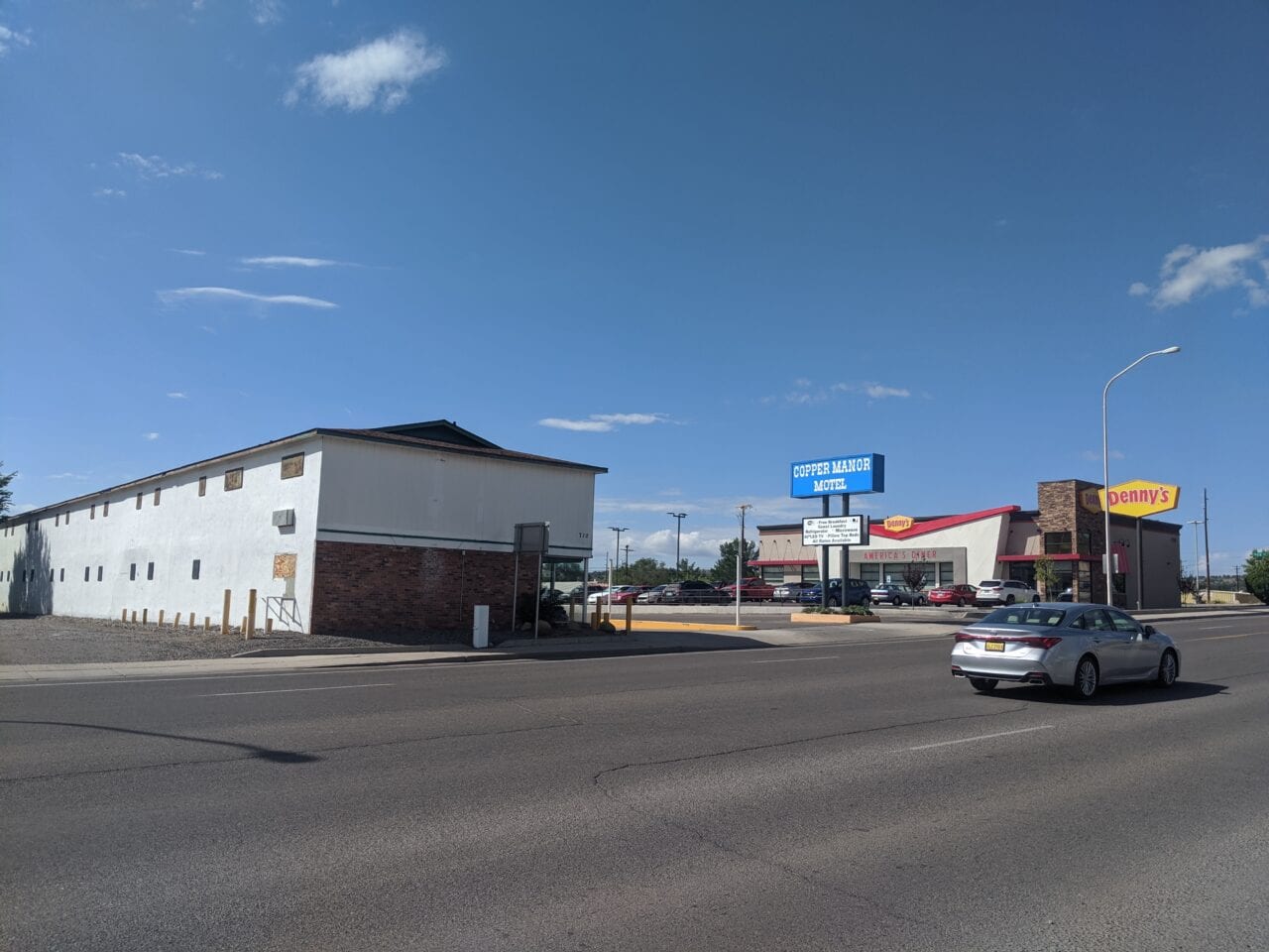
Motel: $81
Motels along the trail tend to be family-owned and of the budget variety. They usually have coin-operated laundry or will do your laundry for a small fee. Many smaller motels in trail towns provide a discount for long-distance hikers – just ask. National chains, like Hilton or Sheraton, can easily cost double the typical motel rate.

Photo provided by Dahn Pratt

Photo provided by Paul Bodnar
Summary
The way you approach overnight town accommodation can greatly impact your hiking budget. Some hikers camp outside of towns to avoid the cost of accommodation, while others relax for a few days in a motel or hotel. Other than buying a new pair of shoes, replacing a main piece of gear, or buying a few weeks of resupply food, there are few ways to spend a lot of money on a long-distance hike. It can, however, be easy to blow your budget on motels if you’re not careful.
Note: The above prices vary by location and season.
Trail Town Hacks
- Most libraries have free public internet.
- Most hostels and RV parks allow you to use the shower and laundry facilities for a nominal fee even if you do not stay the night. Please ask the staff before using any amenity on private property.
- Get into town early to maximize the town experience.
- Write down a to-do list before getting to town. It’s easy to get distracted and forget critical tasks in all the excitement of town life.
- If you plan on staying in town, try to secure accommodation ahead of time, particularly if you are walking in a “herd.” Small towns fill up fast.
- Do your laundry and showering first thing so you can experience dining or shopping without smelling up the place.

Photo provided by Paul Bodnar

Photo provided by Paul Bodnar
Read more!
Check out some related blog posts!
Download our popular hiking and biking guides!
Trail guides that get you to places you’ve dreamed of.
As the makers of Guthook Guides, Bikepacking Guides, and Cyclewayz, we help you navigate the most popular trails around the world on your smartphone. Our hiking guides and biking guides work completely offline. Let Guthook guide your next adventure!
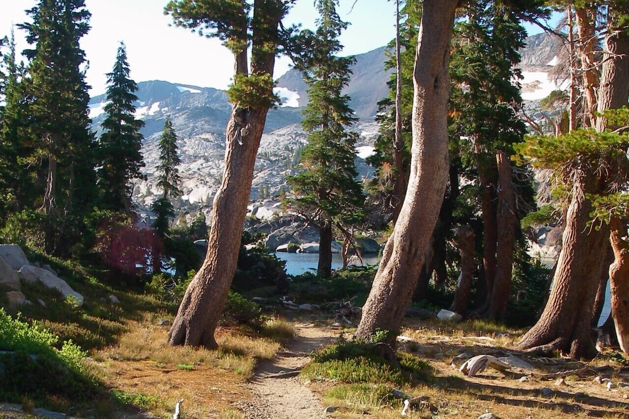
Showers Lake Vista, Tahoe Rim Trail
Photo courtesy of the Tahoe Rim Trail Association
Showers Lake Vista, Tahoe Rim Trail
Photo courtesy of the Tahoe Rim Trail Association
Trail guides that get you to places you’ve dreamed of.
As the makers of Guthook Guides, Bikepacking Guides, and Cyclewayz, we help you navigate the most popular trails around the world on your smartphone. Our hiking guides and biking guides work completely offline. Let Guthook guide your next adventure!
Download our popular hiking and biking guides!
About the Author
Paul Bodnar
Paul has always liked hiking and thru-hiked the Pacific Crest Trail in 1997 after college. After years of working in chemistry, he wanted to create a career involving the outdoors, so he hiked the Pacific Crest Trail again in 2010 to do research for his guide book Pocket PCT. He realized that creating a smartphone app for navigating the outdoors would make it easier to keep the data current and provide a better way to navigate. While hiking with Ryan (aka Guthook) in 2010, they decided to work together to create the first comprehensive smartphone guide for the Pacific Crest Trail. Now with the help of a team of great people they have created over 50 guides for trails around the world.
Australia Rail Trails

Official app of Bikepacking Roots. The Wild West Route offers bikepackers a non-technical, expeditionary-scale riding experience through Arizona, Utah, Idaho and Montana that immerses one in the vast expanses of wild and public lands in the Intermountain West. Nearly 70% of the route is on public lands, and more than 80% is off-pavement, following primarily follows dirt roads and rough 4×4 tracks on which mountain bikes are most suitable. Riders will experience the remote mountains of western Montana and central Idaho, the desolate beauty of southern Idaho’s Snake River Plain, endless vistas from Utah’s high plateaus at 10,000 feet elevation, the canyon country of Navajo Nation and the Grand Canyon region, and the towering Sky Islands and low Sonoran Desert of southern Arizona.
20% off for our Hiking Season Kick-off SALE! The Wild West Route is now $23.99.
Meeniyan Bridge – Great Southern Rail Trail Victoria
Photo courtesy of Australian Cycling Holidays
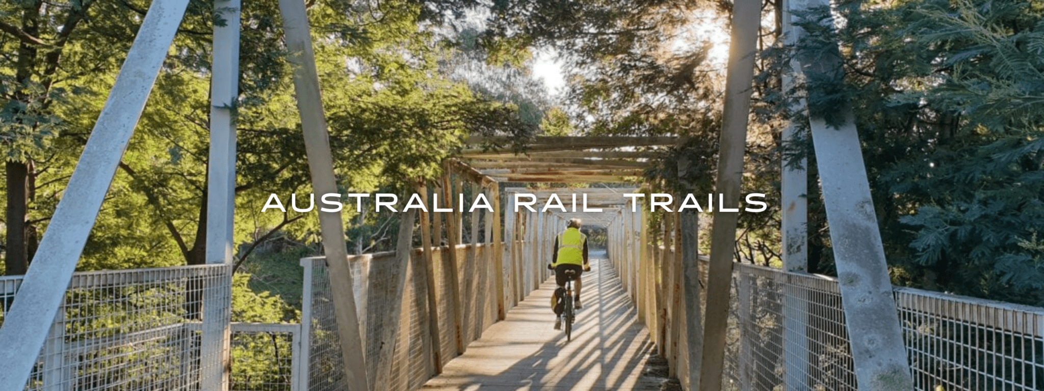
Australia Rail Trails
1000+ km • Australia
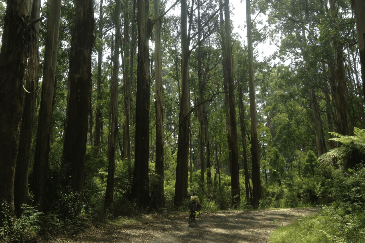
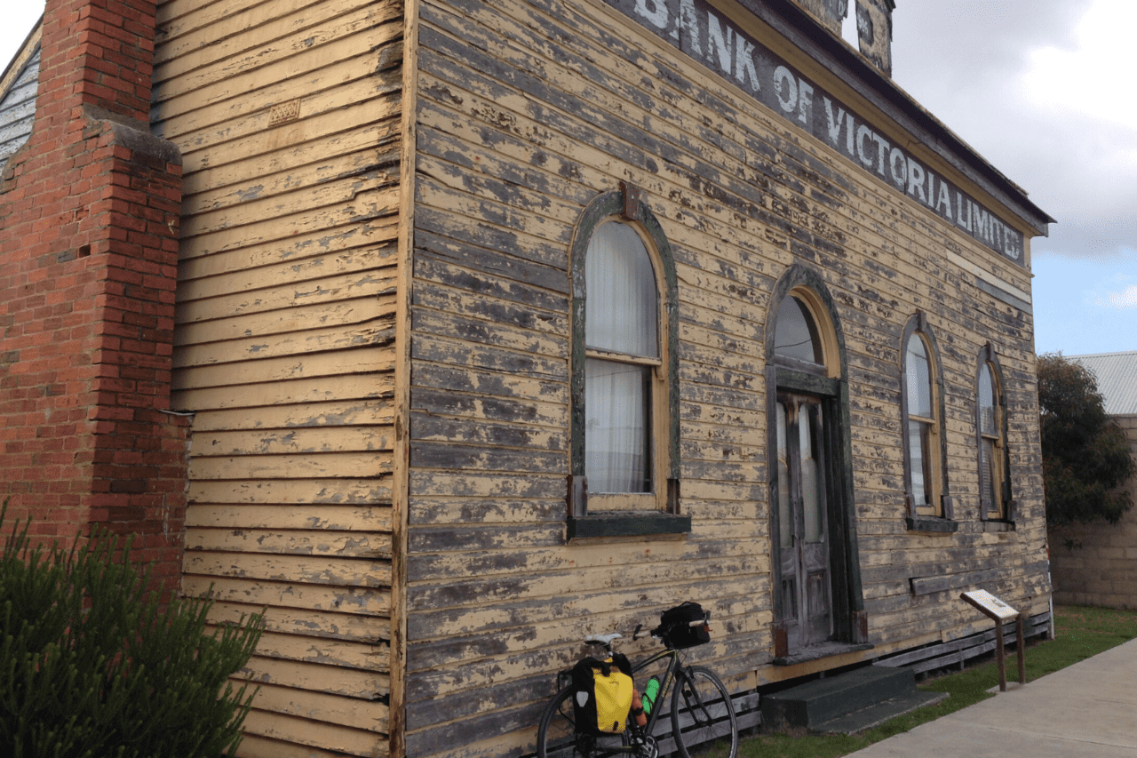
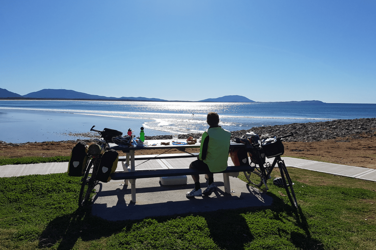
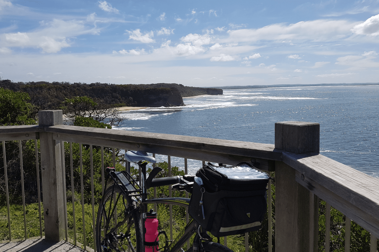
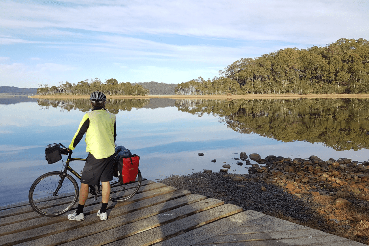
Cycle through history along paths and trails that take you through authentic quirky Australian country towns where nothing has changed from yesteryear except that now they are home to fabulous cafes, iconic country pubs, amazing art galleries and relaxing accommodation. Adults and kids alike will enjoy exploring beautiful countryside, wild oceans, green rolling country, great cafes, iconic pubs and quirky country towns. The trails wind through forests and farmland so you can see farm animals up close and you may even see a kangaroo, wallaby, wombat or echidna.
Australian Rail Trails are dedicated cycling and walking paths on disused railway lines and are fairly gentle when it comes to uphill climbs. The trails are a mix of hard surface and compacted gravel.
FREE Guides 19 routes (All Free)
1000+ km
FREE Guides
19 routes (All Free)


How can I get it?
Available as an in-app purchase in our Bikepacking Guides app, a free download from the Apple App Store or the Google Play Store.
Our iOS and Android apps do differ slightly in their appearance. However, the majority of their features remain the same, and they access the same trail guide data.
FREE
39km, One way Ride, Easy, Flat, Sealed/Unsealed, Rail Trail, 3.5hr
This is a very pretty ride along the Yarra River Valley with wonderful views to the Dandenong Ranges. The surface is really good and easy to ride. With lots of great places for lunch, or an overnight stay, you can ride as little or as much as you like! Its easily accessed by train at Lilydale and ‘Pedal Pickups’ can look after your return journey so you don’t need to ride back. We recommend this scenic cycle for a great day out.
Start: Lilydale Station, Warburton: Access: Mt Evelyn, Wandin, Seville, Woori Yallock, Launching Place
Transport: Lilydale Station, Car
CycleWayz supports Rail Trails Aust.
Copyright 2018 Active Wayz Pty. Ltd
FREE
72 km One Way, Easy/Medium, Flat, Unsealed Rail Trail
The Great Southern Rail Trail is a wonderful journey through South Gippsland. You can cycle as much or as little of the rail trail as you like. It has many small arty villages with great food and accommodation to suit all budgets. The rail trail takes you past native bushlands, through the Black Spur over the trestle bridges, via the wonderful little villages where there so much to explore and finishes in Port Welshpool for fish and chips looking over the Long Jetty and the National Parks.
Start: Leongatha, Port Welshpool Parking: Koonwarra, Meeniyan, Stony Creek, Buffalo, Fish Creek, Foster, Toora, Welshpool Access: Car
Australian Cycling Holidays offers a fully supported self-guided tour including bicycles, hand-picked accommodation, breakfast, luggage transfer and road-side assist.
CycleWayz supports Rail Trails Aust.
Copyright 2018 Active Wayz Pty. Ltd.
FREE
13 km One Way, Flat/Hilly, Easy, Unsealed Rail Trail, 1 Hr
Cycle through the forests and cuttings of this historic area and enjoy the huge trees, many birds and animals. This very pretty Rail Trail links the two outstanding towns of Mirboo North and Boolarra. It doesn’t matter which way you ride, both make a great stop for lunch.
Start: Mirboo North, Boolarra Access: Car
Australian Cycling Holidays offers a fully supported self-guided tour including bicycles, hand-picked accommodation, breakfast, luggage transfer and road-side assist.
CycleWayz supports Rail Trails
Copyright 2018 Active Wayz Pty. Ltd.
FREE
26km One way, Easy, Flat, Family, Unsealed Path, Bus:Anderson-Wonthaggi
This is spectacular coastal rail trail that goes right along the beach. Follow the railway easement built to supply coal to Victoria. There is interesting history, old towns, crashing surf and rolling country views. Love the magnificent trestle bridge, historical mining sites, Wonthaggi Underground Mine, wonderful local cafes and produce.
Start: Wonthaggi, Woolamai, Access: Dalyston, Kilcunda, Anderson Access Bus with Bikes, Wonthaggi, Kilcunda, Anderson
australiancyclingholidays.com.au offers a fully supported self-guided tour including bicycles, hand-picked accommodation, luggage transfer and road-side assist.
CycleWayz supports Rail Trails Aust.
Copyright 2018 Active Wayz Pty. Ltd.
FREE
64 km One Way, Flat, Medium, Unsealed Rail Trail, 5 Hrs
Enjoy this scenic ride through history passing by old rail stations, local museums and dairy farms. Take in the views across to the mountains and have a coffee at a cafe in one of the quaint small towns.
Start: Traralgon, Stratford. Access: Glengarry, Toongabbie, Cowwarr, Heyfield, Tinamba, Maffra Transport: Traralgon and Stratford stations.
CycleWayz proudly supports Rail Trails Aust.
Copyright 2020 Active Wayz Pty. Ltd.
FREE
101 km One Way, Flat, Medium, Sealed/Unsealed, 10 Hr
Cycle from Bairnsdale to Orbost to see the amazing trestle bridges as they loom out of the bush. Experience the birds, views, animals, forests. Enjoy the delights and produce of friendly country towns.
Start: Bairnsdale, Orbost Access: Nowa Nowa, Bruthen Transport: Bairnsdale Station, Car
snowyrivercycling.com.au offers a fully supported self-guided and guided tours including bicycles, hand-picked accommodation and luggage transfer.
CycleWayz proudly supports Rail Trails Aust.
Copyright 2018 Active Wayz Pty. Ltd.
FREE
56 km One Way, (Rail Trail 37 km) Easy/Medium, Flat, Sealed/Unsealed, Path/Road, 5 H
Cyclewayz has started this ride in Albury. Wind along the wonderful riverside cycle paths in Albury and Wondonga to the trail start on Whytes Rd.
Then cross the Kiewa River to imagine being an immigrant arriving at Bonegilla after the Second World war. Ride past the farms, water and forest views. Stop for a picnic. With slab huts, old trains, remnant stations and the green oasis of Tallangatta there is plenty to enjoy! Cycle out, stay the night and ride back the next day.
Start: Albury Station, Tallangatta Access: Wodonga, Numerous parks along Murray Valley Hwy Transport: Albury Station, Car
CycleWayz supports Rail Trails Aust.
Copyright 2018 Active Wayz Pty. Ltd.
FREE
95km One Way, Easy, Flat, Sealed Rail Trail, Family, 10H
The Murray to Mountains Rail Trail goes from Wangaratta to Wandiligong, 5.5km past Bright. Located in Victoria’s beautiful High Country with great mountain views, wonderful vineyards, delightful towns and a sealed surface, this is a lovely ride with lots of places to stop along the way. Have fun exploring the wineries, enjoy the Bright Brewery, the cafes full of local produce and find the Everton Bus stop where you will be happy to wait a while!
Start Wangaratta station, Bright Access: Myrtleford, numerous small towns Transport: Wangaratta station, Car
This ride links with MTM Beechworth to Everton.
CycleWayz supports Rail Trails Aust.
Copyright 2018 Active Wayz Pty. Ltd.
FREE
17km One Way, Easy, Hilly, Sealed Rail Trail, Family, 2H
Roll downhill from Beechworth to the main trail. Alternatively, take the Beechworth spur line uphill from Everton Station. You will need to be on the lookout and watch your navigation as this turn is easy to miss!! The Beechworth spur line takes in forests and farmland, travels over the impressive brick bridges with their curved ramparts, and is home to echidnas, wombats and wallabies. Uphill is a challenge, downhill is a breeze. Link to the main trail to cycle to Wangaratta or Bright, whichever takes your fancy.
Start: Beechworth, Everton Transport: Car
This ride links with MTM Murray to the Mountains.
CycleWayz supports Rail Trails Aust.
Copyright 2018 Active Wayz Pty. Ltd.
FREE
122km, One way, Easy, Flat,Unsealed, Rail Trail, Family, 12 H
Cycle the longest Rail Trail in Victoria through lovely valleys and wide open farmland with sweeping vistas from Tallarook to Mansfield. Enjoy the farms, blue mountains, the Cheviot Tunnel, the picnic areas and charming country towns. It is perfect for your first cycle tour or one to simply enjoy!
Start: Tallarook Station, Mansfield. Access: Yea, Alexandra, Yarck, Boonie Down, Transport: Tallarook station, Car
This links with GVRT Alexandra Spur Line ride.
CycleWayz supports Rail Trails Aust.
Copyright 2018 Active Wayz Pty. Ltd.
FREE
15 km,One way, Easy, Flat with one hill,Unsealed, Rail Trail, Family
Take the Alexandra Spur line from Cathkin. It is a steady climb up to the Eglington Cutting where you will be rewarded with stunning views of the Cathedral Ranges. Drop into Alexandra and enjoy the Alexandra Timber Tramway and Museum right at the station. Enjoy Alexandra’s many cafes and beautiful historic buildings from its gold mining heyday in the 1850s.
Start: Cathkin, Alexandra Transport: Car. Or cycle from Tallarook station on Great Victorian Rail Trail.
This ride links with GVRT Great Victorian Rail Trail.
CycleWayz supports Rail Trails Aust.
Copyright 2018 Active Wayz Pty. Ltd.
FREE
53 km, One way, Easy, Flat,Unsealed, Rail Trail, Family, 4 H
The O’Keefe Rail Trail takes you through majestic native forests with box-ironbark and yellow gum woodland, rich farmland and a range of heritage spots.
Victoria’s rail pioneers forged this rail line over a century ago and it’s named after Andrew O’Keefe – a Bendigo rail pioneer.
You will find the trail has plenty of access points with numerous restaurants, wineries, accommodation and family attractions.
The trail surface is a mixture of sealed roads and unsealed tracks.
A ride along this trail opens your eyes to the historic rail pioneers journey.
Start: Bendigo Station, Heathcote Access: Bendigo-Train, Heathcote-Car
CycleWayz supports Rail Trails Aust.
Copyright 2019 Active Wayz Pty. Ltd.
FREE
57 km One Way, Easy, Flat, Family,Unsealed Rail Trail, 5 Hr
Enjoy riding past plains and remnant native scrub-land forests that once would have been home to thousands of miners and their families. As you ride along, see if you can see evidence of mounds, dips or rusty iron left over from the miners digging up the countryside searching for their elusive alluvial fortune. Take time to explore and appreciate the architecture of the old mining towns. Enjoy too a hot coffee or tasty snack.
The Clarkesdale Bird Sanctuary with its wide range of habitats is a haven for native birds.
Start: Wendouree Station, Skipton Access: Train, Car
CycleWayz proudly supports Rail Trails Aust.
Copyright 2018 Active Wayz Pty. Ltd.
FREE
15 km One Way, Flat, Easy, Family, Sealed Rail Trail
Fernleigh Track Rail Trail is a beautiful surprise. With a fantastic tunnel, interesting history and lots of native forest this is a ride you will love. Enjoy the sealed surface, old railway infrastructure, the 180m tunnel, immensely varied tree views and the history. This is a great ride for everyone regardless of age or experience.
Start: Adamstown station, Railway Pde, Belmont Transport: Adamstown station, Car
CycleWayz supports Rail Trails Aust.
Copyright 2018 Active Wayz Pty. Ltd.
FREE
14km one way to MONA, +2km to Rail Trail end, Flat, Easy, Family, Sealed path, 2Hr
Cycle to the Museum of Old and New Art, Botanical Gardens and parks with fantastic river views and delicious ice cream along the way.
Start: Murray Place Hobart, Bilton Street Claremont Transport: Car
CycleWayz supports Rail Trails Aust.
Copyright 2018 Active Wayz Pty. Ltd.
FREE
25 km One Way, Hilly, Medium, Unsealed Rail Trail, 3 Hr
Additional 8 km one way quiet road to Legerwood and Ringarooma.
This rail trail is full of ferns, native bush and huge trees. With high, fern lined granite cuttings it is a wonderful cycle.You can’t help to marvel at the engineering and perseverance that it took to build this railway. You have a feeling of remoteness as the rail trail swings right away from the road into the bush. With views into the surrounding valleys and the wonderful bush, you will enjoy this ride! We have added a 4 km side trip to Ringarooma which will allow you to enjoy a nights accommodation before you head back to Scottsdale.
Start: Christopher Street Scottsdale,Tasman Highway Tulendeena OR Ringarooma Transport: Car
CycleWayz supports Rail Trails Australia.
Copyright 2018 Active Wayz Pty. Ltd.
FREE
161km , One Way, Medium/Hard, Hilly, Unsealed Rail Trail, 20H
This Rail Trail is in a class of its own! It’s a fun ride on quite a rough surface with lots to see along the way. The views to the ranges are great, we loved the horses and the old buildings in the towns are fantastic. Gravel grinders and those who like a challenge will love this Rail Trail. It has heaps of free camping, many motels and friendly country pubs for dinner. It is quite a climb to Yarraman so you may prefer to start there and enjoy the downhill .
Start: Wulkuraka Station or Yarraman Transport: Wulkuraka Station, Car. Buses with bikes service the north end and the south end separately
Thank you to Stu and Deb for the Moore to Toogoolawah update.
CycleWayz supports Rail Trails Aust.
Copyright 2018 Active Wayz Pty. Ltd.
FREE
38 km One Way, Easy, Flat, Family, Rail Trail Sealed, 3 H
Winding along the renowned McLaren Vale wine region, the Coast to Vines Rail Trail is the ideal way to explore the diverse attractions the region has to offer. This includes the Shiraz Trail.
Start: Marino Rocks Train Station, Willunga Transport, Train or Car
Time to Go: All year although it can be wet in winter and hot in summer.
CycleWayz supports Rail Trails Australia.
Copyright 2018 Active Wayz Pty. Ltd.
FREE
52km, One Way, Flat, Easy, Unsealed, Rail Trail, Family
The Riesling and Rattler Rail Trails pass through beautiful rolling hills, farmlands and vineyards. The trail has a well graded surface and gentle hills.
The Rattler Trail starts just north of Riverton and ends in Auburn and follows the former Spalding railway line.
The Spalding Line opened in 1918 and closed in 1984. The line was built with a very tight budget and consequently, tight curves and bridges with light axle loads. Therefore, larger locomotives could not be used on the line and only old, lighter weight “rattler” trains could ply the route.
The Riesling Trail starts at Auburn and ends at Barinia Road north of Clare.
The Riesling Trail takes its name from passing through the famous Clare Valley vineyards.
Thank you to Josiah Skeats for mapping this journey.
Copyright 2018 Active Wayz Pty. Ltd.
Ride more.
Check out some of the other mountain biking guides we offer!
About our partner
Australian Cycling Holidays
The owners of Australian Cycling Holidays, Angela and Robert Mosley, understand what makes a cycle ride enjoyable, and this understanding is reflected in the rides they have mapped for the Cyclewayz app. They believe in cycling the back roads – whether they be cycle paths, quiet back country roads, or rail trails. They love scenery — from wild beaches to majestic forests — and know that cycling is all about the journey with new experiences and fun challenges.
Thru-hiking 101: Intro to Trail Food
Planning an adventure? Check out our popular trail guides! 4.8 stars (17K+ ratings)
Photo provided by Dahn Pratt
Thru-hiking 101: Intro to Trail Food
Purchasing hiking food for a thru-hike or long backpacking trip can be overwhelming. We provide some tips on how to choose the right food for you!
Paul Bodnar & Dahn Pratt Educational 6/30/2020
Tips for Planning Your Food on the Trail
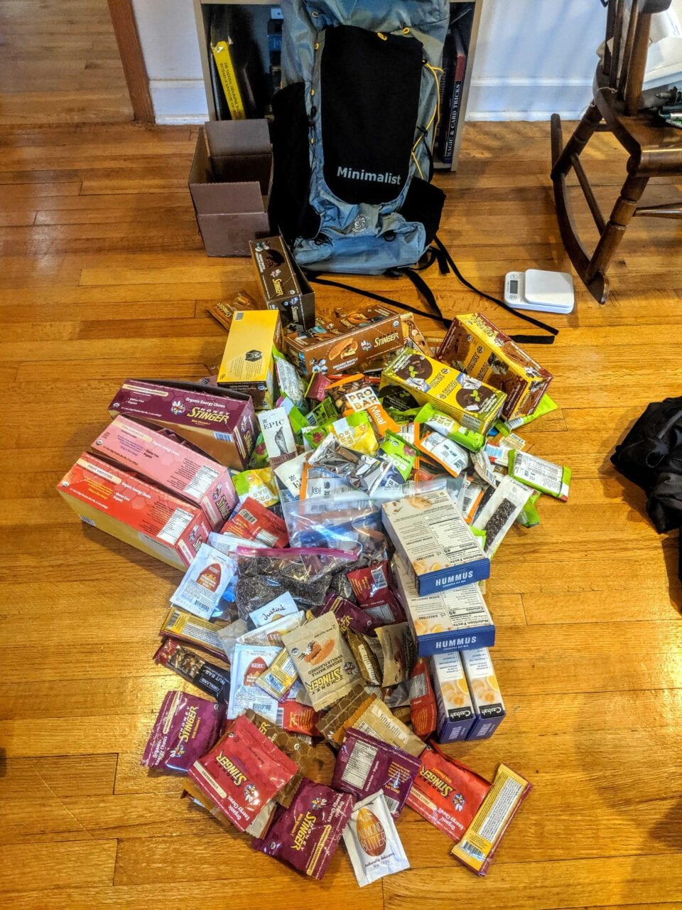
The ideal thru-hiking/backpacking food is delicious, lightweight, non-perishable, calorie dense, easy to prepare, nutritious, and affordable. Finding the best hiking food for your needs can be a lot of fun!

Resupply boxes for a multi-week hike on the Continental Divide Trail.
Photo provided by Dahn Pratt

Whitney “AllGood” La Ruffa enjoying a mountain mocha on the Sierra High Route.
Photo provided by Whitney La Ruffa; Photo taken by Liz Thomas
Start with the food you already eat
Everyone has different dietary needs and preferences when it comes to food whether you are at home or on the trail. I recommend looking at the food you already eat at home as a starting point for your hiking food recipes. With just a few changes, you can enjoy your favorite food in the outdoors.
Visit the grocery store with fresh eyes
Visit your favorite grocery store with an eye towards non-perishable hiking foods. I find this process fun because it involves slowly walking through a grocery store and looking at everything with a new perspective. You will likely see a lot of new food that will be fun to try.
Typical Grocery Store Foods
To help get you started I created a short list of some grocery store items that backpackers commonly eat. The list includes the unit cost, calories per unit and the calculated cost per 1,000 calories. It is sorted by least to most expensive per calorie of energy. All prices reflect retail prices at Safeway.

Click to enlarge.

Click to enlarge.
Test out the recipes at home
Now it is time to test the hiking food at home. Try to simulate the thru-hiking experience by cooking in one pot and don’t add any ingredients that you will not take with you. It’s very rewarding to optimize the cooking process until the food tastes great. If the food tastes great at home, you will enjoy it in the wilderness. I’m not a believer that everything tastes better in the wilderness. The extra work optimizing dishes at home will make your outdoor experience so much more enjoyable.
Find a special treat or two
Everyone deserves a special treat. Maybe eating a Snickers bar after a bad day will help you feel better and give you a little morale boost. I like to have a variety of treats because it’s fun to have a choice, and my cravings change depending on the situation. It’s also nice to share with friends and other hikers.
Plan on eating more than usual while thru-hiking
You will likely need to eat more while thru-hiking than at home. It isn’t uncommon for weekend hikers to consume 3,000 to 4,000 calories a day. Long-distance hikers can easily consume 4,000 to more than 6,000 calories in a day. The amount of food you need depends upon your body weight, backpack weight, distance you hike, and personal requirements. I recommend starting out with smaller hikes until you understand your personal calorie needs.

Shopping along the Te Araroa, New Zealand
Photo provided by Dahn Pratt

Photo provided by Whitney La Ruffa
Photo taken by Liz Thomas
A few more tips
- Repackage food into resealable and reusable containers to minimize bulk and garbage. Be sure to clearly label everything and include cooking instructions.
- Purchase bulk food at a warehouse to save 40 to 50%.
- Use coupons and sales to save 20-30%.
Cost per calorie is important, but not all calories are the same!
Just looking at the table provided, one might be tempted to save an enormous amount of money by buying 4-6 months worth of Ramen packets and calling it a day! Besides getting absolutely sick of Ramen, it would also be fool-hearty from a nutritional stand-point.
Calories do not function on a one to one ratio, even when examining cost. It’s also important to consider how the calories will fuel you. For example different foods have different effects on satiating you. This means some foods will give you a greater feeling of fullness. Also some foods are nutritionally well-rounded, while others simply provide calories that may be unhelpful or even harmful to the level of output a typical thru-hiking adventure requires.
When planning a resupply, I always try to strike a happy medium between reducing cost and having calories that provide great nutritional value.
Download our popular hiking and biking guides!
Trail guides that get you to places you’ve dreamed of.
As the makers of Guthook Guides, Bikepacking Guides, and Cyclewayz, we help you navigate the most popular trails around the world on your smartphone. Our hiking guides and biking guides work completely offline. Let Guthook guide your next adventure!
Showers Lake Vista, Tahoe Rim Trail
Photo courtesy of the Tahoe Rim Trail Association
Showers Lake Vista, Tahoe Rim Trail
Photo courtesy of the Tahoe Rim Trail Association
Trail guides that get you to places you’ve dreamed of.
As the makers of Guthook Guides, Bikepacking Guides, and Cyclewayz, we help you navigate the most popular trails around the world on your smartphone. Our hiking guides and biking guides work completely offline. Let Guthook guide your next adventure!
Download our popular hiking and biking guides!
About the Authors
Paul Bodnar
Paul has always liked hiking and thru-hiked the Pacific Crest Trail in 1997 after college. After years of working in chemistry, he wanted to create a career involving the outdoors, so he hiked the Pacific Crest Trail again in 2010 to do research for his guide book Pocket PCT. He realized that creating a smartphone app for navigating the outdoors would make it easier to keep the data current and provide a better way to navigate. While hiking with Ryan (aka Guthook) in 2010, they decided to work together to create the first comprehensive smartphone guide for the Pacific Crest Trail. Now with the help of a team of great people they have created over 50 guides for trails around the world.
Dahn Pratt
Dahn began collecting trail data for Atlas Guides in 2017 on his 10,000 mile project called Chasing Summer. The most recent data for the Te Araroa, Pacific Crest Trail, Continental Divide Trail, Jordan Trail and Israel National Trail all came from Dahn. Now you will find Dahn on the office side of Atlas Guides doing all kinds of things, like data analytics, data processing, customer support, and more. When he is not hiking he can be found camping, or making bad jokes.
Australia Epic Rides
Official app of Bikepacking Roots. The Wild West Route offers bikepackers a non-technical, expeditionary-scale riding experience through Arizona, Utah, Idaho and Montana that immerses one in the vast expanses of wild and public lands in the Intermountain West. Nearly 70% of the route is on public lands, and more than 80% is off-pavement, following primarily follows dirt roads and rough 4×4 tracks on which mountain bikes are most suitable. Riders will experience the remote mountains of western Montana and central Idaho, the desolate beauty of southern Idaho’s Snake River Plain, endless vistas from Utah’s high plateaus at 10,000 feet elevation, the canyon country of Navajo Nation and the Grand Canyon region, and the towering Sky Islands and low Sonoran Desert of southern Arizona.
20% off for our Hiking Season Kick-off SALE! The Wild West Route is now $23.99.
Australia
Photo courtesy of Australian Cycling Holidays
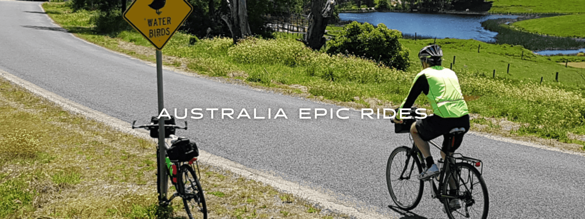
Australia Epic Rides
15,000+ km • Australia
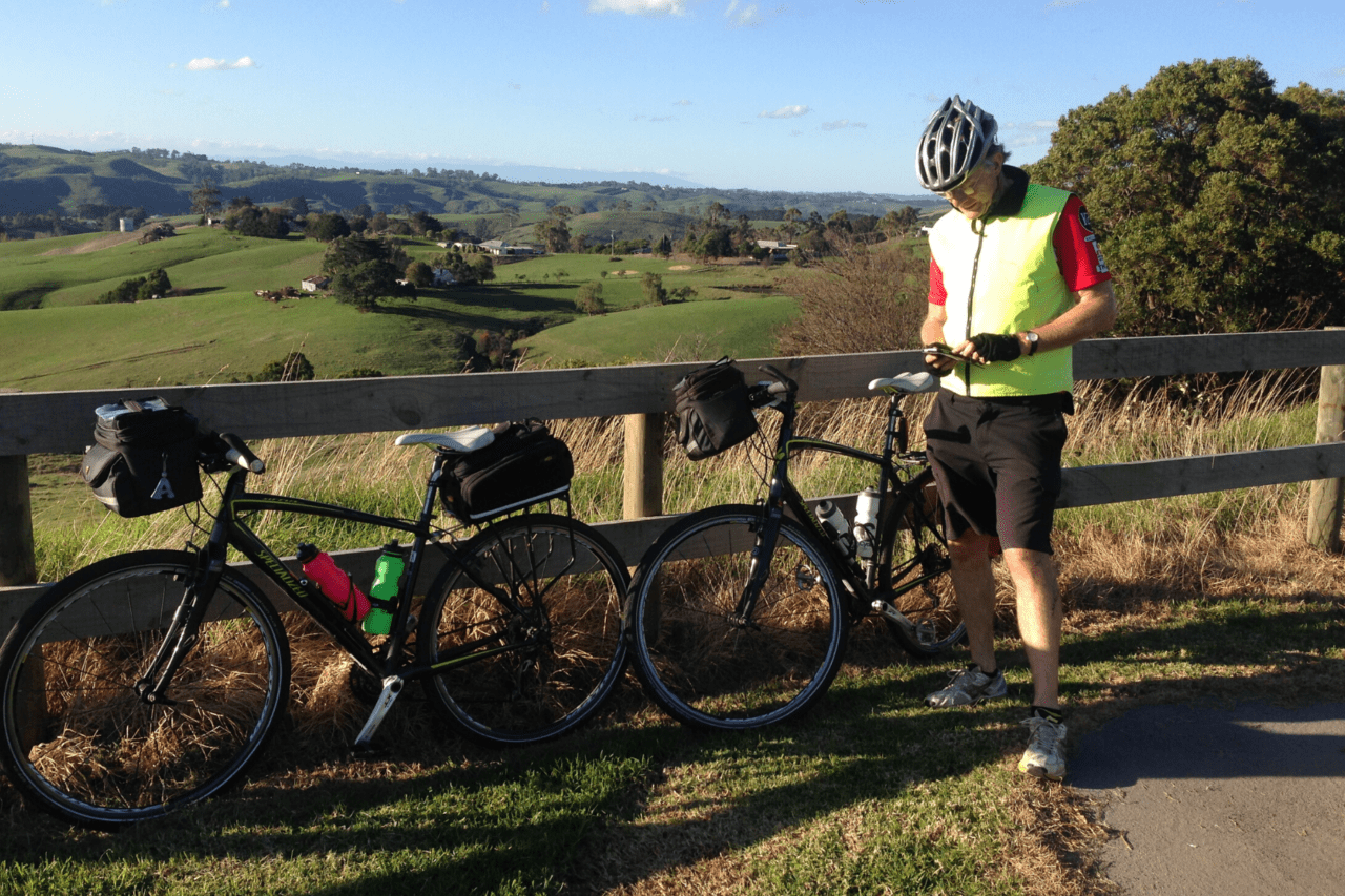
Set off on a cycling adventure and see the real Australia. Enjoy the authentic country towns where you are welcome to lean on the Pub Bar and have a chat with the locals. Our Cyclewayz Routes take you on the roads less travelled with a hugely varied mix of scenery. Enjoy cycling beside the white sandy beaches, following the riverways, through magnificent rainforests, across the plains and over the hills (we call them mountains!). On the East Coast and in West Coast, accommodation is generally a day's ride or less.
$28.99 full guide 16 routes ($3.99 – $9.99 each)
15,000+ km
$28.99 full guide
16 routes ($3.99 – $9.99 each)
How can I get it?
Available as an in-app purchase in our Bikepacking Guides app, a free download from the Apple App Store or the Google Play Store.
Our iOS and Android apps do differ slightly in their appearance. However, the majority of their features remain the same, and they access the same trail guide data.
Free Demo: Grafton to Coffs Harbour
90km One Way, Hilly with one significant hill. Sealed/Unsealed, Quiet roads/Paths,7Hr
Follow the gold diggers to the Golden Dog of timber town Glenreagh set amongst sandstone cliffs. Admire the fmagnificient rainforest trees and vines trees. Roll down past blueberries and bananas and avocado trees to hit the spectacular coast of Coffs Harbour where the Great Divide meets the Pacific Ocean.
75% discount! The “All Epic Rides Bundle” includes every ride in the Australia Epic Rides Category — thousands of kilometres of epic riding in Australia.
US$28.99
US$3.99
486 km Loop, Medium, Flat/Hilly,Roads/Rail Trails, Sealed/Unsealed
Who was Ned Kelly? Why after all this time is he still so well known?
His cool armour head gear could be part of the reason. His helmet can be seen in many farmer’s mailboxes on numerous Cyclewayz Routes.
Was he a villain, a hero, or a bit of both?
You can make up your own mind as you ride and explore all the key sites where the legend of the Ned Kelly Gang lives on!
This trail uses quiet secondary roads and rail trails on mostly flat terrain, although there is a large climb between Mansfield and Whitfield.
This trail will take you from Wangaratta to Seymour via Glenrowan, Benalla, Violet Town, Euroa and Avenel. From Mansfield go over the hills to Milawa, via an optional detour to Stringy Bark Creek and the spectacularly beautiful Powers Lookout. Then it is on to the historic Gold Mining town of Beechworth where Ned spent time in Gaol and 23 of his supporters were held without charge for 3 months.
Thank you very much to John Fuller for designing and recording this ride.
Copyright 2020 Active Wayz Pty. Ltd.
US$9.99
1489km One Way, Easy to Hard, Flat to Mountainous, Sealed/Unsealed.
What a varied ride and all away from the traffic! You will explore stunning beaches, rolling countryside, high plains, historical country towns and spectacular temperate rain forests. Get up close to Australian native animals, reptiles and birds. Enjoy the fresh air, great food and clear skies. This ride has some challenging sectors and you will need to plan using the information given in the app.
Start: Waterfall Station, Melbourne Airport/Southern Cross Station Transport: Sydney, Canberra, Melbourne stations /airports, Wollongong, Bomaderry, Bairnsdale, Stratford, Rosedale stations, Car
Australian Cycling Holidays offers a fully supported self-guided tour including bicycles, hand-picked accommodation, breakfast, luggage transfer and road-side assist.
Copyright 2019 Active Wayz Pty. Ltd
US$4.99
502 km Loop, Medium, Flat/Hilly, Roads, Sealed/Unsealed
Ben Hall roamed these parts carrying out audacious raids on the coaches carrying gold and other valuables,
Explore his hideout and the site of his shooting death in 1865.
The ghost of Ben Hall whispers in the wind.
Thank you to John Fuller for developing this trail.
Start: Binalong Access Points: Forbes, Harden, Cowra
Copyright 2020 Active Wayz Pty. Ltd.
US$3.99
487 km one way, Hilly/Mountainous, Hard/Remote, Unsealed/Sealed Roads, Multi-day
This route takes you through the heart of the true Tasmania. Experience the wilderness and tranquility Tasmania is so famous for as you journey from the North in Devonport to the delightful seaside town of Dover in the South.
This route mainly follows the Tasmanian Trail. Originally developed as a horse trail, the route provides the full range of cycling experiences from sealed roads, to farm and forestry gravel roads, to steep rough tracks through gullies and mountains.
Cycle through remote forests, past tranquil pastures and beside clear rivers. You even have the choice of fording the Mersey River! The Great Western Tiers provide a stunning backdrop as you ride along the Meander Valley. Your climb up to the Central Plateau will be rewarded with stunning views. See how “Mega Watts from Heaven” are created as you ride past the huge penstocks (pipes) delivering water to the Poatina Power Station.
The open alpine plains and lakes of Central Plateau give way to the Eucalyptus forests as you head towards the Huon Valley.
As you break out of the forests you are rewarded with stunning coast line scenery and island views. Enjoy a delicious salmon meal fresh from the nearby estuary.
The ride is a challenge and while it goes past quaint villages, you will need to be self-sufficient as there are remote areas.
The Tasmania Trail Association created the Tasmanian Trail and continue to do wonderful work across the length of the trail. There are a number of locations where gates may be locked, so well before you start your journey please contact them to arrange for a trail key. This key will also provide you access to campsite facilities.
We also recommend becoming a TT Association member and purchase the guidebook. Studying the notes before you go will provide great local knowledge for the ride as well as being aware of the precautions regarding cold weather and bushfires.
Contact: http://www.tasmaniantrail.com.au
Thank you to John, Julia and Ash for photos and trail data.
Copyright 2020 Active Wayz Pty. Ltd.
US$9.99
1144 km Loop, Hilly/Mountainous, Hard/Remote, Unsealed/Sealed Roads, Multi-day
Cycle around the whole of Tasmania. Marvel at the contrast between West and East Coasts.
Only a few roads penetrate the rugged west, a land of mountains and the heart of the remote Tarkine Wilderness. This area of Tasmania is ancient and it is impossible to tell if moss covered trees have been there for fifty or a thousand years.
Roads are often steep and can be rough in the wet. Punctuating the wilderness are small settlements mainly created for mining and logging, and occasionally, tourism. Enjoy riding on roads with little traffic, passing by majestic forests, fields of sheep and fragrant lavender.
As you head south towards Hobart, river valleys open up with cows and sheep grazing beside the road. Enjoy a few days in Hobart, a city skyline unchanged since its convict colonial times and a burst of development in the 1970’s.
On the East Coast, the road hugs the sea. The coast is dramatic and the views to long white sand beaches and rocky headlands are simply stunning. This East Coast is the favourite holiday spot for the Tassie locals. In the last few years the beauty of the area has become well known and now “Mainlanders” and International tourists are enjoying the scenery too.
Best Times: October to mid December
Mid February to April.
The Tasman Highway on the East Coast can very busy so best to avoid riding this section in the Christmas and Easter school holidays.
Thank you to Josiah for riding the trail and collecting photos and trail data.
Copyright 2020 Active Wayz Pty. Ltd.
US$3.99
424km, Loop Ride, Medium, Hilly, Sealed/Unsealed, 32 hours
Tasmania is a great place to cycle. This wonderful ride showcases the best that the North East has to offer – beautiful beaches, temperate rainforests, panoramic views and historic country towns with some of the most stunning landscapes in the state. You can even test your skills on the Blue Derby Mountain Bike Park or take a leisurely ride in the bush along the North East Tasmanian Rail Trail. Take your time and enjoy this journey – you will be happily surprised.
Our advice is avoid January and Easter when the state explodes with tourists and the roads are very busy. The North East of Tasmania is quite dry during winter and so this ride is accessible all year round. We think February to just before Easter and September through to early December are the best great times.
Start: Launceston Access: Launceston Airport – where there is a free, covered bike set up stand. All other towns along the route can be used for access by car.
Copyright 2020 Active Wayz Pty. Ltd.
US$9.99
1180km One Way, Flat/Hilly, Medium: Unsealed/sealed, quiet roads/paths,14 to 16 days.
To Show Ride Sections Go To: Route Selector/Route Filter/Bundle Specials/Epic Journeys/Brisbane to Sydney.
Take a look at the free Grafton to Coffs Harbour ride.
Ride from Brisbane Airport to the Sydney Opera House via beautiful deserted beaches, pristine lakes, rainforests, cattle country, big rivers, huge views, ferries and holiday villages full of fun stuff.
Don’t have enough time for the whole journey? Then split the trip. We have mapped this ride in easy access steps so you can choose the sector you want to ride. Buy each sector separately or buy the whole lot as a Bundle Special/Epic Journeys which will save you lots!
Start at Brisbane Airport and finish at the stunning Sydney Opera House. If you don’t want to cycle into Sydney (which is very busy and not cycle friendly) you can take the mapped route exit around beautiful Lake Tuggerah on the cycle path and take the train in from Tuggerah Station. Cycling out of Brisbane is safe but a little industrial. If you wish to skip that take the train to the Gold Coast and start from there.
Start: Brisbane airport or ferry, Circular Quay station (Or Tuggerah station to avoid traffic) Access: Multiple stations and airports along route.
Copyright 2019 Active Wayz Pty. Ltd.
US$9.99
1120 km One Way, Easy/Medium, Quiet Roads, Sealed/Unsealed, 12 – 16 days
Cycle from Adelaide to Melbourne on this wonderful route with a taste of the outback. Enjoy the historic ports, a cycle through the wineries, a trip across the Mallee through real Australian outback towns and love the ancient hills of Gariwerd (The Grampians). The painted silos along the way loom out of the flat landscape and are a joy to see. Finish through the Brisbane Ranges National Park at the satellite township of Bacchus Marsh and train into Melbourne to avoid the traffic.
Start: Adelaide to make the most of the prevailing wind direction. Access: Adelaide or Melbourne Airports, Train: Adelaide Interstate, Tailem Bend SA, Ararat Vic, Ballarat, Bacchus Marsh. The Overland train service will take your bike for a fee.
Time to Go: Autumn Winter Spring is a good time to avoid the harsh summer temperatures.
Copyright 2018 Active Wayz Pty. Ltd.
US$9.99
1063 km One Way, Easy/Medium, Flat, Mostly quiet roads. (Busy in summer) Sealed/Unsealed 12-16 Days.
Cycle from Adelaide to Melbourne and enjoy the historic ports, a cycle through the wineries and the Great Ocean Road with its stunning sea views.
As our UK rider Josiah says, “Occasionally somewhere comes so highly recommended that you just can’t miss it. The Great Ocean Road felt like it was built specifically to show of Victoria’s beautiful coastline to cyclists.
There are many iconic viewpoints along the route: London Bridge, Bay of Islands, The Grotto and most famously, The Twelve Apostles. All are only a short detour from the main road. In the coastal towns there are many boutique cafes, delicious restaurants and places to stay.
The Great Ocean Road attracts thousands of international drivers each year and it is packed with holiday makers in the summer months. We normally recommend quieter roads but this is such an iconic ride, we suggest you ride during the quieter months after Easter through to mid December.
Start: Adelaide to make the most of the prevailing wind direction and less traffic on Great Ocean Road. Access: Adelaide or Melbourne Airports, Train: Adelaide Interstate, Tailem Bend SA, Warrnambool, Geelong.
The Overland train service will take your bike for a fee.
Time to Go: Autumn Winter Spring Not summer- It is too busy!
Thank you to Josiah Skeats for mapping this journey.
Copyright 2020 Active Wayz Pty. Ltd.
US$9.99
888 km, One Way, Flat, Hilly in Flinders Ranges, Medium/Hard, Remote, Sealed/Unsealed, 12-15 Days
The Mawson Trail showcases everything the region North of Adelaide has to offer, such as the Adelaide Hills, Barossa winery region and the Flinders Ranges.
Enjoy the meandering route which seems to mimic the indecisive trail an ant might take. The trail uses quiet country roads, fire trails and tracks through farms, National Parks and State Parks. It can be a challenge for the cycle tourer as the track is narrow in places but the journey is well worth the odd walk and push. In the wet some of the tracks can become very muddy and we have mapped a few alternate routes.
You may be lucky to see kangaroos and emus as you journey though the Flinders Ranges.
Start: Gorge Road, Castambul End: Blinman
Transport: Southaustraliantrails.com lists a range of options. Google Search Transport to the Mawson
Thank you to Josiah Skeats for mapping this journey.
Copyright 2020 Active Wayz Pty. Ltd.
US$4.99
483 km Loop, Medium, Flat, Quiet Roads/Tracks, Sealed/Unsealed
Get away from it all. Ride on tracks and quiet country roads beside spectacular coastlines.
Expect fabulous scenery, not many people and delicious fish and chips. This ride suits the cyclist who enjoys peace and quiet but coffee addicts may be in withdrawal.
The official one-way Walk the Yorke (By Bike) route starts in the historic copper mining town of Moonta and ends in Port Wakefield.
There are few buses and taxis on the Peninsula and none of them take bikes. So the route we have mapped is a loop ride starting in Clinton passing through the quaint central town of Maitland and on to Balgowan on the West Coast.
Side trips are provided. Clinton to Port Wakefield goes via salt bush flats and the busy Yorke Highway for a number of kilometres.
A longer loop is also provided as a side trip. This loop takes you across the top of the Peninsula from Clinton to Moonta on a quiet unsealed road.
The Walk the Yorke trail can be impacted by sand drifts and track works. For the latest information and planning your trip please refer to
https://www.visityorkepeninsula.com.au/walk-the-yorke/trail-notes.
Thank you to the Yorke Peninsula Council for creating a wonderful trail and your support in supplying trail information.
Copyright 2020 Active Wayz Pty. Ltd.
US$9.99
990 km One Way, Medium, Flat/Hilly, Roads/tracks,Sealed/Unsealed, Multi-day (1016km to Perth City)
Munda Biddi means path through the forest in the Noongar aboriginal language.
This trail gives you a wonderful experience of the Western Australian southern forests and coast line.
Cycle through the dry forests, ancient forests and beside slow flowing rivers. Marvel at the massive Karri forests and dare yourself to climb the 53 m Gloucester Tree. After riding for many days you will be rewarded with stunning views of the Southern Ocean. There are some great spots along the way for a refreshing swim or relax in the quiet of the Australian Bush.
Enjoy the hospitality of the small towns along the way and rest up in one of the many shelters provided in the more isolated areas. Note: Do not rely on water being in the shelters after a dry spell because tanks are replenished by rain only.
Some areas of the track have sections more suited to a mountain bike with steep gullies and soft sand called pea gravel. For the tour cyclist, Cyclewayz has provided alternative routes away from the pea gravel.
When planning your trip we recommend the Mundi Biddi Foundation website https://www.mundabiddi.org.au. You will get local knowledge advice on what you need for your trip and current trail diversions.
We also recommend purchasing the MBF maps as they provide a great overview of your cycle route.
Munda Biddi Trail Head : Mundaring. Albany
Stations: Perth Central, Midland
Car Access: Numerous Towns
Shuttle Service: https://www.mundabiddishuttle.com (Ph +61 474 774 600)
Thank you to End to Ender, Bernard for providing the route notes and photos.
Copyright 2020 Active Wayz Pty. Ltd.
US$5.99
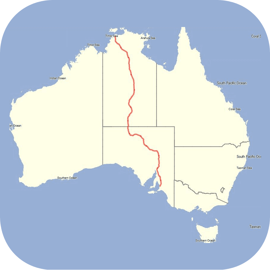
1623 km, One Way, Flat, Hard, Remote, Sealed/Unsealed, 18- 20 Days
This cycle journey takes you across the middle of Outback Australia from the Red Centre to Darwin. It is a best described by Cyclewayz rider Josiah, “The Australian Outback holds notoriety as a barren and hostile place. This reputation is almost completely spot on. But don’t let that fool you into thinking cycling across it would be dull. The earth painted rust-red, the giant termite mounds which pierce up through the ground (some dressed in clothes) and the colossal road trains which shake the world as they thunder past. I had worried about this initial fervour wearing off, but perhaps surprisingly, I never grew tired of the outback.
This ride takes you from Alice Springs To Darwin via the Stuart highway and beautiful Northern Territory National Parks. In outback terms, the Stuart Highway is well-provisioned. Villages and quirky roadhouses (some with traffic lights and alien sightings!) are spaced every 100 – 150 kilometres, and rest areas every 70-100 kilometres allowing weary cyclists to cower in their shade.
Devil’s Marbles sit on the landscape as if they have been dropped from the sky. Marvel at the gorges and the rock art in Nitmiluk NP. The journey to Litchfield NP provides plenty of opportunities for a plunge into crystal clear waterholes beneath the magnificent spring-fed waterfalls of Florence and Wangi.
Then it is on to Darwin, Australia’s city of the Top End.
You will love this hot endless journey through the centre of Australia. Link to the Cyclewayz Red Centre Way and cycle out to Uluru.
Start: Alice Springs, Darwin
Transport: Alice Springs, Darwin Airport or Train
Thank you to Josiah Skeats for mapping this journey.
Copyright 2020 Active Wayz Pty. Ltd.
US$5.99
1148 km, Loop, Flat, HARD, REMOTE, Sealed/Unsealed
(690 km One Way)
This ride takes you through some of the most spectacular scenery the Red Centre offers. The unsealed section can be badly corrugated and is remote so be prepared and carry lots of food and water in this section.
The West MacDonnells (Tjoritja to the indigenous owners) begin immediately out of Alice Springs and stretch west for 160 kilometres. Mountains, painted the typically rich-red of Central Australia rise on both sides of the road, not as separate and distinguishable mountain peaks, but instead as one formidable wave of rock and crag extending further than the eye can see. The West MacDonnell’s have many stunning red rock gorges that puncture the valley walls. Enjoy a swim in the surprisingly cold waterholes.
After riding 140 km of the rough, corrugated section of the Larapinta Drive the sealed road is a welcome sight. The walk around Watarrka (Kings Canyon) offers amazing views and the rock formations are breathtakingly beautiful.
Uluru (Ayers Rock) is THE icon of the Outback. It rises incongruously out of the desert plains and it will feel like you will never reach it because you can see it from so far away. The effort to get there, the days of anticipation, offers a sensation incomparable to arriving by car.
The side trip to the Kata Tjuta (Olgas) is a land of 36 steep monoliths thrusting out of the desert landscape. The Valley of the Winds Walk takes you past some impressive lookout points.
You can either fly home from Ayers Rock Airport or return via the Lasseter Highway to Alice Springs.
Start: Alice Springs or Ayers Rock Airport.
Thank you to Josiah Skeats for mapping this journey.
Copyright 2020 Active Wayz Pty. Ltd.
US$5.99
2240km, Mostly Flat, Hilly in Flinders Ranges, sealed/unsealed, HARD and REMOTE!! 26-30 days
The open desert of the outback has a unique beauty unlike anywhere else in the world. Cycling here is a real challenge and will test your resilience. You will need to be experienced to tackle this fabulous route.
Start in Adelaide right on the beach and cycle through the Flinders ranges, Mawson Trail, Oodnadatta Track and finally on to Alice Springs in the centre of the Outback.
The Mawson Trail showcases everything the region North of Adelaide has to offer, such as the Flinders Ranges and Barossa winery region. This area with water and cycle paths lets you get fit before you take on the outback and its challenges. Enjoy the meandering route which seems to mimic the indecisive trail an ant might take. As you head north your fellow tourists will slowly change from civilised tourists enjoying the finer things in life to the hardy, dusty travellers of the outback.
The legendary 620 km Oodnadatta track traces the route of the Old Ghan railway line named after camels and handlers imported from Afghanistan in the 1800s. The 400 km section we travel on is unsealed, inhospitable and can be very hot and there is NOTHING out here:- no people, food, water — sometimes for 200 km. Josiah told us as finished this ride: ” When you reach Oodnadatta the welcome sign says it all ‘The driest town, of the driest state, of the driest continent.’ I still consider the Oodnadatta Track the most godforsaken place, but I also kind of miss it. Looking back, I might even allow that I enjoyed it!”
Beware that Marree to Oodnadatta and painted desert route via Cadney Homestead to Marla has little support and almost no water. Take care to be well supplied with food and water. Ask the locals for current conditions.
After Marla it is the Stuart Highway to Alice Springs with an optional side trip to Uluru which you can download if you have the energy for it!
Start: Adelaide, Alice Springs
Transport: Adelaide or Alice Springs Airport or Train
Thank you to Josiah Skeats for mapping this incredible journey.
Copyright 2018 Active Wayz Pty. Ltd.
US$9.99
572 km Loop, Hard, Remote, Mountainous, Sealed/Unsealed Rough, 10 to 13 days
Cycling in East Timor is for the adventurous. The roads are a challenge, the temperature and humidity exhausting, and outside the capital city of Dili, shops are very poorly-provisioned. But for the cyclist who dares to come here, they will find themselves richly rewarded for their efforts.
Josiah’s Highlights:
Traditional village life. – Outside the capital, you will cycle through endless tiny villages. The people here are mostly farmers, living simply and in harmony with the land. You will pass traditional bamboo shacks with palm leaf roofs – if you’re lucky you will get invited to stay with a local family. You will cycle past women carrying firewood or pots of water on their head. These people live a unique and fascinating life, most likely so different from your own.
Friendly locals – So few tourists visit East Timor that the locals were very curious when they saw me. They were more shy than other countries in South East Asia, but always welcome and excited to share about their country and display their culture of hospitality. The Timorese people had to fight very hard for their independence which means they are very proud of their country.
Beautiful and varied scenery – around Maubisse, in the west, you will discover beautiful mountains which seem to stretch endlessly in every direction. In the east around Los Palos you will cycle through a grassy plateau with grazing cows and buffalo and horses. It feels a lush and peaceful place to live. The north and south coastline is dramatic, with the water displaying shades of blue, and a clarity, I never imagined possible.
Practical advice:
Ride the loop anti-clockwise. By heading towards Maubisse first, you will get the largest climb (1,900 metres) and the worst roads out of the way first, while you are fresh. The north of the country is more developed than the south.
Stock up on food in Dili. Outside the capital you will be heavily restricted by what is available in the shops. Most shops sell the essentials (cigarettes, petrol, alcohol), and in terms of food, instant noodles and biscuits. In the morning (and only in the morning), you will find fresh bread rolls, and doughnuts available in every village. I would recommend to buy rice and tinned food (vegetables, tuna etc.) in Dili for dinner.
For breakfast I would always eat fresh bread rolls or doughnuts, for lunch instant noodles or a cafe if available, and for dinner I would cook pasta/rice with tinned food. I would snack on bananas or biscuits available from village shops.
Toilets – I did not see any public toilets and had to ask people if I could use theirs. They never seemed to mind.
Water – You can buy (cold, refreshing) bottled water: 1.5 litre for $0.50. Alternatively, most villages had a well or water pump – this was not potable so recommended to carry a filter, purification tablets, or to boil it.
Ride early, finish late. The midday heat could be very harsh. Recommended to start riding early, and take a midday nap for a few hours.
I cycled the loop in 8 days due to time pressure. 9 – 10 days, including a rest day in the middle would have been better.
Copyright 2020 Active Wayz Pty. Ltd.
Ride more.
Check out some of the other mountain biking guides we offer!
About our partner
Australian Cycling Holidays
The owners of Australian Cycling Holidays, Angela and Robert Mosley, understand what makes a cycle ride enjoyable, and this understanding is reflected in the rides they have mapped for the Cyclewayz app. They believe in cycling the back roads – whether they be cycle paths, quiet back country roads, or rail trails. They love scenery — from wild beaches to majestic forests — and know that cycling is all about the journey with new experiences and fun challenges.
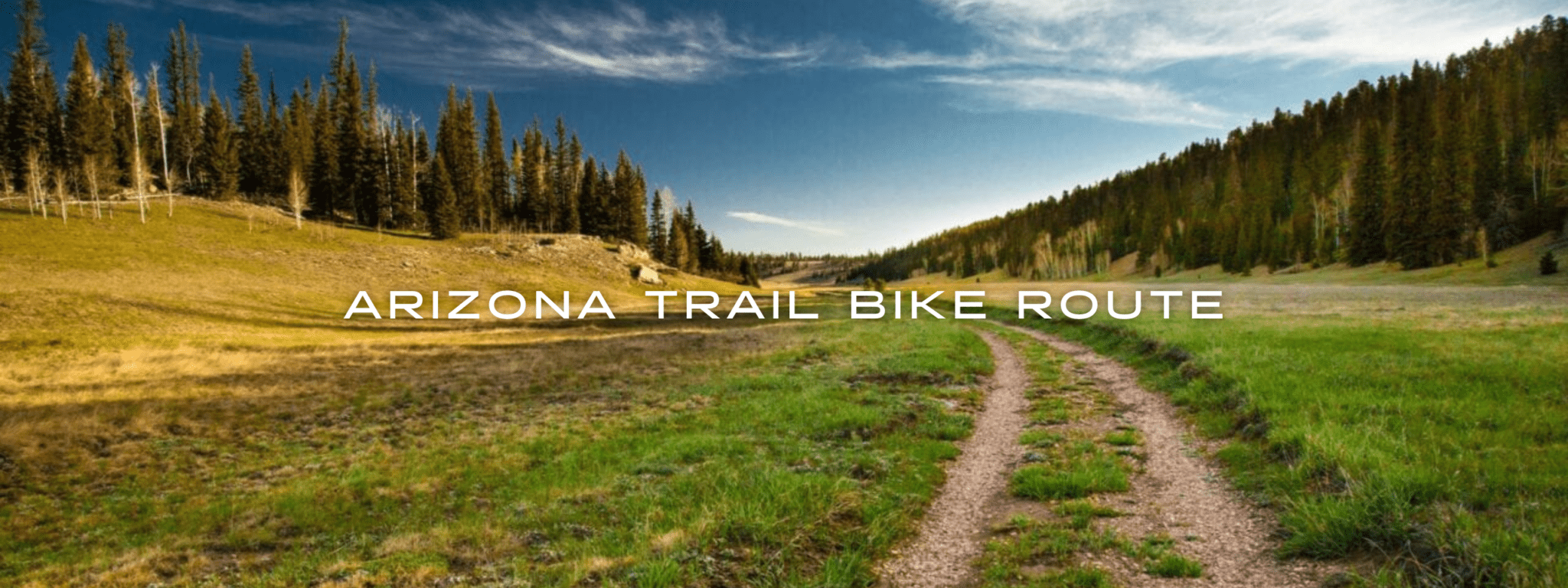
Arizona Trail Bike Route
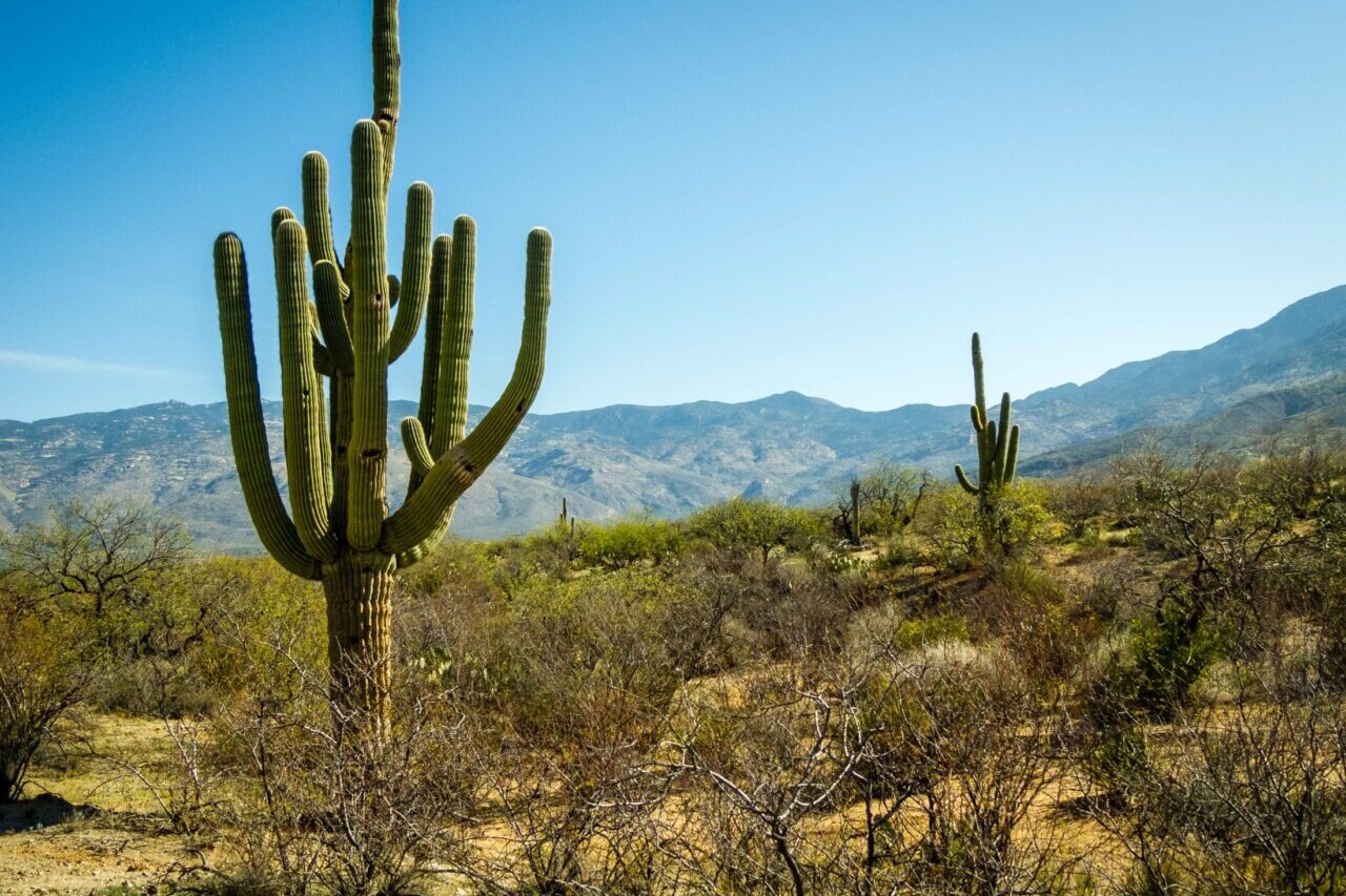
Official app of the Arizona Trail Association. The Arizona National Scenic Trail Bike Route stretches 830 scenic miles across the state of Arizona from Mexico to Utah. It passes through some of the most diverse and beautiful landscapes in the state. Our mountain biking guide is the official app of the Arizona Trail Association, stewards of the Arizona Trail. Check out the official Arizona Trail hiking guide in our Guthook Guides app.
20% off for our Hiking Season Kick-off SALE! The Arizona Trail Bike Route is now $7.99.
30% off for our Small Business Saturday SALE! The Arizona Trail Bike Route is now $6.99.
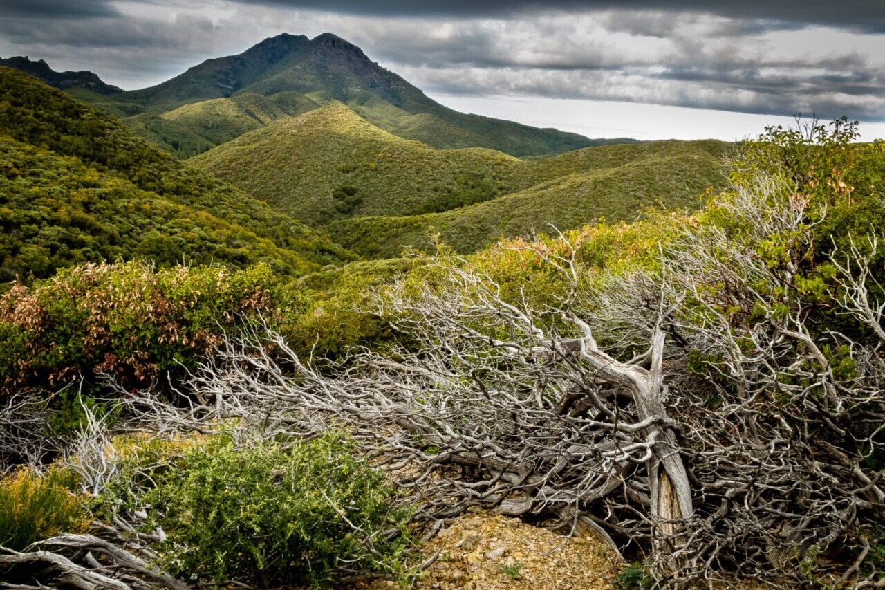
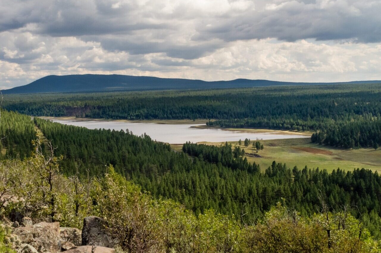
Kaibab Plateau, Arizona Trail Bike Route
Photo courtesy of the Arizona Trail Association
Arizona Trail Bike Route
830 miles • Arizona
Official App of the Arizona Trail Association
The Arizona National Scenic Trail Bike Route stretches 830 scenic miles across the state of Arizona from Mexico to Utah. It passes through some of the most diverse and beautiful landscapes in the state. Our mountain biking guide is the official app of the Arizona Trail Association, stewards of the Arizona Trail. Check out the official Arizona Trail hiking guide in our Guthook Guides app.
$9.99 full guide
830 mi (1335 km)
$9.99 full guide
Official App


How can I get it?
Available as an in-app purchase in our Bikepacking Guides app, a free download from the Apple App Store or the Google Play Store.
Our iOS and Android apps do differ slightly in their appearance. However, the majority of their features remain the same, and they access the same trail guide data.
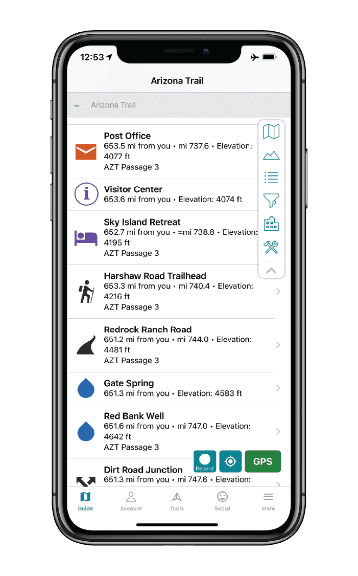
Official bike route of the Arizona Trail Association with waypoints for the Arizona Trail and Flagstaff Urban Trail alternate.
Cheers to giving back! Part of your purchase of the Arizona Trail Bike Route goes to support the Arizona Trail Association’s work to preserve and maintain the hiking trail and bike route. Learn about the Arizona Trail Association.
Stories from the Arizona Trail Bike Route!
Check out our most recent blog posts about biking the Arizona Trail.
Nothing found.
Nothing found.

Ride more.
Check out some of the other mountain biking guides we offer!
About our partner
Arizona Trail Association
The mission of the Arizona Trail Association is to protect, maintain, enhance, promote and sustain the Arizona Trail as a unique encounter with the land. A nonprofit organization, the ATA has trained and coordinated tens of thousands of volunteers to help build and maintain the Arizona Trail since 1994. Their primary focus is on protecting and maintaining the trail, though they also have a number of outreach programs to engage community members in the Arizona Trail experience.
In partnership with the Arizona Trail Association, Atlas Guides has created the official Arizona Trail app, which offers the most relevant information on the Arizona Trail. Together with the ATA, we work to provide frequent updates to the app.

Croatian Long Distance Trail Demo
High mountain trails, beautiful forests, and glittering coastline on the Croatian Long Distance Trail. The Croatian Long Distance Trail is a 2,145 km (1,333 mi) national scenic hiking trail that winds its way through the beautiful landscape of Croatia from the eastern terminus in Ilok—near the beautiful Fruška Gora mountain—to the most northern point, Sveti Martin na Muri, then to the most western point, Savudrija, and on southwards past scenic tourist destinations Split and Dubrovnik tothe southernmost point, Prevlaka. The trail itself is characterized by an avoidance of asphalt roads. It instead takes hikers on a journey of mountain trails, rolling hills, beautiful forests, wide plains, glittering coastline, and three stunning national parks.
20% off for our Hiking Season Kick-off SALE! The Croatian Long Distance Trail is now $19.99.
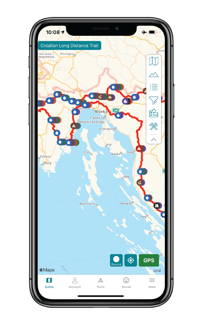
Croatian Long Distance Trail
Photo courtesy of the Croatian Long Distance Trail Association
4.8 ★★★★★ | 17K+ Reviews
Croatian Long Distance Trail
2145 km / 1333 miles • Croatia
Official App of the Croatia Long Distance Trail Association
High mountain trails, beautiful forests, and glittering coastline on the Croatian Long Distance Trail. The Croatian Long Distance Trail is a 2,145 km (1,333 mi) national scenic hiking trail that winds its way through the beautiful landscape of Croatia from the eastern terminus in Ilok—near the beautiful Fruška Gora mountain—to the most northern point, Sveti Martin na Muri, then to the most western point, Savudrija, and on southwards past scenic tourist destinations Split and Dubrovnik tothe southernmost point, Prevlaka. The trail itself is characterized by an avoidance of asphalt roads. It instead takes hikers on a journey of mountain trails, rolling hills, beautiful forests, wide plains, glittering coastline, and three stunning national parks.
$24.99 full guide 3 sections ($11.99 each)
$24.99 full guide
3 sections ($11.99 each)


How can I get it?
Available as an in-app purchase in our Guthook Guides app, a free download from the Apple App Store or the Google Play Store.
Our iOS and Android apps do differ slightly in their appearance. However, the majority of their features remain the same, and they access the same trail guide data.
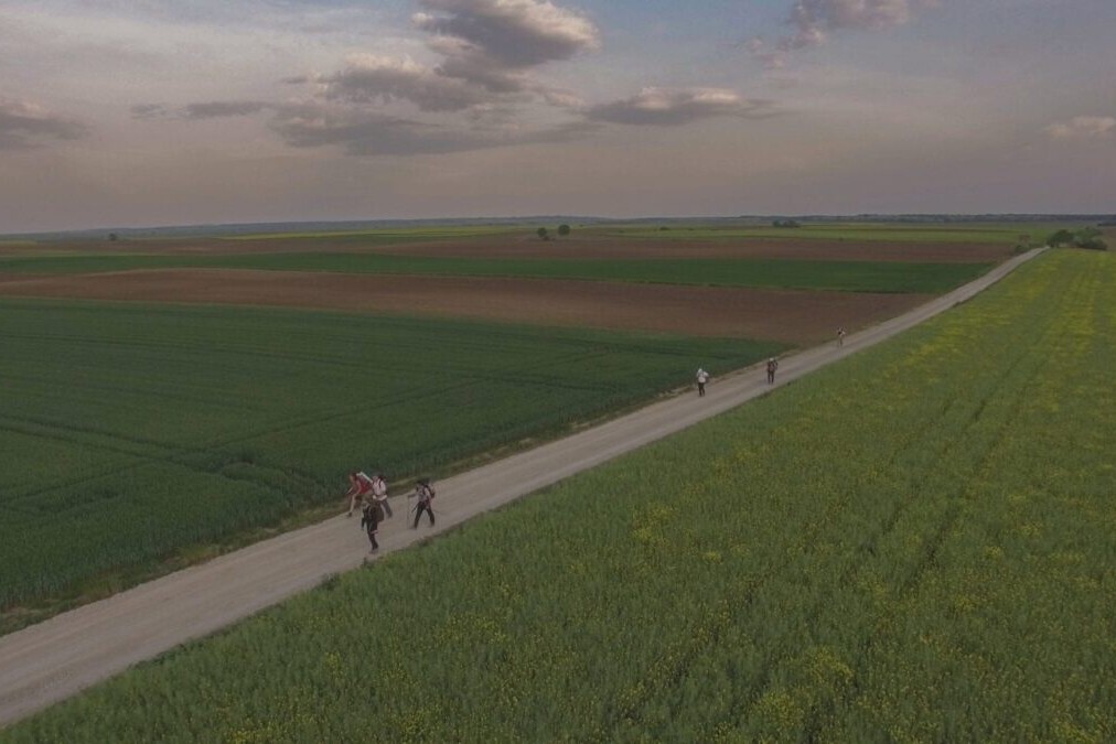
This demo section of the Croatian Long Distance Trail starts at the western-most point in Croatia on the Adriatic Sea in Basanija, and heads south along the sea for 20 km to Karigador.
Entire 2145-km/1333-mile Croatian Long Distance Trail. Purchase the thru-hiker special and save 30% over buying Sections A, B, and C separately.
$24.99
Section A of the Croatian Long Distance Trail is 580km / 360 miles. This section is a diverse portion of CLDT. Starting from the Danube River in eastern Croation, you will experience plains, forests, mountains and hills as you head northwest to Marof on the Mur River.
$11.99
Section B of the Croatian Long Distance Trail is 572 km / 356 miles. It heads southwest from the Mur River in Marof to the westernmost point of Istria Peninsula on the Adriatic Sea, passing northwest of the capital city of Zagreb along the way.
$11.99
Section C of the Croatian Long Distance Trail is the longest section, at 994 km / 617 miles. It begins at the western-most point of Croatia on the Istria Peninsula, on the Adriatic Sea in Basanjia, and heads southeast parallel to the coast, crossing over to the Peljesac peninsula, and ending at the southern-most point of Croatia at the Prevlaka peninsula on the Adriatic Sea.
$11.99

Cheers to giving back! Your purchase helps support the Croatian Long Distance Trail Association’s work to preserve and maintain the trail. Learn about the Croatian Long Distance Trail Association.
Hike more.
Check out some of the other trail guides we offer!
About our partner
Croatian Long Distance Trail Association
The Croatian Long Distance Trail Association is a non-profit organization that helps manage the Croatian Long Distance Trail, a national scenic long distance trail meant to be thru-hiked or hiked in sections throughout Croatia. The Association is a dedicated group of individuals committed to building, maintaining, and promoting recreation on the CLDT.
The Croatian Long Distance Trail Association is working to create, build, and mark the 2145-km Croatian Long Distance Trail. The Association is tied together with a common string – love towards mountains, nature, hiking, and protection of the outdoors – and putting its efforts toward an uninterrupted mountain-hiking trail across Croatia.
Tahoe Rim Trail Demo
Official app of the Tahoe Rim Trail Association. The Tahoe Rim Trail is a circular journey of over 170 miles (270 km) that circumnavigates Lake Tahoe, crossing into both California and Nevada. The TRT traverses the Sierra Nevada and Carson ranges of California and Nevada, and shares about 50 miles of its western section with the Pacific Crest National Scenic Trail. On the Tahoe Rim Trail, there is no defined beginning or end. Thru-hikers and backpackers can begin anywhere on the loop. Along its path, the trail offers many stunning views of Lake Tahoe, which makes it perfect for day-hiking. Hikers and visitors wishing to give back to the Tahoe Rim Trail can adopt a mile or vista through the Tahoe Rim Trail Association.
20% off for our Hiking Season Kick-off SALE! The Tahoe Rim Trail is now $11.99 and the Western Hiker Special is now $39.99.
30% off for our Small Business Saturday SALE! The Tahoe Rim Trail is now $9.99.
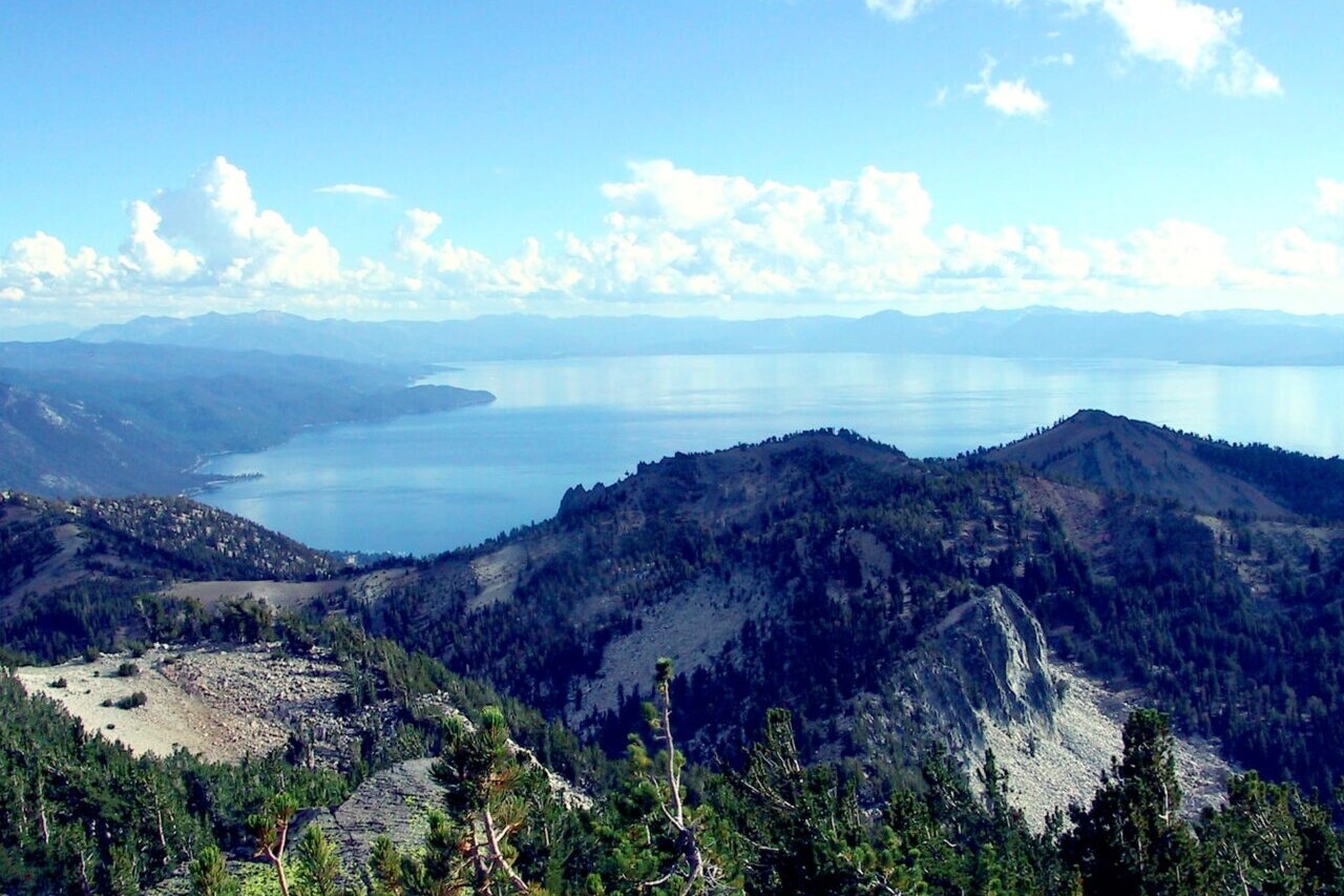
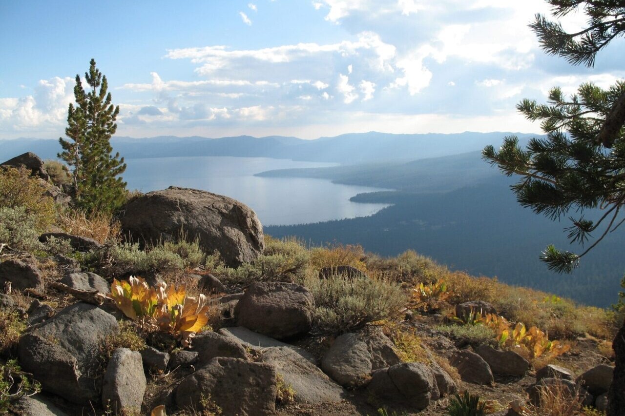
Mike and Sharon Dixon Vista, Lake Tahoe, Tahoe Rim Trail
Photo courtesy of the Tahoe Rim Trail Association
4.8 ★★★★★ | 17K+ Reviews
Tahoe Rim Trail
170 miles • Lake Tahoe, California & Nevada
Official App of the Tahoe Rim Trail Association
The Tahoe Rim Trail is a circular journey of over 170 miles (270 km) that circumnavigates Lake Tahoe, crossing into both California and Nevada. The TRT traverses the Sierra Nevada and Carson ranges of California and Nevada, and shares about 50 miles of its western section with the Pacific Crest National Scenic Trail. On the Tahoe Rim Trail, there is no defined beginning or end. Thru-hikers and backpackers can begin anywhere on the loop. Along its path, the trail offers many stunning views of Lake Tahoe, which makes it perfect for day-hiking. Hikers and visitors wishing to give back to the Tahoe Rim Trail can adopt a mile or vista through the Tahoe Rim Trail Association.
$14.99 full guide
170 mi (270 km)
$14.99 full guide
Official App
Tahoe Rim Trail Map


How can I get it?
Available as an in-app purchase in our Guthook Guides app, a free download from the Apple App Store or the Google Play Store.
Our iOS and Android apps do differ slightly in their appearance. However, the majority of their features remain the same, and they access the same trail guide data.
Free demo
Full-featured preview Tahoe Rim Trail. This demo section includes the 21-mile section of the Tahoe Rim Trail from Tahoe City to Brockaway Summit, near Watson Lake.
The Western Hiker Special (also known as the Super Hiker Special) includes the entire Pacific Crest Trail + John Muir Trail + Tahoe Rim Trail + Wonderland Trail + Lost Coast Trail + Whitney Trail: a 33% savings over buying the sections separately.
$49.99
The Tahoe Rim Trail is a circular journey of over 170 miles (270 km) that circumnavigates Lake Tahoe, crossing into both California and Nevada.
$14.99
Cheers to giving back! Part of your purchase of the Tahoe Rim Trail goes to support the Tahoe Rim Trail Association’s work to preserve and maintain the trail. Learn about the Tahoe Rim Trail Association.
Stories from the Tahoe Rim Trail!
Check out our most recent blog posts about the Tahoe Rim Trail.
Nothing found.
Nothing found.

Hike more.
Check out some of the other trail guides we offer!
About our partner
Tahoe Rim Trail Association
The mission of the Tahoe Rim Trail Association is to maintain and enhance the Tahoe Rim Trail system, practice and inspire stewardship, and preserve access to the natural beauty of the Lake Tahoe region. The Tahoe Rim Trail Association has the privilege of being the primary steward of one of the world’s most beautiful long-distance trails, and protects the Tahoe Rim Trail experience while engaging with the community through volunteer and educational outdoor programs.
In partnership with the TRTA, Atlas Guides has created the official Tahoe Rim Trail navigational app.
Western Wildlands Route Demo
Official app of Bikepacking Roots. The Western Wildlands Route offers bikepackers a non-technical, expeditionary-scale riding experience through Arizona, Utah, Idaho and Montana that immerses one in the vast expanses of wild and public lands in the Intermountain West. Nearly 70% of the route is on public lands, and more than 80% is off-pavement, following primarily follows dirt roads and rough 4×4 tracks on which mountain bikes are most suitable. Riders will experience the remote mountains of western Montana and central Idaho, the desolate beauty of southern Idaho’s Snake River Plain, endless vistas from Utah’s high plateaus at 10,000 feet elevation, the canyon country of Navajo Nation and the Grand Canyon region, and the towering Sky Islands and low Sonoran Desert of southern Arizona.
20% off for our Hiking Season Kick-off SALE! The Western Wildlands Route is now $23.99.
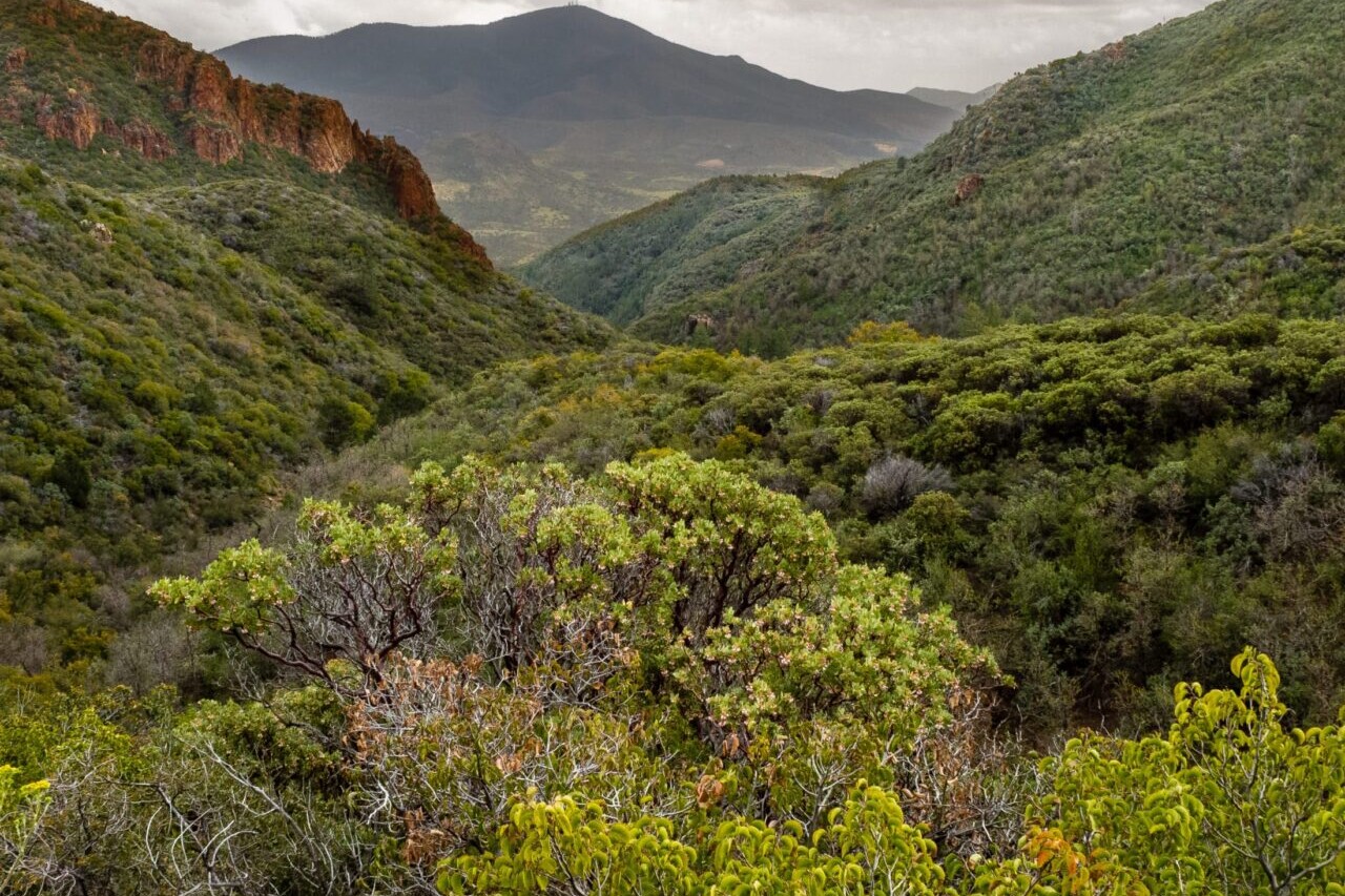
Arizona, Western Wildlands Route
Photo courtesy of Bikepacking Roots
Western Wildlands Route
2657 miles • Arizona, Utah, Idaho & Montana
Official App of Bikepacking Roots
The Western Wildlands Route offers bikepackers a non-technical, expeditionary-scale riding experience through Arizona, Utah, Idaho and Montana that immerses one in the vast expanses of wild and public lands in the Intermountain West. Nearly 70% of the route is on public lands, and more than 80% is off-pavement, following primarily follows dirt roads and rough 4x4 tracks on which mountain bikes are most suitable. Riders will experience the remote mountains of western Montana and central Idaho, the desolate beauty of southern Idaho’s Snake River Plain, endless vistas from Utah’s high plateaus at 10,000 feet elevation, the canyon country of Navajo Nation and the Grand Canyon region, and the towering Sky Islands and low Sonoran Desert of southern Arizona.
$29.99 full guide 3 sections ($9.99 – $19.99 each)
2,657 mi (4,276 km)
$29.99 full guide
3 sections ($9.99 – $19.99 each)
Official App
Western Wildlands Route Map


How can I get it?
Available as an in-app purchase in our Bikepacking Guides app, a free download from the Apple App Store or the Google Play Store.
Our iOS and Android apps do differ slightly in their appearance. However, the majority of their features remain the same, and they access the same trail guide data.
This is the entire 2657-mile Western Wildlands Route, from the U.S.-Canada border in Montana to the U.S.-Mexico border in Arizona.
$29.99
This is the 1,225-mile-long Montana and Idaho section of the Western Wildlands Route (Segments 1-4) from the Canadian border to the Idaho-Utah border and all alternate options and route extensions in these two states. This section of the Western Wildlands Route traverses the lush boreal forests of northern Montana, the wild and remote mountains of central Idaho, and the arid expanse of the Snake River Plain.
$19.99
This is the 585-mile-long Utah section of the Wild West Route (Segments 5-6). This section of the Western Wildlands Route traverses a series of high plateaus across Utah between the Uinta Mountains in the north and the canyon country in the south.
$9.99
This is the 850-mile-long Arizona section of the Western Wildlands Route (Segments 7-9), including all alternate options and route extensions in Arizona. Arizona’s diverse landscapes are showcased on these segments, from the high grasslands and colorful canyons of Navajo Nation to Grand Canyon, across the rugged Central Highlands, and into the low Sonoran Desert.
$14.99
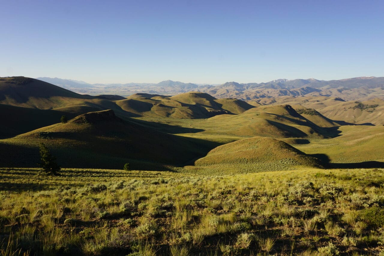
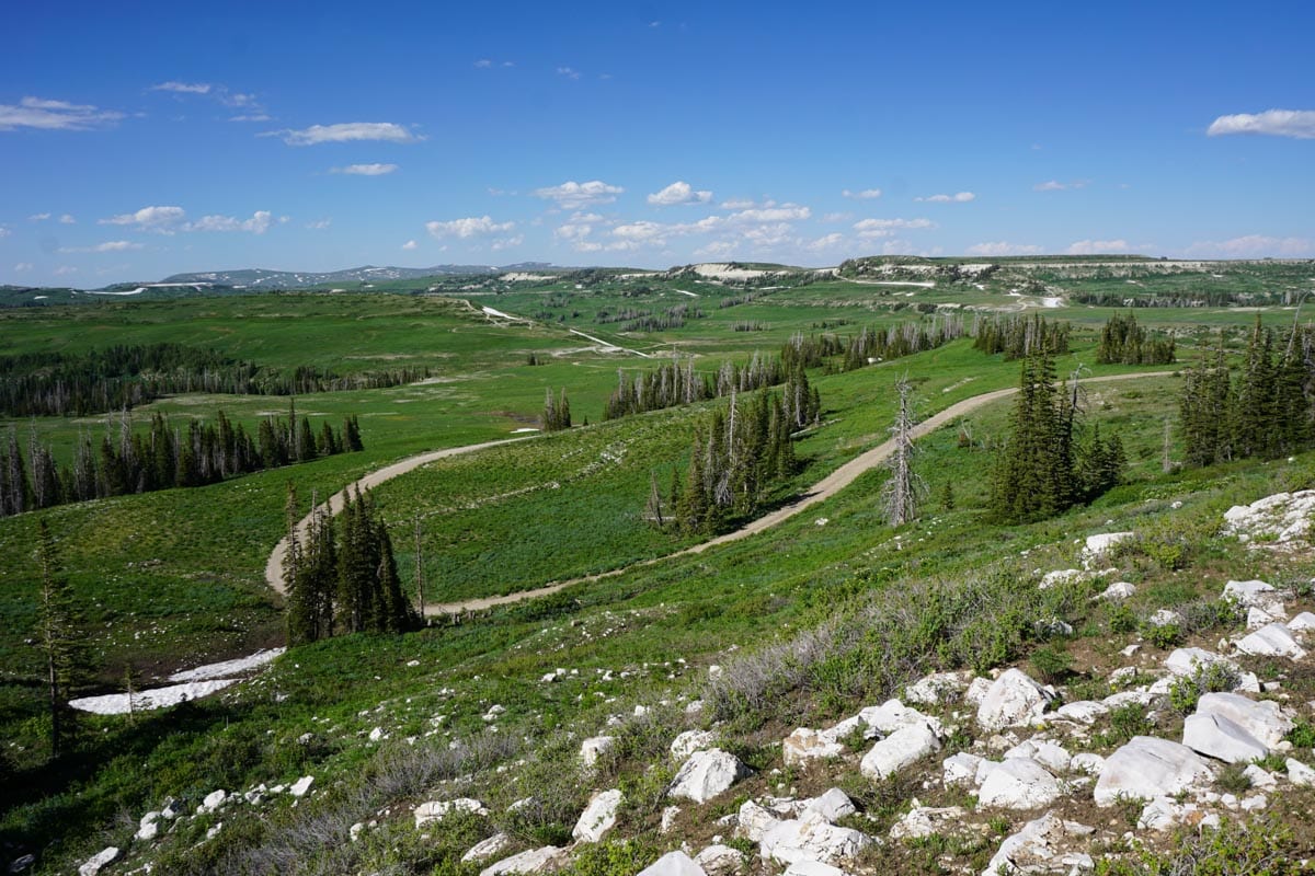
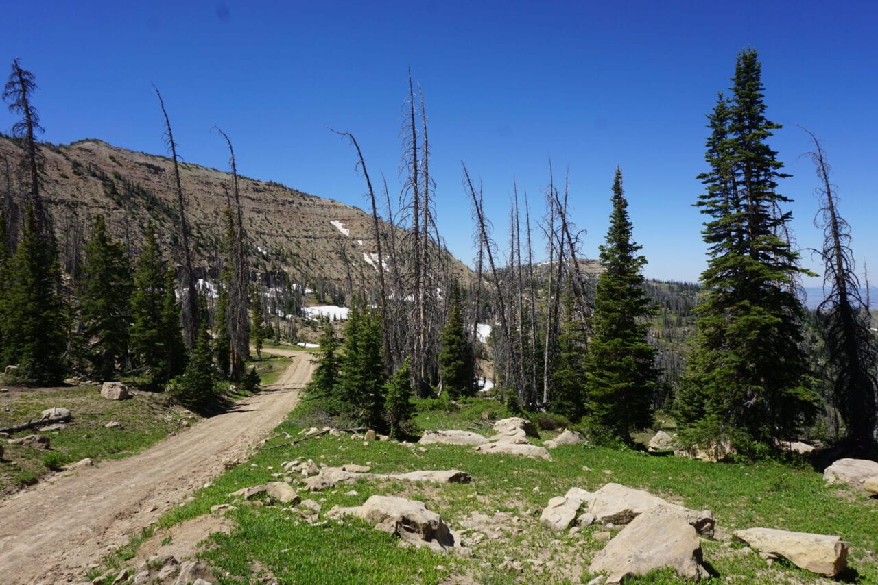
Ride more.
Check out some of the other mountain biking guides we offer!

About our partner
Bikepacking Roots
Bikepacking Roots is dedicated to the support and advancement of bikepacking and the conservation of the landscapes through which we ride. Their goals are to create high-quality, enjoyable, accessible bikepacking routes and route networks in geographic regions throughout North America; provide and promote visibility and access for the bikepacking community; and foster strong connections between bikepackers and landscapes to promote landscape conservation and encourage responsible backcountry ethics.
Together Atlas Guides and Bikepacking Roots have collaborated to bring you the official mobile app of the Western Wildlands Route. This project would not have been possible without the help of Revelate Designs and Salsa Bikes.
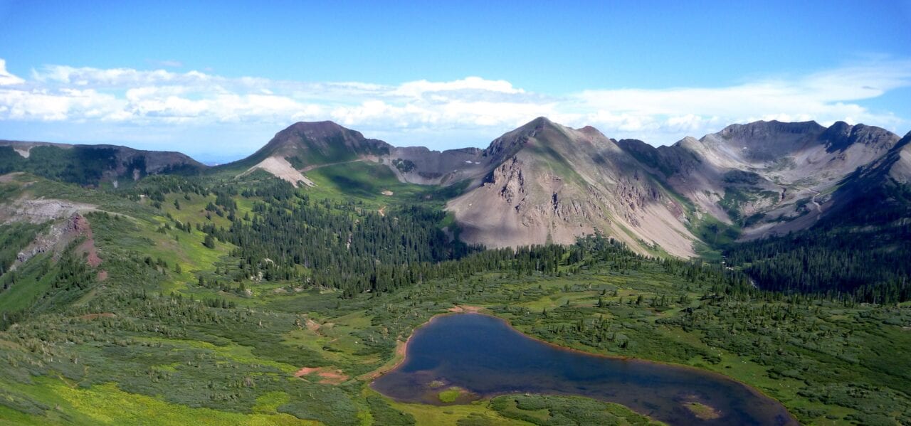
Colorado Trail Bike Demo
Official app of The Colorado Trail Foundation. The Colorado Trail Bike Route is a challenging and rewarding ride of 540 miles that stretches from Denver to Durango, passing through stunning landscapes. Bikers will traverse many mountain ranges, including the Colorado Rocky Mountains, during their journey. The trail is also perfect for hikers of all kinds. We have a companion hiking app available in our Guthook Guides app. Our data for The Colorado Trail guide was collected in partnership with Bear Creek Survey Service, LLC. For more information about their work, visit their website at bearcreeksurvey.com!
20% off for our Hiking Season Kick-off SALE! The Colorado Trail Bike Route is now $15.99.
30% off for our Small Business Saturday SALE! The Colorado Trail Bike Route is now $13.99.
Taylor Lake, La Plata Mountains, The Colorado Trail Bike Route
Photo courtesy of The Colorado Trail Foundation
The Colorado Trail Bike Route
540 miles • Colorado
Official App of The Colorado Trail Foundation
The Colorado Trail Bike Route is a challenging and rewarding ride of 540 miles that stretches from Denver to Durango, passing through stunning landscapes. Bikers will traverse many mountain ranges, including the Colorado Rocky Mountains, during their journey. The trail is also perfect for hikers of all kinds. We have a companion hiking app available in our Guthook Guides app. Our data for The Colorado Trail guide was collected in partnership with Bear Creek Survey Service, LLC. For more information about their work, visit their website at bearcreeksurvey.com!
$19.99 full guide
540 mi (870 km)
$19.99 full guide
Official App
Colorado Trail Bike Map


How can I get it?
Available as an in-app purchase in our Bikepacking Guides app, a free download from the Apple App Store or the Google Play Store.
Our iOS and Android apps do differ slightly in their appearance. However, the majority of their features remain the same, and they access the same trail guide data.
Purchase of The Colorado Trail Bike Route includes The Colorado Trail biking route (540 miles).
Cheers to giving back! Part of your purchase of The Colorado Trail Bike Route goes to support The Colorado Trail Foundation’s work to preserve and maintain the hiking trail and bike route. Learn about The Colorado Trail Foundation.
Stories from the Colorado Trail Bike Route!
Check out our most recent blog posts about biking The Colorado Trail.
Nothing found.
Nothing found.
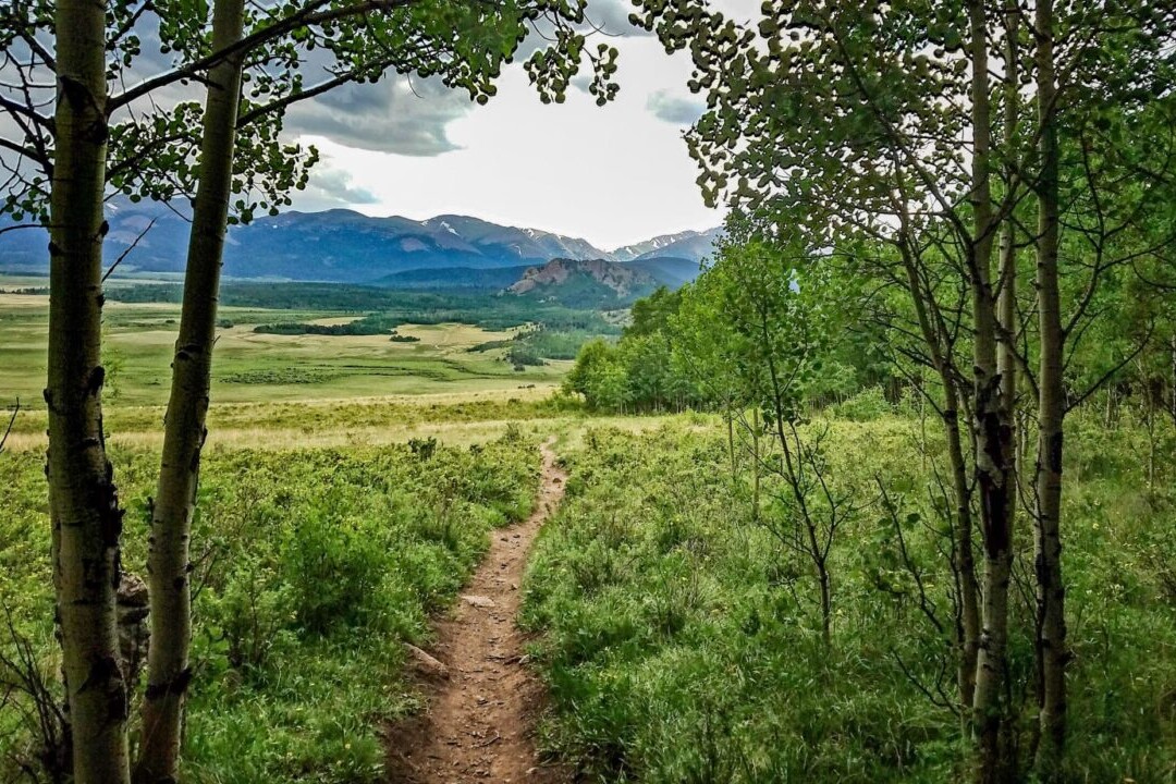
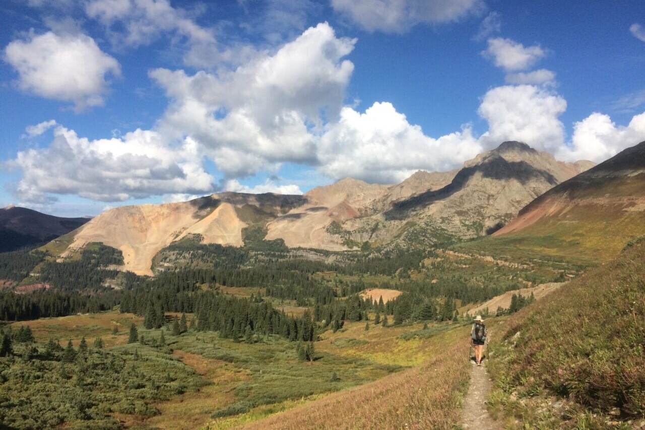
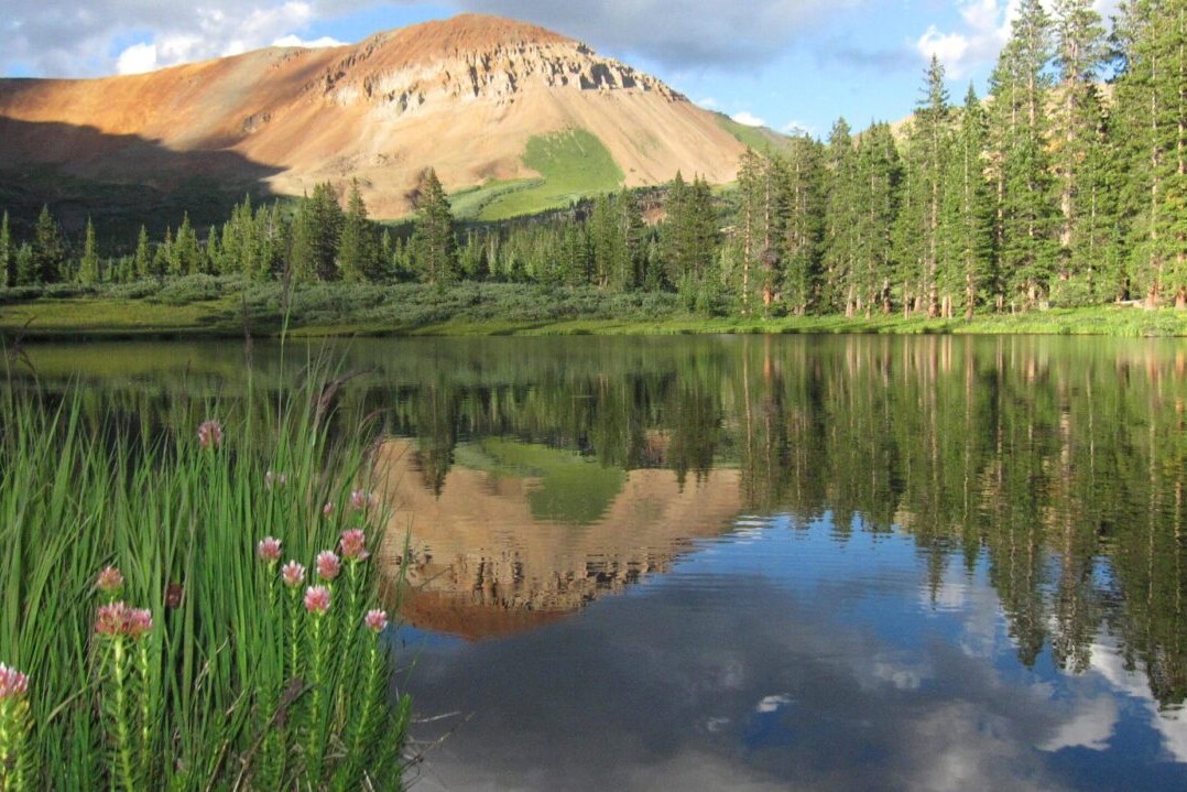
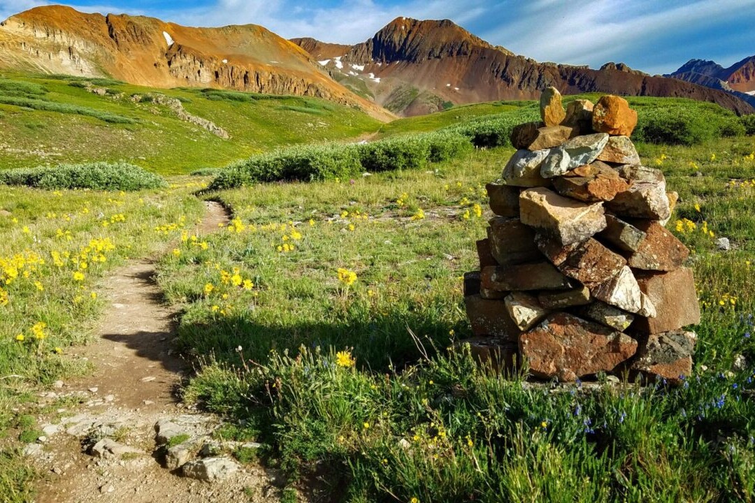
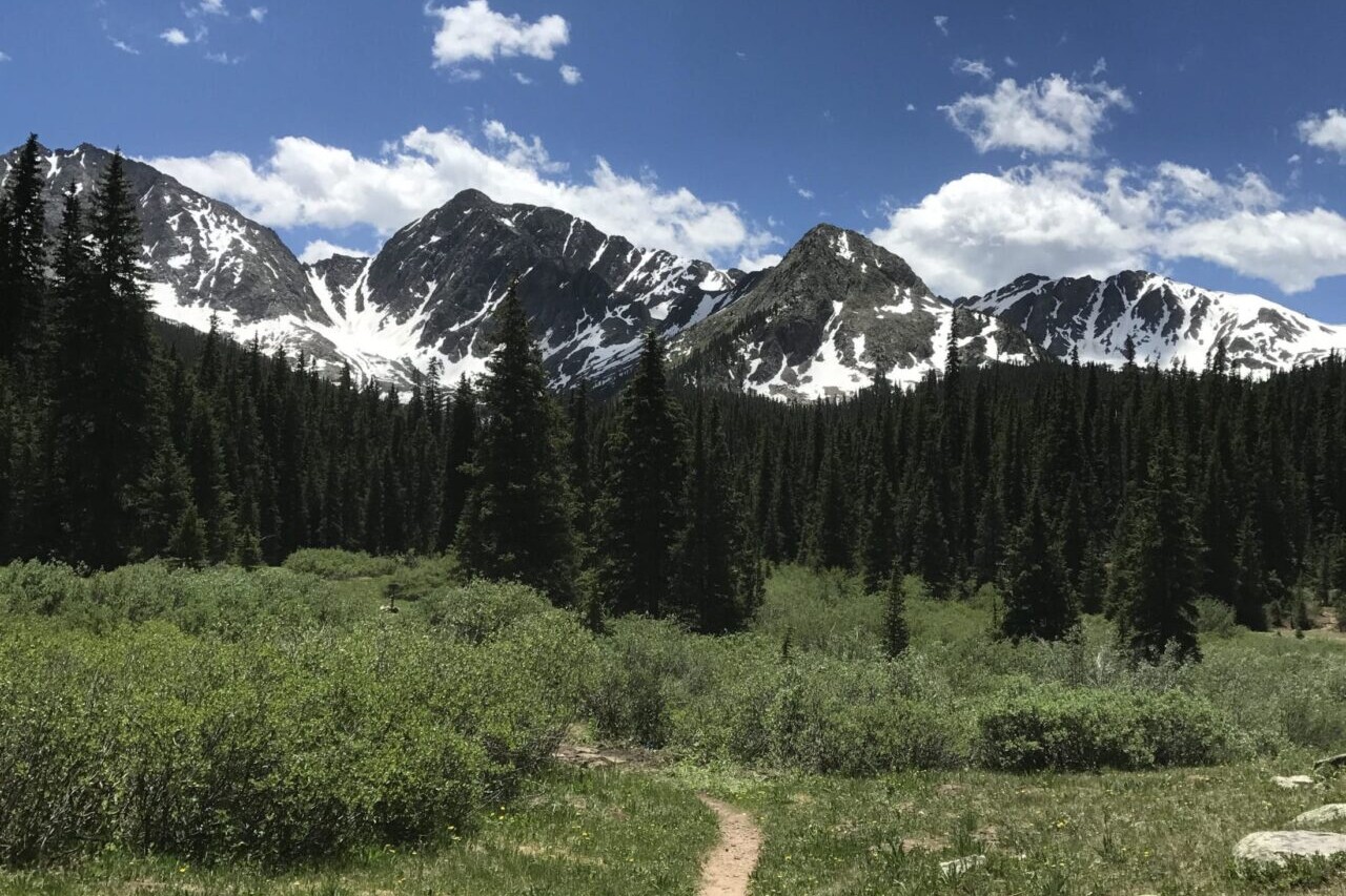
Ride more.
Check out some of the other mountain biking guides we offer!
About our partner
The Colorado Trail Foundation
The Colorado Trail Foundation is a 501(c)(3) nonprofit organization that works to keep The Colorado Trail in good condition. The CTF organizes the volunteers who built The Colorado Trail, as well as those who continue to improve and maintain it.
The Colorado Trail Foundation works with Atlas Guides to create, improve, and update the official Colorado Trail hiking app.