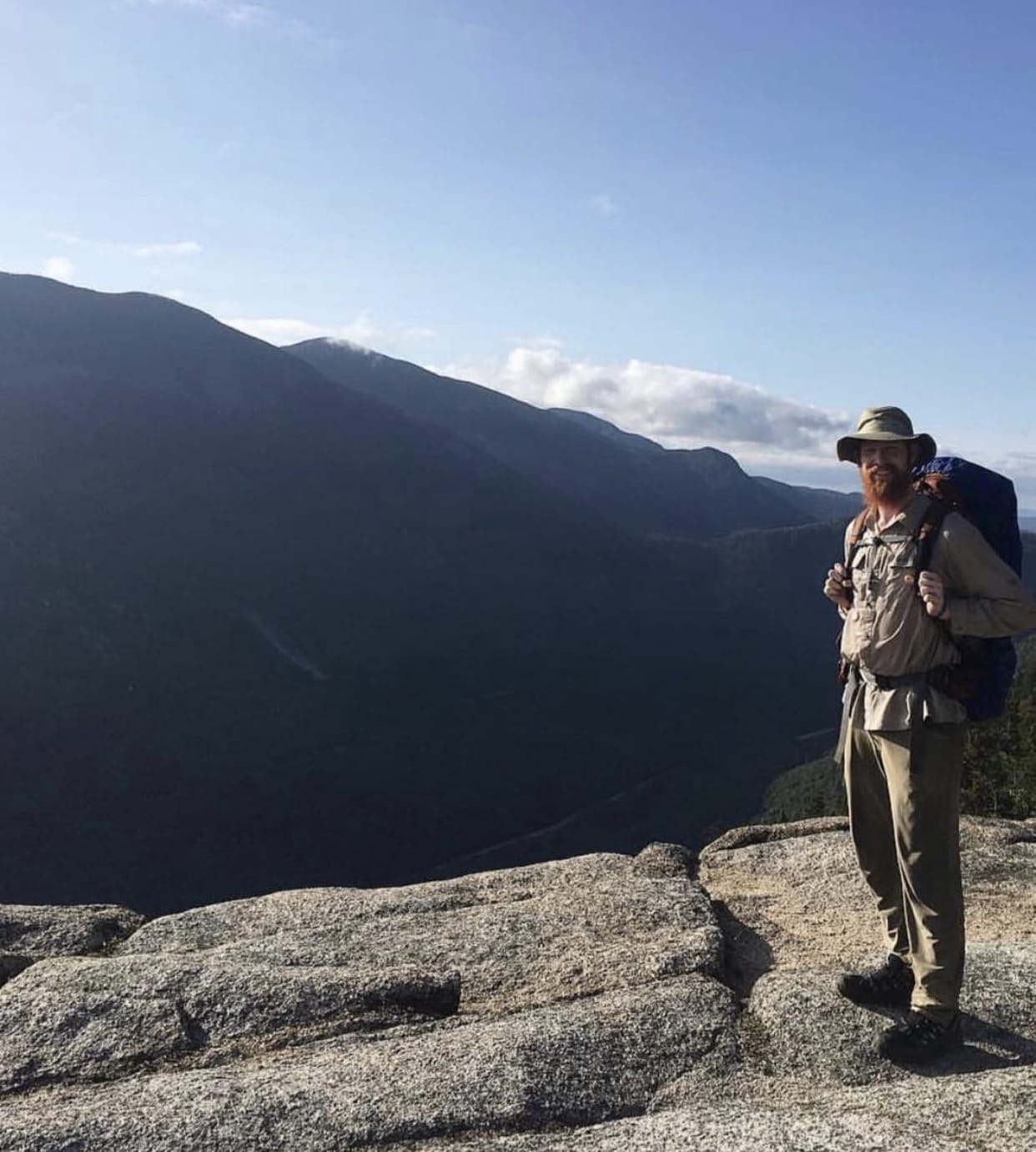
My Trail Story by Nar Nar
Planning an adventure? Check out our popular trail guides! 4.8 stars (17K+ ratings)
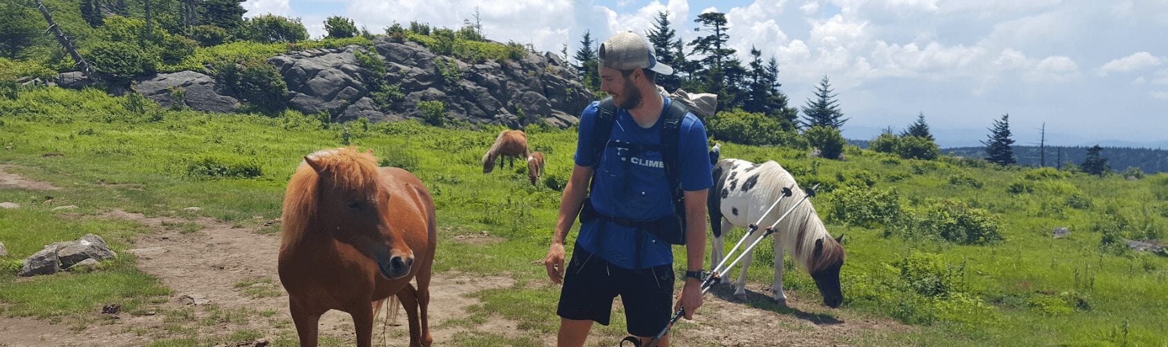
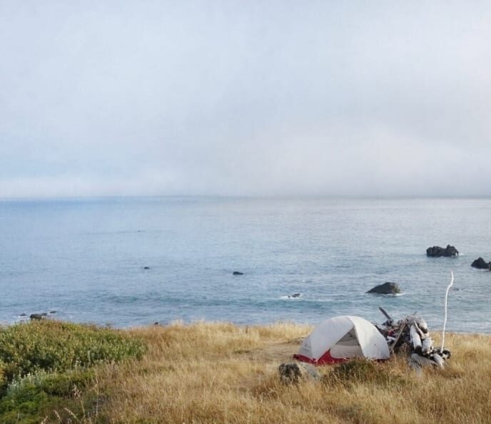
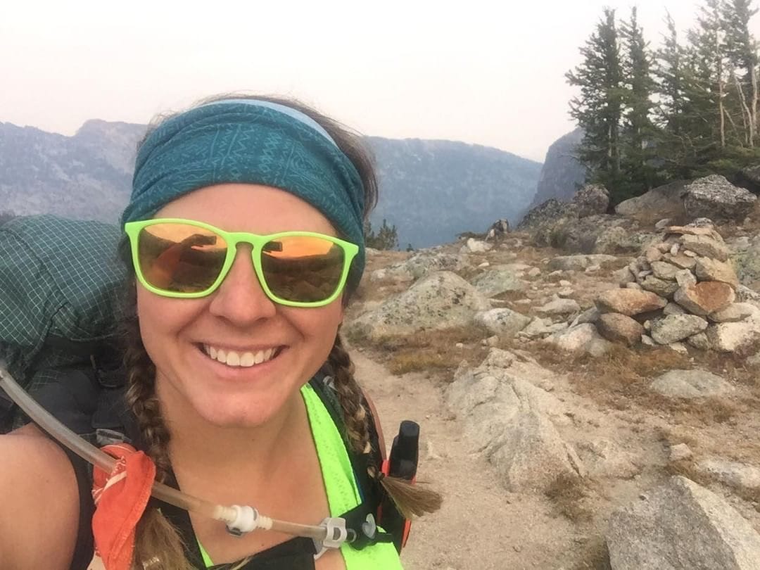
Photo by Kyle O’Grady
My Trail Story featuring Nar Nar
Kyle O'Grady, a.k.a Nar Nar, shares the story of how he became a thru-hiker from his first ever hike to summiting Mt. Katahdin on the Appalachian Trail.
Natalie McMillan My Trail Story 01/31/2019
Natalie McMillan
My Trail Story
01/31/2019
Trail Name: Nar Nar
Trails Hiked: Long Trail (section, 2012-2013, thru-hiked in 2016), Appalachian Trail, thru-hiked in 2018
Age: 23
My Trail Story: I was fortunate to have grown up in the Burlington, Vermont area. It’s a fantastic place for anybody into outdoor recreation, and this certainly holds true for people who are into hiking. The High Peaks of the Adirondacks lay to the West, just on the opposite side of Lake Champlain. The White Mountains in New Hampshire are an easy weekend drive to the East. And perhaps the best perk of the area is that the country’s oldest long distance trail, the Long Trail, is easily accessible from anywhere within Vermont. This makes it hard to find an excuse not to head into the woods when you need to get away for a night or two.
I didn’t realize that I was living in a hiker’s paradise until I was 15 years old. A few friend’s took me up Mount Mansfield, the highest peak in Vermont, and as cliche as it sounds, by the time our parents picked us up at the bottom I knew I wanted to get back out there ASAP. A few weeks later we did Camels Hump, another 4,000 foot peak in the area. It wasn’t long before I was on YouTube, learning all about the challenge of hiking the Long Trail end-to-end. I also found out about the Appalachian Trail through this research, and couldn’t believe that some people were crazy enough to hike over 2,000 miles in one shot. If only.
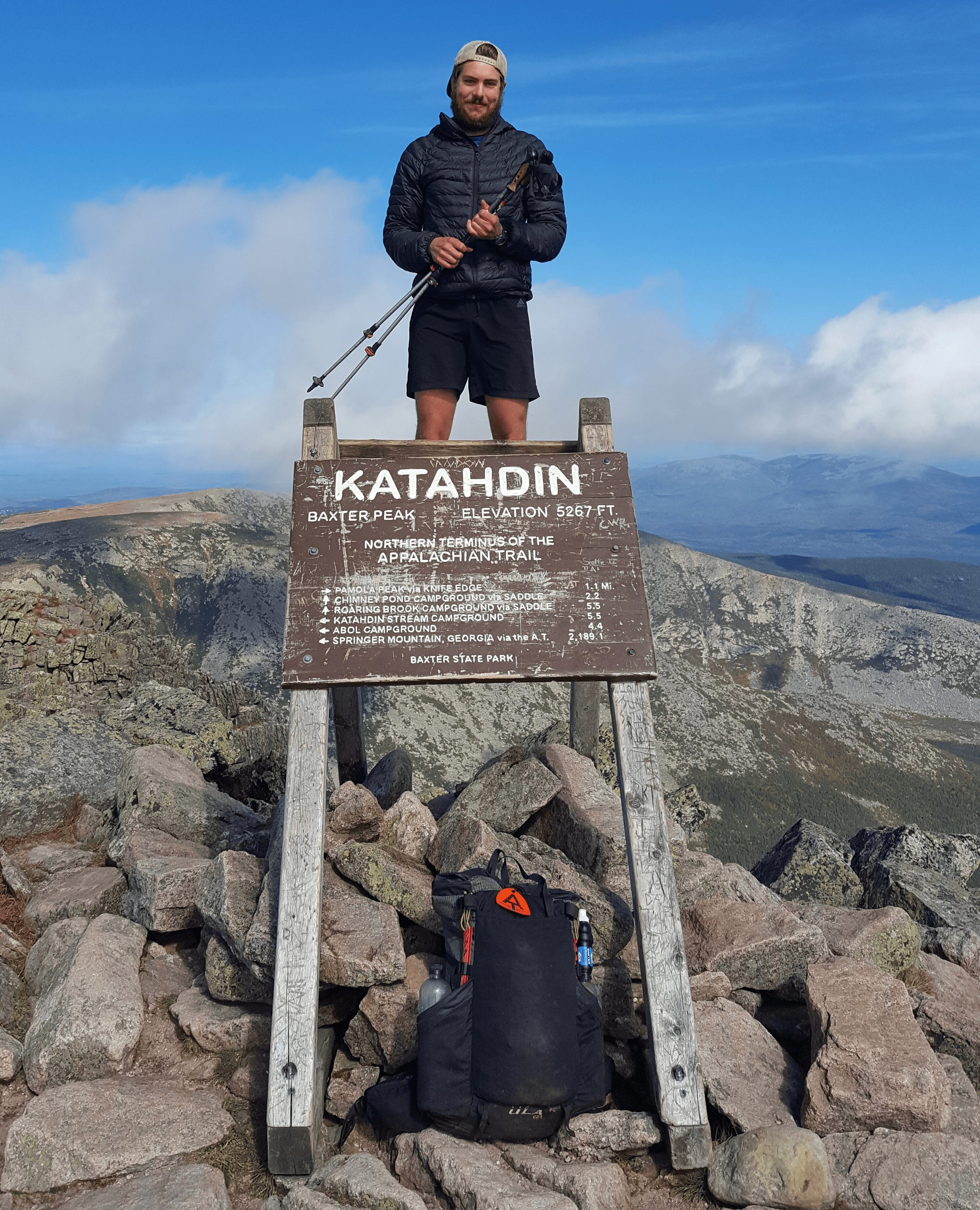
Photo by Kyle O’Grady
Photo by Kyle O’Grady
I was still in high school when I learned about the Appalachian Trail, so rather than making big plans for a thru-hike, I figured I should start small and knock out sections of the Long Trail during my summer breaks. After recruiting my friend Dan “Goobs” Pierce, we began to bug our parents about shuttling us up and down the trail when we had free time from our summer jobs. By the time our Junior year of high school rolled around, we had officially completed the entire trail. I felt great about this accomplishment, but knew I wanted more. At this point I had pretty much decided that I was going to thru-hike the Appalachian Trail at the first available opportunity. Somehow, my 17 year old self had the foresight to anticipate this opportunity coming immediately following my college graduation.
During my four years in college I spent as much time as I could in the mountains. I began to work towards hiking every 4,000 foot peak in New England and New York. I finished the 48 New Hampshire peaks in July of 2017, and also summited 40 of the 46 peaks in the Adirondacks. In addition, I managed to squeeze in a failed attempt of the Northville-Placid Trail, and round two of the Long Trail, this time as a thru-hike.
Every time I got into the backcountry, I thought about the Appalachian Trail, trying to get a jump start on the mental preparation needed to hike over 2,000 miles in one summer. Every hike I did was leading up to the AT. I was having so much fun that I didn’t even realize this until I was standing on top of Springer Mountain.
On May 12th, 2018, I graduated college. Most of my friends spent the following days visiting with family and friends, celebrating their accomplishment, but I had no such desire. I wanted to get on the trail as fast as possible. My parents and sister were incredibly supportive of my goal and drove me 1,000 miles from Potsdam NY, a tiny college town just shy of the Canadian border, to Amicalola Falls State Park in Northern Georgia. I summited Springer Mountain around 48 hours after I walked on stage and received my diploma.
Photo by Kyle O’Grady
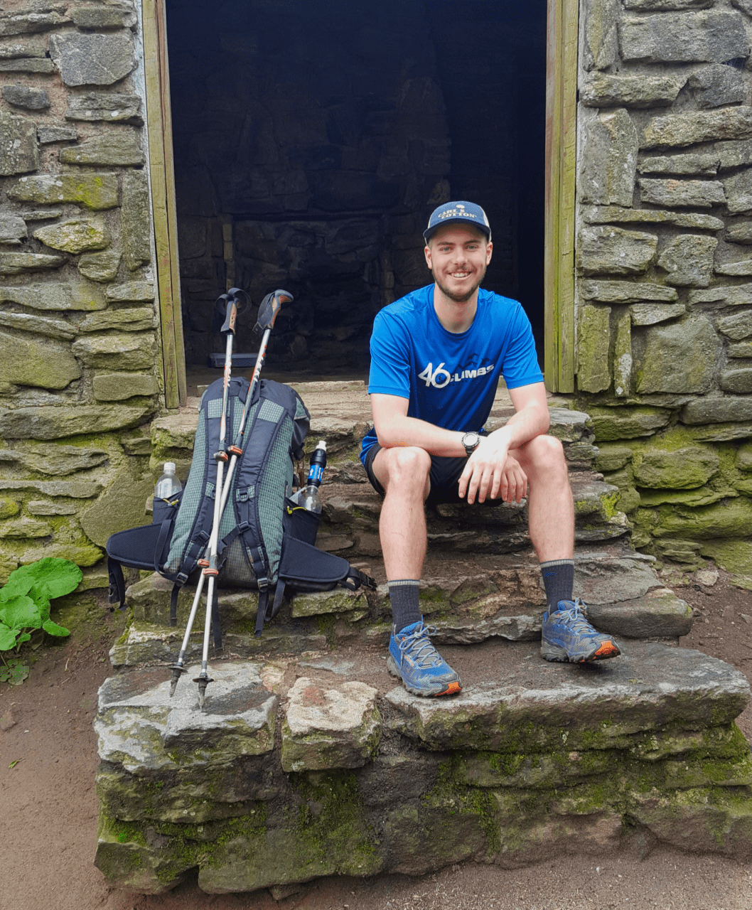
Photo by Kyle O’Grady
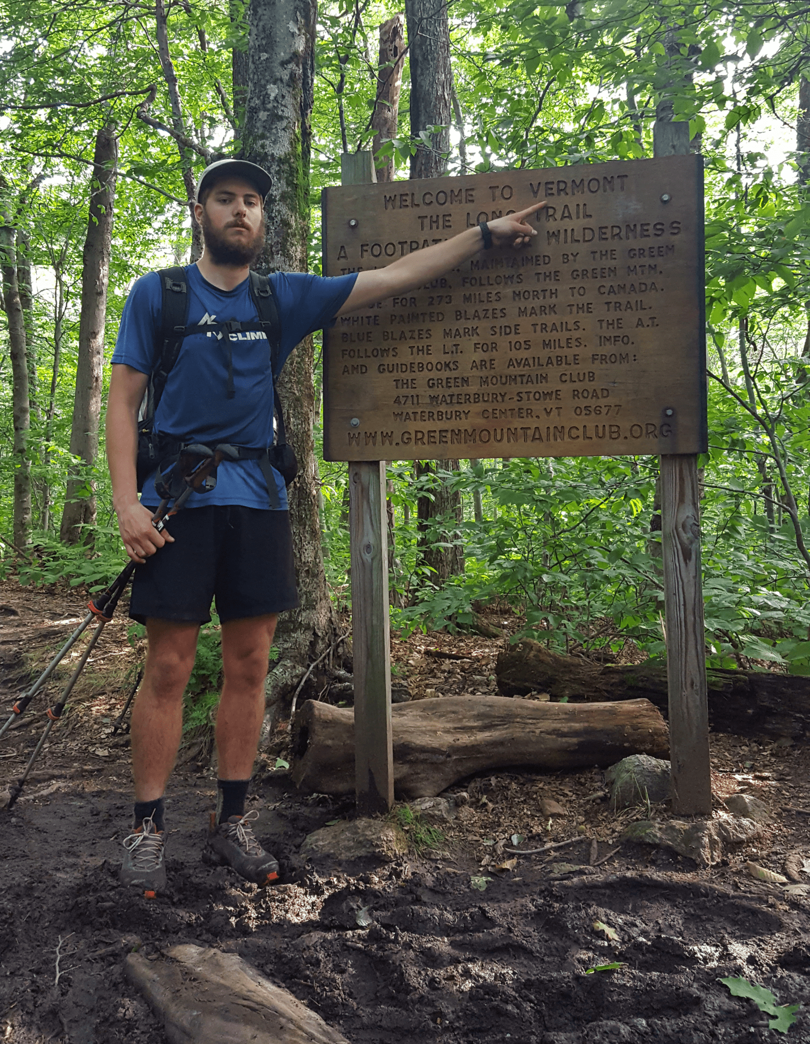
Photo by Kyle O’Grady
“This is it,” I thought. “I am now starting this goal I’ve been thinking about for the past 5 years.” I wish I could say I was excited when I passed under the arch and headed up the Approach Trail, but the truth is, I was extremely nervous. In the past I had hiked through nasty thunderstorms, unbearable heat waves, and seemingly never-ending rain. Knowing that I was going to have to push myself through all of these things for months on end was a daunting realization, and for my first few days I questioned whether or not this was something I really wanted to do. Despite the rough start, I kept pushing North, and can honestly say I never doubted myself again once I got a hundred miles under my belt.
It seemed like the further I hiked, the faster my experience went by. It felt ages before I reached Damascus ,Virginia, about 470 miles into the trail. From there, the next 550 miles flew by and I before I knew it, I was in Harpers Ferry. Some hikers complain of getting the Virginia Blues during this stretch, but I tried to focus on how far I had come at the end of every day. I tried not to dwell on how many miles I had left. That being said, it sure felt damn good walking out of Harpers Ferry and over the border into Maryland.
At this point, my confidence was running high; I knew that the second half of the trail would be no joke, but thought, “Hey, if I could get past the first half, why shouldn’t I be able to crush the second half?!” For those of you who will be thru-hiking in the future, I still believe this is true! Don’t focus on making it to Katahdin; focus on making it to Harpers Ferry, or even Damascus. If you can make it there, you can make it to Harpers Ferry, and then you’ll be standing on top the famous mountain before you know it.
I kept grinding through rain storms and heat waves, trying to take things a day at a time. Even though I was more than halfway, I still didn’t want to think too much about Katahdin. I was able to continue this mindset until I made it to Vermont. I still had over 500 miles to go, but making it back to my home state felt so damn good! Not only was I back in familiar territory, but when I had started the trail, Vermont seemed so far away that it might as well have been the same distance as Katahdin. At this point, the realization that I was likely going to finish the Appalachian Trail started to become clear.
From Vermont onwards, I fought a constant battle with my ego. The end to my hike seemed tangible, so I was trying extra hard to enjoy the time I had left. But I had been on the trail for 3 months at this point, and getting a taste of the finish line was enough to get me excited for my post-trail life. I was walking the fine line of trying to soak in the experience, while still hauling ass to Katahdin so I could finish what I started. By the time I made it to Maine, I knew that I needed to do something to stay involved with the trail community once I integrated back into normal society. “Why not start a podcast?” I thought to myself. I told some fellow hikers about this at the time, and I don’t think they realized I was serious.
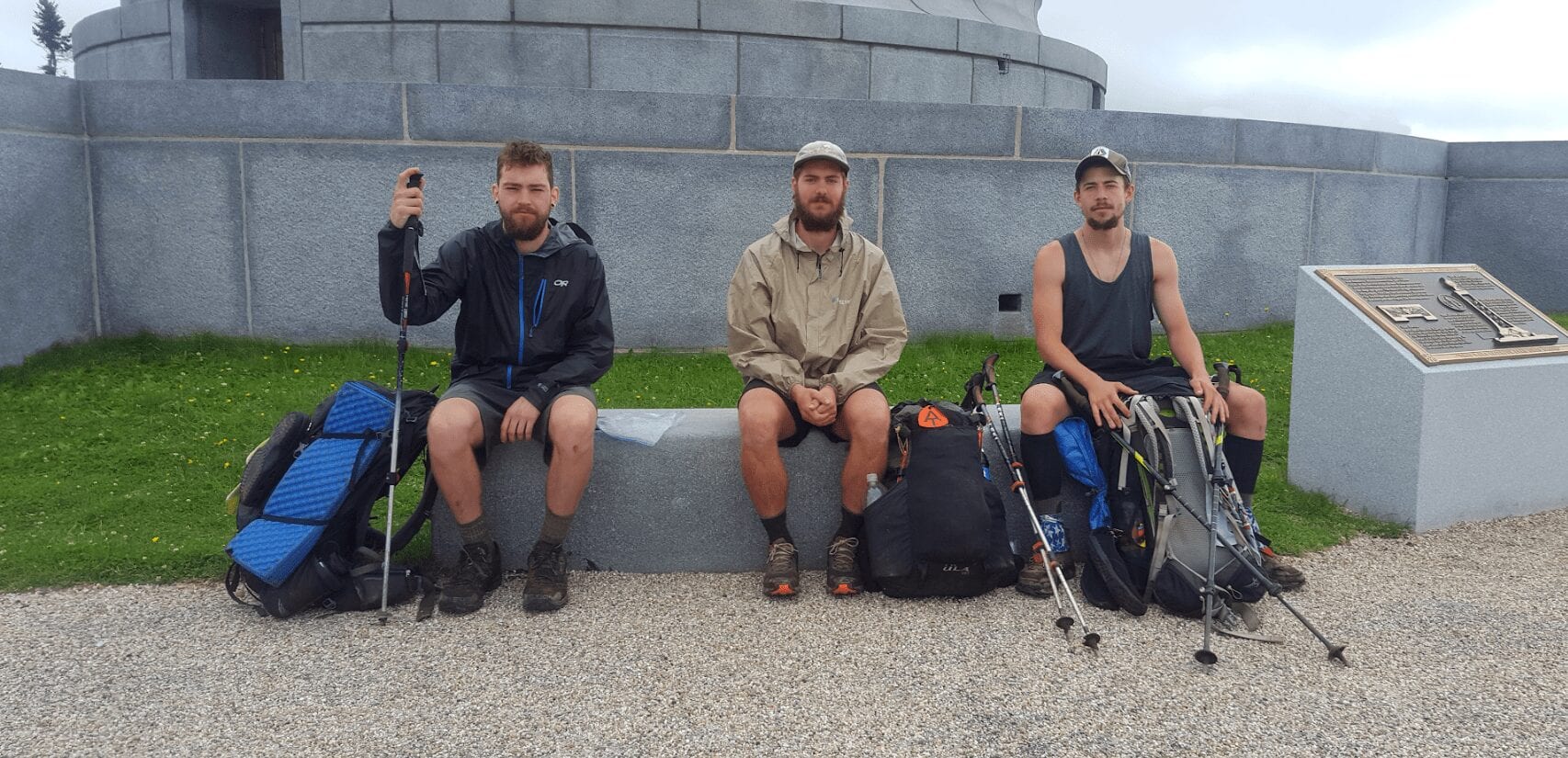
Photo by Kyle O’Grady
I summited Katahdin on October 1st, 2018. Walking up to the famous “Northern Terminus” sign, a moment I had tried so hard not to think about, had finally happened. I celebrated with my trail friends, shed a few tears, and hiked back down the mountain. Now it was time to get back to real life. What a strange concept.
My trail friends soon found out that I wasn’t blowing smoke about the podcast, and by the beginning of November I launched my first three episodes of “Trail Tales.” Those same friends would be my first guests on the show, and their insight helped me go from a clueless podcaster, to a slightly-less clueless podcaster with a bit of experience under my belt. Running the show has given me a great outlet to share my stories, and highlight the experiences of other backpackers who have amazing insight on a magnitude of different subjects. I learn something new with every episode I make.
Thank you for reading my trail story. It was fun being able to put this in writing, but I feel the need to say that you’re reading only part of a story which will hopefully continue for many years to come. Most thru-hikers will agree that once you’ve become accustomed to life on the trail, it’s tough to ever imagine yourself going too long without it. Fortunately for me, I think Vermont has got me covered on that end. I look forward to more in the future; thru-hikes, day hikes, and everything in between.
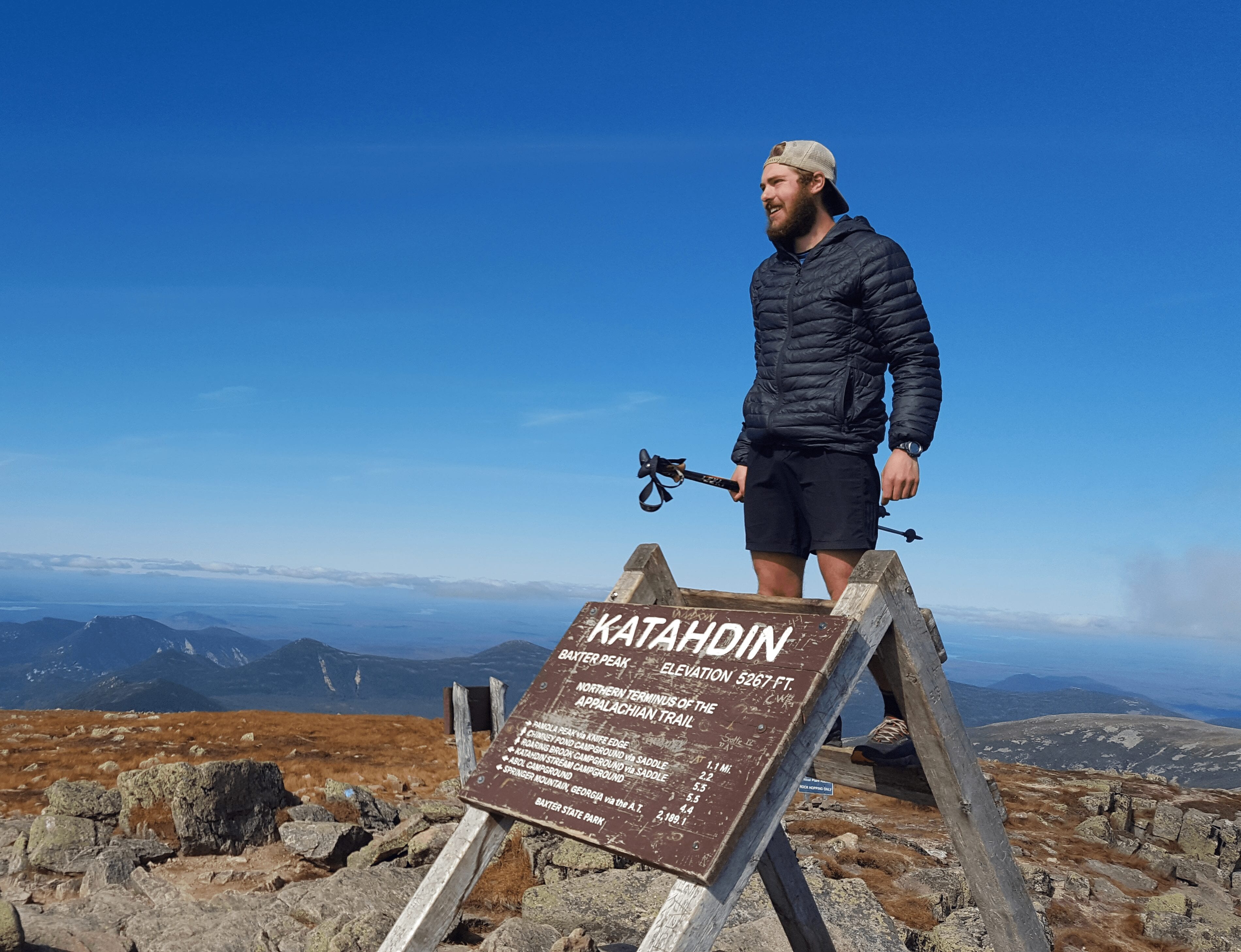
Photo by Kyle O’Grady
Want to keep up with all that’s going on at Atlas Guides? Sign up for our newsletter!
Read more!
Check out some related blog posts!
Get our trail guide for this area!
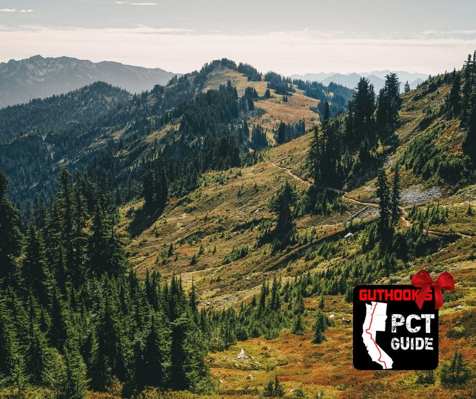
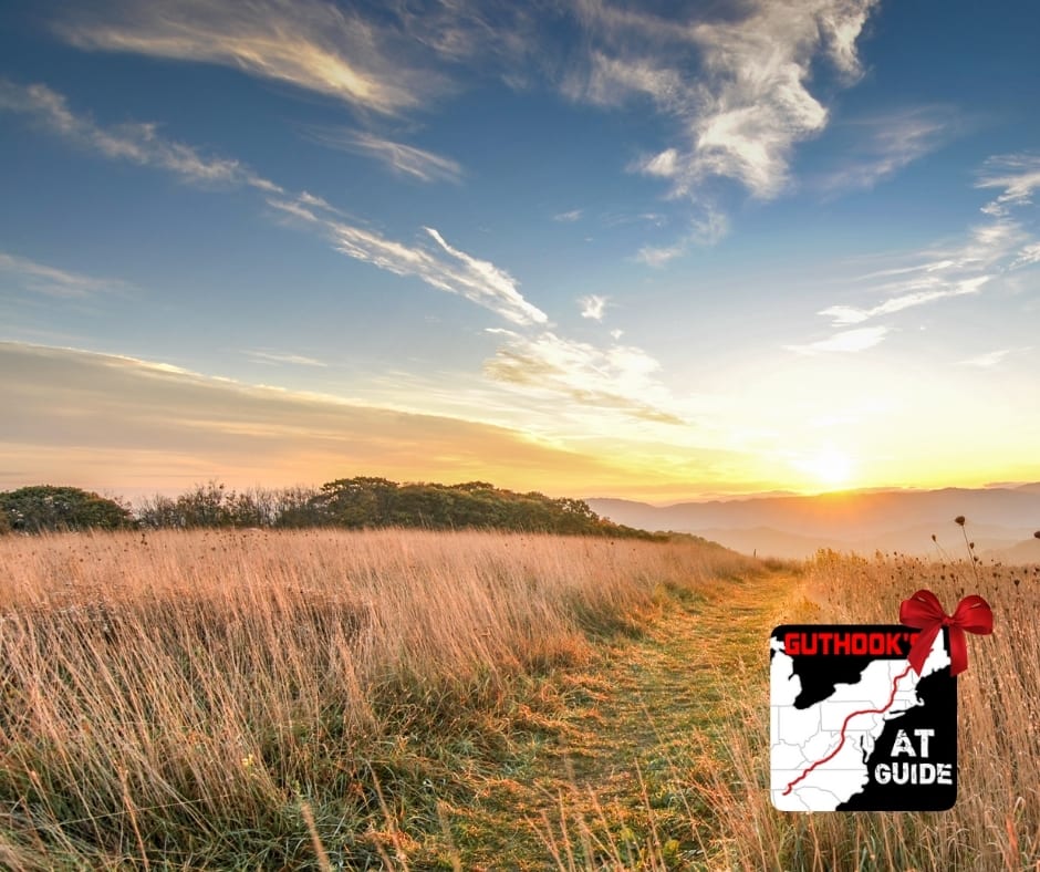
Appalachian Trail
The Appalachian Trail is one of the oldest National Scenic Trails in the US. Its path takes you from Springer Mountain in Georgia to Mt. Katahdin in Maine.
2200 mi (3540 km) $59.99 full guide
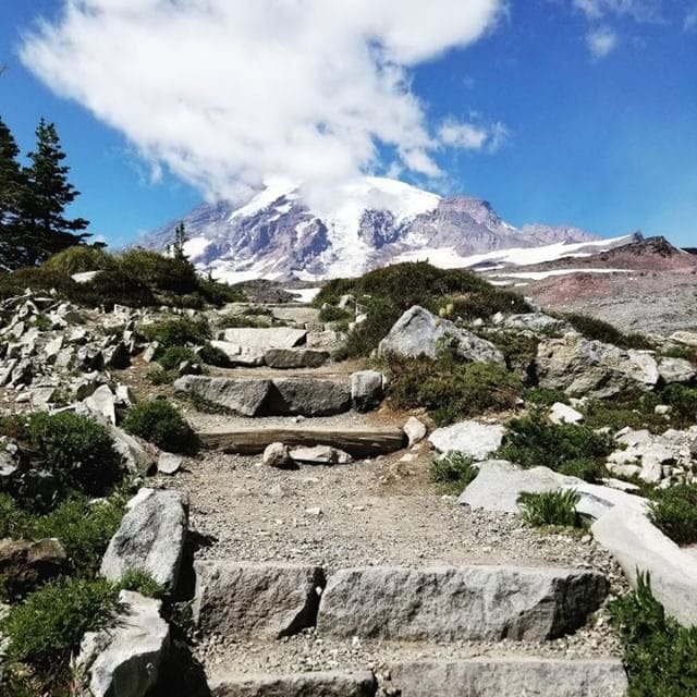
Pennsylvania, Appalachian Trail
Photo by Zoë Symon
Pennsylvania, Appalachian Trail
Photo by Zoë Symon
Appalachian Trail
The Appalachian Trail is one of the oldest National Scenic Trails in the US. Its path takes you from Springer Mountain in Georgia to Mt. Katahdin in Maine.
2200 mi (3540 km)
$59.99 full guide
Get our trail guide for this area!
About the Author

Natalie McMillan
Natalie grew up hiking in Arizona where she fell in love with the outdoors. Her favorite hikes are to Havasu Falls in the Grand Canyon and Angel’s Landing in Zion National Park, UT. She loves taking pictures of people, places, and nature, which might explain why she has almost 47,000 photos currently residing on her phone. She takes care of all things related to social media and marketing and recently moved to Denver, CO from Flagstaff, AZ. You may find her frolicking around the trails and mountains of Colorado, or exploring the new city she gets to call home.

My Trail Story by Croc
Planning an adventure? Check out our popular trail guides! 4.8 stars (17K+ ratings)
Photo by Kate Stelfox
My Trail Story featuring Croc
Kate Stelfox, a.k.a. Croc, talks about her experiences thru-hiking the Appalachian Trail and Pacific Crest Trail.
Natalie McMillan My Trail Story 01/31/2019
Natalie McMillan
My Trail Story
01/31/2019
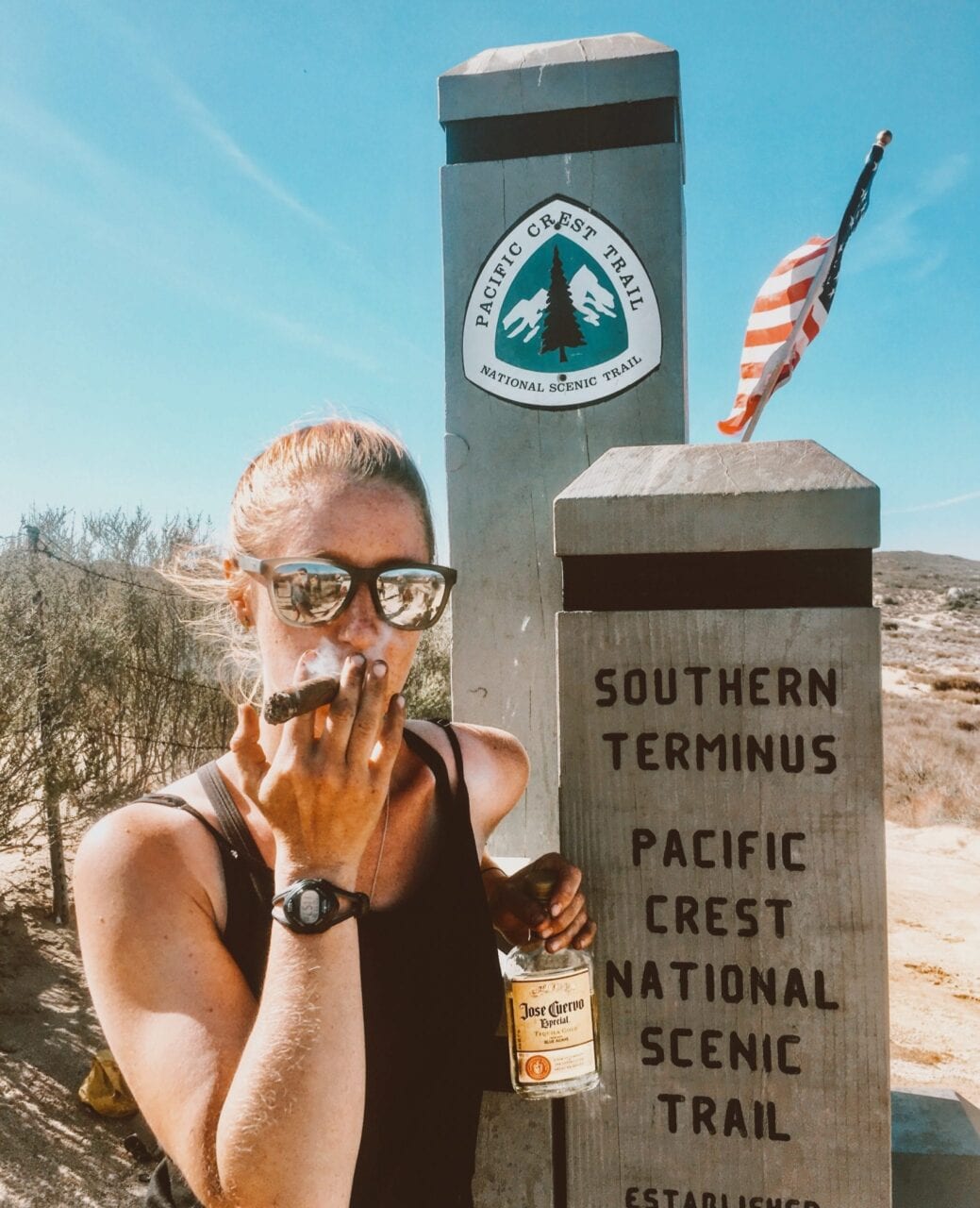
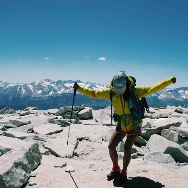
What trail(s) did you hike?
- The Appalachian Trail in 2016 northbound
- The Pacific Crest Trail in 2018 southbound
What was one thing you wish you knew before you started?
Honestly, nothing? I think one of the reasons the Appalachian Trail was so special to me, and the Pacific Crest Trail suffered from a bit of ‘second child syndrome,’ was because I didn’t know anything about anything before heading out on the Appalachian Trail. I grew up outdoorsy and spending time outside, so I suppose I knew more than some people, but I didn’t know much about thru-hiking or trail culture. This made every moment challenging, exciting, and incredibly rewarding. I was constantly surprised by trail life. I would tell people not to stress about not knowing everything before hitting the trail because most things can be learned as you go.
What was your favorite food on the trail?
Ramen has a serious place in my heart. I never tired of it. In fact, I think it’s a big reason why I’m seriously considering walking across a portion of Japan. Think of the ramen selection. There is also no way I could do a thru-hike without hot coffee in the morning. When my food bag allows, I’ll carry hazelnut coffee creamer powder with me. It’s delicious and turns my coffee into a 250 calorie breakfast drink. Some people have pointed out the extra weight that I carry because of this, but I maintain it’s worth it for a sunny disposition in the morning.
“Croc” Photo by Kate Stelfox
What advice would you give to someone who has never done a thru hike before?
Remember that thru-hiking is a privilege. You’re going to spend a lot of money to look like you’re pretty hard done by. Not everyone is going to be able to do what you’re about to. So when it’s rained for the fourth day in a row, you’ve been snowed out of the mountains, or you’re just plain tired, remember how lucky you are to be out there.
Would you do another thru-hike? If yes, which trail is next?
I would love to continue finding elaborate ways to avoid working, and thru-hiking seems to be my favorite way so far, so yes. I have a few hiking aspirations for some smaller trails in the next year or so, but my plan is to be on the Continental Divide Trail for Spring 2020. And as I mentioned earlier, I would love to walk across a section of Japan.
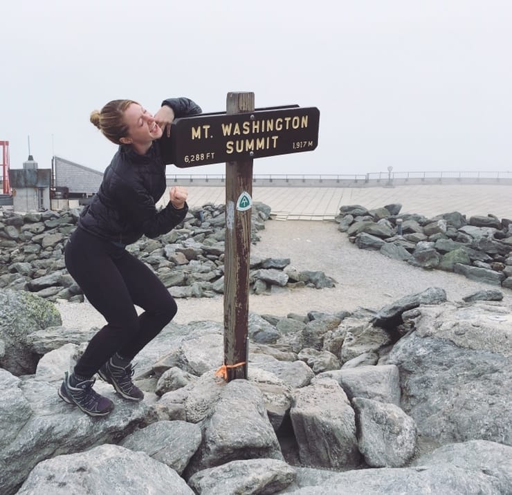
Photo by Kate Stelfox
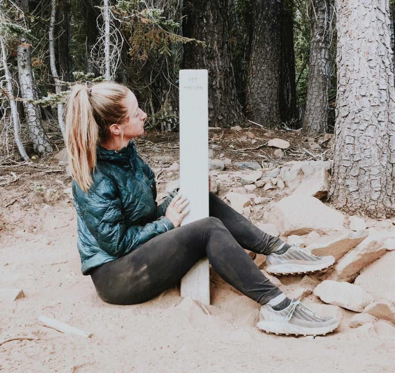
Photo by Kate Stelfox
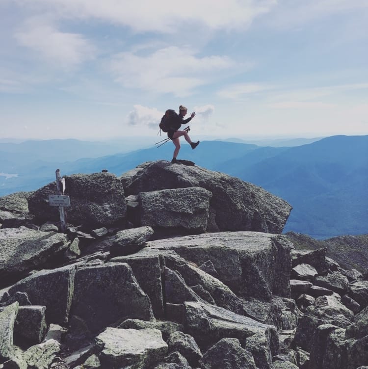
Photo by Kate Stelfox
What was your favorite feature in our app?
I loved the elevation profile feature, more so when I was heading down the climb instead of up it. The elevation profile allowed me to plan my day based on how difficult I thought it was going to be. It gave me a realistic expectation of how far I would make it that day. My second favorite would be the map feature that shows your direction and location as a moving blue arrow along the trail, or off the trail more importantly. This feature came in handy on Mount Washington when I and a couple of other hikers were making our way down to the Madison Spring Hut. It was a bit of a white out rain storm that day and we could hardly see the cairns meant to guide our way. We managed to get completely off trail and were headed down the wrong side of the mountain. Using the map feature we were able to steer ourselves back up in the right direction, rejoin the trail, and make it safely to the hut in time for hot chocolate.
How many pairs of shoes did you go through?
On both the Appalachian Trail and Pacific Crest Trail I went through four pairs of shoes. I’ve gone back and forth between Solomon trail runners and HOKAs. I would have to say my favorite shoe has been the Torrent by HOKA. With that said, I have also hiked over five hundred miles of trail in my Crocs and found it incredibly comfortable, so take my advice with a grain of salt.
What do you wish you had done differently?
After my first thru-hike of the Appalachian Trail, I was looking back on photos and I couldn’t believe how many I took of the same mountain or lake. All the landscape photos seemed to blur together, and I can honestly say I hardly look back on them. But the pictures I have of people and videos of us goofing off on the trail – those are the ones I look back on all the time. I wish I had taken more photos of my friends and enjoyed the views of the mountains without my phone more. On the Pacific Crest Trail, I took way more photos of people and less of the views. I’m pretty happy with that decision.
I also wish I had not sent myself re-supply packages ahead of time for the Pacific Crest Trail. Resupplying along the entire trail is a breeze, and wasn’t worth the stress of making it to post offices on time before they closed or tracking down packages that didn’t arrive on time. Even as a sobo going through the High Sierras during low season, I still felt it wasn’t necessary to send food resupplies ahead of myself.
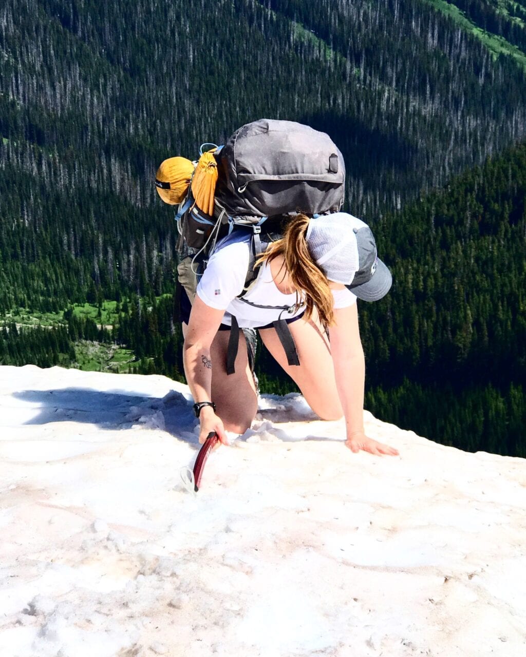
Photo by Kate Stelfox

Photo by Kate Stelfox
Did you ever reach a point where you wanted to quit? How did you stay motivated to finish?
I remember walking into Harpers Ferry, the ceremonial midway point on the Appalachian Trail, crying. I had found out a few days prior that I was accepted into graduate school in the fall. I felt like I should go home to mentally prepare, not to mention save up some more money before heading back to school. I had this feeling like I wasn’t in the right place. I never seriously considered quitting, but that night I was feeling sorry for myself and toying with the idea when a section hiker asked me to dinner. It was her first night on the trail and she was feeling nervous. Sitting at the restaurant that night she told me her life story and how she hoped the trail would bring the necessary changes she needed in her life. She wanted to know what the trail had done for me so far, and why I was still hiking on to Maine. Opening up to her about how the trail had changed my perspective on life and what I wanted out of it, I realized I was exactly where I was meant to be and got back on the trail the next morning.
Want to keep up with all that’s going on at Atlas Guides? Sign up for our newsletter!
Read more!
Check out some related blog posts!
Get our trail guide for this area!
Pacific Crest Trail
The Pacific Crest Trail is an epic journey of three states and over 2600 miles. Its path travels from the US border with Mexico to the northern border with Canada.
2650 mi (4260 km) $29.99 full guide
Washington, Pacific Crest Trail
Photo by Justin Helmkamp
Washington, Pacific Crest Trail
Photo by Justin Helmkamp
Pacific Crest Trail
The Pacific Crest Trail is an epic journey of three states and over 2600 miles. Its path travels from the US border with Mexico to the northern border with Canada.
2650 mi (4260 km)
$29.99 full guide
Get our trail guide for this area!
About the Author
Natalie McMillan
Natalie grew up hiking in Arizona where she fell in love with the outdoors. Her favorite hikes are to Havasu Falls in the Grand Canyon and Angel’s Landing in Zion National Park, UT. She loves taking pictures of people, places, and nature, which might explain why she has almost 47,000 photos currently residing on her phone. She takes care of all things related to social media and marketing and recently moved to Denver, CO from Flagstaff, AZ. You may find her frolicking around the trails and mountains of Colorado, or exploring the new city she gets to call home.
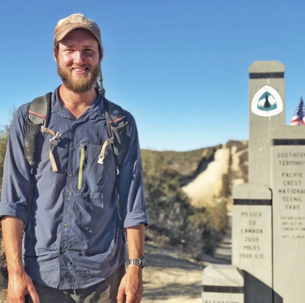
My Trail Story by Grizzly
Planning an adventure? Check out our popular trail guides! 4.8 stars (17K+ ratings)
Photo by Michael Ivey
My Trail Story featuring Grizzly
Our "My Trail Story" series features thru-hikers of all ages and backgrounds sharing their personal, real-life experiences from the trail. Michael Ivey, also known as Grizzly, kicks off this series by answering some questions about his thru-hiking experience.
Natalie McMillan My Trail Story 01/31/2019
Natalie McMillan
My Trail Story
01/31/2019
What is your trail name?
Grizzly
What trail(s) did you hike?
I have hiked the John Muir Trail ’14, Pacific Crest Trail ’15, Colorado Trail ’16, Superior Hiking Trail ’18, large sections of the CDT ’16, and will be hiking the Pacific Crest Trail and Colorado Trail again in 2019
How old are you?
I am 36 years old.
What was one thing you wish you knew before you started hiking?
I wish I would have initially bought ultra light gear rather then being on a budget. In the long run I’ve spent much more money because of it.
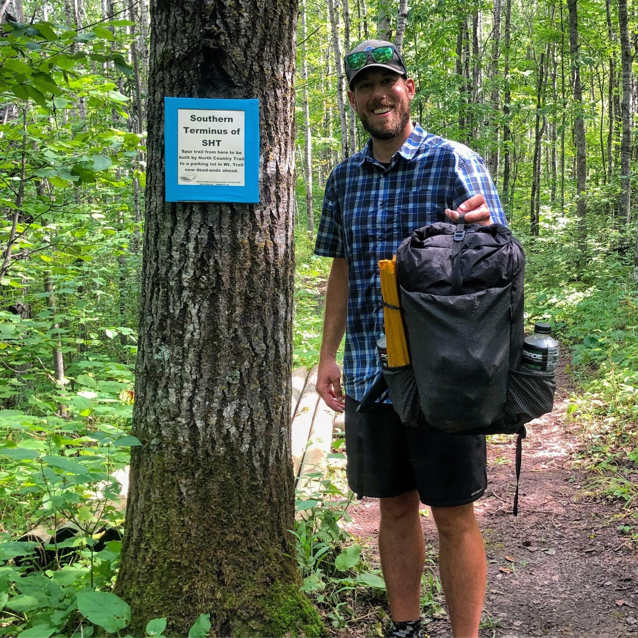
Photo by Michael Ivey
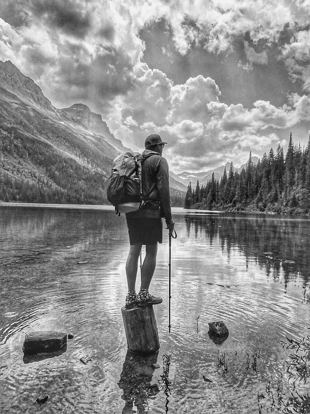
Photo by Michael Ivey
What is your favorite food on the trail?
I typically cold soak my meals so I eat a lot of ramen. That being said, peanut butter is always a favorite as well as cheese and summer sausage.
What advice would you give to someone who has never done a thru-hike before?
I’d say give it a shot if you love backpacking and the outdoors. A lot of people think it’s something unachievable and are intimidated by it before they have even tried one.
What does thru-hiking mean to you?
It means relaxing and re-centering myself. I feel more like myself on a long trail then anywhere else.
Would you do another thru-hike? If yes, which trail is next?
Absolutely, and I’ll be doing the PCT and CT again this year. It will be my second thru-hike of each. I also section hiked 200 miles of the CT in 2018.
What was the easiest/hardest part about your thru-hike?
The easiest part was enjoying my surroundings and the beauty that surrounded me. It wasn’t hard to stay motivated. The hardest part for me is slowing down at times. I have a tendency to just put my head down and do miles rather then slowing down to enjoy my surroundings.
What do you wish you had done differently?
I wish I would have thru-hiked the CDT in 2016 rather then just doing a long section hike. I kick myself all the time for not finishing the trail that year.
What do you miss the most?
The simplicity of thru hiking. It’s just wake up, walk, eat, look for water, and sleep.
Photo by Michael Ivey
Photo by Michael Ivey
What was your favorite feature in our app?
Elevation profiles are something I love about the app. I planned my days around climbs especially in the Sierras and Colorado Rockies.
What was the one thing you had to have with you while you hiked?
I’m pretty attached to my Patagonia R1 hoodie.
Why did you decide to go on a thru-hike in the first place?
Honestly, to see more of the country and to get away from working so much.
Did you hike solo or with other people?
I hiked with other people. Most long trails are fairly crowded at this point, making it tough to ever really be alone.
What part of the trail was your most/least favorite?
Washington on the PCT and Glacier on the CDT were my favorites. New Mexico on the CDT is pretty low on my list of places to hike through again.
How many pairs of shoes did you go through?
I average about 500 miles per pair of shoes. I exclusively hike in Altra shoes and love them.
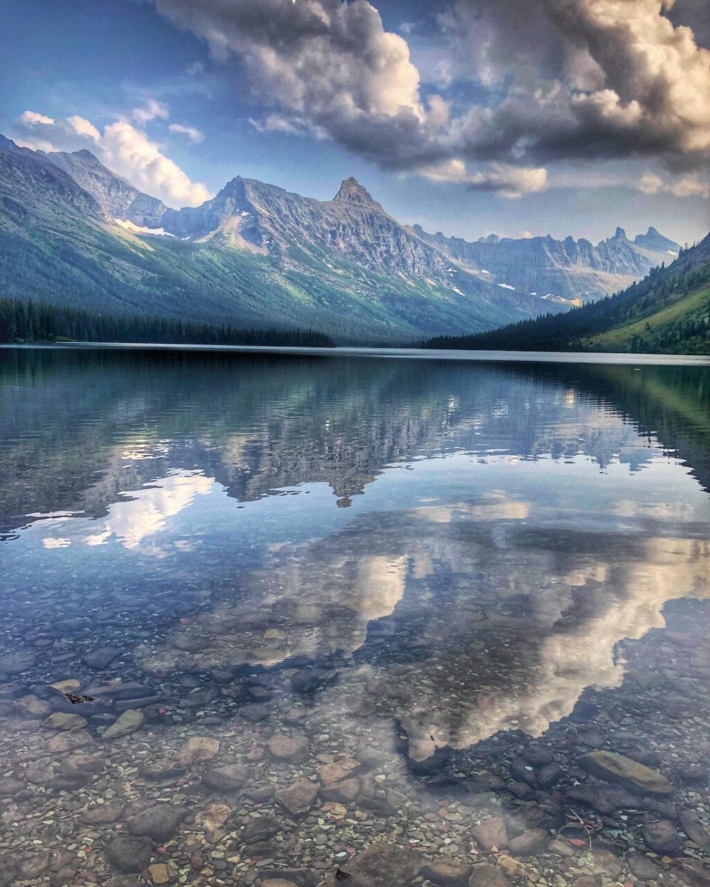
Photo by Michael Ivey
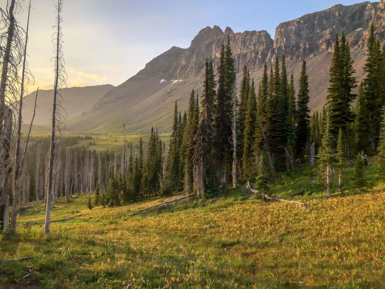
Photo by Michael Ivey
Was there a highlight of your hike?
Goat Rocks and Glacier Peak Wilderness are always a highlight.
What was the scariest part of your hike?
Scaring a grizzly bear out of camp on my first night of the CDT was a thrill.
Did you ever reach a point where you wanted to quit? How did you stay motivated to finish?
Yeah I was pretty down while hiking the CDT. I had pretty bad weather early on and a very bad sinus infection. Ultimately I got off the CDT and thru-hiked the CT before getting back on the CDT for as long as the weather would hold out.
Want to keep up with all that’s going on at Atlas Guides? Sign up for our newsletter!
Read more!
Check out some related blog posts!
Get our trail guide for this area!
Pacific Crest Trail
The Pacific Crest Trail is an epic journey of three states and over 2600 miles. Its path travels from the US border with Mexico to the northern border with Canada.
2650 mi (4260 km) $29.99 full guide
Washington, Pacific Crest Trail
Photo by Justin Helmkamp
Washington, Pacific Crest Trail
Photo by Justin Helmkamp
Pacific Crest Trail
The Pacific Crest Trail is an epic journey of three states and over 2600 miles. Its path travels from the US border with Mexico to the northern border with Canada.
2650 mi (4260 km)
$29.99 full guide
Get our trail guide for this area!
About the Author
Natalie McMillan
Natalie grew up hiking in Arizona where she fell in love with the outdoors. Her favorite hikes are to Havasu Falls in the Grand Canyon and Angel’s Landing in Zion National Park, UT. She loves taking pictures of people, places, and nature, which might explain why she has almost 47,000 photos currently residing on her phone. She takes care of all things related to social media and marketing and recently moved to Denver, CO from Flagstaff, AZ. You may find her frolicking around the trails and mountains of Colorado, or exploring the new city she gets to call home.

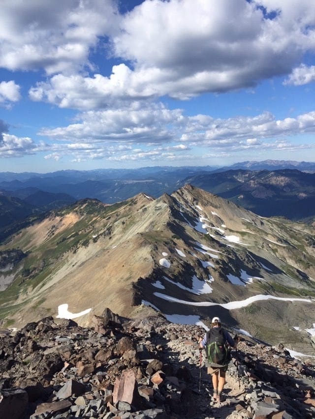
How Long Does it Take to Hike Each Trail?
Planning an adventure? Check out our popular trail guides! 4.7 stars (14K+ ratings)
Photo by Holly Mandarich
How Long Does it Take to Hike Each Trail?
Would you like to hike for 5-6 months? A few weeks? A few days? We've got you covered.
Natalie McMillan Inside Atlas Guides 12/20/2018
Natalie McMillan
Inside Atlas Guides
12/20/2018
Find the trail that’s right for you
The trails are listed here by the average time it takes to walk the entire trail. Some people hike faster, some slower, and some only hike a section. In other words, these time periods only provide a rough estimate of how long it might take to walk the trail.
5-6 months
- Pacific Crest Trail (2650 miles)
- Appalachian Trail (2180 miles)
- Continental Divide Trail (3100 miles)
4 months
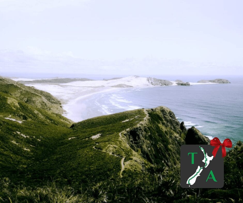
- Te Araroa (1860 miles/3000 km)
2-3 months
- Pacific Northwest Trail (1200 miles)
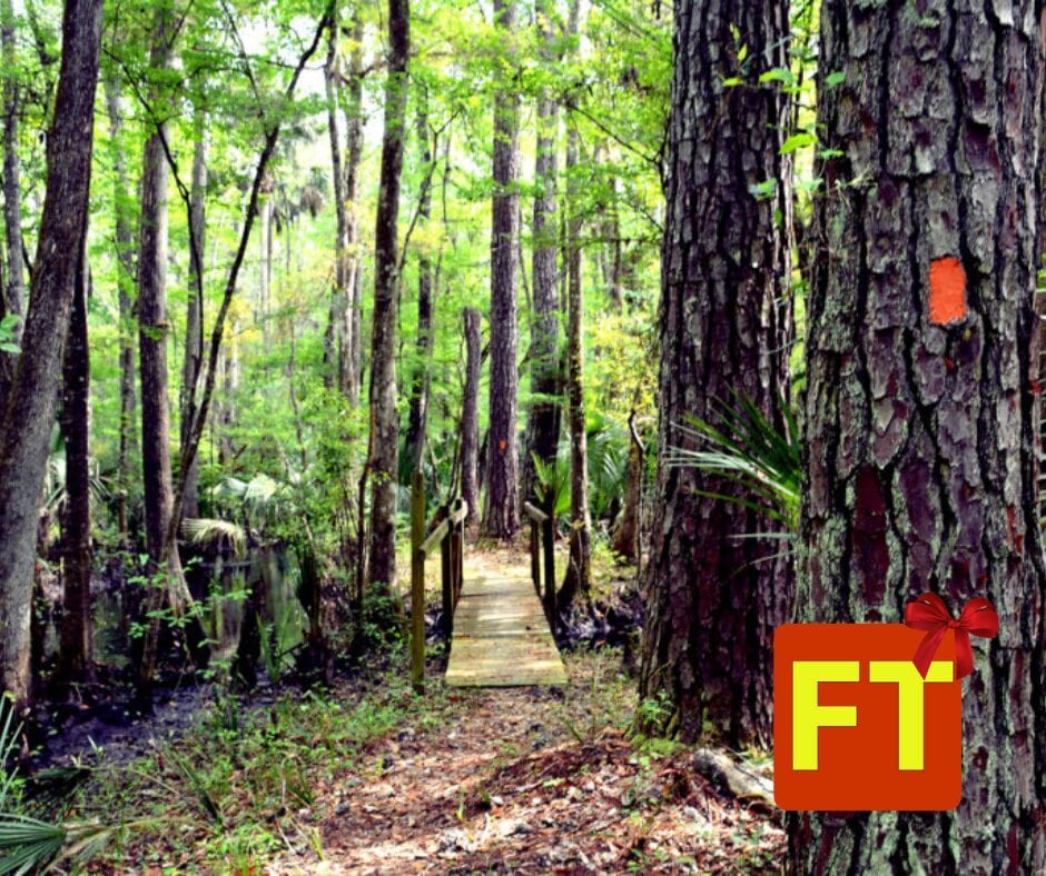
- Florida Trail (1400 miles)
- Great Divide Trail (680 miles/1100 km)
- The Bibbulmun Track (622 miles/ 1002 km)
7-12 weeks
- Ice Age Trail (1200 miles)
4-8 weeks
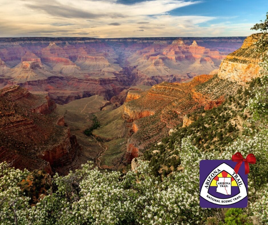
- Arizona Trail (800 miles)
- International Appalachian Trail (724 miles)
- Israel National Trail (664 miles)
4-6 weeks
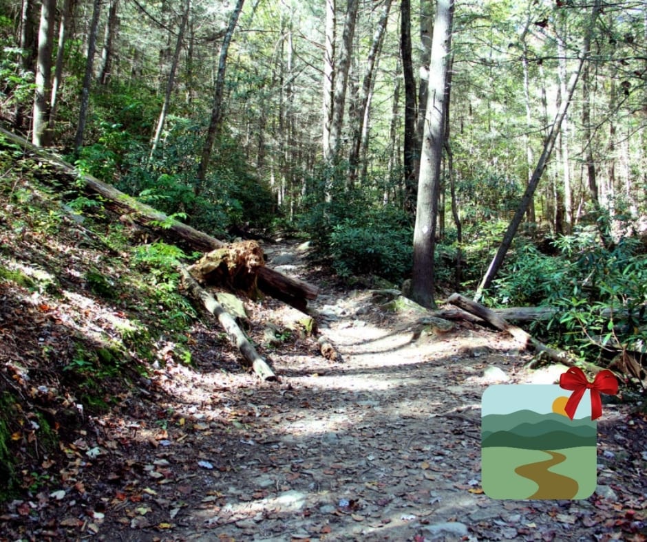
- Colorado Trail (485 miles)
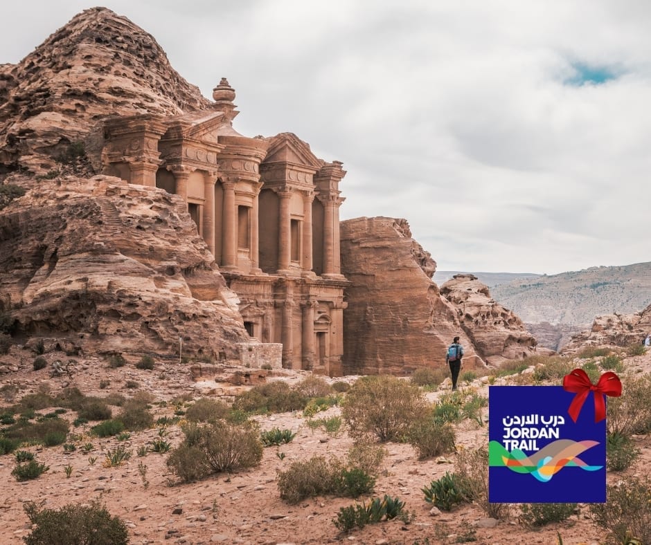
- Jordan Trail (400 miles)
4 weeks
- Camino de Santiago (460 miles/750 km)
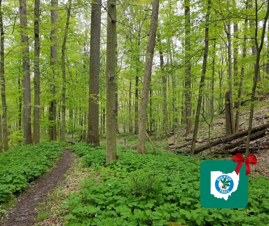
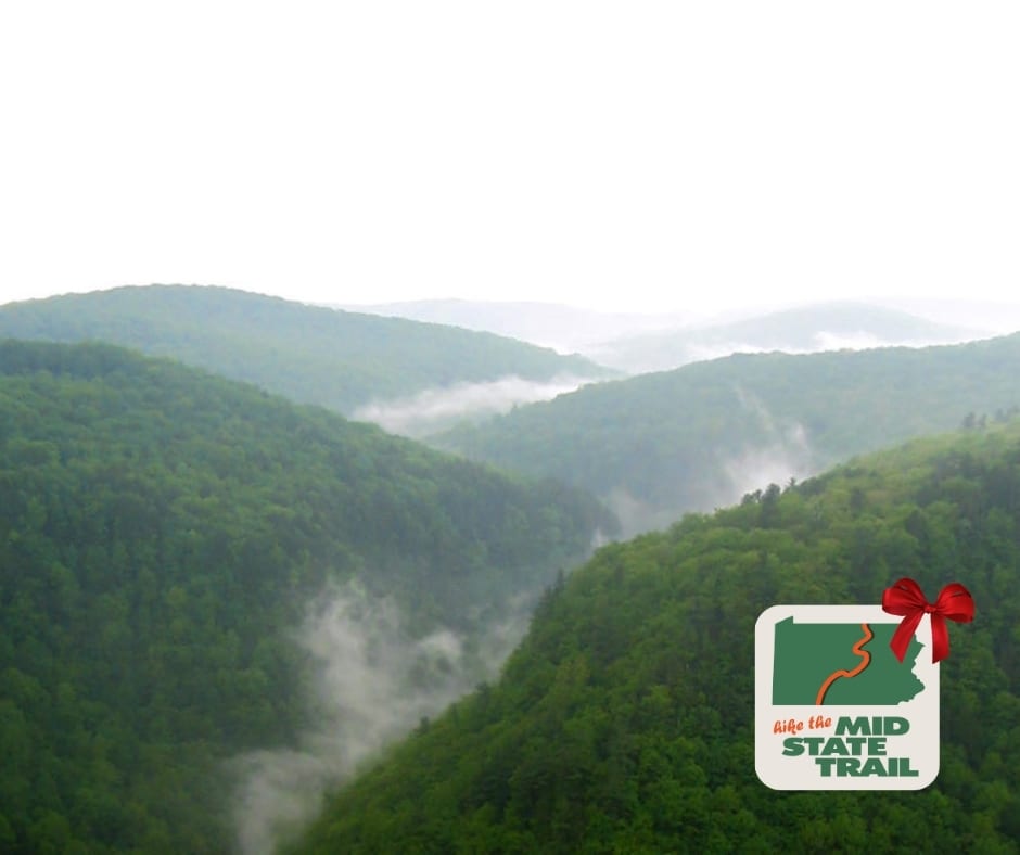
- Mid State Trail (321.2 miles/530 km)
3 weeks
- Benton Mackaye Trail (300 miles)
- John Muir Trail (210 miles)
- The Long Trail (270 miles)
- Ouachita Trail (223 miles)
2 weeks
- Tahoe Rim Trail (170 miles)
- Coast to Coast (200 miles)
- Ozark Highlands Trail (164 miles)
- Larapinta Trail (143 miles/231 km)
10 days
- Wonderland Trail (95 miles)
- South Downs Way (100 miles)
- Cotswold Way (100 miles)
7-10 days
- Tour du Mont Blanc (105 miles)
- Torres del Paine – “O” Circuit (75 miles)
1 week
- Ridgeway (87 miles)
- West Highland Way (96 miles)
- Hadrian’s Wall Path (84 miles)
- Cape to Cape (84 miles/135 km)
3-5 days
- Torres del Paine – “W” Circuit (39 miles)
3-4 days
- Wilsons Promontory Grand Circuit (33 miles/54 km)
- Greenstone and Caples Track (38 miles/61 km)
- Kepler Track (37 miles/60 km)
- Milford Track (32 miles/53 km)
2-4 days
- Lost Coast Trail (24 miles)
2-3 days
- Eagle Rock Loop (26.8 miles)
- Buffalo River Trail (37.1 miles)
- Three Capes Track (30 miles/48 km)
- Routeburn Track (20 miles/32 km)
- Mt Whitney Trail (10.4 miles, 20.8 round-trip)
1 day
- Mt Whitney Trail (10.4 miles, 20.8 round-trip, 1 day is difficult!)
- George Bass Coast Trail (5 miles/8 km)
Want to keep up with all that’s going on at Atlas Guides? Sign up for our newsletter!
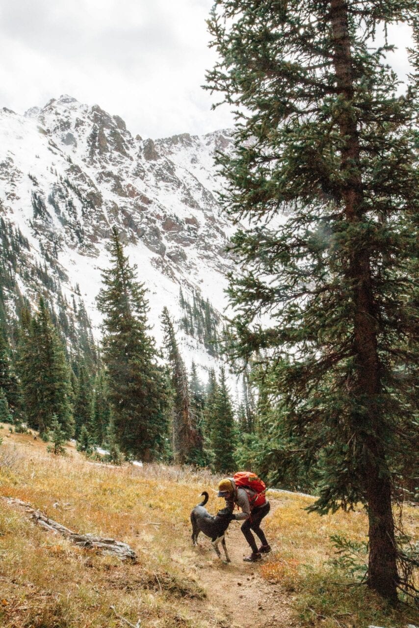
Photo by Holly Mandarich
Read more!
Check out some related blog posts!
Download our popular hiking and biking guides!

Trail guides that get you to places you’ve dreamed of.
As the makers of Guthook Guides, Bikepacking Guides, and Cyclewayz, we help you navigate the most popular trails around the world on your smartphone. Our hiking guides and biking guides work completely offline. Let Guthook guide your next adventure!
Showers Lake Vista, Tahoe Rim Trail
Photo courtesy of the Tahoe Rim Trail Association

Showers Lake Vista, Tahoe Rim Trail
Photo courtesy of the Tahoe Rim Trail Association
Trail guides that get you to places you’ve dreamed of.
As the makers of Guthook Guides, Bikepacking Guides, and Cyclewayz, we help you navigate the most popular trails around the world on your smartphone. Our hiking guides and biking guides work completely offline. Let Guthook guide your next adventure!
Download our popular hiking and biking guides!
About the Author
Natalie McMillan
Natalie grew up hiking in Arizona where she fell in love with the outdoors. Her favorite hikes are to Havasu Falls in the Grand Canyon and Angel’s Landing in Zion National Park, UT. She loves taking pictures of people, places, and nature, which might explain why she has almost 47,000 photos currently residing on her phone. She takes care of all things related to social media and marketing and recently moved to Denver, CO from Flagstaff, AZ. You may find her frolicking around the trails and mountains of Colorado, or exploring the new city she gets to call home.
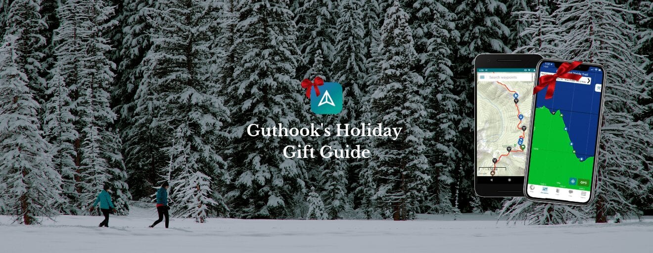
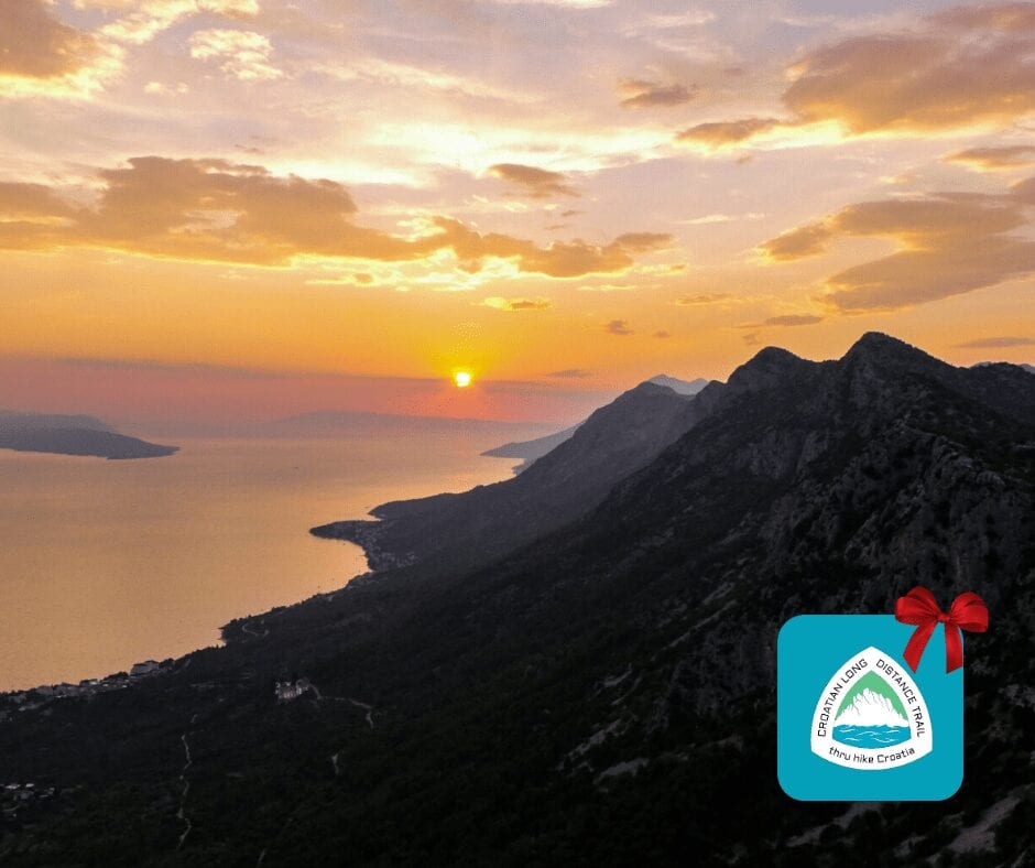
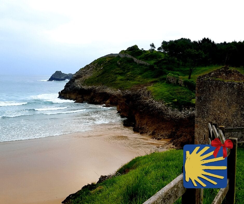
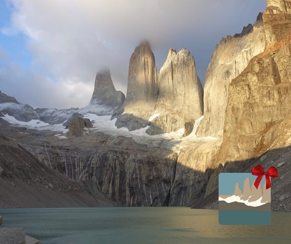
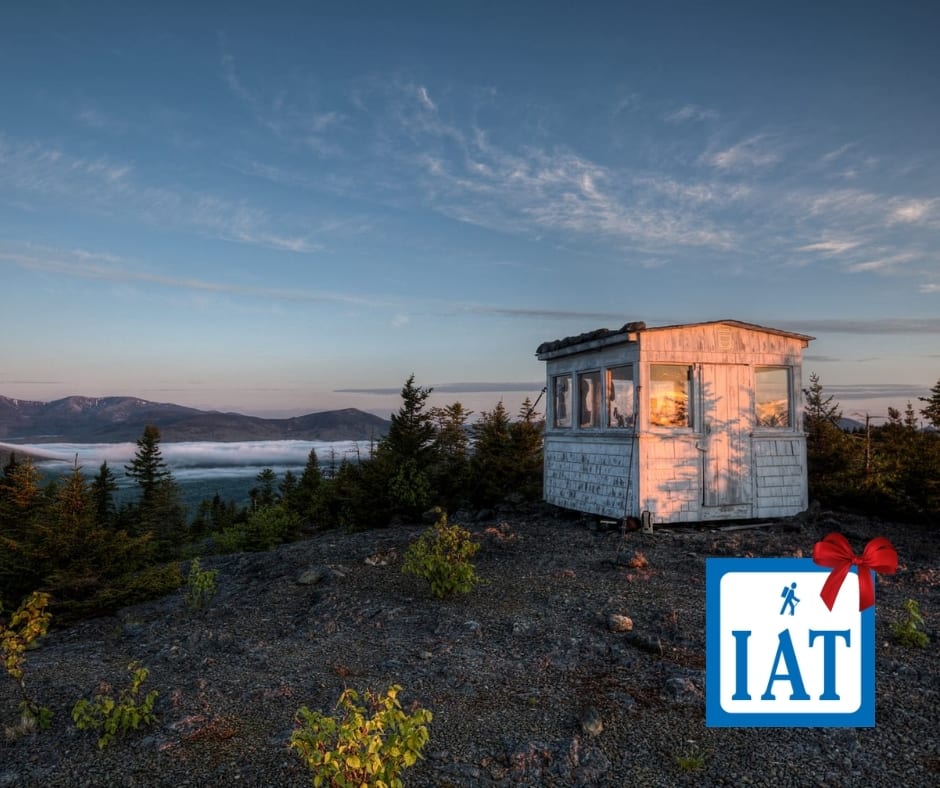
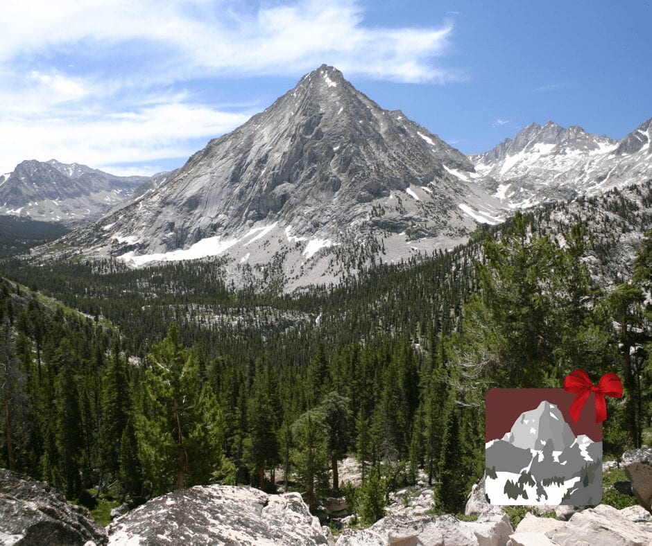
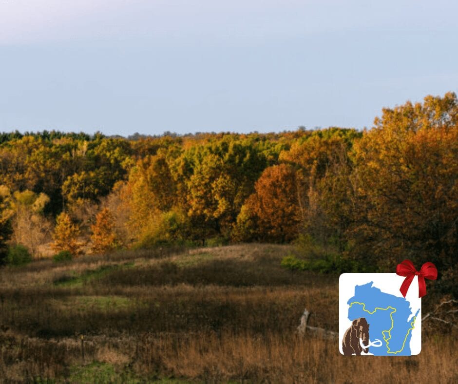
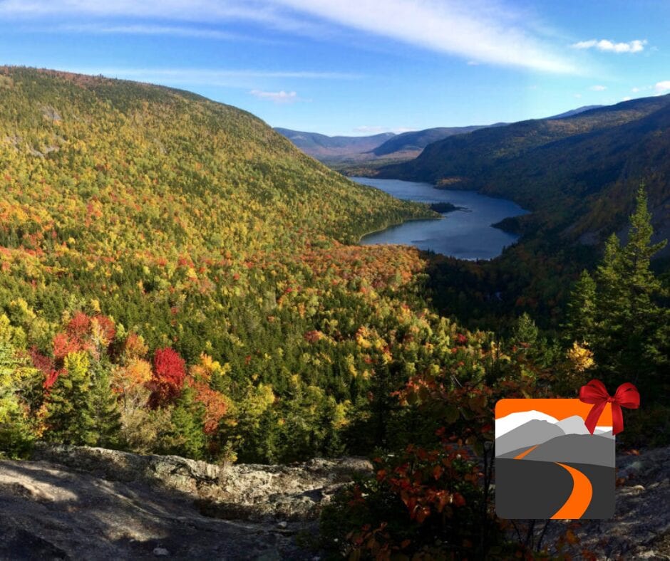
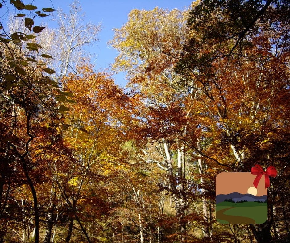
Guthook's Holiday Gift Guide
Planning an adventure? Check out our popular trail guides! 4.7 stars (14K+ ratings)
A winter wonderland
Photo by Ian Schneider
Guthook's Holiday Gift Guide
Give the Gift of Guthook! We have a trail guide for every type of hiker on your list. Whether you know a thru-hiker, section hiker, day hiker, or international hiker, we have something for everyone.
Natalie McMillan Inside Atlas Guides 12/03/2019
Natalie McMillan
Inside Atlas Guides
12/03/2019
How to Give the Gift of Guthook
For the ULTIMATE THRU-HIKER
For the INTERNATIONAL HIKER
For the WEST COAST HIKER
For the EAST COAST/CENTRAL US HIKER
Or shop based on the LENGTH OF EACH HIKE…
The trails are listed here by the average time it takes to walk the entire trail. Some people hike faster, some slower, and some only hike a section. In other words, these time periods only provide a rough estimate of how long it might take to walk the trail.
5-6 months
- Pacific Crest Trail (2650 miles)
- Appalachian Trail (2180 miles)
- Continental Divide Trail (3100 miles)
4 months
- Te Araroa (1860 miles/3000 km)
2-3 months
- Pacific Northwest Trail (1200 miles)
- Florida Trail (1400 miles)
- Great Divide Trail (680 miles/1100 km)
- The Bibbulmun Track (622 miles/ 1002 km)
7-12 weeks
- Ice Age Trail (1200 miles)
4-8 weeks
- Arizona Trail (800 miles)
- International Appalachian Trail (724 miles)
- Israel National Trail (664 miles)
4-6 weeks
- Colorado Trail (485 miles)
- Jordan Trail (400 miles)
4 weeks
- Camino de Santiago (460 miles/750 km)
- Mid State Trail (321.2 miles/530 km)
3 weeks
- Benton Mackaye Trail (300 miles)
- John Muir Trail (210 miles)
- The Long Trail (270 miles)
- Ouachita Trail (223 miles)
2 weeks
- Tahoe Rim Trail (170 miles)
- Coast to Coast (200 miles)
- Ozark Highlands Trail (164 miles)
- Larapinta Trail (143 miles/231 km)
10 days
- Wonderland Trail (95 miles)
- South Downs Way (100 miles)
- Cotswold Way (100 miles)
7-10 days
- Tour du Mont Blanc (105 miles)
- Torres del Paine – “O” Circuit (75 miles)
1 week
- Ridgeway (87 miles)
- West Highland Way (96 miles)
- Hadrian’s Wall Path (84 miles)
- Cape to Cape (84 miles/135 km)
3-5 days
- Torres del Paine – “W” Circuit (39 miles)
3-4 days
- Wilsons Promontory Grand Circuit (33 miles/54 km)
- Greenstone and Caples Track (38 miles/61 km)
- Kepler Track (37 miles/60 km)
- Milford Track (32 miles/53 km)
2-4 days
- Lost Coast Trail (24 miles)
2-3 days
- Eagle Rock Loop (26.8 miles)
- Buffalo River Trail (37.1 miles)
- Three Capes Track (30 miles/48 km)
- Routeburn Track (20 miles/32 km)
- Mt Whitney Trail (10.4 miles, 20.8 round-trip)
1 day
- Mt Whitney Trail (10.4 miles, 20.8 round-trip, 1 day is difficult!)
- George Bass Coast Trail (5 miles/8 km)
Want to keep up with all that’s going on at Atlas Guides? Sign up for our newsletter!
Read more!
Check out some related blog posts!
Download our popular hiking and biking guides!
Trail guides that get you to places you’ve dreamed of.
As the makers of Guthook Guides, Bikepacking Guides, and Cyclewayz, we help you navigate the most popular trails around the world on your smartphone. Our hiking guides and biking guides work completely offline. Let Guthook guide your next adventure!
Showers Lake Vista, Tahoe Rim Trail
Photo courtesy of the Tahoe Rim Trail Association
Showers Lake Vista, Tahoe Rim Trail
Photo courtesy of the Tahoe Rim Trail Association
Trail guides that get you to places you’ve dreamed of.
As the makers of Guthook Guides, Bikepacking Guides, and Cyclewayz, we help you navigate the most popular trails around the world on your smartphone. Our hiking guides and biking guides work completely offline. Let Guthook guide your next adventure!
Download our popular hiking and biking guides!
About the Author
Natalie McMillan
Natalie grew up hiking in Arizona where she fell in love with the outdoors. Her favorite hikes are to Havasu Falls in the Grand Canyon and Angel’s Landing in Zion National Park, UT. She loves taking pictures of people, places, and nature, which might explain why she has almost 47,000 photos currently residing on her phone. She takes care of all things related to social media and marketing and recently moved to Denver, CO from Flagstaff, AZ. You may find her frolicking around the trails and mountains of Colorado, or exploring the new city she gets to call home.
What is thru-hiking?
Planning an adventure? Check out our popular trail guides! 4.8 stars (17K+ ratings)
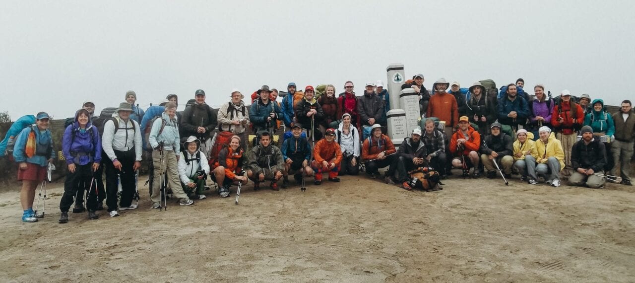
A group of thru-hikers starting at the southern PCT terminus.
What is thru-hiking?
The definition of "thru-hiking" cannot be found in a dictionary. That's why I asked these thru-hikers to share what thru-hiking means to them.
Natalie McMillan Inside Atlas Guides 11/9/2018
Natalie McMillan
Inside Atlas Guides
11/9/2018
I’m going to be honest… before I started working here at Atlas Guides, I had no idea what thru-hiking was. I love to hike, but for some reason (probably having to do with me being in a college bubble in this small town of Flagstaff for the past five years), I had never heard of thru-hiking. So I googled it… and this is what I found:
Good ol’ Wikipedia: Thru-hiking, or through-hiking, is hiking a long-distance trail end-to-end within one hiking season. In the United States, the term is most commonly associated with the Appalachian Trail (AT), the Pacific Crest Trail (PCT), and the Continental Divide Trail (CDT), but also refers to other end-to-end hikes.
The Appalachian Trail Conservancy defines a thru-hike as: “a hike of the entire A.T. in 12 months or less.”
Working at Atlas Guides for almost a year and a half now, I have been completely immersed in the thru-hiking culture and the community that surrounds it. Yet, I still can’t explain what thru-hiking means to me because I have never done one. Yes, it’s possible that I may do one sometime in the future, but right now I’ve just developed my ideas off of the countless articles I’ve read and all of the stories I’ve followed from hikers on Instagram.
I wanted to capture the perspective of people who have actually been out on the trail and experienced thru-hiking themselves. So that’s what I did and this is what they had to say:
“What does thru-hiking mean to you?”
Trail name: Portabella, PCT 2017
Photo by Isabel Reeb
“Thru hiking means the home and a family I never knew I was missing. It means the experiences I never knew I needed. It means the confidence I never knew I had. It means the pain I never knew I could handle. It means the love I will never forget. It means all the emotions I cannot put into words. Thru hiking means everything to me.” – Portabella, PCT 2017
“Solace.” – Nikki Hughes
Trail name: BarefootHiker, AT 2017
Photo by BarefootHiker
“Intoxicating. Fresh air, nice and uplifting people, more of the best people Earth has to offer, all for one crazy destination. You’re left filled and emptied all at once. You’re left craving more. It’s such a powerful feeling.” – BarefootHiker, AT 2017
“Start to finish.” – @bfdtcb
Trail name: Freeball, AT 2015, CT 2016
Photo by Zoë
“Thru hiking means so many things. I’m Freeball and my first thru was the AT in 2015. I consequently caught the trail-bug and hiked the CT in 2016 and did 1000 miles on the PCT this past summer. For me, thru hiking means finding yourself one trail at a time when stripping your life to the minimal. It means being free and being in motion.” – Freeball, AT 2015, CT 2016
“#endlesssummer” – Grouchy, CDT 2018
Trail name: Relish, PCT 2018
Photo by Relish
“I wanted to live simply, to find space, and to see upon reflection, what it taught about how to live. I wanted to live far away, unfettered by the clutter modern life. I wanted to find rest in the quiet ways of nature, to be present there from sunrise to sunset to star filled night. I wanted to find healing for an over busied life, and relish in the soothing touch of a life outdoors. I wanted to see for myself if life couldn’t be improved by reducing it to only the most fundamental of things. I wanted to learn the lands of the American West, not by way of academia but by my feet. I wanted to witness the full display of grandeur nature had to offer, from the smallest spec of sand to the most majestic mountain pass. I wanted to experience hardship, hunger, pain and loneliness and discover what lessons these had to offer. I hoped to live boldly. To test the human spirit and attempt a truly awesome feat. I wanted to be a model, to myself my friends, family and strangers alike, to live a life daring enough to attempt a great dream.”- Relish, PCT 2018
“Fueled by gummy candy. Lots of it.” – Flip, AT 2017
Trail name: Earthcake, PCT 2016
Photo by Earthcake
“Being part of a community.” – Earthcake, PCT 2016
Trail name: Thumbs, PNT 2017
Photo by Thumbs
“It means everything… freedom, peace, strength, resilience, overcoming all obstacles. It means so much to my mental health, physical health, and is always at the forefront of my mind. It’s the place you can just be and only have to worry about walking from resupply to resupply.” -Thumbs, PNT 2017
Trail name: DeadPoet87
Photo by DeadPoet87
“Utopia!” – DeadPoet87
Trail name: White Cheddar, AT 2017
Photo by Ginger
“Freedom.” – White Cheddar

Trail name: Sprout, AT 2018
Photo by Sprout
“Hmmm… FRITOS!!” – Sprout, AT 2018
Want to keep up with all that’s going on at Atlas Guides? Sign up for our newsletter!
Read more!
Check out other blog posts!
Download our popular hiking and biking guides!
Trail guides that get you to places you’ve dreamed of.
As the makers of Guthook Guides, Bikepacking Guides, and Cyclewayz, we help you navigate the most popular trails around the world on your smartphone. Our hiking guides and biking guides work completely offline. Let Guthook guide your next adventure!
Showers Lake Vista, Tahoe Rim Trail
Photo courtesy of the Tahoe Rim Trail Association
Showers Lake Vista, Tahoe Rim Trail
Photo courtesy of the Tahoe Rim Trail Association
Trail guides that get you to places you’ve dreamed of.
As the makers of Guthook Guides, Bikepacking Guides, and Cyclewayz, we help you navigate the most popular trails around the world on your smartphone. Our hiking guides and biking guides work completely offline. Let Guthook guide your next adventure!
Download our popular hiking and biking guides!
About the Author
Natalie McMillan
Natalie grew up hiking in Arizona where she fell in love with the outdoors. Her favorite hikes are to Havasu Falls in the Grand Canyon and Angel’s Landing in Zion National Park, UT. She loves taking pictures of people, places, and nature, which might explain why she has almost 47,000 photos currently residing on her phone. She takes care of all things related to social media and marketing and recently moved to Denver, CO from Flagstaff, AZ. You may find her frolicking around the trails and mountains of Colorado, or exploring the new city she gets to call home.
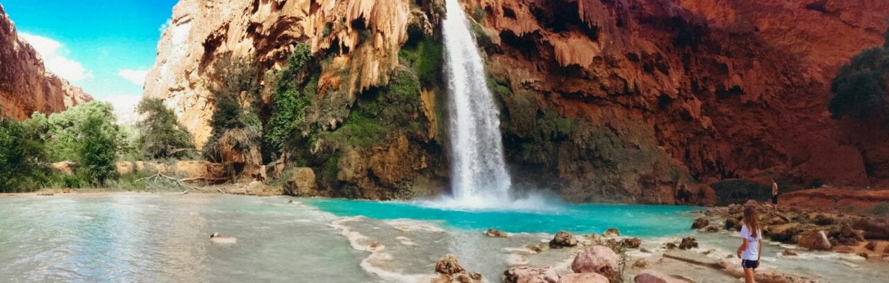
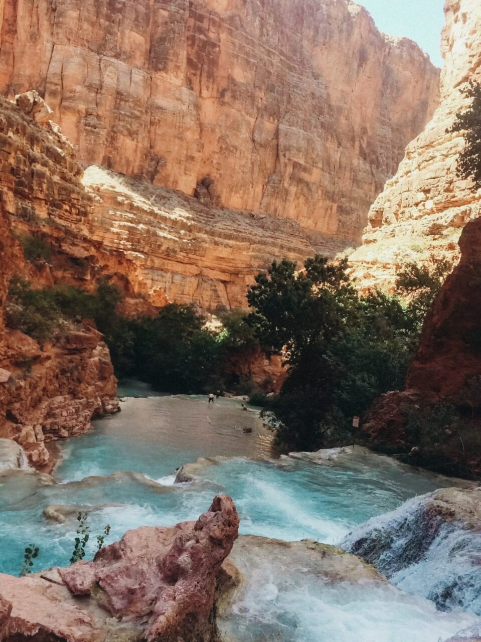
My First Backpacking Trip to Havasu Falls
Planning an adventure? Check out our popular trail guides! 4.8 stars (17K+ ratings)
Havasu Falls, Arizona
Photo by Natalie McMillan
My First Backpacking Trip to Havasu Falls
Let’s throw it back to about three years ago. My first backpacking trip. I was just a wee little caterpillar in college and had never really experienced what real “backpacking” was. But I loved to hike and I loved the outdoors, so it would be pretty easy right? HA, wrong.
Natalie McMillan Trip Report 10/5/2018
Natalie McMillan
Trip Report
10/5/2018
Hiking to Havasu Falls in May 2015 was an experience I will never forget. My best friend invited me and our other friend to join her and her family on this glorious trip down in the Grand Canyon. Being the little adventurous sophomore I was, I was stoked. But here’s the thing, I knew NOTHING about backpacking. I just expected it to be like camping: bring as much stuff as you can shove into your car, except this time it would just be a backpack. So that’s what I did.
After hiking over 20 miles round trip and camping for two nights, I learned a few things from my first time backpacking. All you thru-hikers and experienced backpackers are going to laugh and say “Wow this dumb girl didn’t know anything!” And rightfully so because I had no experience. I didn’t google “Backpacking 101” or look up a backpacking starter kit of some sort. I just went for it! And here is what I learned…
My best friend and I sitting at the top of Mooney Falls with our super outdoorsy Chacos.
Photo by Natalie McMillan
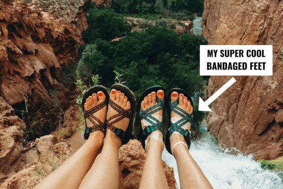
WHAT NOT TO DO: Buy new shoes a few days before your hike and then wear them on your hike.
WHAT YOU SHOULD DO: Buy new shoes months before your hike and BREAK. THEM. IN. But everybody knows that, right?? Well I didn’t.
I started preparing for my first backpacking trip like most people do – by getting new shoes. Because if you know about Havasu Falls, then you know that there’s water everywhere. And because I am always down for shopping and buying new things, that meant I could get new water shoes. I went down to my local REI and bought a new pair of Chacos sandals. “A month before your hike?” Oh no… THREE DAYS before my hike. Yes, it was a very bad idea. And yes I did wear them starting out on our ten mile hike down into the canyon. And yes I did get a million blisters. And yes I did stop halfway down, bandage my feet up, and wear my running shoes for the remainder of the hike down.
My friends and I taking a breather, while I situated my poor, blistered feet in some more appropriate shoes.
Photo by Natalie McMillan
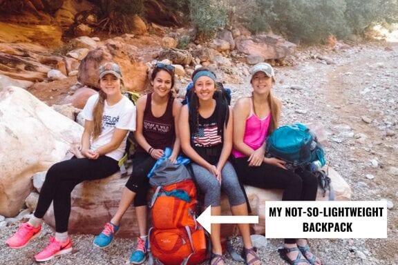
WHAT NOT TO DO: Rent a giant backpack because that means you can bring more stuff and fill it to the brim with crap you don’t need.
WHAT YOU SHOULD DO: Rent or buy a backpack months before your hike to test how much weight you can carry. Oh and only fill it with things YOU ACTUALLY NEED (a.k.a. plan ahead and pack early!).
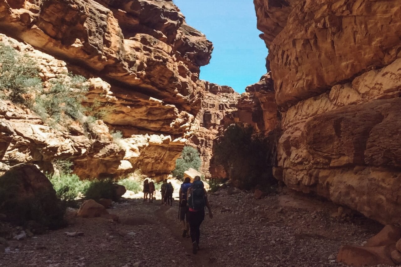
Hiking in the shade >>>
Photo by Natalie McMillan
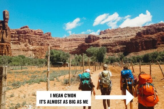
Here you can see the top of my head peeking over my giant, overstuffed backpack.
Photo by Natalie McMillan
Two days before my backpacking trip, I went with my best friend and her family to the local outdoor gear store to rent a “backpacking backpack” because I didn’t have $200 to spare as a college student to buy a brand new one. They had a variety of sizes and colors to choose from, so naturally I went for the biggest and brightest one they had. I walked out of the store with a bright red, 65L Deuter backpack.
When I got home, I started to gather all of the things I needed to bring on my hike. I found my sleeping bag (definitely not lightweight), my hammock (which I planned to sleep in), a blanket (in case it got cold at night), a towel, my new (worn for two days) Chacos, my running shoes, my birkenstocks (so I had more shoes to wear around camp duh!), my swimsuit, I think probably five different outfits, all of my toiletries, headlamp, sunscreen, food, and a bunch of other random little things I can’t even remember. Once I had it all laid out, I shoved it all in my backpack. If I remember correctly, I believe it weighed between 30-40 pounds. Now keep in mind, I’m a fairly petite, five foot girl with a 65L backpack strapped to my back.
Hiking down to Havasu Falls on day one wasn’t that bad, but when we left camp to hike out on day three, I thought my back was going to give out. Not even an hour into our hike up and out of the canyon, we stopped, and my friend and her parents took some stuff out of my backpack to add to theirs to help lighten my load. I was so grateful for their help, but even then, I still remember getting to the switchbacks and feeling like I wasn’t going to make it out of the canyon. TIP: LEAVE EARLY OR LATE IN THE EVENING. DO NOT HIKE OUT IN THE HEAT OF THE DAY.
Never again.
Photo by Natalie McMillan
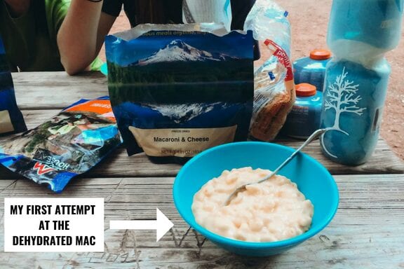
WHAT NOT TO DO: Buy a bunch of dehydrated mac n’ cheese meals because you love mac n’ cheese and it probably will taste the exact same as regular mac n’ cheese that you make at home. Oh and then don’t bring a lot of other food because you are already super prepared with your four bags of dehydrated mac n’ cheese.
WHAT YOU SHOULD DO: Try dehydrated meals at home BEFORE you prepare them out in the depths of the Grand Canyon. But more importantly, pack other food that you know you will actually enjoy eating.
We stayed at the Havasu Falls campground for two nights, which meant I needed to pack lunch and dinner for two days. My two best friends and I headed to our local REI where we decided to buy some dehydrated meals to cook with the fancy Jet Boil my bff’s family was bringing along. Being the picky eater that I am, I perused the aisle looking for a meal I knew I really liked. BINGO – mac n’ cheese it was. I decided to buy four bags because I loved mac n’ cheese so so sooooo much that I wouldn’t mind eating it for four meals in a row. HA, wrong again!
It was my first attempt at cooking dehydrated food. I followed the directions on the bag, poured the water from the Jet Boil in, and waited for my noodles to cook. Except guess what? They never fully cooked and I was forced to eat hard noodles covered in an interesting cheese sauce that did not taste like Kraft, let me tell you. But that’s not even the best part… I was supposed to eat the same thing for the NEXT THREE MEALS. Let’s just say my stomach was not very happy with me and I think I gave up after the second attempt. I was relieved to find my friends’ dehydrated meals tasted much better than mine and was even more grateful that they were kind enough to share with me. I don’t think I ate mac n’ cheese for the next 7 months following my hike.
IN THE END…
I learned a lot from my first backpacking experience. Most things were what I should NOT do on my next backpacking trip, but that’s what a “backpacking for dummies” book is all about! After all the things I dealt with, I’d still say my hike to Havasu Falls was totally worth it. I MEAN JUST LOOK AT ALL THAT TURQUOISE WATER. It is the perfect getaway for the relaxed – I just want to float around in magical water and soak up the sunshine – hiker, and the adventuresome – I want to jump off of all the waterfalls – hiker. Although I had a bit of a rough start, I would still recommend this trip for beginning backpackers. As long as you do your research beforehand and don’t do what I did, you will have so much fun exploring one of the most beautiful wonders that Arizona has to offer!
Here are some of my favorite photos from my trip:
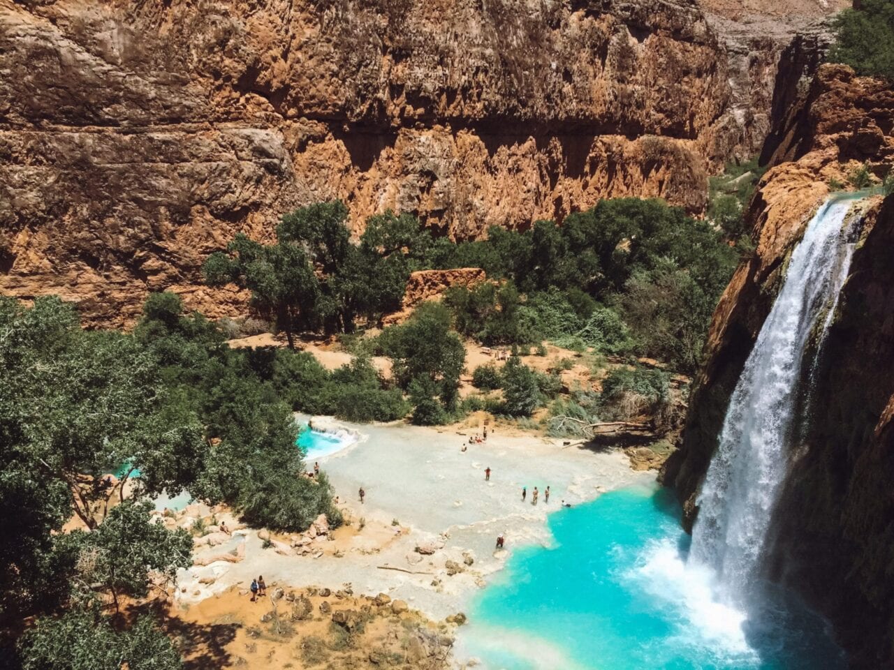
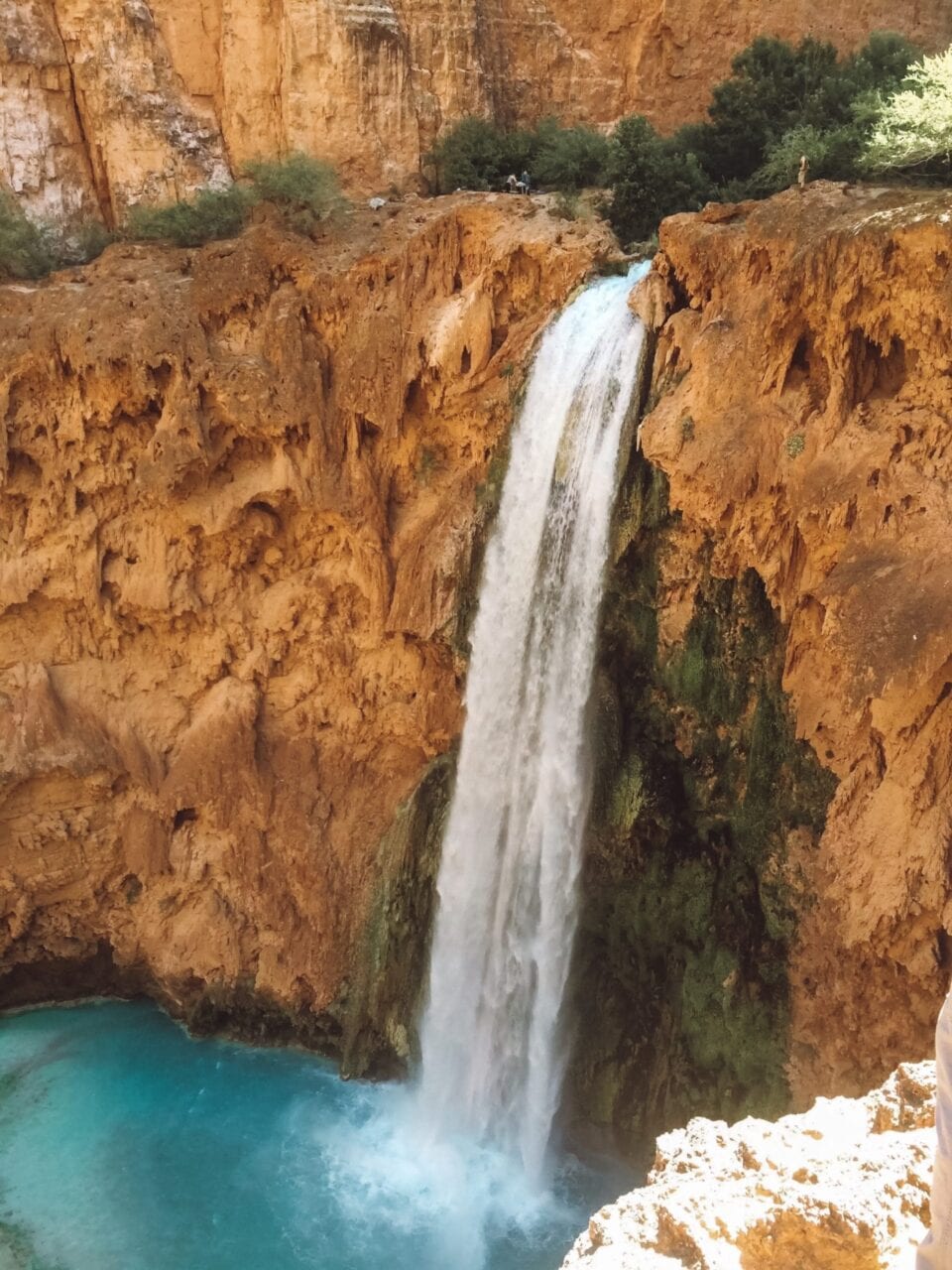
WOW look at the view! – Havasu Falls
Photo by Natalie McMillan
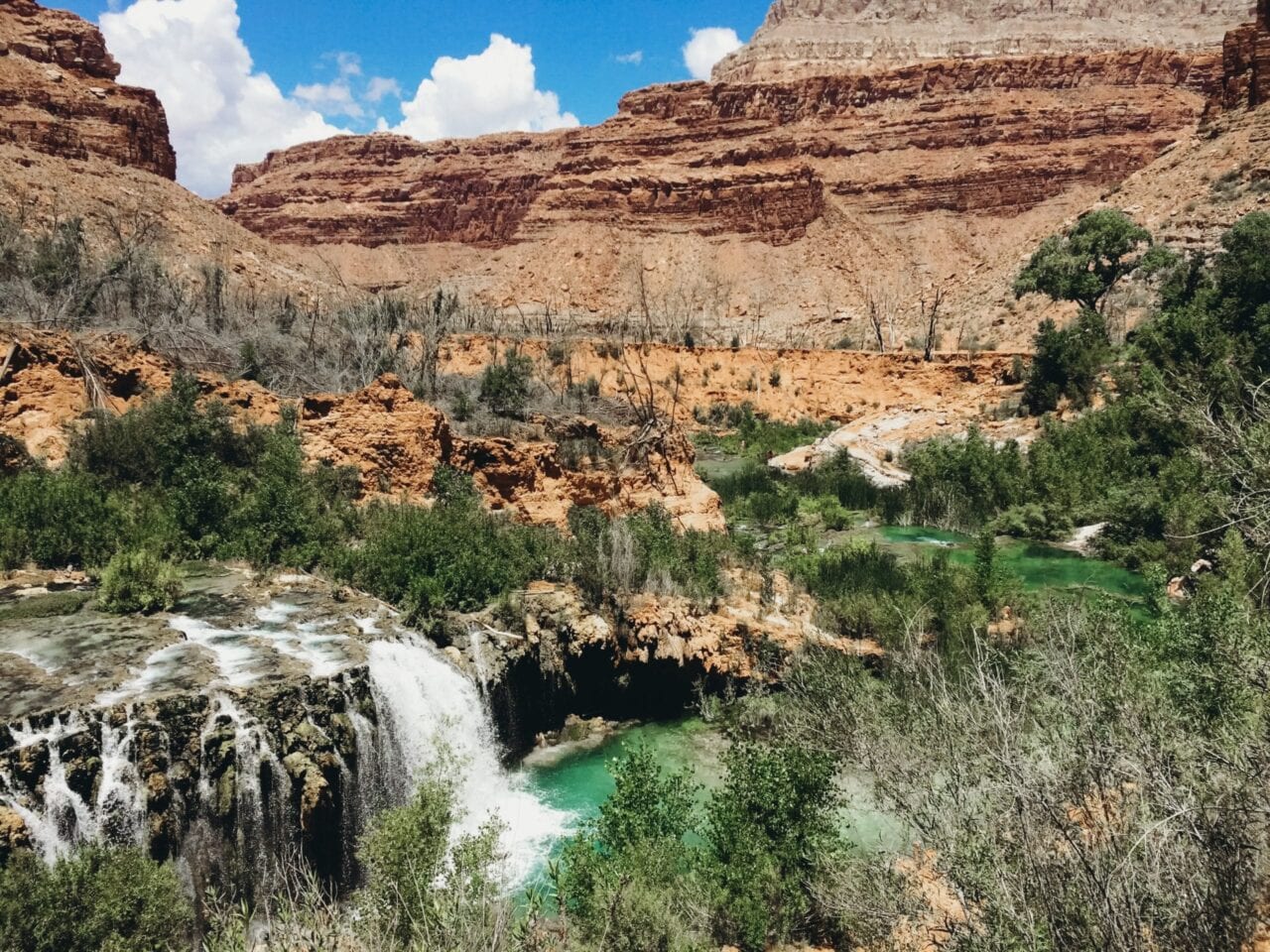
When you get a sneak preview before the real Havasu Falls – Navajo Falls
Photo by Natalie McMillan
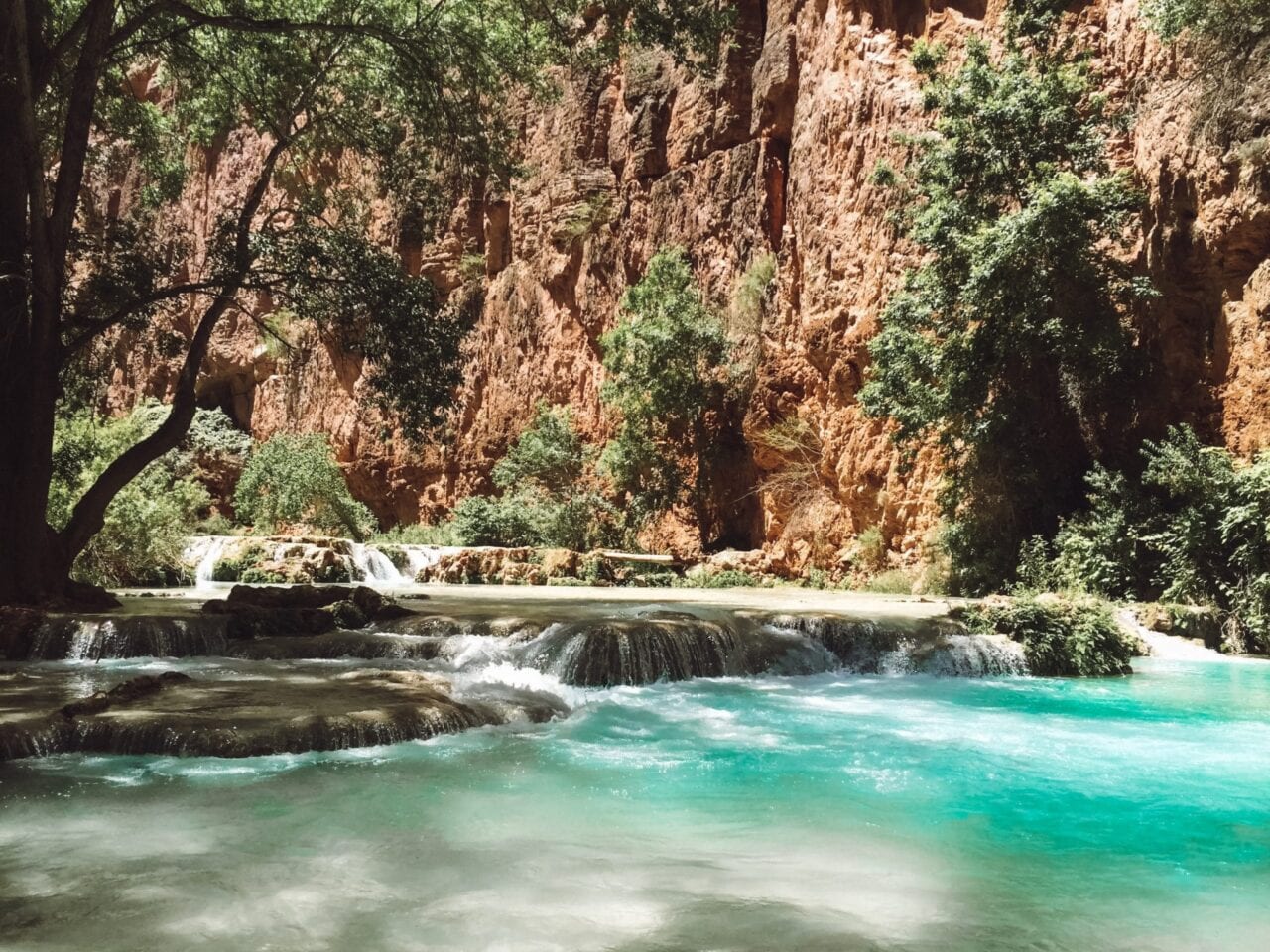
Casually just hiking through magical waters on your way from Mooney Falls to Beaver Falls.
Photo by Natalie McMillan
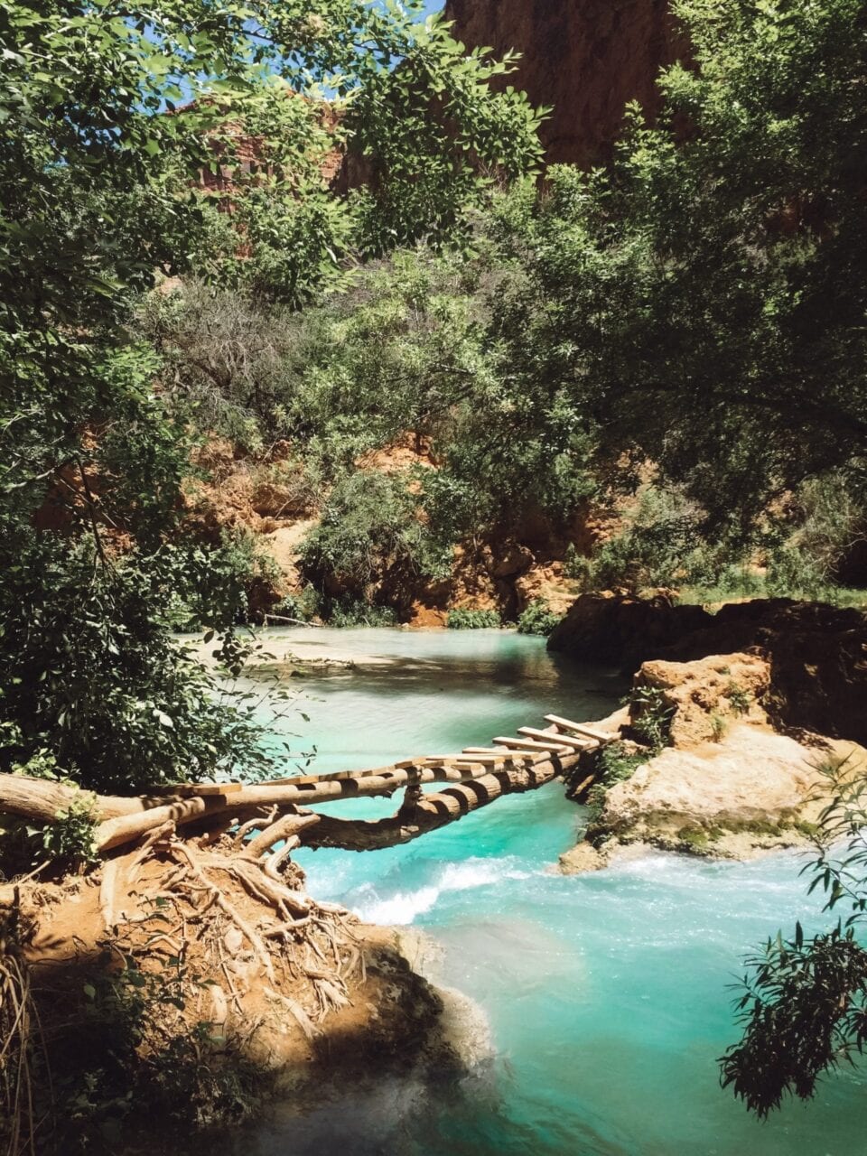
Crossing magic bridges on your way from Mooney Falls to Beaver Falls.
Photo by Natalie McMillan
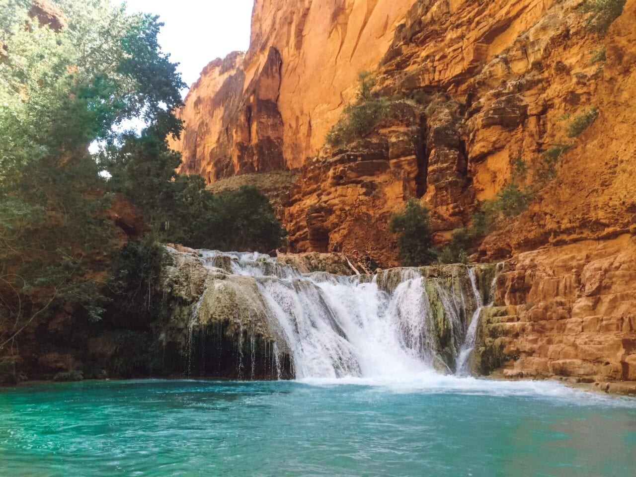
Mooney Falls just showing off.
Photo by Natalie McMillan
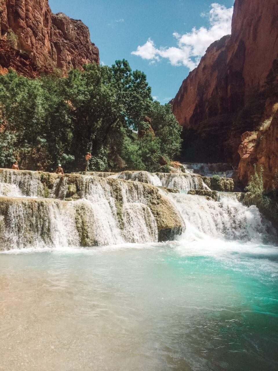
OH OK Beaver Falls, I SEE YOU.
Photo by Natalie McMillan
Can you believe this hidden water oasis exists in some crevice of the Grand Canyon??? – Beaver Falls
Photo by Natalie McMillan
I could have stayed there all day – Beaver Falls
Photo by Natalie McMillan
Want to keep up with all that’s going on at Atlas Guides? Sign up for our newsletter!
Read more!
Check out some of our other blog posts.
Download our popular hiking and biking guides!
Trail guides that get you to places you’ve dreamed of.
As the makers of Guthook Guides, Bikepacking Guides, and Cyclewayz, we help you navigate the most popular trails around the world on your smartphone. Our hiking guides and biking guides work completely offline. Let Guthook guide your next adventure!
Showers Lake Vista, Tahoe Rim Trail
Photo courtesy of the Tahoe Rim Trail Association
Showers Lake Vista, Tahoe Rim Trail
Photo courtesy of the Tahoe Rim Trail Association
Trail guides that get you to places you’ve dreamed of.
As the makers of Guthook Guides, Bikepacking Guides, and Cyclewayz, we help you navigate the most popular trails around the world on your smartphone. Our hiking guides and biking guides work completely offline. Let Guthook guide your next adventure!
Download our popular hiking and biking guides!
About the Author
Natalie McMillan
Natalie grew up hiking in Arizona where she fell in love with the outdoors. Her favorite hikes are to Havasu Falls in the Grand Canyon and Angel’s Landing in Zion National Park, UT. She loves taking pictures of people, places, and nature, which might explain why she has almost 47,000 photos currently residing on her phone. She takes care of all things related to social media and marketing and recently moved to Denver, CO from Flagstaff, AZ. You may find her frolicking around the trails and mountains of Colorado, or exploring the new city she gets to call home.