
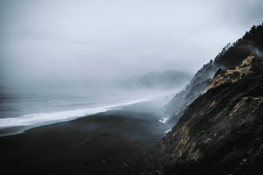
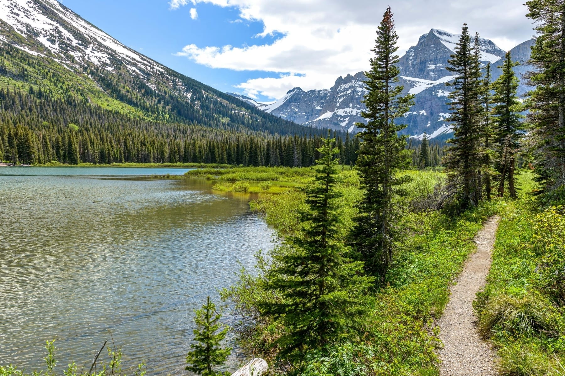
Lost Coast Trail

The Lost Coast Trail is one of the only coastal wilderness experiences in the contiguous United States. Earning its name after California’s HWY 1 had to be routed around this rugged section of the coastline, the 24-mile trail follows the beach of the King Range Conservation Area and is one of the most unique backpacking experiences in the world. Daily encounters include whales, elephant seals, coyotes, and bears; while the trail shows off tide pools, wildflower-covered mountains, and stunning waterfalls from the adjacent cliffsides into the ocean.
20% off for our Hiking Season Kick-off SALE! The Wonderland Trail is now $11.99 and the Western Hiker Special is now $39.99.
Photo courtesy of Kenna Sarae
4.8 ★★★★★ | 17K+ Reviews
Lost Coast Trail
24 miles (38 km) • California, USA
Download our guide to access the Lost Coast Trail map, tracks, waypoints, and comments! The Lost Coast Trail is one of the only coastal wilderness experiences in the contiguous United States. Earning its name after California’s HWY 1 had to be routed around this rugged section of the coastline, the 24-mile trail follows the beach of the King Range Conservation Area and is one of the most unique backpacking experiences in the world. Daily encounters include whales, elephant seals, coyotes, and bears; while the trail shows off tide pools, wildflower-covered mountains, and stunning waterfalls from the adjacent cliffsides into the ocean.
$4.99 full guide
24 mi (38 km)
$4.99 full guide
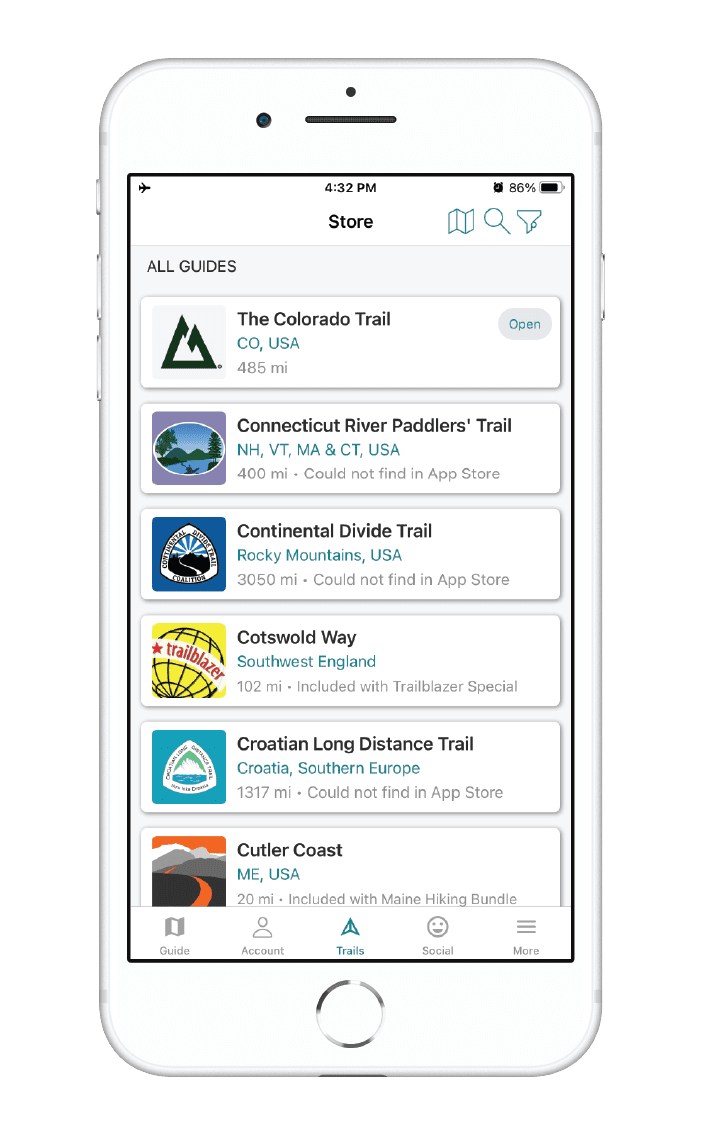
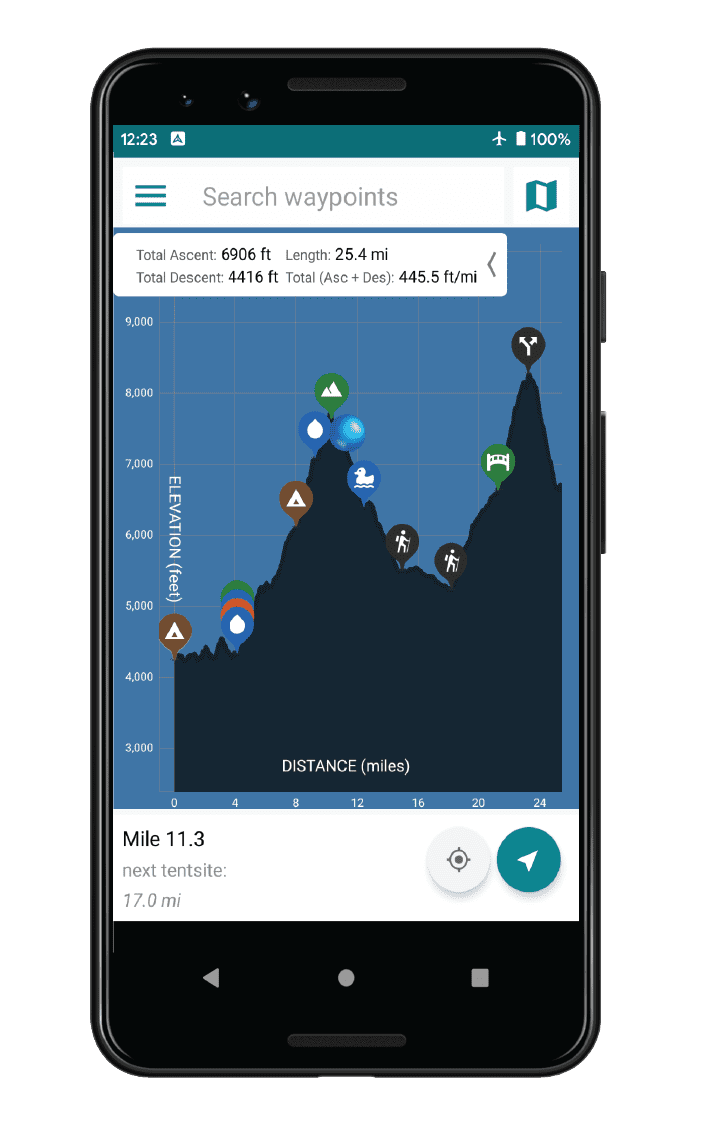
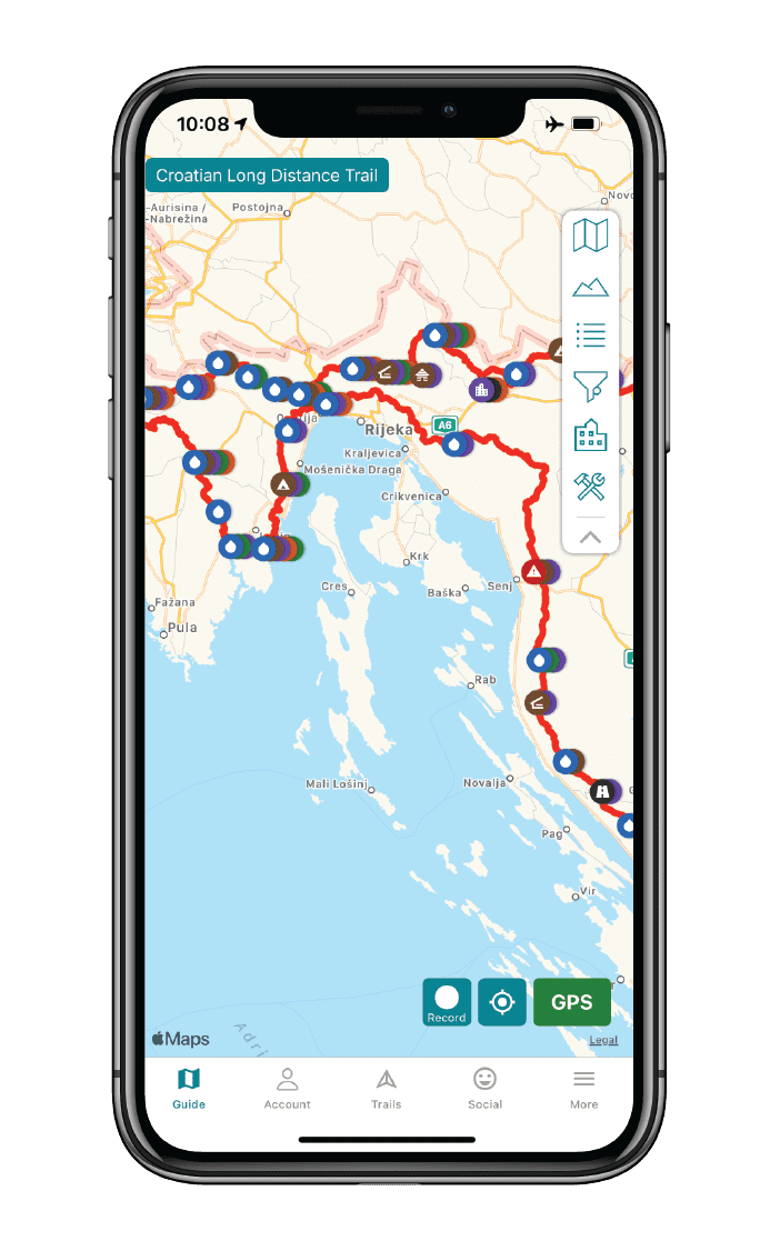
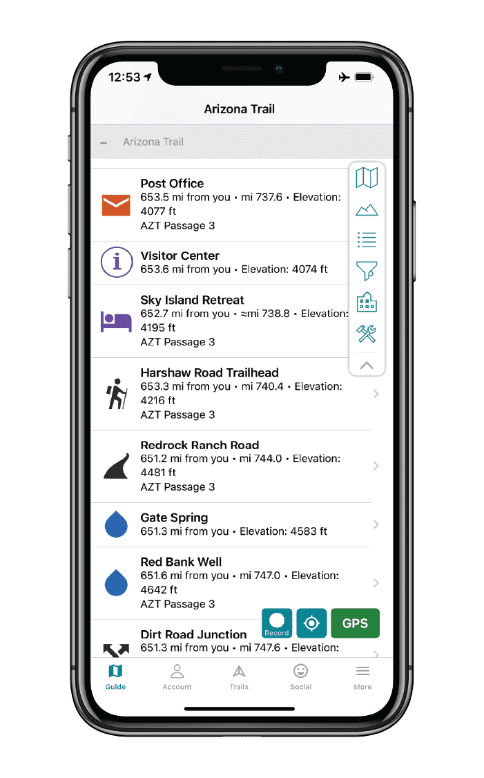


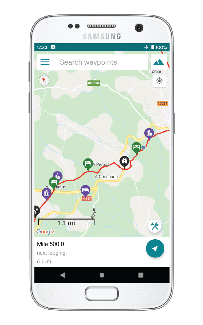
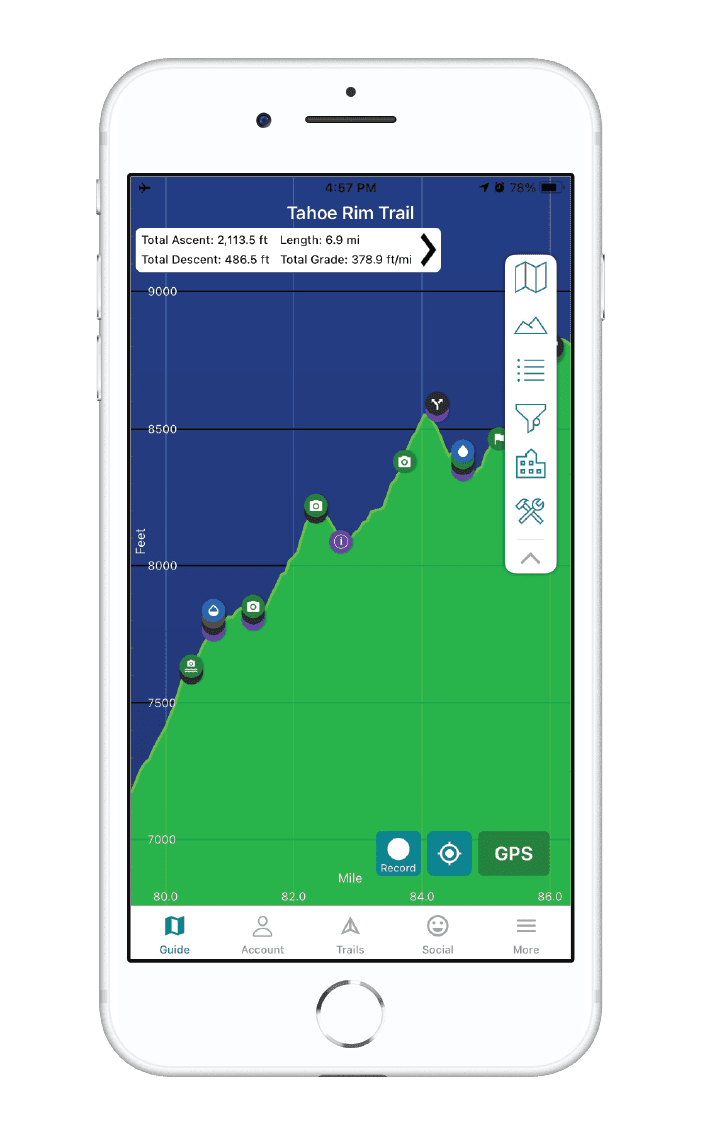
Lost Coast Trail Map


How can I get it?
The Lost Coast Trail map is available as an in-app purchase in our Guthook Guides app, a free download from the Apple App Store or the Google Play Store.
Our iOS and Android apps do differ slightly in their appearance. However, the majority of their features remain the same, and they access the same trail guide data.
The Lost Coast Trail is one of the only coastal wilderness experiences in the contiguous United States. Earning its name after California’s HWY 1 had to be routed around this rugged section of the coastline, the 24-mile trail follows the beach of the King Range Conservation Area and is one of the most unique backpacking experiences in the world. Daily encounters include whales, elephant seals, coyotes, and bears; while the trail shows off tide pools, wildflower-covered mountains, and stunning waterfalls from the adjacent cliffsides into the ocean.
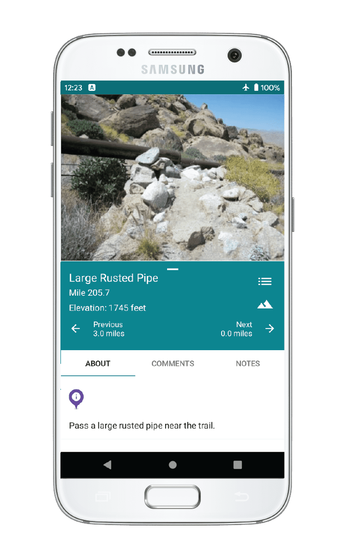
This guides includes the 24 miles from Mattole to Shelter Cove (Black Sands Beach).
$4.99
Photos of the Lost Coast Trail

Hike more.
Check out some of the other trail guides we offer!

Fuel Canister Cap? Or No Cap?
Planning an adventure? Check out our popular trail guides! 4.8 stars (17K+ ratings)
Fuel Canister Cap? Or No Cap?
Should you carry the cap that comes with your fuel canister? We describe the reasons you should.
Paul Bodnar Educational 9/5/2020
Paul Bodnar
Educational
9/5/2020
Use the cap: it protects the canister threads and keeps dirt out!
Many long-distance hikers do not carry the cap that comes with the fuel canister in order to save weight. However, the canister cap serves a valuable purpose by protecting the threads of your canister and keeping dirt from entering the top of the fuel canister.
Damaged threads can damage your stove threads when the canister is attached. Cross threading a stove is one of the most common reasons for stove replacement on the trail (which is expensive and inconvenient)!

Clean Threads

Dirty Threads
Any dirt in the top threaded area of the canister will enter your stove when it is attached, which increases the chances of clogging the stove and reducing performance.

You save about 2 grams (the weight of about 2 paperclips) by leaving the cap behind, but the risk to damaging your stove is relatively high. Therefore, I recommend using the canister cap to protect your canister and stove from damage.
Read more!
Check out some related blog posts!

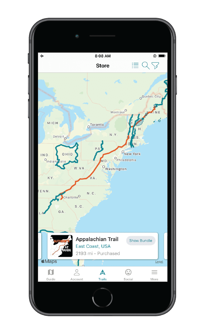
Get our trail guide for this area!
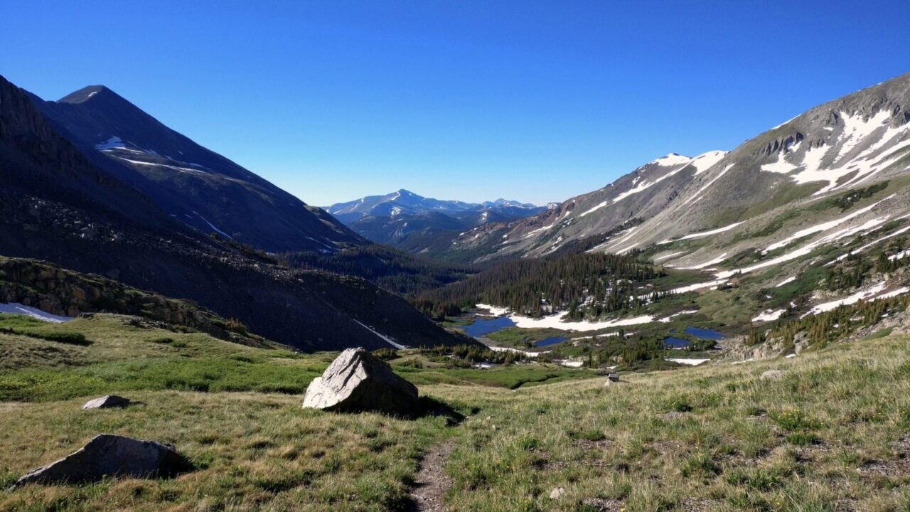
Continental Divide Trail
Considered by many to be the most remote and challenging of the triple crown trails, the Continental Divide Trail is a 3100 mile adventure through five western states.
3100 mi (4980 km) $39.99 full guide
Colorado, Continental Divide Trail
Photo by David Getchel
Colorado, Continental Divide Trail
Photo by David Getchel
Continental Divide Trail
Considered by many to be the most remote and challenging of the triple crown trails, the Continental Divide Trail is a 3100 mile adventure through five western states.
3100 mi (4980 km)
$39.99 full guide
Get our trail guide for this area!
About the Author

Paul Bodnar
Paul has always liked hiking and thru-hiked the Pacific Crest Trail in 1997 after college. After years of working in chemistry, he wanted to create a career involving the outdoors, so he hiked the PCT again in 2010 to do research for his guide book, Pocket PCT. He realized that creating a smartphone app for navigating the outdoors would make it easier to keep the data current and provide a better way to navigate. While hiking with Ryan (aka Guthook) in 2010, they decided to work together to create the first comprehensive smartphone guide for the PCT.

International Appalachian Trail
The IAT began in 1995 with the goal of creating a walking trail that followed the Appalachian Mountains from Mount Katahdin, Maine to Cap Gaspe, Quebec. Since then the IAT has grown to over 5000mi/8000km in length and include trails in 13 countries on 3 continents around the North Atlantic.
20% off for our Hiking Season Kick-off SALE! The Tahoe Rim Trail is now $11.99 and the Western Hiker Special is now $39.99.
30% off for our Small Business Saturday SALE! The Tahoe Rim Trail is now $9.99.
Photo courtesy of Bill Duffy
4.8 ★★★★★ | 17K+ Reviews
International Appalachian Trail
724 miles (1,165 km) • Maine, Canada
Official App of the International Appalachian Trail/Sentier International des Appalaches
Download our guide to access the International Appalachian Trail map, tracks, waypoints, and comments! The International Appalachian Trail (IAT) began in 1994 with the goal of creating a walking trail that followed the Appalachian Mountains from Mount Katahdin, Maine to Cap Gaspe, Quebec. Since then the IAT has grown to over 5000mi/8000km in length and include trails in 13 countries on three continents around the North Atlantic. Our IAT Guide includes the three original sections of the trail: Maine, New Brunswick and Quebec.
$19.99 FULL GUIDE
724 mi (1,165 km)
$19.99 full guide
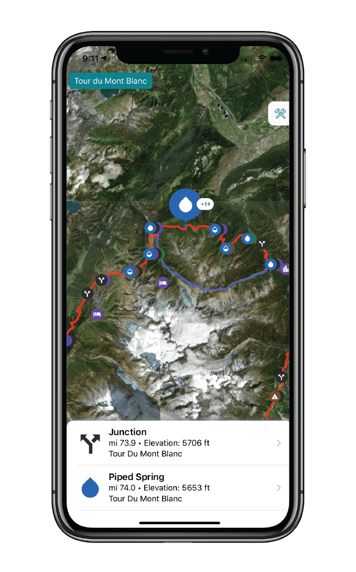
International Appalachian Trail Map


How can I get it?
The International Appalachian Trail map is available as an in-app purchase in our Guthook Guides app, a free download from the Apple App Store or the Google Play Store.
Our iOS and Android apps do differ slightly in their appearance. However, the majority of their features remain the same, and they access the same trail guide data.
This bundle includes the three original sections of the trail: Maine, New Brunswick and Quebec.
$19.99
The Maine section of the IAT/SIA is about 138mi/222km long and begins on the Katahdin Loop in the Katahdin Woods & Waters National Monument east of Baxter State Park. The trail generally follows the East Branch of the Penobscot River north through the Monument, before turning east towards Mount Chase and, eventually, Houlton. Just before Houlton, the trail turns north again and continues to and across Mars Hill Mountain in Aroostook County. It then follows the United States/Canadian international border northward to Fort Fairfield where it crosses into Perth-Andover, New Brunswick.
$6.99
The New Brunswick section of the IAT/SIA is about 185mi/298km long and begins at the United States/Canadian international border in Perth-Andover. The trail then accompanies the Tobique River through the village of Plaster Rock to Nictau. The trail then continues northeast to Mount Carleton Provincial Park before heading west to St. Quentin and Kedgewick. It then turns northeast again crossing the Upsalquitch River and then the mouth of the Restigouche River at Tide Head, NB. The trails turns west here, and crosses the Restigouche into Quebec at Flatlands, New Brunswick.
$6.99
The Québec section of the IAT/SIA is about 401mi/645km long and begins in Matapédia at the bridge crossing the Restigouche River and then runs northwest to Amqui, south of Lac Matapédia. Here, the trail heads northeast through the Reserve Faunique de Matane and then on to Mount Logan in the western portion of the Parc de la Gaspésie. The trail then turns eastward, continuing across Mont Albert and Mont Jacques Cartier and finally along the legendary cliffs of Cap Gaspé in Forillon National Park, where it ends at Shiphead.
$12.99

Cheers to giving back! Part of your purchase of the International Appalachian Trail goes to support the International Appalachian Trail/Sentier International des Appalaches Council’s work to preserve and maintain the trail. Learn about the IAT/SIA!
Photos of the International Appalachian Trail

About our partner
International Appalachian Trail/Sentier International des Appalaches Council
The Council of the International Appalachian Trail was launched in June 1994 when representatives from Maine, New Brunswick and Quebec gathered to begin the work of completing a footpath to connect the three highest points of land in each jurisdiction. Now, 22 chapters in 13 countries on 3 continents around the arc of the North Atlantic Ocean Basin continue the work. Chapters take on the responsibility of building and maintaining the footpath, which traces the ancient Appalachian/Caledonian mountain chain from North America to North Africa. The Council is an informal association whose members agree to a set of structures and responsibilities that includes establishment and maintenance of the footpath, the creation of maps, guides, and other promotional materials. Chapters are encouraged to develop their own means of public communication and education, and all contribute stories and other promotional material to the shared web portal.
Atlas Guides works with the IAT/SIA to create and maintain the International Appalachian Trail/Sentier International des Appalaches Council’s smartphone navigation app.
Hike more.
Check out some of the other trail guides we offer!
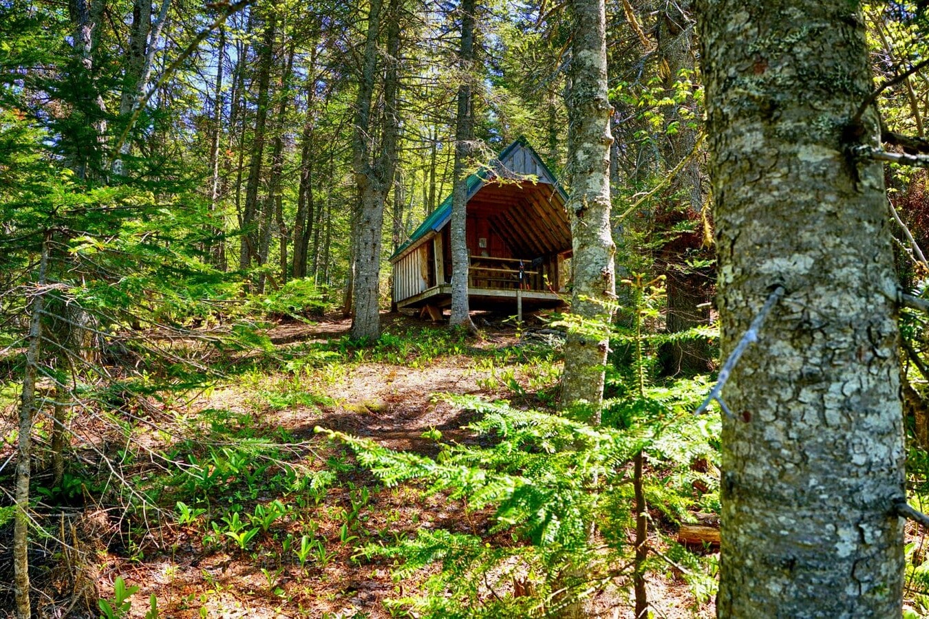
Hike the Lost Coast Trail: Why the LCT is So Special
Planning an adventure? Check out our popular trail guides! 4.7 stars (14K+ ratings)
Hike the Lost Coast Trail: Why the LCT is So Special
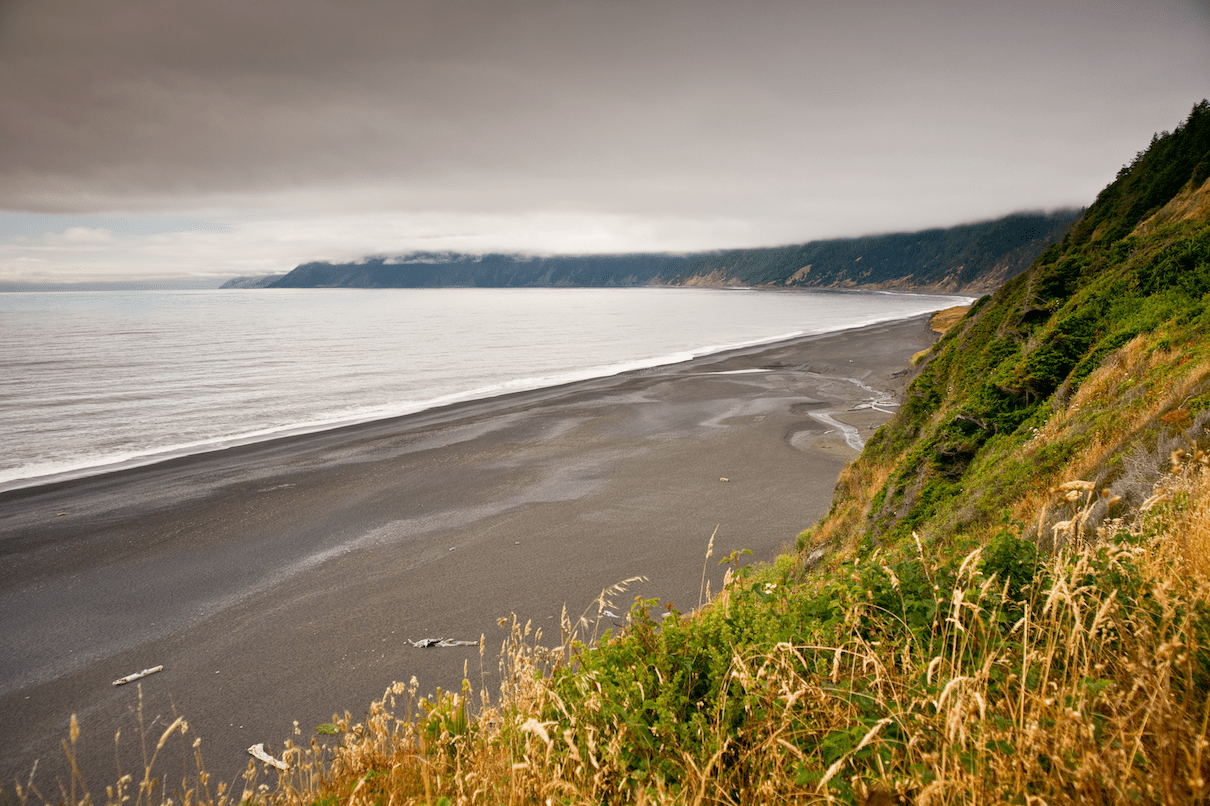
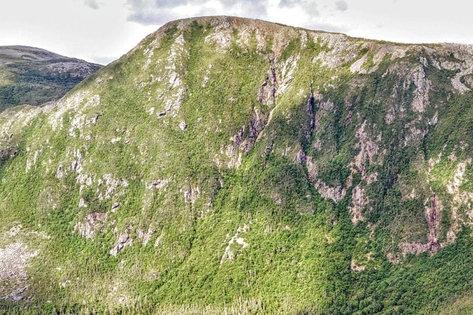
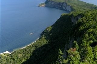
The main portion of the Lost Coast Trail runs for 24 miles from Mattole Beach to Shelter Cove along the headlands of the King Range National Conservation Area in Northern California. This rugged landscape earned its name when the state’s famous Highway 1 had to be routed inland to avoid the steep cliffs and desolate nature of this coastline, resulting in still largely wild coastal landscape.
Kenna Sarae Trip Report 9/10/2020
Kenna Sarae
Trip Report
9/10/2020
The Trail
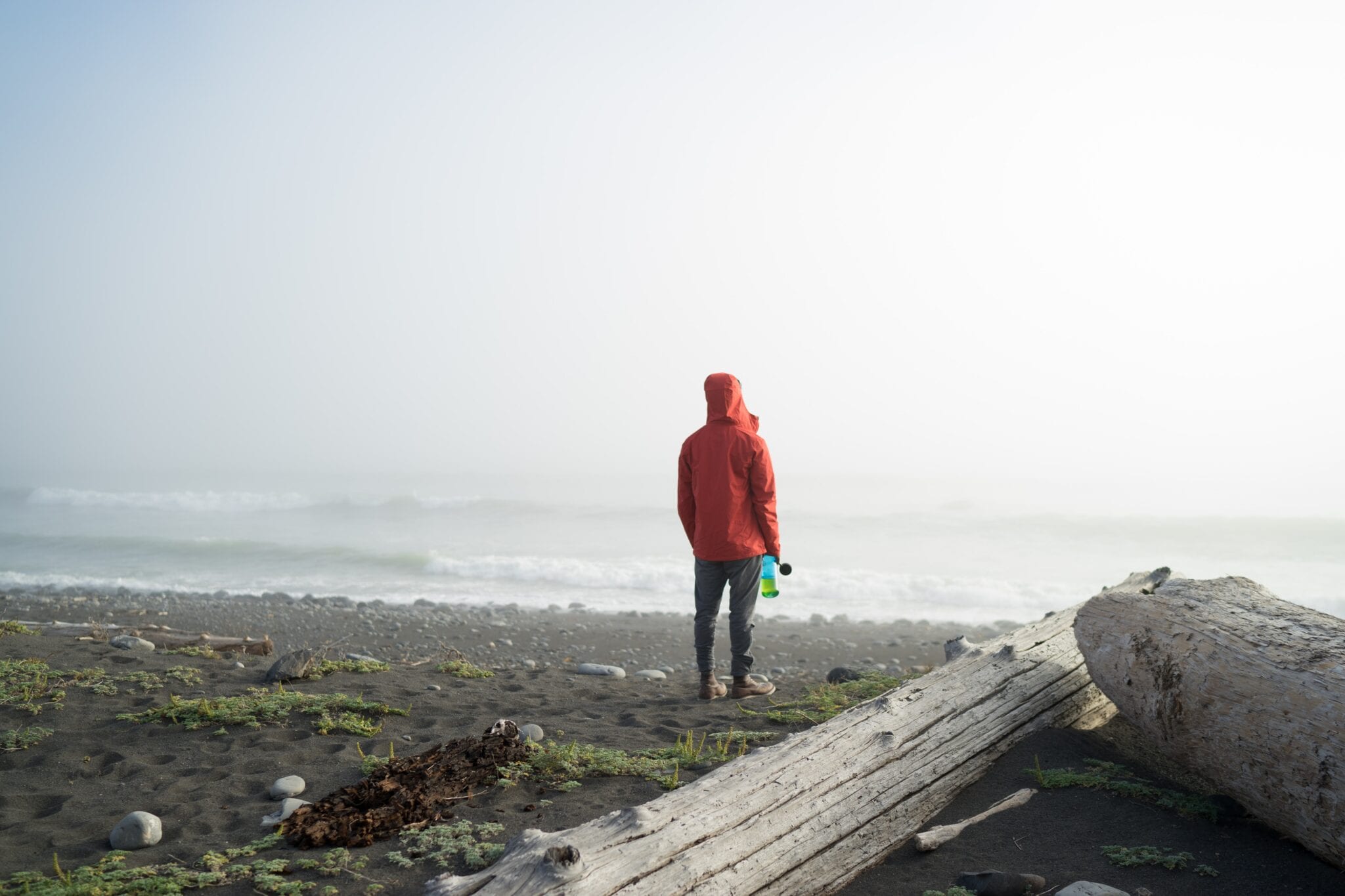
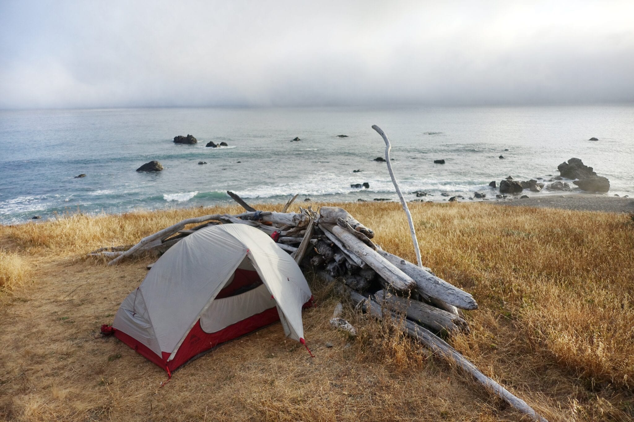
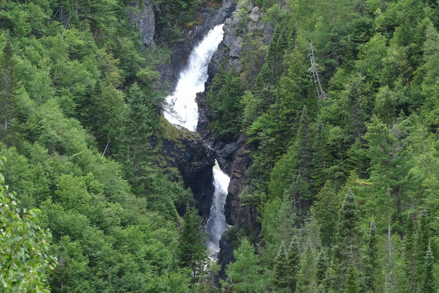
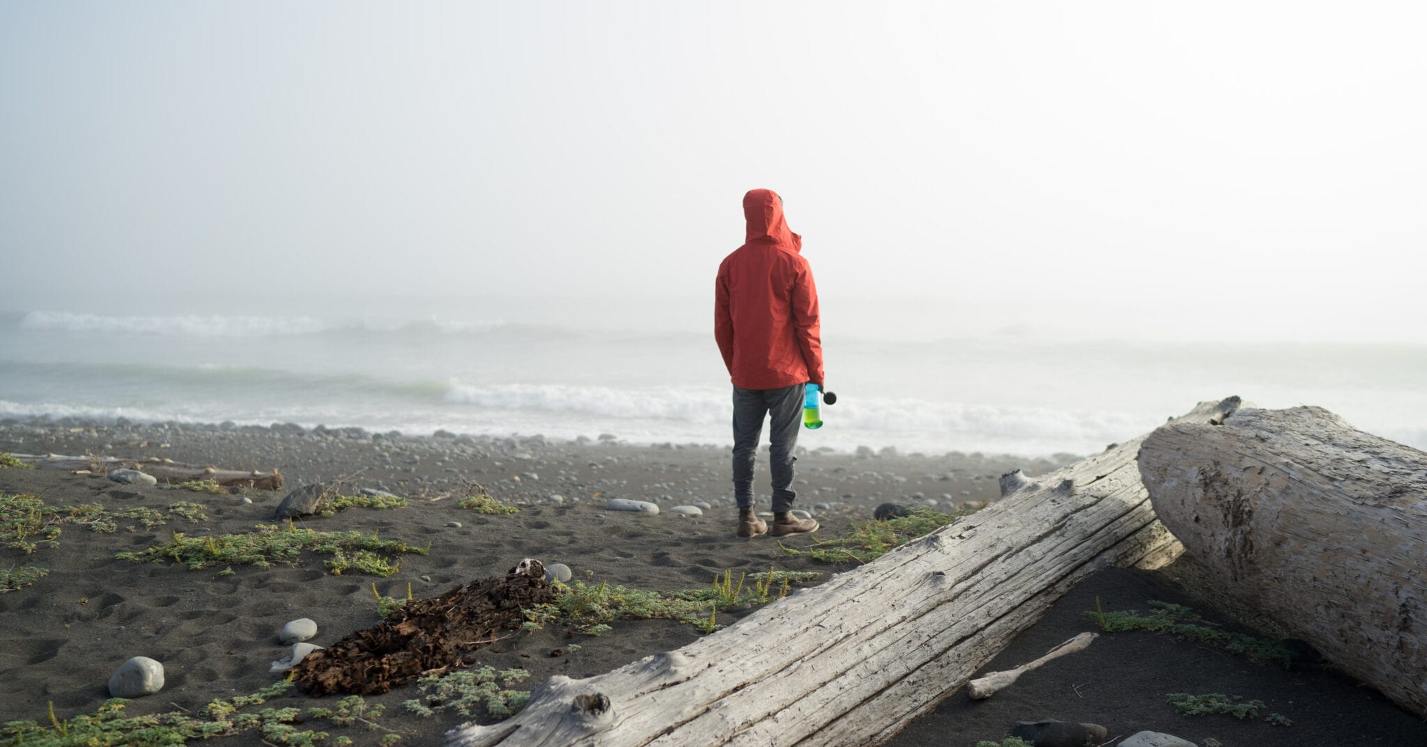
As one of the (if not the) only true coastal wilderness experiences in the contiguous United States, the Lost Coast Trail is unparalleled in its magic. The trail itself never strays more than a hundred or so yards from the shore, when it’s not just traversing the rocky beach. This lends to days of endless views overlooking the ocean, whale watching, and catching sunsets on the ocean horizon. Dispersed camping is abundant, and hikers get to spend their nights on bluffs, below waterfalls, and on the beach itself. The Lost Coast is on Sinkyone and Mattole native land (1).
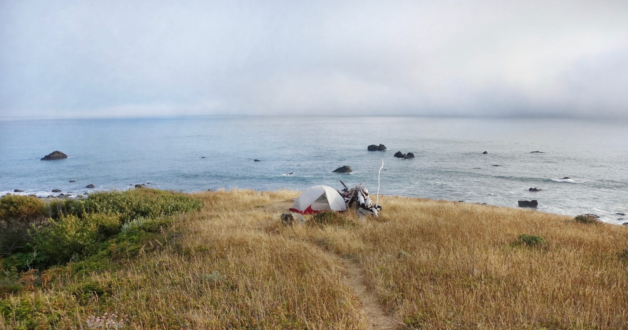
Photo by Kenna Sarae
The Experience
The abundance of aquatic and terrestrial wildlife is in many ways a time capsule of preindustrial California. Deers, coyotes, and black bears all brave the steep cliff sides and often explore the rocky beaches for food before disappearing back up narrow creek valleys. In the right season, elephant seals use this section of coast as a migratory resting space and can be seen fighting for a warmer spot in the rookery on the beach or on nearby rocks. Migrations of humpback and other whales are abundant in the summer as they swim south for winter. (On my first trip on the LCT I was lucky enough to hike the entire day alongside a humpback whale, so now I only hike the trail southbound in hope of it happening again!)
The Lost Coast Trail is subject to dramatic tidal changes (hiking has to be planned around high tides to avoid impassable sections), which means a treasure trove of benthic creatures are left on the shore twice a day. Low tide exposes tide pools full of pink and purple urchins, red and orange sea stars, sea cucumbers, and crabs of every size. High tide leaves beautiful ribbons of colorful kelp, crab shells, urchin skeletons, and since passed sea stars along the shore.

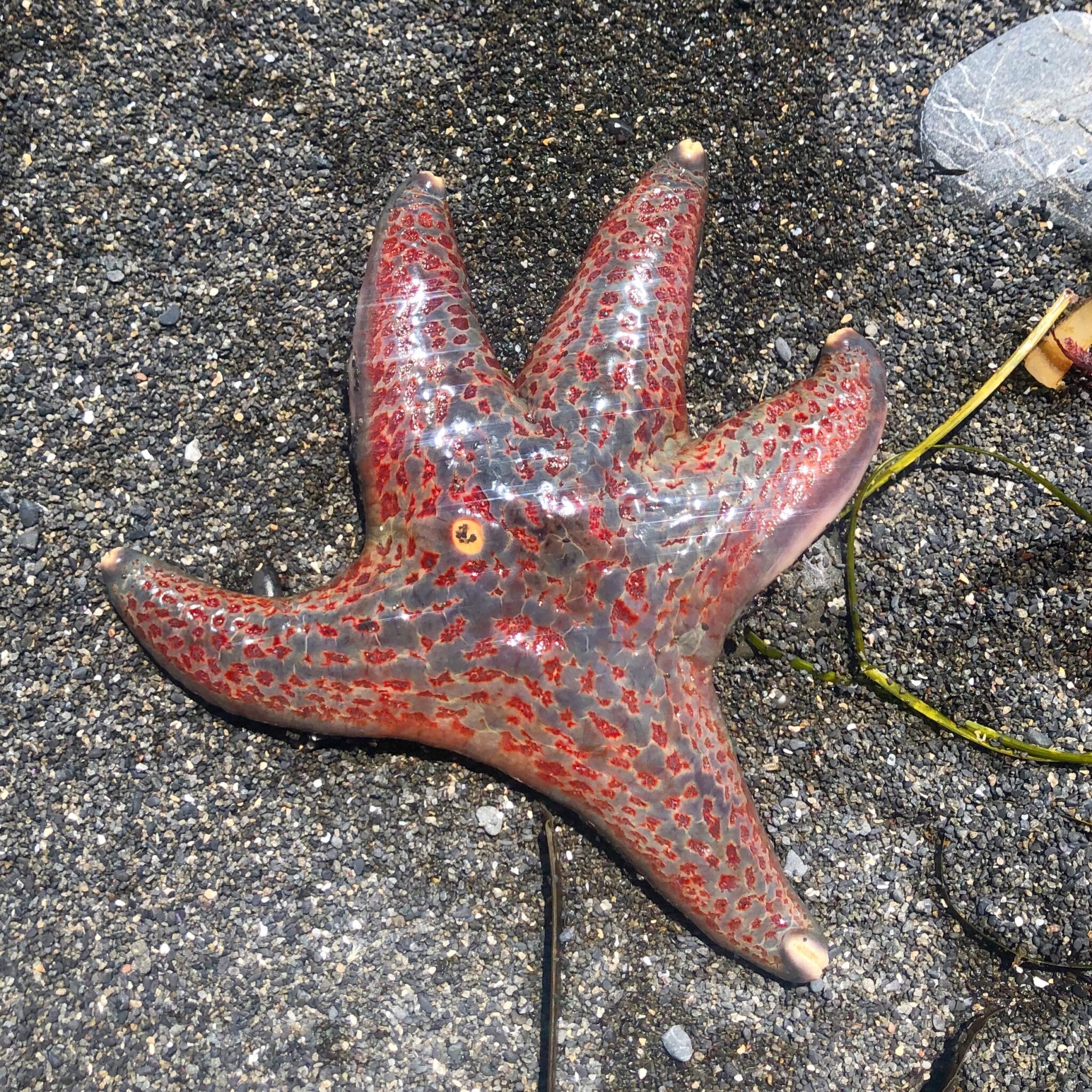

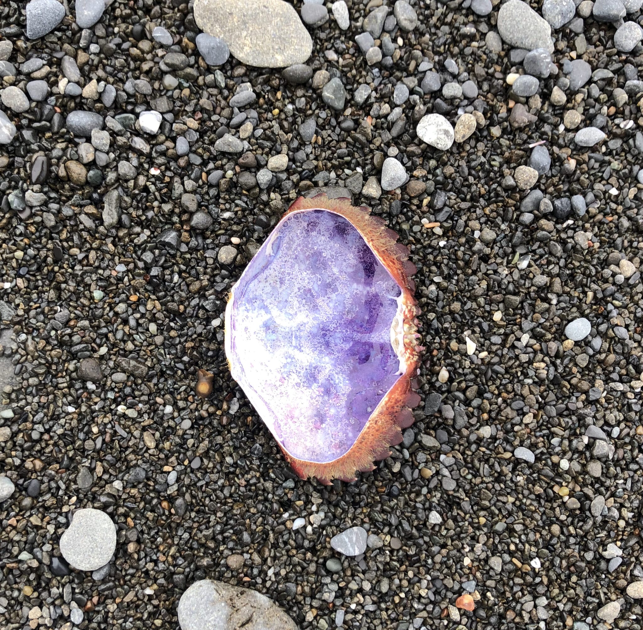
Photos by Kenna Sarae
June to August the trail is engulfed in California’s famous fog, with periodic sunshine exposing the turquoise water.
Water is abundant on the Lost Coast Trail, making it feel much like a Pacific Northwest fairytale. In springtime, the hills are a bright green and bursting with wild flowers, and every drainage out of the mountains is flowing, many of which create beautiful waterfalls off of the dramatic cliffs or seeping out of rocks. Once the hills turn golden in summer, there is rarely a stretch of more than a mile or two without a clean, flowing water source. June to August the trail is engulfed in California’s famous fog, with periodic sunshine exposing the turquoise water. The near-flat nature of the trail can make it accessible to less experienced hikers. There are, however, significant stretches of beach walking. The beaches of the Lost Coast are primarily mid- to large- sized rocks, which can make the going difficult for folks with bad knees or ankles.
As such, the LCT is a year-round trail. Limited permits are distributed, which, in combination with the abundant dispersed camping, means a relatively remote, quiet experience. I have hiked the trail multiple times, in multiple seasons, and keep coming back to its shores again and again. The Lost Coast Trail is unmatched by any other trail I’ve hiked.
Permits on the Lost Coast Trail
Wilderness permits are required to hike the Lost Coast Trail and are distributed by the Bureau of Land Management (BLM). They are free but include a $6 processing fee. Permits for the following year open in October (2021 permits will be available October 1, 2020) – reservations are typically made very early, so it’s worth planning your trip far in advance. With smaller groups, you can sometimes have good luck with a last minute trip as other party’s plans change and permits become intermittently available.
(1) Native Lands App – https://native-land.ca
Read more!
Check out some related blog posts!

Download our popular hiking and biking guides!

Trail guides that get you to places you’ve dreamed of.
As the makers of Guthook Guides, Bikepacking Guides, and Cyclewayz, we help you navigate the most popular trails around the world on your smartphone. Our hiking guides and biking guides work completely offline. Let Guthook guide your next adventure!
Showers Lake Vista, Tahoe Rim Trail
Photo courtesy of the Tahoe Rim Trail Association

Showers Lake Vista, Tahoe Rim Trail
Photo courtesy of the Tahoe Rim Trail Association
Trail guides that get you to places you’ve dreamed of.
As the makers of Guthook Guides, Bikepacking Guides, and Cyclewayz, we help you navigate the most popular trails around the world on your smartphone. Our hiking guides and biking guides work completely offline. Let Guthook guide your next adventure!
Download our popular hiking and biking guides!
About the Author

Kenna Sarae
Kenna-Sarae grew up in Northern California visiting her grandmother’s cabins along the PCT, which helped catalyze her love for the outdoors and interest in backpacking. She is particularly passionate about the intersection between sustainability and outdoor recreation, connecting with womxn and communities that have been historically underrepresented in outdoor spaces, and pesto pasta. You’re likely to find her having an impromptu dance party with her pup, whether it’s while backpacking, climbing, mountain biking, or just on the side of the road. Kenna-Sarae also collected the data for our Lost Coast Trail guide!
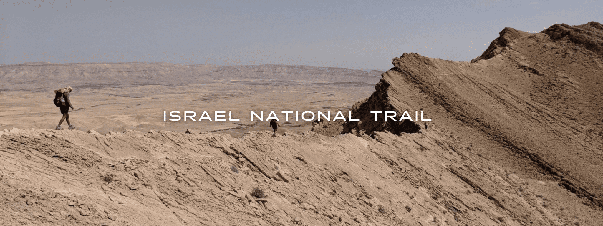
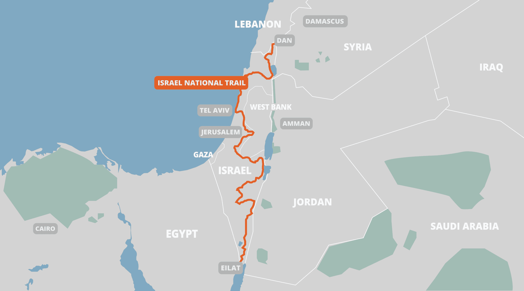
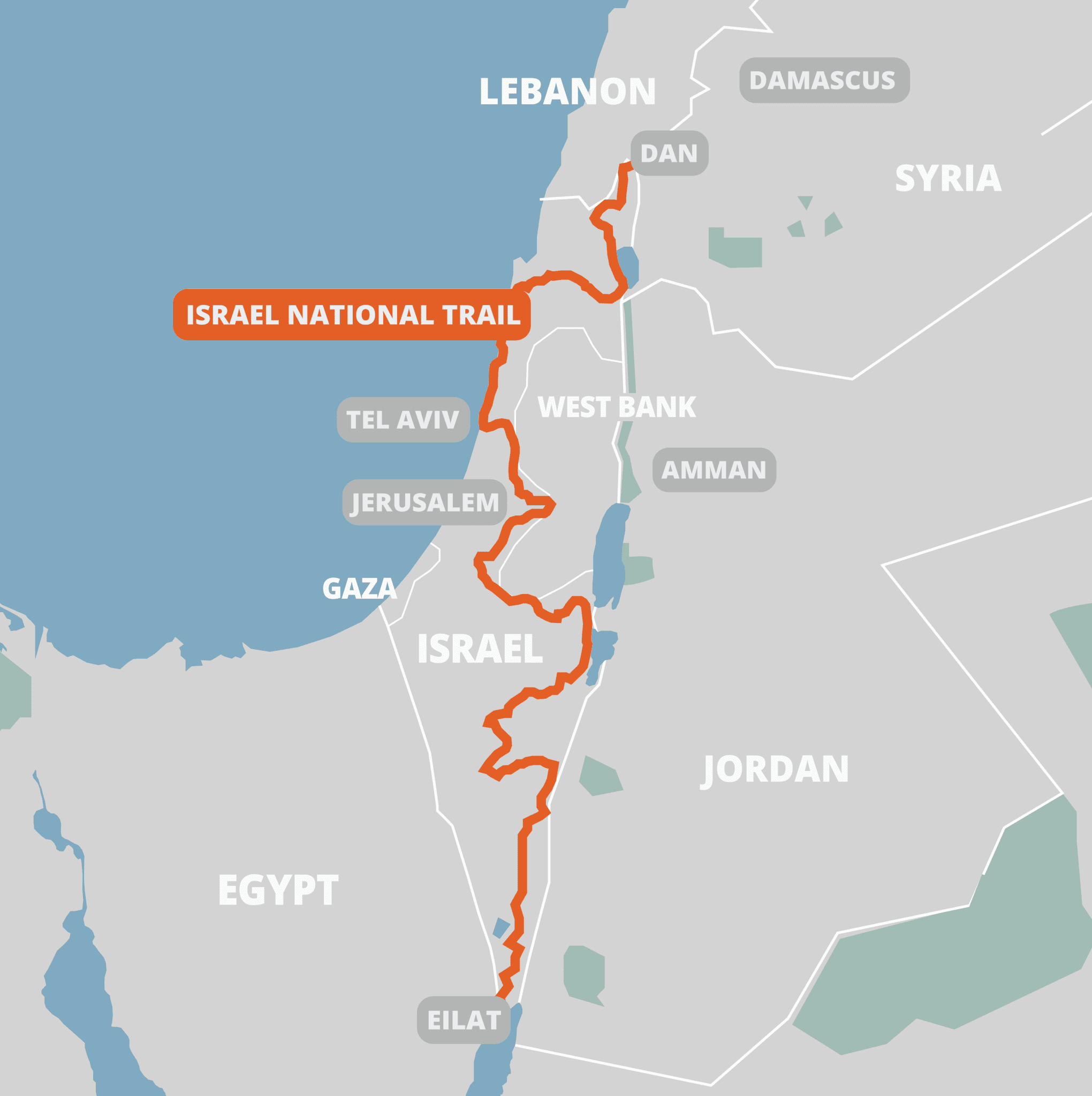
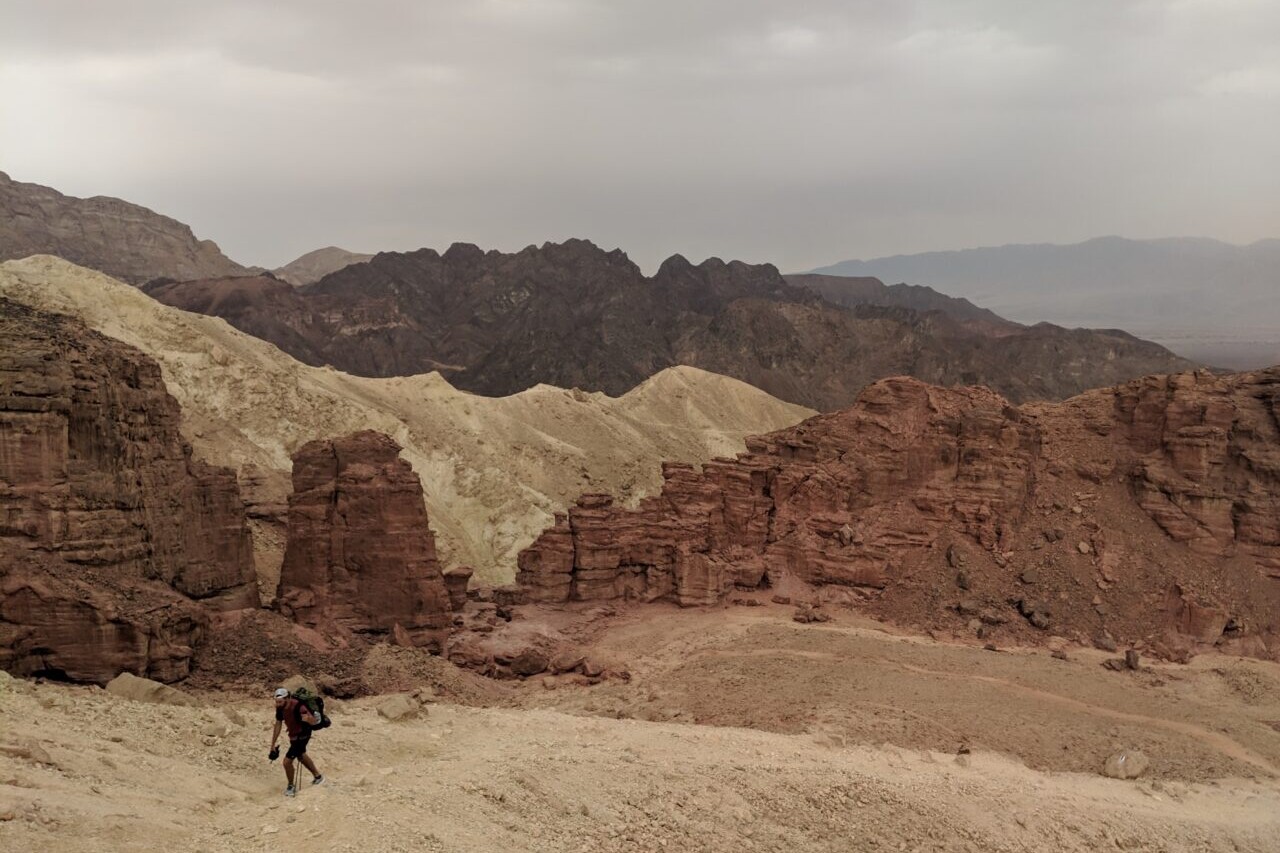
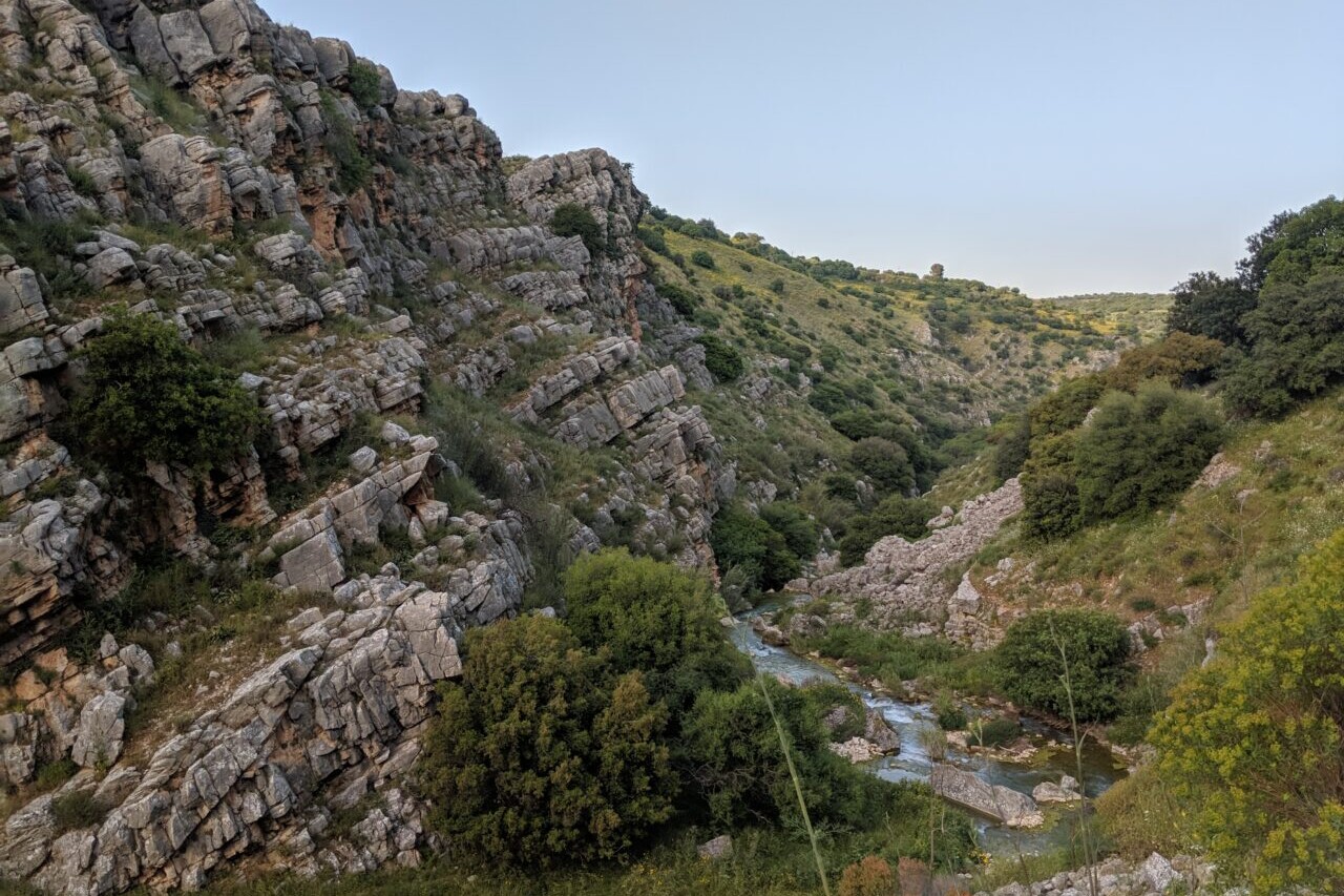
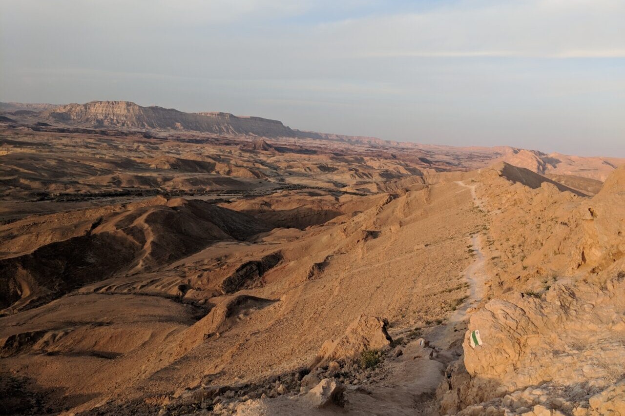
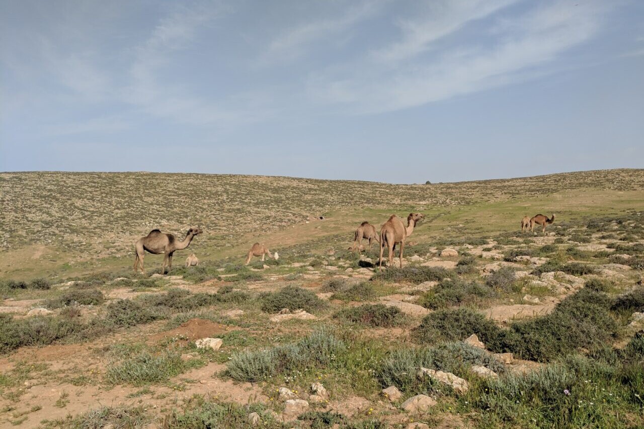
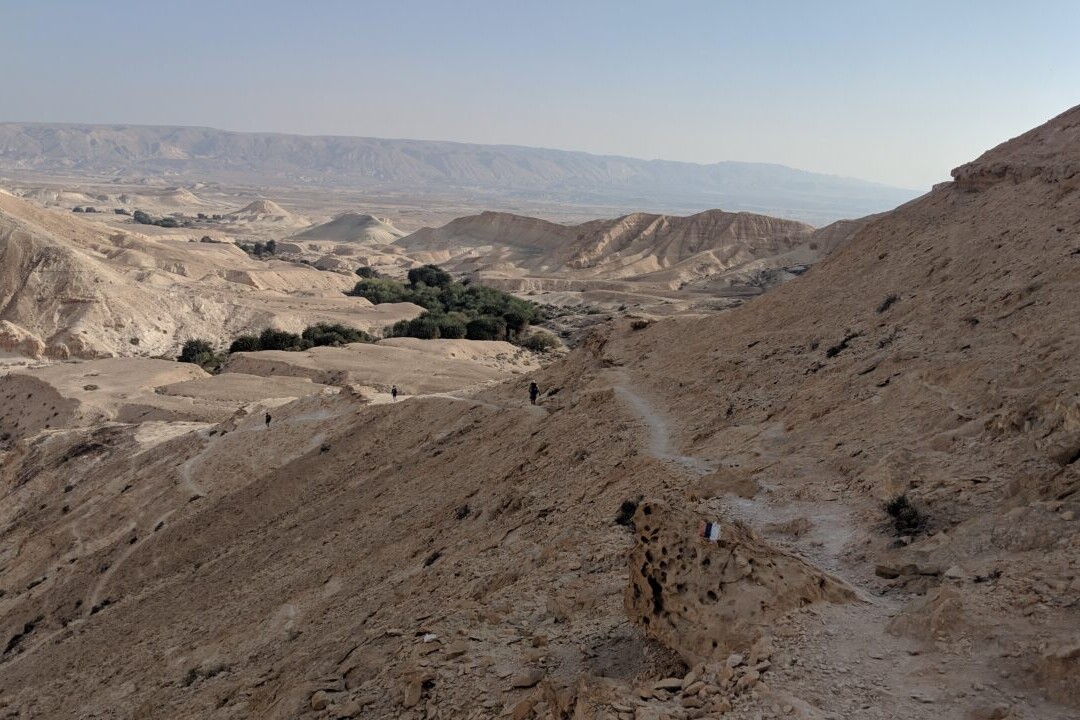
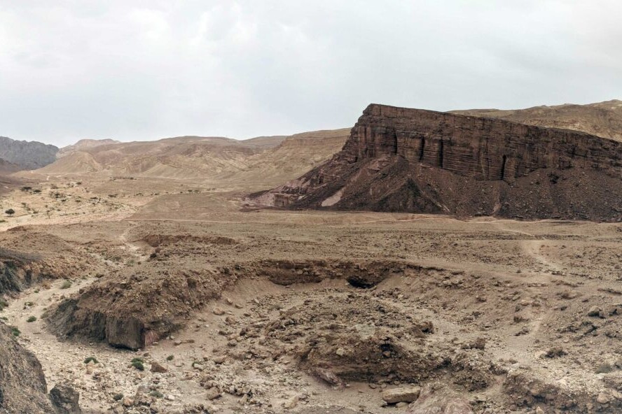
Israel National Trail
The Israel National Trail crosses the entire country of Israel. The trail begins at Dan, near the Lebanese border in the northernmost region of the country, and extends to Eilat at the southernmost tip of Israel on the Red Sea. The INT traverses a wide variety of ecosystems ranging from stunning desert craters, expansive beaches, to lush coniferous forests.
20% off for our Hiking Season Kick-off SALE! The Wonderland Trail is now $11.99 and the Western Hiker Special is now $39.99.
Photo courtesy of Elliot Jarry-Boulduc
4.8 ★★★★★ | 17K+ Reviews
Israel National Trail
664 miles (1,069 km) • Israel
Download our guide to access the INT map, tracks, waypoints, and comments! The Israel National Trail crosses the entire country of Israel. The trail begins at Kibbutz Dan, near the Lebanese border in the northernmost region of the country, and extends to Eilat at the southernmost tip of Israel on the Red Sea. The INT traverses a wide variety of ecosystems ranging from stunning desert craters, expansive beaches, to lush coniferous forests.
$14.99 full guide
664 mi (1,069 km)
$14.99 full guide
Israel National Trail Map
How can I get it?
The Israel National Trail map is available as an in-app purchase in our Guthook Guides app, a free download from the Apple App Store or the Google Play Store.
Our iOS and Android apps do differ slightly in their appearance. However, the majority of their features remain the same, and they access the same trail guide data.
The Israel National Trail crosses the entire country of Israel. The trail begins at Kibbutz Dan, near the Lebanese border in the northernmost region of the country, and extends to Eilat at the southernmost tip of Israel on the Red Sea. The INT traverses a wide variety of ecosystems ranging from stunning desert craters, expansive beaches, to lush coniferous forests.
US$14.99
Photos of the Israel National Trail
Hike more.
Check out some of the other trail guides we offer!

Thru-Hiking 101: How Much Stove Fuel Should You Carry
Planning an adventure? Check out our popular trail guides! 4.8 stars (17K+ ratings)
The best way to determine how much fuel you will need while hiking is to test your stove at home before your hike.
Paul Bodnar Educational 8/06/2020
Paul Bodnar
Educational
8/06/2020
I recommend cooking at least one representative day of food at home and then use the amount of fuel consumed to estimate how much fuel you will need on the trail. For example, if you plan on boiling just 2 cups of water a day then I would recommend boiling 2 cups of water at home using your stove. Then use the amount of fuel you consumed to calculate how long a full tank of fuel would last while hiking. Below is a step by step procedure on how to estimate how long your fuel will last while backpacking.
Step 1: Follow the stove recommendations for the safe operation of your stove.

Step 2: Weigh the fuel canister before using the stove.

Step 3: Use the stove for cooking each representative meal for the day. This might be three meals or just one. For a crude estimate you can just boil the amount of water you need for each meal.

Step 4: Weigh the fuel canister after cooking a representative full day of meals.

Step 5: Take the weight of the canister before cooking and subtract the weight of the canister after cooking. The weight difference is the approximate amount of fuel you will use in a day of cooking.
Step 6: Look at the weight of fuel marked on the side of the canister. Then divide this number by the amount of fuel you used to cook a day of food. The result equals the approximate days a fuel canister will last while hiking.


marked fuel canister weight / (initial fuel canister weight – fuel canister weight after a day of cooking) = estimated days of fuel from a full canister of fuel
Here’s an example of how many days a 220 gram fuel canister will last:

Fuel Tip: Have a partial canister and want to know how much fuel is left?
Weigh a full canister of the same brand and size. Then weigh the partially full canister. The difference in the weight between the full canister and the partial canister is equal to the amount of fuel consumed in the partially full canister. Subtract the difference from the marked weight of the full canister. This is the amount of fuel that remains in the partial canister.

fuel weight marked on side of canister – (weight of full canister – weight of partially used canister) = amount of fuel remaining
Read more!
Check out some related blog posts!
Download our popular hiking and biking guides!
Trail guides that get you to places you’ve dreamed of.
As the makers of Guthook Guides, Bikepacking Guides, and Cyclewayz, we help you navigate the most popular trails around the world on your smartphone. Our hiking guides and biking guides work completely offline. Let Guthook guide your next adventure!
Showers Lake Vista, Tahoe Rim Trail
Photo courtesy of the Tahoe Rim Trail Association
Showers Lake Vista, Tahoe Rim Trail
Photo courtesy of the Tahoe Rim Trail Association
Trail guides that get you to places you’ve dreamed of.
As the makers of Guthook Guides, Bikepacking Guides, and Cyclewayz, we help you navigate the most popular trails around the world on your smartphone. Our hiking guides and biking guides work completely offline. Let Guthook guide your next adventure!
Download our popular hiking and biking guides!
About the Author
Paul Bodnar
Paul has always liked hiking and thru-hiked the Pacific Crest Trail in 1997 after college. After years of working in chemistry, he wanted to create a career involving the outdoors, so he hiked the Pacific Crest Trail again in 2010 to do research for his guide book Pocket PCT. He realized that creating a smartphone app for navigating the outdoors would make it easier to keep the data current and provide a better way to navigate. While hiking with Ryan (aka Guthook) in 2010, they decided to work together to create the first comprehensive smartphone guide for the Pacific Crest Trail. Now with the help of a team of great people they have created over 50 guides for trails around the world.
Thru-Hiking 101: Leave No Trace (LNT) Principles on Trail
Planning an adventure? Check out our popular trail guides! 4.8 stars (17K+ ratings)
Thru-Hiking 101: Leave No Trace (LNT) Principles on Trail
Leave No Trace is a broad set of principles that we should all use to guide our outdoor behavior. Here is our take on the Seven Principles as they apply to no-impact hiking.
Kenna Sarae, Dahn Pratt Educational 7/31/2020
1. Plan Ahead & Prepare
Why it’s important:
- By planning and preparing in advance, you can mitigate the majority of potential breaches of the following 6 principles before evening getting on trail. Understanding local regulations/requirements and designing your personal backcountry systems are key to successful planning.
How to employ it:
- Research local fire regulations, camping restrictions, and wildlife. Always check the local land agency’s website (BLM, Forest Service, Park Service, etc.), and contact them if you need clarification.
- Create a system for waste management (trash and recycling bags or jars, wag-bags, etc. -see principle 3: Dispose of Waste Properly)
Kenna: Note that this principle is not an excuse to ridicule folks who are less experienced in the outdoors than you are, or have less access to planning tools. We are all constantly learning, and the best thing you can do for the community and the environment is to support everyone in that learning.
2. Travel & Camp on Durable Surfaces
Why it’s important:
- Being intentional with where we hike, break, and camp helps protect fragile ecosystems and limits usage to specific areas. This is particularly important on high-use trails, but hikers should always be aware of where they are walking and camping.
How to employ it:
- Stay on trail (and keep any animal companions on trail as well).
- Do not use shortcuts at switchbacks. They cause erosion and save little time.
- Avoid hiking or camping on moss, flowers, lake edges, areas with flora, open alpine zones or other generally sensitive ecosystems.
- Find surfaces that will not be damaged by your shelter and body weight, such as exposed and compacted soil, small rocks, or sand. Ideally, use established campsites.
Kenna: With the rise of social media, this principle has been increasingly compromised for the sake of photographs (i.e. camping at lakes edges to get sunrise shots, or leaving the trail to get a better view). Be mindful of what you are damaging for a photograph.

Desert ecosystems are particularly sensitive to trampling and incorrectly disposed of waste (wagbags are often required).
Photo courtesy of Kenna Sarae.
3. Dispose of Waste Properly
Why it’s important:
- Properly disposing of human waste mitigates pollution of nearby water sources (no, human poop is not like animal poop!), the spread of diseases, and the generally unpleasant experience of finding someone else’s poop.
- Properly disposing of food waste minimizes animal habituation and the spread of non-native species into ecosystems. (In this context, habituation is the process by which animals become familiar with the habits of trail-users and adjust their natural behavior. For example, if hikers routinely leave food crumbs at a regularly used campsite in Glacier National Park, local bears may become habituated to finding food there. Not only does this create an unhealthy dependence on humans for food, but also greatly increases the likelihood of a negative human-bear interaction, which is dangerous both for hikers and for the bear.)
How to employ it:
- If it don’t grow, don’t throw! (Apple cores, orange peels, seeds and nuts, should not be left on trail or at camp. They can take decades to break down and introduce non-native competitors into the ecosystem.)
- Dilution is not the solution to pollution! (Soap (even if biodegradable), toothpaste, and dirty water should not be diluted in streams or lakes. More information below.)
- Pack It In, Pack It Out! (General rule of thumb: if you bring it into your hike with you, it should leave your hike with you.)
Click to Expand:
- Cat holes should be dug 6-8 inches deep, 4-6 inches wide (I generally teach a shaka deep and a shaka wide -Kenna).
- Use a trowel to dig & cover your hole, but not to move feces!
- Your business should be done and buried at least 200 ft (70 adult steps) from water sources, trails, and campsites (I generally say 300 ft. from water if I am in a region with heavy rainfall -KK), ideally in a space where runoff will not carry your waste into nearby water.
- Toilet paper
- Pack it out (double ziplock bag it, cover the outside with duct tape for sights and smells).
- Don’t bring it!
- Use a backcountry bide or natural toilet paper. Some examples include:
- Rocks (preferably smooth)
- Snowballs
- Sticks (preferably smooth)
- Pinecones (go with the grain!)
- Leaves (be extremely careful about what you’re using!)
- Tall grass
- Moss
- (Be sure to bury any natural toilet paper that you use inside of your cathole.)
- Use a backcountry bide or natural toilet paper. Some examples include:
- Feminine products do not biodegrade, and shouldn’t be left in catholes or elsewhere.
- If using tampons/pads, pack them out in a double ziploc bag or in a designated nalgene/water bottle. Whichever you use, cover it with duct tape to mitigate smell and visuals.
- Use a menstrual cup! They are hygienic, affordable, and extremely convenient on trail. Just be sure to practice using one in advance of getting on trail and to bury contents in a cathole 200ft+ from any water source. I carry extra water to clean mine when emptying it.
- As mentioned, wastewater from dishes, handwashing, and bathing should be disposed of 200 ft. from water sources.
- Scatter dishwater after it is strained in an arcing motion to maximize dispersion.
- Similarly, toothpaste should be scattered with a good old spray spit. (Pretend you’re a sprinkler, or that your friends are funny and this is a spit-take.)
- If you choose to swim in lakes or streams, be mindful of what is on your skin and leaching into water sources (i.e. sunscreen, lotion, insect repellent) — especially in areas where water is scarce.


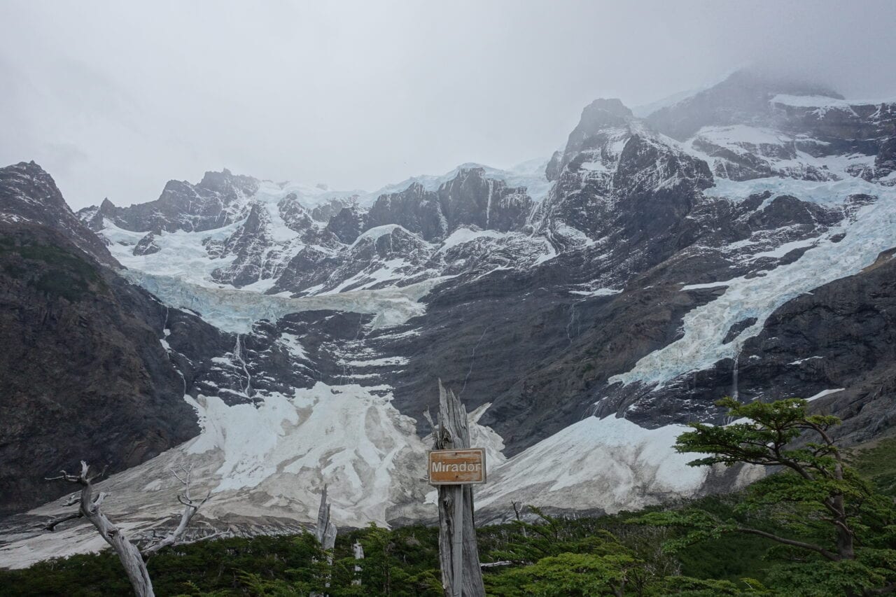
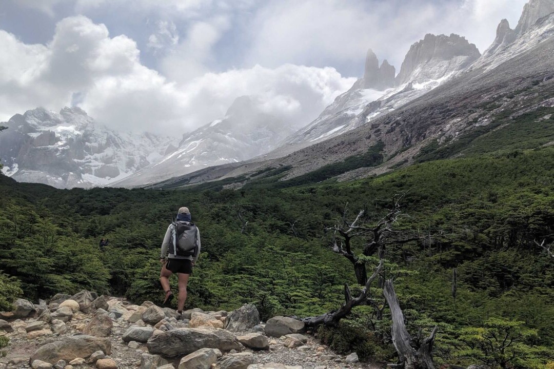
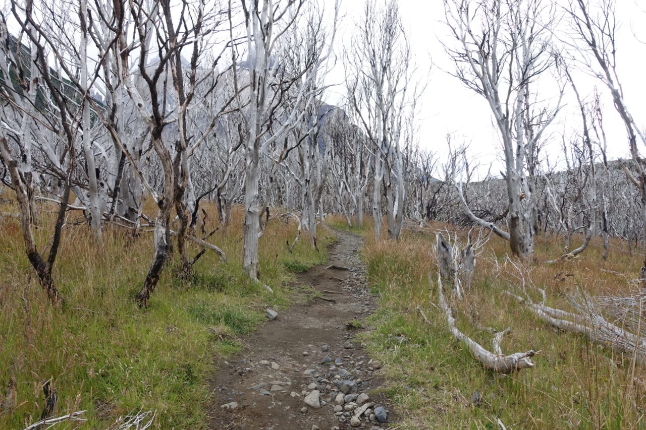
High use areas, like the Torres del Paine circuit in Chile, are particularly at risk of the adverse effects of poor LNT practices. Photos courtesy of Kenna Sarae.
4. Leave What You Find
Why it’s important:
- Leaving resources in their ecosystem both preserves and protects the natural ecosystem and allows for others to enjoy what you’ve seen. Equilibrium can be easily affected by users removing resources such as wildflowers. Cultural assets should be treated with the same respect and left where found.
How to employ it:
- Do not take anything out of an ecosystem unless it is clearly human trash (i.e. candy bar wrappers).
- Avoid constructing “improvements” (tent sites, tables, lean-to’s, non-trail marking cairns, etc.).
Dahn: Take only photos, leave only footsteps is a great motto. (Just remember not to tag your location when posting photos that you took! Digital LNT includes not encouraging overuse of spaces that are heavily featured on social media platforms.)

Albeit common, cairns should only be constructed as trail markers and generally only by trail maintenance crews.
Photo courtesy of Dahn Pratt
5. Minimize Campfire Impacts
Why it’s important:
- 85% of wildland fires are human caused; the importance of minimizing your campfire impact cannot be overstated. Having fires can deplete ecological resources (e.g. cutting down trees, or taking deadfall that is important to cultivating flora & fauna) and emits considerable amounts of carbon into the atmosphere.
How to employ it:
- Know the current fire regulations in the area that you are hiking.
- Keep your fires small and manageable — be mindful of the space you are using. Use established rings with buffer zones to flammable vegetation.
- Do not burn trash in fires, pack it out.
- Dead and down! (Do not harvest firewood from living trees, or from dead trees that are still standing).
- Collect firewood away from established campsites.
Dahn: I never make campfires because I think of fire as a pet or a newborn, it’s something you need to constantly monitor and manipulate. Additionally the constant depletion of resources can alter (visually and ecologically) the space around your campfire. It’s actually very difficult to have a responsible fire as you need to make sure it’s fully out, and responsibly build and source, which requires a lot of work, time, and resources.
6. Respect Wildlife
Why it’s important:
- Human-wildlife contact is dangerous for animals and for hikers. “A fed bear is a dead bear.” See our food waste and habituation section under “Dispose of Waste Properly.”
How to employ it:
- Respect space between you and wildlife, never approach fauna nor make distressing noises, etc. to elicit a reaction
- Never feed animals and conduct thorough camp sweeps to pick up and pack out any dropped crumbs, etc.


Wildlife on the Jordan & Israel National Trail (respectively).
Photos courtesy of Dahn Pratt.
7. Be Considerate of Other Visitors
Why it’s important:
- Ultimately, this principle is intended to allow every hiker and other trail-user to enjoy their experience. Much of this is dependent on your actions with the previous six principles.
How to employ it:
- Avoid playing loud music or yelling.
- Avoid shooting guns.
- Keep pets on leash (or equivalent) or under strong voice command.
- Uphill hikers have right-of-way. Hikers generally yield to equestrians (horses), and bikers generally yield to equestrians and hikers.
- Be active in providing a safe, inclusive environment to all users. Being welcoming and inclusive to BIPOC, LGBTQA+ folks, and womxn includes, but is not limited to, speaking out against disrespectful remarks, and stepping in when unsafe situations arise.
Read more!
Check out some related blog posts!
Download our popular hiking and biking guides!
Trail guides that get you to places you’ve dreamed of.
As the makers of Guthook Guides, Bikepacking Guides, and Cyclewayz, we help you navigate the most popular trails around the world on your smartphone. Our hiking guides and biking guides work completely offline. Let Guthook guide your next adventure!
Showers Lake Vista, Tahoe Rim Trail
Photo courtesy of the Tahoe Rim Trail Association
Showers Lake Vista, Tahoe Rim Trail
Photo courtesy of the Tahoe Rim Trail Association
Trail guides that get you to places you’ve dreamed of.
As the makers of Guthook Guides, Bikepacking Guides, and Cyclewayz, we help you navigate the most popular trails around the world on your smartphone. Our hiking guides and biking guides work completely offline. Let Guthook guide your next adventure!
Download our popular hiking and biking guides!
About the Authors
Kenna Sarae
Kenna-Sarae grew up in Northern California visiting her grandmother’s cabins along the PCT, which helped catalyze her love for the outdoors and interest in backpacking. She is particularly passionate about the intersection between sustainability and outdoor recreation, connecting with womxn and communities that have been historically underrepresented in outdoor spaces, and pesto pasta. You’re likely to find her having an impromptu dance party with her pup, whether it’s while backpacking, climbing, mountain biking, or just on the side of the road.

Dahn Pratt
Dahn began collecting trail data for Atlas Guides in 2017 on his 10,000 mile project called Chasing Summer. The most recent data for the Te Araroa, Pacific Crest Trail, Continental Divide Trail, Jordan Trail and Israel National Trail all came from Dahn. Now you will find Dahn on the office side of Atlas Guides doing all kinds of things, like data analytics, data processing, customer support, and more. When he is not hiking he can be found camping, or making bad jokes.
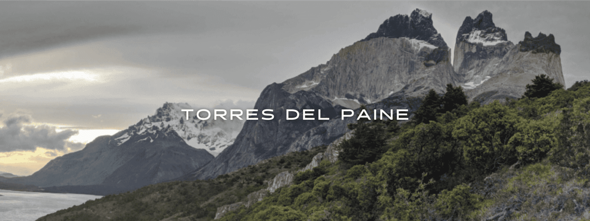
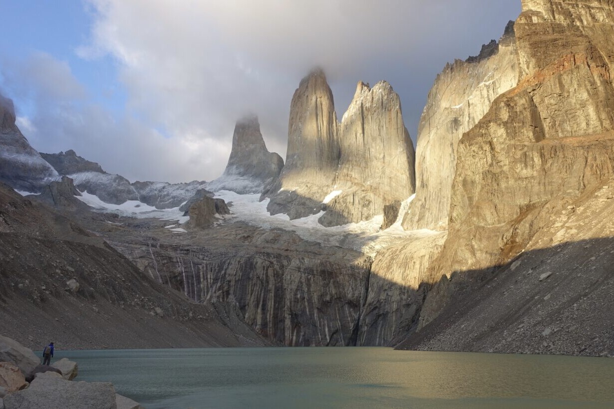
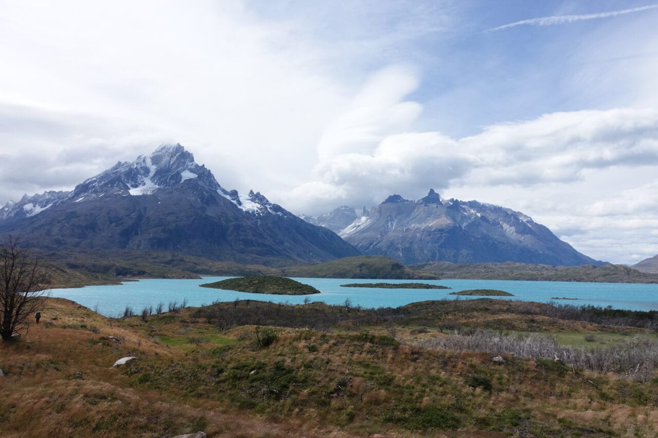
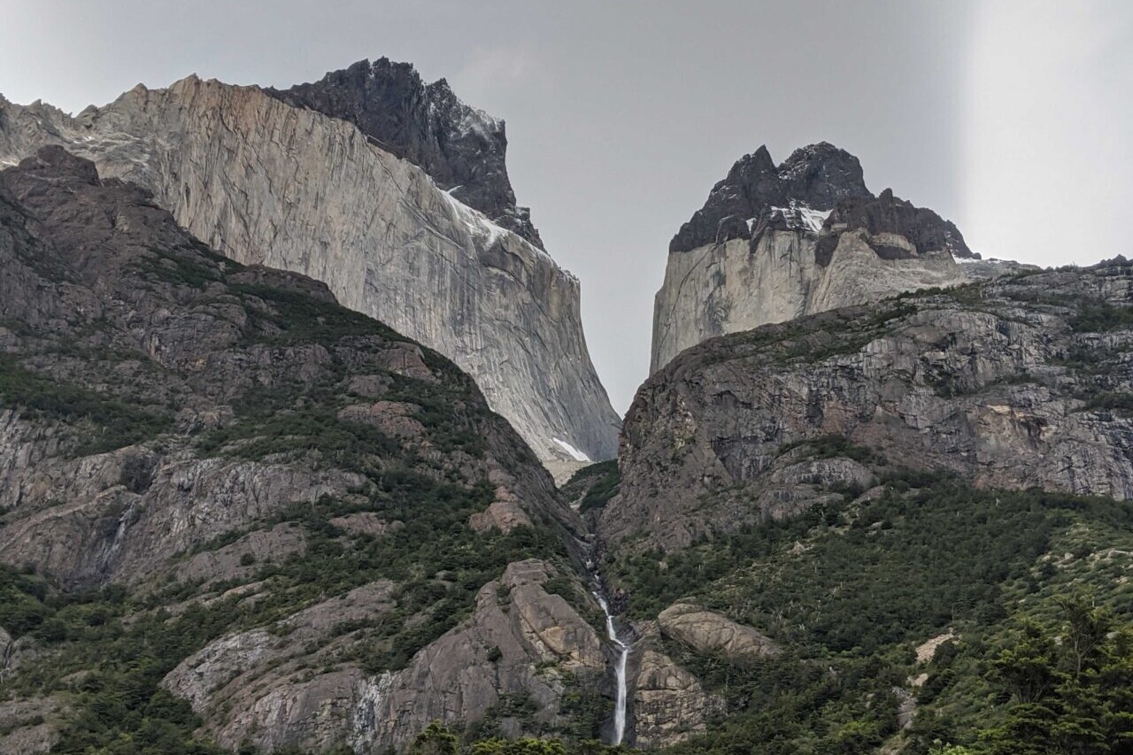
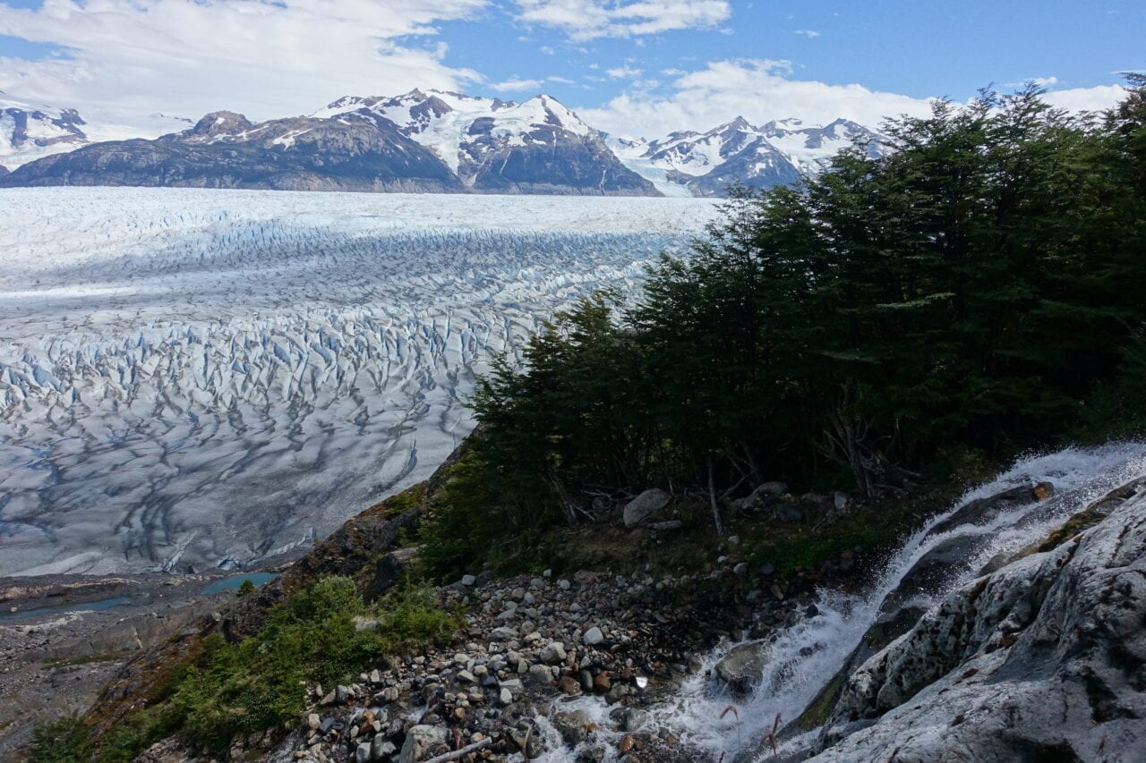
Torres del Paine
Torres del Paine includes the “O” and “W” routes of Torres del Paine National Park in the heart of Chilean Patagonia. Known for its soaring mountains, bright blue icebergs cleaving from glaciers, and golden grasslands full of rare wildlife; this trail is a world-class experience.
20% off for our Hiking Season Kick-off SALE! The Tahoe Rim Trail is now $11.99 and the Western Hiker Special is now $39.99.
30% off for our Small Business Saturday SALE! The Tahoe Rim Trail is now $9.99.
Photo courtesy of Dahn Pratt
4.8 ★★★★★ | 17K+ Reviews
Torres del Paine
78 miles (120 km) • 39 miles ("W" Circuit) • Torres del Paine National Park, Chilean Patagonia
Download our guide to access the Torres del Paine map, tracks, waypoints, and comments! Torres del Paine includes the "O" and "W" routes of Torres del Paine National Park in the heart of Chilean Patagonia. Known for its soaring mountains, bright blue icebergs cleaving from glaciers, and golden grasslands full of rare wildlife; this trail is a world-class experience.
$9.99 FULL GUIDE
78 mi (120 km) • 39 miles (“W” Circuit)
$9.99 full guide
Torres del Paine Map


How can I get it?
The Torres del Paine map is available as an in-app purchase in our Guthook Guides app, a free download from the Apple App Store or the Google Play Store.
Our iOS and Android apps do differ slightly in their appearance. However, the majority of their features remain the same, and they access the same trail guide data.
Full-featured guide to the 75-mile “O” Circuit (encompassing the “W” Route)
$9.99
Full-featured guide to the 39-mile “W” Route
Included with purchase of Torres del Paine O Circuit ($9.99)
Photos of the Torres del Paine Circuit
Hike more.
Check out some of the other trail guides we offer!

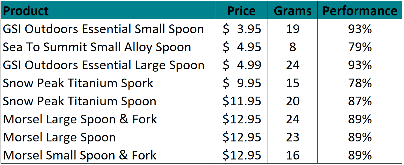
The Best Ultralight Backpacking Spoon
Planning an adventure? Check out our popular trail guides! 4.8 stars (17K+ ratings)
The Best Ultralight Backpacking Spoon
A backpacking spoon is one of the most cherished pieces of gear a hiker carries. We tested seven different ultralight spoons for performance, price, and weight to help you make your utensil decision!
Paul Bodnar Educational 7/23/2020
Paul Bodnar
Educational
7/23/2020
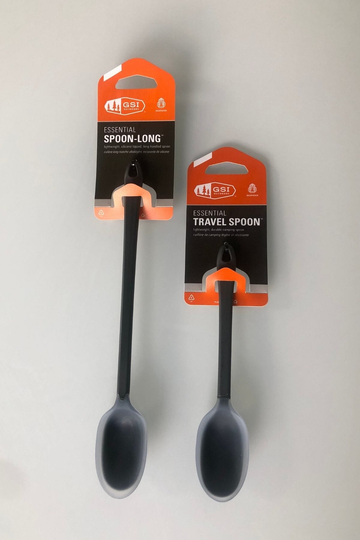
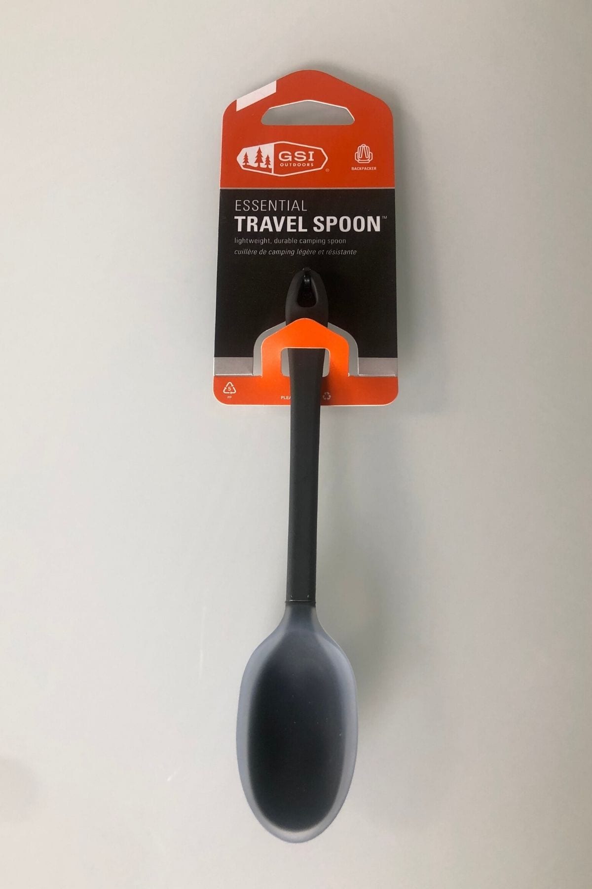
GSI Essential Spoon, Nylon with Silicone Edge

Morsel Spoon, Rubber Edge

My backpacking spoons: alloy, titanium, titanium (L-R)
Methods
To test the effectiveness of each spoon, I measured out exactly 50 grams of creamy peanut butter into a small titanium pot, evenly distributed on the bottom of the pot. I scooped the peanut butter out of the pan by taking one 360-degree scoop around the bottom of the pot. Then I wiped the spoon clean. I repeated this scoop-and-clean process 2 more times, for a total of 3 scoops. Then I weighed the pot to calculate the amount of peanut butter remaining in the pot. I did this process 3 times for each spoon and averaged the results. The best working spoon would remove the most peanut butter.
Spoon Performance After 3 Scoops

Click to enlarge.
Results
The GSI Essential Spoons (small and long handle) were the big winners for peanut butter removal performance: these spoons removed 93% of the peanut butter after just three scoops. The Morsel spoons performed almost as well and removed 89% of the peanut butter. My old Snow Peak titanium spoon removed a surprising 87% of the peanut butter making it a strong performer (especially when you consider it has over 5,000 trail miles and still looks new!). I also like the titanium strength of my old ultralight spoon because I occasionally burn something (hey I’m not perfect). The extra scraping ability of a sturdy titanium spoon comes in handy getting the burned remnants off the pot.
Price vs. Weight & Performance
Click to enlarge.
Conclusion
I am not completely sold on changing from my old titanium spoon. But if you don’t like the feel of a titanium spoon or spork you might want to give these new ultralight spoons a try. Just remember they aren’t as strong as a titanium spoon so treat them with care.
Read more!
Check out some related blog posts!
Download our popular hiking and biking guides!
Trail guides that get you to places you’ve dreamed of.
As the makers of Guthook Guides, Bikepacking Guides, and Cyclewayz, we help you navigate the most popular trails around the world on your smartphone. Our hiking guides and biking guides work completely offline. Let Guthook guide your next adventure!
Showers Lake Vista, Tahoe Rim Trail
Photo courtesy of the Tahoe Rim Trail Association
Showers Lake Vista, Tahoe Rim Trail
Photo courtesy of the Tahoe Rim Trail Association
Trail guides that get you to places you’ve dreamed of.
As the makers of Guthook Guides, Bikepacking Guides, and Cyclewayz, we help you navigate the most popular trails around the world on your smartphone. Our hiking guides and biking guides work completely offline. Let Guthook guide your next adventure!
Download our popular hiking and biking guides!
About the Author
Paul Bodnar
Paul has always liked hiking and thru-hiked the Pacific Crest Trail in 1997 after college. After years of working in chemistry, he wanted to create a career involving the outdoors, so he hiked the PCT again in 2010 to do research for his guide book, Pocket PCT. He realized that creating a smartphone app for navigating the outdoors would make it easier to keep the data current and provide a better way to navigate. While hiking with Ryan (aka Guthook) in 2010, they decided to work together to create the first comprehensive smartphone guide for the PCT.

Thru-hiking 101: Tips for Planning your Food in Town
Planning an adventure? Check out our popular trail guides! 4.8 stars (17K+ ratings)
Timberline Lodge Buffet on the Pacific Crest Trail
Photo provided by Dahn Pratt
Thru-hiking 101: Tips for Planning your Food in Town
“Town food” can be one of the most expensive parts of long-distance hiking. Here are some tips on where to eat and how to best spend your money when eating at restaurants in town.
Paul Bodnar Educational 7/9/2020
“Town food” can be one of the most expensive parts of long-distance hiking. A restaurant meal is typically 3-4 times more expensive than the cost of trail food. This means two days of town food is almost equivalent to a week of trail food. Limiting your restaurant outings in town can save hikers a lot of money, especially if you are spending multiple days in town.
Hiker Hunger
Let’s be honest – many hikers can’t stop talking about town food while hiking. On a long hike, the craving and obsessive talk increases as hiker hunger kicks in. “Hiker hunger” is the continuous, deep hunger that allows one to eat astonishing quantities of food in town. Some hikers crave salads while others crave a hamburger and fries, but trust us, your food cravings will undoubtedly be exposed on trail.
Town Food & Calories
For this blog post I looked at the cost of some typical town food and calculated the corresponding cost per 1,000 calories. As such, this information is designed to help you determine the types of food that may help satisfy your hiker hunger without breaking the bank. Remember: calorie value is only one metric. It is also extremely important to look at the nutritional value of the food you consume.


Typical Fast Food
Below is a list of some popular menu items at Taco Bell and McDonald’s, including the menu price, price with estimated tax, and the calculated cost per 1,000 calories. (All prices reflect non-promotional prices. This is not a sponsored post.)


COST PER 1000 CALORIES = 1000 X COST PER UNIT/CALORIES PER UNIT
Restaurant Food
Below is a list of menu items at common restaurants. Olive Garden, Texas Roadhouse, and Outback Steakhouse were selected for this analysis because these restaurants are both well-known and have published nutritional information. The list includes the menu price, price with estimated tax/tip and the calculated cost per 1,000 calories. (All prices reflect non-promotional prices. This is not a sponsored post.)


COST PER 1000 CALORIES = 1000 X COST PER UNIT/CALORIES PER UNIT
Summary
It’s important to be diligent with your restaurant spending, especially if you are hiking on a budget. Eating breakfast, lunch, and dinner at restaurants can quickly amount to $40 or $50 a day, making a dent in most budgets. By setting reasonable food limits in town, a hiker can avoid breaking the budget. It is also particularly important to note that eating the most affordable food isn’t necessarily the best way to gain the nutrients that trail food often lacks.
Town Food Tips:
- Remember to load up on nutritious fruits and vegetables since you are likely not eating enough while hiking.
- Most grocery stores have full-service delis that offer a wide variety of ready to eat food at more reasonable prices than restaurants.
- Splitting a large pizza is almost always cheaper than ordering two smaller pizzas. Sharing is caring!
- All You Can Eat Buffets are best consumed on an empty stomach, plan accordingly.
- Limiting your alcohol consumption at restaurants and bars will save you a lot of money.

2010 Prices at Kennedy Meadows California
Photo provided by Paul Bodnar

Del Prado Restaurant, New Mexico
Photo provided by Dahn Pratt
Read more!
Check out some related blog posts!
Download our popular hiking and biking guides!
Trail guides that get you to places you’ve dreamed of.
As the makers of Guthook Guides, Bikepacking Guides, and Cyclewayz, we help you navigate the most popular trails around the world on your smartphone. Our hiking guides and biking guides work completely offline. Let Guthook guide your next adventure!
Showers Lake Vista, Tahoe Rim Trail
Photo courtesy of the Tahoe Rim Trail Association
Showers Lake Vista, Tahoe Rim Trail
Photo courtesy of the Tahoe Rim Trail Association
Trail guides that get you to places you’ve dreamed of.
As the makers of Guthook Guides, Bikepacking Guides, and Cyclewayz, we help you navigate the most popular trails around the world on your smartphone. Our hiking guides and biking guides work completely offline. Let Guthook guide your next adventure!
Download our popular hiking and biking guides!
About the Author
Paul Bodnar
Paul has always liked hiking and thru-hiked the Pacific Crest Trail in 1997 after college. After years of working in chemistry, he wanted to create a career involving the outdoors, so he hiked the Pacific Crest Trail again in 2010 to do research for his guide book Pocket PCT. He realized that creating a smartphone app for navigating the outdoors would make it easier to keep the data current and provide a better way to navigate. While hiking with Ryan (aka Guthook) in 2010, they decided to work together to create the first comprehensive smartphone guide for the Pacific Crest Trail. Now with the help of a team of great people they have created over 50 guides for trails around the world.