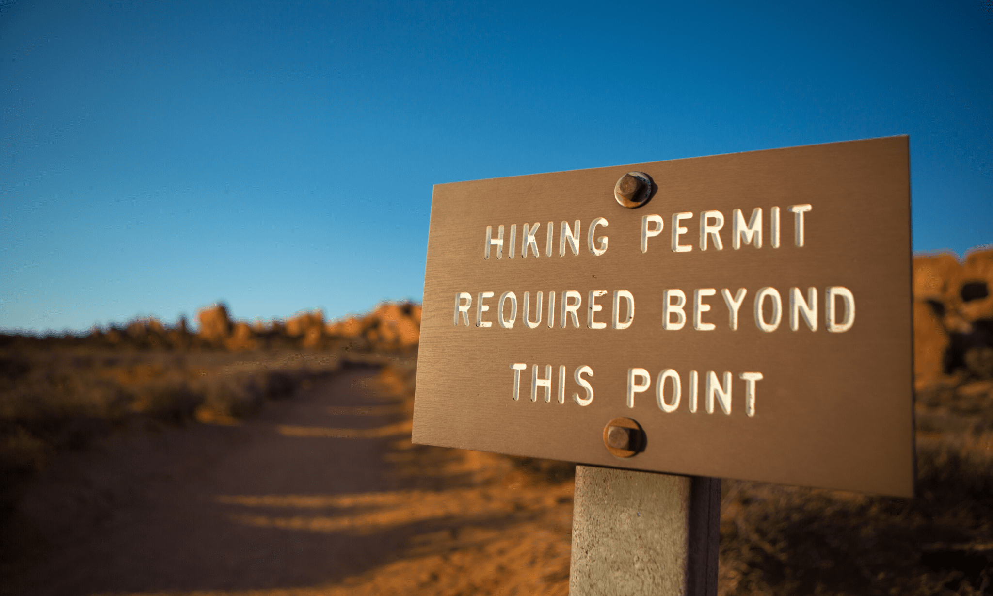
Trail Permits: What You Need to Know
When preparing for a thru-hike or section hike, navigating local, state, and federal land regulations can be complicated. Nonetheless, obtaining proper trail permit(s) is a requisite of the planning process.
Trail permits help land managers understand the usage that areas receive, regulate highly trafficked sections to minimize impact, and in many cases influence funding allocations for trail maintenance and management budgets. Failing to meet permit requirements can result in fines, and is a general breach of trail etiquette.
As such, we’ve collected permit information for the most popular of the trails we offer guides for. Note that while some trails do not require permits, there are still required registries, etc. Always check directly with land managers for the most up-to-date permitting information.
Trails that Require Permits
(Expand for more information)
PERMITS REQUIRED IN NATIONAL/STATE PARKS
- Great Smoky Mountains National Park: Thru-Hiker Permit’s of $20 (available 38 days before entry and up to 8 days in the park).
- Shenandoah National Park): FREE self-registration permits (for AT thru-hikers) at north and south trail points.
- Baxter State Park: FREE permit must be obtained at Katahdin Stream Campground.
Grand Canyon & Saguaro National Park Backcountry PERMITS REQUIRED
- Backcountry permits required for:
- Grand Canyon National Park
- Saguaro National Park
- Fee collected at Colossal Cave Park entrance.
- “If you plan on traveling outside the 15-foot corridor to camp, explore, etc. then it is strongly recommended that you obtain a State Land Recreation Permit.” – AZT Association
Great Smoky Mountains National Park Backcountry Permit Required
- Backcountry permit required.
- Advance reservations for backcountry camping required.
No master permit, permits required in national parks and NM Land
- Advance permit required for: Glacier National Park, Blackfeet Nation land, Yellowstone National Park, Rocky Mountain National Park.
- On-trail permit registries located in wilderness areas.
- General NM state lands permit required.
Numerous small permits & FTA membership required
- Florida Trail Association membership required to cross private lands, regardless of permit necessitation.
No master permit, permits required in national parks
- Permits required for:
- Banff National Park
- Jasper National Park
- Kootenay National Park
- Waterton Lakes National Park
- Yoho National Park
lottery-style permit required
- Daily permits are capped, although a small number of permits are available as walk-ups (at specific entry points).
- Lottery is held 24 weeks (168 days) before start dates, applications are accepted 170 days in advance (two days before the lottery).
- If flexible on start date, one permit can be submitted for a number of potential start dates.
Lottery style permit required
- 2020 lottery applications accepted between February 1 and March 15.
- One application per group can include flexible dates, duplicate applications will be disregarded.
Master Permit Required (FREE)
- Advance submission portal available through PCTA.
- Master permits are for hikers and horseback riders traveling 500 or more miles (in one trip).
- The PCTA administers 50 permits/day for trips NOBO, 15 permits/day SOBO, 1400 section hikers permits crossing the John Muir Trail, 600 permits from the Southern Sierras.
National Park Backcountry Permits Required
- North Cascades and Olympic National Parks allow special phone reservations for PNT thru-hikers.
- Olympic National Park: 360-565-3100
- North Cascades National Park: 360-854-7245
- Glacier National Park: backcountry permit must be obtained from one of the six ranger stations. (The PNTA notes that “the Polebridge and Two Medicine Ranger Stations and the Saint Mary Visitor Center are typically most convenient to PNT thru-hikers.”)
Torres del Paine
park entrance fee & campsite/refugio reservations required
- Reservations can be made in advance, or in the park (be prepared to be flexible), but you can be turned away at Ranger stations if you are attempting to camp without a reservation.
Mt. Rainier National Park Wilderness Permit Required
- Online requests due no less than 7 days and no more than 30 days before trip start day.
- One full-circuit Wonderland Trail trip request per person.
- A limited number of first-come-first-serve permits can be obtained at Visitor, Information, and Wilderness Information stations throughout the park. (Currently suspended for 2020 due to COVID-19.)


Pacific Northwest Trail | Pacific Northwest Trail Association
Trails that DO NOT Require Permits
(Expand for more information & exceptions)


Te Araroa, Jordan Trail | Dahn Pratt
No permit required
- Free, self-service permits are available (and required) where the CT enters wilderness areas.
No permit required
- Ticket required to enter Petra (available in person or in advance).
- If entering through Little Petra, tickets must be purchased in advance.
- Entrance fee to Dana Biosphere Reserve required. Management can be contacted at 079-911-1434.
No permit required
- If staying in location for 2+ nights, contact the local state office to obtain a permit.

Download our popular hiking and biking guides!

Trail guides that get you to places you’ve dreamed of.
As the makers of Guthook Guides, Bikepacking Guides, and Cyclewayz, we help you navigate the most popular trails around the world on your smartphone. Our hiking guides and biking guides work completely offline. Let Guthook guide your next adventure!
Showers Lake Vista, Tahoe Rim Trail
Photo courtesy of the Tahoe Rim Trail Association

Showers Lake Vista, Tahoe Rim Trail
Photo courtesy of the Tahoe Rim Trail Association
Trail guides that get you to places you’ve dreamed of.
As the makers of Guthook Guides, Bikepacking Guides, and Cyclewayz, we help you navigate the most popular trails around the world on your smartphone. Our hiking guides and biking guides work completely offline. Let Guthook guide your next adventure!
Download our popular hiking and biking guides!
About the Author

Kenna Sarae
Kenna-Sarae grew up in Northern California visiting her grandmother’s cabins along the PCT, which helped catalyze her love for the outdoors and interest in backpacking. She is particularly passionate about the intersection between sustainability and outdoor recreation, connecting with womxn and communities that have been historically underrepresented in outdoor spaces, and pesto pasta. You’re likely to find her having an impromptu dance party with her pup, whether it’s while backpacking, climbing, mountain biking, or just on the side of the road.
How Many Calories Do You Burn While Thru-Hiking?
Planning an adventure? Check out our popular trail guides! 4.8 stars (17K+ ratings)
How Many Calories Do You Burn While Thru-Hiking?
Yes, hiking burns a lot of calories. But everyone has a different body weight and hiking style which impacts the number of calories you burn. This blog post considers different body weights and hiking styles to provide a better estimate of the number of calories you will burn while backpacking.
Paul Bodnar Educational 6/23/2020
What is Your Metabolic Equivalent Task (MET)?
Different daily activities burn calories at different rates. These metabolic differences in activities are classified as metabolic equivalent tasks or MET values. Hundreds of different activities have corresponding MET values as illustrated by the referenced physical activities. The more strenuous the activity the higher the MET value. Below is a short list of MET values.
Metabolic Equivalent Task Values

Calculating Calories Burned
To calculate the calories burned multiply the MET value by your weight in pounds times 0.4536 (conversion factor from pounds to kilograms). For example, to compute the calorie expenditure for a 154.3 pound person, backpacking (7.0 MET) for 8 hours would result in 3,920 calories (7 x 154.3 x 0.4536 x 8 h).
Calories Burned = MET value x Body Weight in Pounds x 0.4536 x Duration in Hours
As you can see from the above Metabolic Equivalent Task Value chart, calorie consumption is also dependent on pack weight when climbing hills. The MET value increases as the pack weight increases. I used the MET value of 7.0 for general backpacking which considers both climbing hills and descending with a moderate pack load for the calculations below. The chart below shows the calories burned per hour for three of the most common hiking activities: backpacking, sleeping, and resting.

Calories Burned per Hour by Activity

To determine the number of calories burned in an entire day, each activity during the day should be considered along with how long that activity occurred. For estimating the daily calorie rate, the daily activities used were the number of hours backpacking, and eight hours of sleep and rest. It was calculated that a 150-pound person will burn about 5,062 calories while backpacking for eight hours in a day.
Calories Burned in a Day = Calories Burned Backpacking + Calories Burned Sleeping + Calories Burned Resting
Daily Calories Burned & Trail Hours


Daily Calories Burned While Backpacking is Staggering!!
The difference between backpacking with a heavy pack and a light pack is substantial. But most people do not consider the impact of carrying a heavier pack in terms of calories or energy consumed. Below is a chart comparing the estimated calories burned to hike for five months using a light pack versus a heavy pack.
Estimated Calories Burned on a 5-Month Thru-Hike

Understanding your calories burned while hiking will make it easier to plan your next backpacking trip. Most long-distance backpackers do not eat enough while in the outdoors but make up for the calorie deficit when they return to town to resupply.
More Thoughts on Nutrition

We can infer some pretty fascinating insights from this analysis, including both the importance of calorie-to-weight ratios and nutrition while on trail.
For instance, the final graph indicates that carrying a heavier pack leads to a much greater amount of calories burned. Which gives credence to the people who champion lightweight and ultralight backpacking — when examined purely from a caloric perspective, lightweight backpacking is actually a more efficient hiking methodology.
Although an extended backpacking trip, such as a thru-hike, is a low impact activity, the extended active time it necessitates leads to a massive net calorie deficit. This is an especially important insight when considering nutrition, which is often an after-thought to people planning and executing a long hike. Because our bodies burn so many calories while out for a long walk, the general orthodoxy is to maximize calories per weight. This is intended to maximize the amount of calories we consume and minimize the amount of weight we have to carry. A great idea in theory, when only thinking about pack-weight relationship to calories burned, but not always the best approach to thru-hiking in practice. Nutritionally rich food is crucial to keeping energy levels stable, avoiding injury, and not compromising on long-term health, but isn’t a mutually exclusive relationship to a calorie per weight consideration. One can have nutritional rich foods that are calorie dense, like minimally processed nut butters (those without sugar, palm oil, and other preservatives are best), dried fruits, dehydrated beans and other legumes, even the occasional fresh fruit or vegetable can go a really long way!
“Anecdotally, while hiking the Appalachian Trail in 2014 there was a story going around about a hiker who came down with scurvy (Yes, the 16th century disease that pirates got from lack of vitamin C). Apparently this hiker would just eat very nutritionally poor food, that was calorie dense, e.g. ramen, mashed potatoes, chocolate bars, etc, and when in town would go straight for the burgers and beers. Although this hiker was maximizing calorie to weight, he did not take into consideration nutrition and suffered greatly! We see this all the time on long hikes, people getting overuse injuries because their bodies are not able to recuperate from the long repetitive tasks of thousands and indeed millions of footsteps.”
All of that being said, the important things to consider when planning your diet is not just the amount of calories you will need to replenish but the quality of those calories as well!
References
2011 Compendium of Physical Activities: A Second Update of Codes and MET Values by BARBARA E. AINSWORTH1,2, WILLIAM L. HASKELL3 , STEPHEN D. HERRMANN1,2, NATHANAEL MECKES1,2, DAVID R. BASSETT JR.4 , CATRINE TUDOR-LOCKE5 , JENNIFER L. GREER1,2, JESSE VEZINA1,2, MELICIA C. WHITT-GLOVER6 , and ARTHUR S. LEON
Download our popular hiking and biking guides!
Trail guides that get you to places you’ve dreamed of.
As the makers of Guthook Guides, Bikepacking Guides, and Cyclewayz, we help you navigate the most popular trails around the world on your smartphone. Our hiking guides and biking guides work completely offline. Let Guthook guide your next adventure!
Showers Lake Vista, Tahoe Rim Trail
Photo courtesy of the Tahoe Rim Trail Association
Showers Lake Vista, Tahoe Rim Trail
Photo courtesy of the Tahoe Rim Trail Association
Trail guides that get you to places you’ve dreamed of.
As the makers of Guthook Guides, Bikepacking Guides, and Cyclewayz, we help you navigate the most popular trails around the world on your smartphone. Our hiking guides and biking guides work completely offline. Let Guthook guide your next adventure!
Download our popular hiking and biking guides!
About the Author

Paul Bodnar
Paul has always liked hiking and thru-hiked the Pacific Crest Trail in 1997 after college. After years of working in chemistry, he wanted to create a career involving the outdoors, so he hiked the Pacific Crest Trail again in 2010 to do research for his guide book Pocket PCT. He realized that creating a smartphone app for navigating the outdoors would make it easier to keep the data current and provide a better way to navigate. While hiking with Ryan (aka Guthook) in 2010, they decided to work together to create the first comprehensive smartphone guide for the Pacific Crest Trail. Now with the help of a team of great people they have created over 50 guides for trails around the world.
The Effect of Shoe Weight on Hiking Speed
Planning an adventure? Check out our popular trail guides! 4.8 stars (17K+ ratings)
The era of heavy boots on long-distance trails seems to be over: about 95% of long-distance hikers use hiking shoes or trail runners instead of boots. I set out to see if I can provide scientific evidence that the lighter shoe is better for long-distance hiking.
I decided to test the effect of different shoes on hiking speed using a relatively flat 2-mile loop trail at an elevation of 5,500 feet. I selected a flat trail so that I could assume that any change in average speed was due to the weight of the shoe not a grade change in the trail.
Calculated speed while carrying a 30-pound pack
For each test hike I carried a backpack with a total weight of 30 pounds and enough water, so I did not have to stop to refill water. The weather and departure time were also about the same for each hike. I rested for at least 48 hours between hikes to make sure I was fully recovered from each hike. For each experimental hike day, I wore a different pair of shoes with a different weight. I decided for this experiment that I would hike exactly four miles on the flat trail to calculate the average speed for each type of shoe worn.
Tested 3 different hiking shoes
I tested three different hiking shoes with varying weight. (The brand names of the shoes are intentionally omitted.) I tested a light trail runner (1.31 pounds/ 0.594 kg), a heavier hiking shoe (1.95 pounds/0.884 kg) and a lightweight boot (2.15 pounds/ 0.975 kg). When wearing the lightest shoe my average hiking speed was 3.17 mph. The slightly heavier hiking shoe slowed my hiking speed down 0.1 mph to 3.07 mph. The lightweight boot performed the worst averaging 2.99 mph.

The lighter shoe performed the best
The chart above clearly illustrates that the heavier the shoe the slower the speed. The extra ounces on my feet made a drastic impact on speed! With today’s lighter pack weights, you likely do not need a heavy boot. However, the hiking shoe you use should always provide the required support for your specific, individual needs.
Want to keep up with all that’s going on at Atlas Guides? Sign up for our newsletter!
Read more!
Check out some related blog posts!

Get our trail guide for this area!
Continental Divide Trail
Considered by many to be the most remote and challenging of the triple crown trails, the Continental Divide Trail is a 3100 mile adventure through five western states.
3100 mi (4980 km) $39.99 full guide
Colorado, Continental Divide Trail
Photo by David Getchel
Colorado, Continental Divide Trail
Photo by David Getchel
Continental Divide Trail
Considered by many to be the most remote and challenging of the triple crown trails, the Continental Divide Trail is a 3100 mile adventure through five western states.
3100 mi (4980 km)
$39.99 full guide
Get our trail guide for this area!
About the Author
Paul Bodnar
Paul has always liked hiking and thru-hiked the Pacific Crest Trail in 1997 after college. After years of working in chemistry, he wanted to create a career involving the outdoors, so he hiked the PCT again in 2010 to do research for his guide book, Pocket PCT. He realized that creating a smartphone app for navigating the outdoors would make it easier to keep the data current and provide a better way to navigate. While hiking with Ryan (aka Guthook) in 2010, they decided to work together to create the first comprehensive smartphone guide for the PCT.

12 GORP Varieties to Hike With
Planning an adventure? Check out our popular trail guides! 4.7 stars (14K+ ratings)
Trail mix full of nuts and fruit.
Photo by Maksim Shutov
12 GORP Varieties to Hike With
This post was originally written for The Trek before my 2016 Appalachian Trail thru-hike. There’s a reason why trail mix is a trail staple. It’s easy to make, easy to eat, and it tastes good. Eating it day after day can get a little monotonous, however, so why not try a variety of different mixtures?
Zoë Symon Inside Atlas Guides 02/19/2020
Zoë Symon
Inside Atlas Guides
02/19/2020
Originally written for The Trek. See the original post here.
There’s a reason why trail mix is a trail staple. It’s easy to make, easy to eat, and it tastes good. Eating it day after day can get a little monotonous, however, so why not try a variety of different mixtures? Here are a few I’ve mixed up for my impending hike.

1. Papa Food
This is the classic gorp I’ve grown up with my whole childhood. I have many distinctive memories of my papa shaking up a bucket of gorp before we drive to the airport or get in the car for a road trip.
Ingredients: Mixed nuts (I used peanuts, cashews, almonds, and walnuts in this batch, but have included macadamia nuts or brazil nuts in the past), M&Ms, raisins (I prefer dried cranberries. I used golden raisins and cranberries for this batch.)
Instructions: Mix equal parts of mixed nuts, M&Ms, and raisins.

2. Zoë Hates Peanuts
Disclaimer: I don’t really hate peanuts (see #12), but sometimes there are just too many in trail mixes! This is my favorite, go-to blend. The almonds provide the crunch, and the cranberries provide a mild sweetness.
Ingredients: Cashews (I prefer whole, but pieces are sometimes cheaper. Salt is optional), almonds (raw or roasted, but no strange flavors), dried cranberries
Instructions: Mix equal parts of almonds, cashews, and dried cranberries. I use whole raw almonds and salted cashew pieces.
3. Zoë Hates Peanuts (Sweet Version)
The classic Zoë mixture can be made sweet if desired. It’s good with white chocolate chips, but those can get very melty on sunny trail days. If that’s something that would bother you, use M&Ms.
Ingredients: Zoë Hates Peanuts (#2), M&Ms or white chocolate chips
Instructions: Add chocolate of choice to Zoë Hates Peanuts (#2).

4. Caffeine (Kimmy’s Mix)
This is a mixture that has been recommended to me by a variety of people. The first person to suggest it was fellow 2016 Appalachian Trials blogger, Kimmy.
Ingredients: Coconut flakes (or roasted chips), almonds (raw or roasted), chocolate-covered espresso/coffee beans
Instructions: Mix equal parts of coconut flakes and almonds. Add fewer of the chocolate-covered espresso/coffee beans. They’re a fairly substantial flavor and can easily overpower the rest of the mixture.

5. S’mores
This idea came into being when I saw a bag of marshmallows while shopping for gorp ingredients in the grocery store. Who doesn’t love s’mores?
Ingredients: Annie’s Bunny Grahams (I found these to be the easiest to mix, but if you have another favorite graham, feel free to use that instead!), M&Ms, mini marshmallows
Instructions: Mix equal parts of graham, marshmallows, and M&Ms.

6. Banana Bread
I love banana bread. Nutty, gooey, tasty goodness. This mix is less gooey, and not as bready, but it still has some of the delicious flavors you associate with banana bread. Chocolate is optional, but encouraged.
Ingredients: Banana chips (break them up if they’re too large), walnuts (raw, pieces), chocolate of your choice (I used semi-sweet chocolate chips, but they may melt on hot days. Dark chocolate M&Ms are a good substitute)
Instructions: Mix equal parts of banana chips and walnuts. Add chocolate to taste. Don’t add too much! The bananas should be the heroes here.

7. Savory Crunch
Since most trail mixes verge some what on the sweet with chocolate or fruit, I thought it was important to include a decidedly savory mix. I have always been a fan of rye chips (yes, I pick them out of the Chex Mix), so this was a good spot to showcase them!
Ingredients: Rye chips, sesame sticks, corn nuts, optional flavoring (I like my crunch pain, but if you want to add an extra kick of flavor, go right ahead!)
Instructions: Mix equal parts of rye chips, sesame sticks, and corn nuts. Flavor as desired.

8. Spicy Savory Crunch
I love wasabi peas, and this crunch is delicious with them! Regulate the spiciness by adding more or fewer wasabi peas.
Ingredients: Savory Crunch (#7), wasabi peas
Instructions: Mix as many wasabi peas as you dare into Savory Crunch (#7)!

9. Number 9
This has no name right now (if you think of a good one, let me know!), but was the ninth mix I made. It’s inspired by a Gorp mix from Lou Adsmond’s The Appalachian Trail Food Planner.
Ingredients: Date pieces, walnuts, coconut flakes (or chips), optional chocolate of your choice.
Instructions: Mix equal parts of dates, walnuts, and coconut flakes. Add chocolate to taste (I prefer it without, but my mama says it needs chocolate, and mama knows all.)

10. Frood
Desperate for some fruit food? Look no further than frood. Frood is also delicious in oatmeal or granola in the mornings.
Ingredients: Dried fruit of choice (my batch contains cranberries, papaya, kiwi, banana chips, and pineapple), cashews (macadamias would be a good addition too, but can be expensive), sunflower seeds
Instructions: Mixture should be 1/2 fruit, and 1/2 everything else.
11. Paxton’s Blend
After asking for gorp advice, Paxton came to the rescue with this delicious blend. I don’t have a photo because I ate it.
Ingredients: Dark chocolate M&Ms, dried raspberries, salted cashews (whole or pieces)
Instructions: Mix equal parts of dried raspberries and salted cashews. I like my gorp mixtures less chocolatey, so I included fewer M&Ms, but feel free to include as many as you like.

12. Zoë Loves Peanuts
As I said before, I don’t really hate peanuts, so here is an ode to my love for peanuts.
Ingredients: Peanut butter-filled pretzels, peanut butter M&Ms, peanuts (salted or not, your choice, but I think salt brings out the flavors)
Instructions: Mix equal parts pretzels, peanuts, and M&Ms.
Bonus: Grandma’s Birthday Mix
My mama told me that my grandmother used to make this mix for her kids’ birthday parties and set it in little muffin papers beside everyone’s plate. Well, I tried it, and it’s delicious. Thanks, Grandma! I did have a really difficult time finding butter mints though.
Ingredients: Butter mints (I had to order mine from Amazon, and they came in a 4lb bag. Anyone want mints?), peanuts (I like adding salted peanuts), M&Ms
Instructions: Mix equal parts butter mints and M&Ms. I would add slightly more peanuts since the other flavors can be overwhelming.
Want to keep up with all that’s going on at Atlas Guides? Sign up for our newsletter!
Read more!
Check out some related blog posts!
About the Author

Zoë Symon
Zoë grew up in North Carolina and first heard of the Appalachian Trail during her time in college. In 2016, she took a leave of absence from her job and thru-hiked the trail. This adventure fostered her love for the outdoors and for hiking. Currently, she explores the public lands of Oregon. In 2017 she joined the team at Atlas Guides as Creative Director. She spends her days improving experiences for all our users.
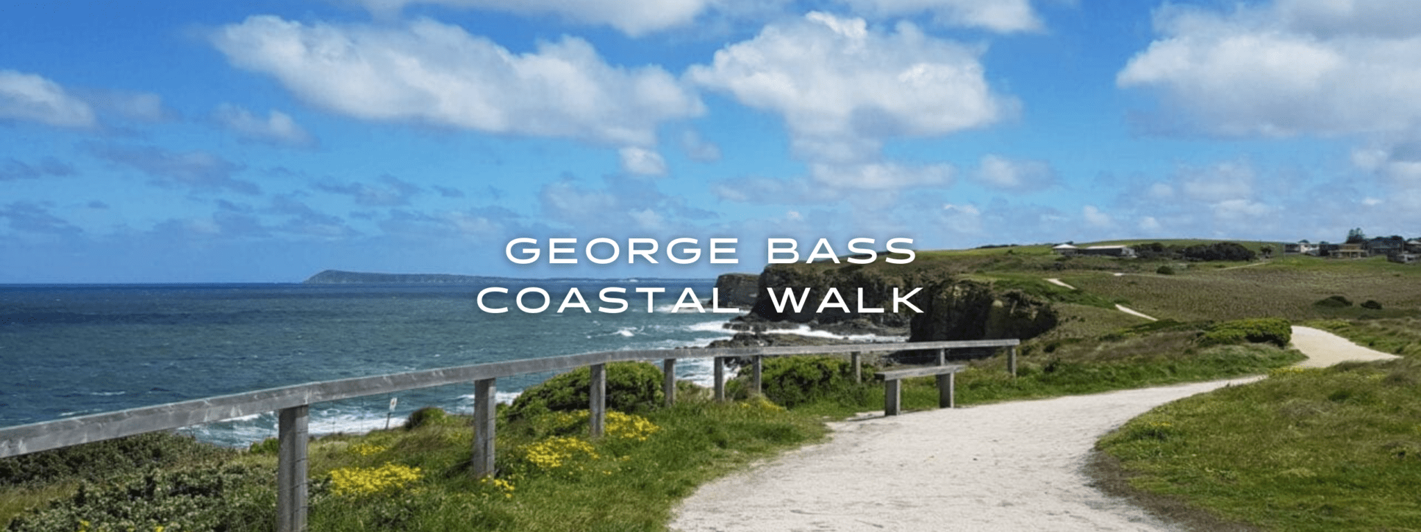
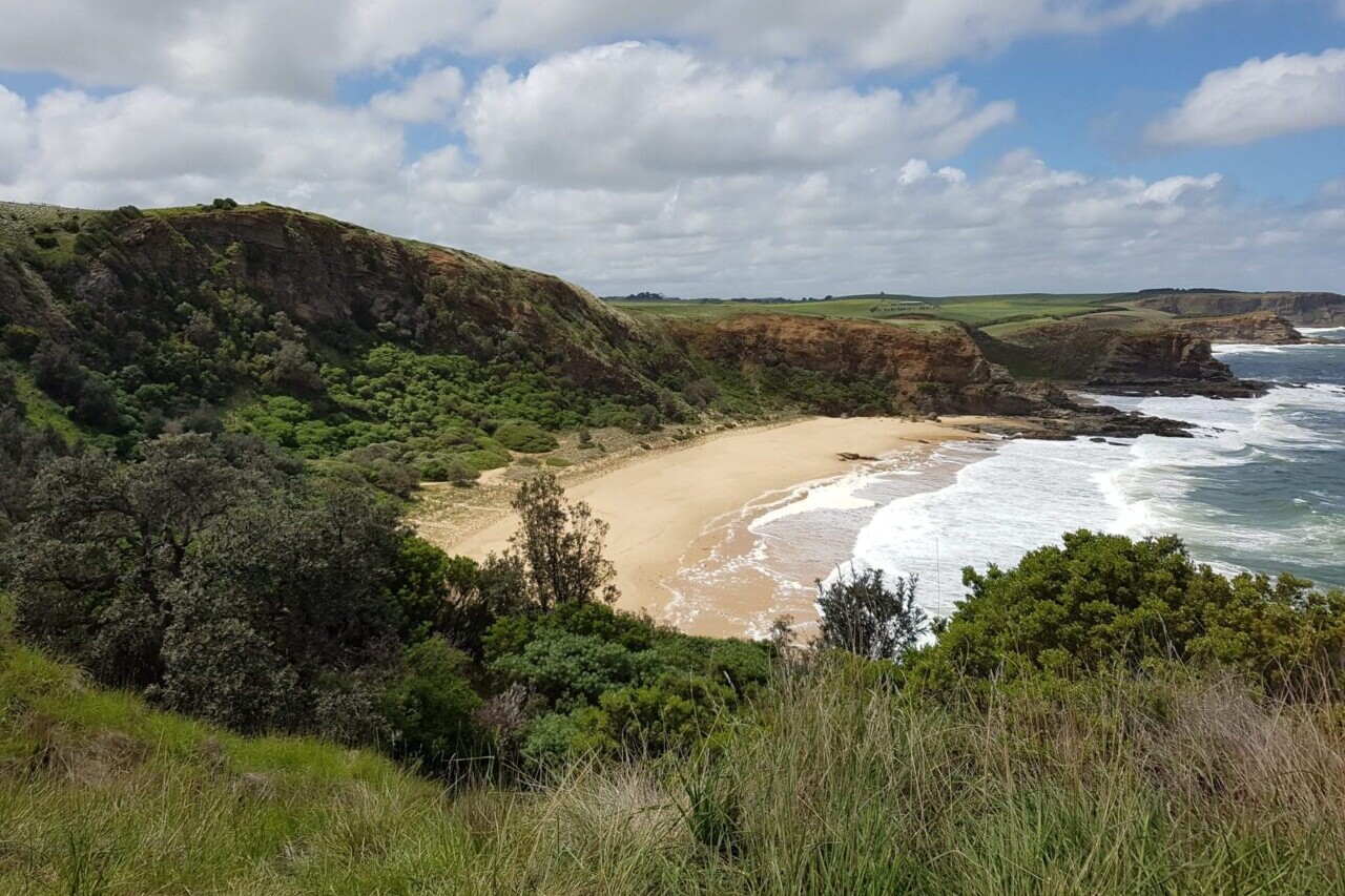
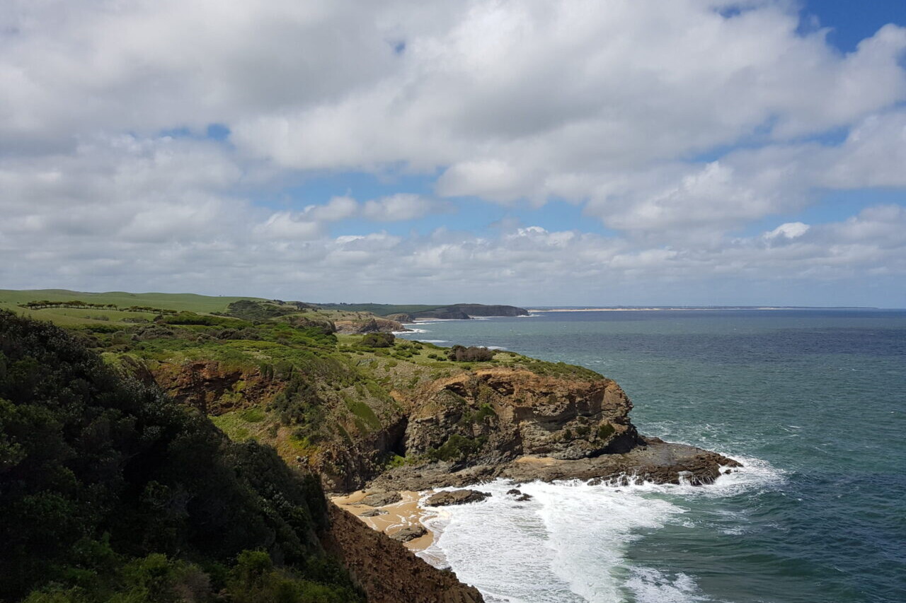
George Bass Coastal Walk

Named after the renowned maritime explorer, George Bass (a man hardly known for walking), this is a wonderful walk along clifftops and sandy beaches of Australia. Popular among locals, the expansive views of the cliffs, headlands, and the wild Bass Straight oceans are well worth it.
20% off for our Hiking Season Kick-off SALE! Though the George Bass Coastal Walk is free, it is also included in the Australia and New Zealand Hiker Special which is now $35.99. Explore the Aus NZ Hiker Special!
Victoria, Australia, George Bass Coastal Walk
Photo courtesy of Active Wayz
4.8 ★★★★★ | 17K+ Reviews
George Bass Coastal Walk
8 km / 5 miles • Victoria, Australia
Download our guide to access the George Bass Coastal Walk map, tracks, waypoints, and comments! Named after the renowned maritime explorer, George Bass (a man hardly known for walking), this is a wonderful walk along clifftops and sandy beaches. Popular among locals, the expansive views of the cliffs, headlands, and the wild Bass Straight oceans are well worth it.
FREE DEMO
FREE DEMO


George Bass Coastal Walk Map


How can I get it?
Available as an in-app purchase in our Guthook Guides app, a free download from the Apple App Store or the Google Play Store.
Our iOS and Android apps do differ slightly in their appearance. However, the majority of their features remain the same, and they access the same trail guide data.
Hike Australia and New Zealand with a saving of 56% over buying the trails separately. This bundle does not include Te Araroa hikes which are part of the Te Araroa Bundle.
Purchase now and get all future trails added to the bundle for free!
This bundle currently includes: Australian Alps Walking Track, Bibbulmun Track, Cape to Cape, George Bass Coastal Walk, Greenstone and Caples Track, Heysen Trail, Kepler Track, Larapinta Trail, Milford Track, Overland Track, Routeburn Track, Three Capes Track, Walk the Yorke, and Wilsons Promontory Grand Circuit.
AU$69.99 / NZ$77.99 / US$44.99
Victoria, 8 Km, Coastal, 1-3 hours
This is a wonderful walk along the clifftops and dipping down to the sandy beach. With expansive views of the cliffs, headland and wild Bass Straight oceans are well worth it. All the locals love this walk!
This walk is named after the renowned maritime explorer, George Bass, a man hardly known for walking. In 1797, he set sail from Sydney Cove and encountered this coastline while proving that a stretch of water did separate the mainland from Tasmania. It was a hell of a point to make, given he did it in an open boat only 8.7 meters long. It could be powered by its sails or by 6 to 8 oarsmen. It was a very adventurous journey and replicated in 1997, by a team of sailors from Sydney.
Copyright 2019 Active Wayz Pty. Ltd
FREE DEMO
Hike more.
Check out some of the other trail guides we offer!
About our partner
Active Wayz
Activewayz is very passionate about the outdoors, whether it be hiking, bushwalking, or tramping. They enjoy mapping new routes and planning new adventures to share in the app. They have incorporated their love for adventure, long-distance hiking, and mapping to create a resourceful guide in Australia and New Zealand.
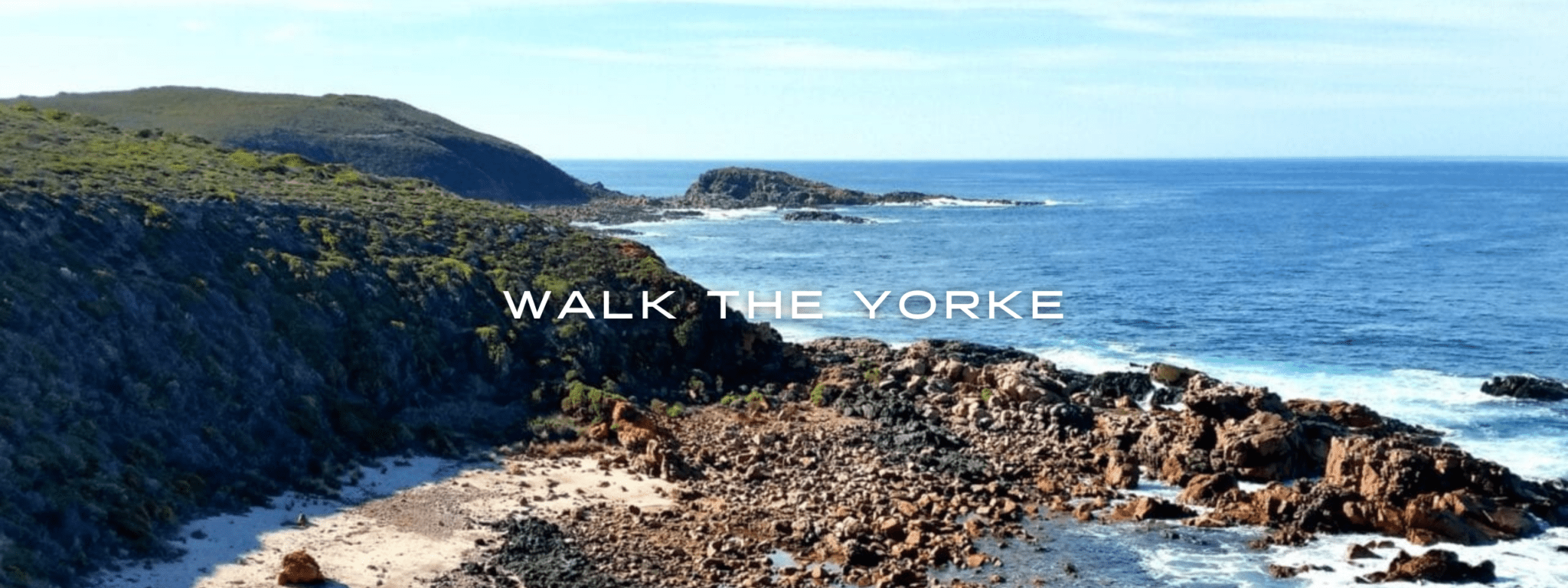
Walk the Yorke
Walk the Yorke starts in the historic copper mining town of Moonta and ends in Port Wakefield. The hike hugs the coast for almost all of the journey around the Peninsula. The remote trail showcases views of the St. Vincent Gulf, the saltbush plains beside the Yorke Highway, quiet country roads, and spectacular coastlines. Expect fabulous scenery, not many people, and delicious fish and chips. This walk suits the hiker who enjoys peace and the sound of the sea.
20% off for our Hiking Season Kick-off SALE! The Australia and New Zealand Hiker Special is now $35.99. Explore the Aus NZ Hiker Special!
Yorke Peninsula, South Australia, Walk the Yorke
Photo courtesy of Active Wayz
4.8 ★★★★★ | 17K+ Reviews
Walk the Yorke
483 km / 300 miles • South Australia
Download our guide to access the Walk the Yorke map, tracks, waypoints, and comments! Get away from it all. Walk long stretches of coast with no one else in sight; walk on tracks and quiet country roads next to spectacular coastlines and cliffs. Walk the Yorke starts in the historic copper mining town of Moonta and ends in Port Wakefield. The hike hugs the coast for almost all of the journey around the Peninsula. The remote trail showcases views of the St. Vincent Gulf, the saltbush plains beside the Yorke Highway, quiet country roads, and spectacular coastlines. Expect fabulous scenery, not many people, and delicious fish and chips. This walk suits the hiker who enjoys peace and the sound of the sea.
$9.99 full guide
$9.99 full guide
Walk the Yorke Map


How can I get it?
Available as an in-app purchase in our Guthook Guides app, a free download from the Apple App Store or the Google Play Store.
Our iOS and Android apps do differ slightly in their appearance. However, the majority of their features remain the same, and they access the same trail guide data.
Hike Australia and New Zealand with a saving of 56% over buying the trails separately. This bundle does not include Te Araroa hikes which are part of the Te Araroa Bundle.
Purchase now and get all future trails added to the bundle for free!
This bundle currently includes: Australian Alps Walking Track, Bibbulmun Track, Cape to Cape, George Bass Coastal Walk, Greenstone and Caples Track, Heysen Trail, Kepler Track, Larapinta Trail, Milford Track, Overland Track, Routeburn Track, Three Capes Track, Walk the Yorke, and Wilsons Promontory Grand Circuit.
AU$69.99 / NZ$77.99 / US$44.99
483 km One Way, Easy, Flat, Quiet Roads/Tracks,
Get away from it all. Walk along long stretches of coast with no one else in sight. Walk on tracks and quiet country roads beside spectacular coastlines and cliffs.
Expect fabulous scenery, not many people and delicious fish and chips. This walk suits the hiker who enjoys peace and just the sound of the sea. The towns along the coast are small and the grocery shops with limited food options for hiking.
Walk the Yorke starts in the historic copper mining town of Moonta and ends in Port Wakefield.
The hike hugs the coast for almost all the Peninsula. The last 33 km from Clinton to Port Wakefield takes you up a hill to get views of the St Vincent Gulf and then onto the saltbush plains beside the Yorke Highway towards Port Wakefield. Just before Port Wakefield there is a tidal creek to cross.
The Walk the Yorke trail can be impacted by sand drifts and track works. For the latest information and planning your trip please refer to
https://www.visityorkepeninsula.com.au/walk-the-yorke/trail-notes.
Thank you to the Yorke Peninsula Council for creating a wonderful trail and your support in supplying trail information.
Copyright 2019 Active Wayz Pty. Ltd.
AUD$14.99 / NZ$16.99 / US$9.99
Hike more.
Check out some of the other trail guides we offer!
About our partner
Active Wayz
Activewayz is very passionate about the outdoors, whether it be hiking, bushwalking, or tramping. They enjoy mapping new routes and planning new adventures to share in the app. They have incorporated their love for adventure, long-distance hiking, and mapping to create a resourceful guide in Australia and New Zealand.
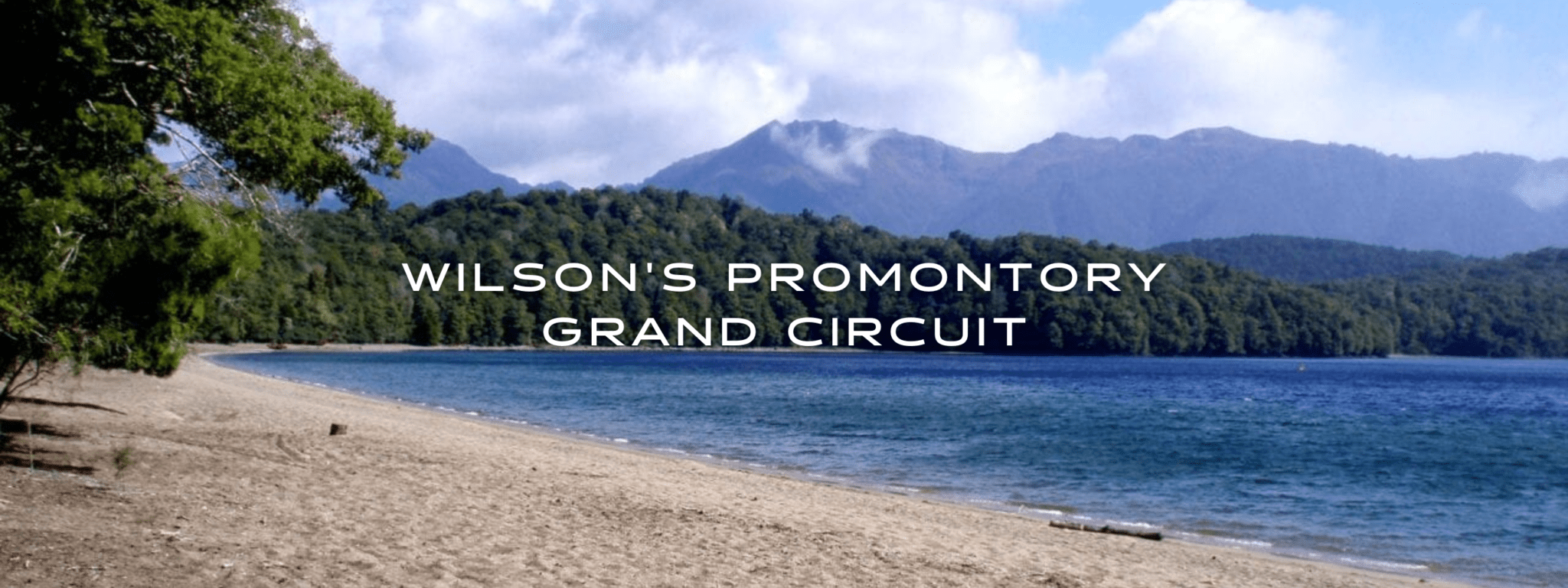
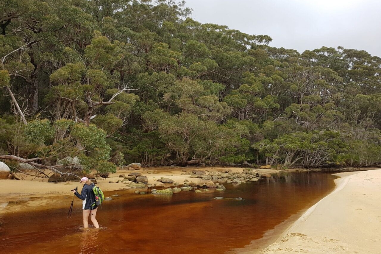
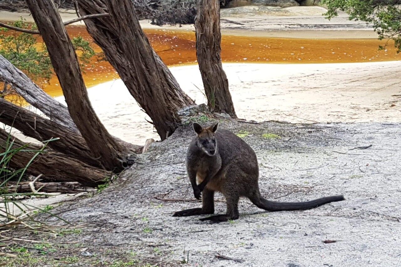
Wilson's Promontory Grand Circuit
Follow the coast, with its turquoise blue beaches, ferny glades, and huge granite boulders covered in orange lichens, to the southernmost point of the Australian Mainland. With 53 km of good track hiking, this walk has a lot to offer. The campsites are shady, and most are set close to beautiful sandy beaches. For a unique overnight accommodation, spoil yourself at the historic lighthouse which can only be reached by foot. Enjoy seeing wildlife such as wombats, wallabies, possums and a mix of interesting reptiles. Australia.
20% off for our Hiking Season Kick-off SALE! The Australia and New Zealand Hiker Special is now $35.99. Explore the Aus NZ Hiker Special!
20% off for our Boxing Day SALE! The Australia and New Zealand Hiker Special is now $35.99. Explore the Aus NZ Hiker Special!
Victoria, Australia, Wilson’s Promontory Grand Circuit
Photo courtesy of Active Wayz
4.8 ★★★★★ | 17K+ Reviews
Wilson's Promontory Grand Circuit
54 km / 34 miles • Victoria, Australia
Download our guide to access the Wilson's Promontory Grand Circuit map, tracks, waypoints, and comments! Hike the Prom, one of the best loved hikes in Australia. Follow the coast, with its turquoise blue beaches, ferny glades, and huge granite boulders covered in orange lichens, to the southernmost point of the Australian Mainland. With 53 km of good track hiking, this walk has a lot to offer. The campsites are shady, and most are set close to beautiful sandy beaches. For a unique overnight accommodation, spoil yourself at the historic lighthouse which can only be reached by foot. Enjoy seeing wildlife such as wombats, wallabies, possums and a mix of interesting reptiles.
AU$5.99/NZ$6.99/US$3.99 full guide
AU$5.99/NZ$6.99/US$3.99 full guide
Wilson’s Promontory Grand Circuit Map


How can I get it?
Available as an in-app purchase in our Guthook Guides app, a free download from the Apple App Store or the Google Play Store.
Our iOS and Android apps do differ slightly in their appearance. However, the majority of their features remain the same, and they access the same trail guide data.
Hike Australia and New Zealand with a saving of 56% over buying the trails separately. This bundle does not include Te Araroa hikes which are part of the Te Araroa Bundle.
Purchase now and get all future trails added to the bundle for free!
This bundle currently includes: Australian Alps Walking Track, Bibbulmun Track, Cape to Cape, George Bass Coastal Walk, Greenstone and Caples Track, Heysen Trail, Kepler Track, Larapinta Trail, Milford Track, Overland Track, Routeburn Track, Three Capes Track, Walk the Yorke, and Wilsons Promontory Grand Circuit.
AU$69.99 / NZ$77.99 / US$44.99
Australia, 54 km, Coastal walk, 3-4 days.
Hike the Prom, one of the best loved hikes in Australia. Following the coast, with turquoise blue beaches, ferny glades, huge granite boulders covered in orange lichens on your way to the southernmost point of the Australian Mainland. With 53 km of good track hiking, this walk has a lot to offer. The campsites are shady, and most are set close to beautiful sandy beaches. For a unique overnight accommodation, spoil yourself at the historic lighthouse which can only be reached by foot. Enjoy the wildlife as you will see wombats, wallabies, possums and a mix of interesting reptiles.
AUD$5.99 / NZ$6.99 / US$3.99
Hike more.
Check out some of the other trail guides we offer!
About our partner
Active Wayz
Activewayz is very passionate about the outdoors, whether it be hiking, bushwalking, or tramping. They enjoy mapping new routes and planning new adventures to share in the app. They have incorporated their love for adventure, long-distance hiking, and mapping to create a resourceful guide in Australia and New Zealand.
How to Train With No Mountains: My Favorite Hikes near Austin
Planning an adventure? Check out our popular trail guides! 4.8 stars (17K+ ratings)
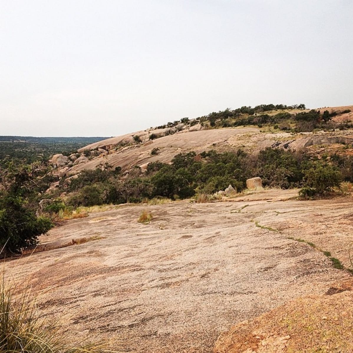
Barton Creek Greenbelt, Austin, TX.
Photo by Zoë Symon
How to Train With No Mountains: My Favorite Hikes near Austin
This post was originally written for The Trek before my 2016 Appalachian Trail thru-hike. I declared that I would be hiking the AT in 2016, so now all I had to do was prepare myself. As a full-time employee, I couldn't take two weeks off to go on a long shakedown hike, so I took many day hikes and a few weekend hikes. There was only one small problem. I lived in Austin, Texas, where the tallest mountain took only 120 steps to reach the top.
Zoë Symon Trip Report 11/5/2019
Zoë Symon
Trip Report
11/5/2019
Originally written for The Trek. See the original post here
So, I’ve declared that I will be hiking the Appalachian Trail in 2016. My friends know, my family knows, my job knows, the world knows through this blog, so now all I have to do is prepare myself. As a full-time employee of a great company, I can’t very well take two weeks off to go on a long shakedown hike. That’s okay, right? I’ll just go on many day hikes and a few weekend hikes. There’s only one small problem. I live in Austin, Texas.
The only mountain that exists in Austin is Mt. Bonnell. It has about 120 steps to reach the top, which make up the bulk of its .3 total trail miles. So. How do I train for hiking the Appalachian mountains when I have no mountains to hike? Luckily Austin (and the surrounding area) has some amazing hikes available. You won’t gain much in the way of elevation, but you’ll see some beautiful natural sights (and sites), and if you combine your hikes with some gradual pack weight and a few hours on the incline treadmill or stair-stepper a few times a week, you’ll be well on your way. Below are some of my favorite hikes in and around Austin.
Cacti along the Barton Creek Greenbelt.
Photo by Zoë Symon
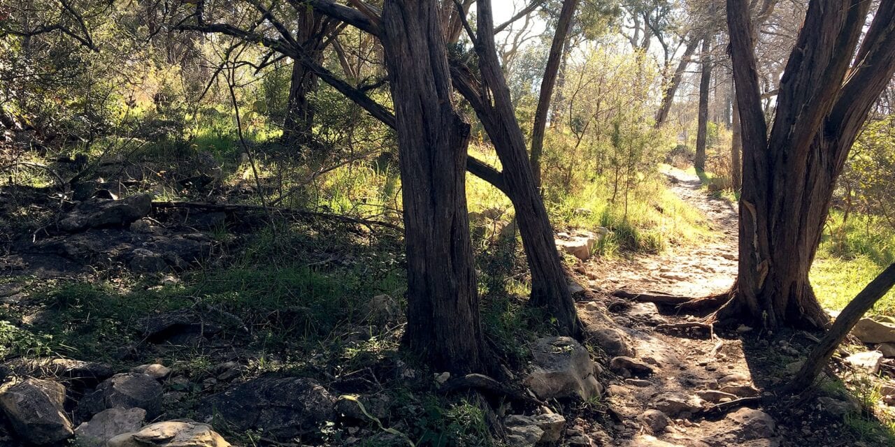
Barton Creek Greenbelt (Violet Crown Trail)
Day Hike
Located in Austin: 10 minutes from downtown
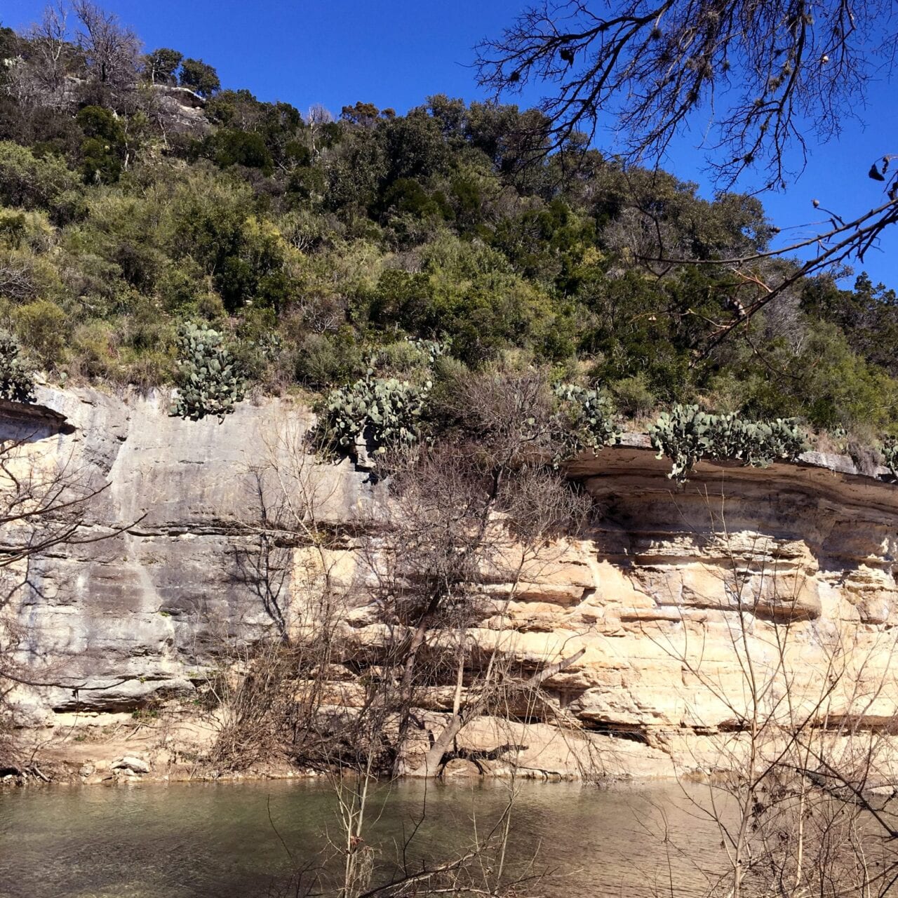
The Violet Crown Trail has been my lifeblood in terms of preparation. In its current state, it’s just under 12 miles round-trip. It’s a great half-day hike, running along Barton Creek for most of its length.
There are a few water crossings if you choose to follow the exact path of the trail, but most of them can be avoided if you choose, as there are trails blazed along both sides of the creek. On your way you’ll see joggers, hikers, mountain bikers (and one mountain unicyclist!!), and meet many new canine friends. One of the best things about the Greenbelt is that, as soon as you’re in it, you no longer feel like you’re in the middle of a city. You can’t even see the Austin “skyline” from the majority (if not all) of the trail.
Favorite Entrances: The Greenbelt and Violet Crown Trail have many entrances. When I hike the whole length, I usually start at Zilker Park (more parking) and hike to the 290 entrance. My favorite entrance, though, is the Gus Fruh entrance. If you don’t follow the VCT and cross the river, there’s a great hike up a side trail to the top of a cliff, which gives you an amazing bird’s-eye view of Barton Creek and the Greenbelt.
Palo Duro Canyon State Park
Long Weekend
Distance from Austin: 7.5 hours, not including stops
Palo Duro Canyon claims to be the second-largest canyon in the United States, after the Grand Canyon. It resides in the Texas Panhandle, and is virtually invisible in the flat landscape until you’re right on top of it. It features beautiful rock formations with amazing colors from yellow to red to purple. There are many different ways to enjoy the Canyon. It can be explored by foot, mountain bike, horse, or car. We stayed at the Fortress Cliff Camp area, which had good access to the majority of the trails we wanted to do. There are also Backpacking sites available if you wish to be a little further from civilization. We broke the drive into 2 days on the way to Palo Duro, and stayed at Abilene State Park on the way.
Favorite Trails: Lighthouse Trail; Givens, Spicer, and Lowry Trail; Rock Garden Trail
The Lighthouse Trail is a must-do for anyone visiting Palo Duro, it’s an easy, flat trail that takes you to the rock formation known as the “Lighthouse,” which is the most recognizable formation in the park, and even makes it into the logo for the park itself. The Givens, Spicer, and Lowry Trail is a long, flat, winding trail that takes you through some of the most breathtaking high-desert scenery in the park. Connect it with the Little Fox Canyon trail and the Paseo Del Rio Trail to extend your hike. The Rock Garden Trail is a lesser-hiked gem of a trail that ascends the canyon wall and which, along its way and at the top, offers beautiful views of the canyon itself. Continue hiking the Fortress Cliff Trail along the rim to extend your hike.
A View of Enchanted Rock.
Photo by Zoë Symon
Enchanted Rock State Natural Area
Day Hike
Distance from Austin: 1.5 hours, not including stops
Enchanted Rock is a super-neat natural formation. It’s a completely bald pink granite dome that offers a strenuous hike to the top, and a flat, easy hike circling its base. There are even caves and canyons to explore.
Overnight camping is permitted on sites and with a reservation, but the park closes at 10pm, so even though the sky is dark enough to see a beautiful expanse of stars, don’t get caught inside the locked gates! Be sure to visit Pieous Pizza or Jester King Brewery on your way to or from Enchanted Rock. both are out-of-the-way gems.
Big Bend National Park
Long Weekend
Distance from Austin: 8 hours, not including stops
Admittedly, I have not been to Big Bend. It’s one of my biggest regrets of my time in Austin that I never seemed to have the time to visit. However, it still deserves a place on this list, so I’ve enlisted the help of friends who have visited. While I’m typing this blog post, we’re having a conversation about Big Bend, and this is the best quote from their five-star review: “I have to say at this point, Big Bend is one of my top favorite national parks I’ve ever been to.” If you have the time, stop in Marfa on your drive in. The quirky little town is worth a visit. Or, if stars are more your thing, catch a Star party at McDonald Observatory, UT-Austin’s home of Astronomy, star-gazing, and giant telescopes.
Definitely consider carefully the time of year for your trip. By May, the park is already very hot, though the temperature can vary by up to 20 degrees depending on what part of the park you’re in. Overall, there is very little shade, so bring a hat and lots of sunscreen. Also, keep in mind that, being a desert the park does get cold at night. There are many different options for campsites, and all amazing. The Chisos Basin Campground is surrounded by beautiful mountains and cliffs, and has access to some of the best trails.
Favorite Trails: Window Trail, South Rim Trail
Both trails offer stunning views, though the South Rim Trail is significantly longer and more strenuous. The Window Trail is 5.6 miles round-trip, and travels down through the Oak Creek Canyon to the “window” which frames a beautiful desert landscape. The South Rim Trail gains 2,000 feet over its length, and offers stunning views of the canyon. There are a couple of different routes to take that vary in their strenuousness.
Pedernales Falls State Park
Day Hike
Distance from Austin: 1 hour, not including stops
A gem of a park outside of Austin, Pedernales offers great day hikes and some overnight camping as well. The Falls are a must-see. Often they are a series of calm pools tucked between massive slabs of limestone, but if there has been any rain recently, they can turn into a spectacular series of falls. Be alert for flash floods if you decide to swim.
Favorite Trails: 5.5 Mile Loop Trail, Wolf Mountain Trail
The 5.5 Mile Loop Trail is a nice trail with some beautiful views, a water crossing, and a scenic overlook. It’s especially nice because it’s customizable. Want a shorter hike? Take the cut-through. Want a longer hike? Add the Spur Trail. The Wolf Mountain Trail is a well-rounded trail that showcases many of the best parts of the natural area at Pedernales. For a much longer trek (15+ miles), connect the Wolf Mountain Trail and the Juniper Trail.
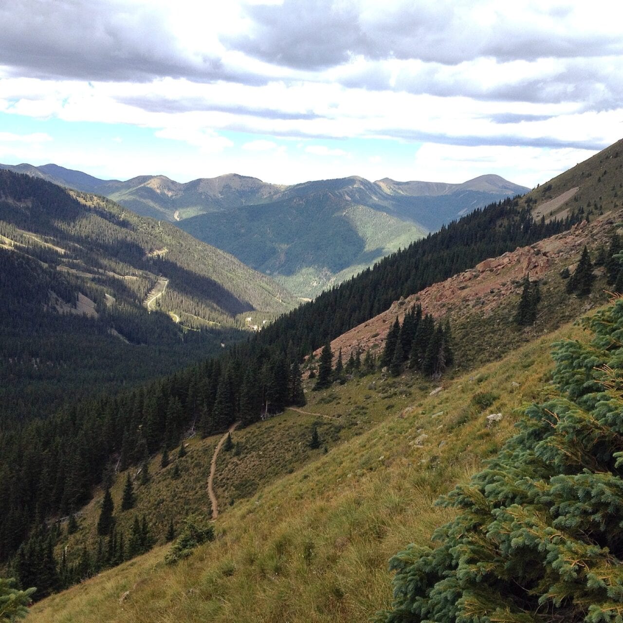
A view from halfway to the Wheeler Peak summit.
Photo by Zoë Symon
Carson National Forest/Wheeler Peak Wilderness (Taos, NM)
Long Weekend
Distance from Austin: 12 hours, not including stops
Finally, mountains! This one is a long drive or a short flight, but is one of my favorite hikes that I’ve done since being in Austin. I went in early September, and the weather was beautiful.
In the winter, the area is used for skiing and snow sports, but if you’re into cross-country skiing or snowshoeing, I’m sure the views will still be amazing. We didn’t camp during our stay, but Carson National Forest does offer many options for campgrounds. Be sure to stop in Roswell, NM on your drive. Maybe you’ll see some aliens.
Favorite Trails: Wheeler Peak Summit Trail (#67), Williams Lake Trail (#62)
These two trails run together for a while. Eventually the trailhead for the Summit Trail will be on your left, but it’s worth it to continue the short distance to Williams Lake. The Williams Lake Trail offers a chance to relax by the lake, and a couple of small bluffs to climb to get better views of the surrounding area. The Wheeler Peak Summit Trail offers what it promises, breathtaking views the whole way up, a variety of landscapes, and an amazing hike to the summit. Beware of changing weather in the afternoons on the summit.
Want to keep up with all that’s going on at Atlas Guides? Sign up for our newsletter!
Read more!
Check out some related blog posts!
Download our popular hiking and biking guides!
Trail guides that get you to places you’ve dreamed of.
As the makers of Guthook Guides, Bikepacking Guides, and Cyclewayz, we help you navigate the most popular trails around the world on your smartphone. Our hiking guides and biking guides work completely offline. Let Guthook guide your next adventure!
Showers Lake Vista, Tahoe Rim Trail
Photo courtesy of the Tahoe Rim Trail Association
Showers Lake Vista, Tahoe Rim Trail
Photo courtesy of the Tahoe Rim Trail Association
Trail guides that get you to places you’ve dreamed of.
As the makers of Guthook Guides, Bikepacking Guides, and Cyclewayz, we help you navigate the most popular trails around the world on your smartphone. Our hiking guides and biking guides work completely offline. Let Guthook guide your next adventure!
Download our popular hiking and biking guides!
About the Author
Zoë Symon
Zoë grew up in North Carolina and first heard of the Appalachian Trail during her time in college. In 2016, she took a leave of absence from her job and thru-hiked the trail. This adventure fostered her love for the outdoors and for hiking. Currently, she explores the public lands of Oregon. In 2017 she joined the team at Atlas Guides as Creative Director. She spends her days improving experiences for all our users.
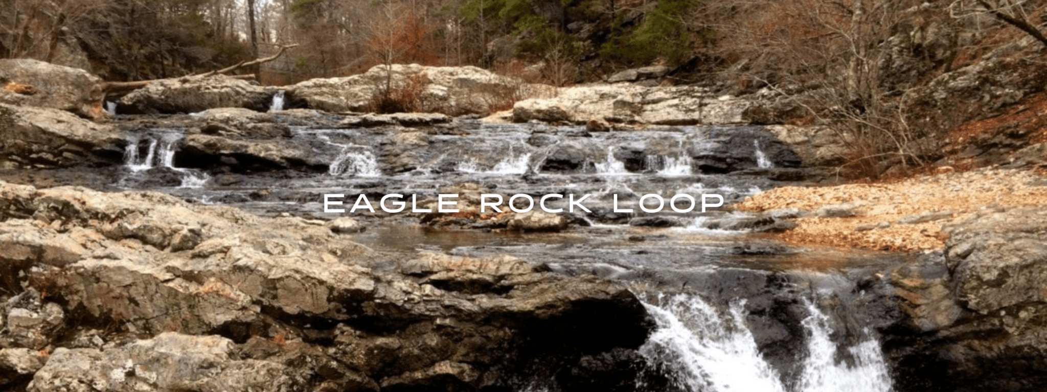
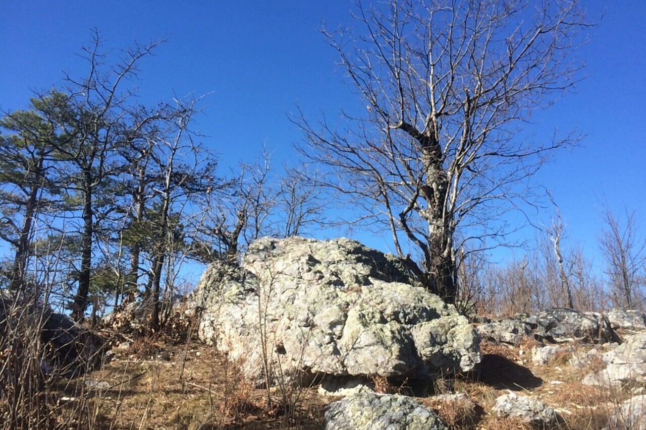
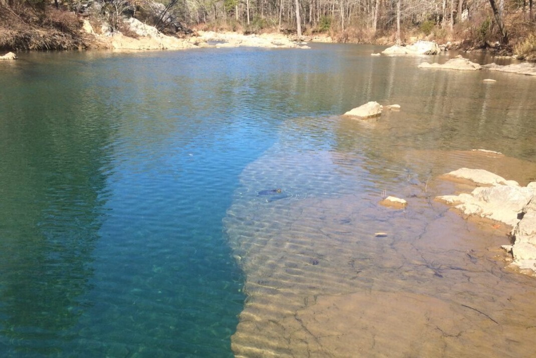
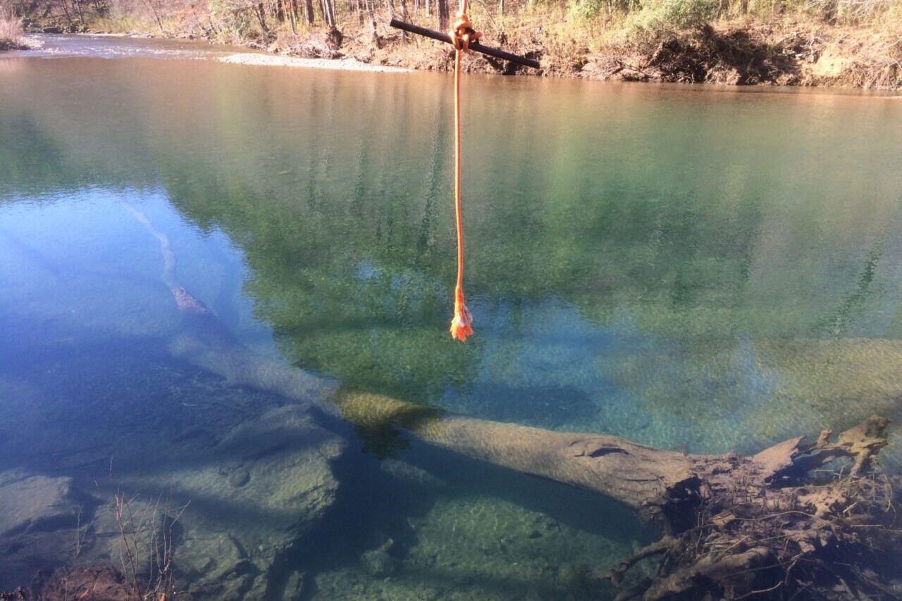
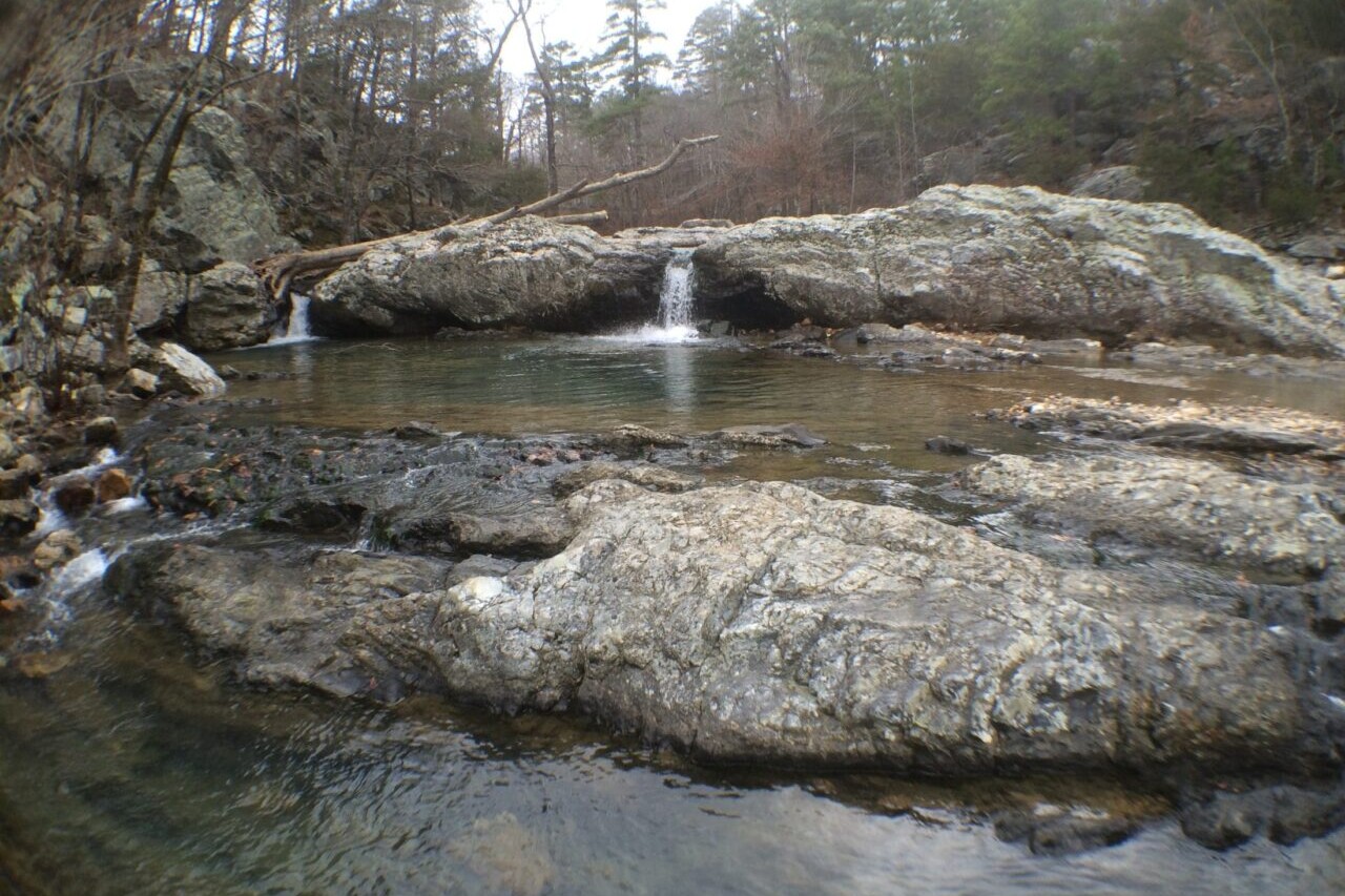
Eagle Rock Loop
Climb though the rugged hardwood and pine forests of Arkansas’s Ouachita Mountains on the The Eagle Rock Loop. This trail travels through the Ouachita National Forest via the Little Missouri Trail, the Viles Branch Horse Trail, and the Athens-Big Fork Trail, along a 100 year-old postal route and many old wagon roads. This loop is among the most difficult yet popular routes in Arkansas. Considered by many to be the best hike in the Ouachita Mountains, as well as a great bike route, this trail offers rugged climbs though hardwood and pine forests, numerous beautiful stream crossings, and a variety of stunning mountain peaks. Hikers and bikers on this loop can choose from five trailheads, which means there are many ways to hike this trail.
20% off for our Hiking Season Kick-off SALE! The Arkansas Hiker Bundle is now $15.99. Explore the Arkansas Hiker bundle!
30% off for our Small Business Saturday SALE! The Arkansas Hiker Bundle is now $13.99. Explore the Arkansas Hiker bundle!
Arkansas, Eagle Rock Loop
Photo by Logan Wilcoxson
4.8 ★★★★★ | 17K+ Reviews
Eagle Rock Loop
27 miles • Arkansas
Download our guide to access the Eagle Rock Loop Trail map, tracks, waypoints, and comments! Climb though the rugged hardwood and pine forests of the Ouachita Mountains on the The Eagle Rock Loop. This trail travels through the Ouachita National Forest via the Little Missouri Trail, the Viles Branch Horse Trail, and the Athens-Big Fork Trail, along a 100 year-old postal route and many old wagon roads. This loop is among the most difficult yet popular routes in Arkansas. Considered by many to be the best hike in the Ouachita Mountains, as well as a great bike route, this trail offers rugged climbs though hardwood and pine forests, numerous beautiful stream crossings, and a variety of stunning mountain peaks. Hikers and bikers on this loop can choose from five trailheads, which means there are many ways to hike this trail.
$4.99 full guide
$4.99 full guide
Eagle Rock Loop Map


How can I get it?
The Eagle Rock Loop map is available as an in-app purchase in our Guthook Guides app or our Bikepacking Guides app, both free downloads from the Apple App Store or the Google Play Store.
Our iOS and Android apps do differ slightly in their appearance. However, the majority of their features remain the same, and they access the same trail guide data.
Save 33% off our Arkansas hiking trails with the Arkansas Hiker Special! Includes: Ouachita Trail, Ozark Highlands Trail, Buffalo River Trail and Eagle Rock Loop
$19.99
26.8-mile loop trail through the Ouachita National Forest via the Little Missouri Trail, Viles Branch Horse Trail, and Athens-Big Fork Trail. This trail is among the most difficult yet popular hikes and bike routes in Arkansas.
$4.99
Photos from the Eagle Rock Loop
Hike more.
Check out some of the other trail guides we offer!
4.8 ★★★★★ | 17K+ Reviews
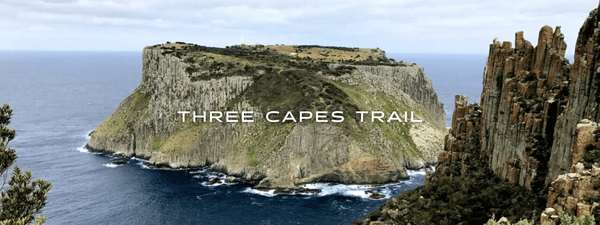
Three Capes Track
The Three Capes Track is a cliff hugging hike in the wilds of Tasmania. The amazing, ancient dolerite cliffs of Cape Pillar, Cape Hauy, and Cape Raoul drop 300 meters directly to the ocean, making them the tallest sea cliffs in the southern hemisphere. This is a hut hike and allows only 48 hikers each day. Hikers start and finish their journey at the World Heritage-listed Port Arthur Historic Site. Hikers might even see migratory whales, dolphins, and resident fur seal populations. The hike takes you through woodlands, ferny forests, and coastal areas. Australia.
20% off for our Hiking Season Kick-off SALE! The Australia and New Zealand Hiker Special is now $35.99. Explore the Aus NZ Hiker Special!
20% off for our Boxing Day SALE! The Australia and New Zealand Hiker Special is now $35.99. Explore the Aus NZ Hiker Special!
Tasmania, Australia, Three Capes Track
Photo courtesy of Active Wayz
4.8 ★★★★★ | 17K+ Reviews
Three Capes Track
48 km / 30 miles • Tasmania, Australia
Download our guide to access the Three Capes Track map, tracks, waypoints, and comments! The Three Capes Track is a cliff hugging hike in the wilds of Tasmania. The amazing, ancient dolerite cliffs of Cape Pillar, Cape Hauy, and Cape Raoul drop 300 meters directly to the ocean, making them the tallest sea cliffs in the southern hemisphere. This is a hut hike and allows only 48 hikers each day. Hikers start and finish their journey at the World Heritage-listed Port Arthur Historic Site. Hikers might even see migratory whales, dolphins, and resident fur seal populations. The hike takes you through woodlands, ferny forests, and coastal areas.
AU$5.99/NZ$6.99/US$3.99 full guide
AU$5.99/NZ$6.99/US$3.99 full guide
Three Capes Track Map


How can I get it?
Available as an in-app purchase in our Guthook Guides app, a free download from the Apple App Store or the Google Play Store.
Our iOS and Android apps do differ slightly in their appearance. However, the majority of their features remain the same, and they access the same trail guide data.
Hike Australia and New Zealand with a saving of 56% over buying the trails separately. This bundle does not include Te Araroa hikes which are part of the Te Araroa Bundle.
Purchase now and get all future trails added to the bundle for free!
This bundle currently includes: Australian Alps Walking Track, Bibbulmun Track, Cape to Cape, George Bass Coastal Walk, Greenstone and Caples Track, Heysen Trail, Kepler Track, Larapinta Trail, Milford Track, Overland Track, Routeburn Track, Three Capes Track, Walk the Yorke, and Wilsons Promontory Grand Circuit.
AU$69.99 / NZ$77.99 / US$44.99
Tasmania, Australia, 48 km, Coastal, 3 Days.
The Tasmanian 3 Capes Track is a cliff hugging hike in the wilds of Tasmania. The amazing, ancient dolerite cliffs of Cape Pillar, Cape Hauy and Cape Raoul drop 300 metres directly to the ocean making them the tallest sea cliffs in the southern hemisphere. This 46km hike is set up as a hut hike and allows only 48 hikers each day. You are required to stop at each hut and stay a night along the way.
You start and finish your journey at the World Heritage-listed Port Arthur Historic Site. The first part of the tour is a boat cruise where you will explore coves and see the amazing dolerite cliffs from the water as you head to Denmans Cove. You might be lucky to see migratory whales, dolphins and resident fur seals populations. The hike takes you through Eucalypt woodlands, ferny forests and coastal heaths. At Cape Hauy spot the climbers out on the Totem Pole – a small column of rock that just up from the oceans below.
AUD$5.99 / NZ$6.99 / US$3.99
Hike more.
Check out some of the other trail guides we offer!
About our partner
Active Wayz
Activewayz is very passionate about the outdoors, whether it be hiking, bushwalking, or tramping. They enjoy mapping new routes and planning new adventures to share in the app. They have incorporated their love for adventure, long-distance hiking, and mapping to create a resourceful guide in Australia and New Zealand.