
Bringing Leave No Trace to Life Off-Trail
Planning an adventure? Check out our popular trail guides! 4.8 stars (17K+ ratings)
My backyard container garden.
Photo by Zoë Symon
Bringing Leave No Trace to Life Off-Trail
This post was originally written for The Trek after my Appalachian Trail thru-hike. Leave No Trace is a moral code and daily practice for any thru hiker, section hiker, or day hiker. It teaches us to respect the ground we walk on, the plants that grow from it, the animals who share our space, and the other hikers. When we get off-trail and go home to our apartment or house, how do we bring the lessons of the trail back home with us? This led me to research and think about a variety of topics including self-sufficiency and zero waste.
Zoë Symon Inside Atlas Guides 10/10/2019
Zoë Symon
Inside Atlas Guides
10/10/2019
Originally written for The Trek. See the original post here.
Leave No Trace is a moral code and daily practice for any thru hiker, section hiker, or day hiker. It teaches us to respect the ground we walk on, the plants that grow from it, the animals who share our space, and the other hikers.
Why is it that, as soon as we return to “the real world” we forget about the ways we lived kindly withe the natural world around us? We buy pre-packaged food and throw all the wrappers and scraps into the trash, we buy a iced coffee in a plastic cup and chuck it in the nearest trash can when we are done, we buy the cheapest things we can with no thought to how they came to be there or how they were made.
While I was on the Appalachian Trail, Leave No Trace was an ethos that I did my best to follow every day. Over the past year or so, I’ve started to think more about how Leave No Trace principles can extend to my off-trail life as well. What is the impact I have on this planet? How can I tread more lightly on this place we call home?
Not all of us are able to live trail life, or a more minimalist, nomadic lifestyle, for the entire year. When we get off-trail and go home to our apartment or house, how do we bring the lessons of the trail back home with us?
This led me to research and think about a variety of topics including self-sufficiency and zero waste.The Zero Waste International Alliance defines Zero Waste as:
A goal that is ethical, economical, efficient and visionary, to guide people in changing their lifestyles and practices to emulate sustainable natural cycles, where all discarded materials are designed to become resources for others to use. Zero Waste means designing and managing products and processes to systematically avoid and eliminate the volume and toxicity of waste and materials, conserve and recover all resources, and not burn or bury them. Implementing Zero Waste will eliminate all discharges to land, water or air that are a threat to planetary, human, animal or plant health.
I believe that, as people who love the trail – love a part of the natural world – we have a responsibility to see that it continues to exist and thrive for future years and generations. We have a responsibility to check and examine our own consumption and disposal habits and practices. We also have a responsibility to bring the power of our community to bear on the forces that would seek to undermine, destroy, or disregard these natural spaces that we care about.
A few ways you can start thinking about zero waste, self-sufficiency, and off-trail Leave No Trace:
- Set goals for yourself. Can’t put plants in the ground because you live in an apartment? Try setting a goal to grow a few herbs on your kitchen countertop. Do you clean your house (if not, gross.)? Think about turning your last cleaning spray bottle into a reusable bottle. Mix up your own cleaning solution, and get to work! Set goals for 1 month, 1 year, and 5 years. Track your progress!
- Engage in your community. Are you passionate about environmental policy? Write a letter to your representatives, or research the grassroots movements are happening in your area. Are you interested in eating local? Buy your produce at a farmer’s market or go visit a farm!
- Advocate for Zero Waste and sustainable practices. Talk about this with your friends and family. Start a meetup! Research and share blog posts and recipes (you could start with this one!).
- Be conscientious and deliberate. Research the companies and products that you purchase. Support companies and organizations that are transparent, sustainable, and considerate with their sourcing and production practices.
It seems like a daunting task to climb these mountains and implement these changes in my life, but as I well know, all hikes have to start with a first step.
So what am I doing?
My first baby steps down this journey are to be more deliberate about the cleaning products I use, how and where I get my food, and attempting a garden of my own.

Homemade cleaning supplies.
Photo by Zoë Symon
Cleaning Supplies
I find cleaning to be a meditative and satisfying activity (I’m probably the only one), but when looking at the amount of paper towels, plastic bottles of cleaning products, and Swiffer sheets that I go through, I cringe. Time to make a change. Pictured here with my prayer plant is homemade all-purpose cleanser and homemade air freshener.
All-Purpose Cleaner
Any aspiring zero-waster should invest in a good reusable spray bottle (or multiple!). A great mixture is 50/50 water and white vinegar. I’ve added drops of essential oil – rosemary and lemon – because I’m a sucker for good-smelling cleaners.
Air Freshener
You can also make DIY air fresheners using essential oils. I borrowed a recipe from Jill at The Prairie Homestead. Combine 3/4 cup of water with 2 tbsp of alcohol (vodka, rubbing alcohol, and vanilla extract all work, according to Jill. I used rubbing alcohol because it’s what I had on hand) and add your desired essential oil scents. I used lavender, rosemary, and lemon, for a refreshing and clean smell.

Vegetables in reusable vegetable bags.
Photo by Zoë Symon
Buying Food
Another change I’ve made is to frequent my local farmer’s market more often. By supporting local growers, I can rest easy knowing what processes, techniques, and chemicals they’ve used to grow their food.
One of the seven Leave No Trace principles is to Plan Ahead and Prepare. Leave No Trace adds a sub-component of that principle by asking hikers to repackage food to minimize waste. This idea can easily be applied to off-trail life. Whenever you go grocery shopping, whether it’s at your local farmer’s market or a big box store, remember to minimize the packaging waste of the food you are purchasing. I’ve extended the zero waste impact of my shopping by using reusable bags.
Produce Bags
We’re all used to those flimsy plastic bags at grocery stores. What are they good for once you get home? I’ve used them in the past to pick up dog poop or line small trash cans, but that’s really their only use, and then they go in the trash. Why not invest $10 and get some cotton mesh bags that you can reuse again and again? There are a variety of options out there, but I bought these on Amazon.
Grocery Bags
Reusable grocery bags are even more common than reusable produce bags. Your grocery store probably even sells them. Find yourself a couple of tote bags, and don’t let the cashier ever give you a plastic bag again!
Buying in Bulk
In addition to having your own bags, consider finding a store where you can buy in bulk. Why buy pre-packaged goods when you could buy exactly how much you need for the next day, week, month, or year – without the excess packaging.

Vegetables from my garden.
Photo by Zoë Symon
Growing Food
Another way to minimize your waste impact is to grow your own food. This sounds daunting, but it’s really not! I was surprised how easy this was to do, even with my lack of a green thumb. If I can do it, you can too!
Container Garden
This season, I attempted to grow a container garden. We gathered some 5-gallon buckets, drilled a few holes in the bottom, and planted some seedlings purchased from our local nursery. We have 5 tomato plants, a few okra plants, 4 bell pepper plants (all varieties), herbs, and some strawberries (these didn’t fare as well as the rest).
Next year, I’ll probably try a few more varieties of vegetables, and I might even be a little more scientific about it by looking up a growing schedule for my region. I also hope to invest in canning supplies so that I can store my vegetables for less bountiful months.
Composting
I haven’t yet built my own compost pile, but most cities have opportunities for composting. Some have businesses that offer composting services (think of it as a utility, like garbage, water, or electric), some have local farmers who would be happy to add your food scraps to their piles, and some offer a variety of composting as a part of standard yard waste disposal.
Another of the seven Leave No Trace principles is to Dispose of Waste Properly. On the trail, this includes not leaving your food scraps around for people or animals to find. Why shouldn’t we continue this practice off-trail? Landfills keep trash for years, and organic matter can get buried and sealed under non-organic trash. This creates a vacuum where the organic matter breaks down anaerobically and creates methane, which is a very environmentally damaging greenhouse gas. If you want your favorite trail to be here in the future, compost!
Want to keep up with all that’s going on at Atlas Guides? Sign up for our newsletter!
Read more!
Check out some related blog posts!
Download our popular hiking and biking guides!

Trail guides that get you to places you’ve dreamed of.
As the makers of Guthook Guides, Bikepacking Guides, and Cyclewayz, we help you navigate the most popular trails around the world on your smartphone. Our hiking guides and biking guides work completely offline. Let Guthook guide your next adventure!
Showers Lake Vista, Tahoe Rim Trail
Photo courtesy of the Tahoe Rim Trail Association

Showers Lake Vista, Tahoe Rim Trail
Photo courtesy of the Tahoe Rim Trail Association
Trail guides that get you to places you’ve dreamed of.
As the makers of Guthook Guides, Bikepacking Guides, and Cyclewayz, we help you navigate the most popular trails around the world on your smartphone. Our hiking guides and biking guides work completely offline. Let Guthook guide your next adventure!
Download our popular hiking and biking guides!
About the Author

Zoë Symon
Zoë grew up in North Carolina and first heard of the Appalachian Trail during her time in college. In 2016, she took a leave of absence from her job and thru-hiked the trail. This adventure fostered her love for the outdoors and for hiking. Currently, she explores the public lands of Oregon. In 2017 she joined the team at Atlas Guides as Creative Director. She spends her days improving experiences for all our users.
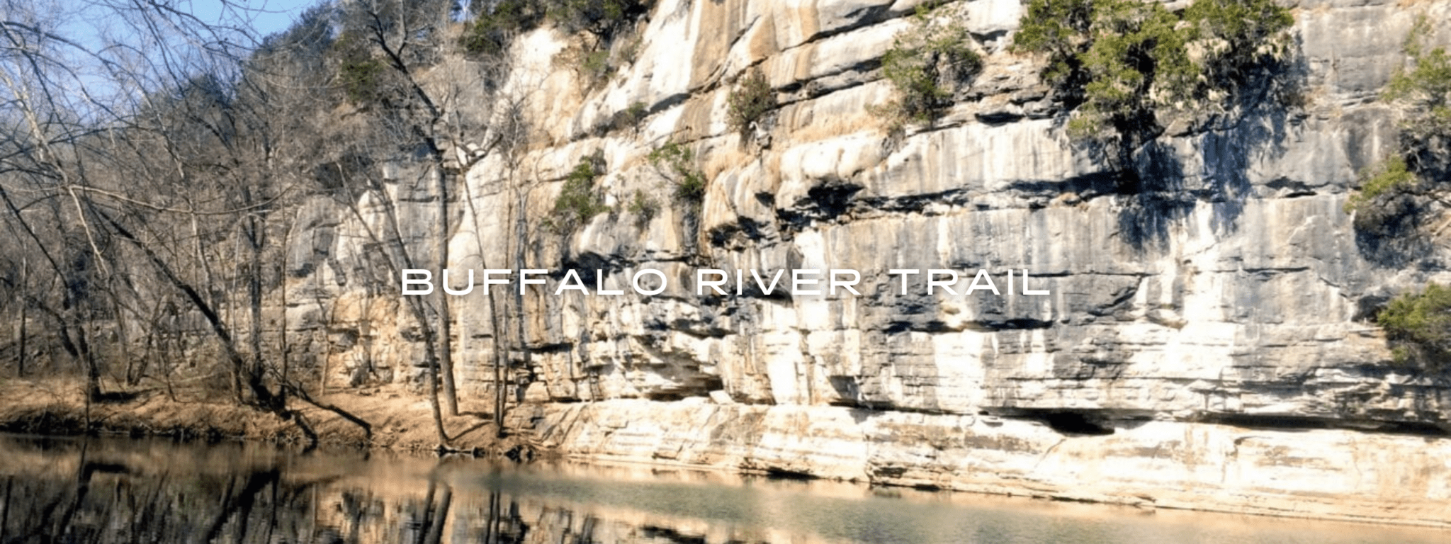
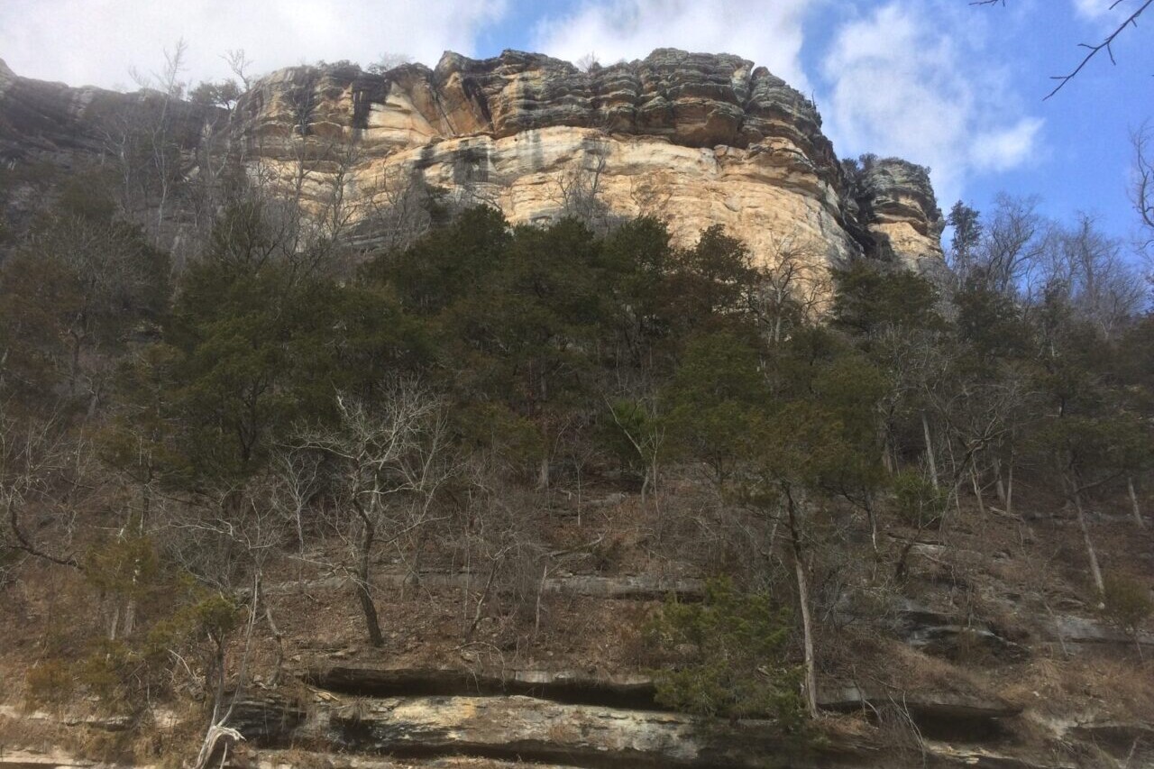
Buffalo River Trail

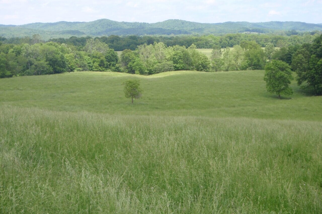
This 37-mile trail follows the Buffalo National River in Arkansas, America’s first National River and one of the few remaining undammed rivers in the United States. The trail travels from Boxley Valley to Woollum where it joins the Ozark Highlands Trail. It follows the stunning and rugged landscape on the southern side of the river, passing epic views from cliffs, historical features including homestead sites and Civil War-era mining and logging sites, as well as a multitude of native wildlife. This is another great Southern trail to hike in the spring and fall.
20% off for our Hiking Season Kick-off SALE! The Arkansas Hiker Bundle is now $15.99. Explore the Arkansas Hiker bundle!
30% off for our Small Business Saturday SALE! The Arkansas Hiker Bundle is now $13.99. Explore the Arkansas Hiker bundle!
Buffalo River, Arkansas, Buffalo River Trail
Photo by Logan Wilcoxson
4.8 ★★★★★ | 17K+ Reviews
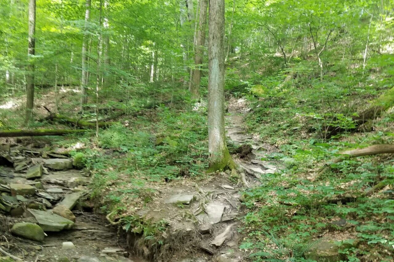
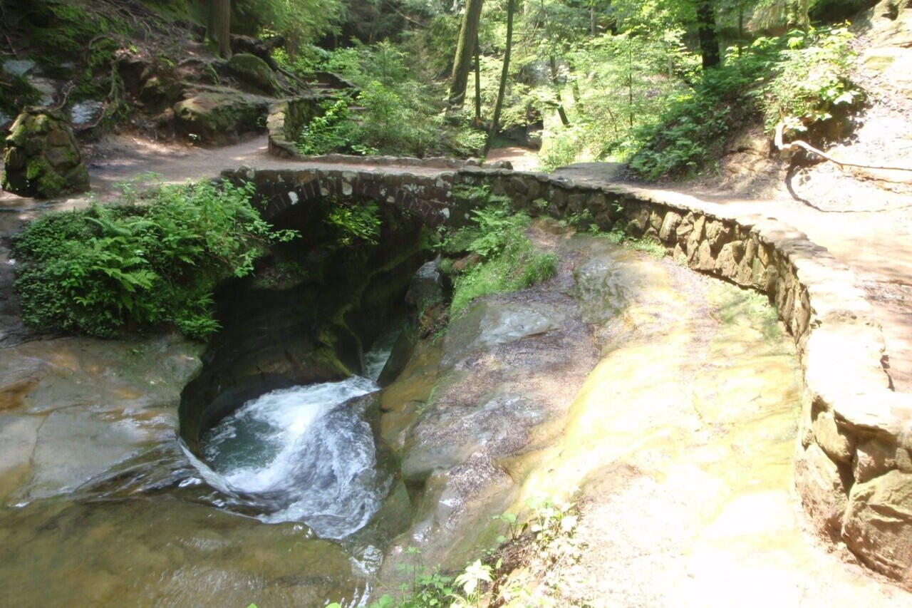
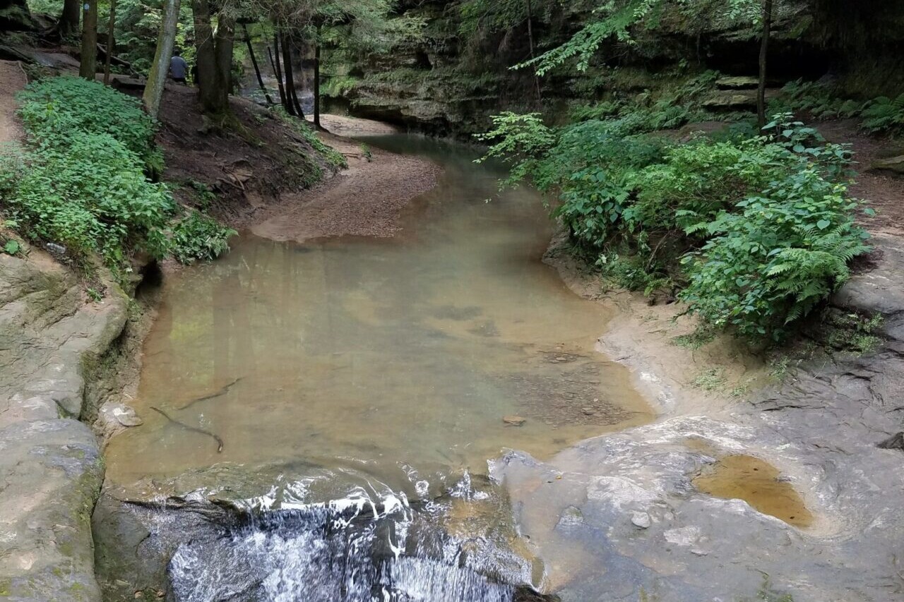
Buffalo River Trail
37 miles • Arkansas
Download our guide to access the Buffalo River Trail map, tracks, waypoints, and comments! Follow the rugged scenic shores of America's first National River on the Buffalo River Trail. This 37-mile trail follows the Buffalo National River, America's first National River and one of the few remaining undammed rivers in the United States. The trail travels from Boxley Valley to Woollum where it joins the Ozark Highlands Trail. It follows the stunning and rugged landscape on the southern side of the river, passing epic views from cliffs, historical features including homestead sites and Civil War-era mining and logging sites, as well as a multitude of native wildlife. This is another great Southern trail to hike in the spring and fall.
$4.99 full guide
$4.99 full guide


Buffalo River Trail Map


How can I get it?
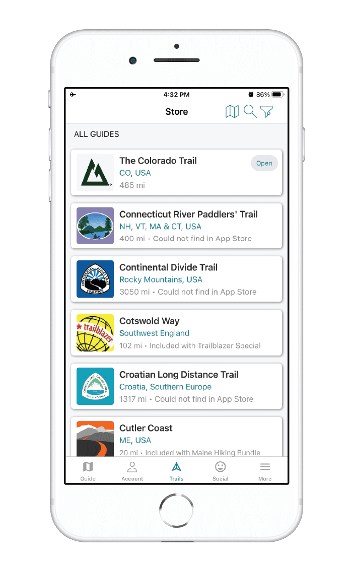
The Buffalo River Trail map is available as an in-app purchase in our Guthook Guides app, a free download from the Apple App Store or the Google Play Store.
Our iOS and Android apps do differ slightly in their appearance. However, the majority of their features remain the same, and they access the same trail guide data.
Save 33% off our Arkansas hiking trails with the Arkansas Hiker Special! Includes: Ouachita Trail, Ozark Highlands Trail, Buffalo River Trail and Eagle Rock Loop
$19.99
The 37.1-mile Buffalo River Trail follows the Buffalo National River, America’s first National River and one of the few remaining undammed rivers in the U.S.
$4.99
Photos of the Buffalo River Trail
Hike more.
Check out some of the other trail guides we offer!

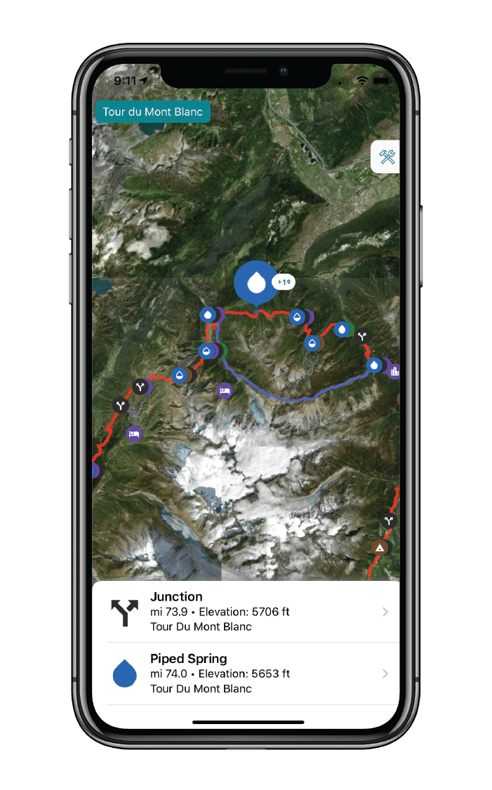
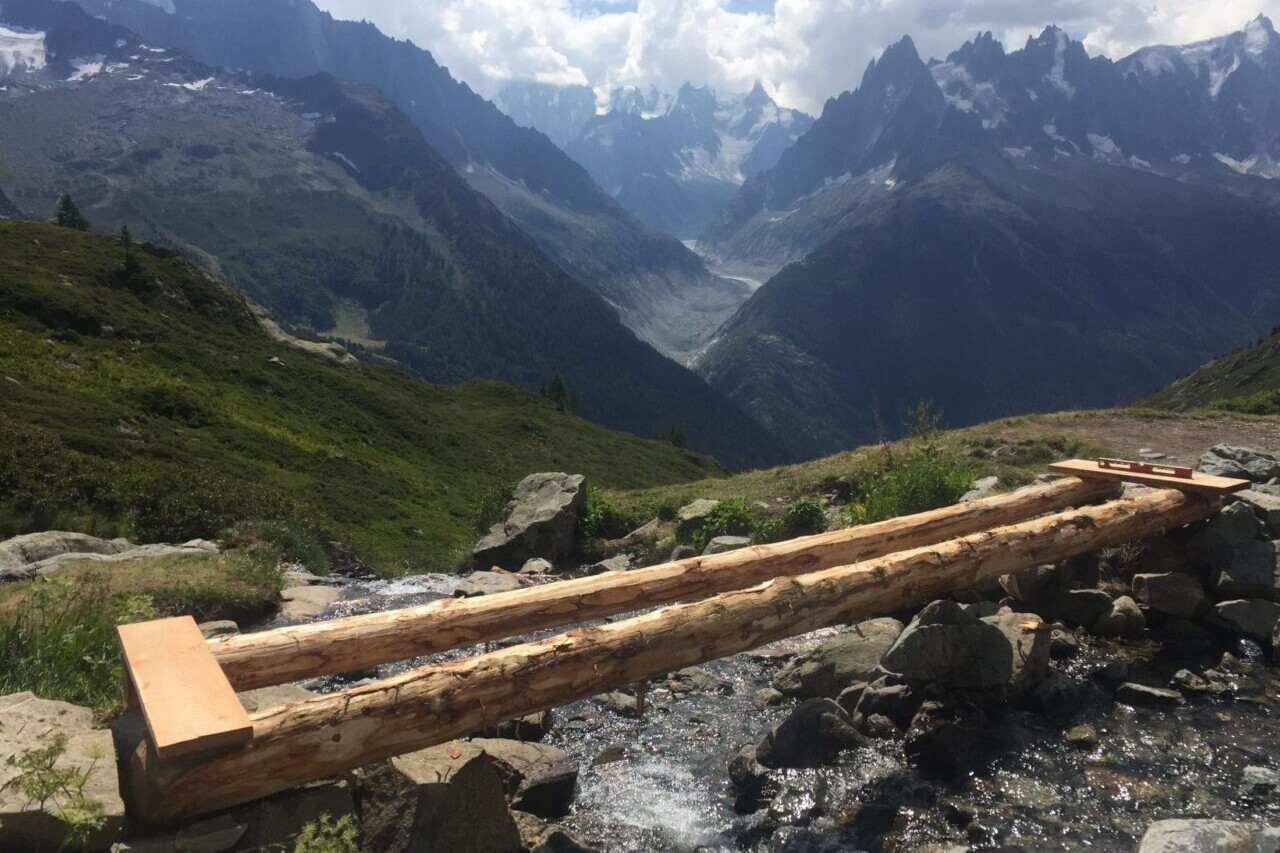
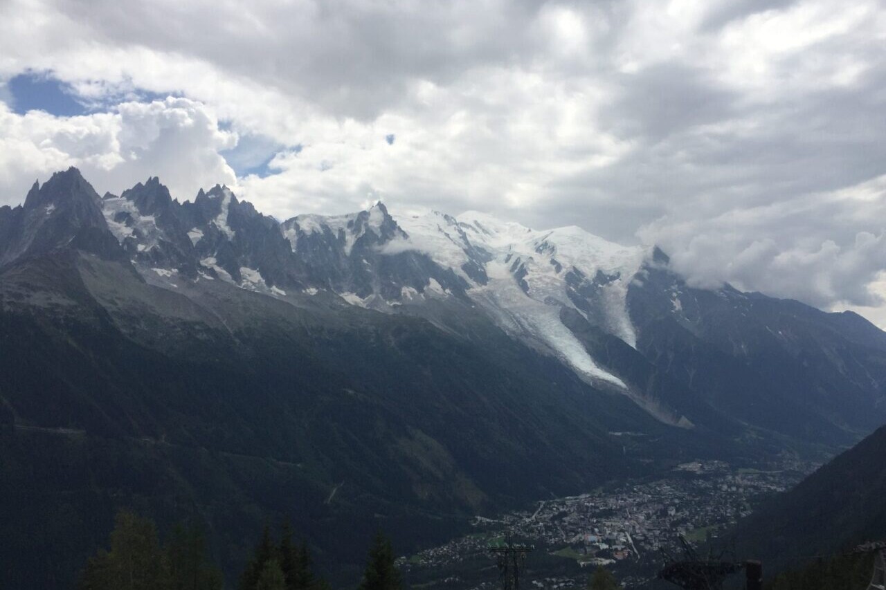
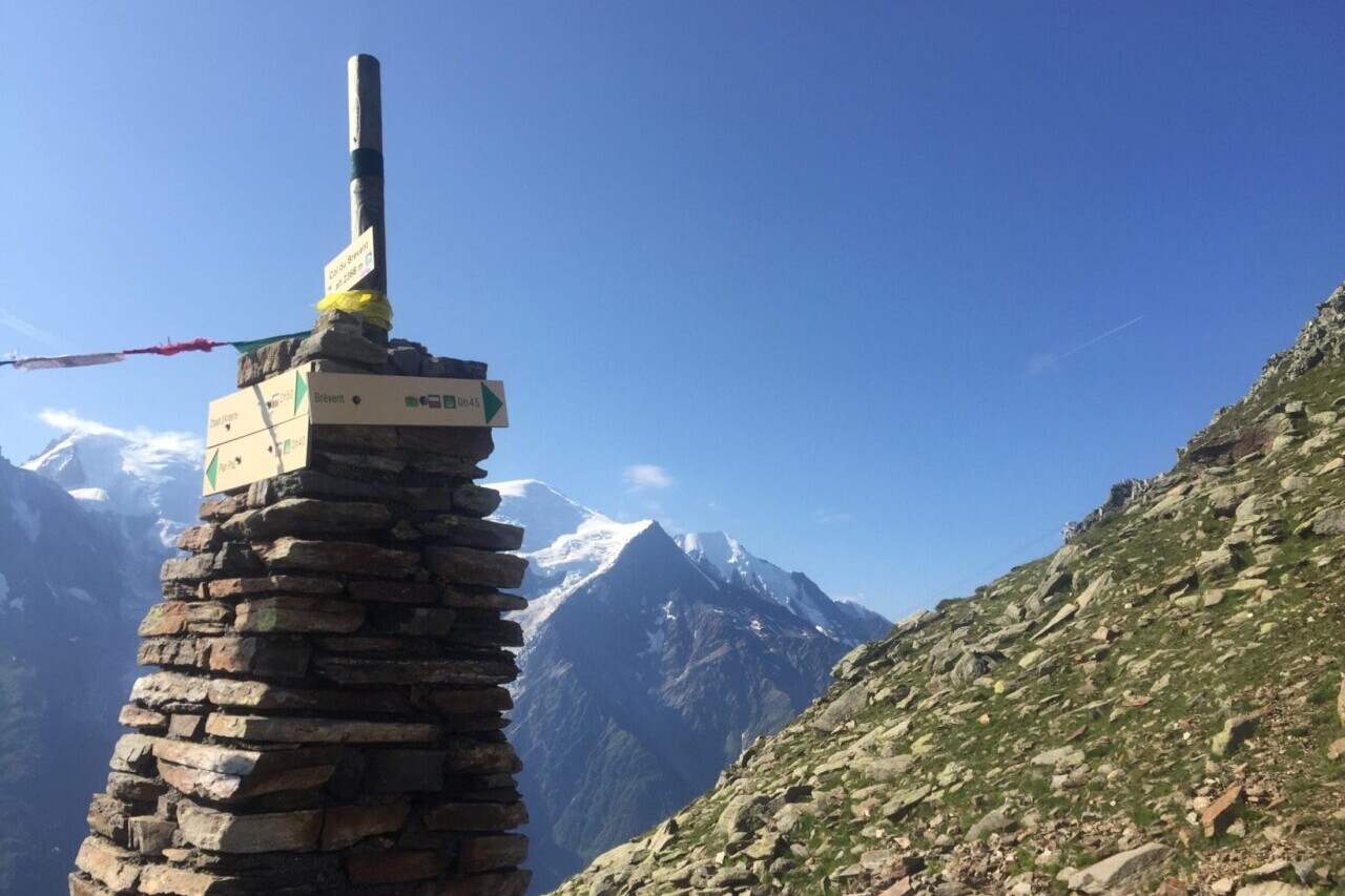
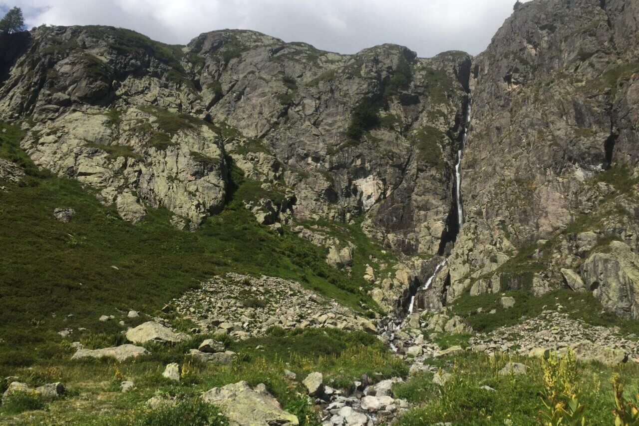
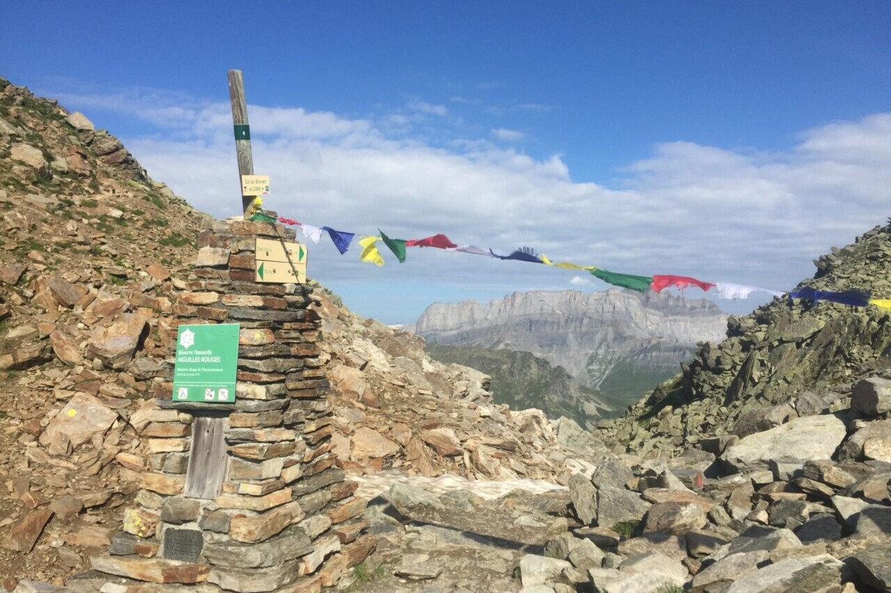
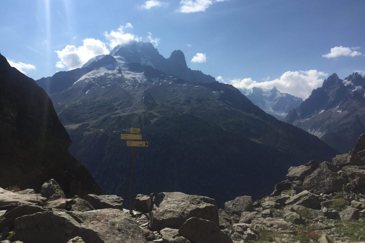
Tour du Mont Blanc
Official Companion App to the Trailblazer Guidebook to the Tour du Mont Blanc. Trek the European Alps through the epic peaks and stunning valleys of the Tour du Mont Blanc. The Tour du Mont Blanc is one of the world’s most famous hiking trails. This loop route passes through seven stunning mountain valleys around the spectacular Mont Blanc. This amazing scenery is classic European Alps: rugged spiky mountains, lush green valleys, strenuous mountain passes, and photo-worthy vistas. Hikers can start the loop from a variety of points in France, Italy, and Switzerland, including in Les Houches in the Chamonix Valley, Les Contamines in the Montjoie Valley, Courmayeur, Champex, and Martigny. The route also passes Chamonix, the famous resort which hosted the first Winter Olympic Games in 1924.
New Trail! The Tour du Mont Blanc is new to our set of hiking guides. Explore it today!
European Alps, Tour du Mont Blanc
Photo courtesy of Trailblazer Guides
4.8 ★★★★★ | 17K+ Reviews
Tour du Mont Blanc
170km / 105 miles • The Alps of France, Italy & Switzerland
Official Companion App to Trailblazer's Tour du Mont Blanc by Jim Manthorpe
Download our guide to access the Tour du Mont Blanc map, tracks, waypoints, and comments! Trek the European Alps through the epic peaks and stunning valleys of the Tour du Mont Blanc. The Tour du Mont Blanc is one of the world’s most famous hiking trails. This loop route passes through seven stunning mountain valleys around the spectacular Mont Blanc. This amazing scenery is classic European Alps: rugged spiky mountains, lush green valleys, strenuous mountain passes, and photo-worthy vistas. Hikers can start the loop from a variety of points in France, Italy, and Switzerland, including in Les Houches in the Chamonix Valley, Les Contamines in the Montjoie Valley, Courmayeur, Champex, and Martigny. The route also passes Chamonix, the famous resort which hosted the first Winter Olympic Games in 1924.
$6.99 full guide A Trailblazer Guide
$6.99 full guide
A Trailblazer Guide
Tour du Mont Blanc Map


How can I get it?
The Tour du Mont Blanc map is available as an in-app purchase in our Guthook Guides app, a free download from the Apple App Store or the Google Play Store.
Our iOS and Android apps do differ slightly in their appearance. However, the majority of their features remain the same, and they access the same trail guide data.
The Tour du Mont Blanc is one of the world’s most famous hiking trails. This loop route passes through seven stunning mountain valleys around the spectacular Mont Blanc. This amazing scenery is classic European Alps: rugged spiky mountains, lush green valleys, strenuous mountain passes, and photo-worthy vistas. Hikers can start the loop from a variety of points in France, Italy, and Switzerland, including in Les Houches in the Chamonix Valley, Les Contamines in the Montjoie Valley, Courmayeur, Champex, and Martigny. The route also passes Chamonix, the famous resort which hosted the first Winter Olympic Games in 1924.
$6.99
Photos of the Tour de Mont Blanc
Hike more.
Check out some of the other trail guides we offer!
About our partner
Trailblazer Guides
Since 1991 Trailblazer has been publishing a select list of practical guidebooks written by travellers for travellers. Their guidebooks include everything from adventure travel guides, to rail guides, to worldwide trekking guides, including British walking guides. Trailblazer guides are entertaining as well as informative, and are strong on practical information without neglecting the cultural background.
Atlas Guides created and maintains the official app of Trailblazer’s British Walking Guides.
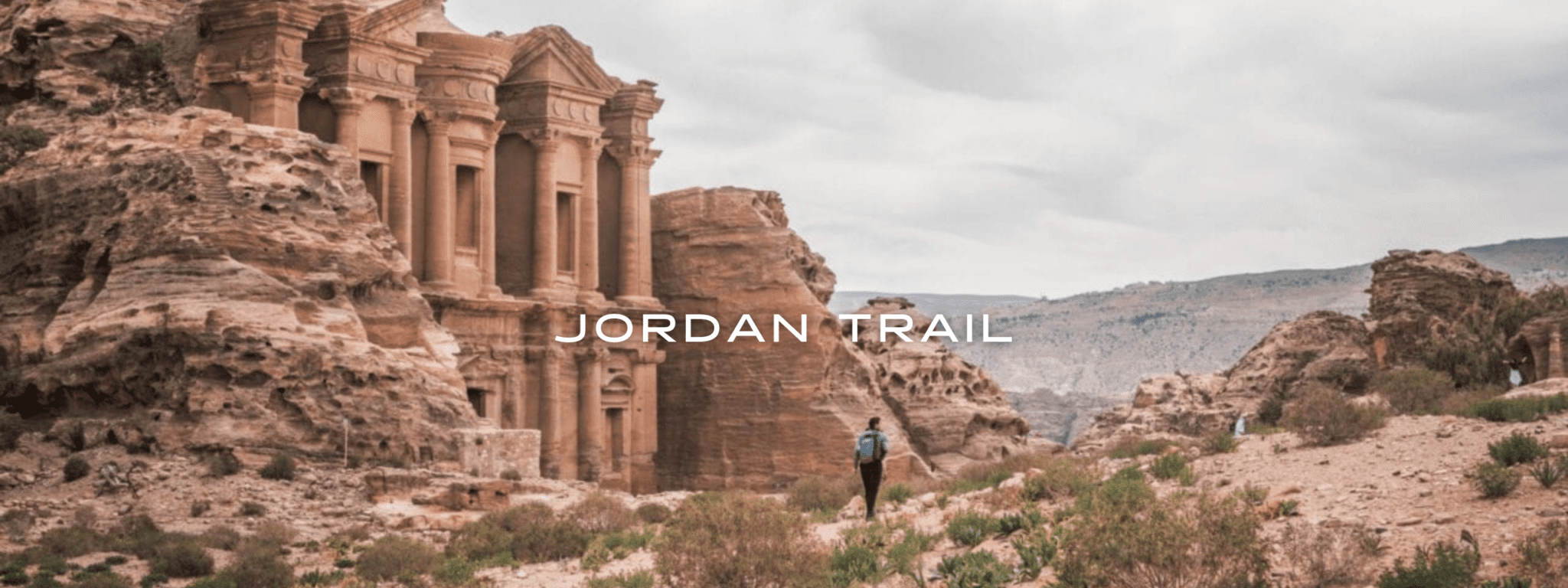
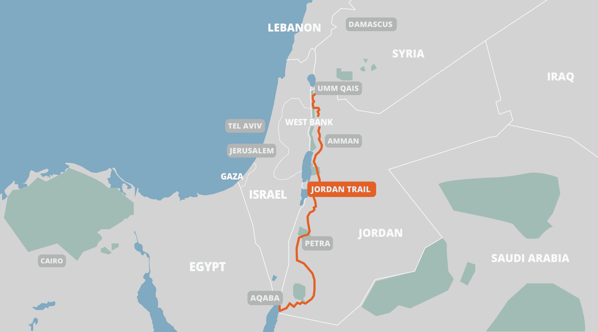
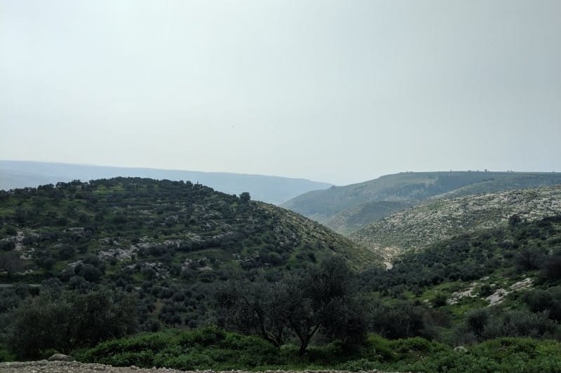
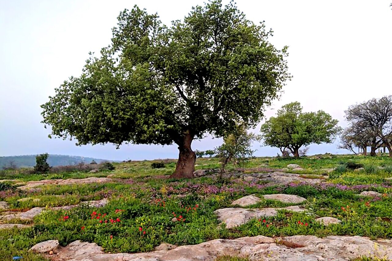
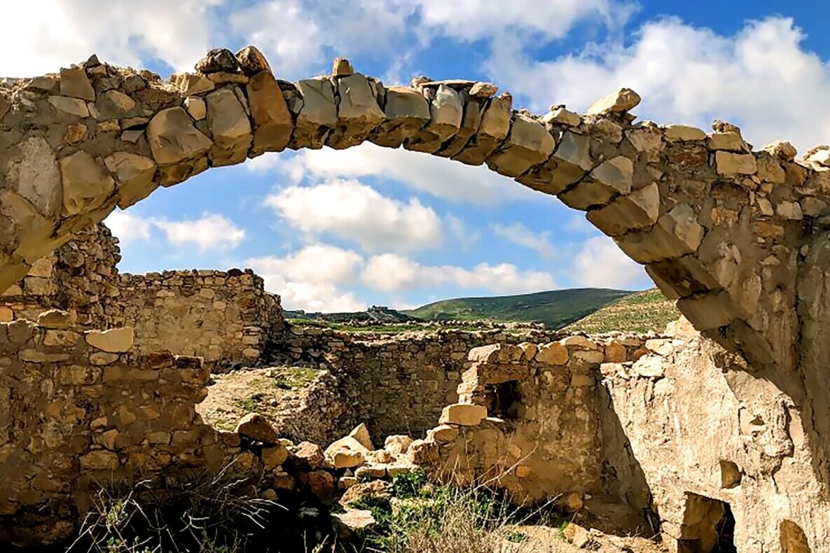
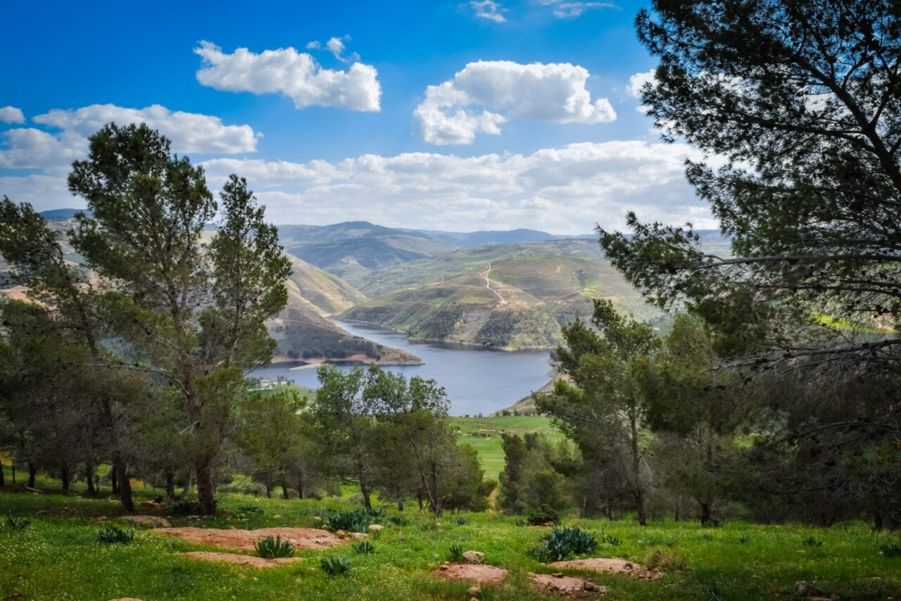
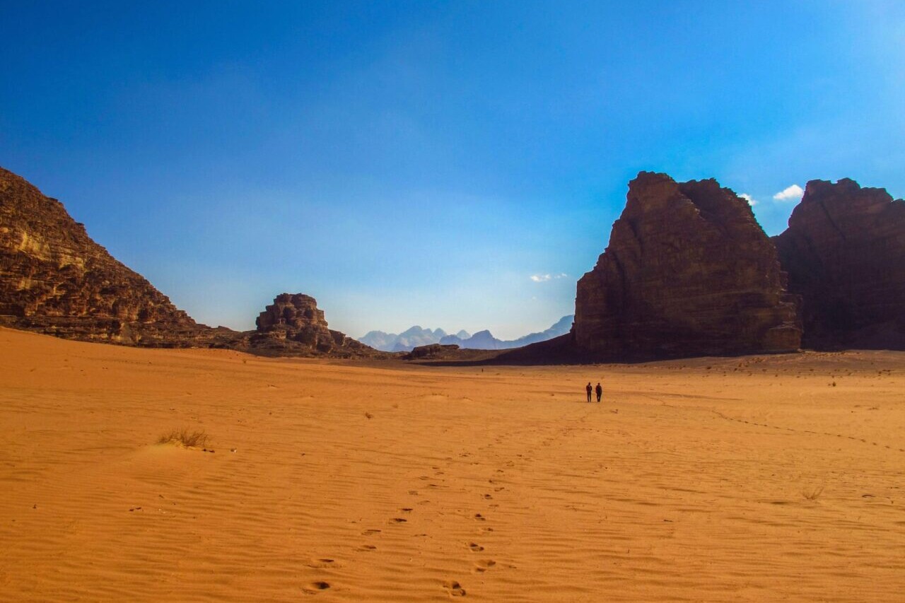
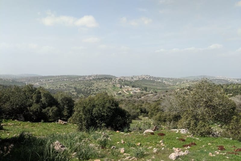
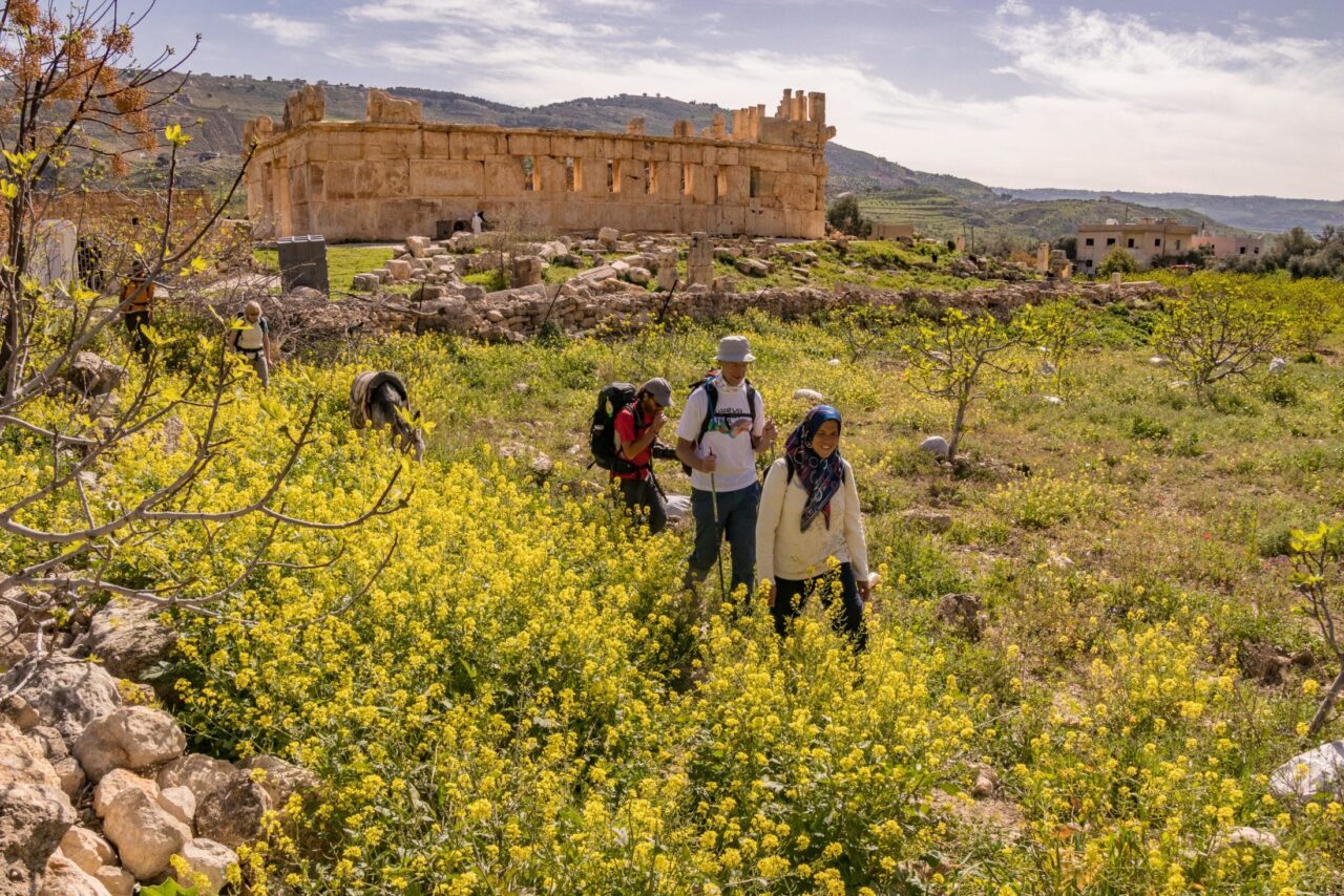
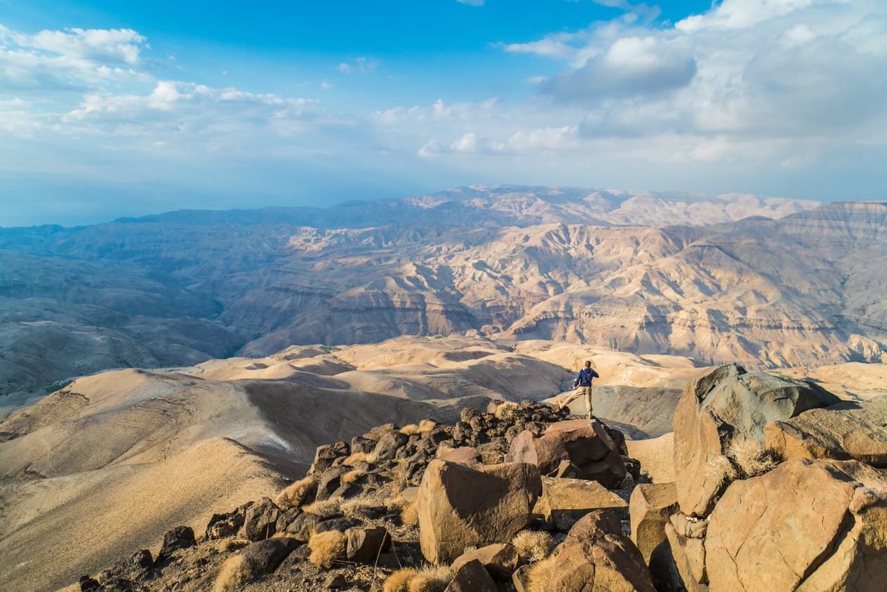
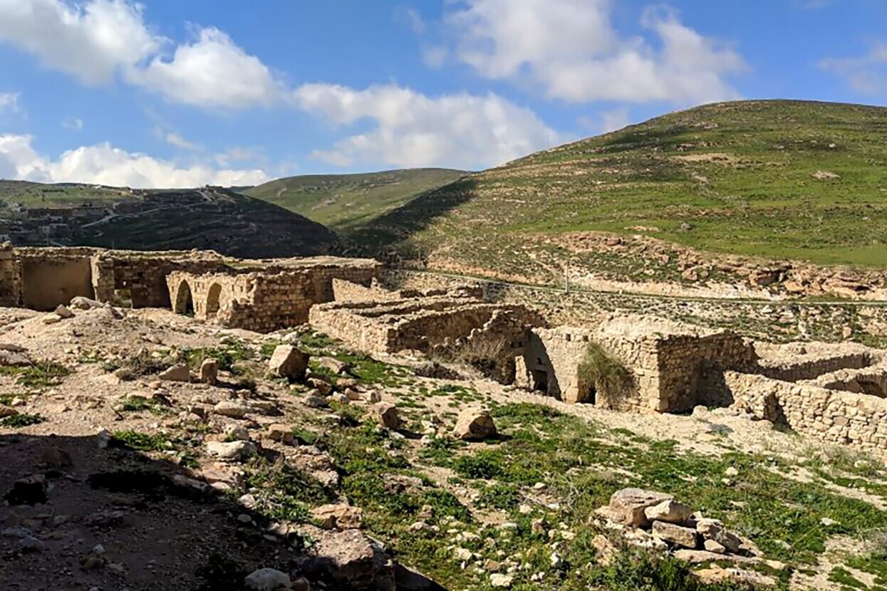
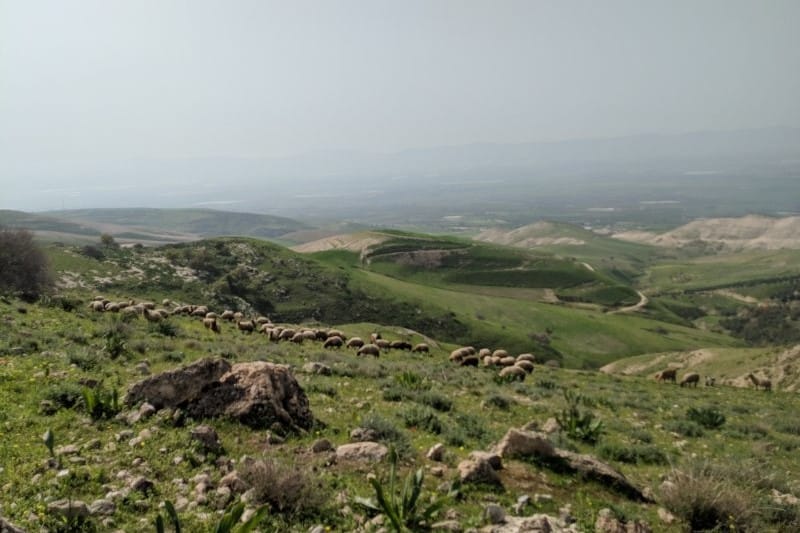
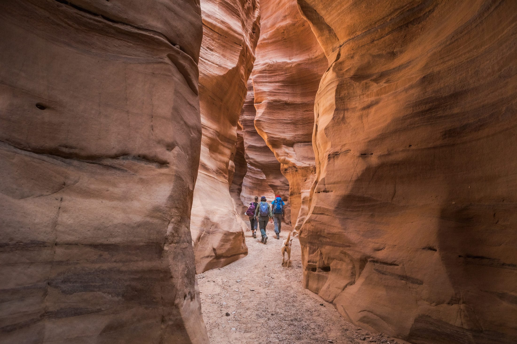
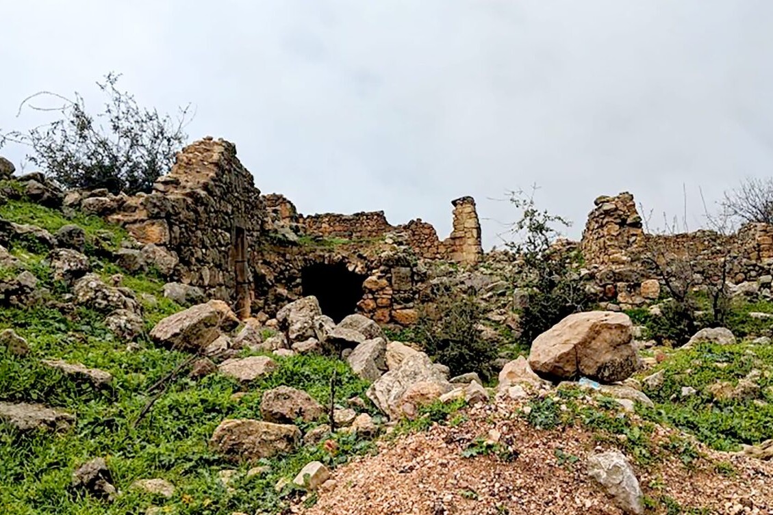
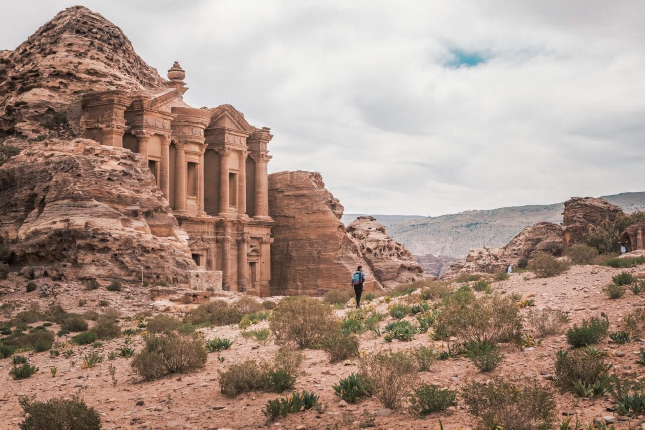
Jordan Trail
Official app of the Jordan Trail Association. Travel through desert history, culture, and stunning landscapes on the Jordan Trail. The Jordan Trail is a rugged and historic route that crosses the entire country of Jordan. It runs along parts of ancient trading routes and intersects with the King’s Highway that stretched from Egypt to Aqaba and then north to Damascus, and is said to have been travelled by many ancient people, including such historic figures as Jesus, Moses, and Muhammad. The Jordan Trail stretches from the Fertile Crescent in the North to the edge of the Arabian Desert and the Red Sea in the South. The trail travels through a multitude of villages, allowing hikers to experience rich culture, natural beauty, and vivid history. The project is supported by numerous groups, including volunteers, Bedouin tribes, and local hiking enthusiasts. Middle East.
20% off for our Hiking Season Kick-off SALE! The Jordan Trail is now $7.99.
New guide! The Jordan Trail is new to our set of hiking guides. Explore it today!
Al Der Petra, Jordan Trail
Photo courtesy of the Jordan Trail Association
4.8 ★★★★★ | 17K+ Reviews
Jordan Trail
650 km / 400 miles • Jordan
Official App of the Jordan Trail Association
Download our guide to access the Jordan Trail map, tracks, waypoints, and comments! Travel through desert history, culture, and stunning landscapes on the Jordan Trail. The Jordan Trail is a rugged and historic route that crosses the entire country of Jordan. It runs along parts of ancient trading routes and intersects with the King’s Highway that stretched from Egypt to Aqaba and then north to Damascus, and is said to have been travelled by many ancient people, including such historic figures as Jesus, Moses, and Muhammad. The Jordan Trail stretches from the Fertile Crescent in the North to the edge of the Arabian Desert and the Red Sea in the South. The trail travels through a multitude of villages, allowing hikers to experience rich culture, natural beauty, and vivid history. The project is supported by numerous groups, including volunteers, Bedouin tribes, and local hiking enthusiasts.
$9.99 full guide Official App
$9.99 full guide
Official App
Jordan Trail Map


How can I get it?
The Jordan Trail map is available as an in-app purchase in our Guthook Guides app, a free download from the Apple App Store or the Google Play Store.
Our iOS and Android apps do differ slightly in their appearance. However, the majority of their features remain the same, and they access the same trail guide data.
The Jordan Trail is a rugged and historic route that crosses the entire country of Jordan. It runs along parts of ancient trading routes and intersects with the King’s Highway that stretched from Egypt to Aqaba and then north to Damascus, and is said to have been travelled by many ancient people, including such historic figures as Jesus, Moses, and Muhammad. The Jordan Trail stretches from the Fertile Crescent in the North to the edge of the Arabian Desert and the Red Sea in the South. The trail travels through a multitude of villages, allowing hikers to experience rich culture, natural beauty, and vivid history. The project is supported by numerous groups, including volunteers, Bedouin tribes, and local hiking enthusiasts.
$9.99

Cheers to giving back! Part of your purchase of the Jordan Trail goes to support the Jordan Trail Association’s work to preserve and maintain the trail. Learn about the Jordan Trail Association.
Photos of the Jordan Trail
Hike more.
Check out some of the other trail guides we offer!
About our partner
Jordan Trail Association
The initiative to create the Jordan Trail existed prior to the formation of the Jordan Trail Association, but as the project gained support, the JTA was formed to take on the development of the trail and its maintenance. The JTA was formed in July of 2015 and also works to establish strong connections and provide comprehensive information regarding the trail. The Jordan Trail is supported by many local volunteers, aids the economic development of local communities, and supports the country’s economy through minimum impact tourism and by promoting an outdoor culture and environmental awareness.

The One Piece of Gear You Never Knew You Needed
Planning an adventure? Check out our popular trail guides! 4.8 stars (17K+ ratings)
A hiker smiling in the forest.
Photo by Jamie Brown
The One Piece of Gear You Never Knew You Needed
This post was originally written for The Trek shortly after my Appalachian Trail thru-hike. Dental care in the backcountry is not something that is on the top of most hikers' lists to worry about before leaving. It often seems pretty self-explanatory. However, there are a variety of options out there for dental care while on the trail.
Zoë Symon Tech on the Trail 09/24/2019
Zoë Symon
Tech on the Trail
09/24/2019
Originally written for The Trek. See the original post here
Dental care in the backcountry seems relatively self-explanatory, right?
If you said yes, you would be right. However, like any part of your gear list, there’s always room for improvement.
Let me start with a story. When I was preparing for my thru-hike, I spent a lot of time walking through the aisles of Austin’s grocery stores looking for new varieties of bars and snacks to try, new dehydrated foods, trail mixes that I hadn’t sampled yet… you get the picture. One day, I had gone down an internet rabbit hole about brushing your teeth in the backcountry, and I had decided that I wanted to find some biodegradable, eco-friendly toothpaste. I was wandering down the aisle, not really finding anything, until I saw a tiny 2-ounce bottle of EcoDent Tooth Powder.
What?
Tooth powder?
I read the bottle (cleans and polishes teeth? Check. Leaves your entire mouth feeling fresh and tingly? Sounds good. Up to 200 brushings per 2-ounce bottle? Um, yes please. Lower cost and less environmentally polluting packaging waste? Hallelujah!) and decided to give it a try.
Fast forward to nights on the trail. I watched other hikers squirt goopy standard toothpaste out of travel sized tubes, watched them struggle with getting the last remnants out of a tiny tube that had only lasted them a couple weeks, watched them try to find travel-sized toothpaste in a small town with a terrible resupply… and all the while, I was still using that same glorious 2-ounce bottle of tooth powder.
The Bottom Line
- Tooth powder is lighter (and possibly cheaper) for the amount of use you get. You aren’t paying for the water in the paste.
- One 2-ounce bottle will last you for 150 to 200 brushings, so chances are good that you won’t have to get more while on a thru-hike.
- Tooth powder is often more environmentally friendly in its chemical composition and its packaging.
There are a variety of different companies and options out there for tooth powder. Below are a few that I’ve tried or heard recommendations before.

Eco-Dent DailyCare Tooth Powder
This is what I carried during my thru-hike. It was purely by chance that I found this, but it served me well. In my recent attempts at zero waste, I try to avoid plastics as much as possible, but this little bottle is recyclable, so just make sure you recycle it properly if this is the route you go.
You can find Eco-Dent in most health food stores or grocery stores.
Lush Toothy Tabs
As I’ve started to go down the zero waste path, I’ve heard Lush recommended more and more. These tablets come in a cardboard box that can be recycled. I’ve heard that you don’t need a full tablet for one brushing, so cutting the tabs in half can make them last twice as long. To use one, crunch it between your teeth. It’ll foam like regular toothpaste and will clean just as well, too. Lush also offers tooth powder if you prefer not to have tablets. The one downside to Lush is that it can be kind of expensive.
You can find Lush products online or in Lush stores.
Rose of Sharon Acres Tooth Chips
I’m super skeptical of this one, but if you’re interested in trying soap for your teeth, more power to you. Rose of Sharon Acres makes flavored tooth soaps that come as little chips of soap in a metal tin.
You can buy tooth chips direct from Rose of Sharon Acres online.
Other Tooth Powder Providers
There are many other tooth powder providers out there. I’ve seen these recommended in other books and blogs, and you can find more online.
Usually, these are available direct from the online seller.
Make Your Own
Tooth powder has simple ingredients for the most part, and can be relatively easy to make yourself. Most contain some or all of: baking soda, salt, natural sweeteners like xylitol, natural flavoring like essential oils, and food-grade clays. You can find a variety of recipes with a simple google search.
Want to keep up with all that’s going on at Atlas Guides? Sign up for our newsletter!
Read more!
Check out some related blog posts!
Download our popular hiking and biking guides!
Trail guides that get you to places you’ve dreamed of.
As the makers of Guthook Guides, Bikepacking Guides, and Cyclewayz, we help you navigate the most popular trails around the world on your smartphone. Our hiking guides and biking guides work completely offline. Let Guthook guide your next adventure!
Showers Lake Vista, Tahoe Rim Trail
Photo courtesy of the Tahoe Rim Trail Association
Showers Lake Vista, Tahoe Rim Trail
Photo courtesy of the Tahoe Rim Trail Association
Trail guides that get you to places you’ve dreamed of.
As the makers of Guthook Guides, Bikepacking Guides, and Cyclewayz, we help you navigate the most popular trails around the world on your smartphone. Our hiking guides and biking guides work completely offline. Let Guthook guide your next adventure!
Download our popular hiking and biking guides!
About the Author
Zoë Symon
Zoë grew up in North Carolina and first heard of the Appalachian Trail during her time in college. In 2016, she took a leave of absence from her job and thru-hiked the trail. This adventure fostered her love for the outdoors and for hiking. Currently, she explores the public lands of Oregon. In 2017 she joined the team at Atlas Guides as Creative Director. She spends her days improving experiences for all our users.
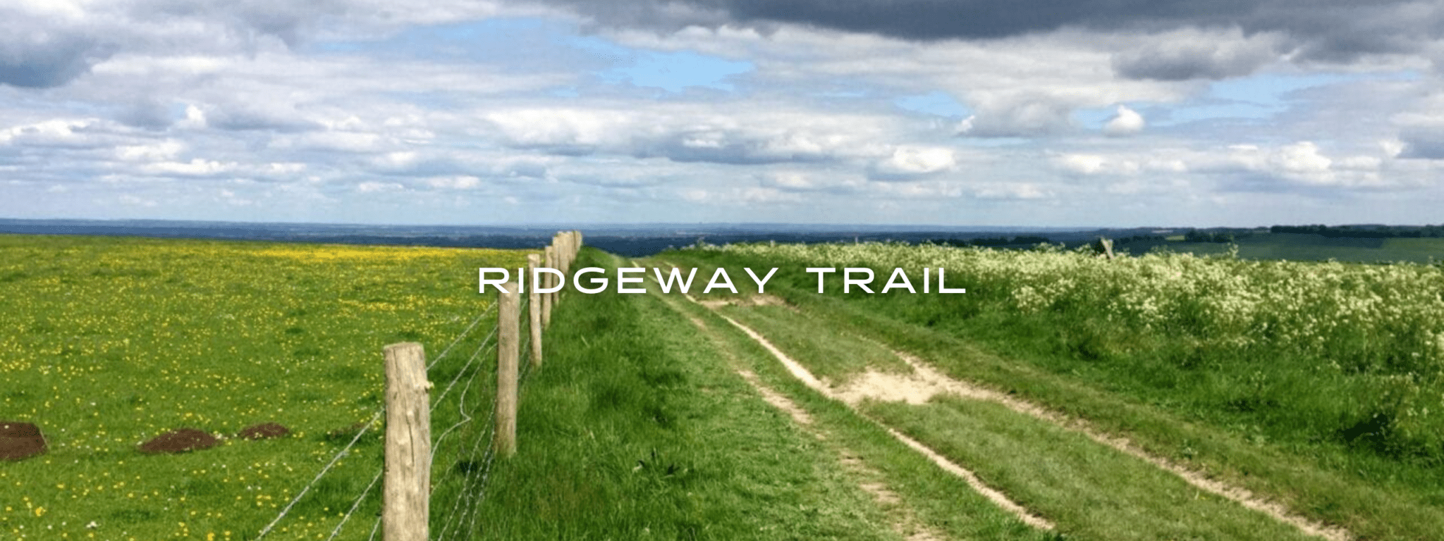
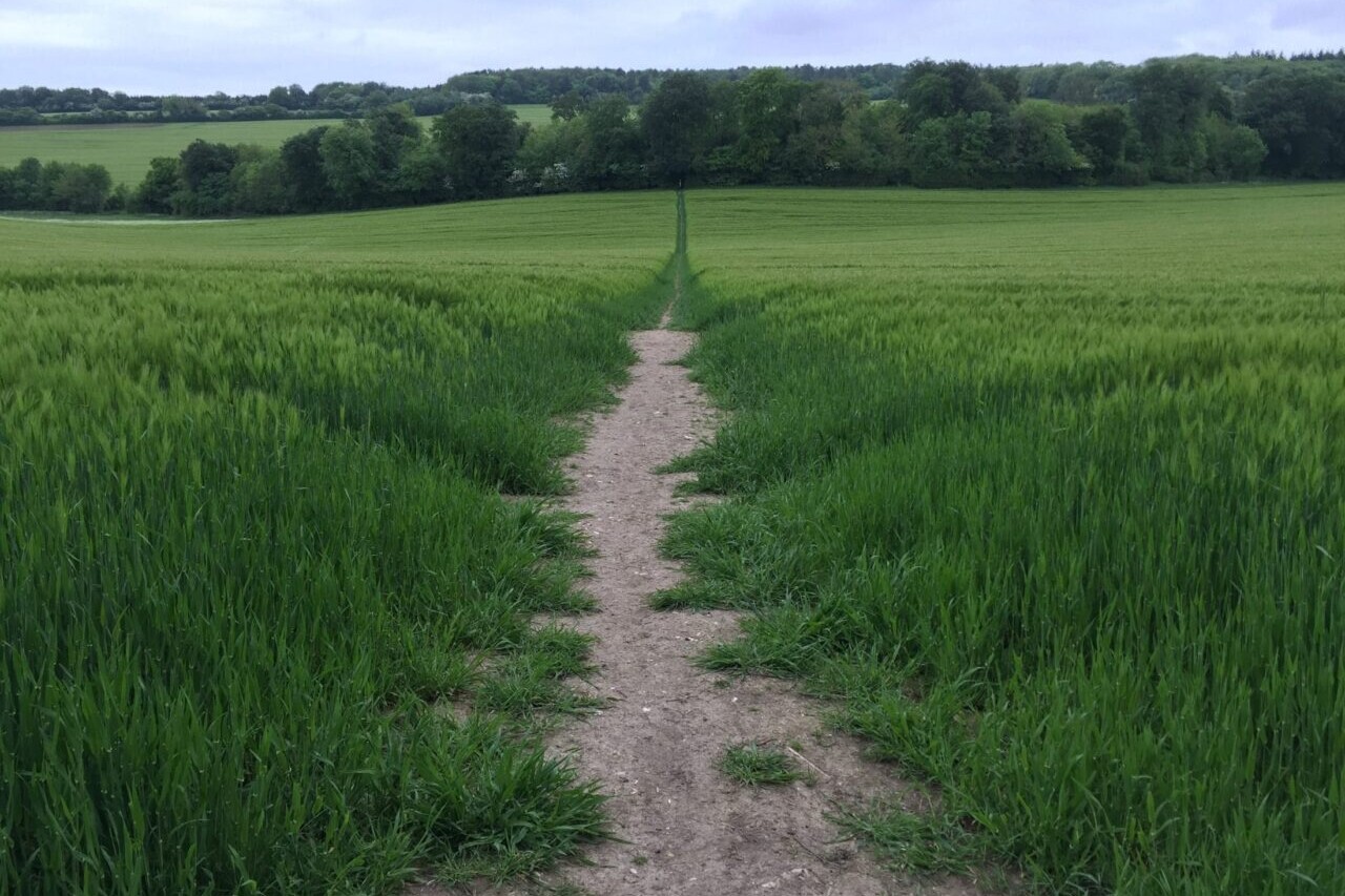
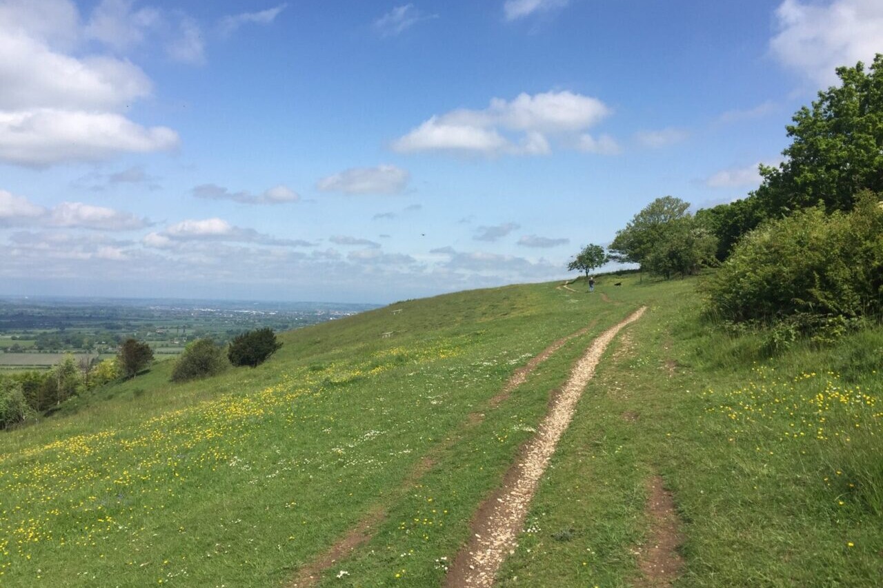
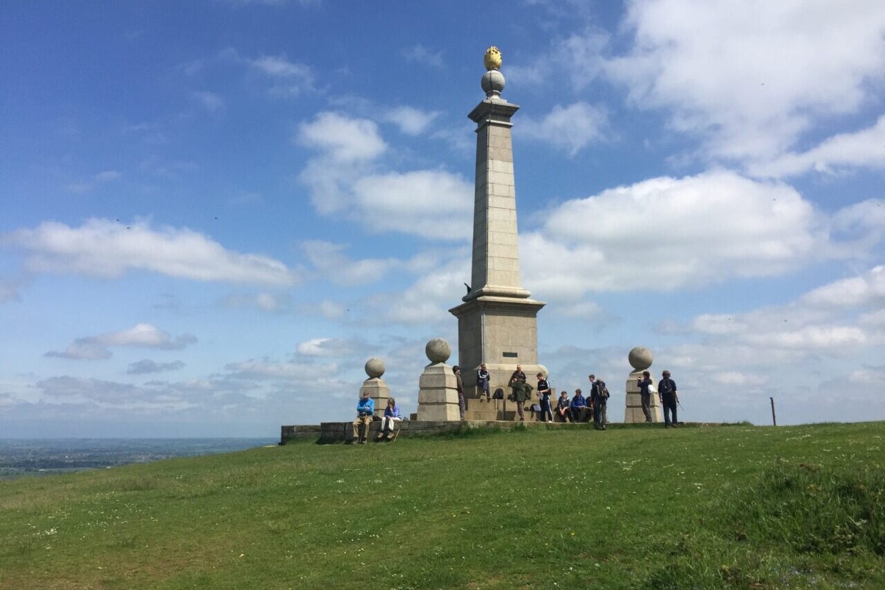
Ridgeway
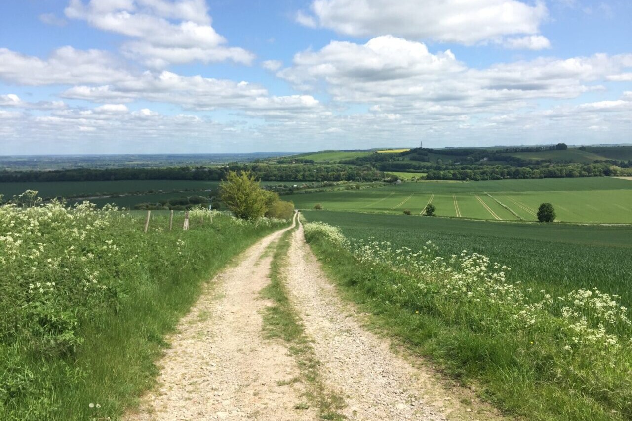
Official Companion App to the Trailblazer Guidebook to The Ridgeway. The Ridgeway is a 87-mile (139km) National Trail that runs from Overton Hill near Avebury in Wiltshire to Ivinghoe Beacon in Buckinghamshire. Part of this route follows Britain’s oldest road, dating back millennia. This is not a difficult walk and the rewards are many: stunning countryside, Iron Age forts, Neolithic burial mounds, white horses carved into the chalk downs, and picturesque villages. UK/Britain.
20% off for our Hiking Season Kick-off SALE! The Trailblazer Special is now $19.99. Explore the Trailblazer Special!
20% off for our Boxing Day SALE! The Trailblazer Special is now $18.99. Explore the Trailblazer Special!
White Horse Hill, England, Ridgeway
Photo courtesy of Trailblazer Guides
4.8 ★★★★★ | 17K+ Reviews
The Ridgeway
87 miles • England
Official Companion App to Trailblazer's The Ridgeway by Nick Hill and Henry Stedman
Download our guide to access the Ridgeway map, tracks, waypoints, and comments! The Ridgeway is a 87-mile (139km) National Trail that runs from Overton Hill near Avebury in Wiltshire to Ivinghoe Beacon in Buckinghamshire. Part of this route follows Britain’s oldest road, dating back millennia. This is not a difficult walk and the rewards are many: stunning countryside, Iron Age forts, Neolithic burial mounds, white horses carved into the chalk downs, and picturesque villages.
$4.99 full guide A Trailblazer Guide
$4.99 full guide
A Trailblazer Guide
The Ridgeway Trail Map


How can I get it?
The Ridgeway Trail map is available as an in-app purchase in our Guthook Guides app, a free download from the Apple App Store or the Google Play Store.
Our iOS and Android apps do differ slightly in their appearance. However, the majority of their features remain the same, and they access the same trail guide data.
Purchase all Trailblazer apps in one package. Includes South Downs Way, Coast to Coast, West Highland Way, Hadrian’s Wall Path, The Cotswold Way, and The Ridgeway. Purchase now and you will receive any new apps we add in the future at no additional cost.
$24.99
This app is the companion to Trailblazer’s Ridgeway guide book. The Ridgeway is a 87-mile (139km) National Trail that runs from Overton Hill near Avebury in Wiltshire to Ivinghoe Beacon in Buckinghamshire. Part of this route follows Britain’s oldest road, dating back millennia. Taking 5-7 days, this is not a difficult walk and the rewards are many: rolling countryside, Iron Age forts, Neolithic burial mounds, white horses carved into the chalk downs and picturesque villages.
$4.99
Photos of the Ridgeway Trail
Hike more.
Check out some of the other trail guides we offer!
About our partner
Trailblazer Guides
Since 1991 Trailblazer has been publishing a select list of practical guidebooks written by travellers for travellers. Their guidebooks include everything from adventure travel guides, to rail guides, to worldwide trekking guides, including British walking guides. Trailblazer guides are entertaining as well as informative, and are strong on practical information without neglecting the cultural background.
Atlas Guides created and maintains the official app of Trailblazer’s British Walking Guides.
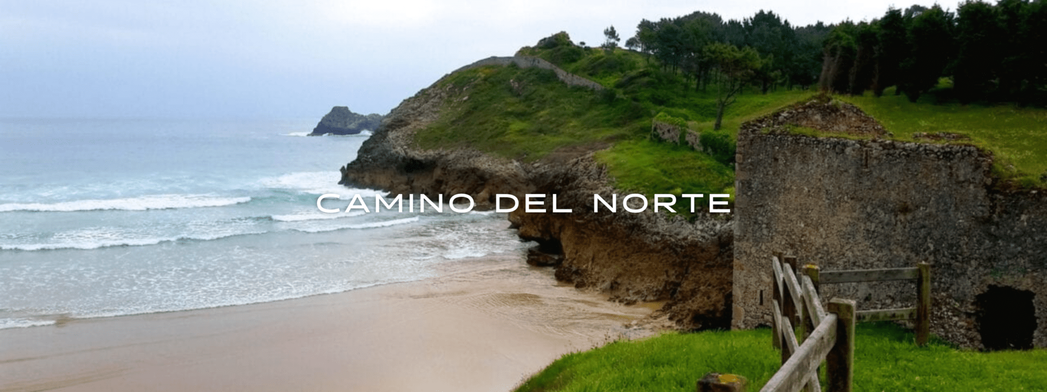
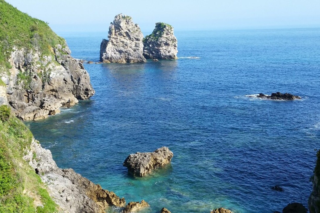
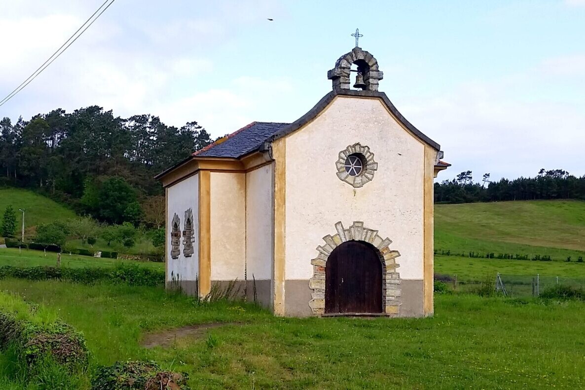
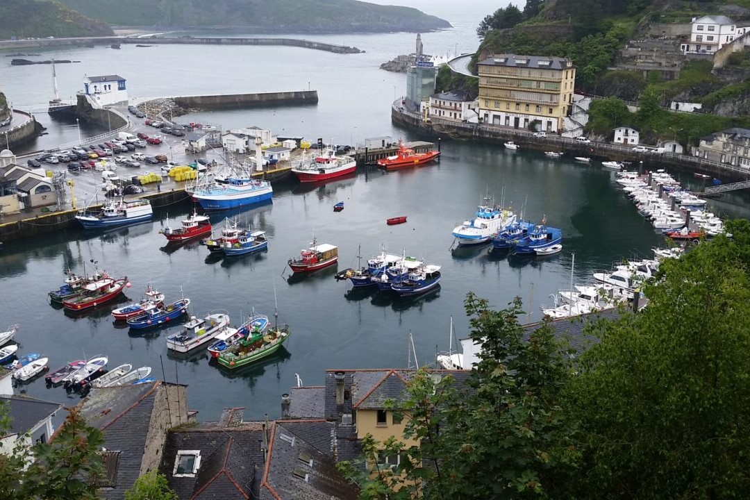
Camino del Norte
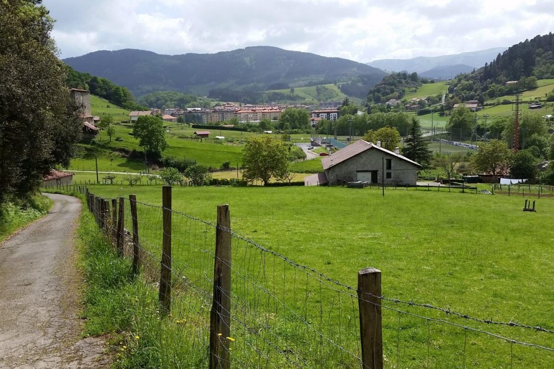
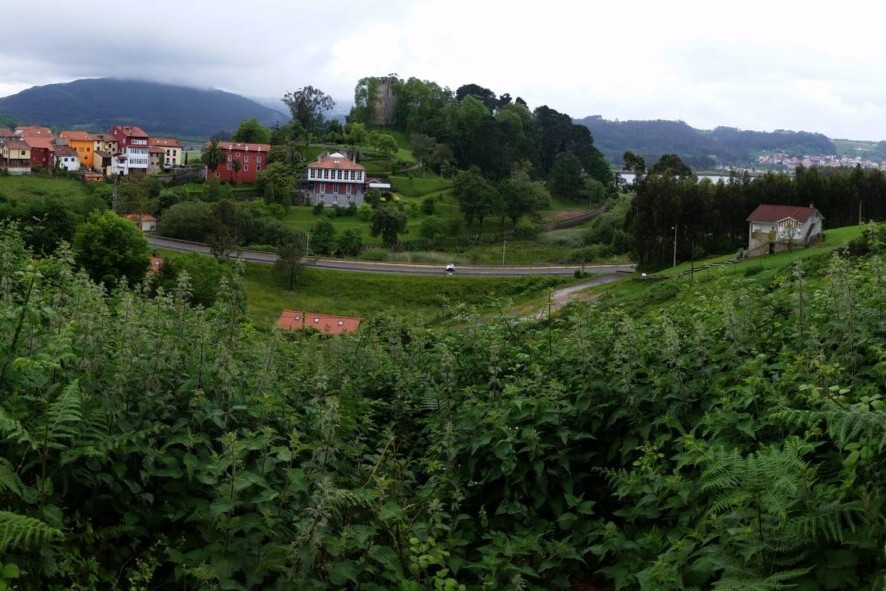
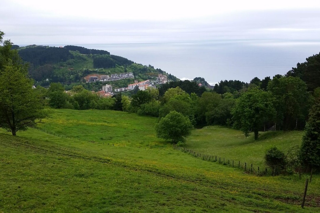
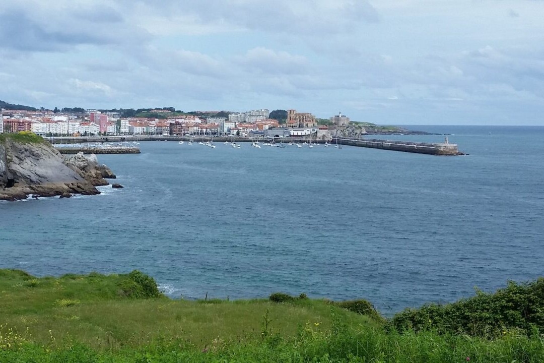
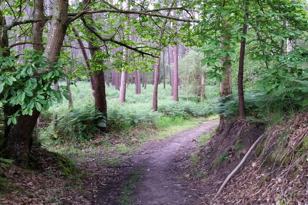
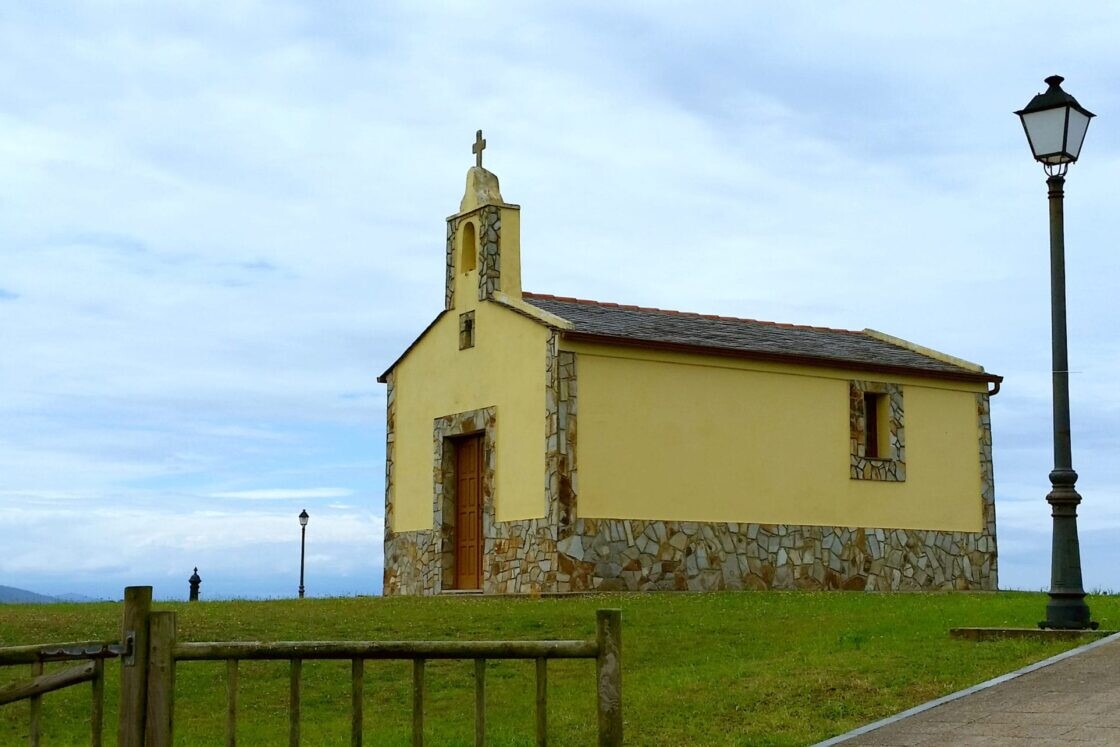
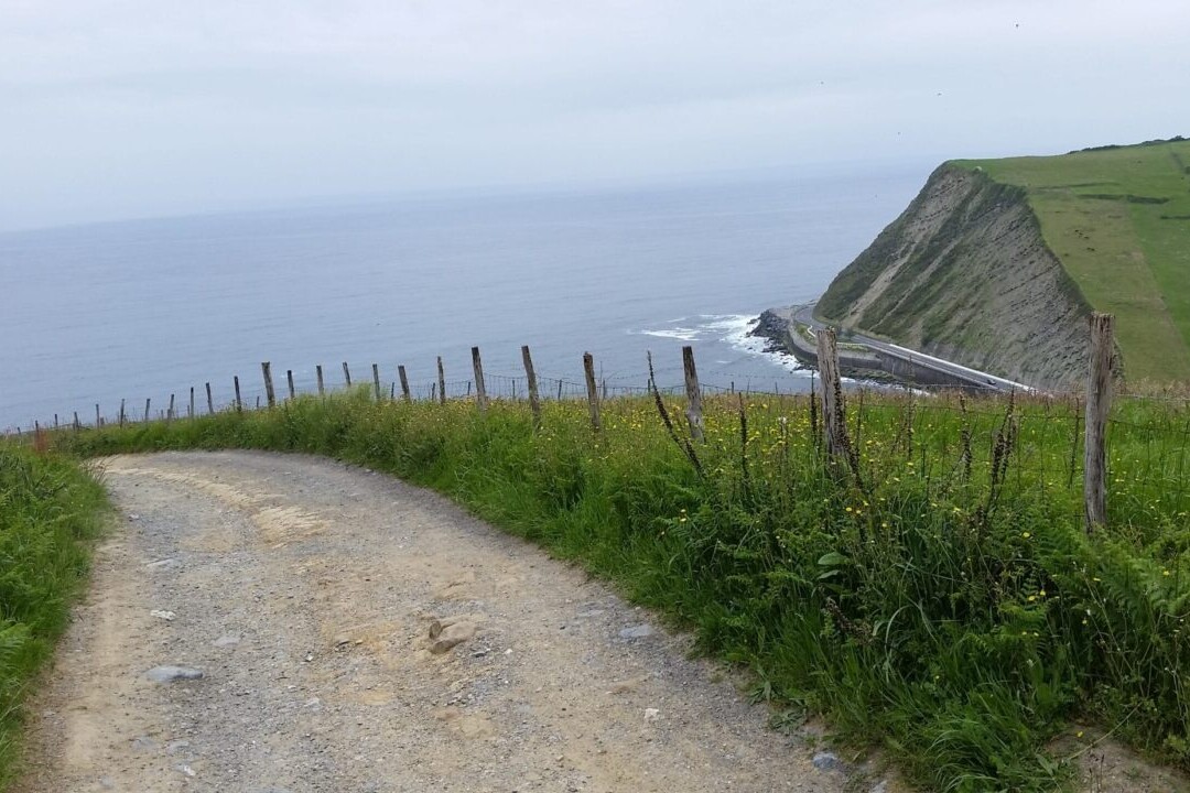
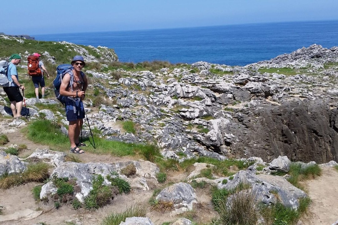
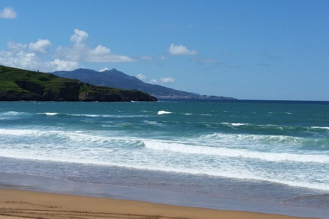
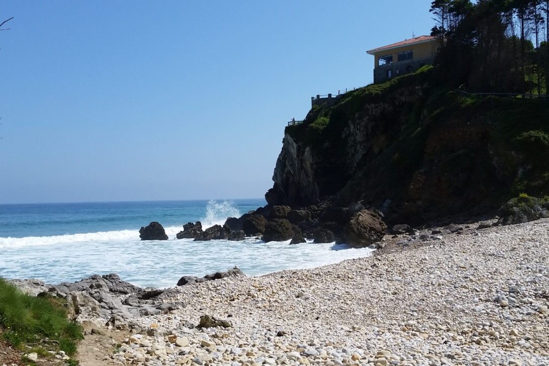
Find a pilgrimage of lush countryside, stunning beaches, and rich history on Spain’s Camino del Norte. The Camino del Norte, or The Northern Way, is the northernmost of the Spanish Camino routes, taking pilgrims through the beautiful green countryside of Northern Spain. Though it is less well known, it is said to be one of the oldest Camino routes. This Camino is a coastal route, offering breathtaking views of the Atlantic Ocean from rocky cliffs and sandy beaches. Lush green landscapes from coast to mountain await pilgrims on the Camino del Norte, and the delicious coastal cuisines of the region will have you stopping at every rural restaurant to sample the local flavors. Spain.
New guide! The Camino del Norte is new to our set of hiking guides. Explore it today!
20% off for our Hiking Season Kick-off SALE! The Camino del Norte is now $5.99.
Spain, Camino del Norte
Photo by Stacy Wittig
4.8 ★★★★★ | 17K+ Reviews
Camino del Norte
825 km / 510 miles • Spain
Download our guide to access the Camino del Norte map, tracks, waypoints, and comments! Find a pilgrimage of lush countryside, stunning beaches, and rich history on Spain's Camino del Norte. The Camino del Norte, or The Northern Way, is the northernmost of the Spanish Camino routes, taking pilgrims through the beautiful green countryside of Northern Spain. Though it is less well known, it is said to be one of the oldest Camino routes. This Camino is a coastal route, offering breathtaking views of the Atlantic Ocean from rocky cliffs and sandy beaches. Lush green landscapes from coast to mountain await pilgrims on the Camino del Norte, and the delicious coastal cuisines of the region will have you stopping at every rural restaurant to sample the local flavors.
$7.99 full guide A Camino de Santiago route
$7.99 full guide
A Camino de Santiago route
Camino del Norte Map


How can I get it?
The Camino del Norte map is available as an in-app purchase in our Guthook Guides app, a free download from the Apple App Store or the Google Play Store.
Our iOS and Android apps do differ slightly in their appearance. However, the majority of their features remain the same, and they access the same trail guide data.
The Camino del Norte, or The Northern Way, is the northernmost of the Spanish Camino routes, taking pilgrims through the beautiful green countryside of Northern Spain. Though it is less well known, it is said to be one of the oldest Camino routes. The route travels through Basque country—Cantabria, Asturias, and Galicia—to eventually join with the Camino Frances in the city of Arzúa and continue the rest of the way to Santiago de Compostela. This Camino is a coastal route, offering breathtaking views of the Atlantic Ocean from rocky cliffs and sandy beaches. Lush green landscapes from coast to mountain await pilgrims on this route, and the delicious coastal cuisines of the region will have you stopping in to every rural restaurant to sample the local flavors.
Photos of the Camino del Norte


Hike more.
Check out some of the other trail guides we offer!

Western Wildlands Route
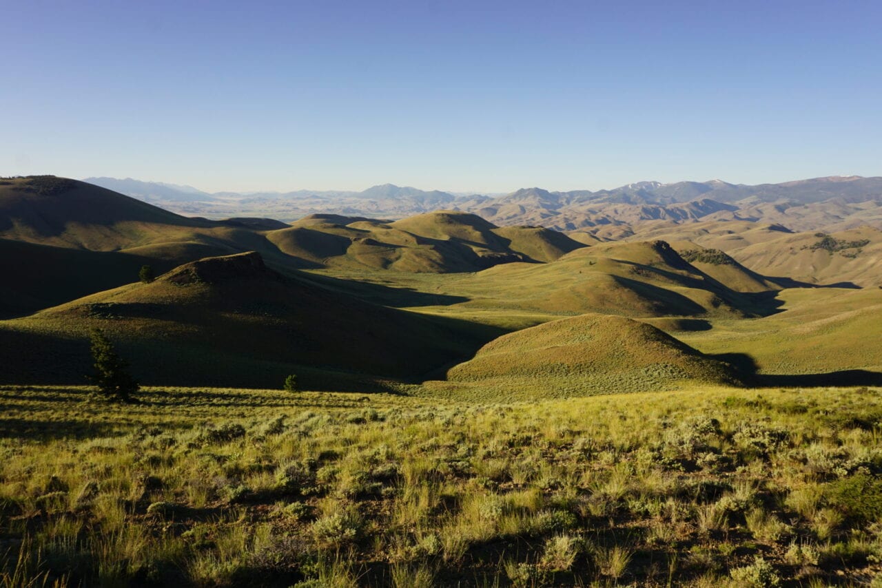
Official app of Bikepacking Roots. The Western Wildlands Route offers bikepackers a non-technical, expeditionary-scale riding experience through Arizona, Utah, Idaho and Montana that immerses one in the vast expanses of wild and public lands in the Intermountain West. Nearly 70% of the route is on public lands, and more than 80% is off-pavement, following primarily dirt roads and rough 4×4 tracks on which mountain bikes are most suitable. Riders will experience the remote mountains of western Montana and central Idaho, the desolate beauty of southern Idaho’s Snake River Plain, endless vistas from Utah’s high plateaus at 10,000 feet elevation, the canyon country of Navajo Nation and the Grand Canyon region, and the towering Sky Islands and low Sonoran Desert of southern Arizona.
20% off for our Hiking Season Kick-off SALE! The Wild West Route is now $23.99.
Arizona, Western Wildlands Route
Photo courtesy of Bikepacking Roots
Western Wildlands Route
2657 miles • Arizona, Utah, Idaho & Montana
Official App of Bikepacking Roots
The Western Wildlands Route offers bikepackers a non-technical, expeditionary-scale riding experience through Arizona, Utah, Idaho and Montana that immerses one in the vast expanses of wild and public lands in the Intermountain West. Nearly 70% of the route is on public lands, and more than 80% is off-pavement, following primarily dirt roads and rough 4x4 tracks on which mountain bikes are most suitable. Riders will experience the remote mountains of western Montana and central Idaho, the desolate beauty of southern Idaho’s Snake River Plain, endless vistas from Utah’s high plateaus at 10,000 feet elevation, the canyon country of Navajo Nation and the Grand Canyon region, and the towering Sky Islands and low Sonoran Desert of southern Arizona.
$29.99 full guide 3 sections ($9.99 – $19.99 each)
2,657 mi (4,276 km)
$29.99 full guide
3 sections ($9.99 – $19.99 each)
Official App
Western Wildlands Route Map


How can I get it?
The Western Wildlands Route is available as an in-app purchase in our Bikepacking Guides app, a free download from the Apple App Store or the Google Play Store.
Our iOS and Android apps do differ slightly in their appearance. However, the majority of their features remain the same, and they access the same trail guide data.
This is the entire 2657-mile Western Wildlands Route, from the U.S.-Canada border in Montana to the U.S.-Mexico border in Arizona.
$29.99
This is the 1,225-mile-long Montana and Idaho section of the Western Wildlands Route (Segments 1-4) from the Canadian border to the Idaho-Utah border and all alternate options and route extensions in these two states. This section of the Western Wildlands Route traverses the lush boreal forests of northern Montana, the wild and remote mountains of central Idaho, and the arid expanse of the Snake River Plain.
$19.99
This is the 585-mile-long Utah section of the Western Wildlands Route (Segments 5-6). This section of the Western Wildlands Route traverses a series of high plateaus across Utah between the Uinta Mountains in the north and the canyon country in the south.
$9.99
This is the 850-mile-long Arizona section of the Western Wildlands Route (Segments 7-9), including all alternate options and route extensions in Arizona. Arizona’s diverse landscapes are showcased on these segments, from the high grasslands and colorful canyons of Navajo Nation to Grand Canyon, across the rugged Central Highlands, and into the low Sonoran Desert.
$14.99
Ride more.
Check out some of the other mountain biking guides we offer!

About our partner
Bikepacking Roots
Bikepacking Roots is dedicated to the support and advancement of bikepacking and the conservation of the landscapes through which we ride. Their goals are to create high-quality, enjoyable, accessible bikepacking routes and route networks in geographic regions throughout North America; provide and promote visibility and access for the bikepacking community; and foster strong connections between bikepackers and landscapes to promote landscape conservation and encourage responsible backcountry ethics.
Together Atlas Guides and Bikepacking Roots have collaborated to bring you the official mobile app of the Western Wildlands Route. This project would not have been possible without the help of Revelate Designs and Salsa Bikes.

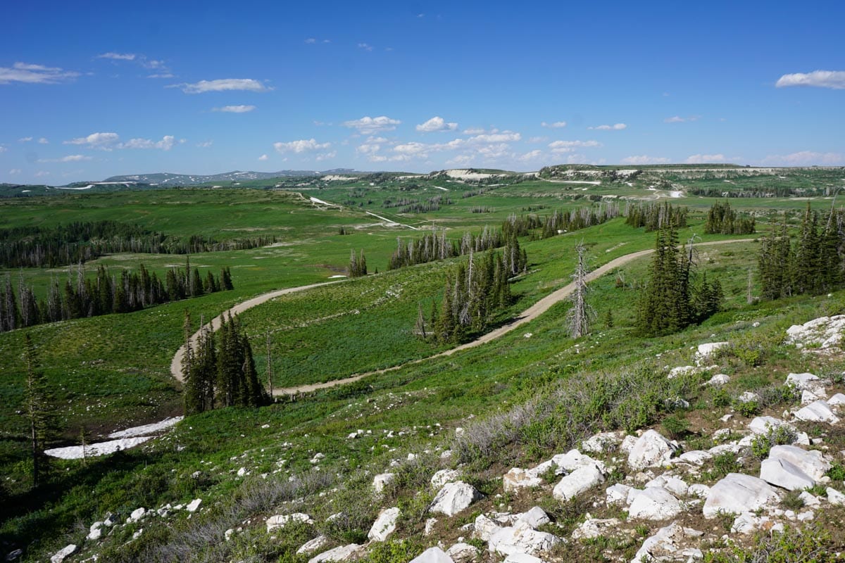
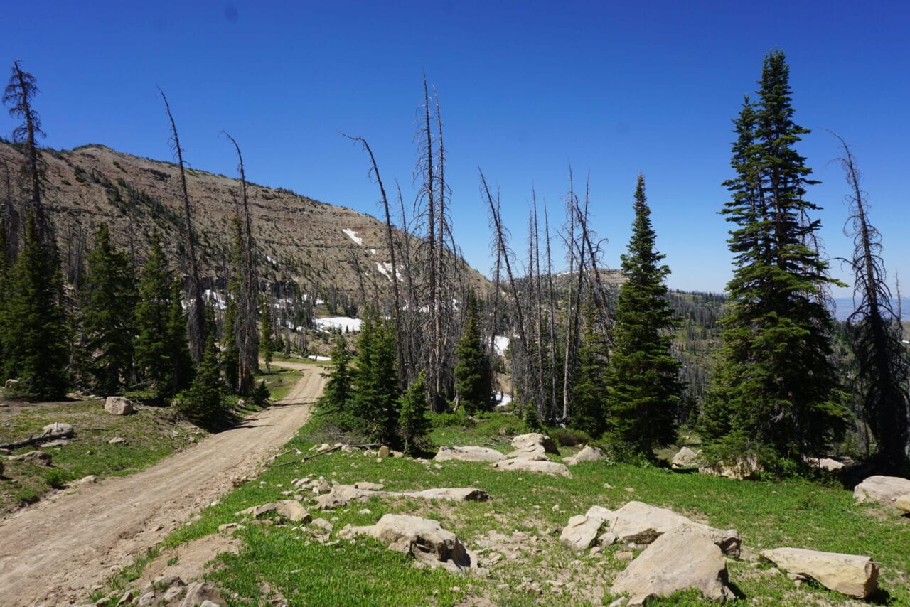
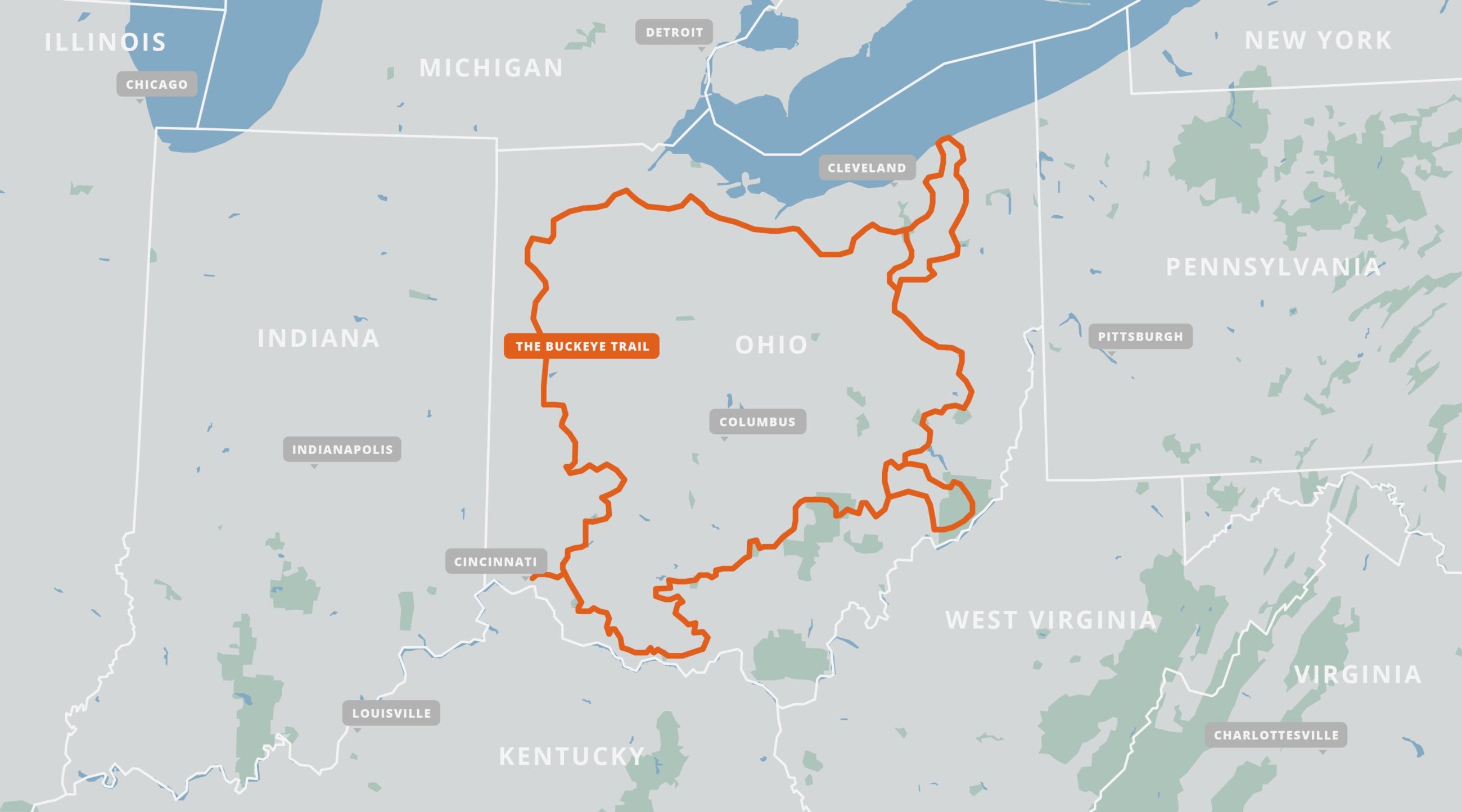
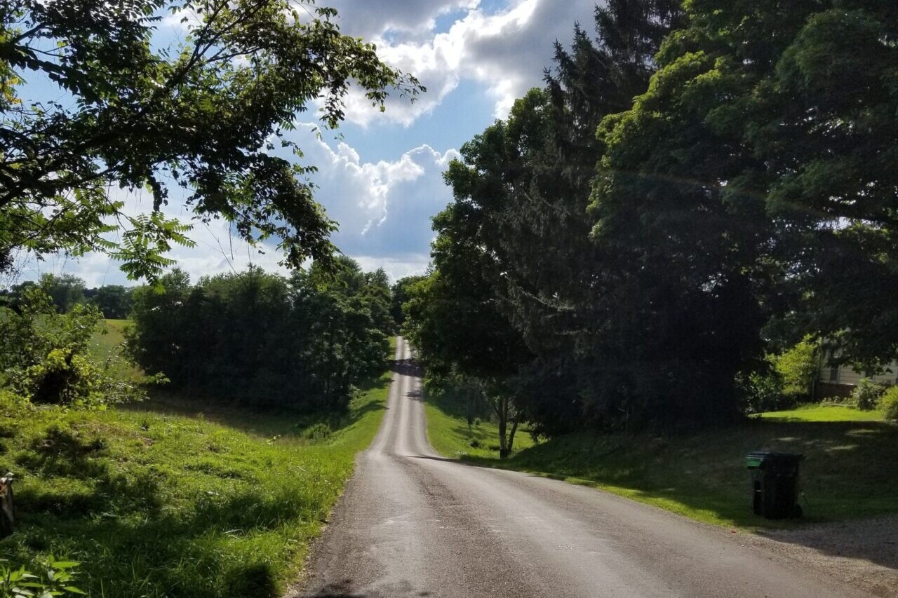
Buckeye Trail
Official App of the Buckeye Trail Association. Walk a loop of Ohio’s natural and historic wonders on the Buckeye Trail. The blue-blazed Buckeye Trail is Ohio’s most famous long distance hiking trail. Its 1440 mile (2320 km) length wraps around the entire state, passing through the most scenic regions that the state has to offer, including Cuyahoga Valley National Park and the historic route of the Ohio and Erie Canal as well as the Miami and Erie Canal. The trail’s northern terminus is on Lake Erie in Headlands Beach State Park. From there, one branch leads south down the eastern edge of the state, and another leads west across the northern portion of the state. The two branches rejoin and form a single branch that leads to the southern terminus in Cincinnati.
20% off for our Hiking Season Kick-off SALE! The Buckeye Trail is now $31.99.
30% off for our Small Business Saturday SALE! The Buckeye Trail is now $27.99.
4.8 ★★★★★ | 17K+ Reviews
Buckeye Trail
1440 miles • Ohio
Official App of the Buckeye Trail Association
Download our guide to access the Buckeye Trail map, tracks, waypoints, and comments! Walk a loop of Ohio's natural and historic wonders on the Buckeye Trail. The blue-blazed Buckeye Trail is Ohio's most famous long distance hiking trail. Its 1440 mile (2320 km) length wraps around the entire state, passing through the most scenic regions that the state has to offer, including Cuyahoga Valley National Park and the historic route of the Ohio and Erie Canal as well as the Miami and Erie Canal. The trail's northern terminus is on Lake Erie in Headlands Beach State Park. From there, one branch leads south down the eastern edge of the state, and another leads west across the northern portion of the state. The two branches rejoin and form a single branch that leads to the southern terminus in Cincinnati.
$39.99 full guide 8 sections ($4.99-$14.99)
Buckeye Trail Map

How can I get it?
The Buckeye Trail map is available as an in-app purchase in our Guthook Guides app, a free download from the Apple App Store or the Google Play Store.
Our iOS and Android apps do differ slightly in their appearance. However, the majority of their features remain the same, and they access the same trail guide data.
56-mile Defiance Section on the northwest portion of the Buckeye Trail.
The Buckeye Trail Thru-hiker Package includes all 8 packages of the Buckeye Trail (all 26 Sections) and is a 50% discount over buying the packages individually
$39.99
The Miami Rivers package includes the Williamsburg, Loveland, Caesar Creek, and Troy sections. This 150-mile portion of the trail begins in Cincinnati then heads northward through Dayton and ends in Lockington. The 52-mile Williamsburg section branches off to the southeast from the Loveland section. It winds around Harsha Lake and ends at Grant Lake.
Total trail miles: 202
Total waypoints: 149
$14.99
The Miami & Erie Canal package includes the St. Mary’s, Delphos, and Defiance sections of the Buckeye Trail. This 147-mile portion of the trail begins in Lockington and then heads northward past Lake Loramie, through New Bremen, Saint Marys, Spencerville, Delphos, Fort Jennings, Ottoville, and Defiance, then follows the Maumee River, ending in Waterville.
Total trail miles: 147
Total waypoints: 115
$14.99
The North Coast Inland package includes the Pemberville, Norwalk, and Medina sections of the Buckeye Trail. This is the northern portion of the Buckeye Trail. This 164-mile portion of the trail begins outside Toledo in Waterville and then heads east through Haskins, Pemberville, Woodville, Elmore, Lindsey, Fremont, Clyde, Bellevue, Monroeville, Norwalk, Wakeman, Findley State Park, and Medina, and ends in Cleveland Metroparks, just outside Brecksville.
Total trail miles: 164
Total waypoints: 109
$4.99
The Crooked River package includes the Bedford, Burton, Akron, and Mogadore sections of the Buckeye Trail. This 255-mile loop trail is the northeast portion of the Buckeye Trail. Beginning outside Brecksville in Cleveland Metroparks, the trail heads northeast, mostly through parkland, to Bentleyville, Kirtland Hills, and Mentor on the shore of Lake Erie. The trail loop turns south at Headlands Beach State Park and goes through or near Painesville, Chardon, Burton, Hiram, and Mantua. The trail then winds its way around the Kirwan Reservoir in West Branch State Park, and heads southwest along the Mogadore Reservoir and Wingfoot Lake, through Hartville, Green, along Nimisila Reservoir, and joins the Akron section at the Tuscarawas River. The trail then follows the river northwest through Clinton and onto the city of Akron. The trail then heads north out of Akron and parallels the Cuyahoga River up to the start point of the loop.
Total trail miles: 255
Total waypoints: 223
$14.99
The Muskingum Lakes package includes the Massillon, Bowerston, and Belle Valley sections of the Buckeye Trail. This 175-mile trail is in the northeast portion of the Buckeye Trail. This segment begins in Hartville and goes west to the Nimisila Reservoir, then heads south through Massillon, Navarre and Boliver, along Leesville Lake, then through New Hagerston, and Bowerston, along Tappan Lake, Clendening Lake, and Piemont Lake, through Smyrna, Salt Fork State Park, Old Washington, near Senecaville Lake, then through Wolf Run State Park and Belle Valley, ending at Bicentennial Campground.
Total Miles: 175
Total Waypoints: 152
$9.99
The Wilderness Loop Package includes the Road Fork and Whipple Sections in the southeast portion of the Buckeye Trail.
Total miles: 138
Total waypoints: 81
$4.99
The Little Cities of the Forest Package includes the Stockport, New Straigtsville, and Old Man’s Cave Sections in the southern portion of the Buckeye Trail.
Total miles: 153
Total waypoints: 115
$9.99
The Appalachian Foothills Package includes the Scioto Trail, Sinking Spring, Shawnee, and West Union Sections of the Buckeye Trail. This is in the southern portion of the Buckeye Trail.
Total miles: 224
Total waypoints: 163
$9.99
Cheers to giving back! Part of your purchase of the Buckeye Trail goes to support the Buckeye Trail Association’s work to preserve and maintain the trail. Learn about the Buckeye Trail Association.
Photos of the Buckeye Trail
Hike more.
Check out some of the other trail guides we offer!
About our partner
Buckeye Trail Association
Throughout its history, the BTA has promoted the construction, maintenance, and use of a state-wide trail system within the State of Ohio. The main Buckeye Trail is supplemented with side trails, campsites, and other facilities, so that visitors can see some of the historical and beauty spots of the Buckeye State. The BTA maintains the Buckeye Trail primarily as a footpath, though certain portions are also designated for use by horsemen and other non-motorized users.
Today, the Buckeye Trail Association is a large, strong body of volunteers who maintain and promote the trail. Under the eye of the BTA, the Buckeye Trail continues to change and improve as the BTA looks for ways to move road sections off the roads, and to upgrade those off-road sections to high quality trail.
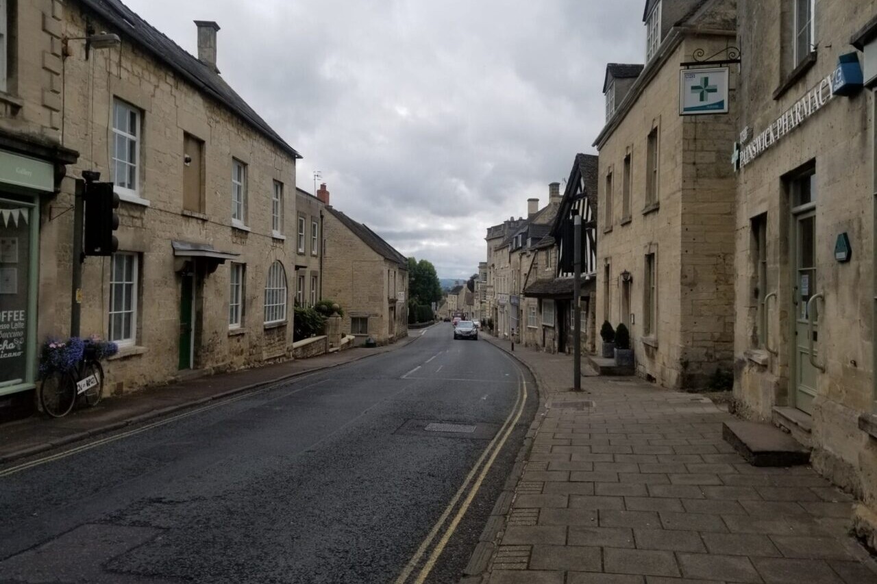
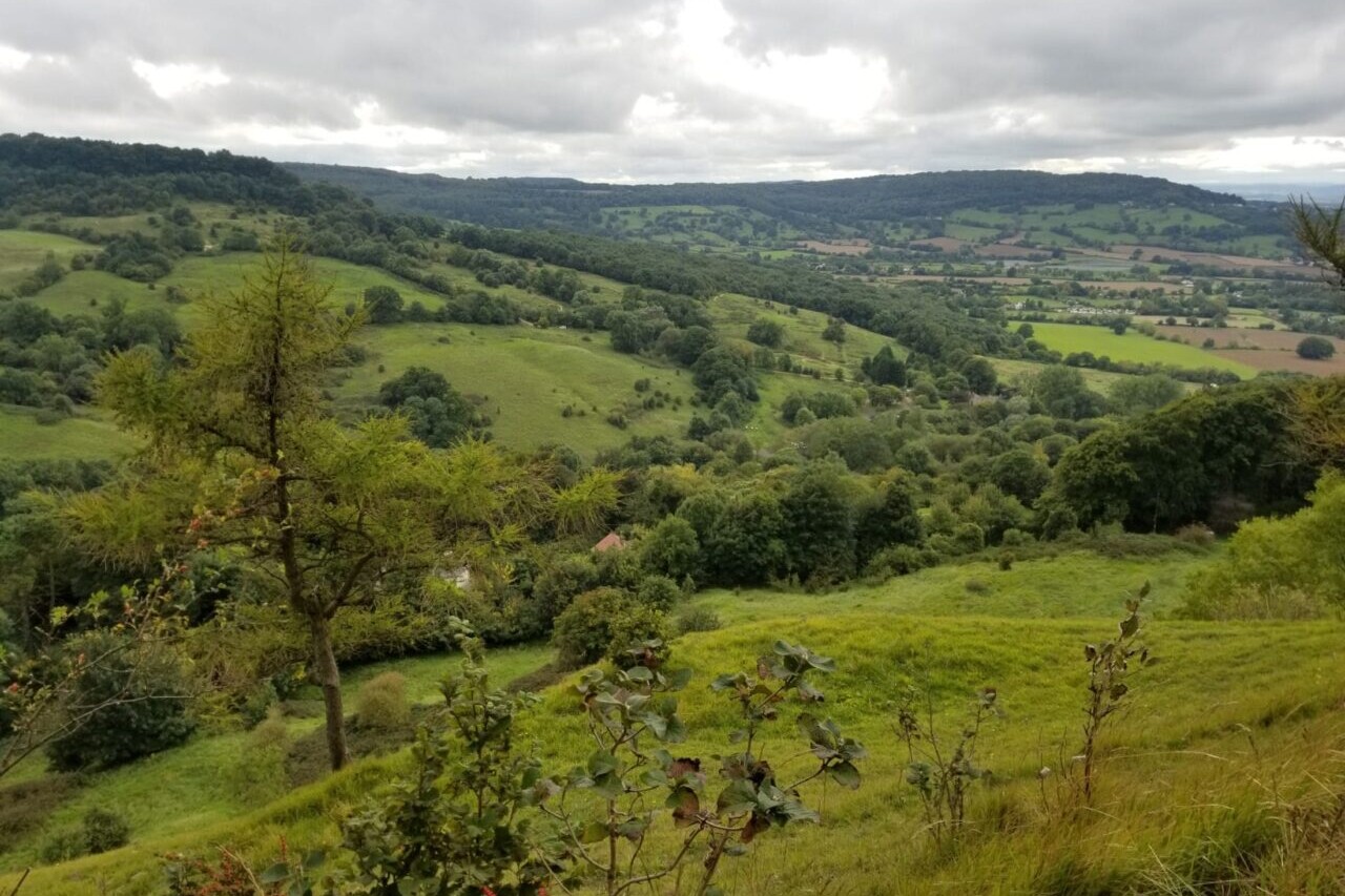
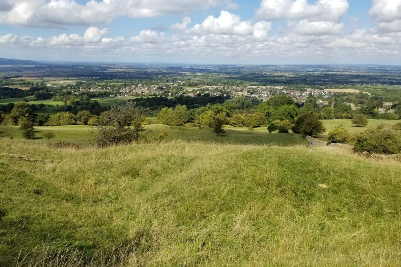
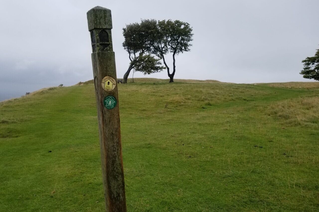
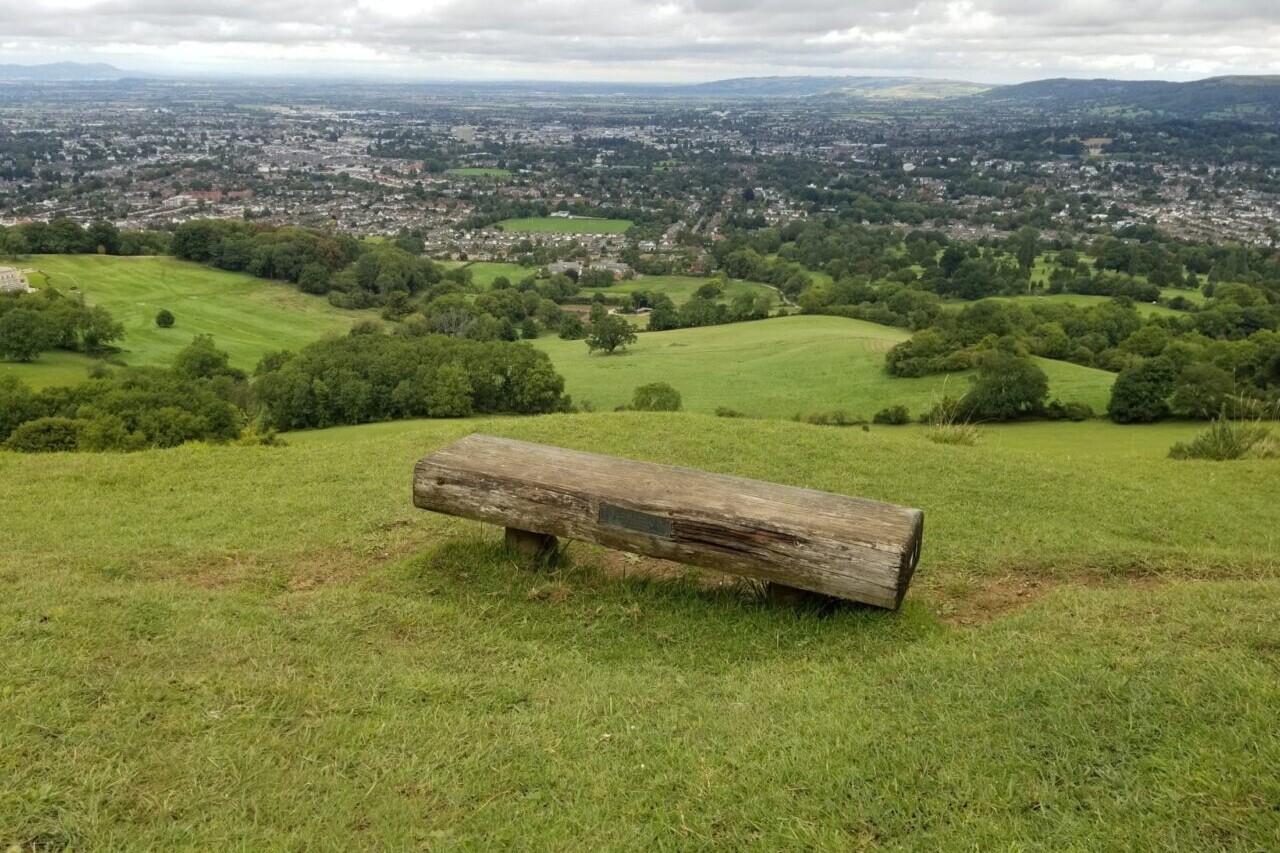
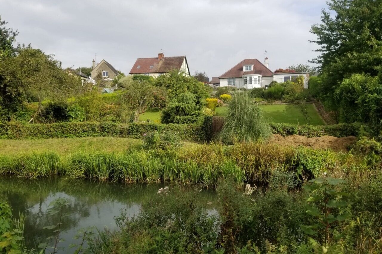
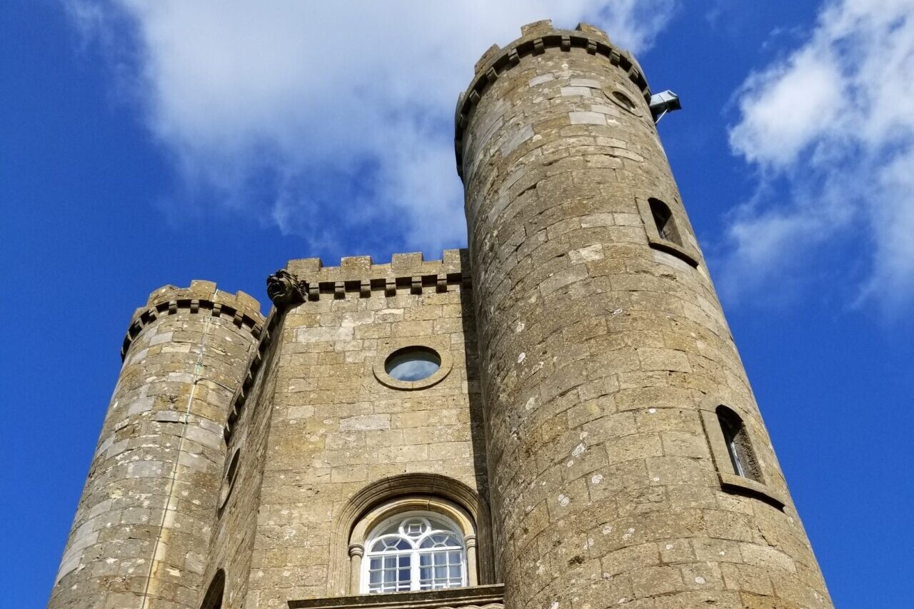
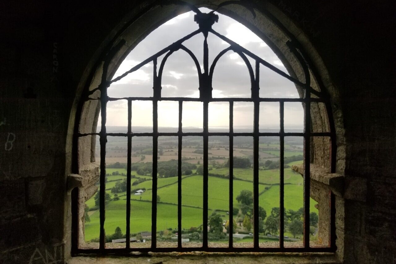
Cotswold Way
Official Companion App to the Trailblazer Guidebook to The Cotswold Way. Follow the Cotswold escarpment past scenic countryside and rich history on the Cotswold Way. The Cotswold Way is a National Trail in the United Kingdom that runs from Chipping Campden to Bath, following the beautiful Cotswold escarpment for much of its course. The trail leads through quintessentially English countryside with little villages of honey-coloured stone and open farmland all the way to the historic city of Bath. Because its route follows the Cotswold escarpment, the route often offers fantastic views of the surrounding country, including such famous landmarks as the River Severn, the Forest of Dean, the Black Mountains along the Welsh border, and the Vale of Evesham. As is the case with many trails in the United Kingdom, the Cotswold Way also passes many notable places of historic interest, including the location of the Battle of Lansdowne, Sudeley Castle, and the ruins of Hailes Abbey. UK/Britain, Europe.
20% off for our Hiking Season Kick-off SALE! The Trailblazer Special is now $19.99. Explore the Trailblazer Special!
20% off for our Boxing Day SALE! The Trailblazer Special is now $18.99. Explore the Trailblazer Special!
England, Cotswold Way
Photo courtesy of Trailblazer Guides
4.8 ★★★★★ | 17K+ Reviews
Cotswold Way
102 miles • England
Official Companion App to Trailblazer's Cotswold Way by Tricia & Bob Hayne and Henry Stedman
Download our guide to access the Cotswold Way map, tracks, waypoints, and comments! Follow the Cotswold escarpment past scenic countryside and rich history on the Cotswold Way. The Cotswold Way is a National Trail in the United Kingdom that runs from Chipping Campden to Bath, following the beautiful Cotswold escarpment for much of its course. The trail leads through quintessentially English countryside with little villages of honey-coloured stone and open farmland all the way to the historic city of Bath. Because its route follows the Cotswold escarpment, the route often offers fantastic views of the surrounding country, including such famous landmarks as the River Severn, the Forest of Dean, the Black Mountains along the Welsh border, and the Vale of Evesham. As is the case with many trails in the United Kingdom, the Cotswold Way also passes many notable places of historic interest, including the location of the Battle of Lansdowne, Sudeley Castle, and the ruins of Hailes Abbey.
$5.99 full guide A Trailblazer Guide
$5.99 full guide
A Trailblazer Guide
Cotswold Way Map


How can I get it?
The Cotswold Way map is available as an in-app purchase in our Guthook Guides app, a free download from the Apple App Store or the Google Play Store.
Our iOS and Android apps do differ slightly in their appearance. However, the majority of their features remain the same, and they access the same trail guide data.
Purchase all Trailblazer apps in one package. Includes South Downs Way, Coast to Coast, West Highland Way, Hadrian’s Wall Path, The Cotswold Way, and The Ridgeway. Purchase now and you will receive any new apps we add in the future at no additional cost.
$24.99
The Cotswold Way is a ~100-mile (161km) National Trail that runs from Chipping Campden to Bath, following the beautiful Cotswold escarpment for much of its course. The trail leads through quintessentially English countryside with little villages of honey-coloured stone, from open farmland to the historic city of Bath.
$5.99
Photos of Cotswold Way


Hike more.
Check out some of the other trail guides we offer!
About our partner
Trailblazer Guides
Since 1991 Trailblazer has been publishing a select list of practical guidebooks written by travellers for travellers. Their guidebooks include everything from adventure travel guides, to rail guides, to worldwide trekking guides, including British walking guides. Trailblazer guides are entertaining as well as informative, and are strong on practical information without neglecting the cultural background.
Atlas Guides created and maintains the official app of Trailblazer’s British Walking Guides.