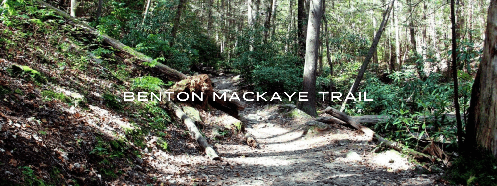
Benton MacKaye Trail

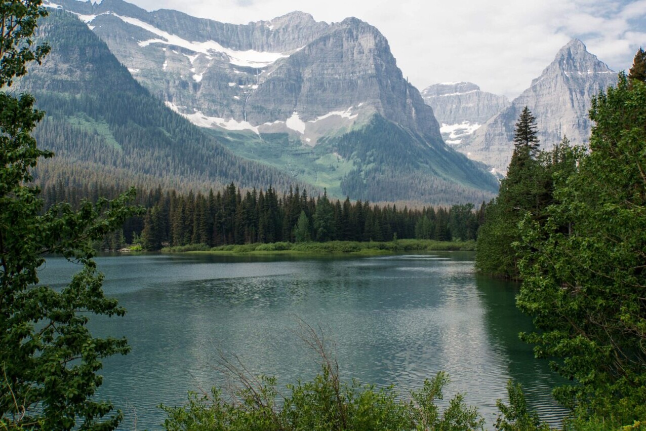
Climb mountains through green forests, splash across trout-filled rivers on the Benton MacKaye Trail. This trail is an Appalachian footpath of almost 300 miles (480 km). Named for the American forester and conservationist who sparked the idea for the Appalachian Trail, the Benton Mackaye Trail runs from Springer Mountain in Georgia to Davenport Gap in the Great Smoky Mountains National Park. The trail passes through Tennessee, North Carolina, Georgia, and a multitude of wilderness areas.
20% off for our Hiking Season Kick-off SALE! The Benton MacKaye Trail is now $8.99.
30% off for our Small Business Saturday SALE! The Benton MacKaye Trail is now $7.99.
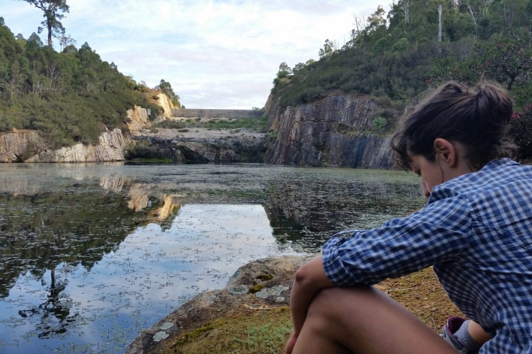
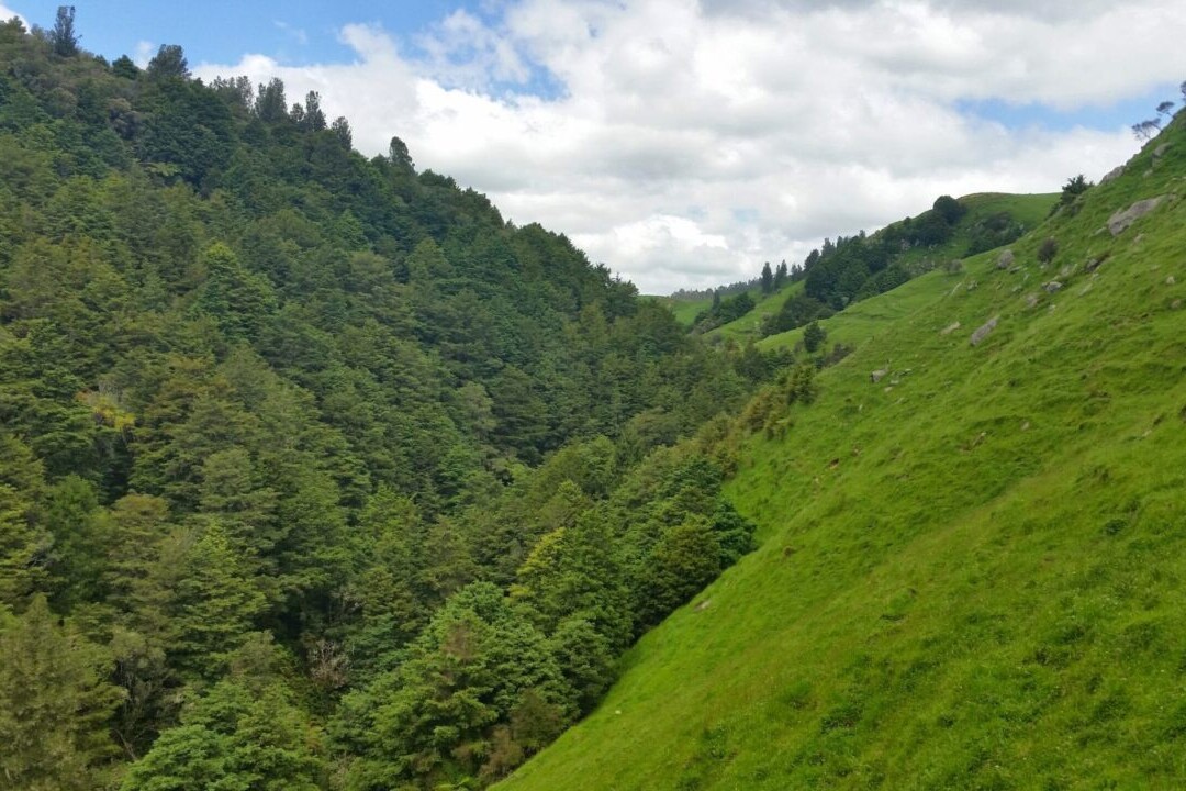
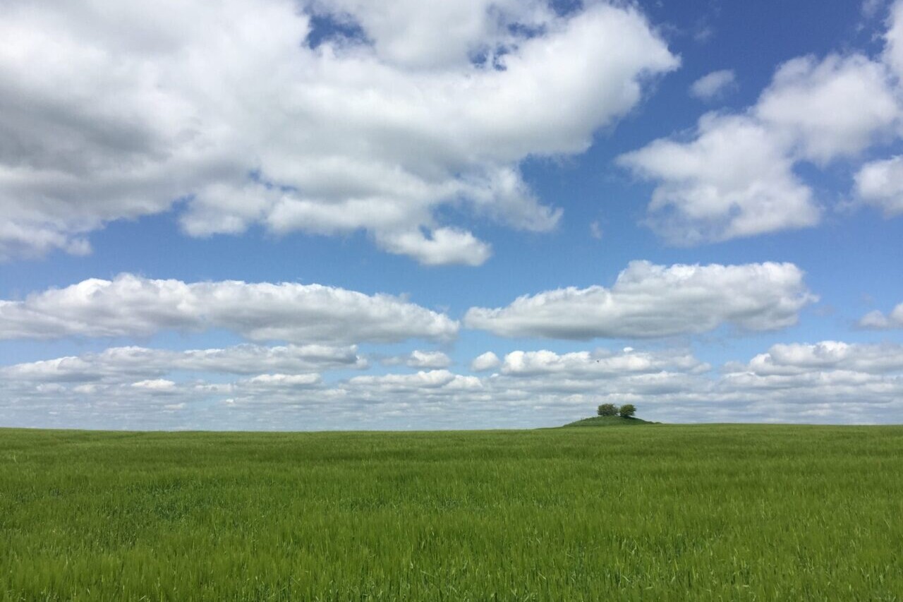
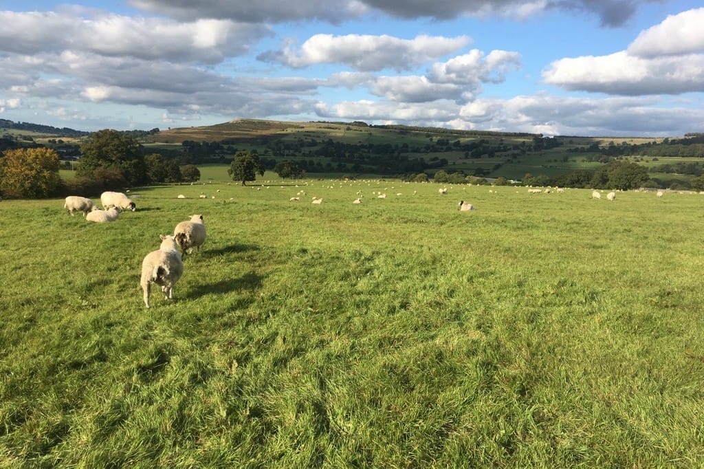
Georgia, Benton MacKaye Trail
Photo by Thomson
4.8 ★★★★★ | 17K+ Reviews
Benton MacKaye Trail
289 miles • Georgia, Tennessee & North Carolina
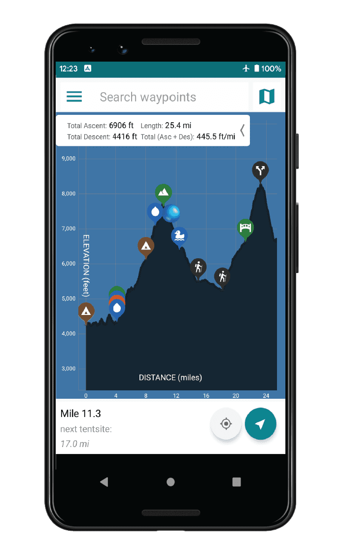
Download our guide to access the Benton MacKaye Trail map, tracks, waypoints, and comments! Climb mountains through green forests, splash across trout-filled rivers on the Benton MacKaye Trail. This trail is an Appalachian footpath of almost 289 miles (480 km). Named for the American forester and conservationist who sparked the idea for the Appalachian Trail, the Benton Mackaye Trail runs from Springer Mountain in Georgia to Davenport Gap in the Great Smoky Mountains National Park. The trail passes through 3 states and a multitude of wilderness areas.
$11.99 full guide
$11.99 full guide


Benton MacKaye Trail


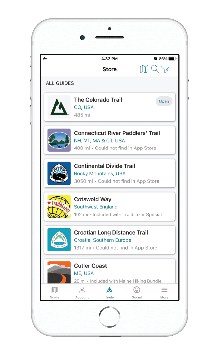
How can I get it?
The Benton MacKaye Trail map is available as an in-app purchase in our Guthook Guides app, a free download from the Apple App Store or the Google Play Store.
Our iOS and Android apps do differ slightly in their appearance. However, the majority of their features remain the same, and they access the same trail guide data.
The Benton MacKaye Trail (BMT), named for the man who originally proposed the idea for the Appalachian Trail, is an approximately 290-mile trail in Georgia, North Carolina, and Tennessee. It shares the southern terminus of the AT, crosses it several times, and ends in the Great Smoky Mountains National Park, near the Appalachian Trail, making it an possible alternate route or loop with the AT.
The BMT is far less popular than the southern section of the AT, and far less developed, so those attempting to hike it should be ready for a wilder, more difficult experience. Along the way, you’ll visit deep wildernesses in the Chattahoochee-Oconee and Cherokee National Forests, high ridge lines and low river valleys, and some of the more remote corners of the Smoky Mountains.
We do not have a town/resupply guide for the BMT, so we highly recommend you purchase one of the guidebooks for the trail before planning your trip. See the Info tab for more on the Benton MacKaye Trail Association and guidebook options.
$11.99
Hike more.
Check out some of the other trail guides we offer!

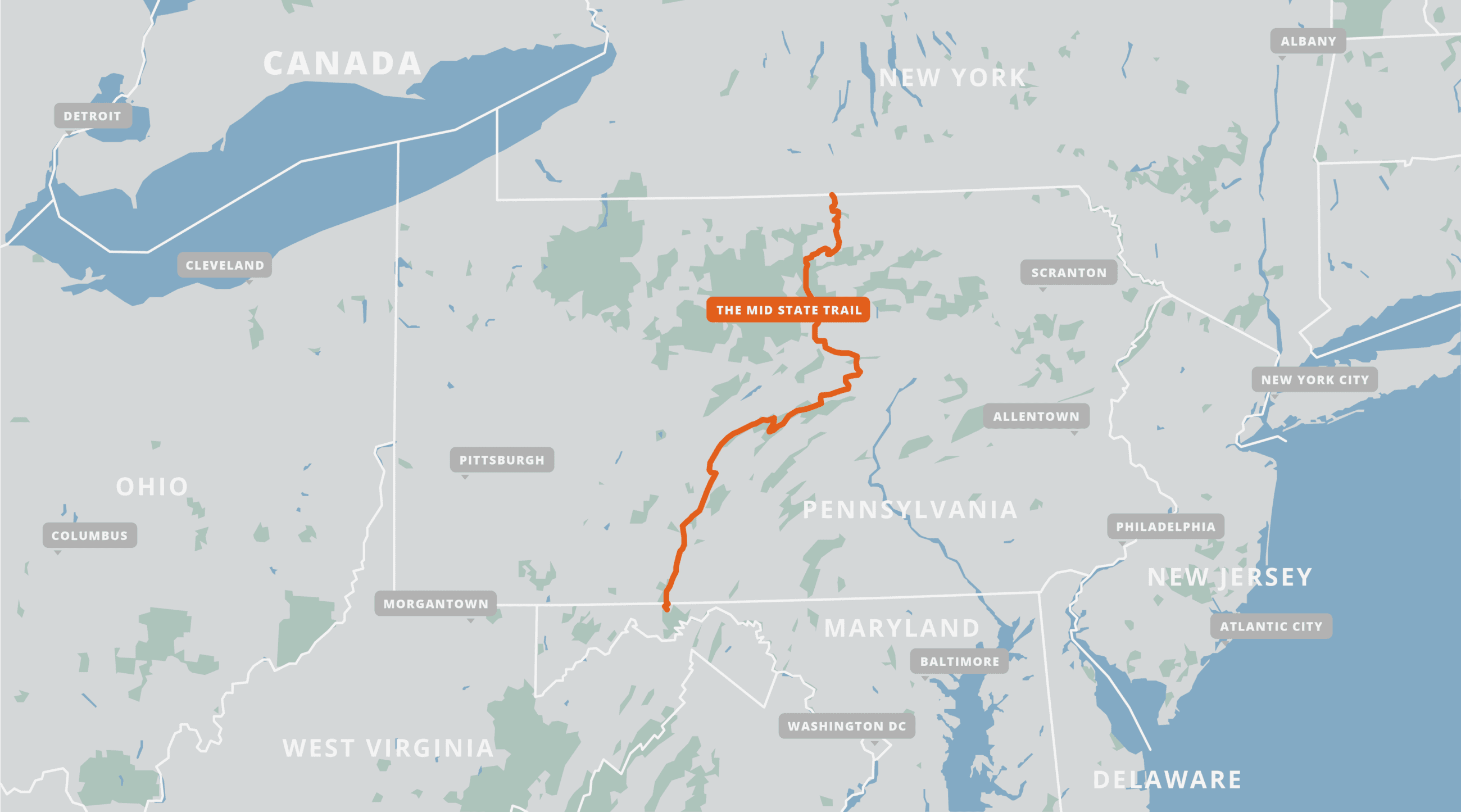
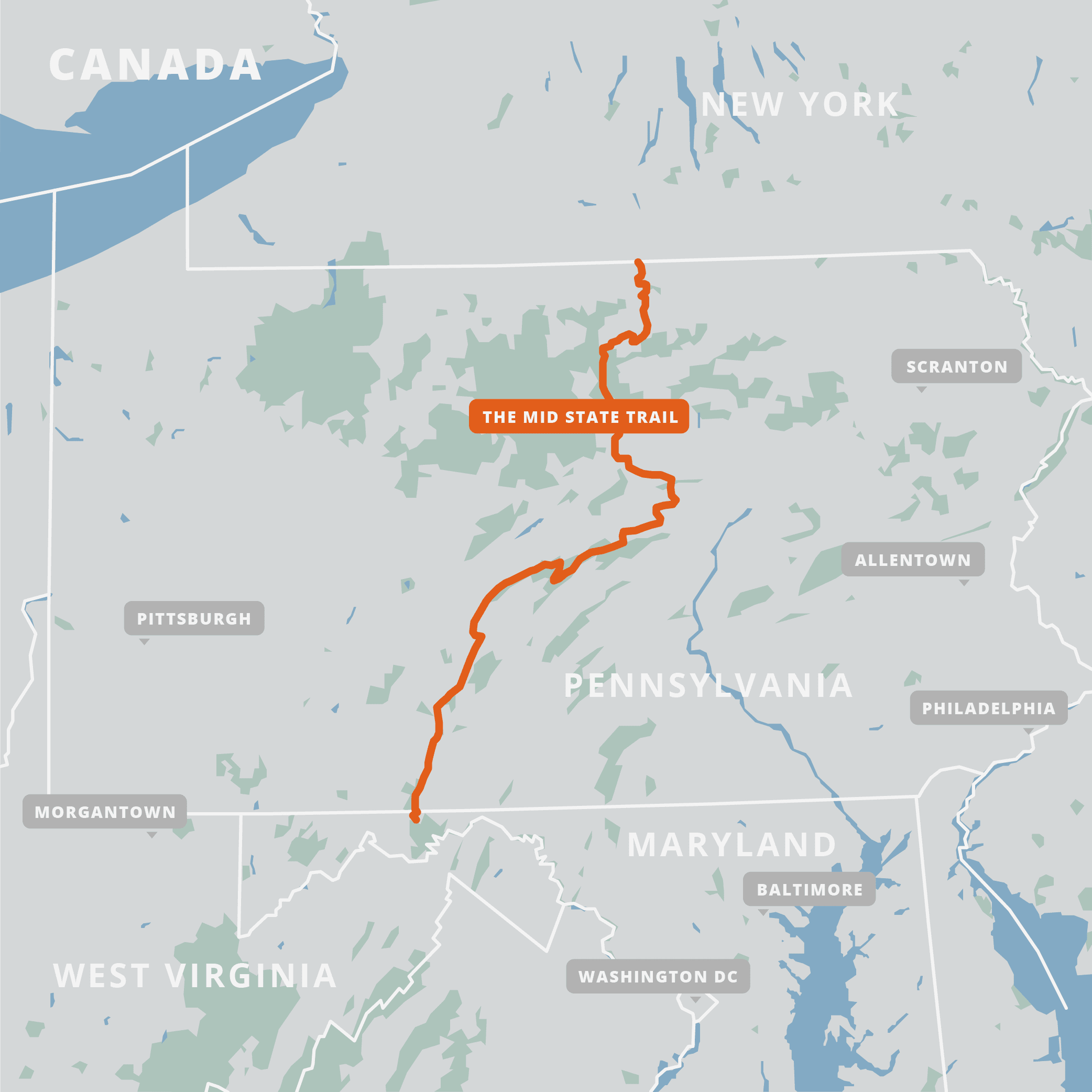
Mid State Trail
Official app of the Mid State Trail Association. Pennsylvania’s Mid State Trail is a hike of almost 330 miles (530 km), and offers dramatic views, rocky ridgelines, high plateaus, rolling hills, and a variety of other spectacular natural features. The trail crosses the entire state, from the border with New York in the north, to the border with Maryland in the south. The trail traverses many unique natural areas, including the Allegheny Mountains and the Northern Tier, a region of the trail shaped by the retreat of ancient glaciers.
20% off for our Hiking Season Kick-off SALE! The Mid State Trail is now $8.99.
30% off for our Small Business Saturday SALE! The Mid State Trail is now $7.99.
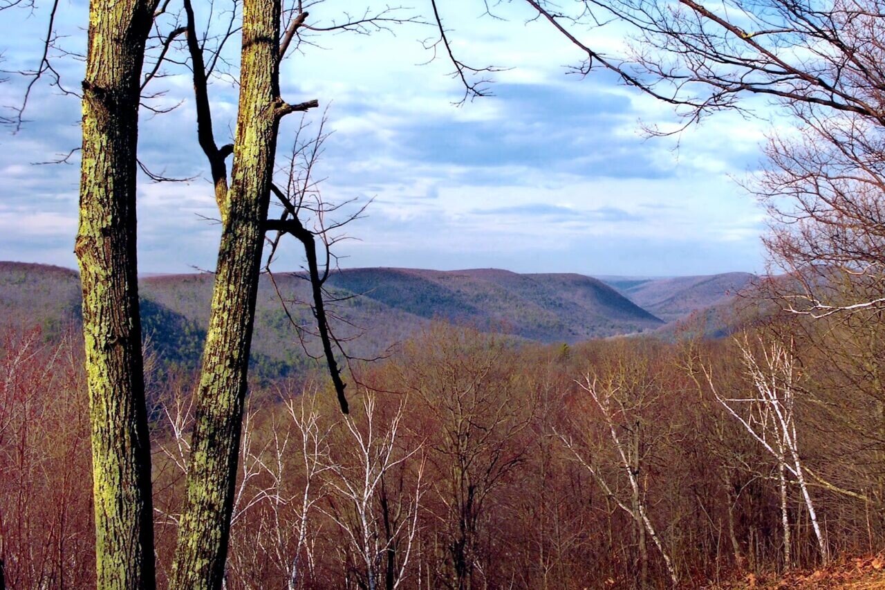
Pennsylvania, Mid State Trail
Photo by Ruhrfisch
4.8 ★★★★★ | 17K+ Reviews
Mid State Trail
330 miles • Pennsylvania
Official App of the Mid State Trail Association
Download our guide to access the Mid State Trail map, tracks, waypoints, and comments! Pennsylvania's Mid State Trail is a hike of almost 330 miles (530 km), and offers dramatic views, rocky ridgelines, high plateaus, rolling hills, and a variety of other spectacular natural features. The trail crosses the entire state, from the border with New York in the north, to the border with Maryland in the south. The trail traverses many unique natural areas, including the Allegheny Mountains and the Northern Tier, a region of the trail shaped by the retreat of ancient glaciers.
$11.99 full guide
$11.99 full guide
Mid State Trail Map
How can I get it?
The Mid State Trail map is available as an in-app purchase in our Guthook Guides app, a free download from the Apple App Store or the Google Play Store.
Our iOS and Android apps do differ slightly in their appearance. However, the majority of their features remain the same, and they access the same trail guide data.
The Mid State Trail (MST) is an old-fashioned wilderness footpath across Pennsylvania from Bedford County in the south to Tioga County in the north. Features of the MST are its many views and side trails, its sense of isolation and remoteness, and its use of metric measure.
Initial trail clearing began in 1969 under the auspices of Penn State Outing Club. The Mid State Trail Association (MSTA) is an organization of trail overseers and others formed in 1982 and dedicated to the completion, maintenance, and preservation of the Mid State Trail System.
$11.99
Cheers to giving back! Part of your purchase of the Mid State Trail goes to support the Mid State Trail Association’s work to preserve and maintain the trail. Learn about the Mid State Trail Association.
Hike more.
Check out some of the other trail guides we offer!
About our partner
Mid State Trail Association
The Mid State Trail was created to foster natural, spiritual experiences, so that all may enjoy a greater respect for nature and therefore protect nature for future generations. The Mid State Trail Association seeks out remote, quiet natural corridors for placing the Mid State Trail, constructs and maintains only footpaths, and acts to protect the quiet, wild and scenic, natural and cultural resources of the corridor through which the trail passes.
Atlas Guides has partnered with the Mid State Trail Association to create, improve, and update the official Mid State Trail app.
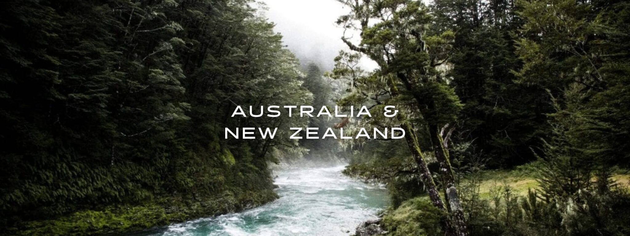
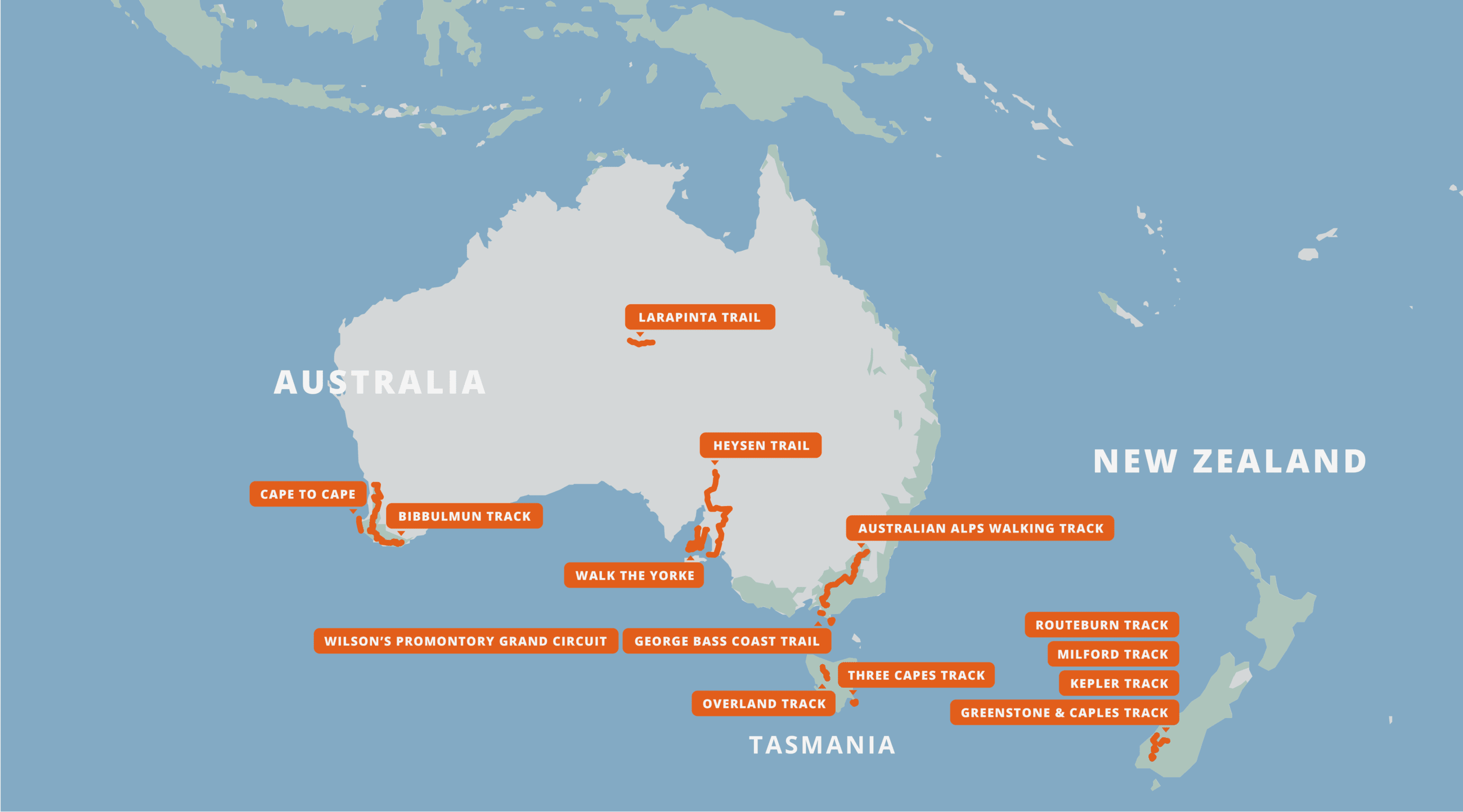
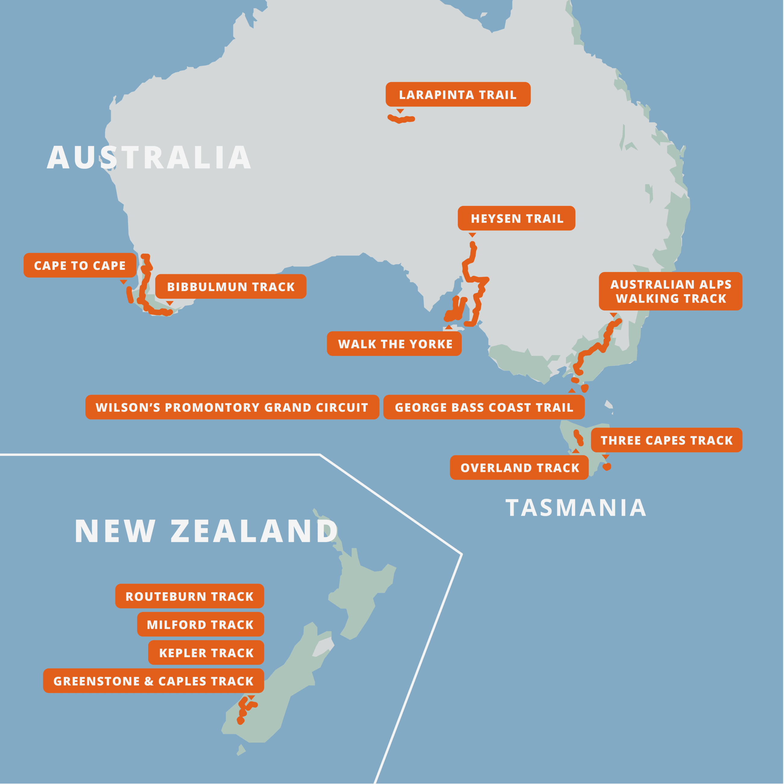
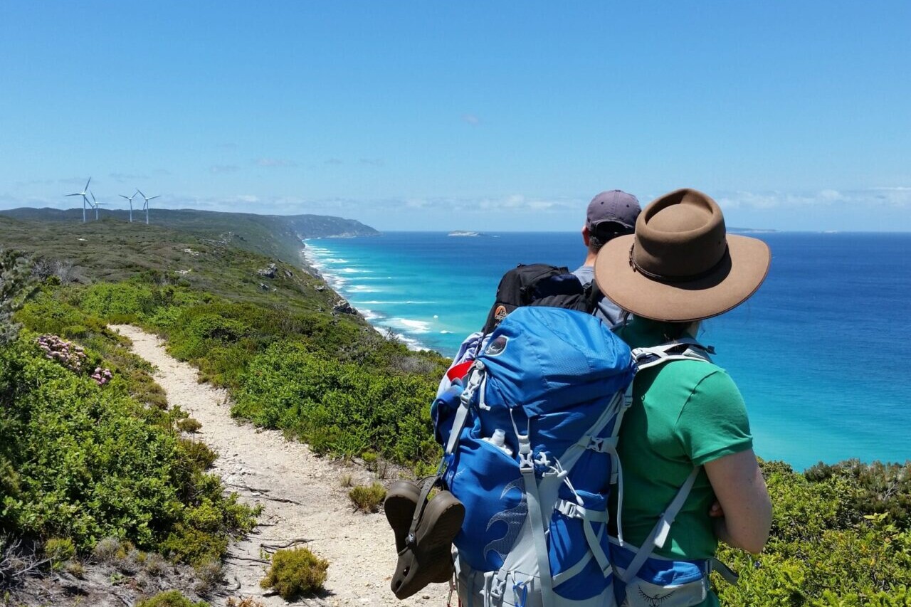
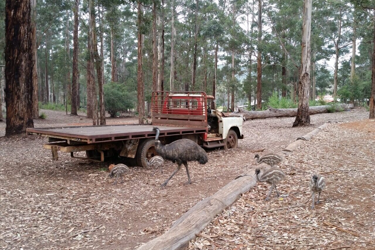
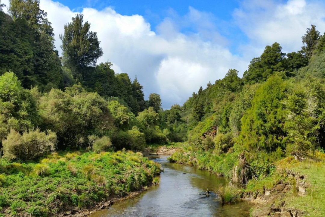
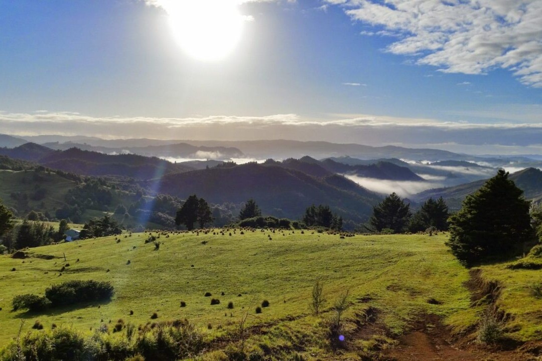
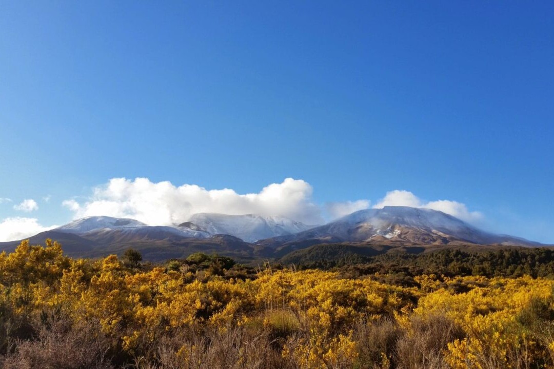
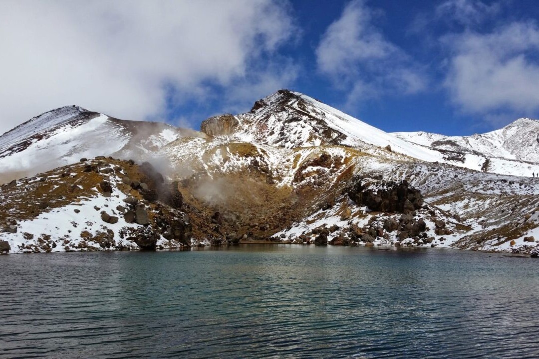
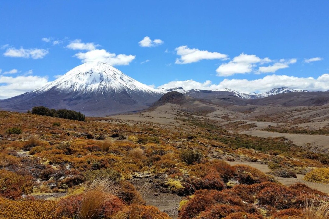
Australia & New Zealand
Australia and New Zealand are a hiker’s paradise. With an amazing variety of natural landscapes, travelers will experience crystal coastlines, tall rocky cliffs, blue lakes, towering mountains, old growth forests, spectacular wildflowers, outback desert, and more. Our hiking guide offers a variety of regional hikes ranging from the 8 km (5 mi) George Bass Coast Trail to the 1002 km (620 mi) Bibbulmun Track. It also includes Australia’s Overland Track and Three Capes Track (both in Tasmania), the Larapinta Trail, Cape to Cape, and Wilsons Promontory Grand Circuit; and New Zealand’s Kepler Track, Milford Track, Routeburn Track, and Greenstone and Caples Track. Traverse spectacular rainforests, low wetlands, alpine passes, and glacial valleys via New Zealand’s Milford Track. Experience white sandy beaches, Karri forests, rocky beach-side ledges and thundering surf while walking Australia’s Cape to Cape route.
20% off for our Hiking Season Kick-off SALE! The Australia and New Zealand Hiker Special is now $35.99.
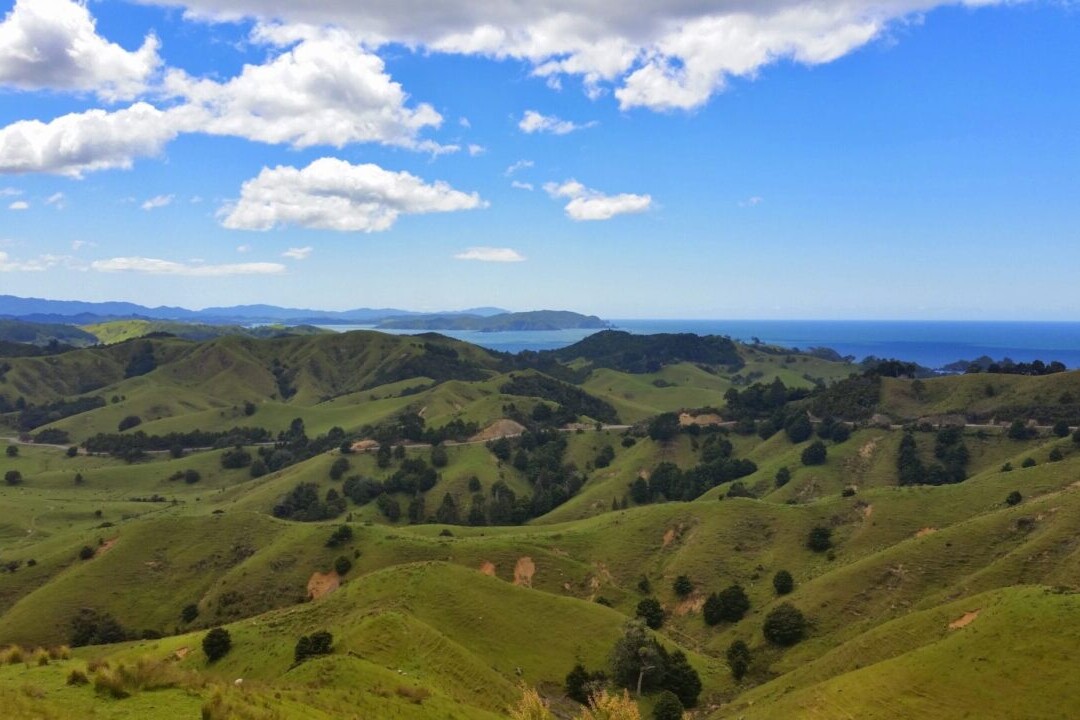
Fiordland National Park, New Zealand, Routeburn Track
Photo by Evan Clark
4.8 ★★★★★ | 17K+ Reviews
Australia and New Zealand
Download our guide to access the Australia & New Zealand Hiker Special maps, tracks, waypoints, and comments! Australia and New Zealand are a hiker's paradise. With an amazing variety of natural landscapes, travelers will experience crystal coastlines, tall rocky cliffs, blue lakes, towering mountains, old growth forests, spectacular wildflowers, outback desert, and more. Our hiking guide offers a variety of regional hikes ranging from the 8 km (5 mi) George Bass Coast Trail to the 1002 km (620 mi) Bibbulmun Track. It also includes Australia's Overland Track and Three Capes Track (both in Tasmania), the Larapinta Trail, Cape to Cape, and Wilsons Promontory Grand Circuit; and New Zealand's Kepler Track, Milford Track, Routeburn Track, and Greenstone and Caples Track. Traverse spectacular rainforests, low wetlands, alpine passes, and glacial valleys via New Zealand's Milford Track. Experience white sandy beaches, Karri forests, rocky beach-side ledges and thundering surf while walking Australia's Cape to Cape route.
$44.99 all guides 15 guides ($0 to $15.99 each) Bibbulmun Track, and more
$44.99 all guides
15 guides ($0 to $15.99 each)
Bibbulmun Track, and more
How can I get it?
Available as an in-app purchase in our Guthook Guides app, a free download from the Apple App Store or the Google Play Store.
Our iOS and Android apps do differ slightly in their appearance. However, the majority of their features remain the same, and they access the same trail guide data.
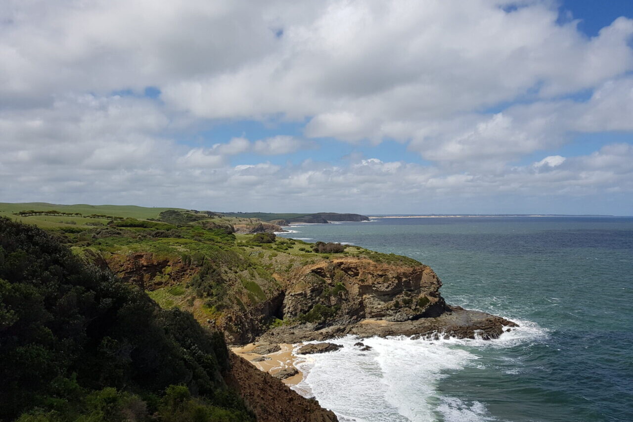
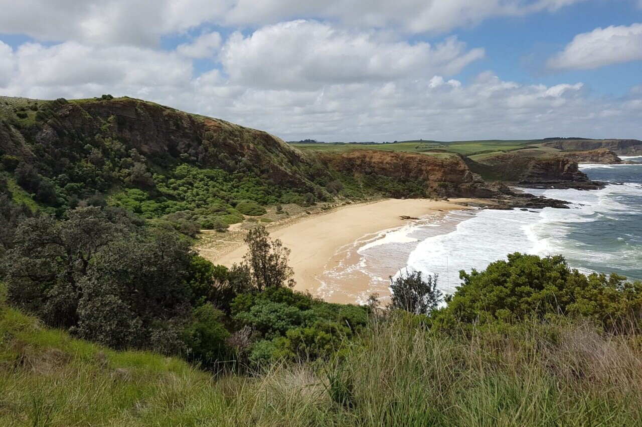
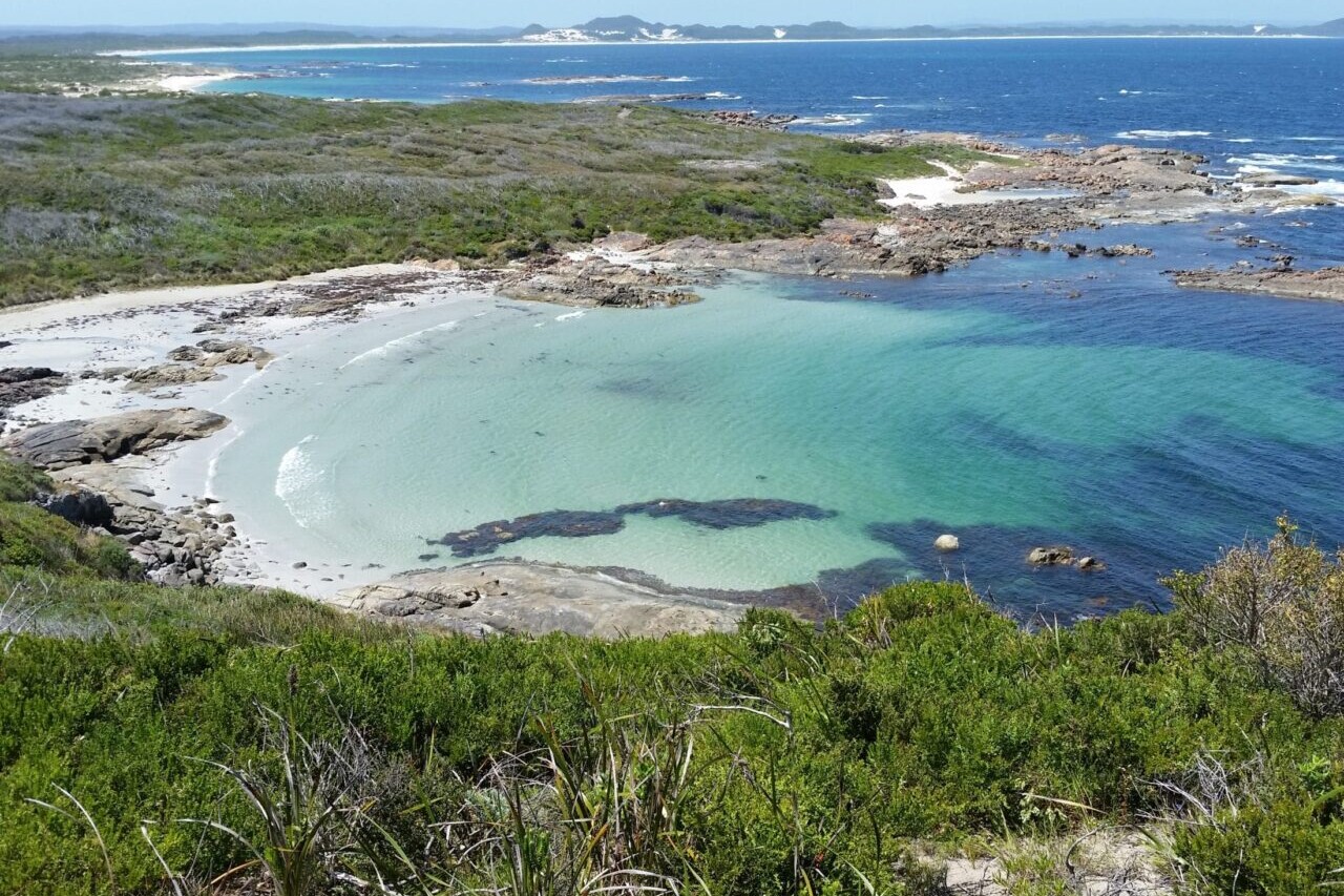
Victoria, 8 Km, Coastal, 1-3 hours
This is a wonderful walk along the clifftops and dipping down to the sandy beach. With expansive views of the cliffs, headland and wild Bass Strait oceans are well worth it. All the locals love this walk!
Hike Australia and New Zealand with a saving of 60% over buying the trails separately. This bundle does not include Te Araroa hikes which are part of the Te Araroa Bundle.
Purchase now and get all future trails added to the bundle for free!
This bundle currently includes: Australian Alps Walking Track, Bibbulmun Track, Cape to Cape, George Bass Coastal Walk, Greenstone and Caples Track, Heysen Trail, Kepler Track, Larapinta Trail, Milford Track, Overland Track, Routeburn Track, Three Capes Track, Walk the Yorke, and Wilsons Promontory Grand Circuit.
AU$69.99 / NZ$77.99 / US$44.99
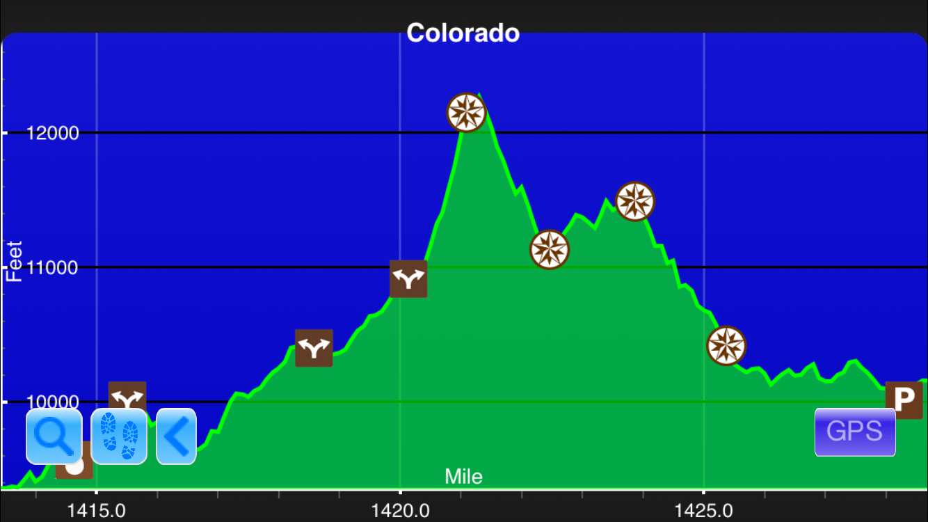
Distance: One way, 680 km HARD and REMOTE
The Australian Alps Walking Track takes you through some Australia’s best hiking country. The views are spectacular.
The hike goes through remote areas and requires planning as you will need to arrange food and water drops prior to your journey. The area passes through alpine and sub-alpine forests so please avoid hiking in times of extreme fire danger. Water on the trail can be very scarce.
Most people walk south to north because the guidebook by Chapman goes that way.
Namadgi Visitor Centre has a basis cafe and can provide reasonably safe, free long term car parking to walkers on the track. You should always notify staff however.
Walhalla has no public transport and leaving car in the village for 6 to 8 weeks would be at your own risk. The Star hotel offers a shuttle if you stay 2 nights but we suggest you call them for detail and cost.
Kiandra is an excellent place for a food drop. Great road access and midway between Dead Horse Gap (Thredbo) and Namadgi.
Best options for a break on the track are Hotham, Falls Creek and Thredbo. All are walking distance from the AAWT.
There is no guaranteed potable water anywhere on the track. It is all from streams, springs and hut rooves so always treat it. Some is polluted by horses, some by humans and some by carcasses. Some form of treatment system is essential on this track.
Climate change is impacting the track, so if it is dry season, only rely on the larger marked rivers. Many springs are drying up and cannot be relied on. Carry plenty of water.
The few water tanks on the trail are filled by guttering on a small roof.
Sometimes it is wise to include a water drop with you food drops. It can make all the difference.
We have shown huts on the app. All publicly open huts in the Australian Alps National Parks are designated for temporary ‘Emergency Shelter Only’. Walkers and park visitors are encouraged to be self sufficient in regarding to always carrying their own tent or shelter rather than relying on huts for overnight accommodation, as they may not reach the hut; may not find the hut in poor weather; or it may be overcrowded when they arrive. Generally, suitable tent campsites can be found near-by to most huts.
Basic ‘Caring for huts and respecting heritage’ info can be found here on the Alps website:
Caring for huts and respecting heritage
https://theaustralianalps.files.wordpress.com/2013/11/code-huts.pdf
Thank you for the AAWT Management Team for their valuable route and waypoint information.
AUD$24.99 / NZ$27.99 / US$15.99
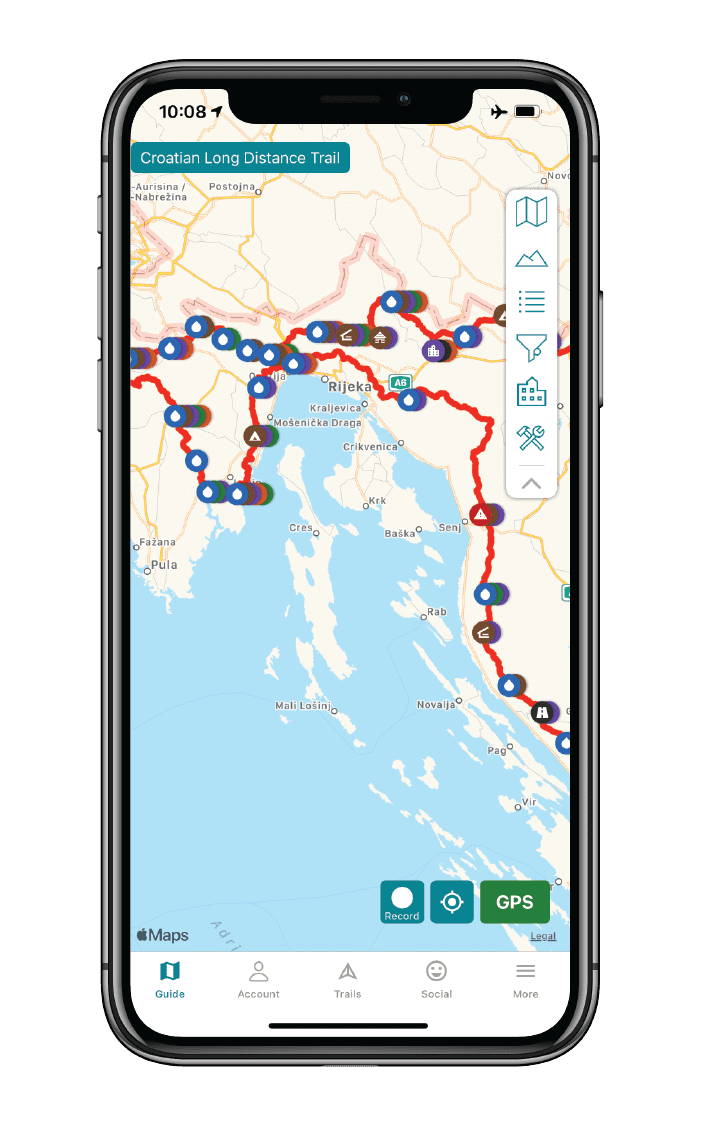
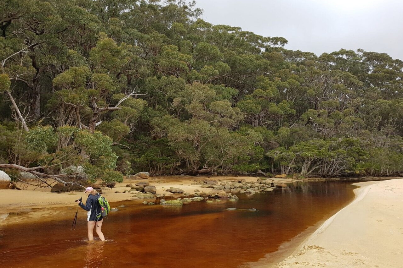
Australia, 1002km, Mixed country, 2 months approximately
The Bibblumun Track – Ancient old growth karri forests, tingle trees, breathtaking wildflowers and stunning coastal scenery. A long distance hike that passes through small country towns and peaceful forests. There are well placed shelters (with water tanks) each night and not too many hills!
Tiny birds that sound like bells wake you up each morning. A landscape that meanders along as the mind often does the same on a slow hike. A wonderful place to absorb subtle changes. A journey for the soul not to be missed! Just keep alert to the snakes!
AUD$22.99 / NZ$25.99 / US$14.99
Australia, 135 km, Coastal, 6 to 8 Days.
A wild, uninhabited coast line with majestic forests, cliffs, caves, headlands and rocky formations awaits the Cape to Cape hiker. The white sandy beaches, Karri forests, rocky beach side ledges and thundering surf mean this walk is always fun and interesting! It meanders along the whole length of the Leeuwin-Naturaliste Ridge, which forms the backbone of the Leeuwin-Naturaliste National Park between the lighthouses of Cape Naturaliste and Cape Leeuwin in the far south west of Western Australia. The wildflowers in spring are amazing. You will need to do some preparation as uninhabited means small shops with few supplies.
AUD$9.99 / NZ$9.99 / US$5.99
8 Km, Coastal, 1-3 hours
This is a wonderful walk along the clifftops and dipping down to the sandy beach. With expansive views of the cliffs, headland and wild Bass Straight oceans are well worth it. All the locals love this walk!
This walk is named after the renowned maritime explorer, George Bass, a man hardly known for walking. In 1797, he set sail from Sydney Cove and encountered this coastline while proving that a stretch of water did separate the mainland from Tasmania. It was a hell of a point to make, given he did it in an open boat only 8.7 metres long. It could be powered by its sails or by 6 to 8 oarsmen. It was a very adventurous journey and replicated in 1997, by a team of sailors from Sydney.
FREE DEMO
1100 km. Easy/Medium, Northern Section is remote and can be very hot and dry.
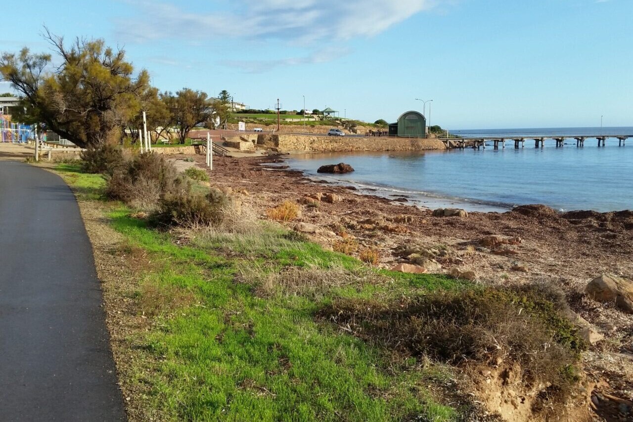
South Australia’s Heysen Trail extends from Cape Jervis, on the Fleurieu Peninsula, to Parachilna Gorge, in the Flinders Ranges, opening up South Australia like a zipper as it traverses coastal areas, native bushland, rugged gorges, pine forests, vineyards, rich farmland and historic towns.
The Trail passes through some of the most scenic parts of the state including national parks, state forests and internationally acclaimed tourist destinations, including the Barossa Valley and the stunning outback of Wilpena Pound.
It caters for both the serious backpacker hiking the entire trail and for walkers doing day walks along shorter sections.
For planning your trip, food re-supply points and transport options there is excellent information at https://heysentrail.asn.au/heysen-trail/service-directory/
Thank you to Julian and the Friends of the Heysen Trail for the trail route, waypoint information and photos.
For the latest information and planning your trip please refer to:-
AUD$24.99 / NZ$27.99 / US$15.99
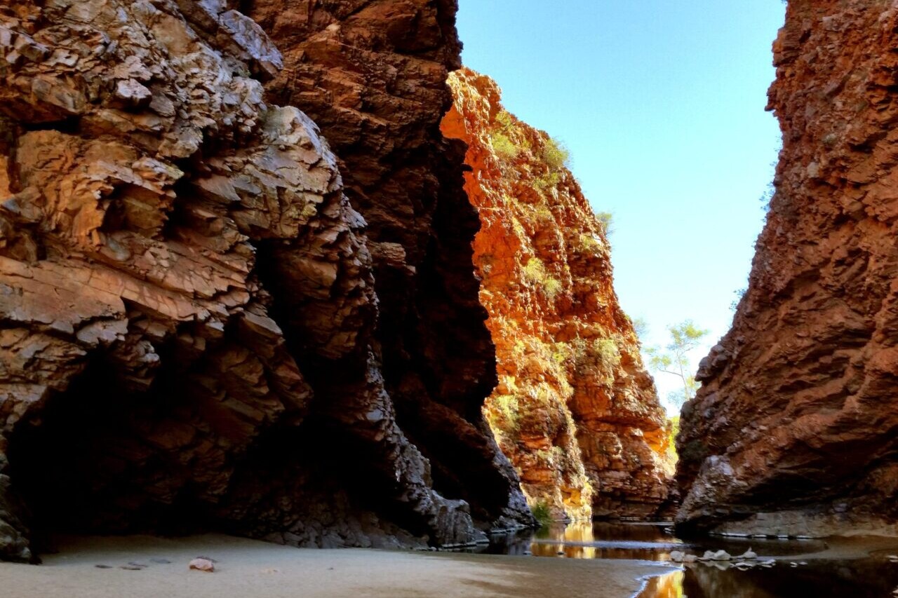
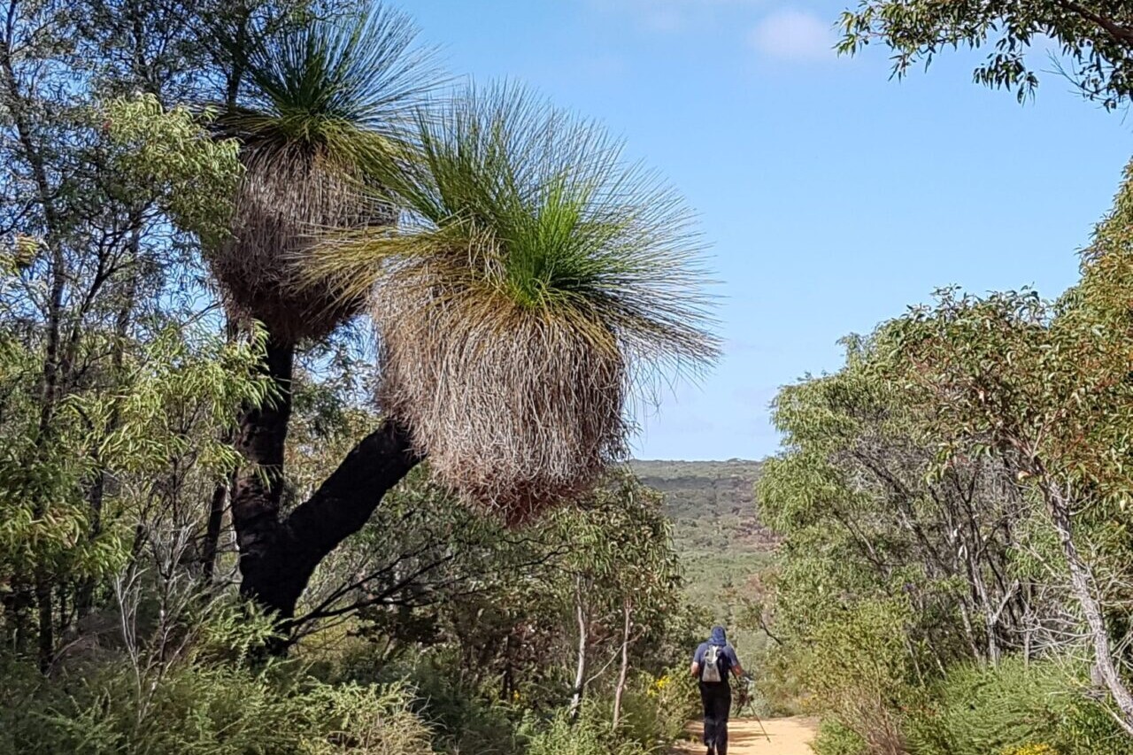
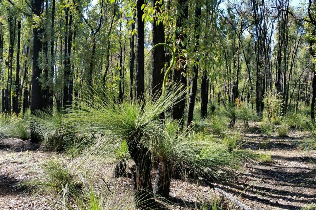
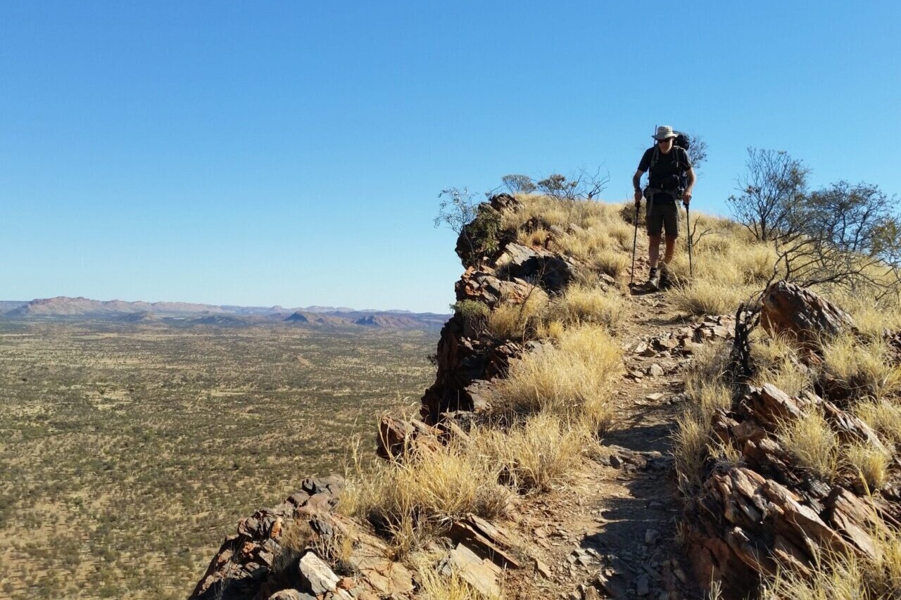
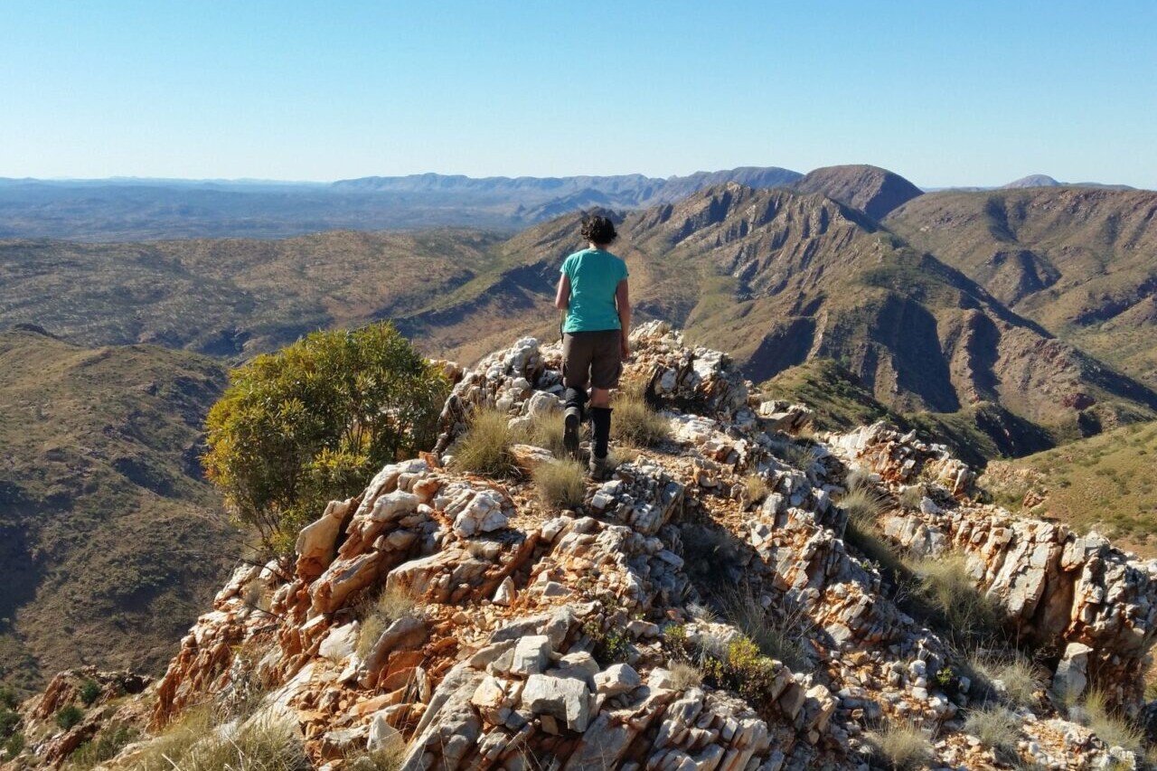
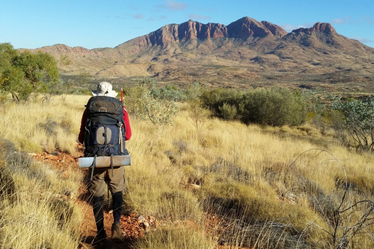
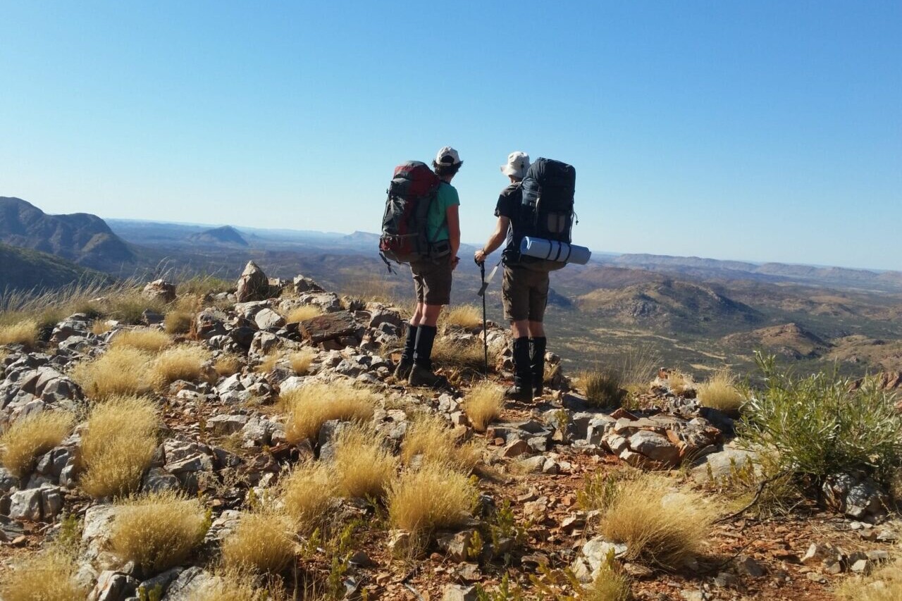
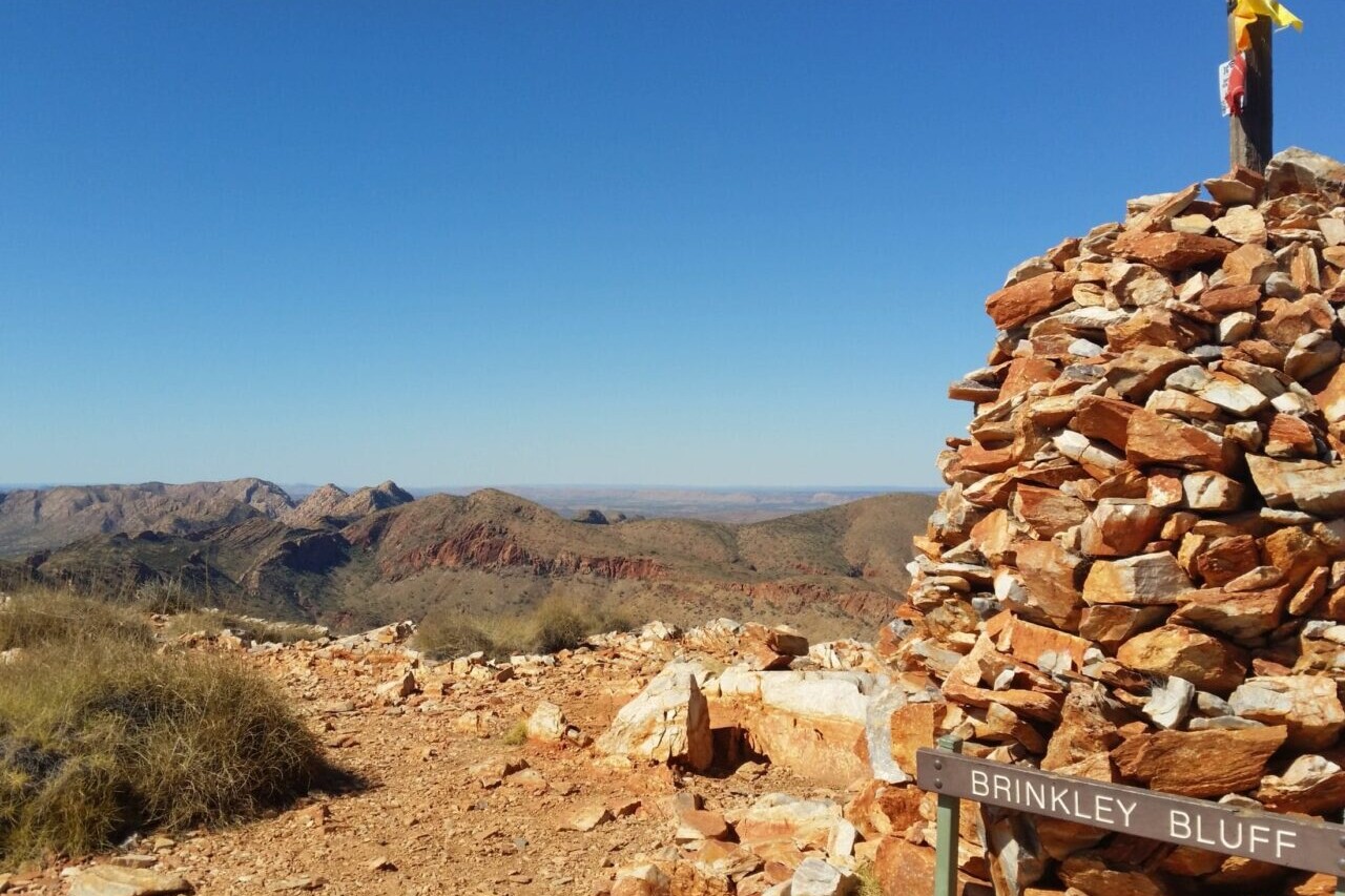
Australia, 231 km, Desert/Outback, 13-18 Days.
The Larapinta Trail, in the heart of Central Australia, runs 223km along the spine of the West MacDonnell Ranges covering some of the most spectacular ranges and gorges within the vast Australian outback desert.
The deep red gorges and cool waterholes offer an oasis for a refreshing swim in a very hot and arid land. On the rugged rocky ridges, formed millions of years ago by the rock layers being pushed on edge, you can see forever – to far off ranges without any sign of human development.
AUD$14.99 / NZ$16.99 / US$9.99
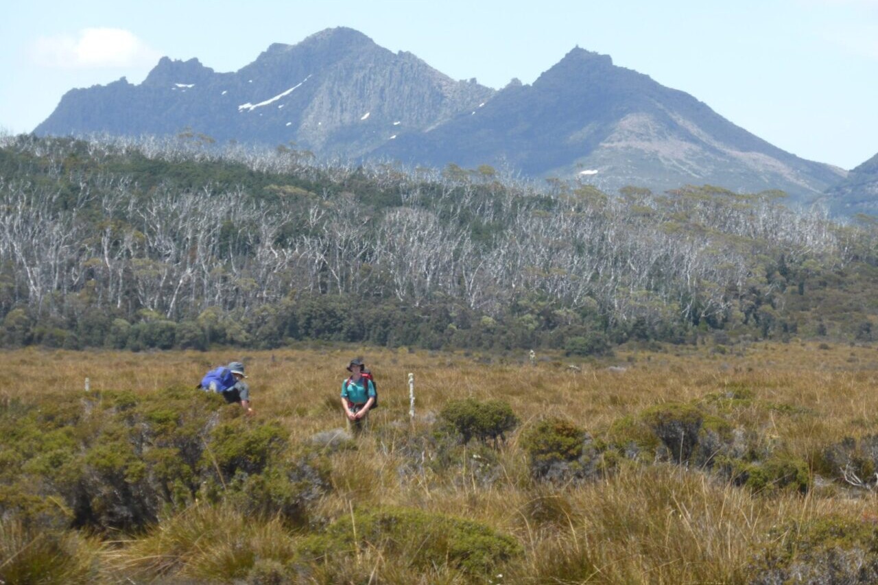
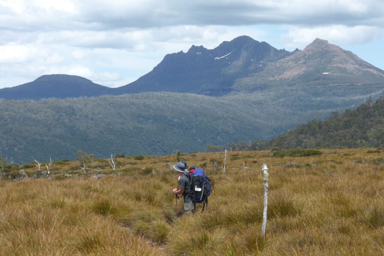
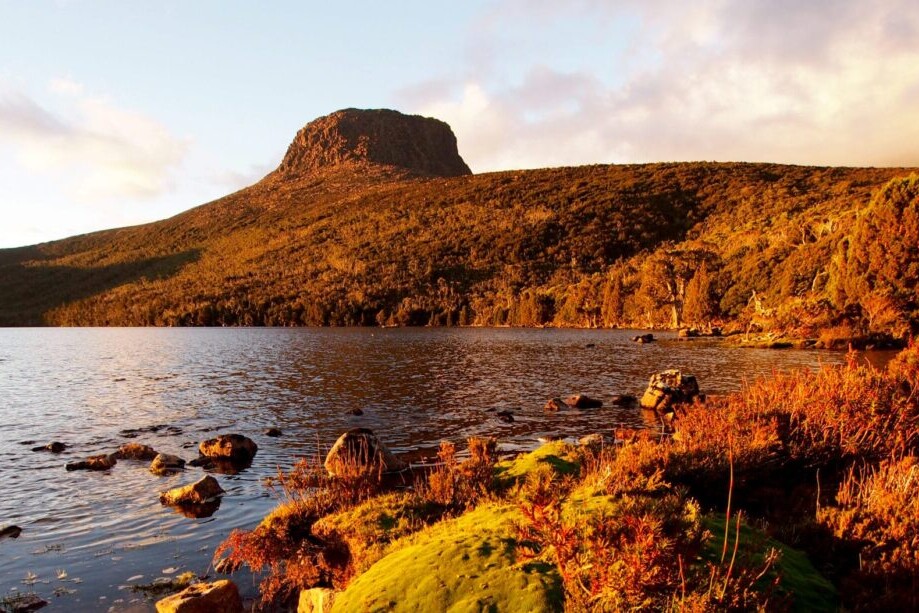
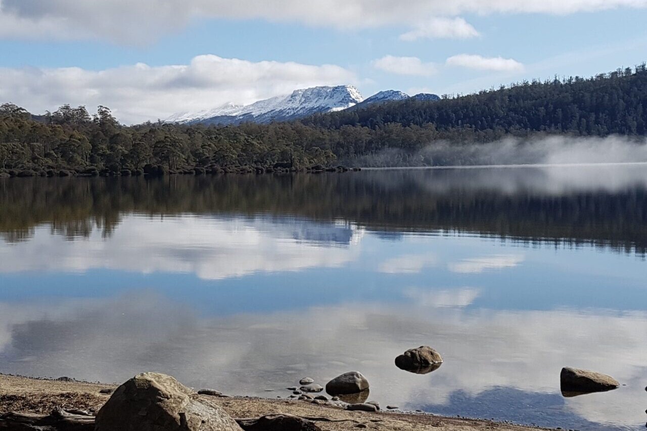
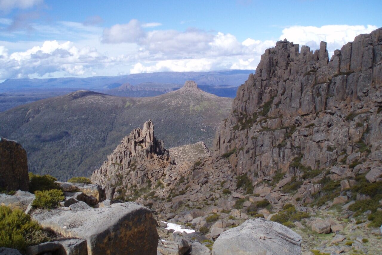
Tasmania, Australia, 72 km, 5-6 Days
The Overland Track located in a World Heritage area is Tasmania’s iconic hike. Start out at the beautiful Dove Lake and marvel at Cradle Mountain with its distinctive rock outcrops towering above. The side trip to climb Cradle Mountain rewards you with spectacular views over the glacially formed alpine lakes, tarns and far off mountains. As you hike south, the dominant dolerite peak of Barn Bluff commands your attention from the surrounding alpine plains.
Magnificent Pandani palms with their dark green spiky leaves flourish like an oasis in the shelter of Waterfall Valley. Enjoy a snack on the sandy beach of Lake Will and even a swim in its icy waters.
Like medieval Japanese paintings, the pencil pines with their ancient trunks and spindly foliage reflect into the tranquil Lake Windemere waters.
The views down to the rugged and remote Mersey River Gorge from Pine Forest Moor provide you with a wonderful sense of being in the wilderness.
The peaks of West Pelion and the very distinctive East Pelion stand like sentinels.
A side trip to Tasmania’s highest peak Mount Ossa (1617 m) can provide 360 degree views across to Frenchman’s Cap and beyond.
The Du Cane Range has some magnificent forests and views. Following the Narcissus River downstream towards Lake St Clair provides great views of The Acropolis and Mt Geryon. When you arrive at Lake St Clair you can either catch the ferry or meander along beside the lake in a beautiful forest.
Start: Dove Lake, Lake St Clair.
Seasons: Spring, Summer and Autumn. Weather conditions can change quickly and snow, hail and rain can occur any time of the year – even summer!
AUD$9.99 / NZ$9.99 / US$5.99
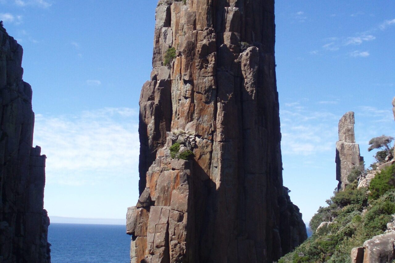
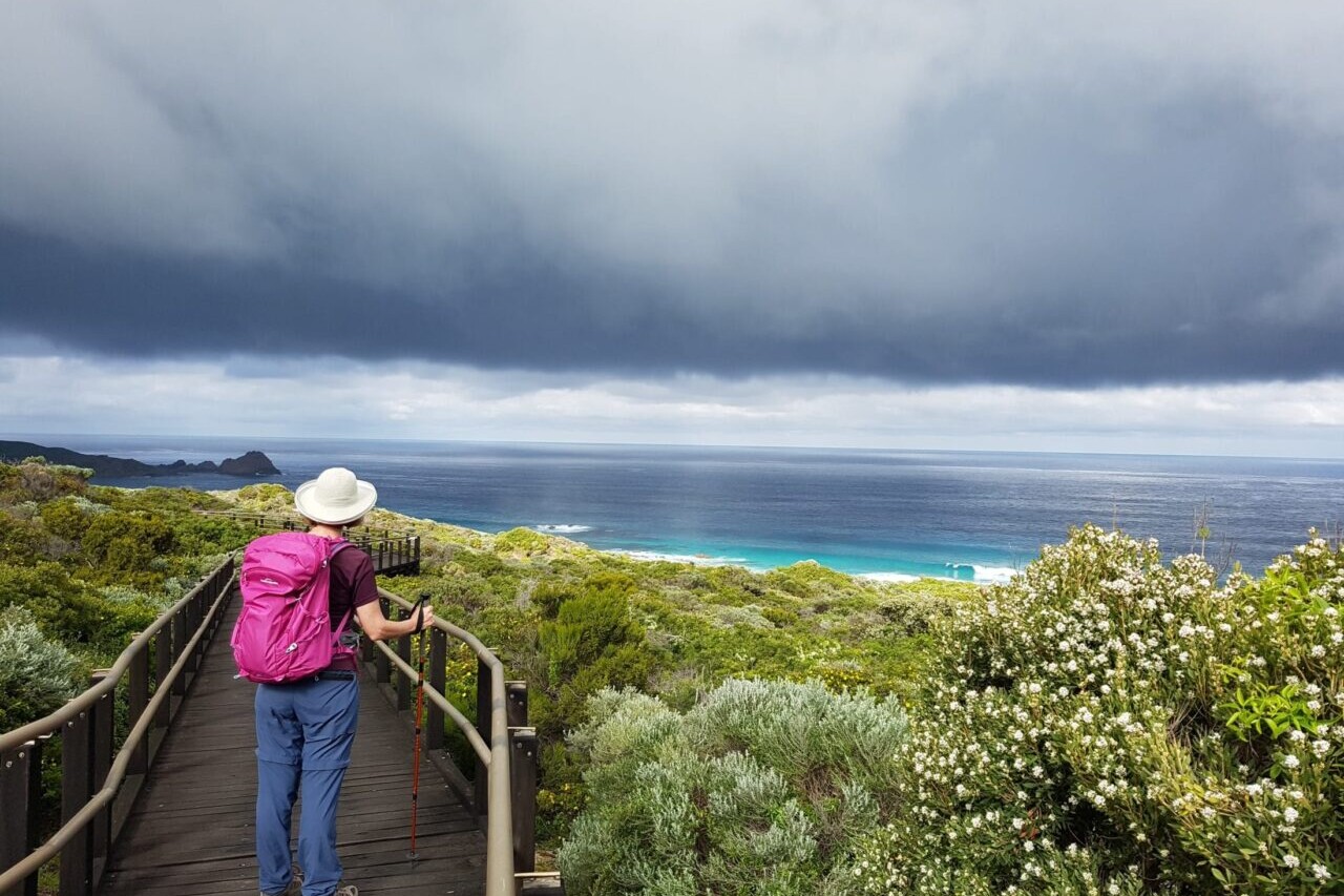
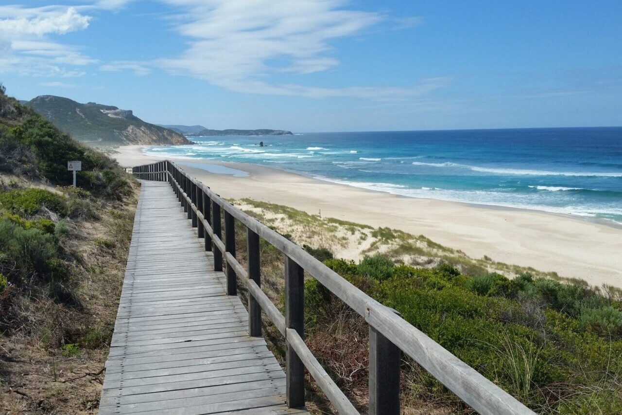
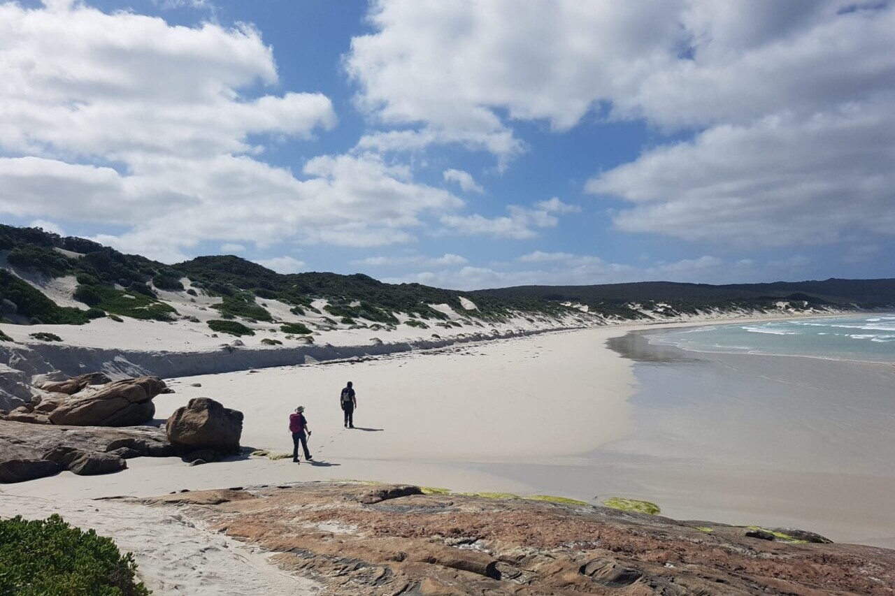
Tasmania, Australia, 48 km, Coastal, 3 Days.
The Tasmanian 3 Capes Track is a cliff hugging hike in the wilds of Tasmania. The amazing, ancient dolerite cliffs of Cape Pillar, Cape Hauy and Cape Raoul drop 300 metres directly to the ocean making them the tallest sea cliffs in the southern hemisphere. This 46km hike is set up as a hut hike and allows only 48 hikers each day. You are required to stop at each hut and stay a night along the way.
You start and finish your journey at the World Heritage-listed Port Arthur Historic Site. The first part of the tour is a boat cruise where you will explore coves and see the amazing dolerite cliffs from the water as you head to Denmans Cove. You might be lucky to see migratory whales, dolphins and resident fur seals populations. The hike takes you through Eucalypt woodlands, ferny forests and coastal heaths. At Cape Hauy spot the climbers out on the Totem Pole – a small column of rock that just up from the oceans below.
AUD$5.99 / NZ$6.99 / US$3.99
483 km One Way, Easy, Flat, Quiet Roads/Tracks,
Get away from it all. Walk along long stretches of coast with no one else in sight. Walk on tracks and quiet country roads beside spectacular coastlines and cliffs.
Expect fabulous scenery, not many people and delicious fish and chips. This walk suits the hiker who enjoys peace and just the sound of the sea.
The towns along the coast are small and the grocery shops with limited food options for hiking .
Walk the Yorke starts in the historic copper mining town of Moonta and ends in Port Wakefield.
The hike hugs the coast for almost all the Peninsula. The last 33 km from Clinton to Port Wakefield takes you up a hill to get views of the St Vincent Gulf and then onto the saltbush plains beside the Yorke Highway towards Port Wakefield. Just before Port Wakefield there is a tidal creek to cross.
The Walk the Yorke trail can be impacted by sand drifts and track works. For the latest information and planning your trip please refer to
https://www.visityorkepeninsula.com.au/walk-the-yorke/trail-notes.
Thank you to the Yorke Peninsula Council for creating a wonderful trail and your support in supplying trail information.
AUD$14.99 / NZ$16.99 / US$9.99
Australia, 54 km, coastal walk, 3-4 days.
Hike the Prom, one of the best loved hikes in Australia. Following the coast, with turquoise blue beaches, ferny glades, huge granite boulders covered in orange lichens on your way to the southernmost point of the Australian Mainland. With 53km of good track hiking, this walk has a lot to offer. The campsites are shady, and most are set close to beautiful sandy beaches. For a unique overnight accommodation, spoil yourself at the historic lighthouse which can only be reached by foot. Enjoy the wildlife as you will see wombats, wallabies, possums and a mix of interesting reptiles.
AUD$5.99 / NZ$6.99 / US$3.99
New Zealand, 61 km, Alpine, 4 Days
This is a beautiful valley walk, with a subalpine pass, in superb surroundings along crystal creeks with a backdrop of rocky mountains.
The Caples and Greenstone Valleys are linked by McKellar Saddle, a sub-alpine pass, to make a moderately demanding, 4 day loop tramp with some days averaging 6-7 hours of walking. A reasonable degree of fitness is required. This loop is 61 km with a possible addition of the Routeburn Track.
NZ$6.99 / AUD$5.99 / US$3.99
New Zealand, 32 km, Alpine, 2-3 Days
The Routeburn is a fantastically scenic hike with alpine and lake views, alpine gardens full of delicate alpine plants, tussock meadows and spectacular vistas over the mountain ranges and valleys. There are many waterfalls including the impressive Earland Falls (174 metres), Routeburn Falls cascade and the beautiful Bridal Veil Waterfall. You can connect the Routeburn to the Greenstone Caples Track and enjoy 95km of wonderful alpine hiking.
NZ$6.99 / AUD$5.99 / US$3.99
New Zealand, 60 km, Alpine, 4 Days
The Kepler track is, quite simply, spectacular! Walk along high ridges, covered in tussock grass, and see the planes taking joy flights in the valleys below.
The alpine views across Lake Te Anau to the Murchison Ranges are as stunning as they are expansive.
As you hike through the the ancient, thick, moss covered, Southern Beech forests that flank the high ridges you might expect characters from Lord of the Rings to suddenly start rushing along the path in front of you! The lakes are beautiful and the crystal water of the Waiau River lead to the swing bridge at Rainbow Reach. All of the huts have wonderful views and are a great spots to chat to other trampers.
NZ$6.99 / AUD$5.99 / US$3.99
New Zealand, 53 km, Alpine, 4 Days
The 53.5 km hike starts at Glade Wharf at the head of Lake Te Anau and finishes in Milford Sound at Sandfly Point. Trampers require boat transport to the start of the track from Te Anau Downs to Glade House and at the other end they must take a boat from Sandfly Point to Milford Sound.
The walk itself is well known for being spectacular and traverses rainforests, wetlands, and the alpine MacKinnons pass which sits stride valleys carved by glaciers and exceptional views of Lake Mintaro and the Clinton Canyon along the way. Sutherland falls are well worth the side trip with water thundering over the 580m drop. The final boat trip gives you views of the world famous Milford Sound.
NZ$6.99 / AUD$5.99 / US$3.99
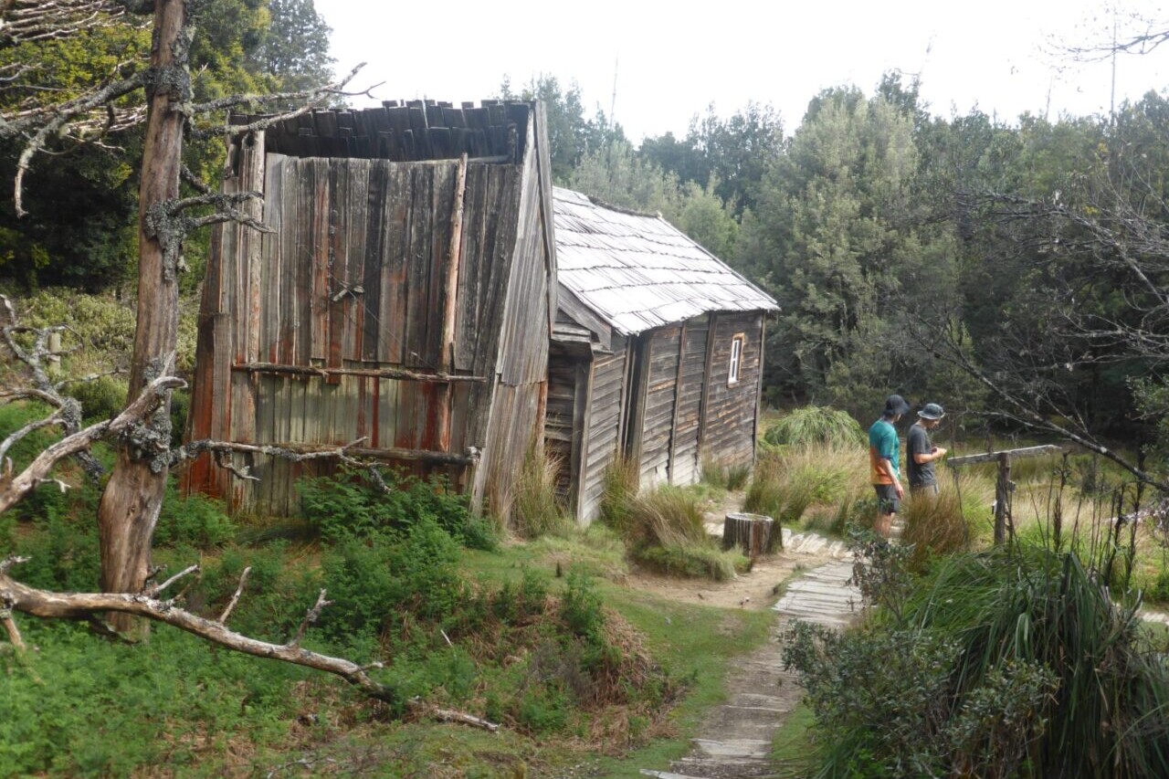
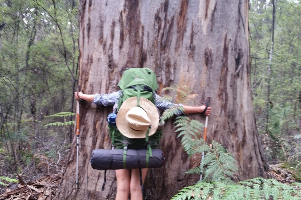
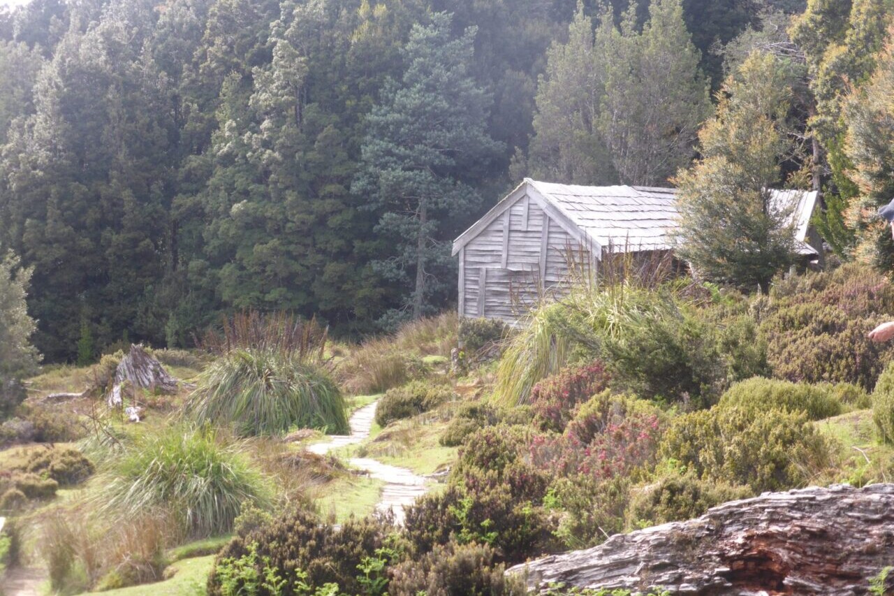
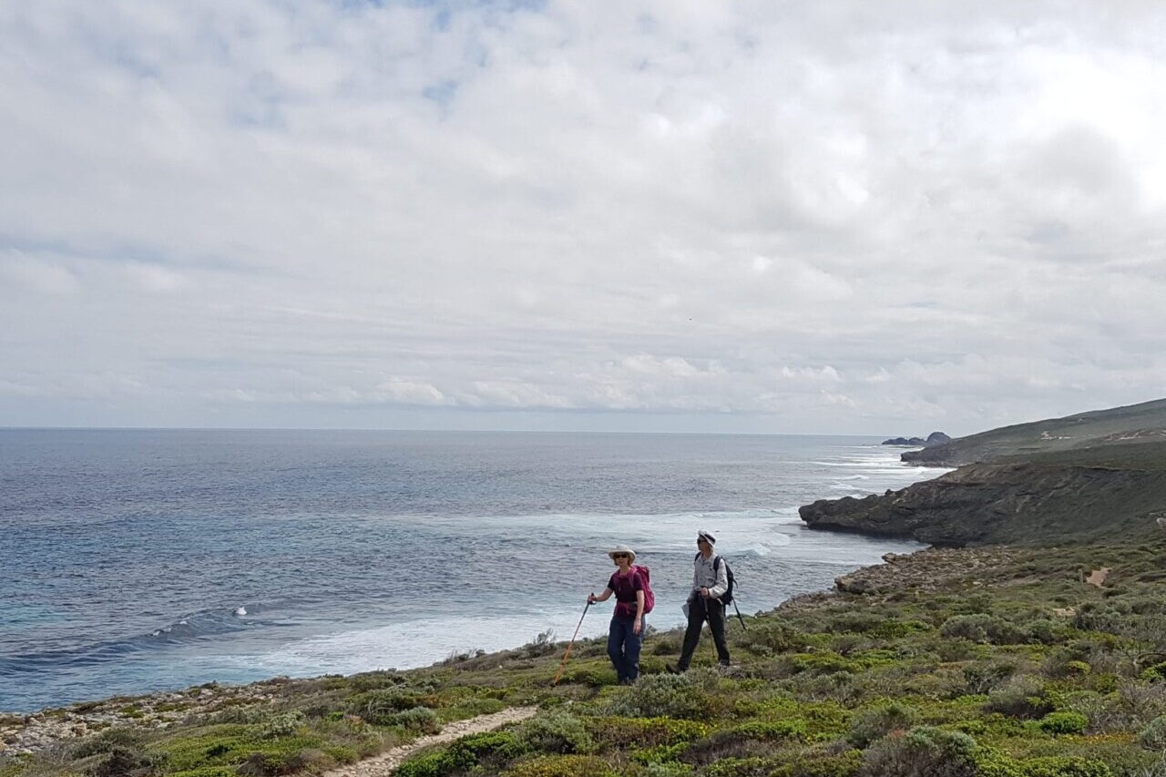
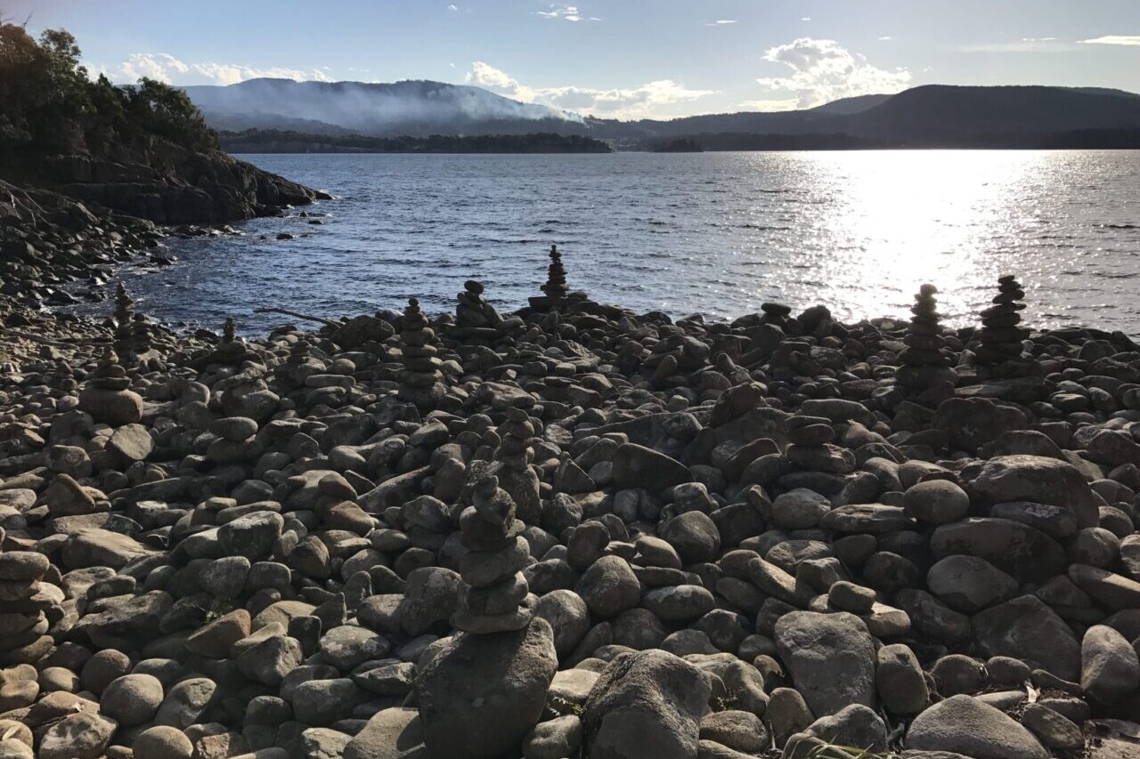
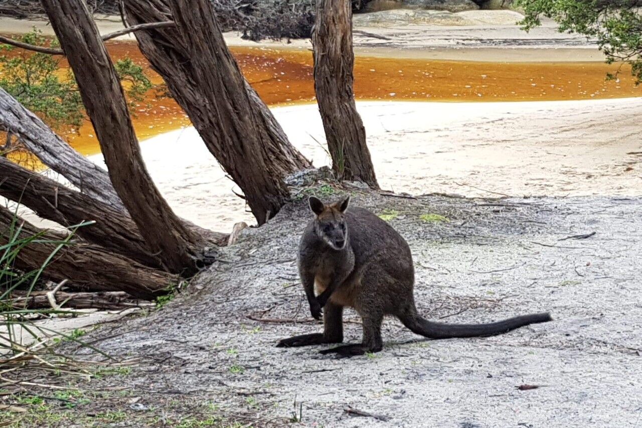
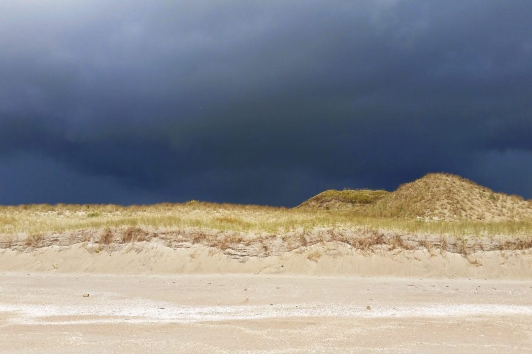
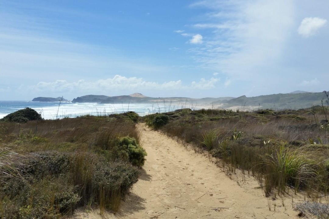
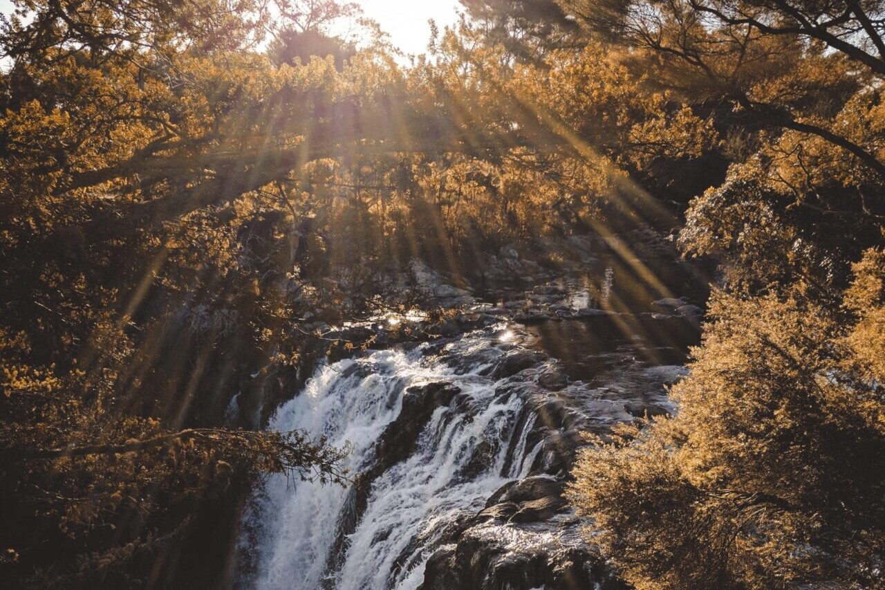
Photos from Australia/New Zealand Trails
Hike more.
Check out some of the other trail guides we offer!
About our partner
Active Wayz
Activewayz is very passionate about the outdoors, whether it be hiking, bushwalking, or tramping. They enjoy mapping new routes and planning new adventures to share in the app. They have incorporated their love for adventure, long-distance hiking, and mapping to create a resourceful guide in Australia and New Zealand.
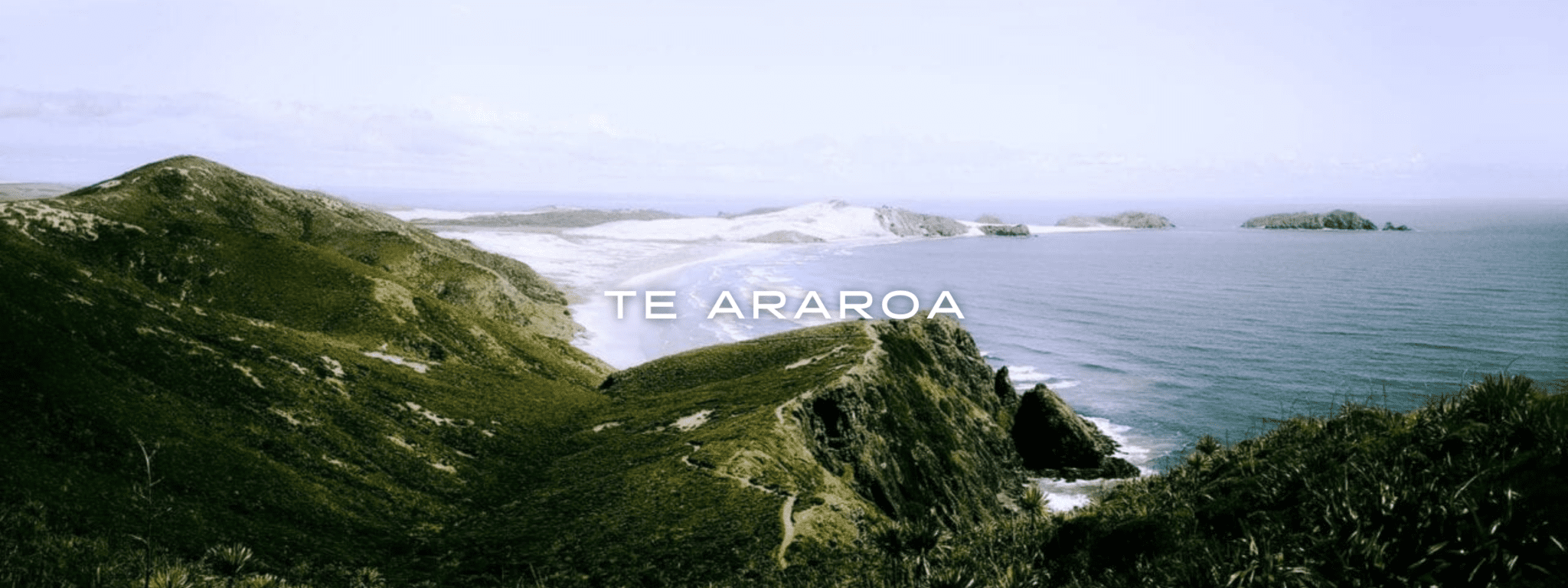
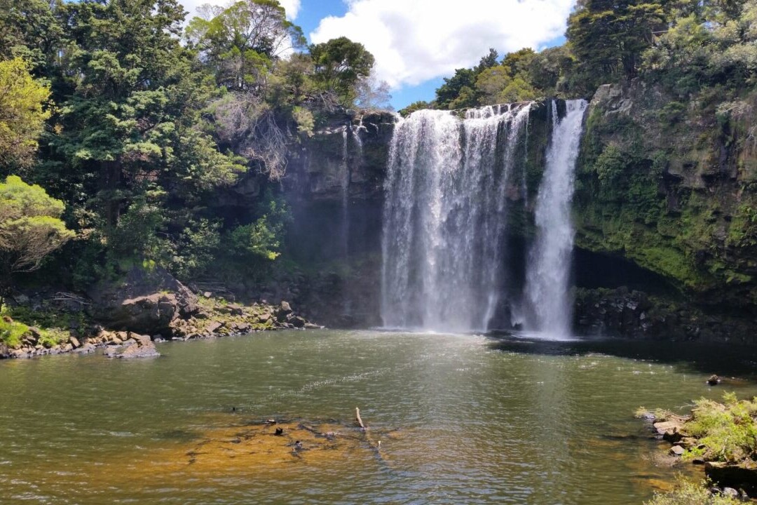
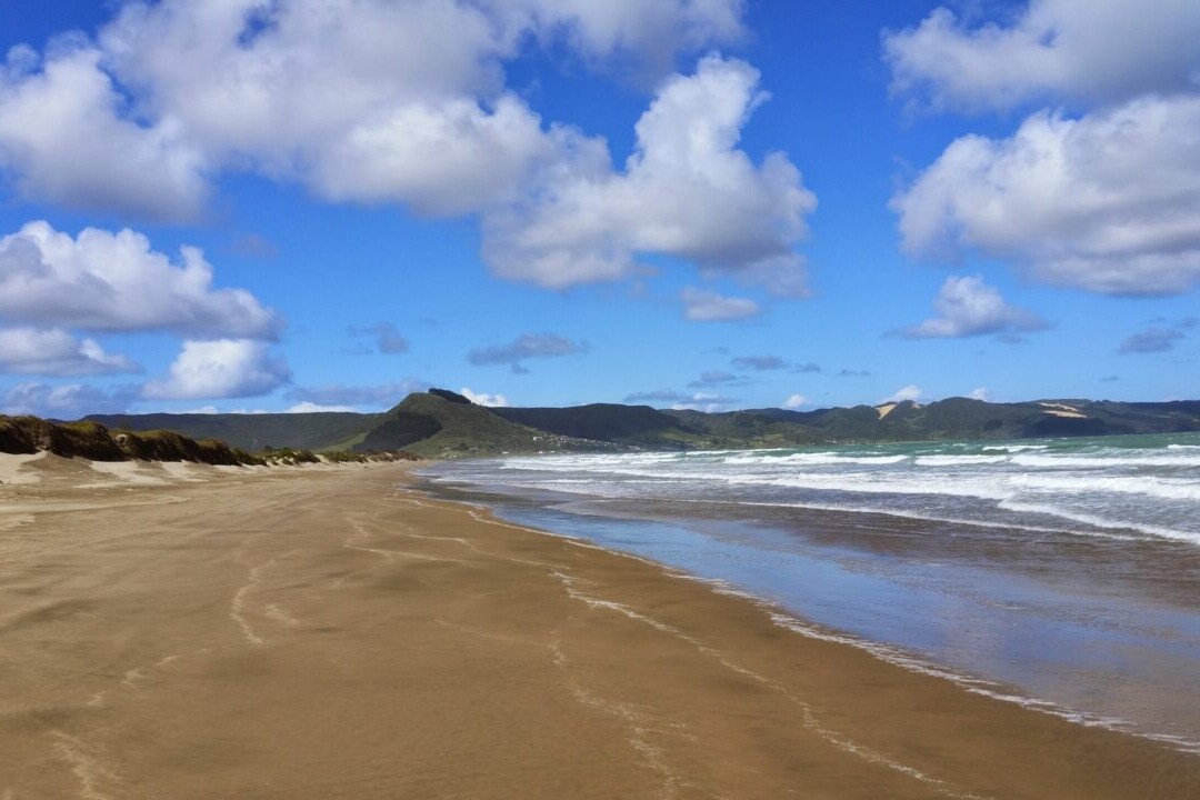
Te Araroa
Te Araroa is New Zealand’s premier long-distance hiking trail, stretching 3000 km (1860 mi) across the country’s two main islands. The trail travels from Cape Reinga on the North Island to Bluff on the South Island, passing through 9 distinct regions on its way. The trail offers spectacular views of all the amazing landscapes that New Zealand has to offer, from bustling cities to towering volcanoes. Te Araroa is truly an experience of all aspects of New Zealand – historic, cultural, and natural. From ocean beaches to deep forests, the trail is perfect for thru-hiking, backpacking, section-hiking, and day-hiking.
20% off for our Hiking Season Kick-off SALE! Our Te Araroa trail guide is now $23.99.
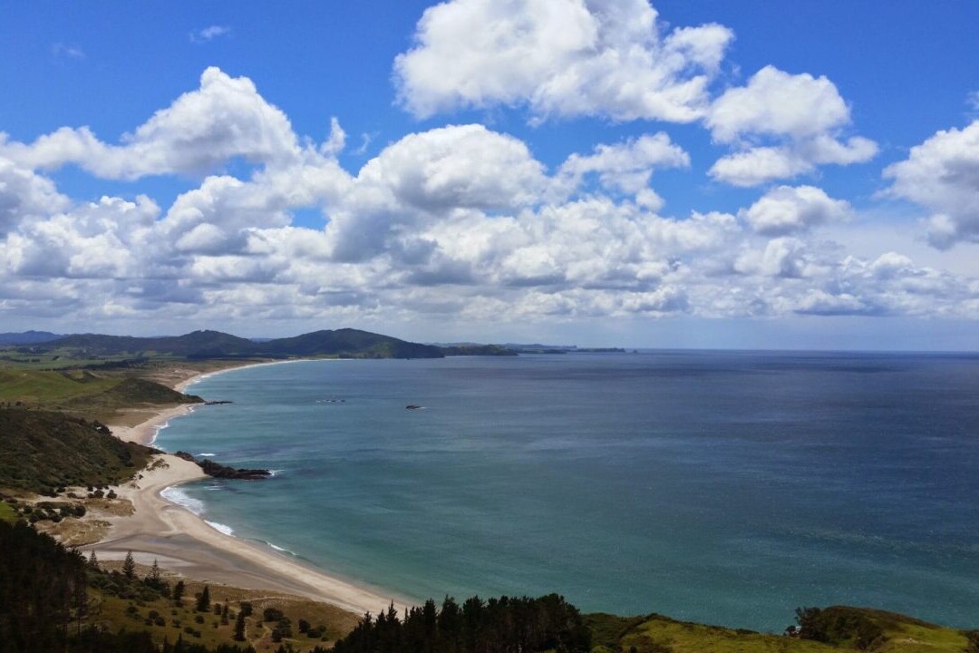
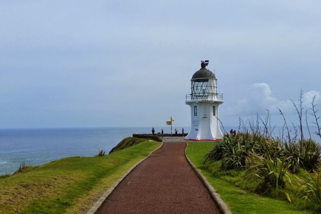
Cape Reinga, North Island, New Zealand, Te Araroa
Photo by T L
4.8 ★★★★★ | 17K+ Reviews
Te Araroa
3000 km • New Zealand
Download our guide to access the TA map, tracks, waypoints, and comments! Te Araroa is New Zealand’s premier long-distance hiking trail, stretching 3000 km (1860 mi) across the country’s two main islands. The trail travels from Cape Reinga on the North Island to Bluff on the South Island, passing through 9 distinct regions on its way. The trail offers spectacular views of all the amazing landscapes that New Zealand has to offer, from bustling cities to towering volcanoes. Te Araroa is truly an experience of all aspects of New Zealand - historic, cultural, and natural. From ocean beaches to deep forests, the trail is perfect for thru-hiking, backpacking, section-hiking, and day-hiking.
US$29.99 / NZ$49.99 full guide 4 sections (US$9.99 / NZ$16.99 each)
US$29.99 / NZ$49.99 full guide
4 sections (US$9.99 / NZ$16.99 each)
Te Araroa Map


How can I get it?
The Te Araroa map is available as an in-app purchase in our Guthook Guides app, a free download from the Apple App Store or the Google Play Store.
Our iOS and Android apps do differ slightly in their appearance. However, the majority of their features remain the same, and they access the same trail guide data.
This full-featured demo of the app includes a 60 km segment of the Te Araroa on the North Island in the Auckland area.
Te Araroa Thru-Hiker Special includes purchase of the entire Te Araroa at a 42% savings over purchasing the sections separately.
US$29.99/NZ$49.99/AU$46.99
This full-featured demo of the app includes a 60 km segment of Te Araroa on the North Island in the Auckland area.
FREE DEMO
Te Araroa North Island part 1: northern 801 km portion of Te Araroa on the North Island from Cape Reinga to Hamilton.
US$12.99/NZ$22.99/AU$19.99
Te Araroa North Island part 2: southern 932 km portion of Te Araroa on the North Island from Hamilton to Wellington.
US$12.99/NZ$22.99/AU$19.99
Te Araroa South Island part 1: northern 690 km portion of Te Araroa on the South Island from Ship Cove to Tekapo Village/Lake Tekapo.
US$12.99/NZ$22.99/AU$19.99
Te Araroa South Island part 2: southern 618 km portion of Te Araroa on the South Island, from Tekapo Village/Lake Tekapo to Bluff.
US$12.99/NZ$22.99/AU$19.99
Stories from Te Araroa!
Check out our most recent blog posts about Te Araroa.
Nothing found.
Nothing found.
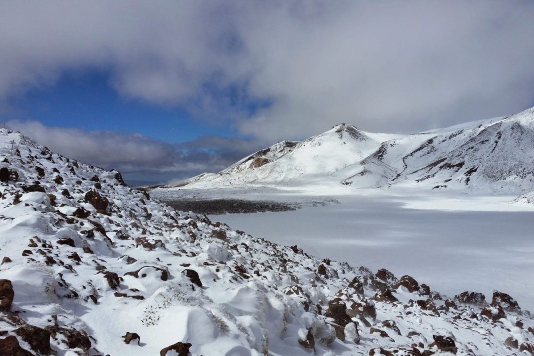
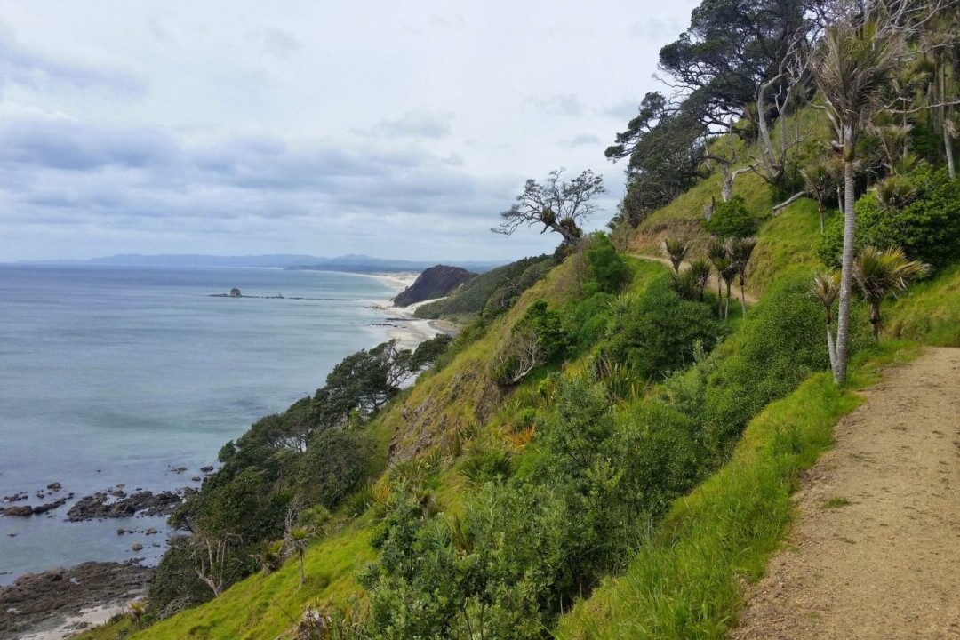
Photos from the Te Araroa


Hike more.
Check out some of the other trail guides we offer!
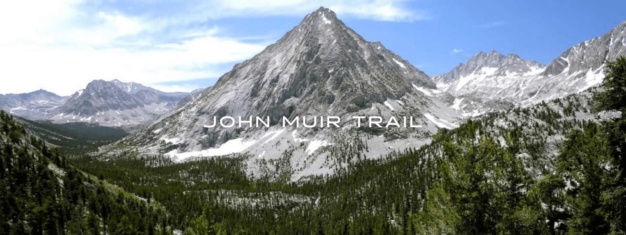
John Muir Trail
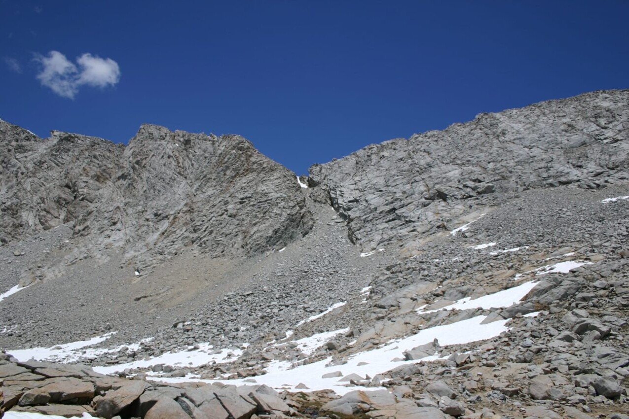
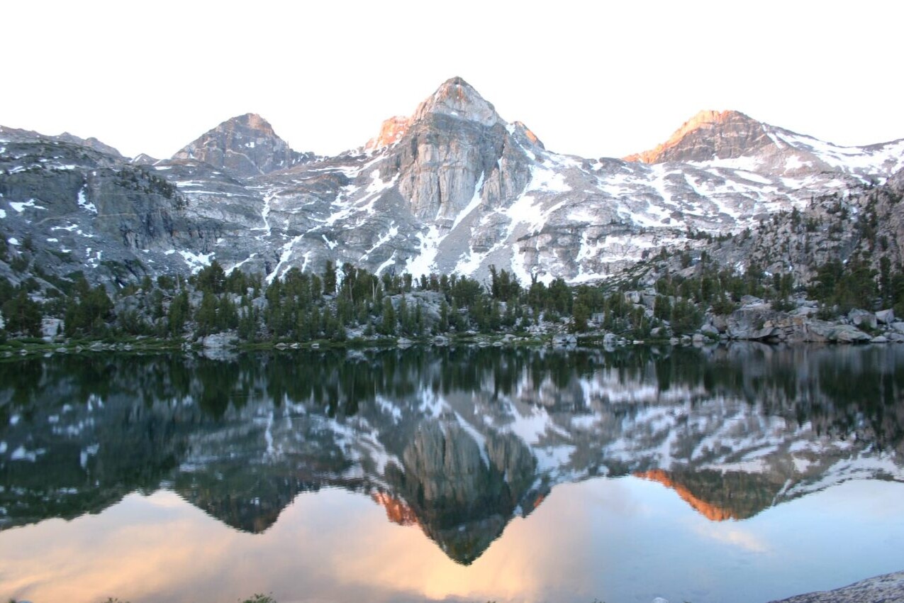
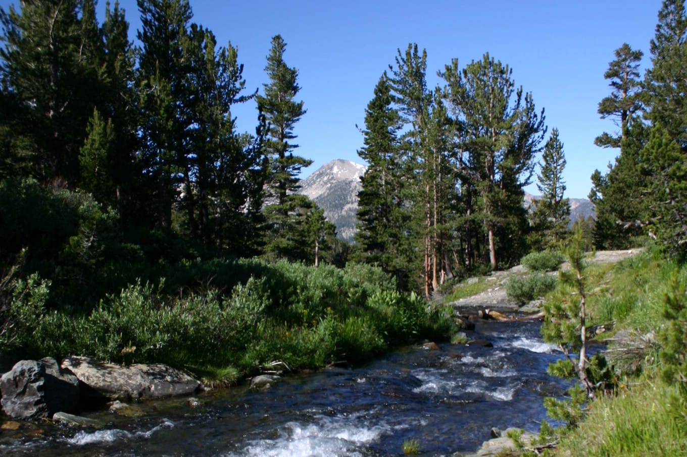
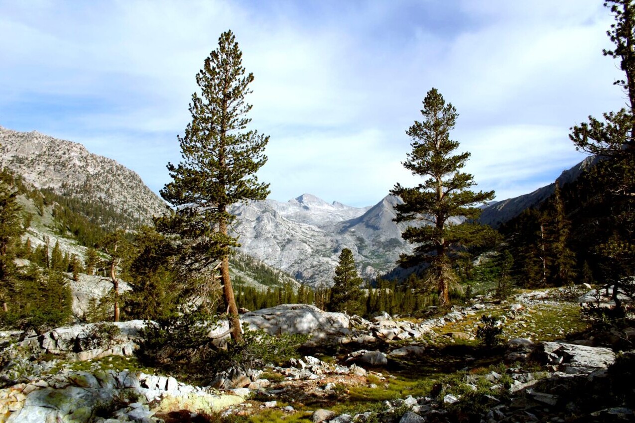
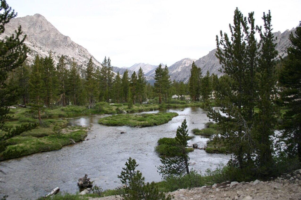
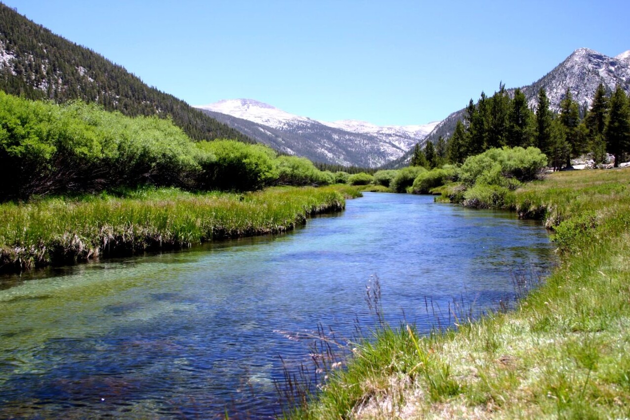
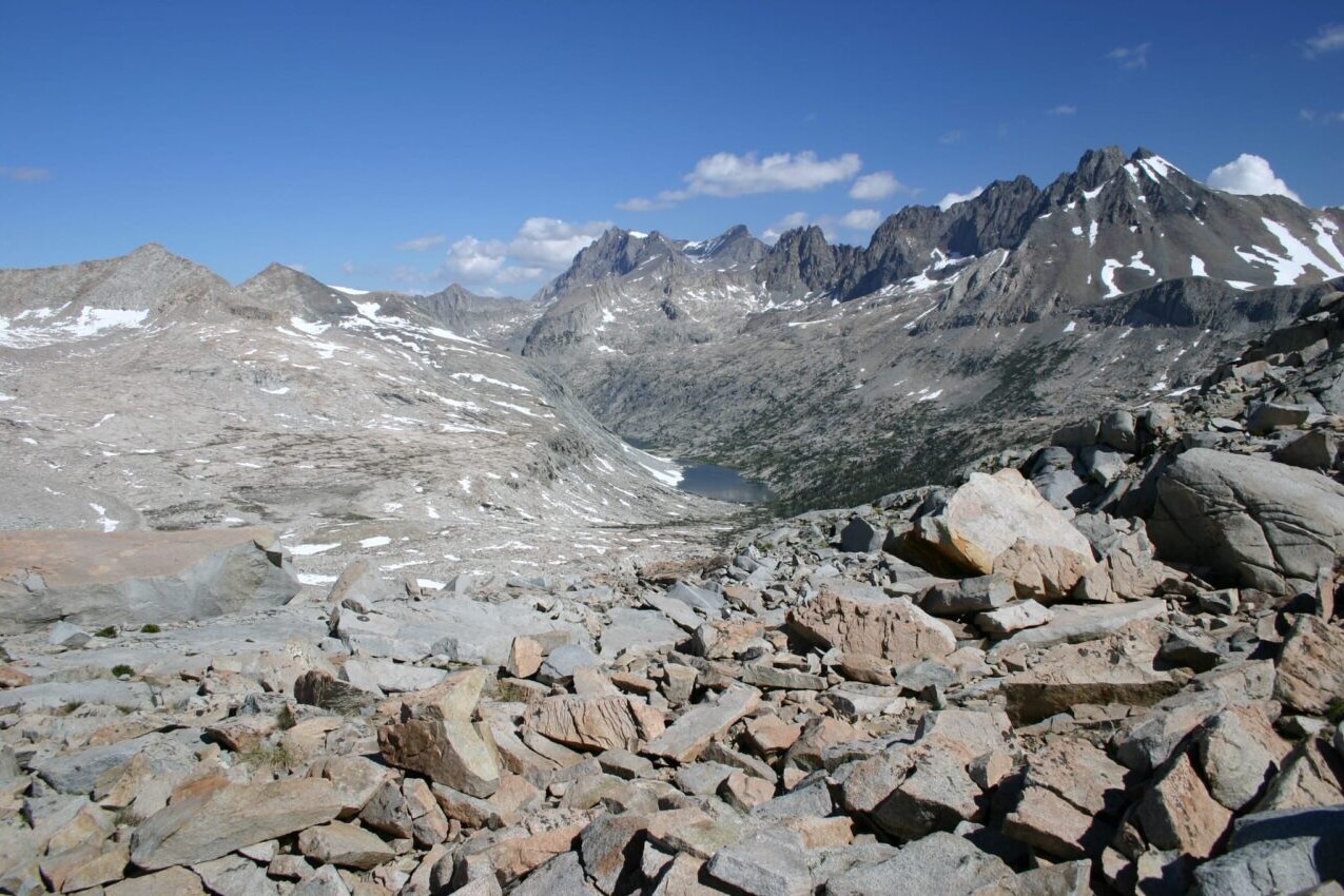
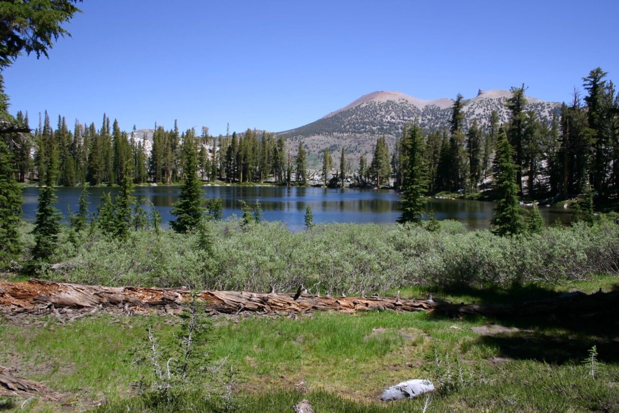
The John Muir Trail runs for over 210 miles through the Sierra Nevada Mountain Range of California. It starts in Yosemite Valley and travels to the summit of Mt. Whitney. The JMT is one of the most popular hiking trails in the country and is an incredible adventure for thru-hikers, section-hikers, and day-hikers. It passes through beautiful and scenic protected areas including Yosemite National Park, Sequoia National Park, Kings Canyon National Park, and two national forests.
20% off for our Hiking Season Kick-off SALE! The John Muir Trail is now $11.99 and the Western Hiker Special is now $39.99.
East Vidette, Southern Sierra, John Muir Trail
Photo by Alice Bodnar
4.8 ★★★★★ | 17K+ Reviews
John Muir Trail
210 miles • California High Sierra Range
Download our guide to access the JMT map, tracks, waypoints, and comments! The John Muir Trail runs for over 210 miles through the Sierra Nevada Mountain Range of California. It starts in Yosemite Valley and travels to the summit of Mt. Whitney. The JMT is one of the most popular hiking trails in the country and is an incredible adventure for thru-hikers, section-hikers, and day-hikers. It passes through beautiful and scenic protected areas including Yosemite National Park, Sequoia National Park, Kings Canyon National Park, and two national forests.
210 mi (338 km) $14.99 full guide
210 mi (338 km)
$14.99 full guide
John Muir Trail Map


How can I get it?
The John Muir Trail map is available as an in-app purchase in our Guthook Guides app, a free download from the Apple App Store or the Google Play Store.
Our iOS and Android apps do differ slightly in their appearance. However, the majority of their features remain the same, and they access the same trail guide data.
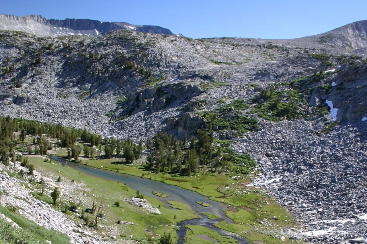
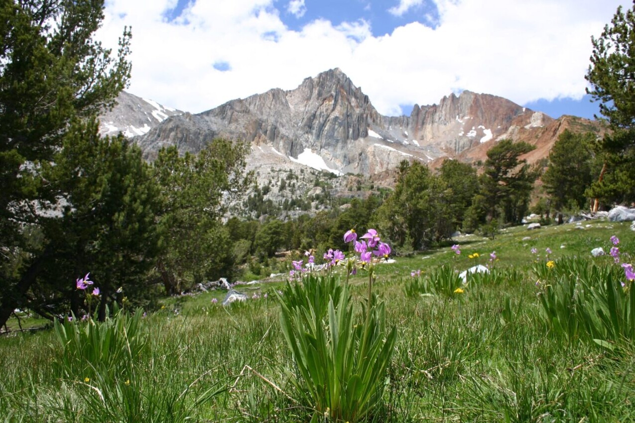
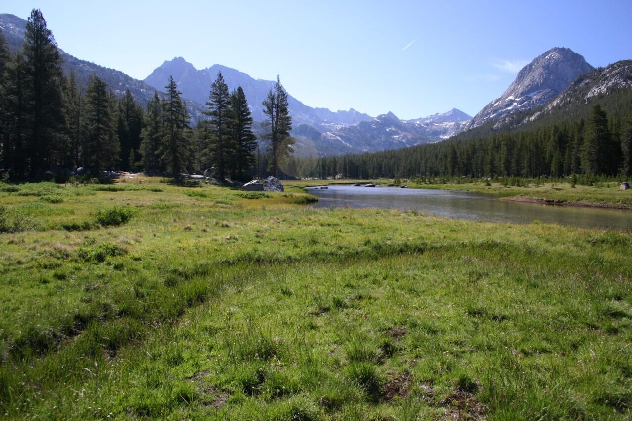
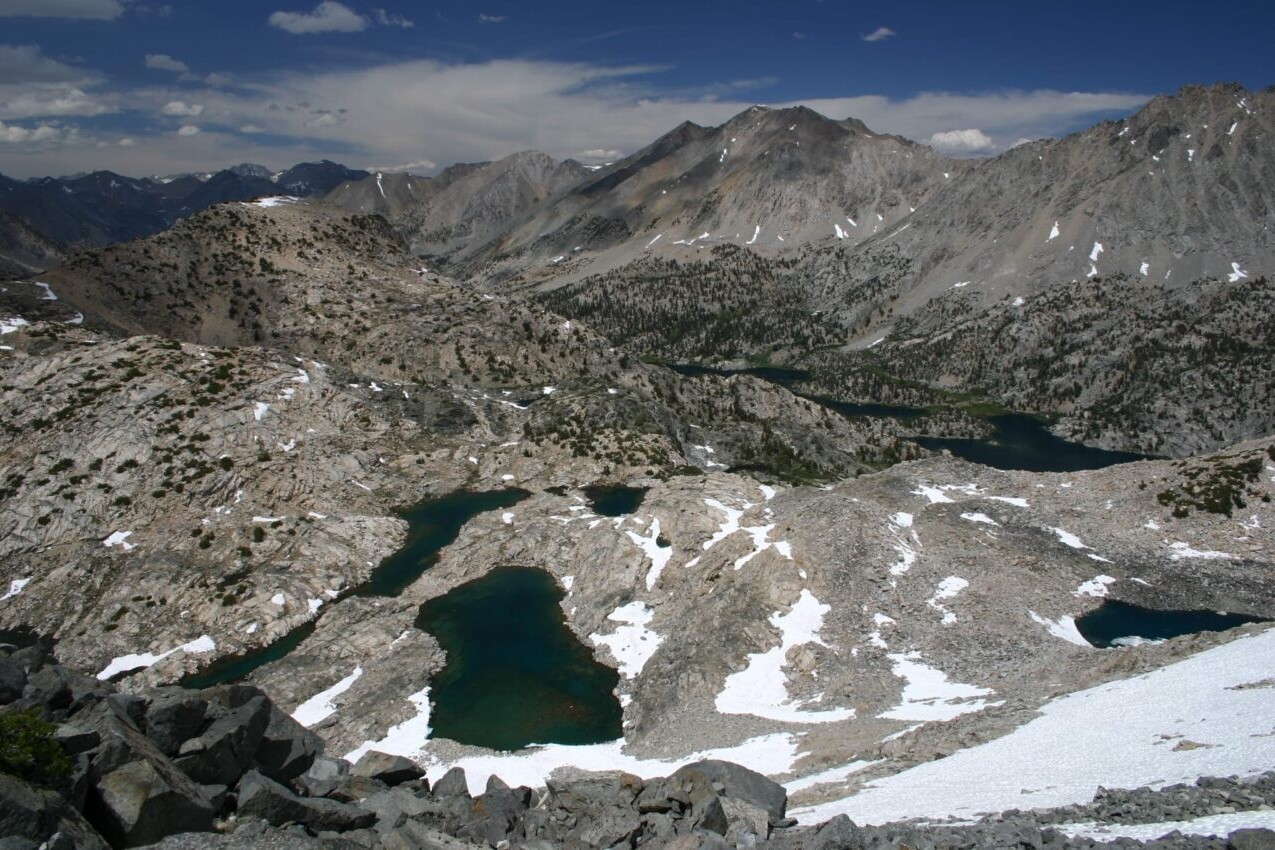
The John Muir Trail is a 211-mile trail from Yosemite Valley to Mount Whitney in the heart of the Sierra Nevada mountain range of California. The John Muir Trail is considered one of the most beautiful trails in the world.
$14.99
Stories from the John Muir Trail!
Check out our most recent blog posts about the John Muir Trail.
Nothing found.
Nothing found.
Photos of the John Muir Trail


Hike more.
Check out some of the other trail guides we offer!

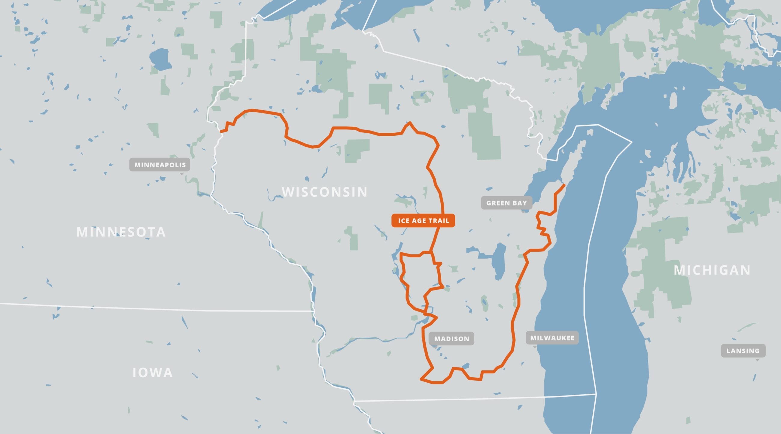
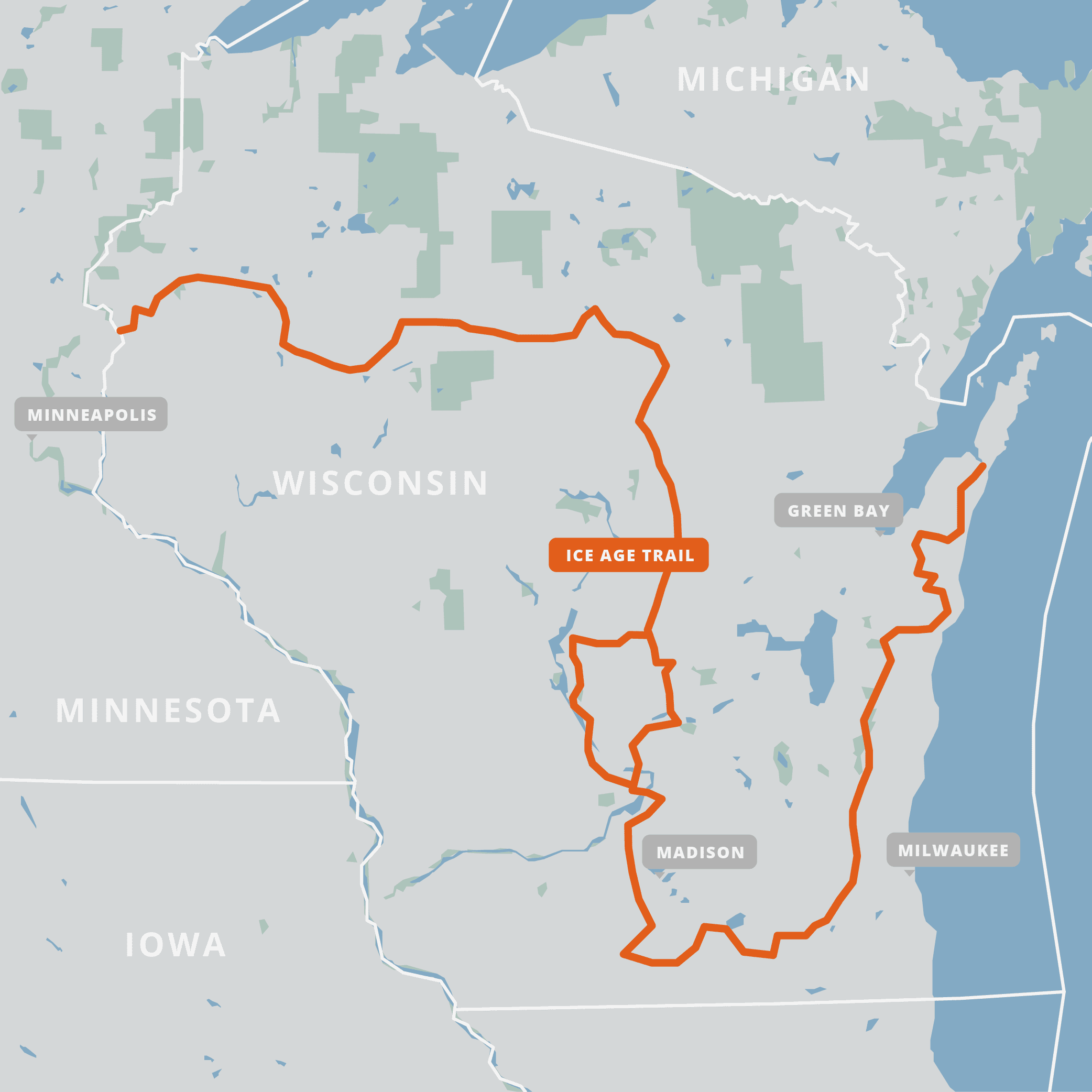
Ice Age Trail
Official app of the Ice Age Trail Alliance. The Ice Age Trail is a historic adventure of almost 1200 miles (1930 km) that traces the edge of the huge glacier that once covered North America. The landscape that its retreating mass carved in the state of Wisconsin is a spectacular example of the mark that natural forces, such as continental glaciation, can leave on our planet. The Ice Age Trail is one of the country’s National Scenic Trails, and is a trek across the state of Wisconsin that travels through rolling green hills, river valleys, and wide lakes; all reminders of a planetary era long past. Its path stretches from the Interstate State Park along the St. Croix River to Potawatomi State Park near Sturgeon Bay. Traveling through some of the state’s most beautiful natural areas, the trail is perfect for day-hiking, thru-hiking, snowshoeing, and backpacking adventures.
20% off for our Hiking Season Kick-off SALE! The Ice Age Trail is now $19.99.
30% off for our Small Business Saturday SALE! The Ice Age Trail is now $16.99.
Wisconsin, Ice Age Trail
Photo by Justin Helmkamp
4.8 ★★★★★ | 17K+ Reviews
Ice Age Trail
1200 miles • Wisconsin
Official App of the Ice Age Trail Alliance
Download our guide to access the Ice Age Trail map, tracks, waypoints, and comments! The Ice Age Trail is a historic adventure of almost 1200 miles (1930 km) that traces the edge of the huge glacier that once covered North America. The landscape that its retreating mass carved in the state of Wisconsin is a spectacular example of the mark that natural forces, such as continental glaciation, can leave on our planet. The Ice Age Trail is one of the country's National Scenic Trails, and is a trek across the state of Wisconsin that travels through rolling green hills, river valleys, and wide lakes; all reminders of a planetary era long past. Its path stretches from the Interstate State Park along the St. Croix River to Potawatomi State Park near Sturgeon Bay. Traveling through some of the state’s most beautiful natural areas, the trail is perfect for day-hiking, thru-hiking, snowshoeing, and backpacking adventures.
$24.99 full guide 3 sections ($9.99 each)
$24.99 full guide
3 sections ($9.99 each)
Ice Age Trail Map

How can I get it?
The Ice Age Trail map is available as an in-app purchase in our Guthook Guides app, a free download from the Apple App Store or the Google Play Store.
Our iOS and Android apps do differ slightly in their appearance. However, the majority of their features remain the same, and they access the same trail guide data.
About 29 miles of the Ice Age Trail through the Kettle Moraine State Forest in Walworth County.
Buy all three sections (West, Central, East) of the Ice Age Trail at once and save 17%.
$24.99
The West Section of the Ice Age Trail begins at St. Croix Falls and ends at Langlade/Marathon County line, covering about 440 miles of trail.
$9.99
The Central Section of the Ice Age Trail begins at Langlade/Marathon County line and ends at Walworth/Rock County line, covering about 380 miles of trail. This section also covers the western branch of the bifurcation.
$9.99
The East Section of the Ice Age Trail begins at Walworth/Rock County line and ends at the eastern terminus at Potawatomi State Park, covering about 300 miles of trail.
$9.99

Cheers to giving back! Part of your purchase of the Ice Age Trail goes to support the Ice Age Trail Alliance’s work to preserve and maintain the trail. Learn about the Ice Age Trail Alliance.
Hike more.
Check out some of the other trail guides we offer!
About our partner
Ice Age Trail Alliance
The mission of the Ice Age Trail Alliance is to create, support and protect the thousand-mile Ice Age National Scenic Trail, which traces Ice Age formations across Wisconsin. In collaboration with their partners, they envision a premier, continuous, permanently protected Ice Age National Scenic Trail. Coursing through Wisconsin, the Trail is a place where all people can enjoy and embrace the unique natural landscapes and cultural histories of Wisconsin, while finding physical and mental renewal in a peaceful setting and an enduring spiritual connection to the land.
Atlas Guides has partnered with the Ice Age Trail Alliance to create and maintain their official app, Mammoth Tracks. The Ice Age Trail Alliance works with Atlas Guides to continually update all data in Mammoth Tracks.

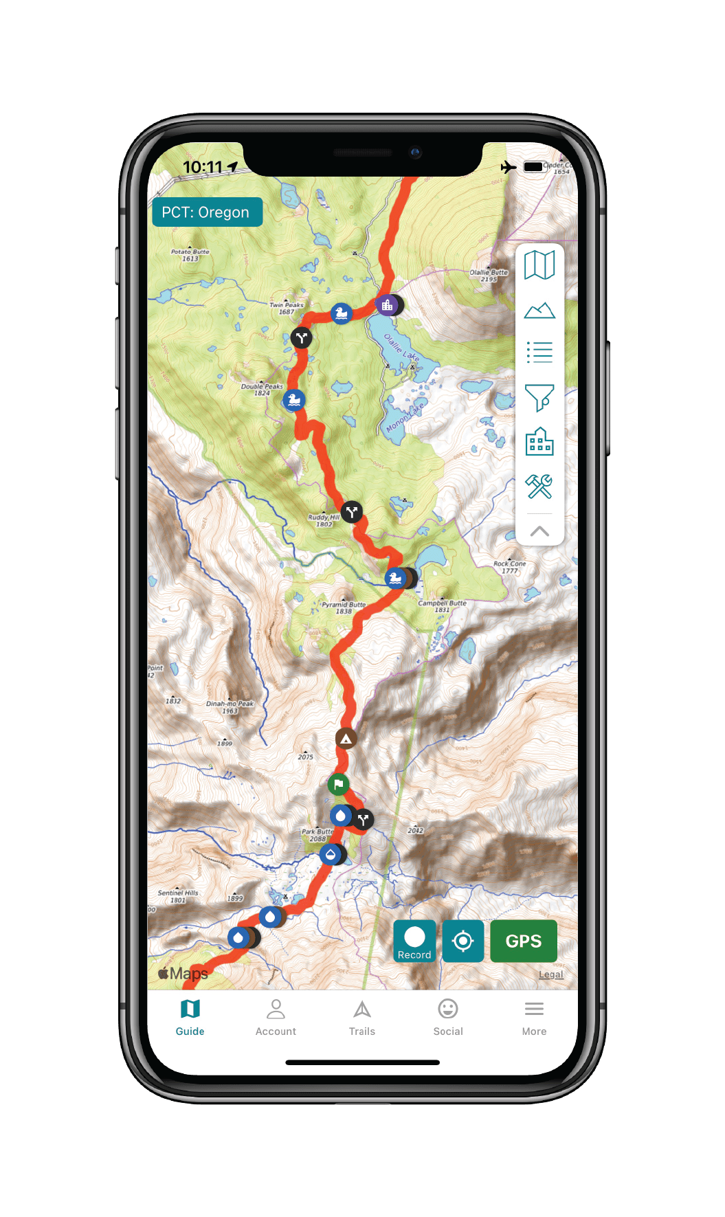
Pacific Crest Trail
The Pacific Crest National Scenic Trail is an epic journey of over 2650 miles (4260 km) in length and is one of the most popular thru-hiking trails in the United States. Its path travels from the US-Mexico border to the northern US-Canada border, passing through California, Oregon, and Washington. The trail offers desert sun and heat, challenging and snowy high-elevation passes, and all of the amazing views and experiences in between. As one of the Triple Crown trails, the PCT is an amazing hiking adventure for long-distance hikers and thru-hikers, yet it is also perfect for day-hikers and section-hikers looking to enjoy a world class wilderness experience. Download our guide to access the PCT map, tracks, waypoints, and comments!
20% off for our Hiking Season Kick-off SALE! The Pacific Crest Trail Thru-hiker Special is now $23.99 and the Western Hiker Special is now $39.99.
30% off for our Small Business Saturday SALE! The Pacific Crest Trail Thru-hiker Special is now $20.99 and the Western Hiker Special is now $34.99.
Washington, Pacific Crest Trail
Photo by Justin Helmkamp
4.8 ★★★★★ | 17K+ Reviews
Washington, Pacific Crest Trail
Photo by Justin Helmkamp
4.8 ★★★★★ | 17K+ Reviews
4.8 ★★★★★ | 17K+ Reviews
Pacific Crest Trail
2650 miles • California, Oregon & Washington
Download our guide to access the PCT map, tracks, waypoints, and comments! The Pacific Crest National Scenic Trail is an epic journey of over 2650 miles (4260 km) in length and is one of the most popular thru-hiking trails in the United States. Its path travels from the US-Mexico border to the northern US-Canada border, passing through California, Oregon, and Washington. The trail offers desert sun and heat, challenging and snowy high-elevation passes, and all of the amazing views and experiences in between. As one of the Triple Crown trails, the PCT is an amazing hiking adventure for long-distance hikers and thru-hikers, yet it is also perfect for day-hikers and section-hikers looking to enjoy a world class wilderness experience.
2650 mi (4260 km) $29.99 full guide 5 sections ($7.99 each)
2650 mi (4260 km)
$29.99 full guide
5 sections ($7.99 each)
Pacific Crest Trail Map


How can I get it?
The Pacific Crest Trail map is available as an in-app purchase in our Guthook Guides app, a free download from the Apple App Store or the Google Play Store.
Our iOS and Android apps do differ slightly in their appearance. However, the majority of their features remain the same, and they access the same trail guide data.
This full-featured preview of Guthook’s PCT Guide includes Mile 0 to 77.3 of the PCT: from the Mexico border to Scissors Crossing, which leads to the resupply town of Julian, CA. 157 waypoints. Comprehensive water information, including reliability and historic flow information. Comprehensive resupply guide.
The PCT Thru-Hiker Special includes the entire PCT from Mexico to Canada: a 25% savings over buying the 5 sections separately.
$29.99
Mile 0 to 566: Mexico Border to Highway 58 between Tehachapi and Mojave.
$7.99
Mile 566 to 1092: Tehachapi to Echo Lake (outside South Lake Tahoe)
$7.99
Mile 1092 to 1692: Echo Lake (outside South Lake Tahoe) to the California-Oregon border.
$7.99
Mile 1692 to 2147: State of Oregon.
$7.99
Mile 2147 to 2652: State of Washington and 8 miles to Manning Park, British Columbia.
$7.99
Stories from the Pacific Crest Trail!
Check out our most recent blog posts about the Pacific Crest Trail.

Photos of the Pacific Crest Trail
Hike more.
Check out some of the other trail guides we offer!
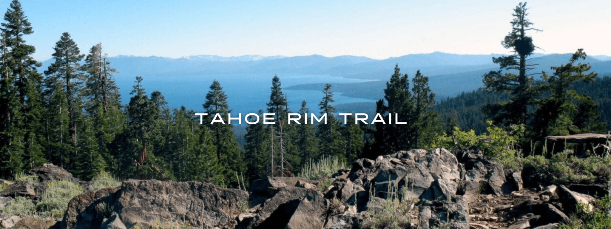
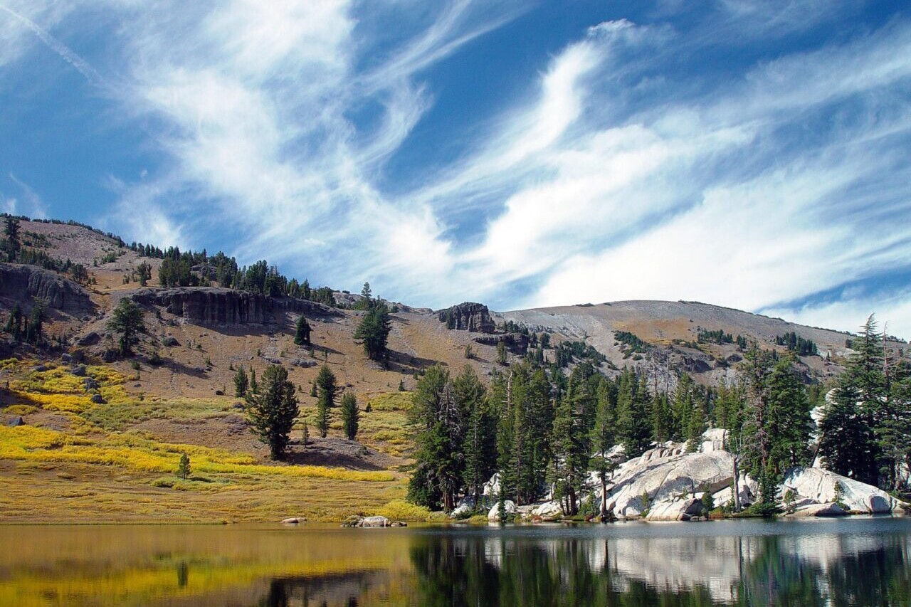
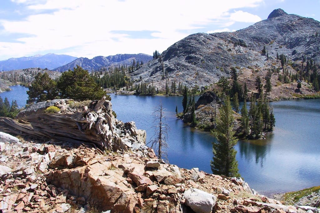
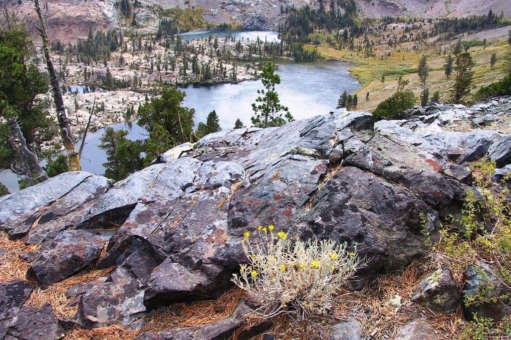
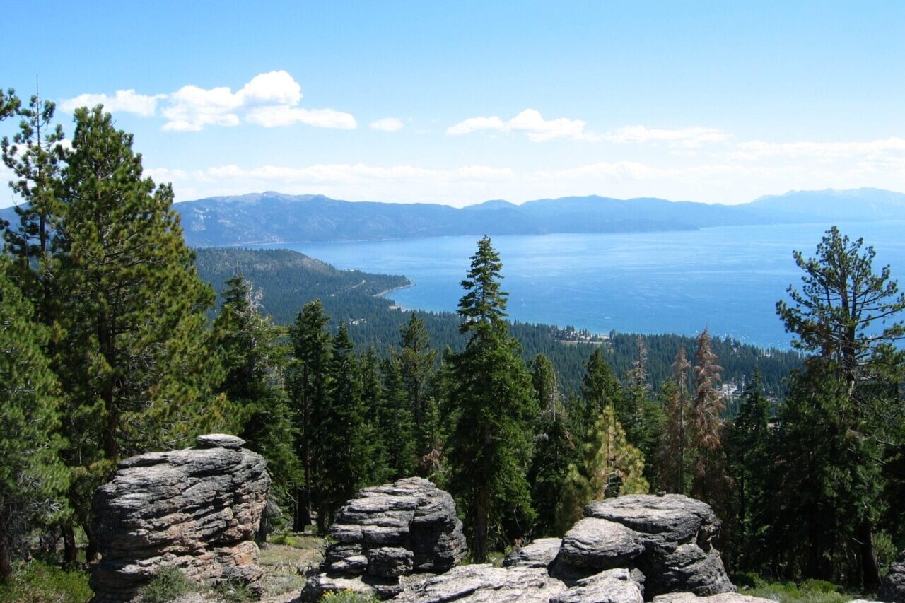
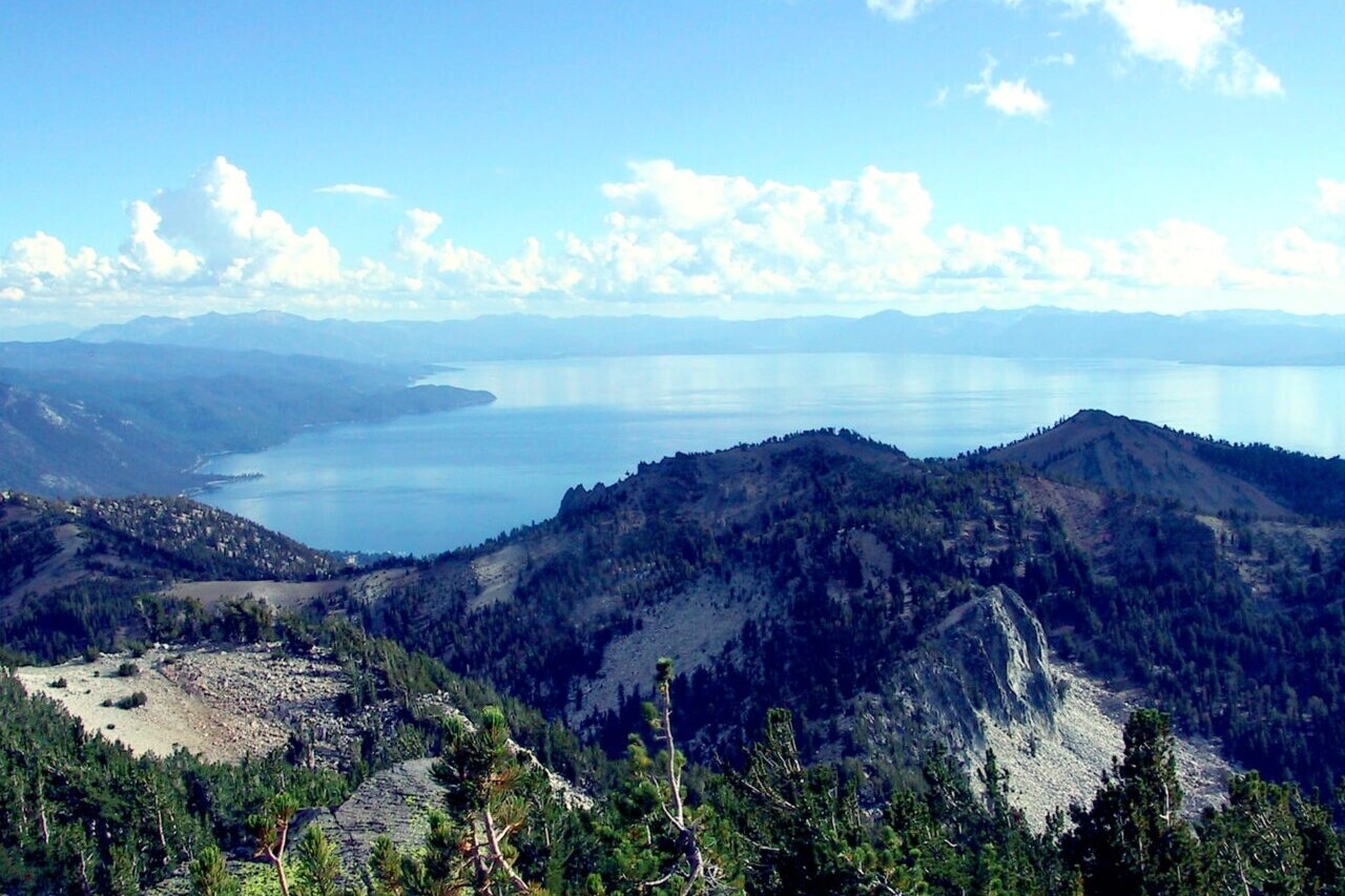
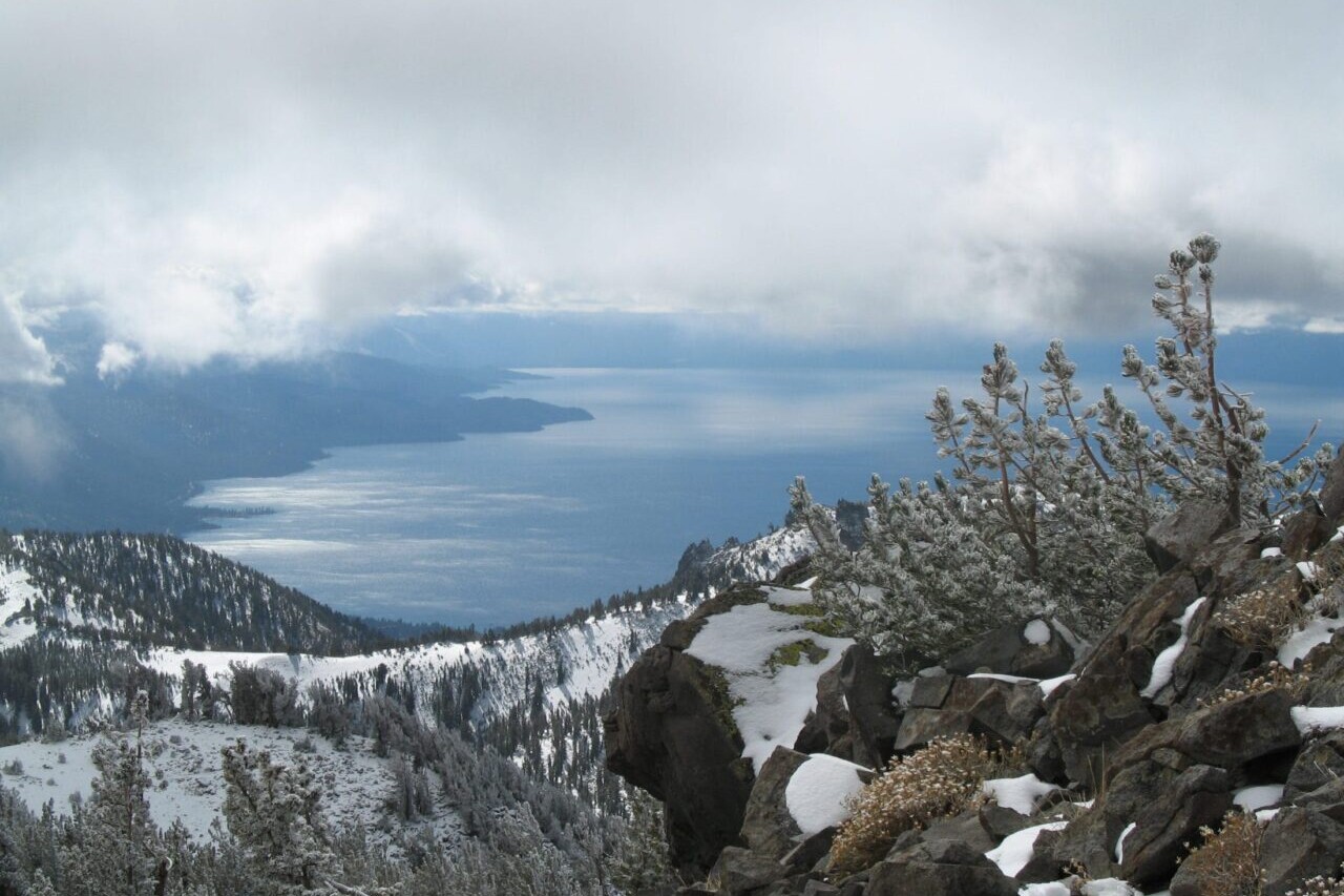
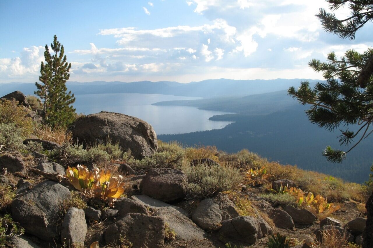
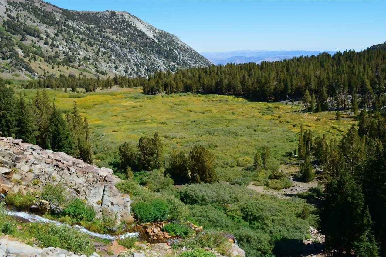
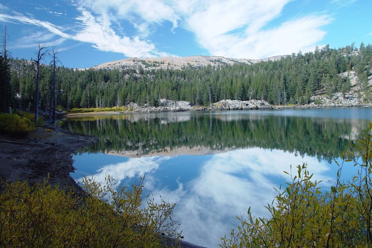
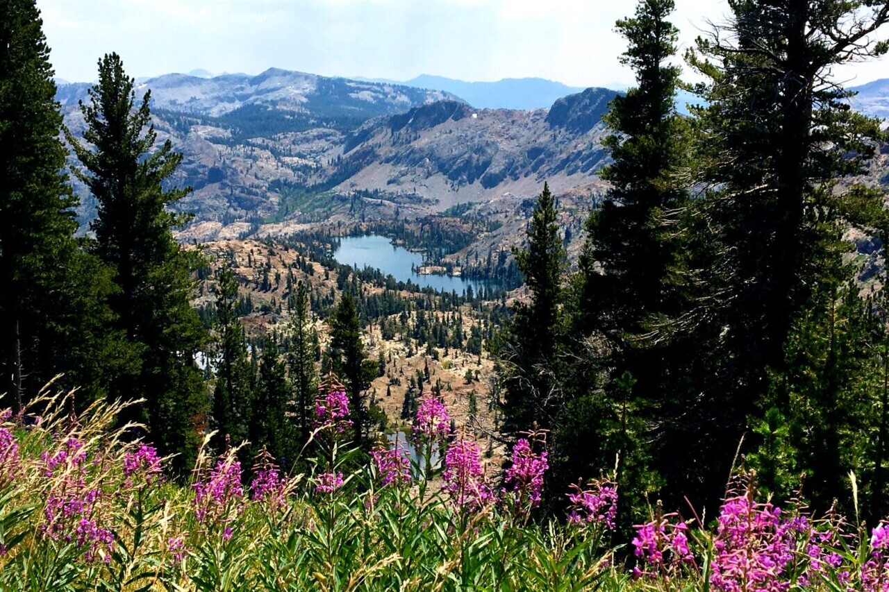
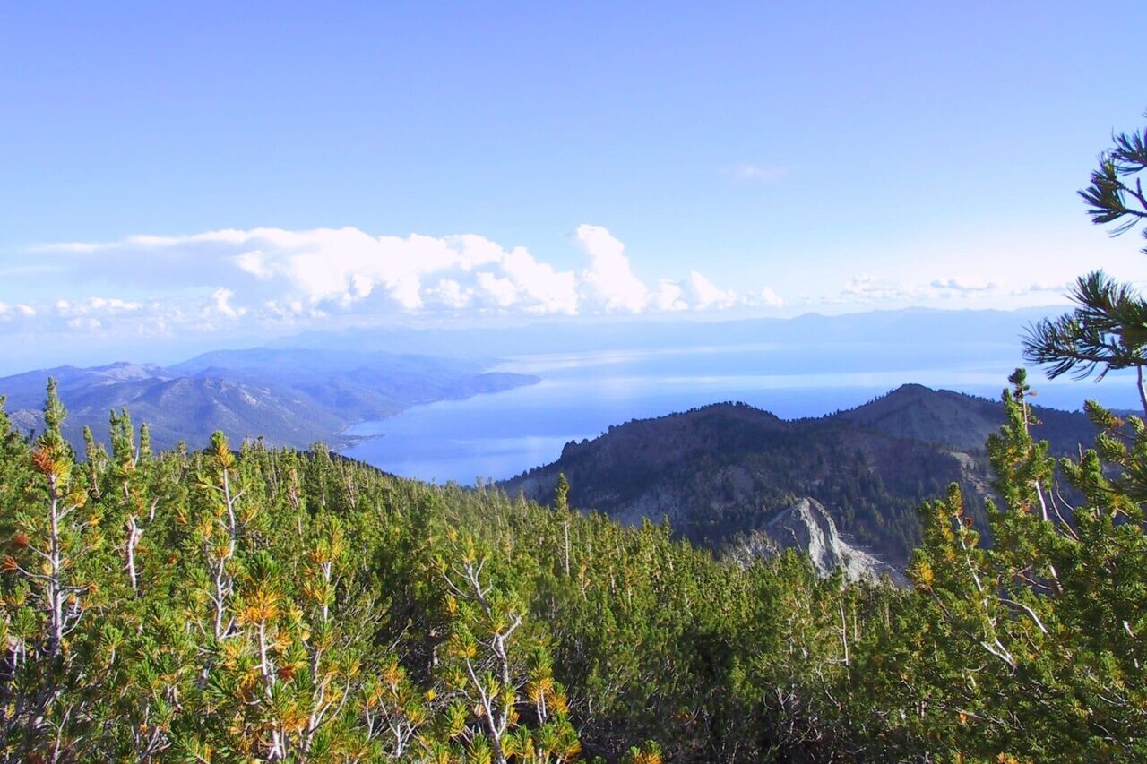
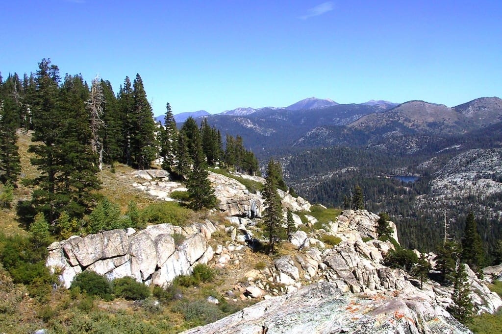
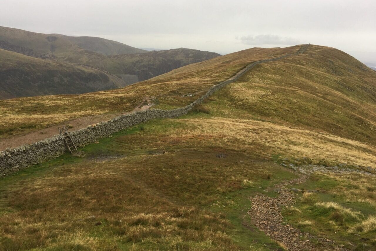
Tahoe Rim Trail
Official app of the Tahoe Rim Trail Association. The Tahoe Rim Trail is a circular journey of over 170 miles (270 km) that circumnavigates Lake Tahoe, crossing into both California and Nevada. The TRT traverses the Sierra Nevada and Carson ranges of California and Nevada, and shares about 50 miles of its western section with the Pacific Crest National Scenic Trail. On the Tahoe Rim Trail, there is no defined beginning or end. Thru-hikers and backpackers can begin anywhere on the loop. Along its path, the trail offers many stunning views of Lake Tahoe, which makes it perfect for day-hiking. Hikers and visitors wishing to give back to the Tahoe Rim Trail can adopt a mile or vista through the Tahoe Rim Trail Association.
20% off for our Hiking Season Kick-off SALE! The Tahoe Rim Trail is now $11.99 and the Western Hiker Special is now $39.99.
30% off for our Small Business Saturday SALE! The Tahoe Rim Trail is now $9.99.
Mike and Sharon Dixon Vista, Lake Tahoe, Tahoe Rim Trail
Photo courtesy of the Tahoe Rim Trail Association
4.8 ★★★★★ | 17K+ Reviews
Tahoe Rim Trail
170 miles • Lake Tahoe, California & Nevada
Official App of the Tahoe Rim Trail Association
Download our guide to access the Tahoe Rim Trail map, tracks, waypoints, and comments! The Tahoe Rim Trail is a circular journey of over 170 miles (270 km) that circumnavigates Lake Tahoe, crossing into both California and Nevada. The TRT traverses the Sierra Nevada and Carson ranges of California and Nevada, and shares about 50 miles of its western section with the Pacific Crest National Scenic Trail. On the Tahoe Rim Trail, there is no defined beginning or end. Thru-hikers and backpackers can begin anywhere on the loop. Along its path, the trail offers many stunning views of Lake Tahoe, which makes it perfect for day-hiking. Hikers and visitors wishing to give back to the Tahoe Rim Trail can adopt a mile or vista through the Tahoe Rim Trail Association.
$14.99 full guide
170 mi (270 km)
$14.99 full guide
Official App
Tahoe Rim Trail Map


How can I get it?
The Tahoe Rim Trail map is available as an in-app purchase in our Guthook Guides app, a free download from the Apple App Store or the Google Play Store.
Our iOS and Android apps do differ slightly in their appearance. However, the majority of their features remain the same, and they access the same trail guide data.
Free demo
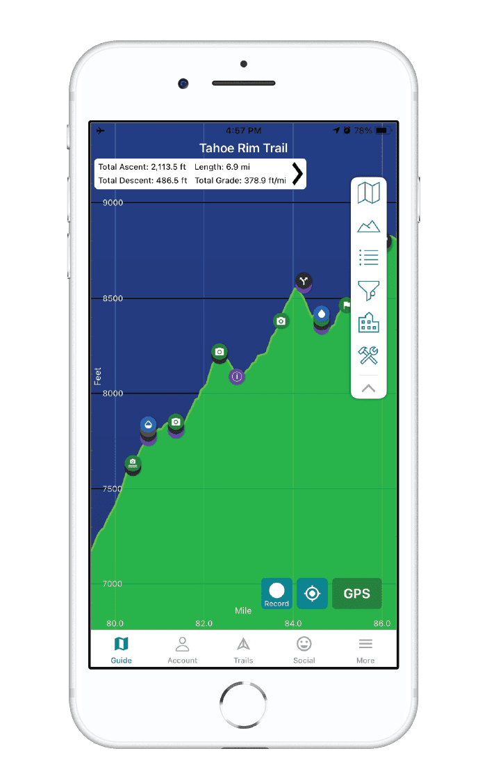
Full-featured preview Tahoe Rim Trail. This demo section includes the 21-mile section of the Tahoe Rim Trail from Tahoe City to Brockaway Summit, near Watson Lake.
The Tahoe Rim Trail is a circular journey of over 170 miles (270 km) that circumnavigates Lake Tahoe, crossing into both California and Nevada.
$14.99
Cheers to giving back! Part of your purchase of the Tahoe Rim Trail goes to support the Tahoe Rim Trail Association’s work to preserve and maintain the trail. Learn about the Tahoe Rim Trail Association.
Stories from the Tahoe Rim Trail!
Check out our most recent blog posts about the Tahoe Rim Trail.
Nothing found.
Nothing found.
Photos of the Tahoe Rim Trail

Hike more.
Check out some of the other trail guides we offer!
About our partner
Tahoe Rim Trail Association
The mission of the Tahoe Rim Trail Association is to maintain and enhance the Tahoe Rim Trail system, practice and inspire stewardship, and preserve access to the natural beauty of the Lake Tahoe region. The Tahoe Rim Trail Association has the privilege of being the primary steward of one of the world’s most beautiful long-distance trails, and protects the Tahoe Rim Trail experience while engaging with the community through volunteer and educational outdoor programs.
In partnership with the TRTA, Atlas Guides has created the official Tahoe Rim Trail navigational app.
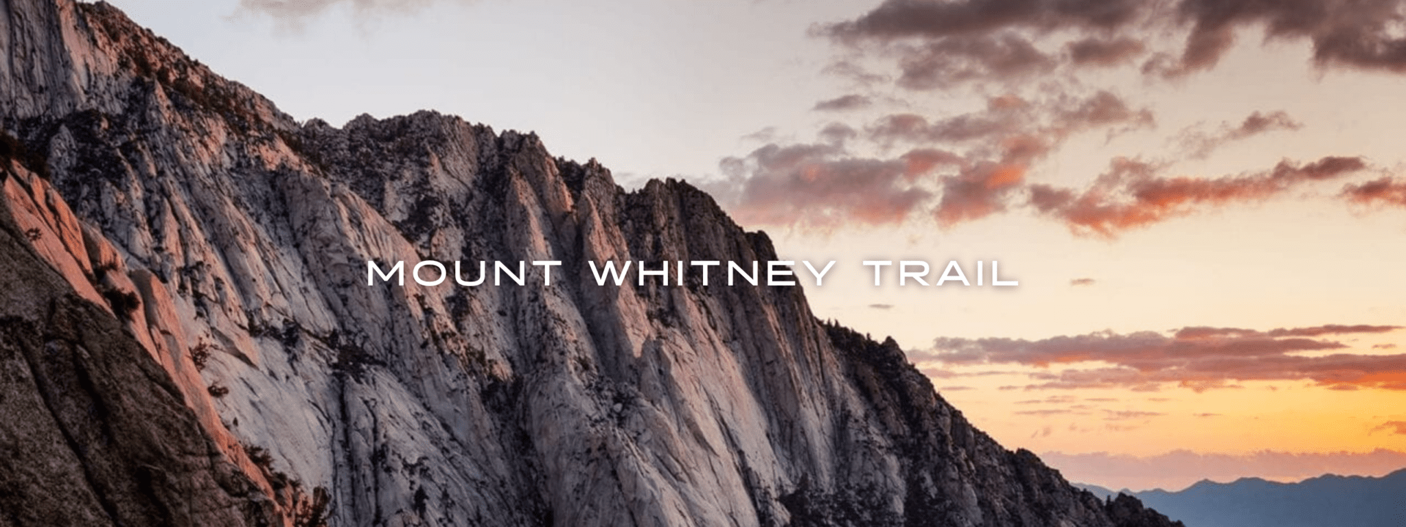
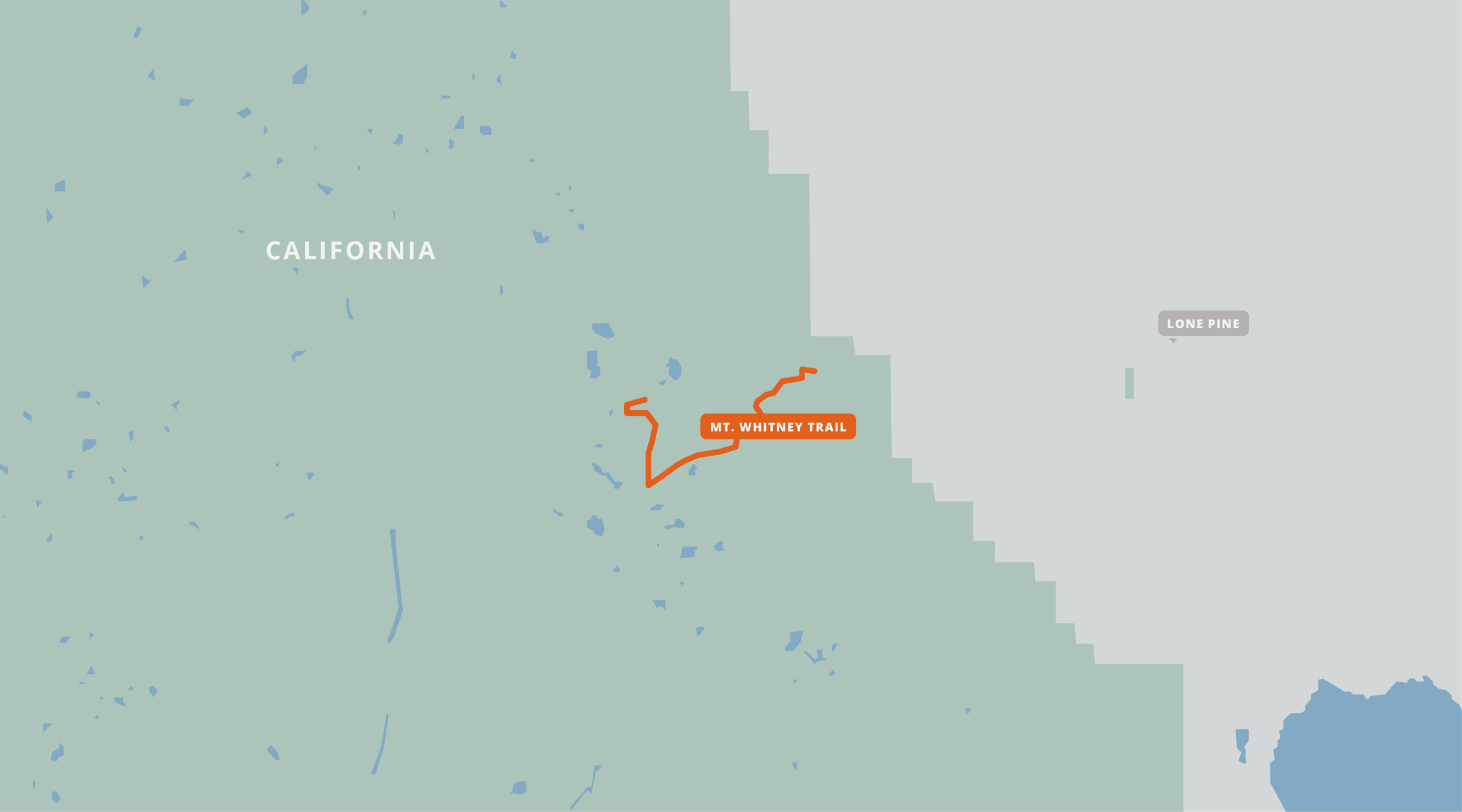
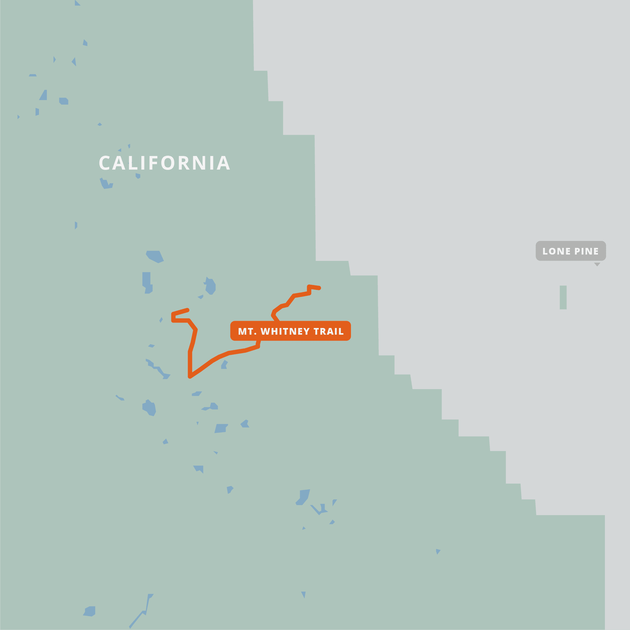
Mount Whitney Trail
At an elevation of 14505 feet (4421 m), Mt. Whitney is the highest peak in the continental United States. The Mount Whitney Trail, starting at the Whitney Portal, is the most popular route to the summit, and travels for 10.4 miles (16.7 km) with an elevation gain over 6000 feet (1820 m). It lies on the boundary of Sequoia National Park and Inyo National Forest. Hikers come from all over the world to experience this permitted summit hike and its commanding panoramic views of the surrounding area. Thru-hikers and day-hikers should be aware of the effects that a hike can have on those not accustomed to the high altitude. California.
20% off for our Hiking Season Kick-off SALE! The Mount Whitney guide may be free, but it is also included in the Western Hiker Special which is now $39.99.
30% off for our Small Business Saturday SALE! The Mount Whitney guide may be free, but it is also included in the Western Hiker Special which is now $34.99.
View from the Mount Whitney Trail
Photo by Alan Carrillo
4.8 ★★★★★ | 17K+ Reviews
Mount Whitney Trail
10.4 miles • California High Sierra Range
Download our guide to access the Mt. Whitney map, tracks, waypoints, and comments! At an elevation of 14505 feet (4421 m), Mt. Whitney is the highest peak in the continental United States. The Mount Whitney Trail, starting at the Whitney Portal, is the most popular route to the summit, and travels for 10.4 miles (16.7 km) with an elevation gain over 6000 feet (1820 m). It lies on the boundary of Sequoia National Park and Inyo National Forest. Hikers come from all over the world to experience this permitted summit hike and its commanding panoramic views of the surrounding area. Thru-hikers and day-hikers should be aware of the effects that a hike can have on those not accustomed to the high altitude.
Free guide
10.4 mi (16.7 km)
Free guide
Mount Whitney Trail Map
How can I get it?
The Mt. Whitney map is available as a free in-app purchase in our Guthook Guides app, a free download from the Apple App Store or the Google Play Store.
Our iOS and Android apps do differ slightly in their appearance. However, the majority of their features remain the same, and they access the same trail guide data.
The Western Hiker Special (also known as the Super Hiker Special) includes the entire Pacific Crest Trail + John Muir Trail + Tahoe Rim Trail + Wonderland Trail + Lost Coast Trail + Whitney Trail: a 33% savings over buying the sections separately.
$49.99
The Mount Whitney Trail is a 10.4-mile trail that leads to the highest point in the “lower 48” states of the contiguous United States. The trail starts at Whitney Portal and finishes at the summit of Mount Whitney.
FREE
Photos of Mount Whitney
Hike more.
Check out some of the other trail guides we offer!

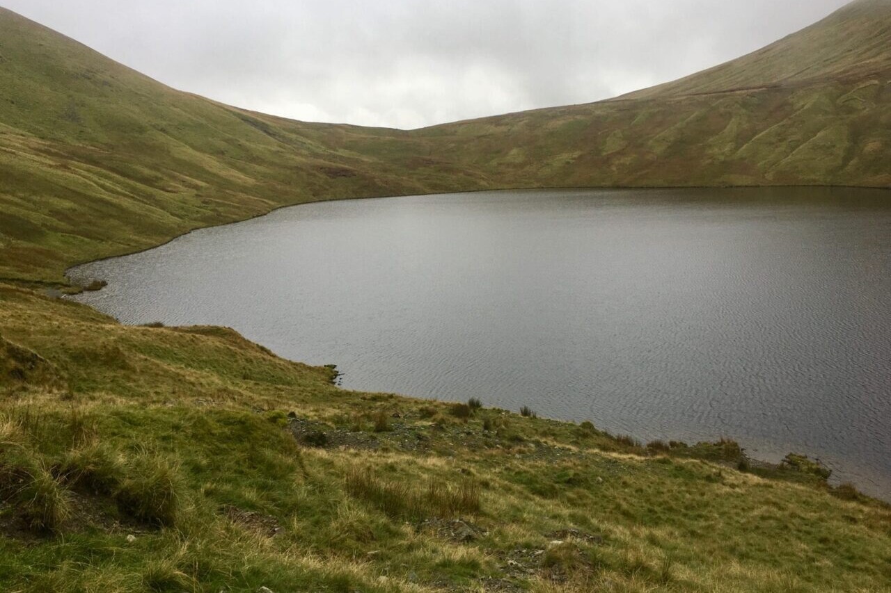
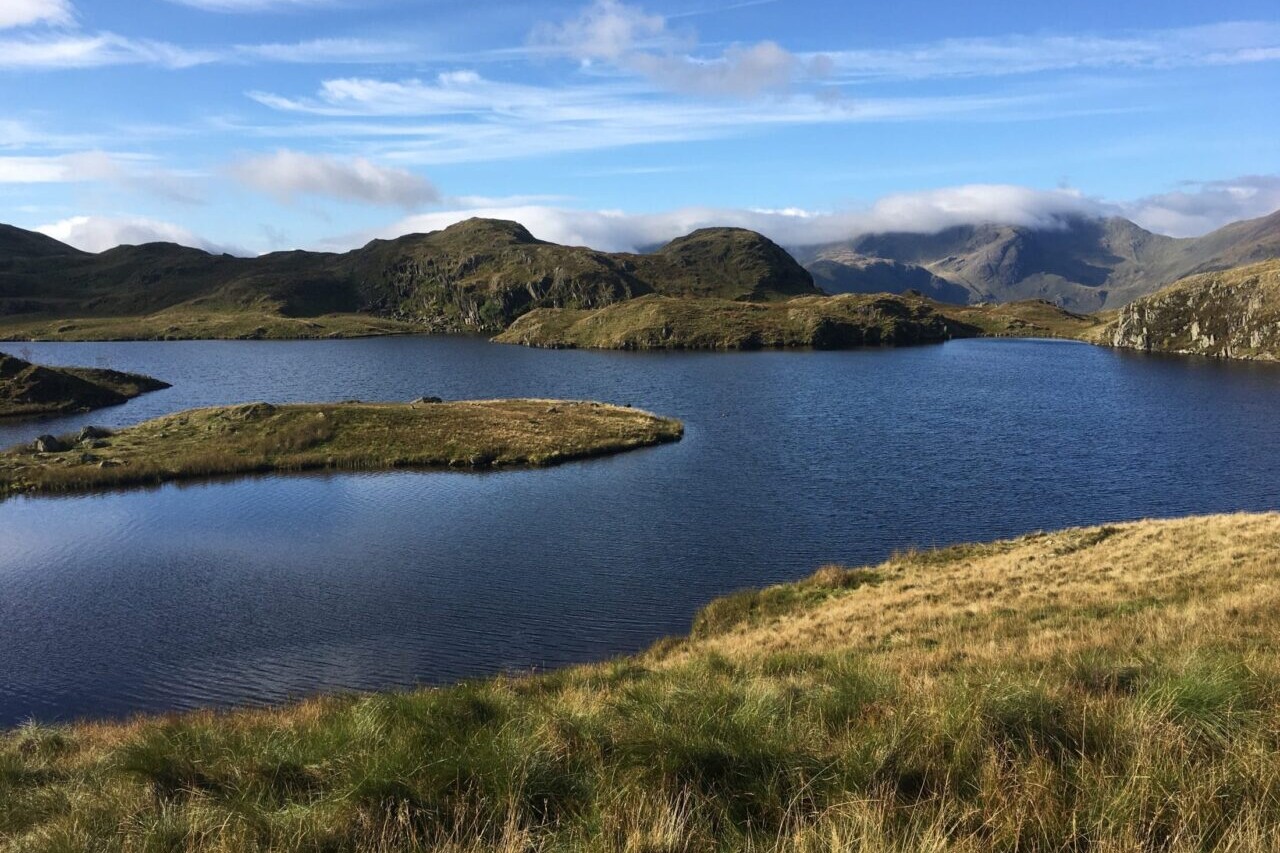
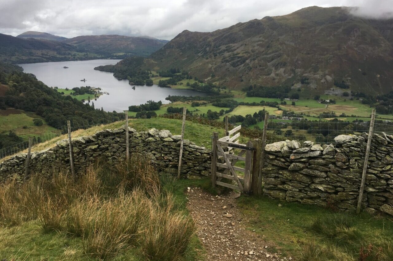
Trailblazer Guides
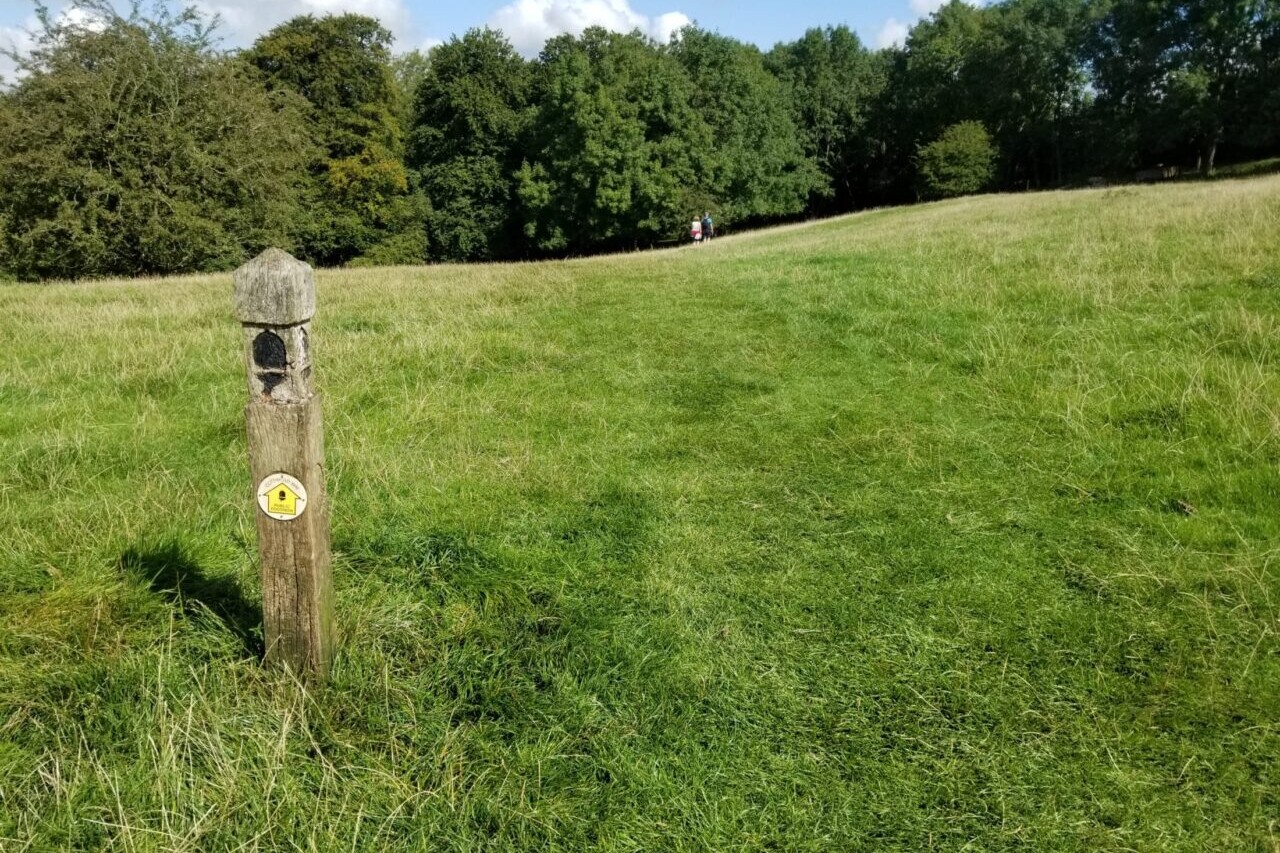
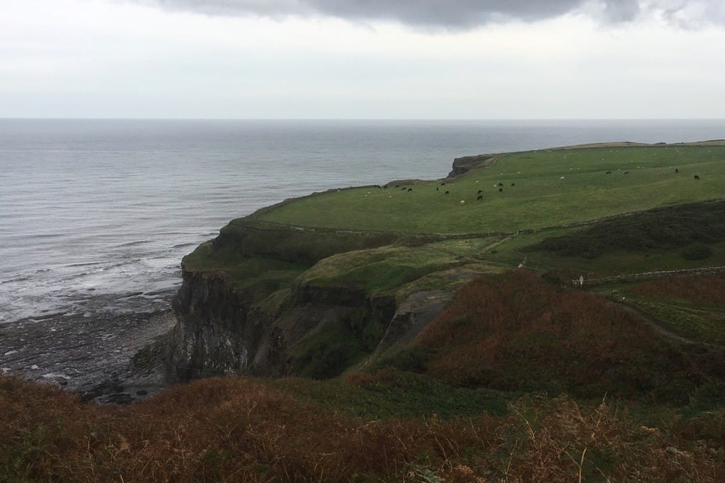
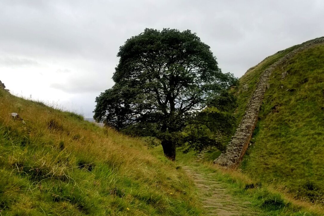
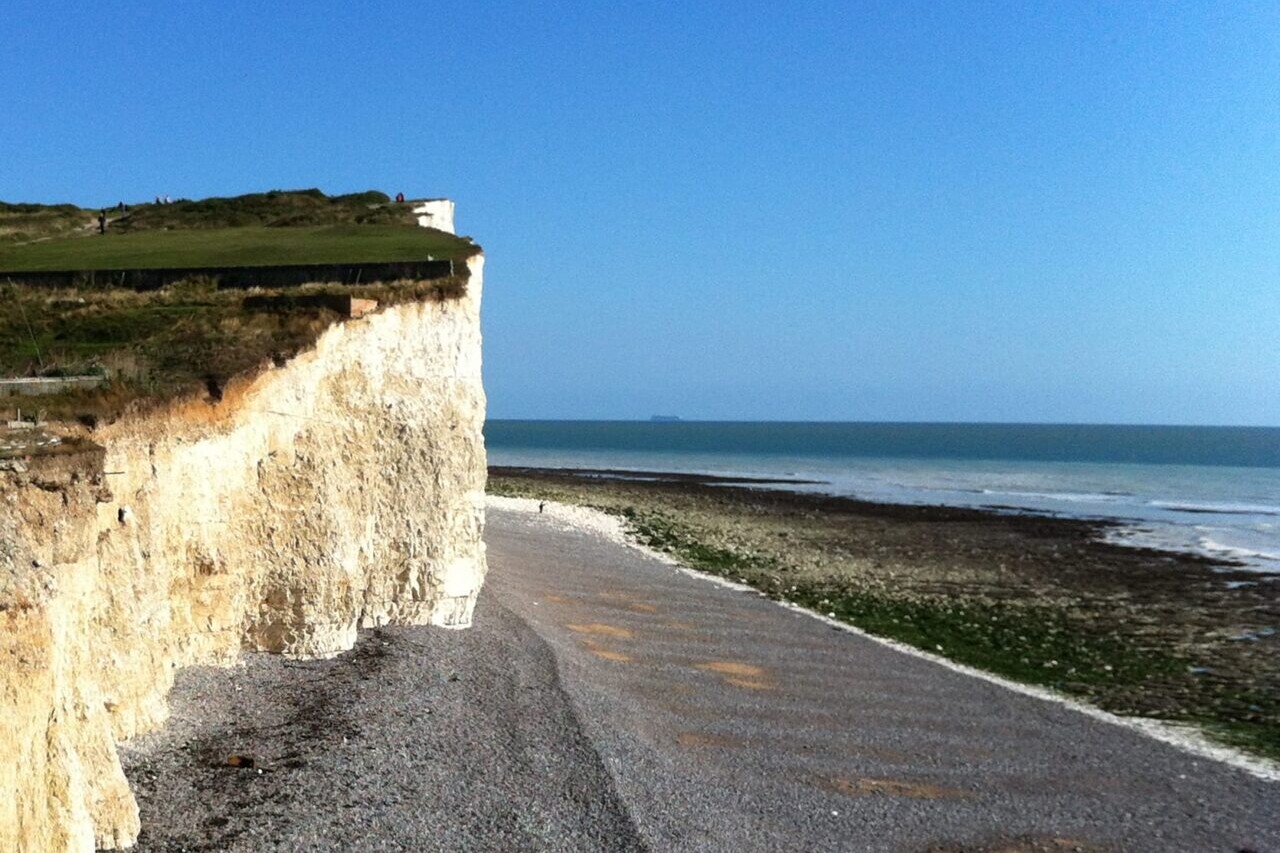
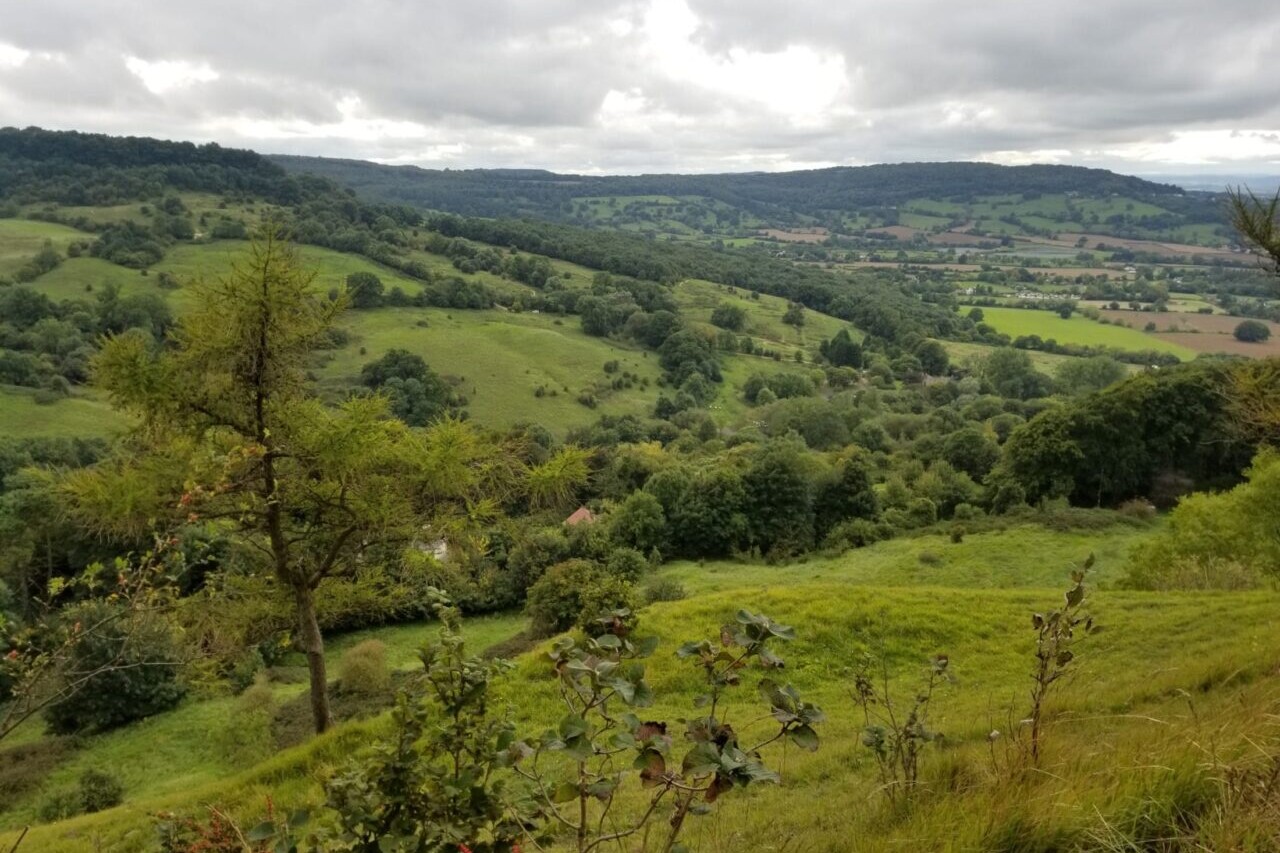
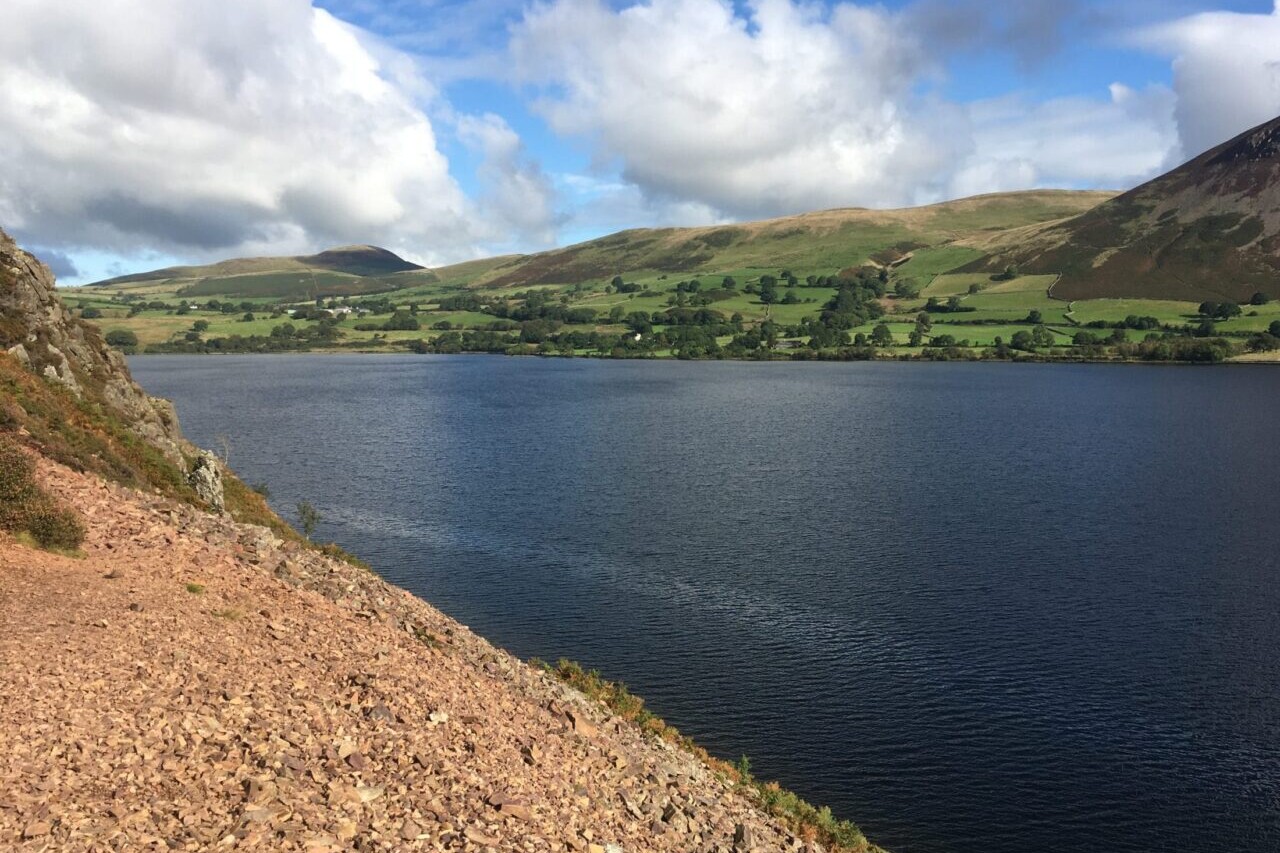
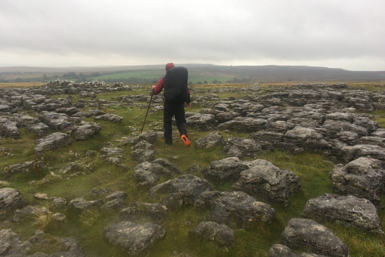
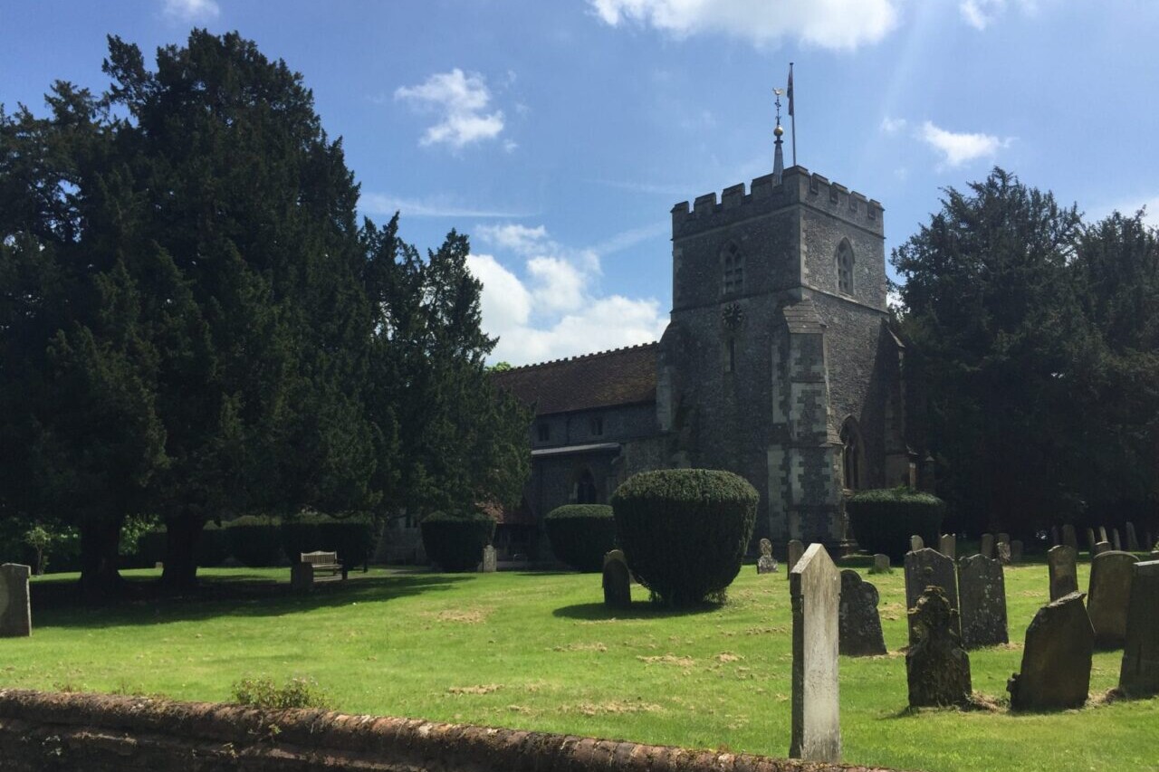
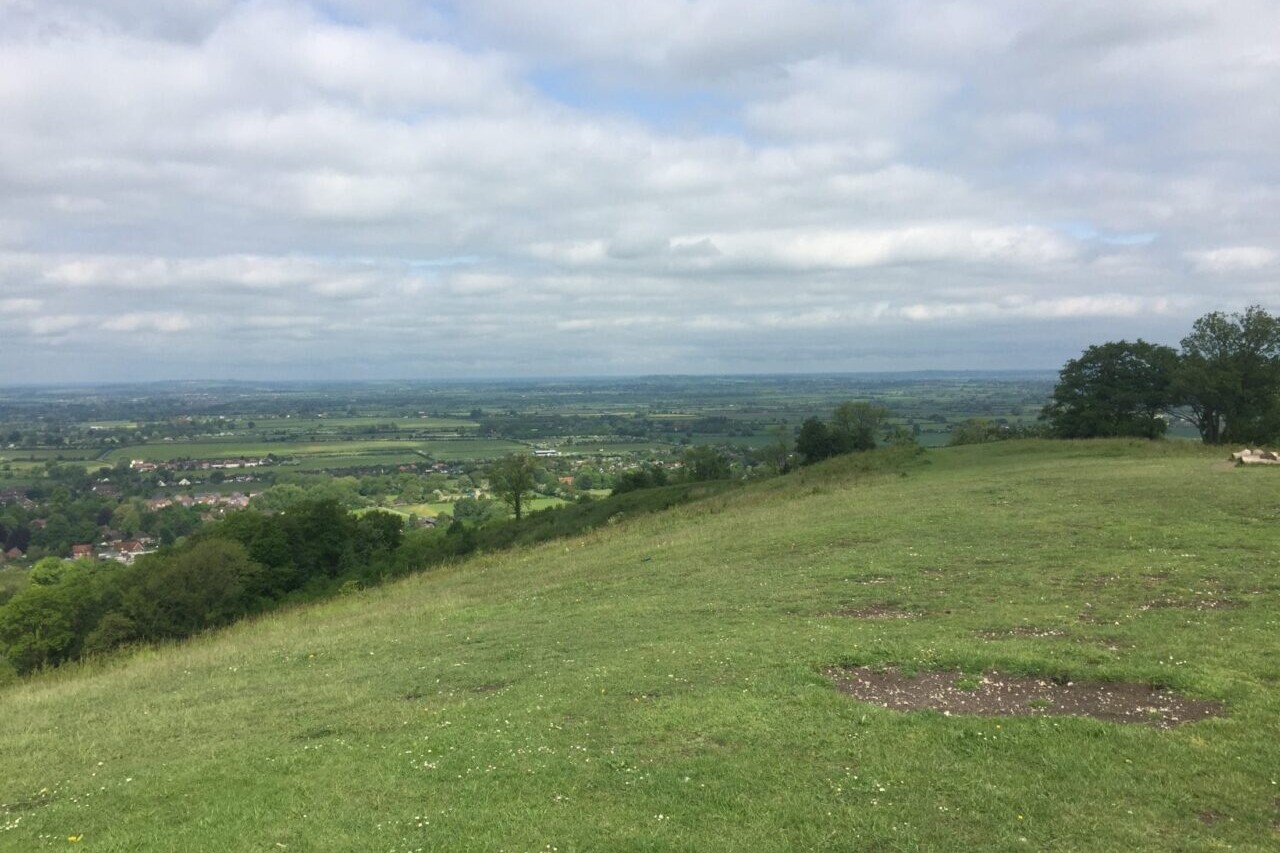
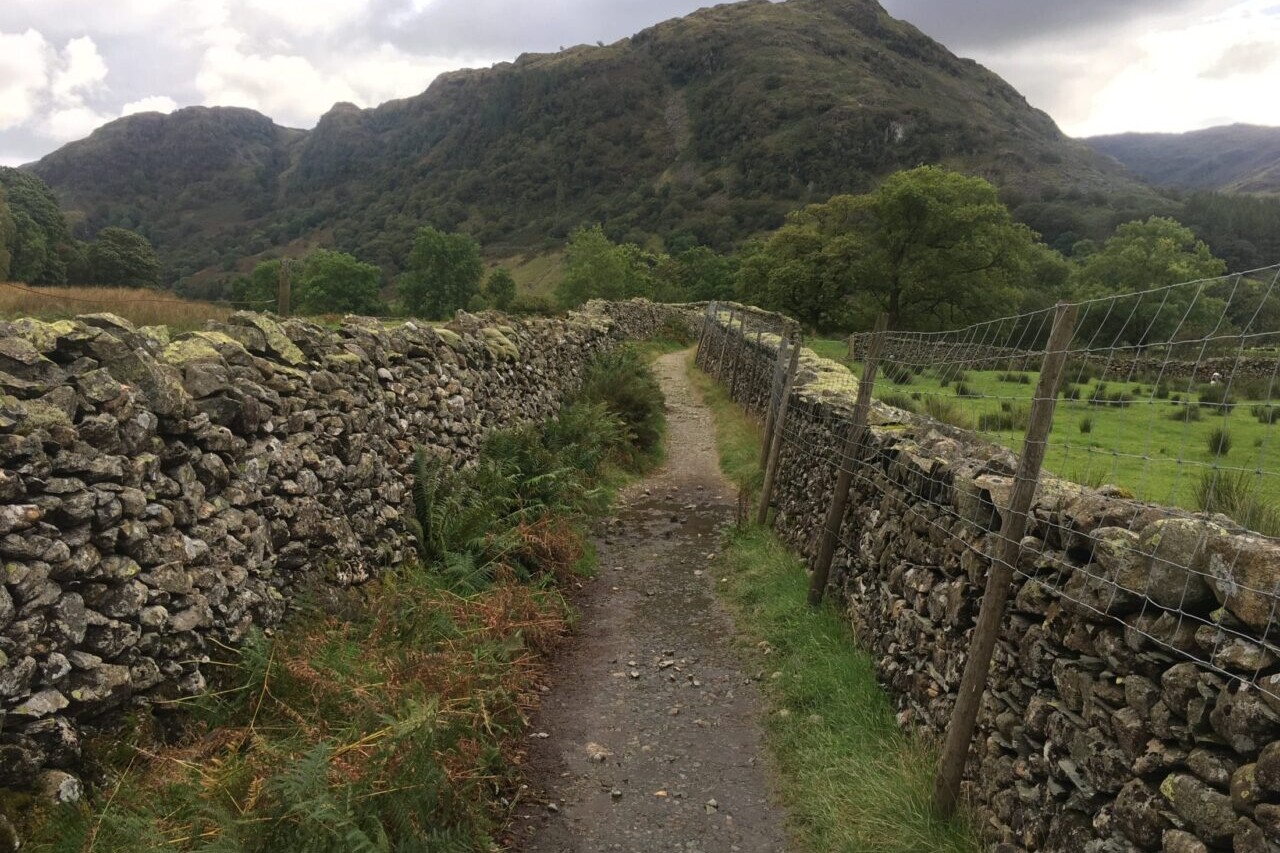
Official Companion Apps to Trailblazer Guidebooks. Our collaboration with Trailblazer guides includes hiking guides for the South Downs Way, Wainwright’s Coast to Coast, West Highland Way, Hadrian’s Wall Path, The Ridgeway, Costwold Way (all in the UK) and the Tour du Mont Blanc in the European Alps. All of the trails are full of history, stunning countryside, and charming towns and pubs. All of Trailblazer’s guides are perfect for thru-hikers, backpackers, section-hikers, and day-hikers. France. England. Italy.
20% off for our Hiking Season Kick-off SALE! The Trailblazer Special is now $19.99.
20% off for our Boxing Day SALE! The Trailblazer Special is now $18.99.
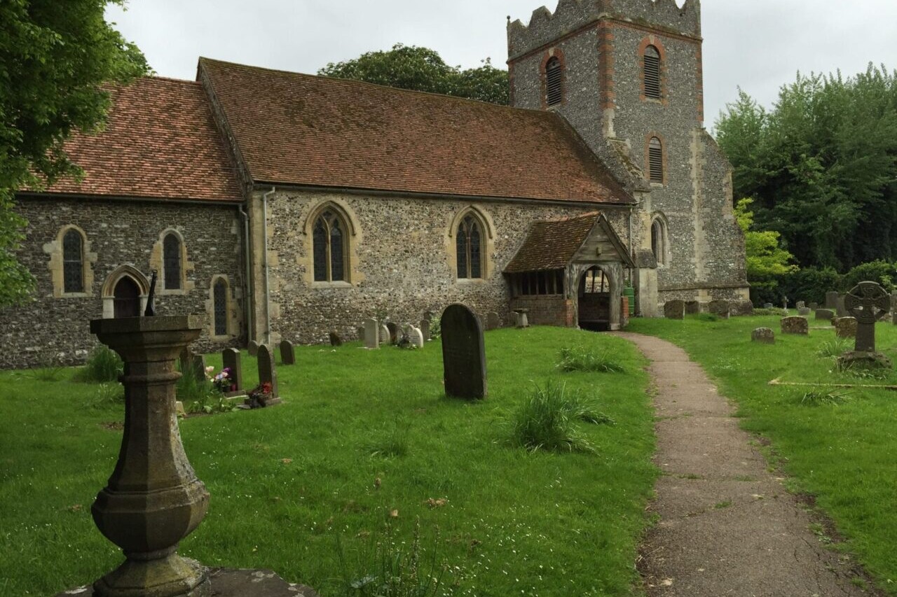
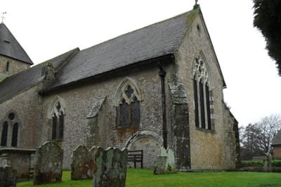
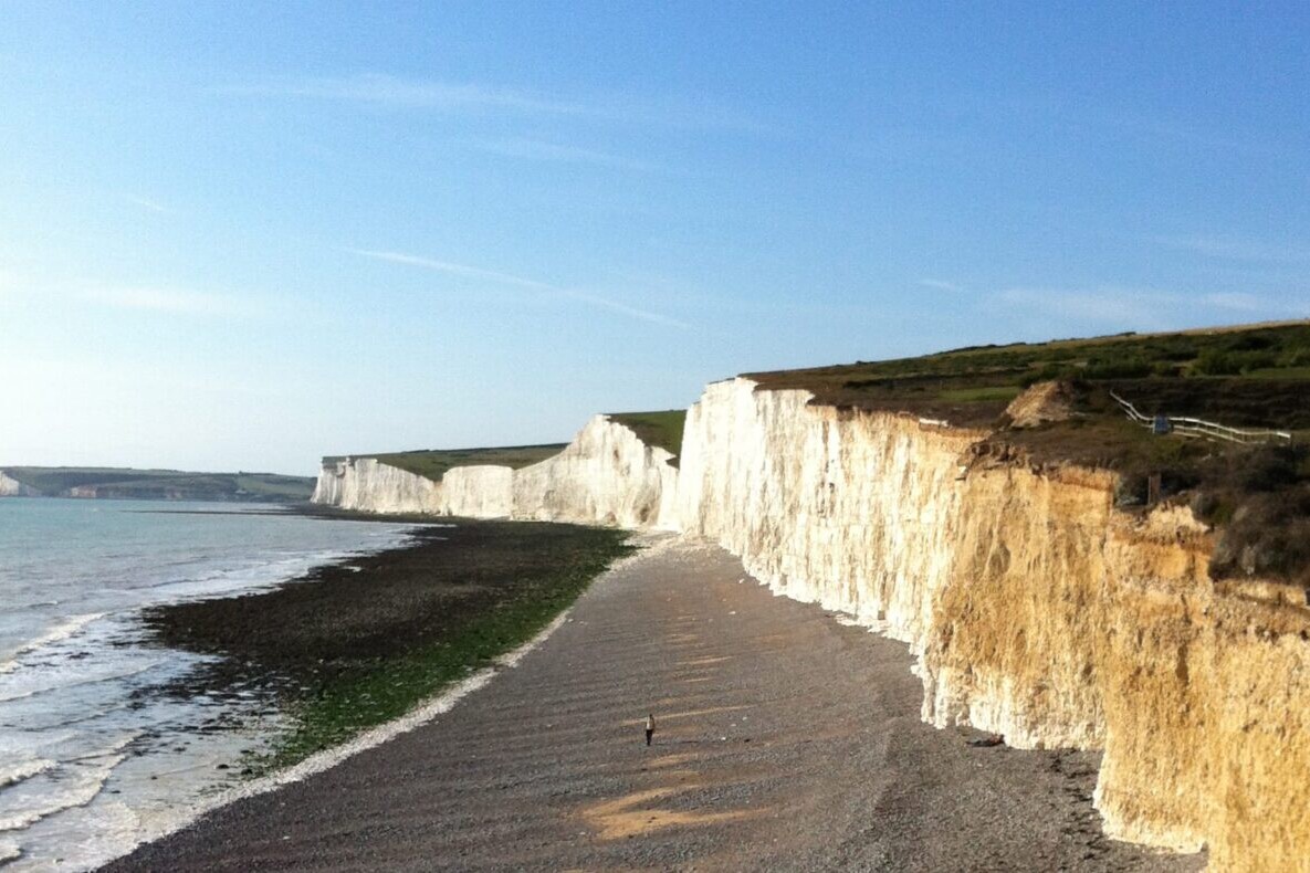
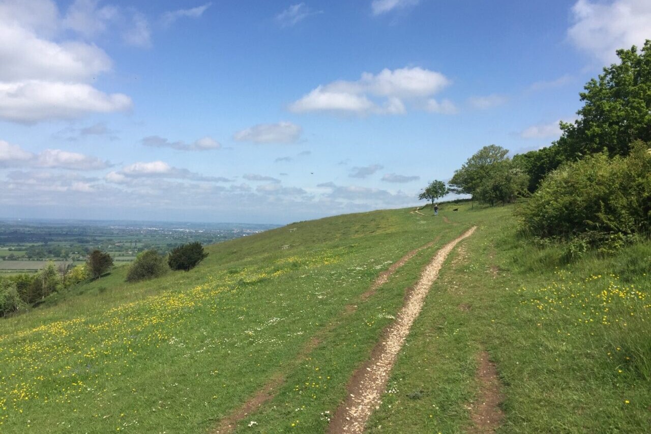
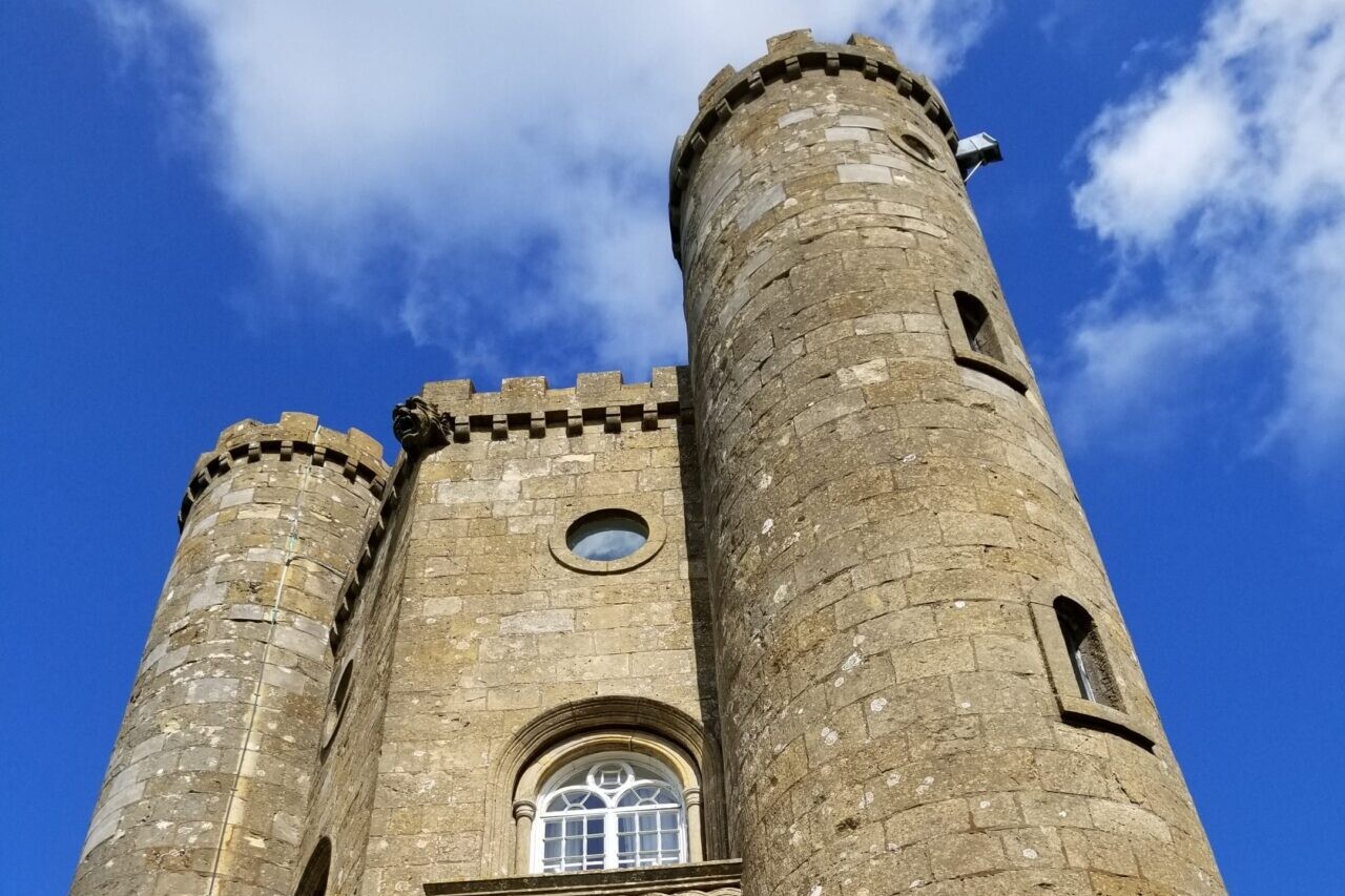
England, South Downs Way
Photo courtesy of Trailblazer Guides
4.8 ★★★★★ | 17K+ Reviews
Trailblazer Guides: The UK's Best Walking Guides
South Downs Way, The Ridgeway, Cotswold Way, Coast to Coast, Hadrian's Wall Path, West Highland Way, Tour du Mont Blanc
Official Companion Apps to Trailblazer Guidebooks
Download our guide to access the Trailblazer maps, tracks, waypoints, and comments! Our collaboration with Trailblazer guides includes hiking guides for the South Downs Way, Wainwright’s Coast to Coast, West Highland Way, Hadrian’s Wall Path, The Ridgeway, Cotswold Way (all in the UK) and the Tour du Mont Blanc in the European Alps. All of the trails are full of history, stunning countryside, and charming towns and pubs. All of Trailblazer's guides are perfect for thru-hikers, backpackers, section-hikers, and day-hikers.
$24.99 all guides 7 guides ($4.99 to $8.99 each)
$24.99 all guides
7 guides ($4.99 to $8.99 each)
Trailblazer British Hiking Maps


How can I get it?
The Trailblazer British hiking maps are available as an in-app purchase in our Guthook Guides app, a free download from the Apple App Store or the Google Play Store.
Our iOS and Android apps do differ slightly in their appearance. However, the majority of their features remain the same, and they access the same trail guide data.
This selection is a fully functional demonstration of the Trailblazer British Walking Guides app. Trailblazer apps are navigational companions to Trailblazer’s guide books: the app guides you along the trail while the guidebook provides comprehensive details regarding trip planning, suggested itineraries, public transportation, local history, natural history, safety, where to stay and eat, and much more. This demonstration app includes the western end of the the South Downs Way from Winchester Cathedral to the Beacon Hill Car Park, which is the first 10.9 miles of the South Downs Way.
Purchase all Trailblazer apps in one package. Includes South Downs Way, Coast to Coast, West Highland Way, Hadrian’s Wall Path, The Cotswold Way, The Ridgeway, and the Tour du Mont Blanc. Purchase now and you will receive any new apps we add in the future at no additional cost.
$24.99
This app is the companion to Trailblazer Walking Guides’ guide to Wainwright’s Coast to Coast.
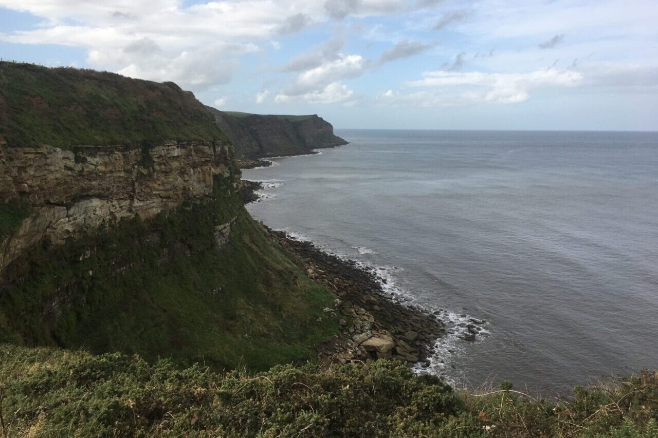
The Coast to Coast Path is a nearly 200-mile (320km) route that runs from St Bees on the Irish Sea across the width of Northern England to the North Sea at Robin Hood’s Bay. This spectacular two-week walk crosses three National Parks: the Lake District, the Yorkshire Dales, and the North York Moors.
$8.99
This app is the companion to Trailblazer’s Ridgeway guide book.
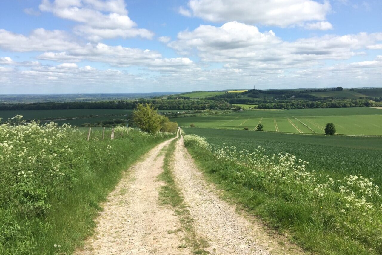
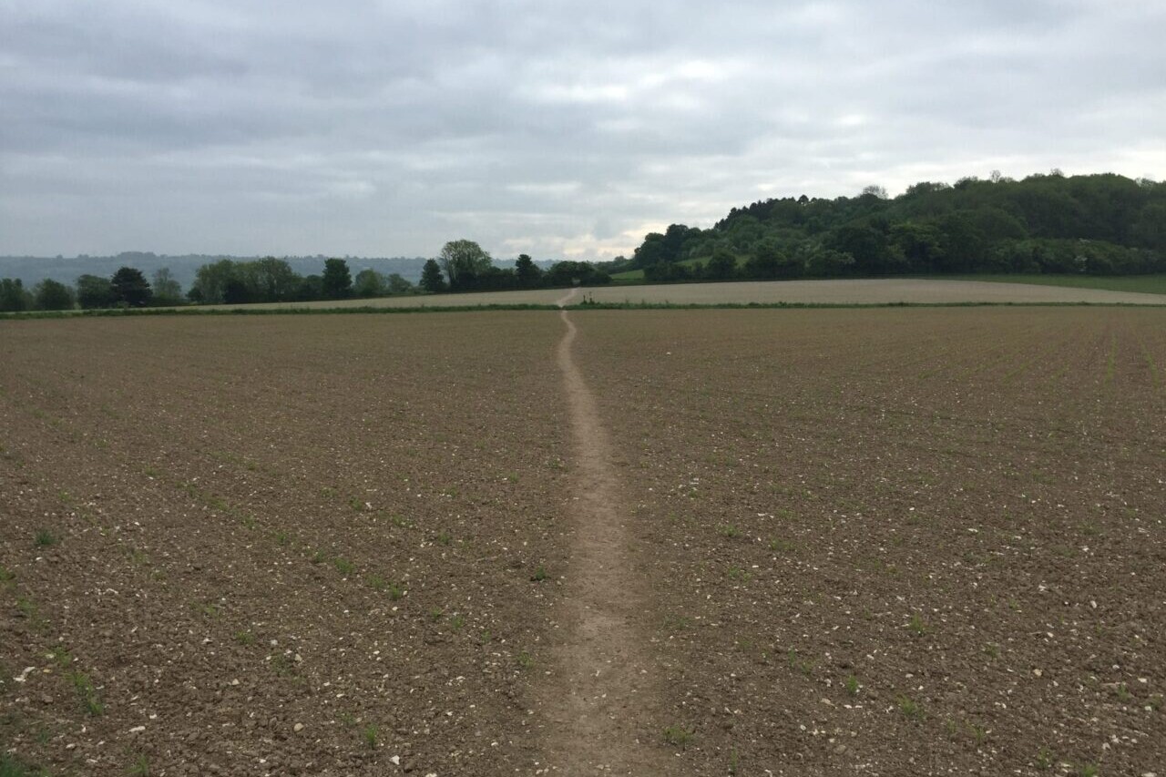
The Ridgeway is a 87-mile (139km) National Trail that runs from Overton Hill near Avebury in Wiltshire to Ivinghoe Beacon in Buckinghamshire. Part of this route follows Britain’s oldest road, dating back millennia. Taking 5-7 days, this is not a difficult walk and the rewards are many: rolling countryside, Iron Age forts, Neolithic burial mounds, white horses carved into the chalk downs and picturesque villages.
$4.99
This app is the companion to Trailblazer’s South Downs Way guide book.
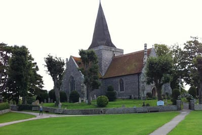
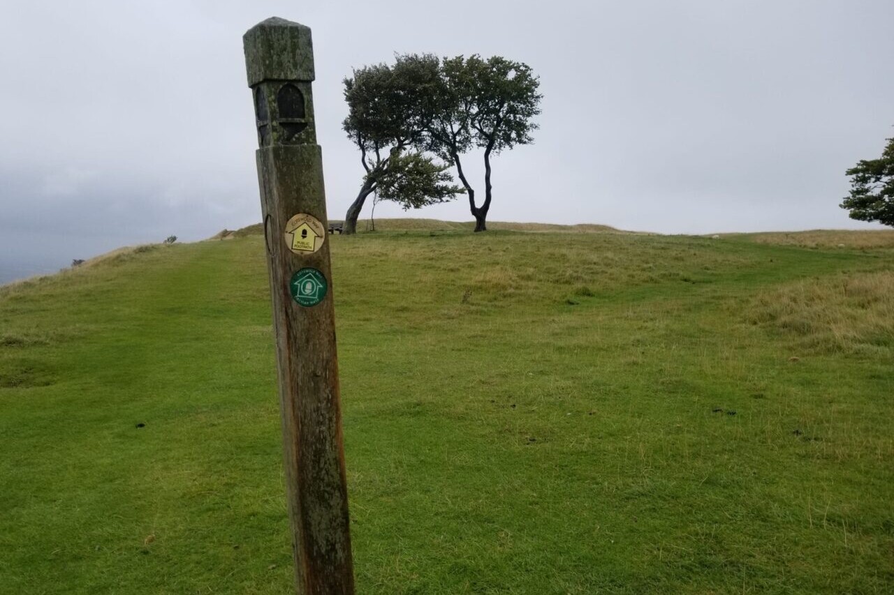
The South Downs Way is a 100-mile (160km) National Trail that follows the line of chalk hills stretching from Winchester in Hampshire across Sussex to Eastbourne. Walking the length of the Downs is the best way to experience this beautiful landscape with its mixture of rolling hills, steep hanging woodland and windswept fields. You’ll also pass picture-postcard villages with welcoming pubs, thatched cottages and quintessentially English country gardens.
$4.99
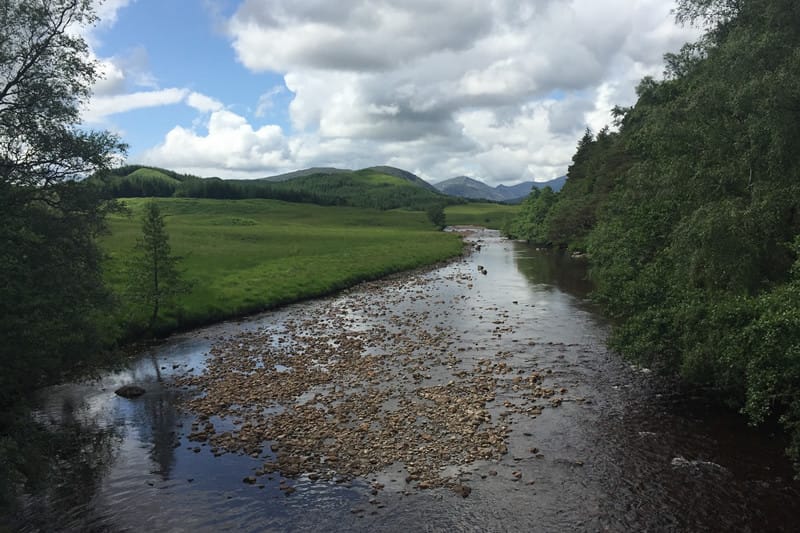
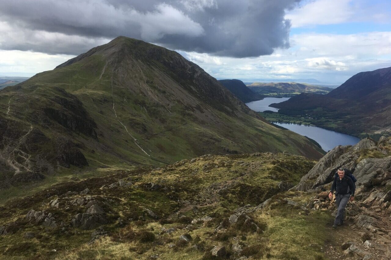
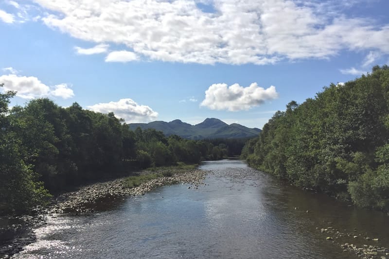
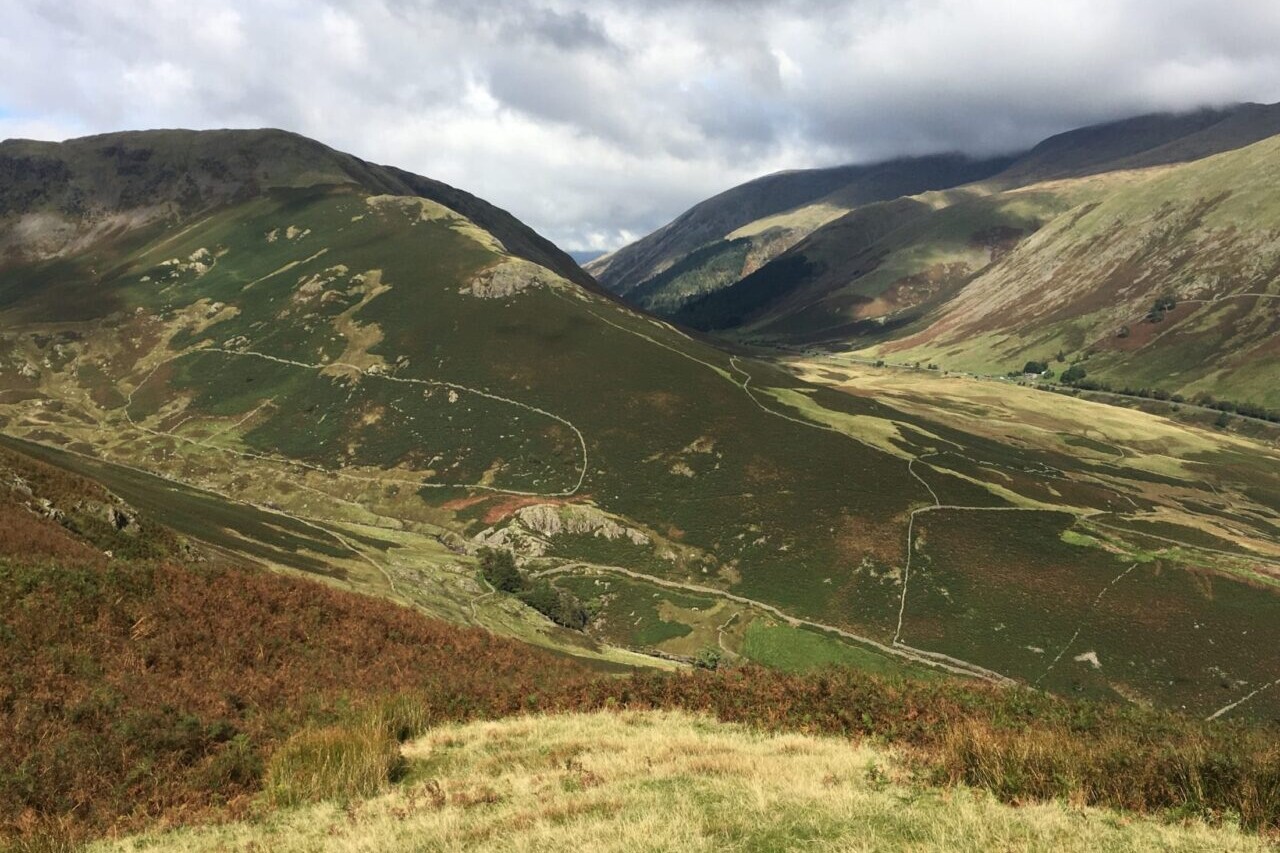
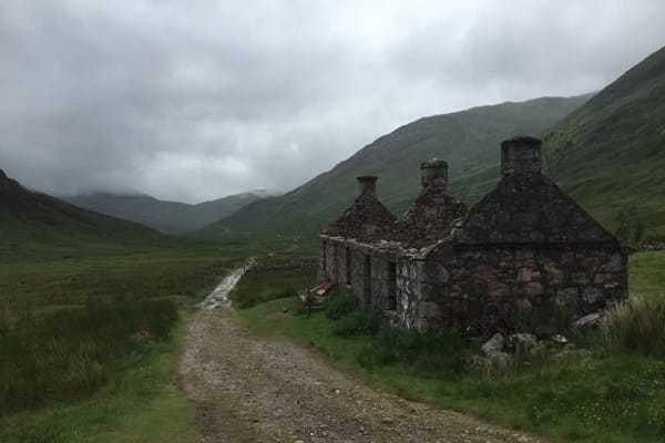
This app is the companion to Trailblazer’s West Highland Way guide book.
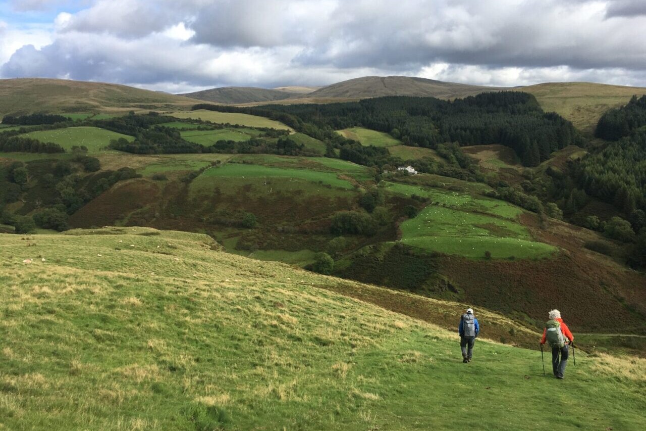
The West Highland Way is a 96-mile (154km) trail that passes through some of the most spectacular scenery in all of Britain. From the outskirts of Glasgow it winds along the wooded banks of Loch Lomond, across the wilderness of Rannoch Moor, over the mountains above Glencoe to a dramatic finish below Ben Nevis – Britain’s highest mountain.
$5.99
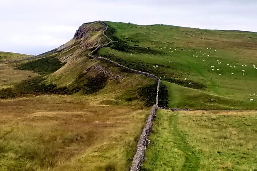
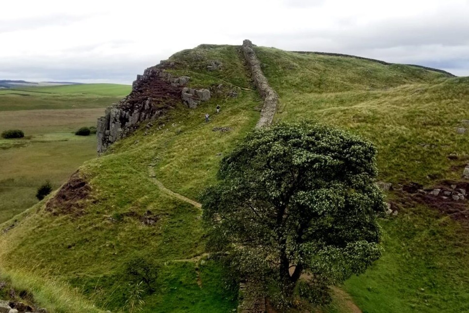
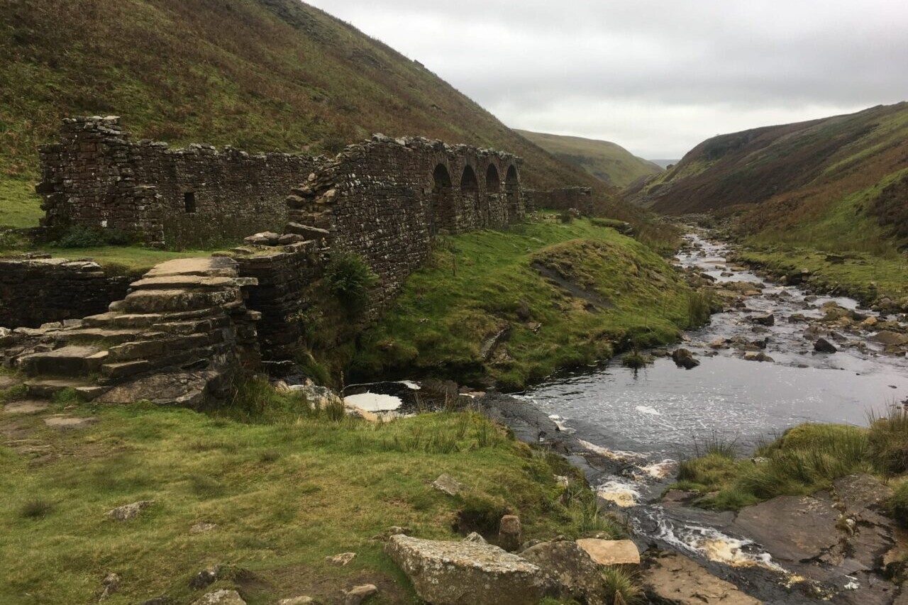
Hadrian’s Wall Path, 84 miles (135km) from end to end, follows the course of northern Europe’s largest surviving Roman monument, a 2nd-century fortification built in the border country between England and Scotland on the orders of the Emperor Hadrian in AD122.
Hadrian’s Wall Path is the first National Trail to follow the course of a UNESCO World Heritage Site. This week-long walk is regarded as one of the most pleasant of the National Trails.
$4.99
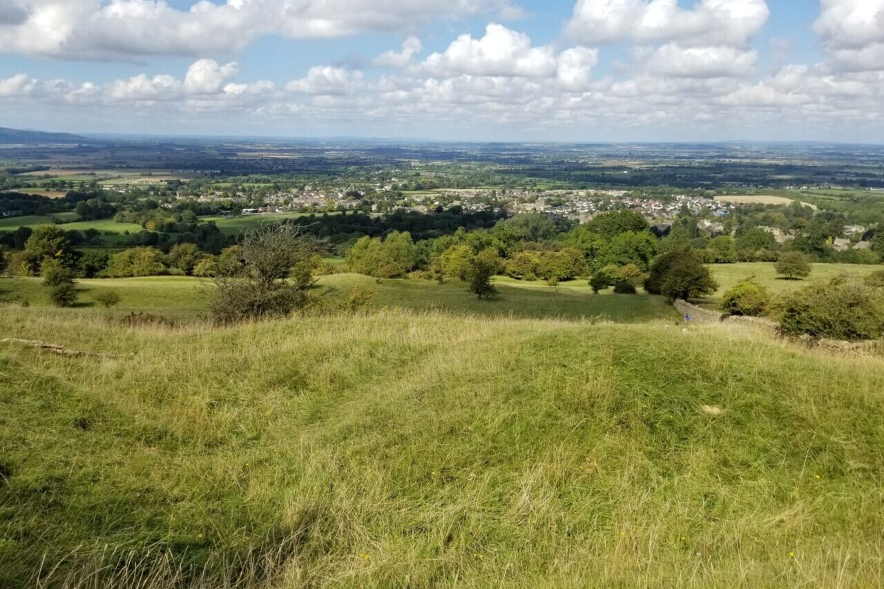
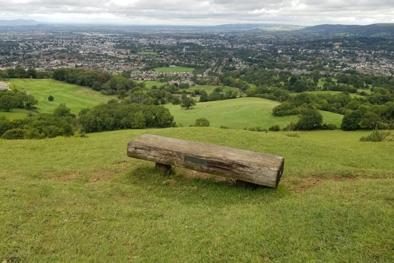
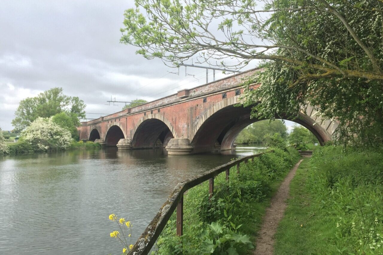
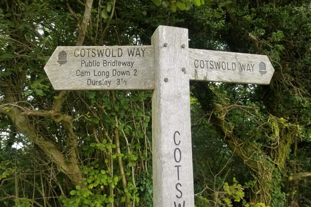
The Cotswold Way is a ~100-mile (161km) National Trail that runs from Chipping Campden to Bath, following the beautiful Cotswold escarpment for much of its course. The trail leads through quintessentially English countryside with little villages of honey-coloured stone, from open farmland to the historic city of Bath.
$5.99
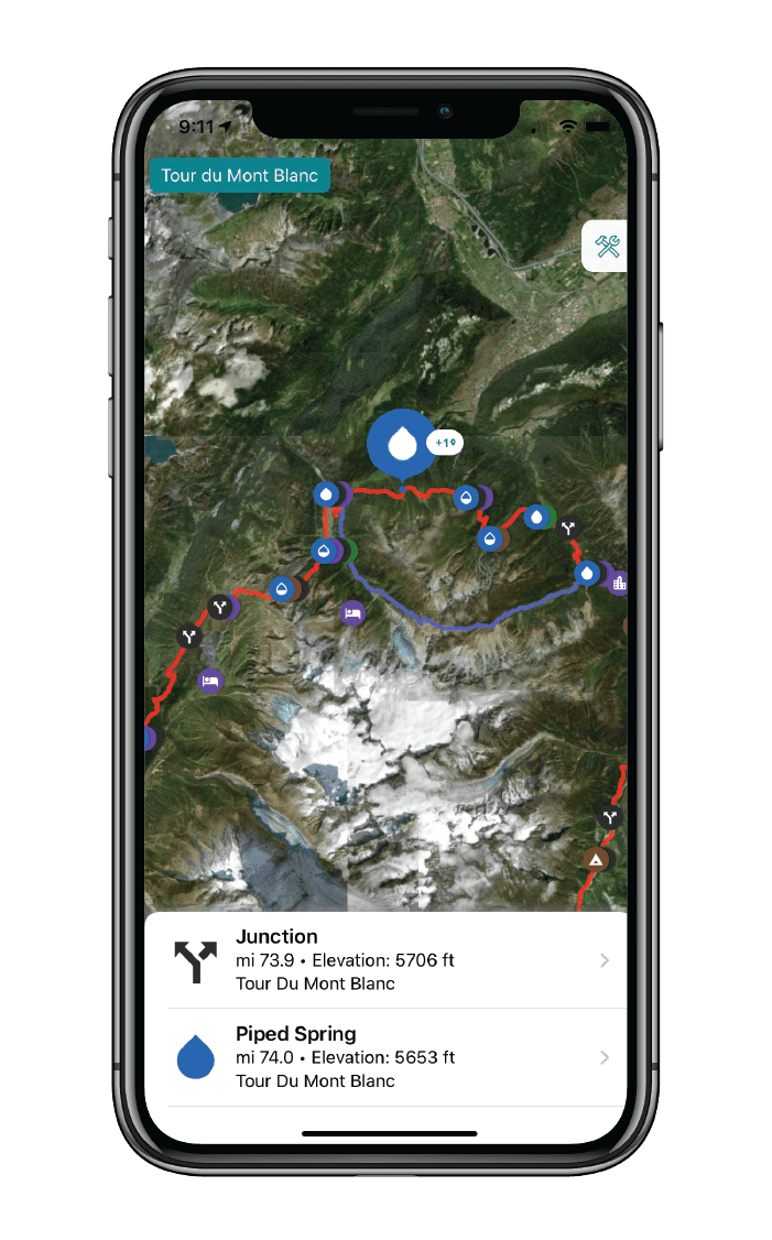
The Tour du Mont Blanc is one of the world’s most famous hiking trails. This loop route passes through seven stunning mountain valleys around the spectacular Mont Blanc. This amazing scenery is classic European Alps: rugged spiky mountains, lush green valleys, strenuous mountain passes, and photo-worthy vistas. Hikers can start the loop from a variety of points in France, Italy, and Switzerland, including in Les Houches in the Chamonix Valley, Les Contamines in the Montjoie Valley, Courmayeur, Champex, and Martigny. The route also passes Chamonix, the famous resort which hosted the first Winter Olympic Games in 1924.
$6.99
Photos of the Trailblazer Guide


Hike more.
Check out some of the other trail guides we offer!
About our partner
Trailblazer Guides
Since 1991 Trailblazer has been publishing a select list of practical guidebooks written by travellers for travellers. Their guidebooks include everything from adventure travel guides, to rail guides, to worldwide trekking guides, including British walking guides. Trailblazer guides are entertaining as well as informative, and are strong on practical information without neglecting the cultural background.
Atlas Guides created and maintains the official app of Trailblazer’s British Walking Guides.