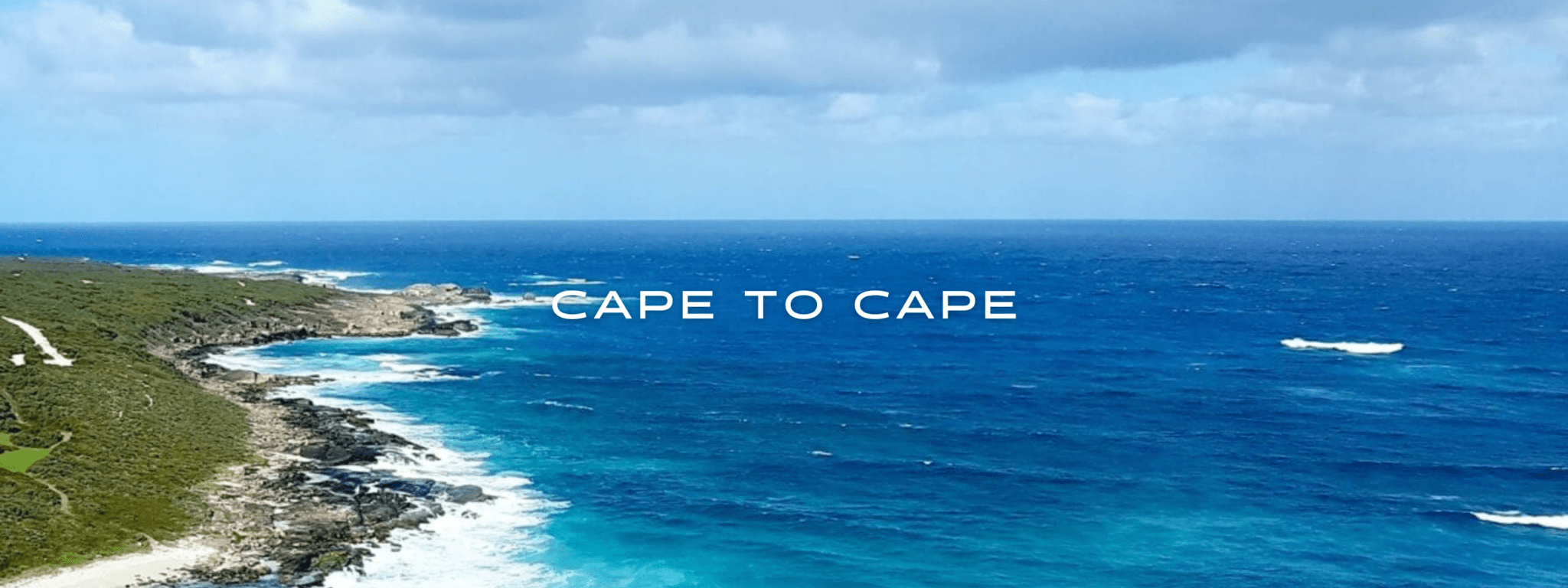
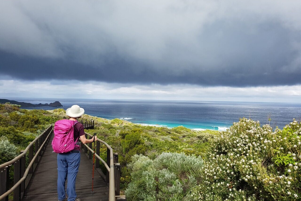
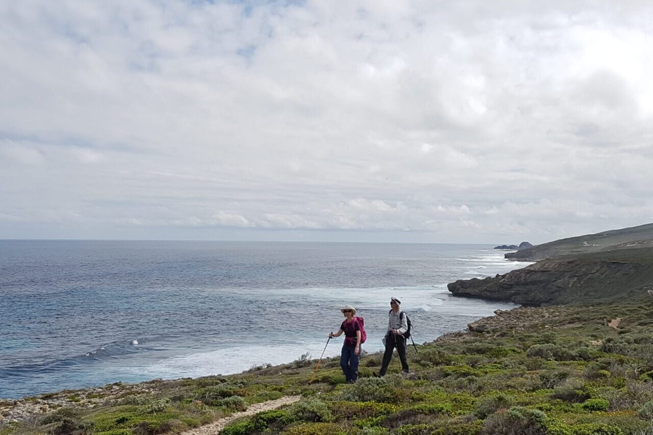
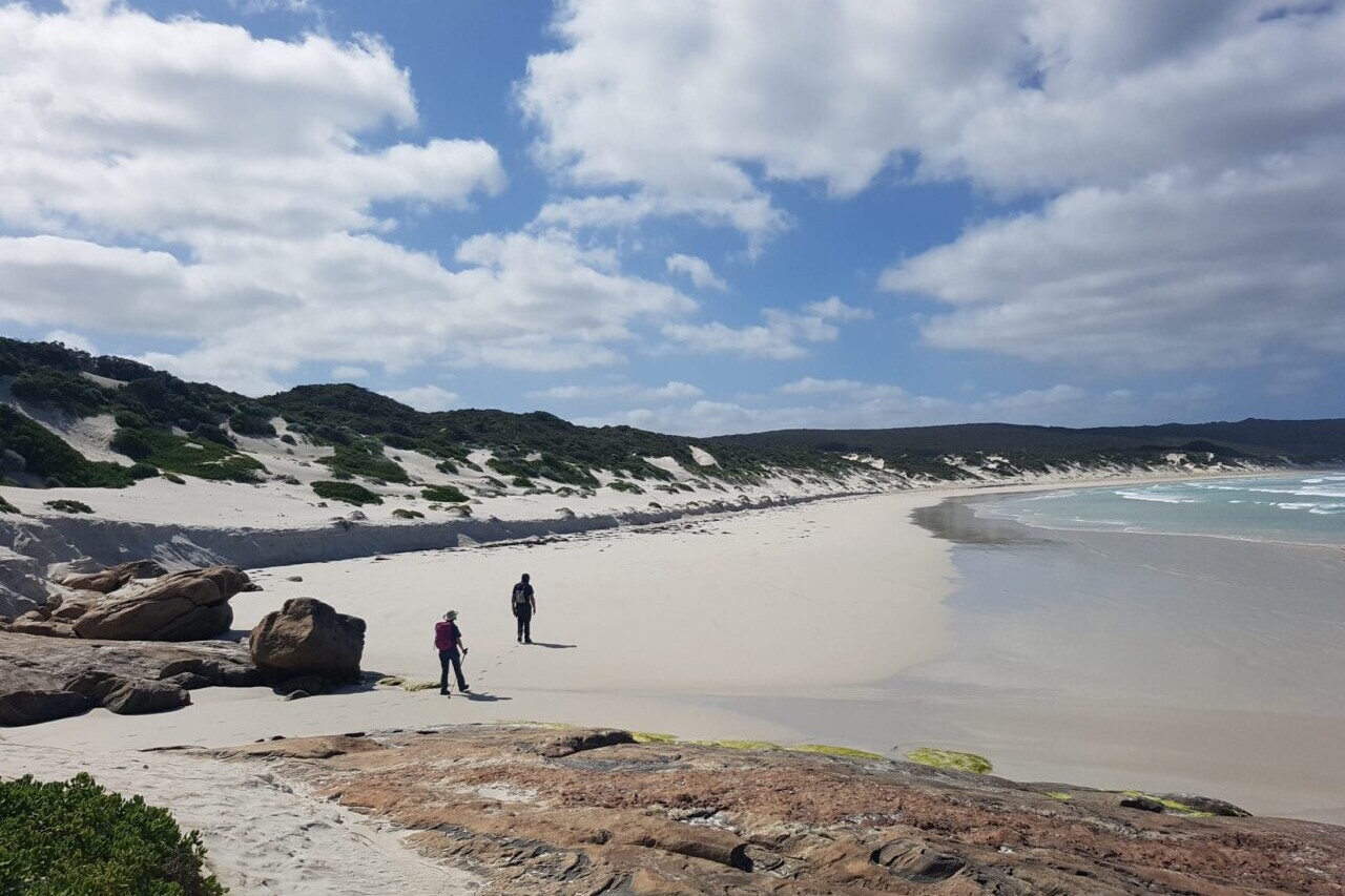
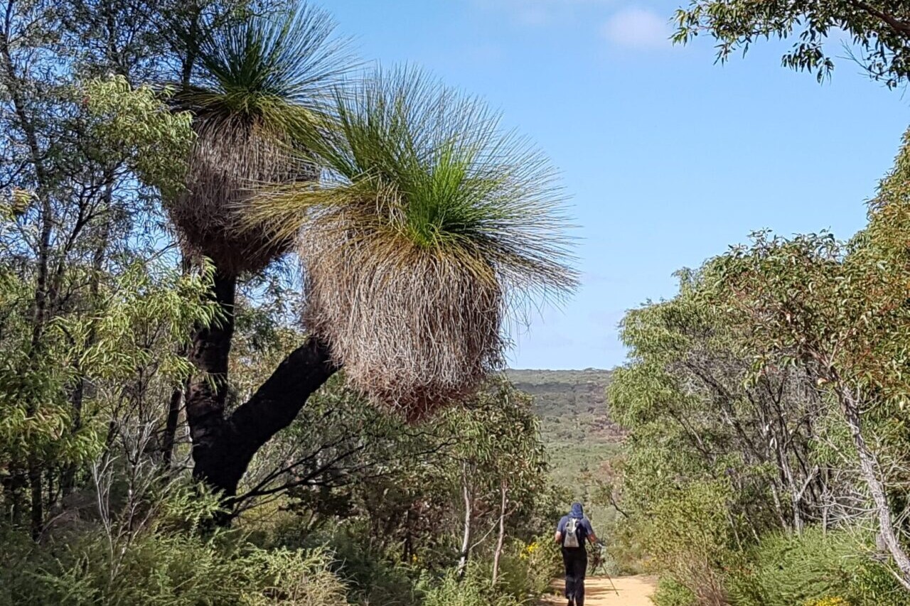
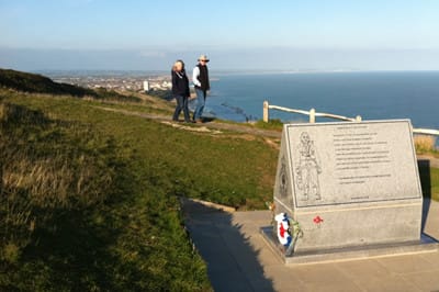
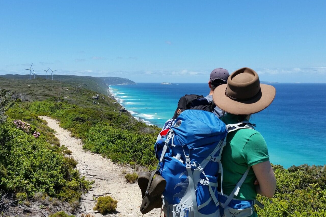
Cape to Cape

A wild, uninhabited coast line with majestic forests, cliffs, caves, headlands and rocky formations awaits the Cape to Cape hiker. The white sandy beaches, beautiful spring wildflowers, Karri forests, rocky beach side ledges, and thundering surf mean this walk is always fun and interesting! The route meanders along the whole length of the Leeuwin-Naturaliste Ridge, which forms the backbone of the Leeuwin-Naturaliste National Park between the lighthouses of Cape Naturaliste and Cape Leeuwin in the far south west of Western Australia.
20% off for our Hiking Season Kick-off SALE! The Australia and New Zealand Hiker Special is now $35.99. Explore the Aus NZ Hiker Special!
20% off for our Boxing Day SALE! The Australia and New Zealand Hiker Special is now $35.99. Explore the Aus NZ Hiker Special!
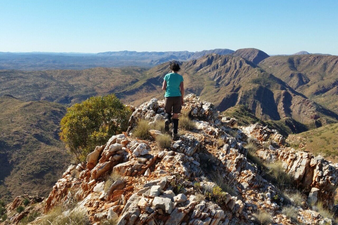
Western Australia, Cape to Cape Track
Photo courtesy of Active Wayz
4.8 ★★★★★ | 17K+ Reviews
Cape to Cape Track
125 km / 78 miles • Western Australia
Download our guide to access the Cape to Cape Track map, tracks, waypoints, and comments! A wild, uninhabited coast line with majestic forests, cliffs, caves, headlands and rocky formations awaits the Cape to Cape hiker. The white sandy beaches, beautiful spring wildflowers, Karri forests, rocky beach side ledges, and thundering surf mean this walk is always fun and interesting! The route meanders along the whole length of the Leeuwin-Naturaliste Ridge, which forms the backbone of the Leeuwin-Naturaliste National Park between the lighthouses of Cape Naturaliste and Cape Leeuwin in the far south west of Western Australia.
AU$9.99/NZ$9.99/US$5.99 full guide
AU$9.99/NZ$9.99/US$5.99 full guide
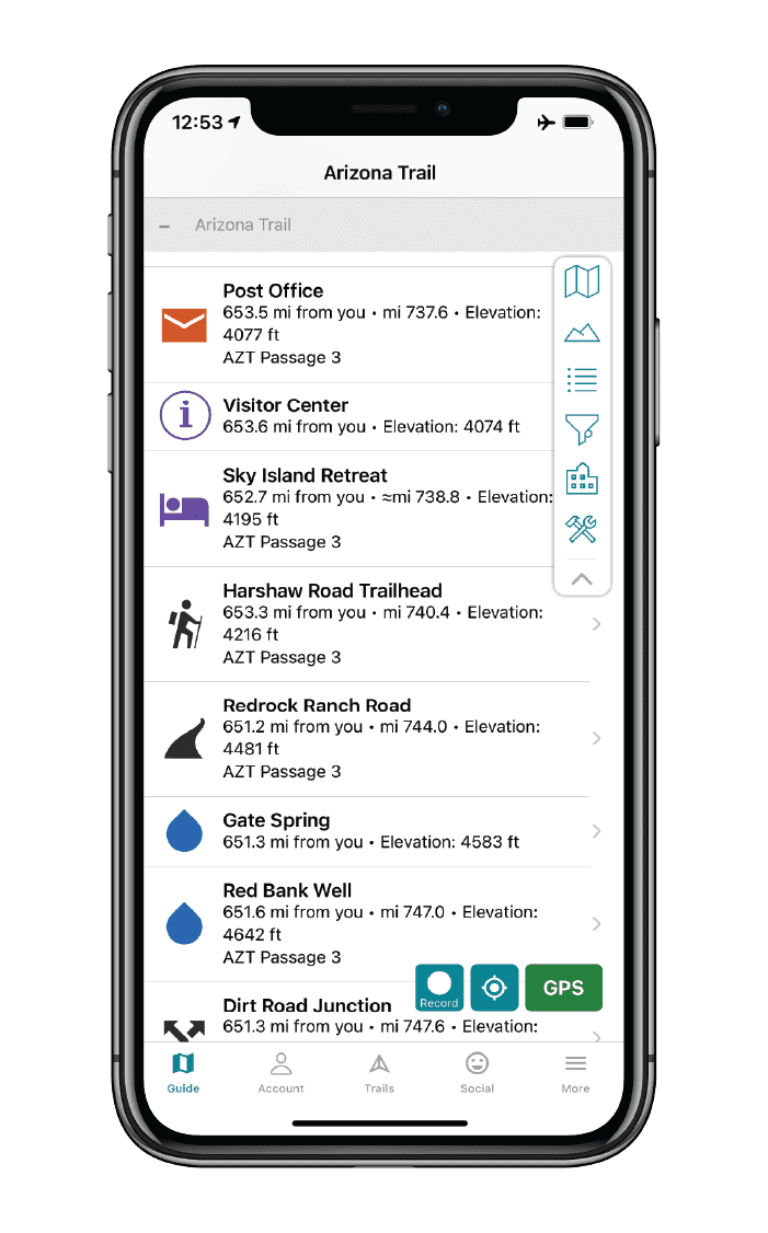


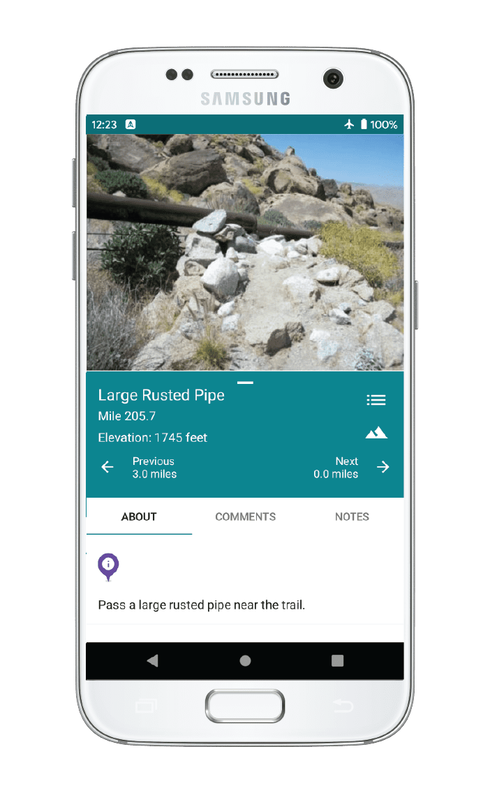
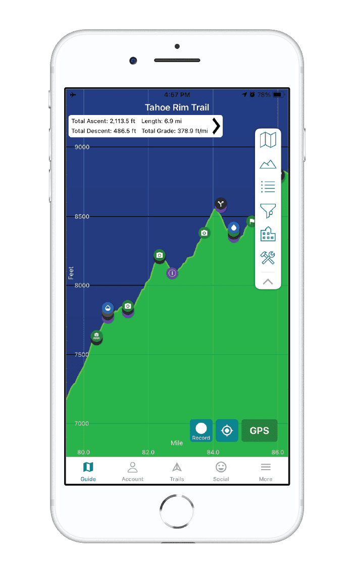
Cape to Cape Map


How can I get it?
Available as an in-app purchase in our Guthook Guides app, a free download from the Apple App Store or the Google Play Store.
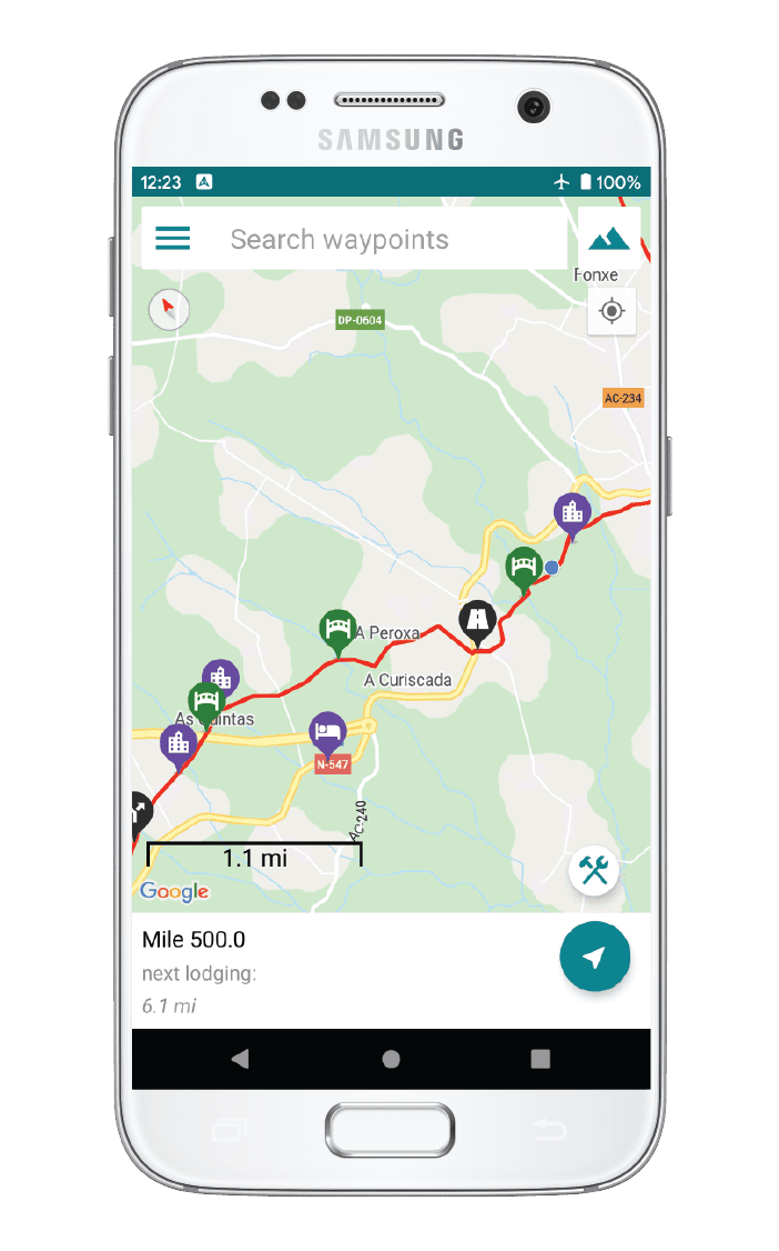
Our iOS and Android apps do differ slightly in their appearance. However, the majority of their features remain the same, and they access the same trail guide data.
Hike Australia and New Zealand with a saving of 56% over buying the trails separately. This bundle does not include Te Araroa hikes which are part of the Te Araroa Bundle.
Purchase now and get all future trails added to the bundle for free!
This bundle currently includes: Australian Alps Walking Track, Bibbulmun Track, Cape to Cape, George Bass Coastal Walk, Greenstone and Caples Track, Heysen Trail, Kepler Track, Larapinta Trail, Milford Track, Overland Track, Routeburn Track, Three Capes Track, Walk the Yorke, and Wilsons Promontory Grand Circuit.
AU$69.99 / NZ$77.99 / US$44.99
Australia, 135 km, Coastal, 6 to 8 Days.
A wild, uninhabited coast line with majestic forests, cliffs, caves, headlands and rocky formations awaits the Cape to Cape hiker. The white sandy beaches, Karri forests, rocky beach side ledges and thundering surf mean this walk is always fun and interesting! It meanders along the whole length of the Leeuwin-Naturaliste Ridge, which forms the backbone of the Leeuwin-Naturaliste National Park between the lighthouses of Cape Naturaliste and Cape Leeuwin in the far south west of Western Australia. The wildflowers in spring are amazing. You will need to do some preparation as uninhabited means small shops with few supplies.
AUD$9.99 / NZ$9.99 / US$5.99
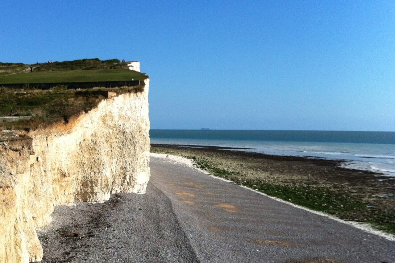
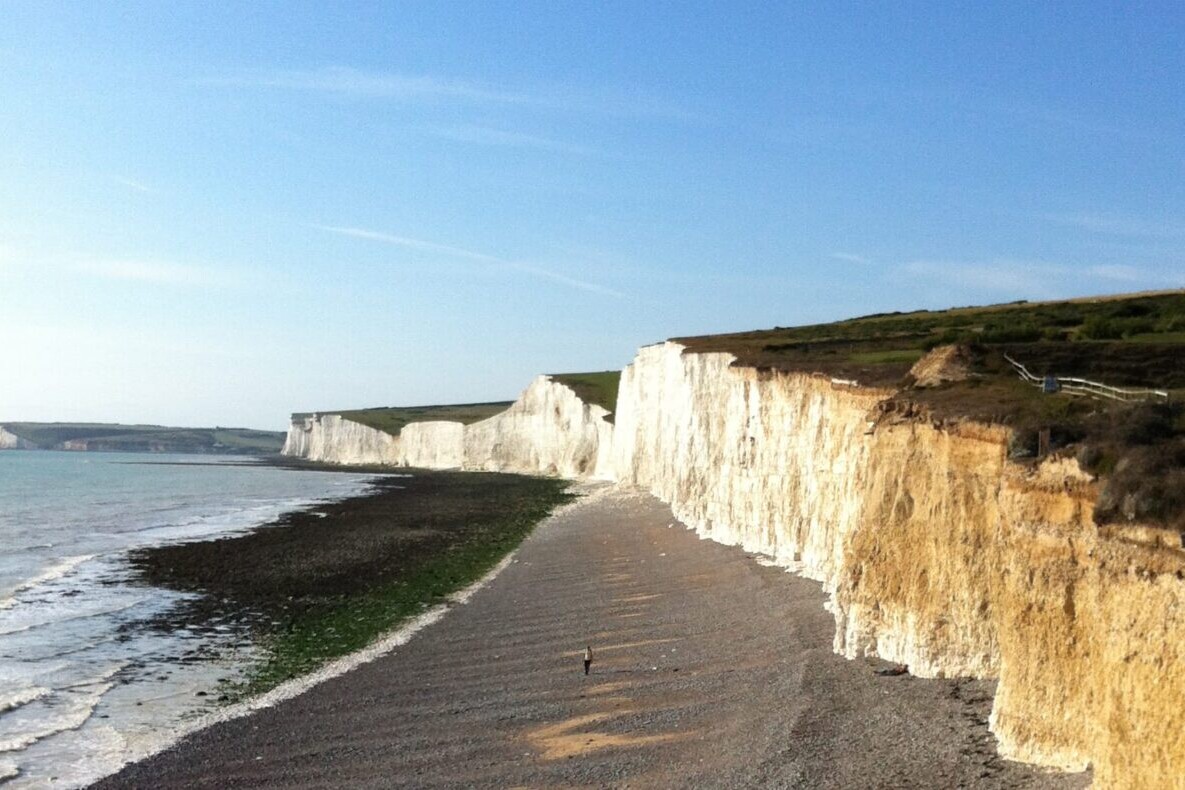
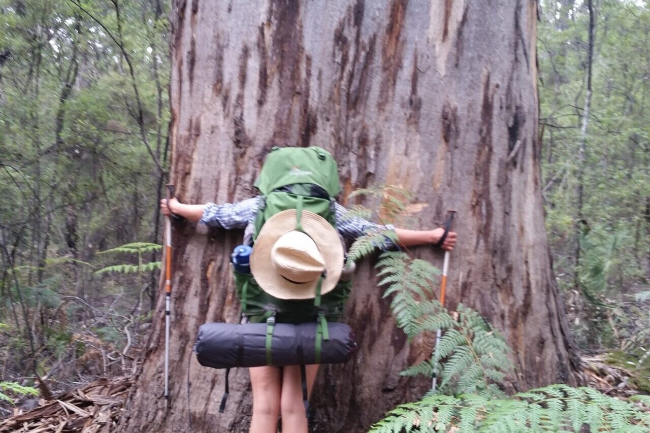
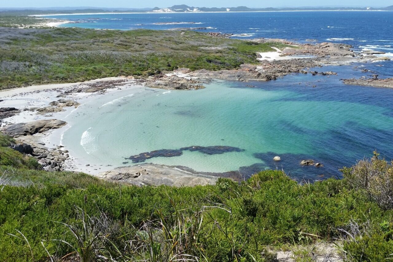
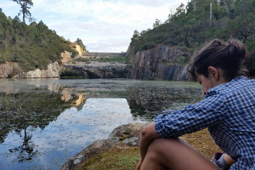
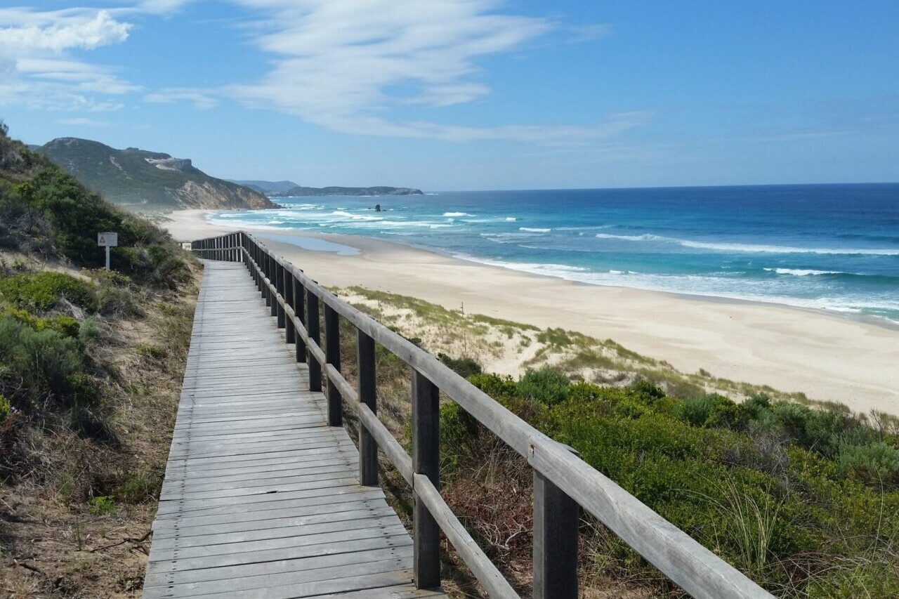
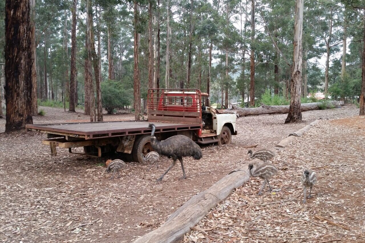
Photos of the Cape to Cape Trail
Hike more.
Check out some of the other trail guides we offer!
About our partner
Active Wayz
Activewayz is very passionate about the outdoors, whether it be hiking, bushwalking, or tramping. They enjoy mapping new routes and planning new adventures to share in the app. They have incorporated their love for adventure, long-distance hiking, and mapping to create a resourceful guide in Australia and New Zealand.
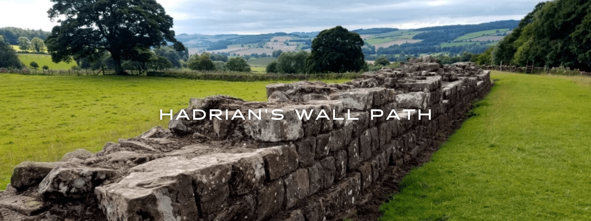
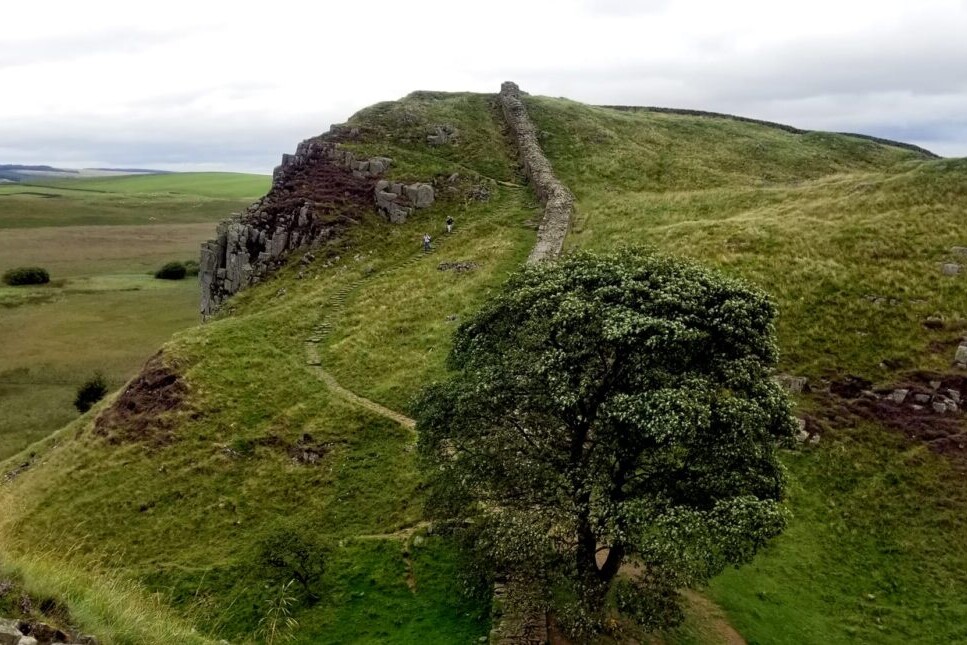
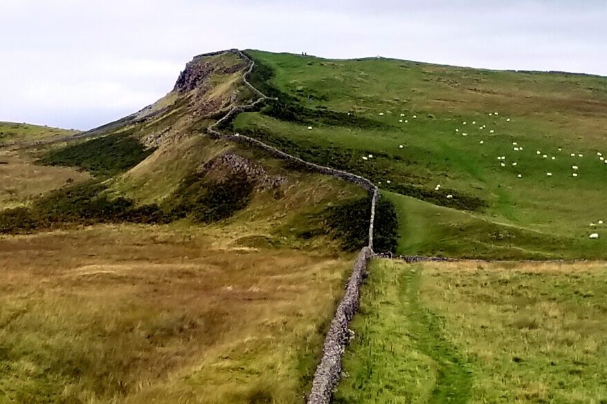
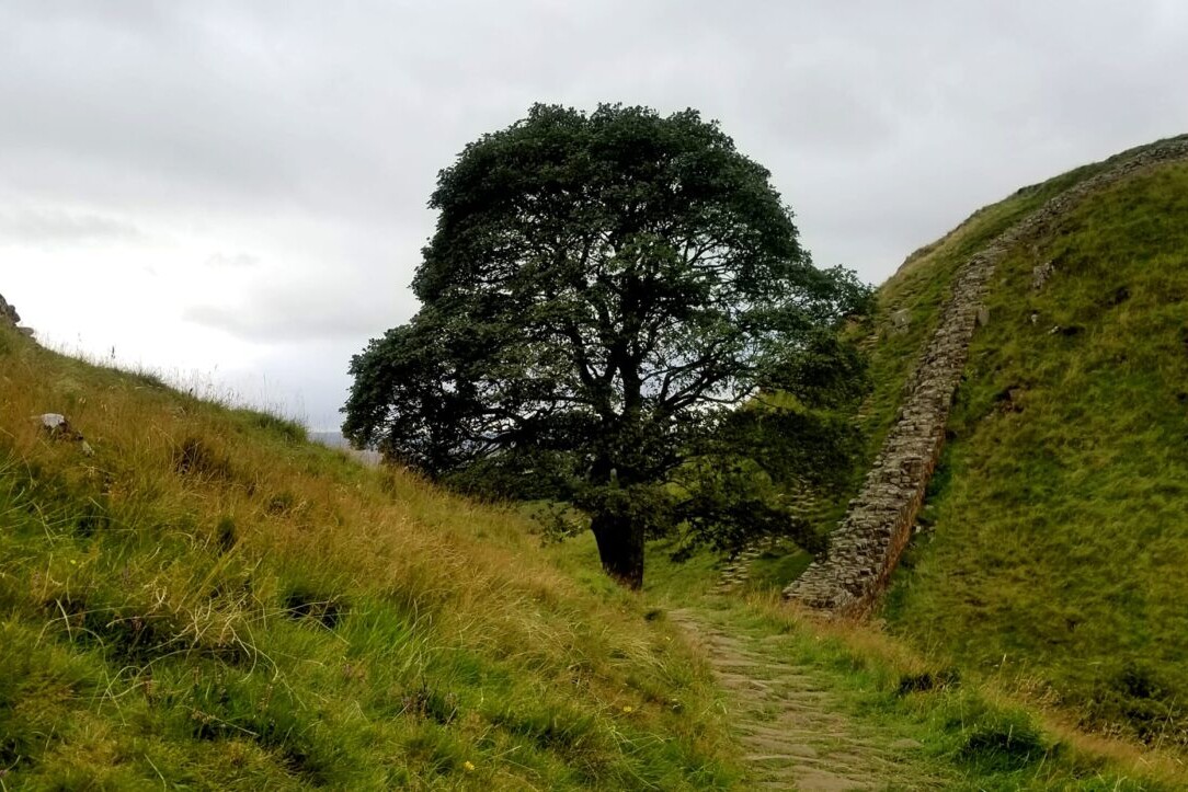
Hadrian's Wall Path
Official Companion App to the Trailblazer Guidebook to Hadrian’s Wall Path. Hadrian’s Wall Path is the first National Trail to follow the course of a UNESCO World Heritage Site. This week-long walk is regarded as one of the most pleasant of the National Trails. The 84-mile (135km) trail follows the course of northern Europe’s largest surviving Roman monument, a 2nd-century fortification built in the border country between England and Scotland on the orders of the Emperor Hadrian in the year 122 AD. The walk traverses beautiful countryside, with small villages and cozy pubs along the way. England.
20% off for our Hiking Season Kick-off SALE! The Trailblazer Special is now $19.99. Explore the Trailblazer Special!
20% off for our Boxing Day SALE! The Trailblazer Special is now $18.99. Explore the Trailblazer Special!
England, Hadrian’s Wall Path
Photo courtesy of Trailblazer Guides
4.8 ★★★★★ | 17K+ Reviews
Hadrian's Wall Path
84 miles • England
Official Companion App to Trailblazer's Hadrian's Wall Path by Henry Stedman and Daniel McCrohan
Download our guide to access the Hadrian Wall's Path map, tracks, waypoints, and comments! Hadrian’s Wall Path is the first National Trail to follow the course of a UNESCO World Heritage Site. This week-long walk is regarded as one of the most pleasant of the National Trails. The 84-mile (135km) trail follows the course of northern Europe’s largest surviving Roman monument, a 2nd-century fortification built in the border country between England and Scotland on the orders of the Emperor Hadrian in the year 122 AD. The walk traverses beautiful countryside, with small villages and cozy pubs along the way.
$4.99 full guide A Trailblazer Guide
$4.99 full guide
A Trailblazer Guide
Hadrian’s Wall Path Map


How can I get it?
The Hadrian's Wall map is available as an in-app purchase in our Guthook Guides app, a free download from the Apple App Store or the Google Play Store.
Our iOS and Android apps do differ slightly in their appearance. However, the majority of their features remain the same, and they access the same trail guide data.
Purchase all Trailblazer apps in one package. Includes South Downs Way, Coast to Coast, West Highland Way, Hadrian’s Wall Path, The Cotswold Way, and The Ridgeway. Purchase now and you will receive any new apps we add in the future at no additional cost.
$24.99
Hadrian’s Wall Path, 84 miles (135km) from end to end, follows the course of northern Europe’s largest surviving Roman monument, a 2nd-century fortification built in the border country between England and Scotland on the orders of the Emperor Hadrian in AD122.
Hadrian’s Wall Path is the first National Trail to follow the course of a UNESCO World Heritage Site. This week-long walk is regarded as one of the most pleasant of the National Trails.
$4.99
Photos of Hadrian’s Wall Path
Hike more.
Check out some of the other trail guides we offer!
About our partner
Trailblazer Guides
Since 1991 Trailblazer has been publishing a select list of practical guidebooks written by travellers for travellers. Their guidebooks include everything from adventure travel guides, to rail guides, to worldwide trekking guides, including British walking guides. Trailblazer guides are entertaining as well as informative, and are strong on practical information without neglecting the cultural background.
Atlas Guides created and maintains the official app of Trailblazer’s British Walking Guides.
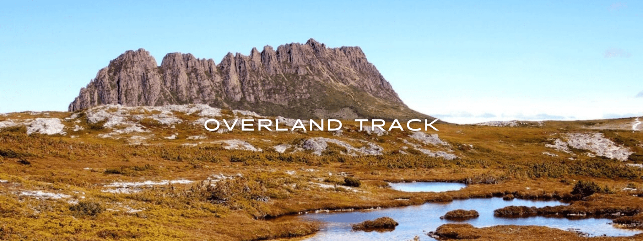
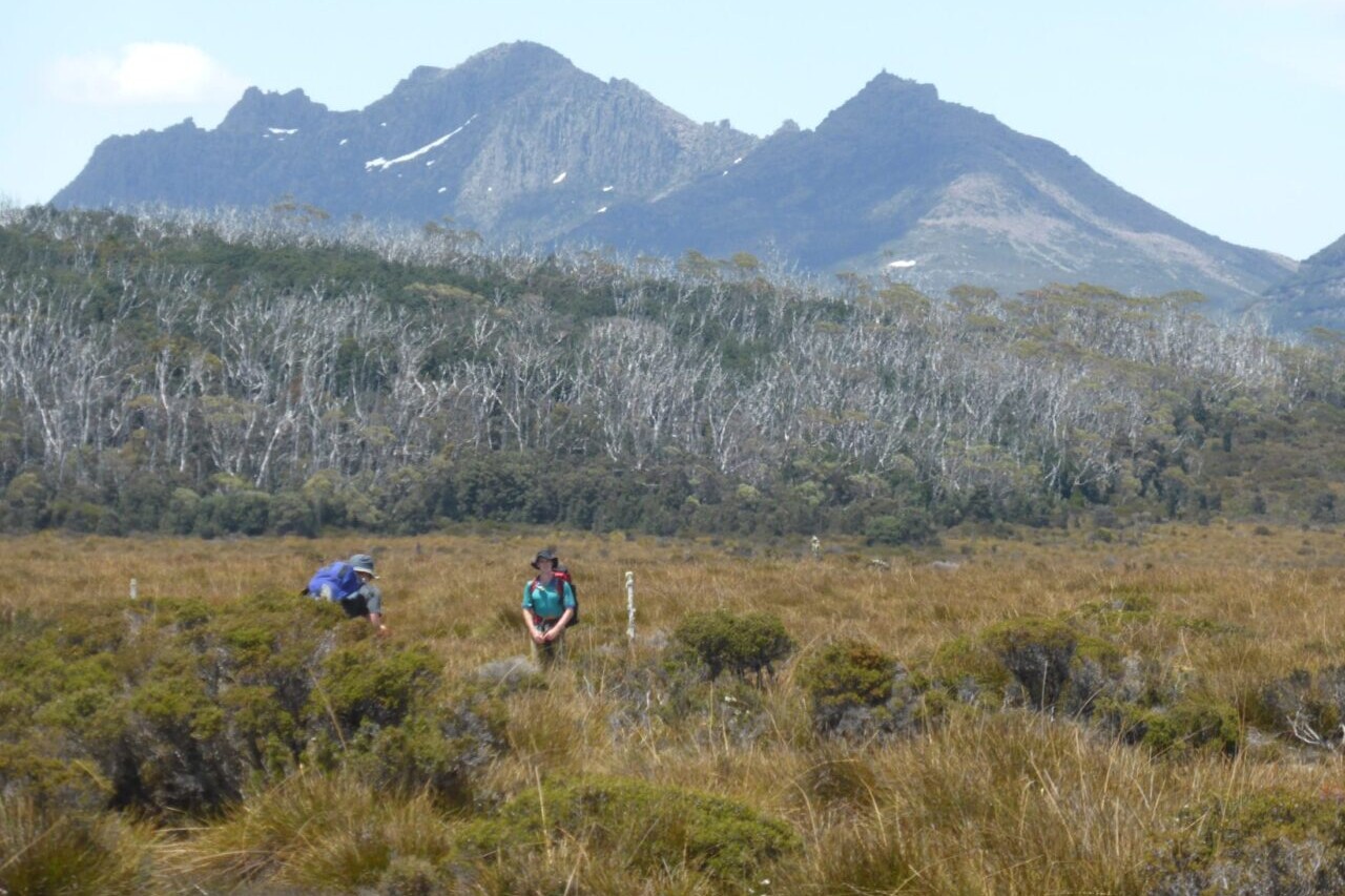
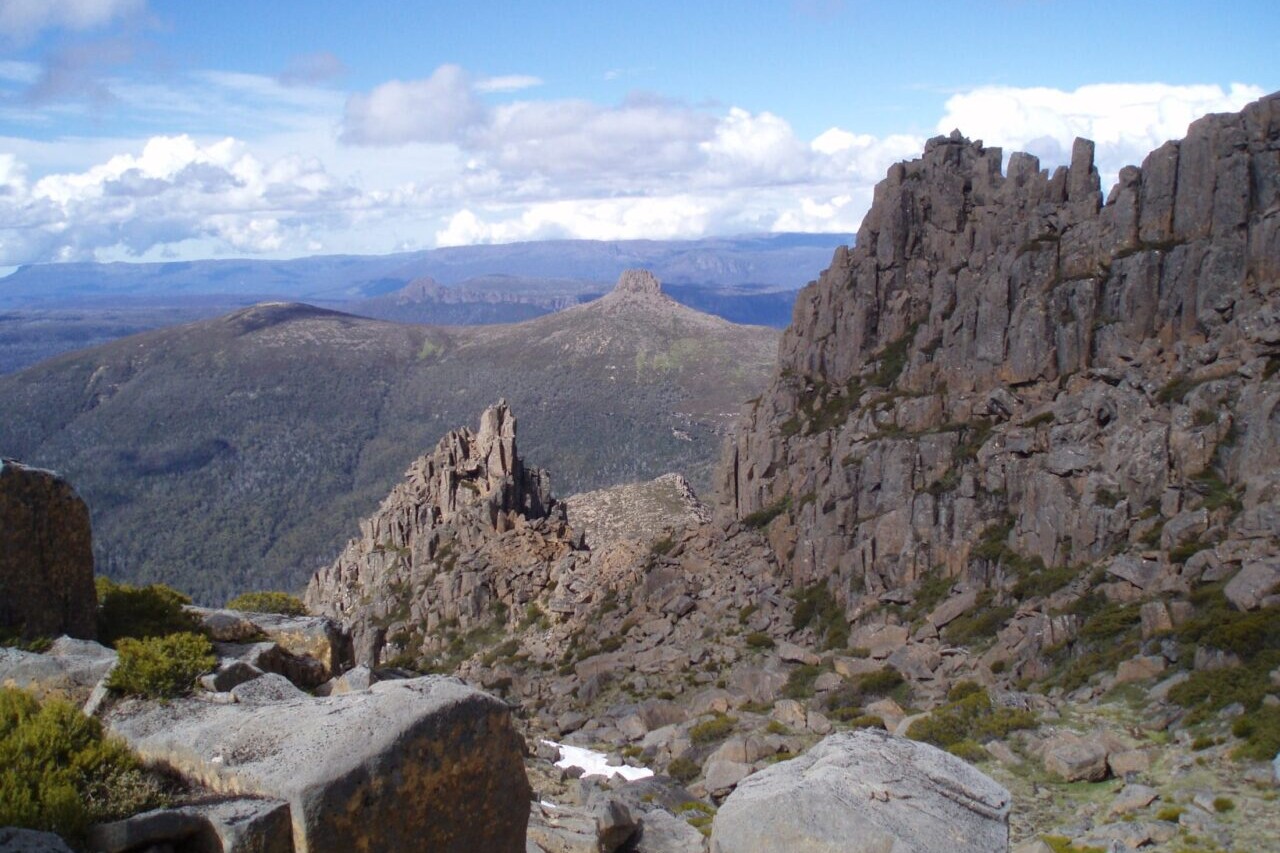
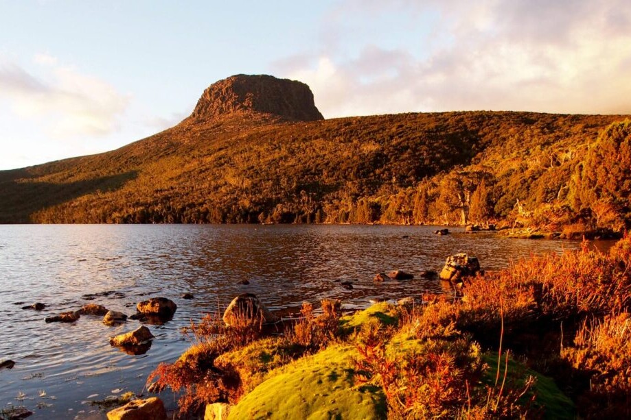
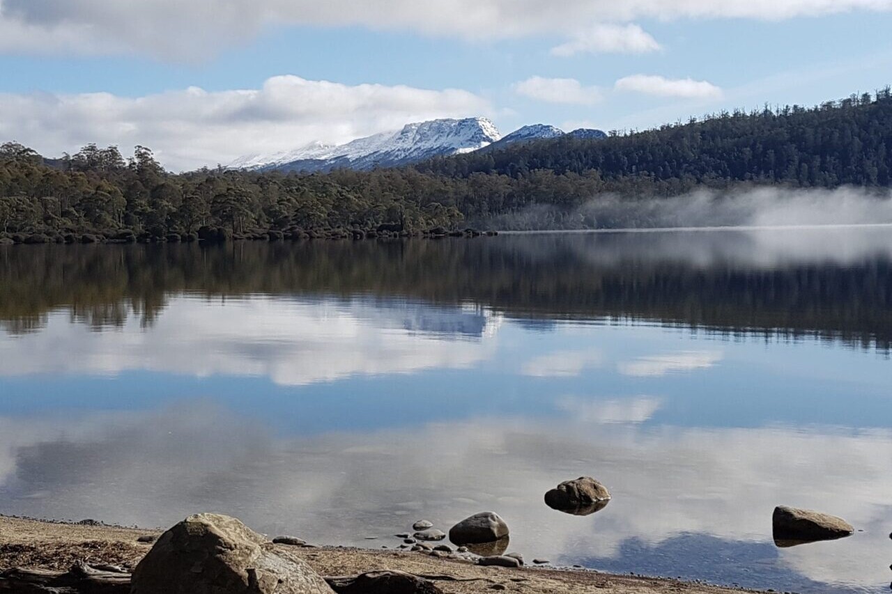
Overland Track
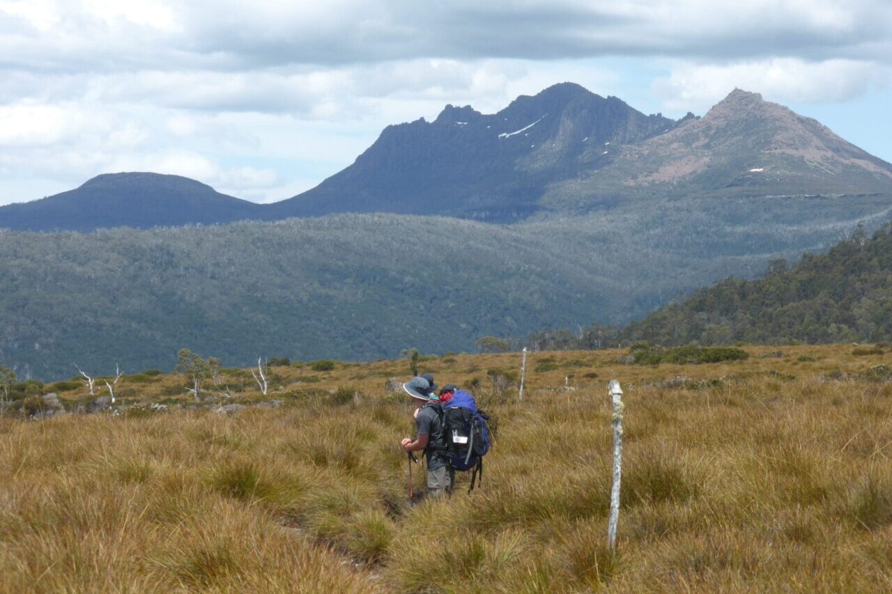
The Overland Track is Tasmania’s iconic hike, located in a World Heritage Area. Hikers will start at beautiful Dove Lake and travel through towering mountains, spectacular views, alpine lakes and plains, magnificent forests, and clear rivers. The rugged and remote Mersey River Gorge and Pine Forest Moor will provide you with a wonderful sense of being in the wilderness. A side trip to Tasmania’s highest peak, Mount Ossa (1617m), will provide 360 degree views across to Frenchman’s Cap and beyond. Australia.
20% off for our Hiking Season Kick-off SALE! The Australia and New Zealand Hiker Special is now $35.99. Explore the Aus NZ Hiker Special!
20% off for our Boxing Day SALE! The Australia and New Zealand Hiker Special is now $35.99. Explore the Aus NZ Hiker Special!
Tasmania, Australia, Overland Track
Photo courtesy of Active Wayz
4.8 ★★★★★ | 17K+ Reviews
Overland Track
72 km / 45 miles • Tasmania, Australia
Download our guide to access the Overland Track map, tracks, waypoints, and comments! The Overland Track is Tasmania's iconic hike, located in a World Heritage Area. Hikers will start at beautiful Dove Lake and travel through towering mountains, spectacular views, alpine lakes and plains, magnificent forests, and clear rivers. The rugged and remote Mersey River Gorge and Pine Forest Moor will provide you with a wonderful sense of being in the wilderness. A side trip to Tasmania’s highest peak, Mount Ossa (1617m), will provide 360 degree views across to Frenchman’s Cap and beyond.
AU$9.99/NZ$9.99/US$5.99 full guide
AU$9.99/NZ$9.99/US$5.99 full guide
Overland Track Map


How can I get it?
Available as an in-app purchase in our Guthook Guides app, a free download from the Apple App Store or the Google Play Store.
Our iOS and Android apps do differ slightly in their appearance. However, the majority of their features remain the same, and they access the same trail guide data.
Hike Australia and New Zealand with a saving of 56% over buying the trails separately. This bundle does not include Te Araroa hikes which are part of the Te Araroa Bundle.
Purchase now and get all future trails added to the bundle for free!
This bundle currently includes: Australian Alps Walking Track, Bibbulmun Track, Cape to Cape, George Bass Coastal Walk, Greenstone and Caples Track, Heysen Trail, Kepler Track, Larapinta Trail, Milford Track, Overland Track, Routeburn Track, Three Capes Track, Walk the Yorke, and Wilsons Promontory Grand Circuit.
AU$69.99 / NZ$77.99 / US$44.99
Distance: One way, 72 km 5-6 Days
The Overland Track located in a World Heritage area is Tasmania’s iconic hike. Start out at the beautiful Dove Lake and marvel at Cradle Mountain with its distinctive rock outcrops towering above. The side trip to climb Cradle Mountain rewards you with spectacular views over the glacially formed alpine lakes, tarns and far off mountains. As you hike south, the dominant dolerite peak of Barn Bluff commands your attention from the surrounding alpine plains.
Magnificent Pandani palms with their dark green spiky leaves flourish like an oasis in the shelter of Waterfall Valley. Enjoy a snack on the sandy beach of Lake Will and even a swim in its icy waters.
Like medieval Japanese paintings, the pencil pines with their ancient trunks and spindly foliage reflect into the tranquil Lake Windemere waters. The views down to the rugged and remote Mersey River Gorge from Pine Forest Moor provide you with a wonderful sense of being in the wilderness.
The peaks of West Pelion and the very distinctive East Pelion stand like sentinels. A side trip to Tasmania’s highest peak Mount Ossa (1617 m) can provide 360 degree views across to Frenchman’s Cap and beyond.
The Du Cane Range has some magnificent forests and views. Following the Narcissus River downstream towards Lake St Clair provides great views of The Acropolis and Mt Geryon. When you arrive at Lake St Clair you can either catch the ferry or meander along beside the lake in a beautiful forest.
Start: Dove Lake, Lake St Clair.
Seasons: Spring, Summer and Autumn. Weather conditions can change quickly and snow, hail and rain can occur any time of the year – even summer!
AUD$9.99 / NZ$9.99 / US$5.99
Photos of the Overland Track
Hike more.
Check out some of the other trail guides we offer!
About our partner
Active Wayz
Activewayz is very passionate about the outdoors, whether it be hiking, bushwalking, or tramping. They enjoy mapping new routes and planning new adventures to share in the app. They have incorporated their love for adventure, long-distance hiking, and mapping to create a resourceful guide in Australia and New Zealand.
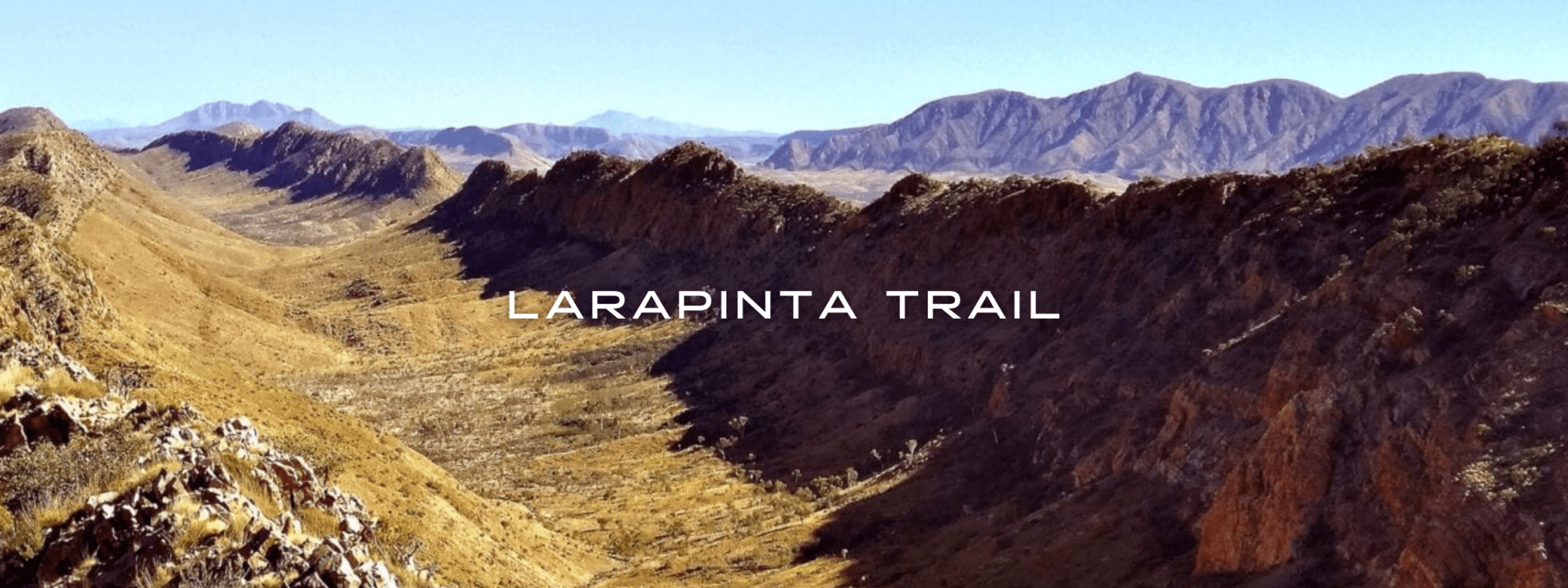
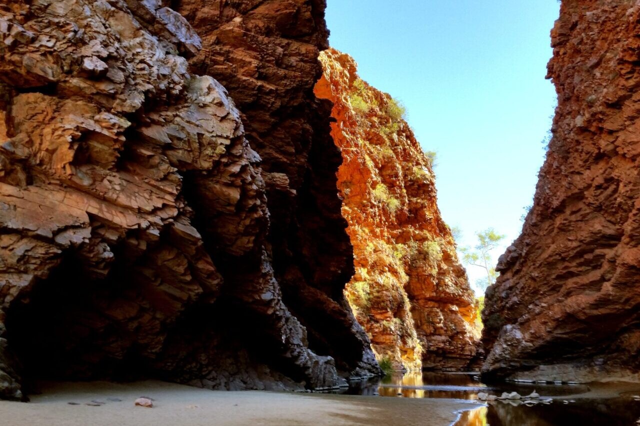
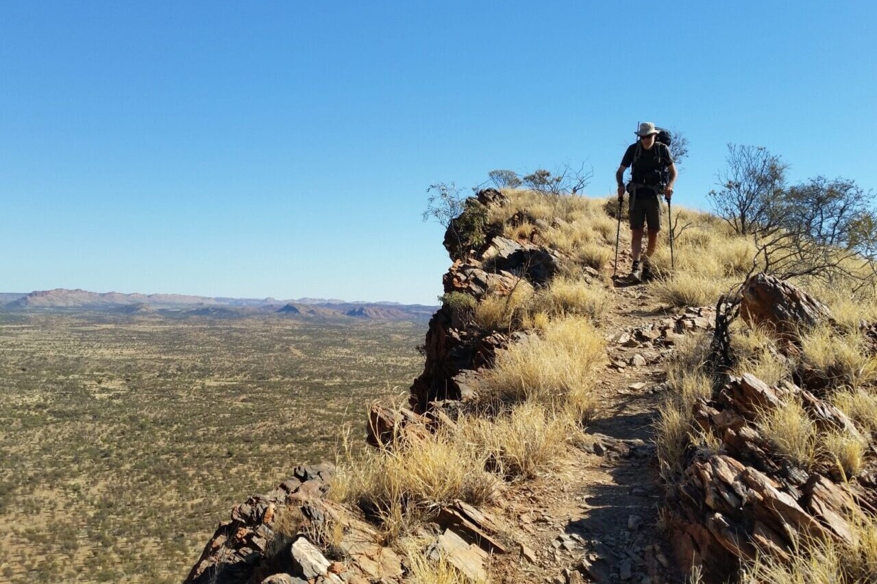
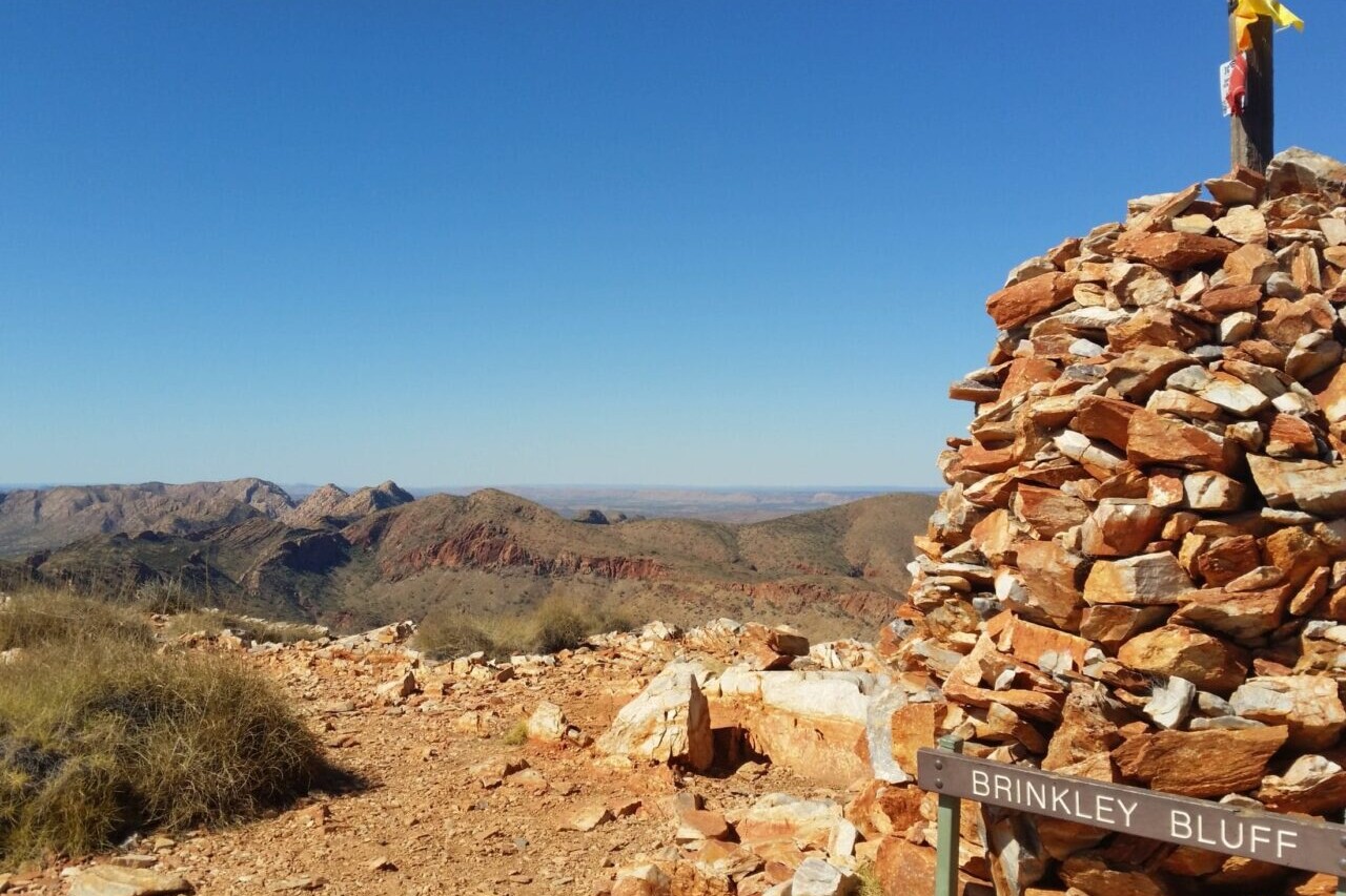
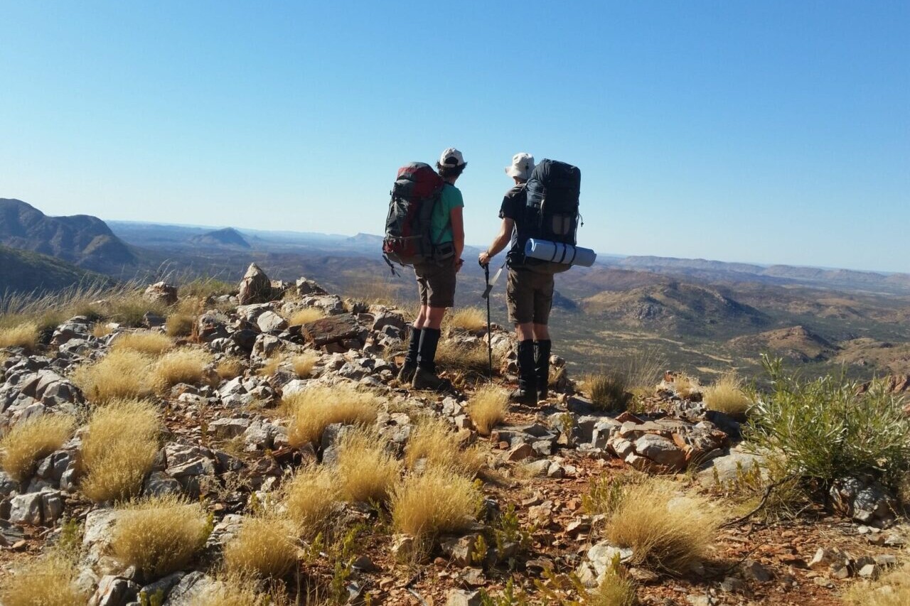
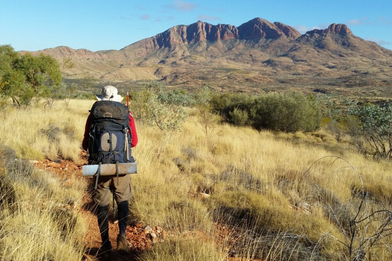
Larapinta Trail
The Larapinta Trail travels 223 km (140 mi) through the heart of Central Australia, covering some of the most spectacular ranges and gorges within the vast Australian outback desert. The deep red gorges and cool waterholes offer an oasis in a very hot and arid land. On the rugged rocky ridges, you can see all the way to far off ranges without any sign of human development.
20% off for our Hiking Season Kick-off SALE! The Australia and New Zealand Hiker Special is now $35.99. Explore the Aus NZ Hiker Special!
20% off for our Boxing Day SALE! The Australia and New Zealand Hiker Special is now $35.99. Explore the Aus NZ Hiker Special!
Australian Outback, Larapinta Trail
Photo courtesy of Active Wayz
4.8 ★★★★★ | 17K+ Reviews
Larapinta Trail
223 km / 140 miles • Northern Territory, Australia
Download our guide to access the Larapinta Trail map, tracks, waypoints, and comments! The Larapinta Trail travels 223 km (140 mi) through the heart of Central Australia, covering some of the most spectacular ranges and gorges within the vast Australian outback desert. The deep red gorges and cool waterholes offer an oasis in a very hot and arid land. On the rugged rocky ridges, you can see all the way to far off ranges without any sign of human development.
AU$14.99/NZ$16.99/US$9.99 full guide
AU$14.99/NZ$16.99/US$9.99 full guide
Larapinta Trail Map


How can I get it?
Available as an in-app purchase in our Guthook Guides app, a free download from the Apple App Store or the Google Play Store.
Our iOS and Android apps do differ slightly in their appearance. However, the majority of their features remain the same, and they access the same trail guide data.
Hike Australia and New Zealand with a saving of 56% over buying the trails separately. This bundle does not include Te Araroa hikes which are part of the Te Araroa Bundle.
Purchase now and get all future trails added to the bundle for free!
This bundle currently includes: Australian Alps Walking Track, Bibbulmun Track, Cape to Cape, George Bass Coastal Walk, Greenstone and Caples Track, Heysen Trail, Kepler Track, Larapinta Trail, Milford Track, Overland Track, Routeburn Track, Three Capes Track, Walk the Yorke, and Wilsons Promontory Grand Circuit.
AU$69.99 / NZ$77.99 / US$44.99
Australia, 231 km, Desert/Outback, 13-18 Days.
The Larapinta Trail, in the heart of Central Australia, runs 223km along the spine of the West MacDonnell Ranges covering some of the most spectacular ranges and gorges within the vast Australian outback desert.
The deep red gorges and cool waterholes offer an oasis for a refreshing swim in a very hot and arid land. On the rugged rocky ridges, formed millions of years ago by the rock layers being pushed on edge, you can see forever – to far off ranges without any sign of human development.
AUD$14.99 / NZ$16.99 / US$9.99
Photos of the Larapinta Trail
Hike more.
Check out some of the other trail guides we offer!
About our partner
Active Wayz
Activewayz is very passionate about the outdoors, whether it be hiking, bushwalking, or tramping. They enjoy mapping new routes and planning new adventures to share in the app. They have incorporated their love for adventure, long-distance hiking, and mapping to create a resourceful guide in Australia and New Zealand.
A Lookingglass Lake Loop
Planning an adventure? Check out our popular trail guides! 4.7 stars (14K+ ratings)
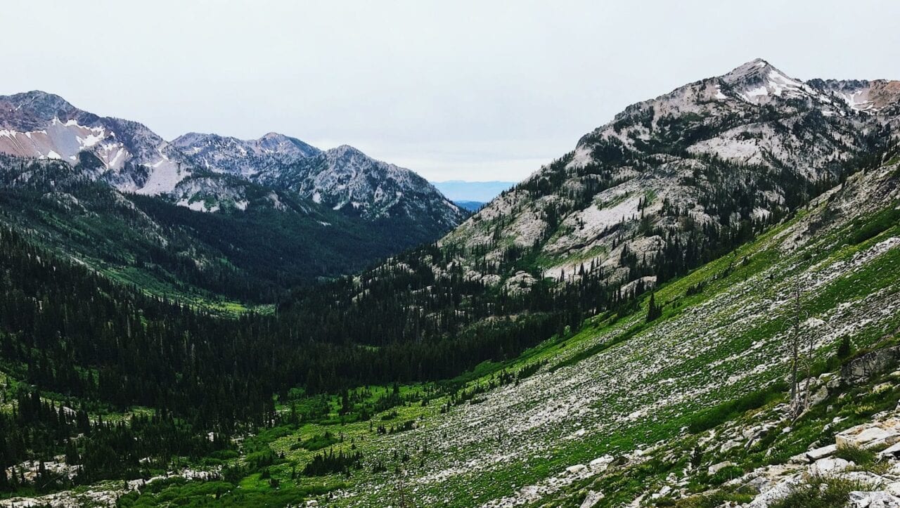
Eagle Cap Wilderness, Wallowa Whitman National Forest
Photo by Zoë Symon
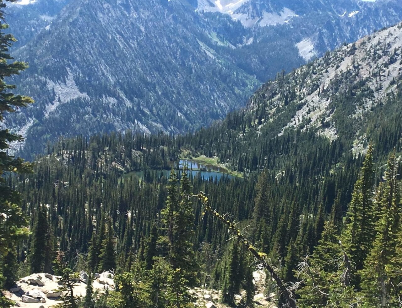
A Lookingglass Lake Loop
It’s the middle of winter right now in Eastern Oregon. I’ve been looking out the window at snow and dreaming of Spring and Summer. As I think about hiking season and plan hikes for this summer, I keep looking back on some of my favorite trips from last year.
Zoë Symon Trip Report 02/05/2019
Zoë Symon
Trip Report
02/05/2019
I’m extremely lucky to live in this part of the country. The Eagle Cap Wilderness is a vast, beautiful section of the Wallowa Whitman National Forest. It is less crowded and more remote than some of the more popular hiking areas in Oregon, and has quickly become one of my favorite hiking destinations.
Last summer, Evan and I took many backpacking trips into the Eagle Cap Wilderness, but one that stands out in particular is our loop hike of about 25 miles that took us to seven beautiful alpine lakes on the southwest side of the forest.
Day 1
This blog post could probably be titled “How To Make the Most of A Weekend”. We left late in the afternoon on Friday and the two-hour drive got us to the trailhead by 6pm. This left us with enough time to hike hard to make it to our planned campsite at Lookingglass Lake by sunset around 9:30, or at least we hoped so.
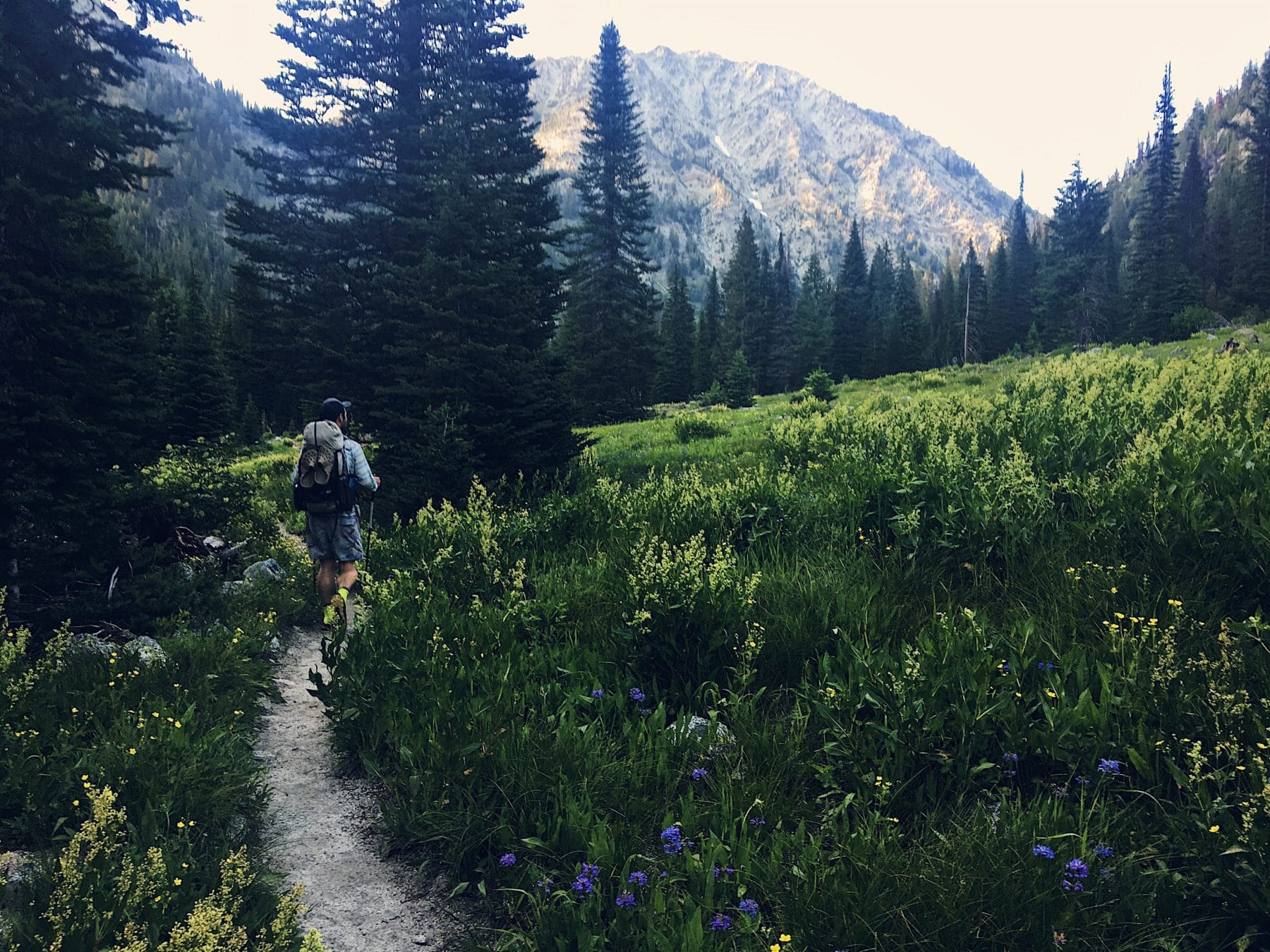
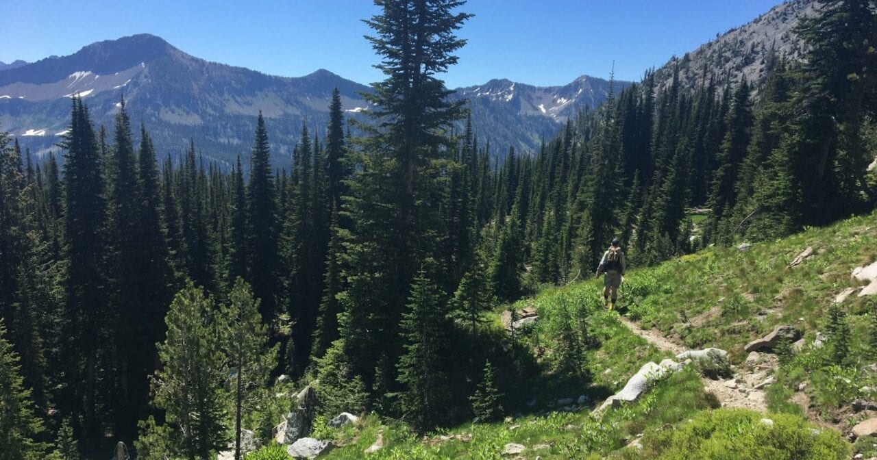
Evan hikes through a meadow on the way to our first campsite.
Photo by Zoë Symon
On the first leg of the hike we crossed beautiful rivers and creeks, walked lush meadows, and climbed rocky trails through evergreen forests. Though we hiked fast, it became clear that we weren’t going to reach our planned destination.
We stepped out of a forested section and into a valley with towering peaks on either side. It was beautiful, and we decided to look for a campsite there rather than making the steep ascent and descent to Lookingglass Lake.
There was one other group camped in the area, but with such a big and beautiful area, we hardly noticed. Finding a suitable place to pitch our tent was another matter. The ground was rocky, making it difficult to pitch our non-freestanding tent with stakes. We ended up using rocks to anchor our lines, and it worked great! The setting sun was quickly turning our little valley cold, so we quickly ate dinner and climbed into our sleeping bags for warmth, occasionally sticking our heads out to look at the array of stars above.
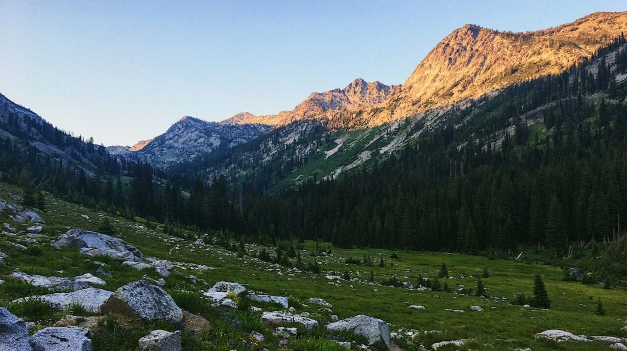
The valley where we found our first campsite.
Photo by Zoë Symon
Day 2
Day two dawned just as beautiful as the previous day. Knowing we had a long day ahead of us, we packed and ate quickly, and made our way to the trail junction that would take us to the first 5 of our 7 lakes.
We quickly came upon a wide, shallow creek. There was no way to cross except by wading, but the cold clear water felt great on our feet. After that, we began the steep ascent to the ridge that surrounded the lakes. Though tough, the ascent afforded us some amazing views of the peaks and valleys in the area.
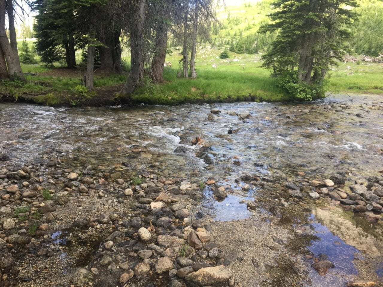
The only creek we had to ford for the entire weekend.
Photo by Zoë Symon
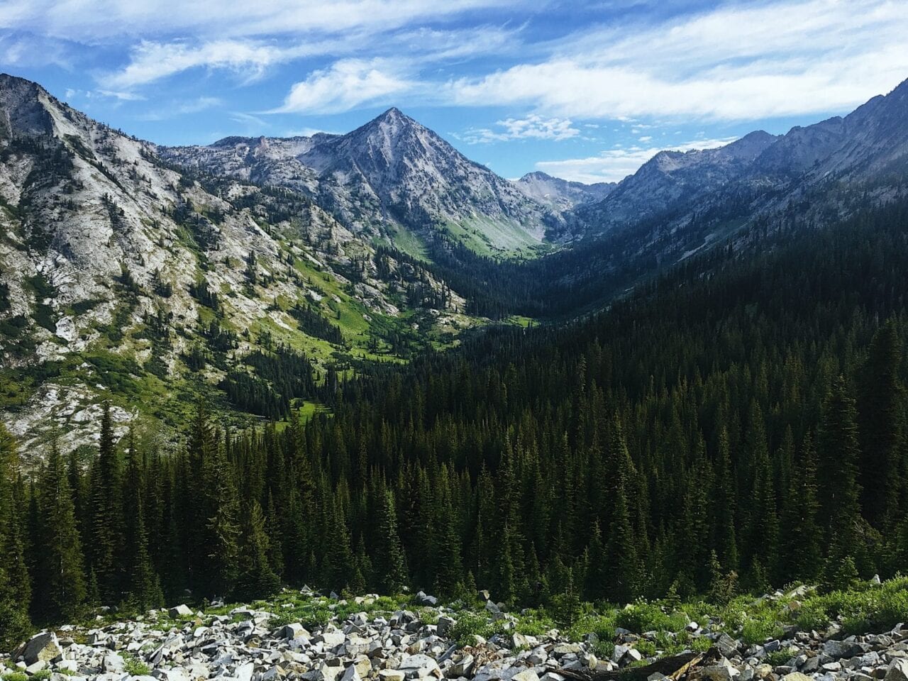
Views from the climb.
Photo by Zoë Symon
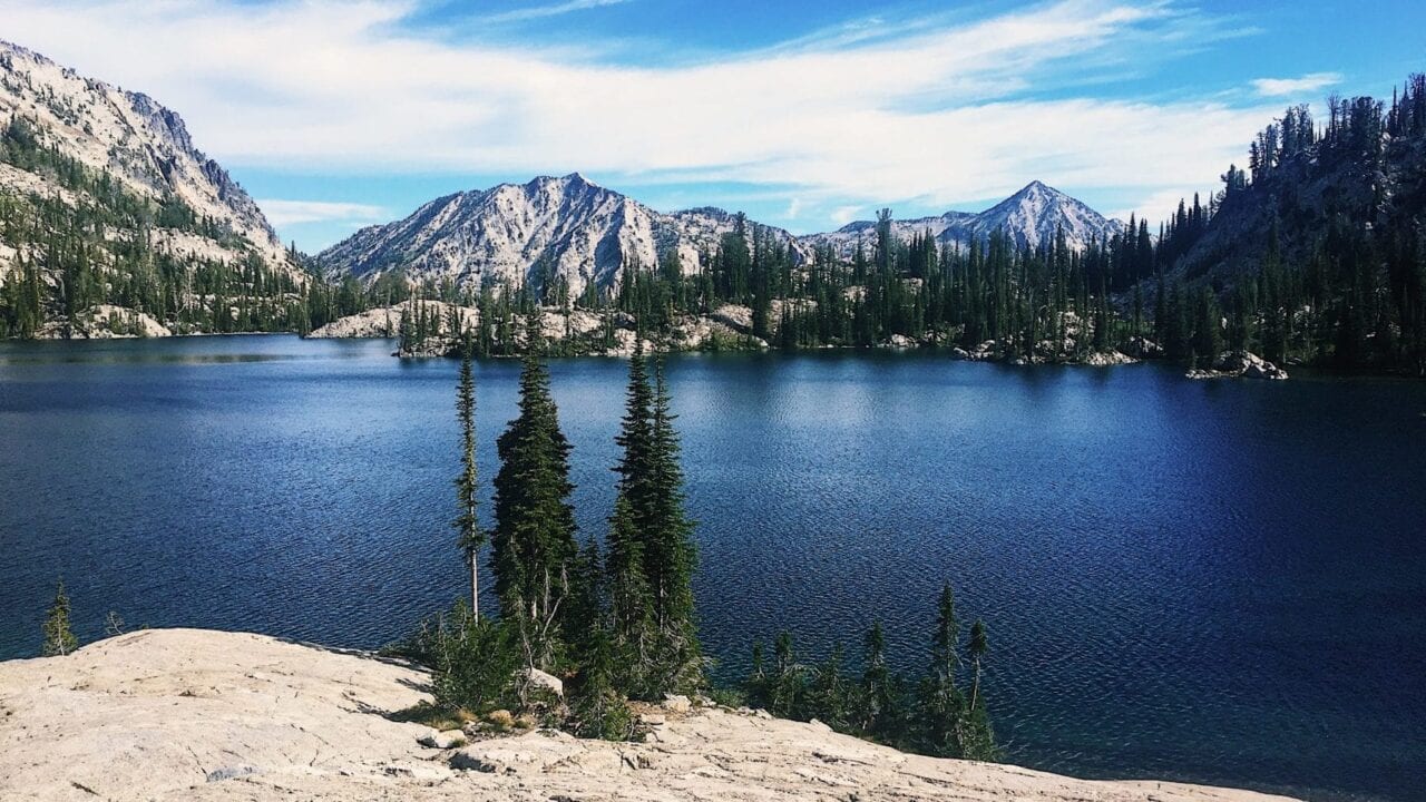
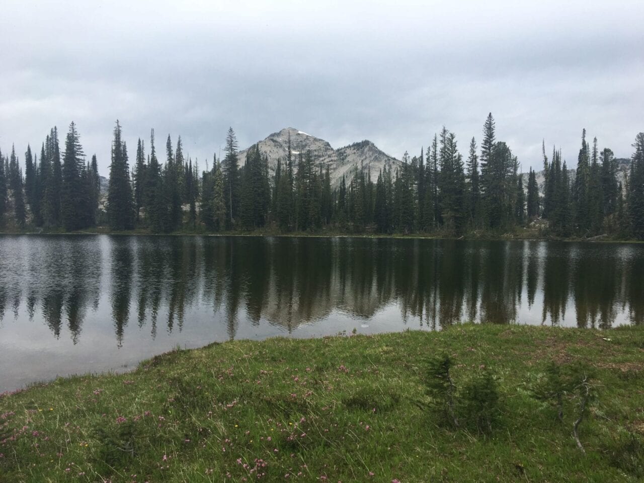
We walked through evergreen forests and marshy meadows, passing a few tiny lakes and ponds before getting a glimpse of our first destination: Lookingglass Lake. The large blue lake was beautiful, surrounded by rocky peaks, and we quickly descended to get a closer look. The blue water sparkled in the rising sun that was just starting to warm the rocks on the shore. We decided to take a break by the lake for a while, and enjoy the sun.
Our second destination of the day was Culver Lake, a smaller lake with more tree cover. We lounged for a bit in a lakeside lounge chair made out of branches, but left pretty quickly due to a rotting deer carcass nearby.
Our third lake was Bear Lake. Like Lookingglass, Bear Lake was surrounded by tall peaks that still showed pockets of snow on their slopes. It also offered great views of more distant peaks, and had a wide, open meadow on the shore where we rested and had another snack.
Lookingglass Lake.
Photo by Zoë Symon
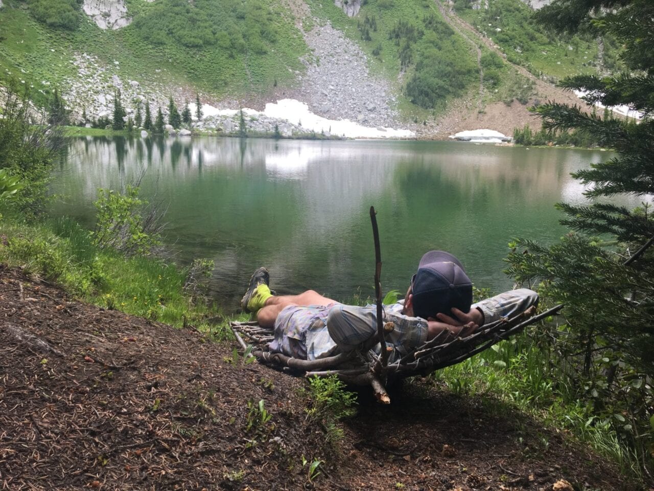
Relaxing at Culver Lake.
Photo by Zoë Symon
Bear Lake. The day had gotten a little more gray by this point.
Photo by Zoë Symon
After Bear Lake, we descended back towards our campsite from the first night, and waded back over the creek, rejoining the main trail. We continued to follow the trail, passing a couple other groups of hikers, and eventually reached the turn for our fourth lake, Eagle Lake.
The trail to Eagle Lake took us up another steep slope that skirted the edge of Needle Point, a prominent peak in the area. We couldn’t see Eagle Lake until we were right on top of it, stepping into a large area framed on all sides by rocky cliffs. Eagle Lake is also one of the few in the Wilderness that is held back by an old manmade dam.
Of all the lakes we visited on this trip, Eagle was by far the most rocky and the least green. It was almost as if we had stepped into an alien world.
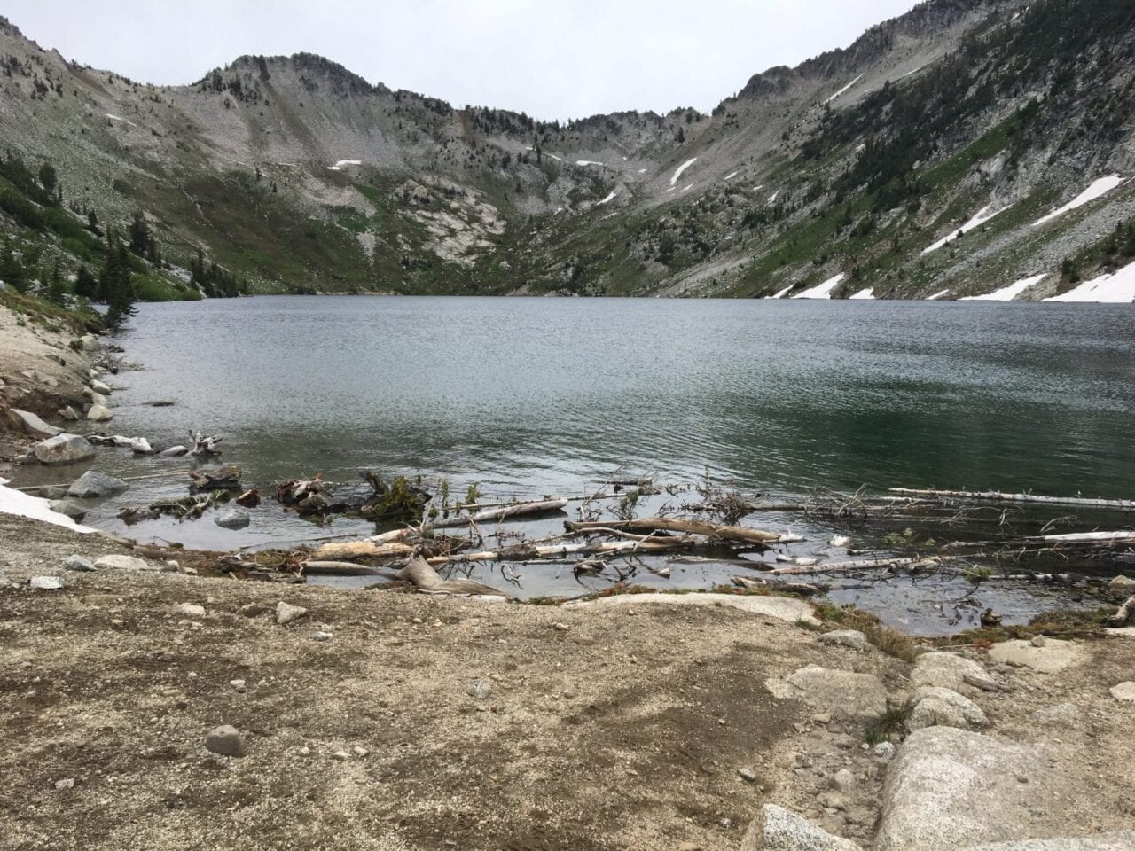
Eagle Lake. Deceptively small-looking. The lake is actually huge!
Photo by Zoë Symon

Evan and Springer stand near the dam.
Photo by Zoë Symon
We descended back and again rejoined the main trail with beautiful views of the surrounding area the whole way down. Beginning to get tired, we stopped for another snack before continuing on. Though the sky had turned gray, and a misty rain began to fall, the rest of the hike was still beautiful. We made our way to the fifth and final lake of the day, Cached Lake. There was ample flat area in the forested areas around the lake, and we quickly picked a spot to pitch our tent. The clouds stayed for the evening, and we fell asleep with a soft rain on our tent.
Day 3
Our third and final day brought us our highest point of the hike, our last two lakes, and our return to civilization. We packed up in the morning and headed out. With Cached Lake in sight, we opted to avoid the trail through a soggy, swampy meadow, and instead walked through a drier part of the woods.
The highest point of our whole hike. Above 8000 ft!
Photo by Zoë Symon
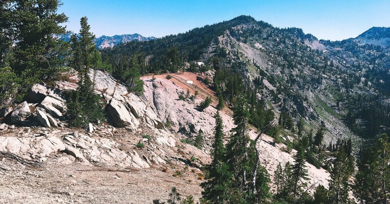
We met back up with the trail and continued our climb to over 8000 feet. The trail after the lake quickly left water behind, and we were glad we had stocked up on water before leaving camp.
The rocky, dusty climb traveled around the sides of parks before depositing us on top of a rocky ridge that offered spectacular 360 views of the surrounding Wilderness. We took a break, soaking up sun, views, and snacks, before descending down the other side of the ridge.
We eventually made it to our next junction, and a sign warned us that the trail was not maintained for stock through Bench Canyon. The reason for this sign soon became obvious. The next section of trail was grueling, undoubtedly the most difficult part of our hike.
We made it to the top of the pass and were rewarded with a view of our sixth lake, Arrow Lake. Though the trail didn’t get as close to Arrow as it did to the other lakes, it was a quick walk over to check it out.
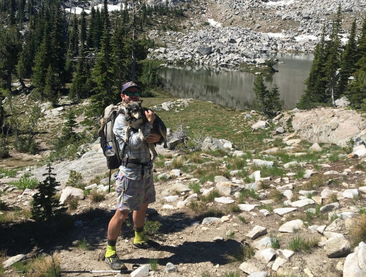
Evan and Springer celebrate the end of our climb. Arrow Lake in the background.
Photo by Zoë Symon
Heart Lake from afar. You can tell how it got it’s name!
Photo by Zoë Symon
We continued our descent back to the trailhead, making a quick detour to look at Heart Lake along the way. By the time we reached the trailhead, we were dusty, sore, and happy. We opted to take a quick dip in the cold, clear river, rinsing the dust from our feet and soaking our sore legs. The two hour drive home was a welcome chance to rest our legs and reflect on a great trip.
This was definitely an amazing hike, and one I’d like to do again. Lookingglass Lake, in particular, is one of the most spectacular places I’ve visited, and I’m excited to return in the future! There are so many great hikes to take in the Eagle Cap Wilderness. I can’t wait for summer so that we can start exploring again!
Evan descends on the trail towards Heart Lake.
Photo by Zoë Symon
Want to keep up with all that’s going on at Atlas Guides? Sign up for our newsletter!
Read more!
Check out some related blog posts!
Download our popular hiking and biking guides!

Trail guides that get you to places you’ve dreamed of.
As the makers of Guthook Guides, Bikepacking Guides, and Cyclewayz, we help you navigate the most popular trails around the world on your smartphone. Our hiking guides and biking guides work completely offline. Let Guthook guide your next adventure!
Showers Lake Vista, Tahoe Rim Trail
Photo courtesy of the Tahoe Rim Trail Association

Showers Lake Vista, Tahoe Rim Trail
Photo courtesy of the Tahoe Rim Trail Association
Trail guides that get you to places you’ve dreamed of.
As the makers of Guthook Guides, Bikepacking Guides, and Cyclewayz, we help you navigate the most popular trails around the world on your smartphone. Our hiking guides and biking guides work completely offline. Let Guthook guide your next adventure!
Download our popular hiking and biking guides!
About the Author

Zoë Symon
Zoë grew up in North Carolina and first heard of the Appalachian Trail during her time in college. In 2016, she took a leave of absence from her job and thru-hiked the trail. This adventure fostered her love for the outdoors and for hiking. Currently, she explores the public lands of Oregon. In 2017 she joined the team at Atlas Guides as Creative Director. She spends her days improving experiences for all our users.
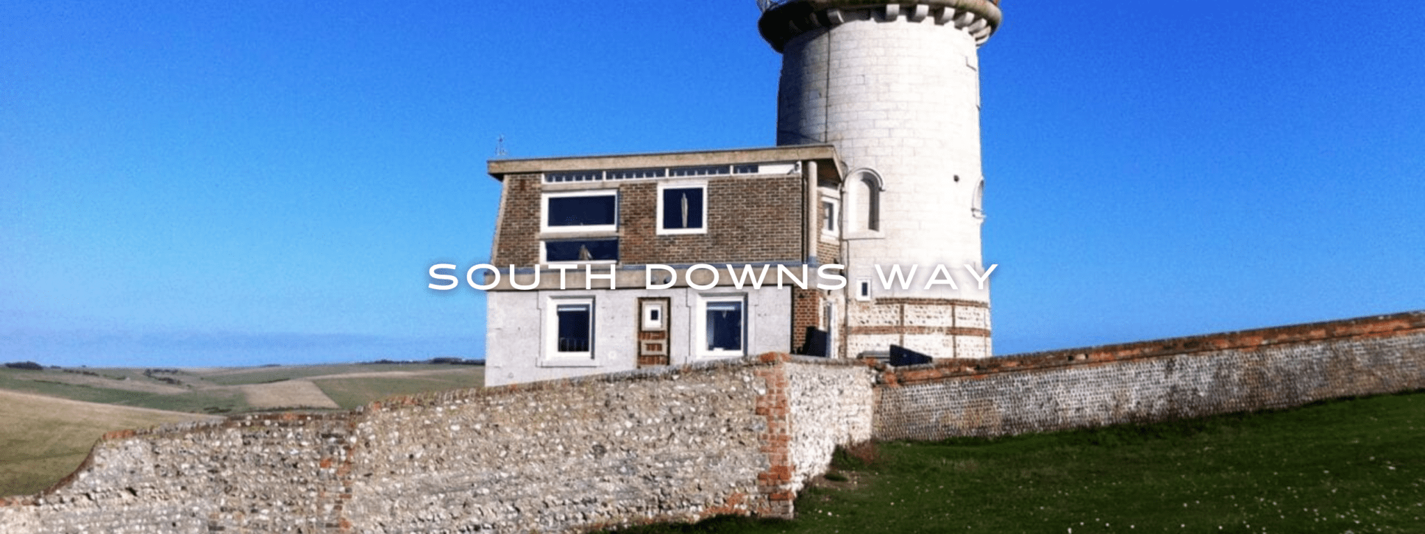
South Downs Way
Official Companion App to the Trailblazer Guidebook to the South Downs Way. The South Downs Way is a 100-mile (160km) National Trail that follows the line of chalk hills stretching from Winchester in Hampshire across Sussex to Eastbourne. Walking the length of the Downs is the best way to experience this beautiful landscape with its mixture of rolling hills, steep hanging woodland and windswept fields. You’ll also pass postcard-worthy picturesque villages with welcoming pubs, thatched cottages, and quintessentially English country gardens. This app is the companion to Trailblazer’s South Downs Way guide book. England, U.K., UK, Europe.
20% off for our Hiking Season Kick-off SALE! The Trailblazer Special is now $19.99. Explore the Trailblazer Special!
20% off for our Boxing Day SALE! The Trailblazer Special is now $18.99. Explore the Trailblazer Special!
England, South Downs Way
Photo courtesy of Trailblazer Guides
4.8 ★★★★★ | 17K+ Reviews
South Downs Way
100 miles • England
Official Companion App to Trailblazer's South Downs Way by Jim Manthorpe and Daniel McCrohan
Download our guide to access the South Downs Way map, tracks, waypoints, and comments! The South Downs Way is a 100-mile (160km) National Trail that follows the line of chalk hills stretching from Winchester in Hampshire across Sussex to Eastbourne. Walking the length of the Downs is the best way to experience this beautiful landscape with its mixture of rolling hills, steep hanging woodland and windswept fields. You'll also pass postcard-worthy picturesque villages with welcoming pubs, thatched cottages, and quintessentially English country gardens. This app is the companion to Trailblazer's South Downs Way guide book.
$4.99 full guide A Trailblazer Guide
$4.99 full guide
A Trailblazer Guide
South Downs Way Map


How can I get it?
The South Downs Way map is available as an in-app purchase in our Guthook Guides app, a free download from the Apple App Store or the Google Play Store.
Our iOS and Android apps do differ slightly in their appearance. However, the majority of their features remain the same, and they access the same trail guide data.
Purchase all Trailblazer apps in one package. Includes South Downs Way, Coast to Coast, West Highland Way, Hadrian’s Wall Path, The Cotswold Way, and The Ridgeway. Purchase now and you will receive any new apps we add in the future at no additional cost.
$24.99
This app is the companion to Trailblazer’s South Downs Way guide book. The South Downs Way is a 100-mile (160km) National Trail that follows the line of chalk hills stretching from Winchester in Hampshire across Sussex to Eastbourne. Walking the length of the Downs is the best way to experience this beautiful landscape with its mixture of rolling hills, steep hanging woodland and windswept fields. You’ll also pass picture-postcard villages with welcoming pubs, thatched cottages and quintessentially English country gardens.
$4.99
Photos of South Downs Way


Hike more.
Check out some of the other trail guides we offer!
About our partner
Trailblazer Guides
Since 1991 Trailblazer has been publishing a select list of practical guidebooks written by travellers for travellers. Their guidebooks include everything from adventure travel guides, to rail guides, to worldwide trekking guides, including British walking guides. Trailblazer guides are entertaining as well as informative, and are strong on practical information without neglecting the cultural background.
Atlas Guides created and maintains the official app of Trailblazer’s British Walking Guides.
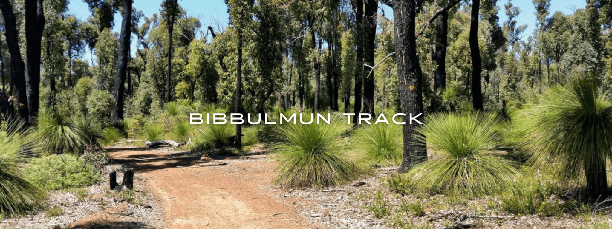
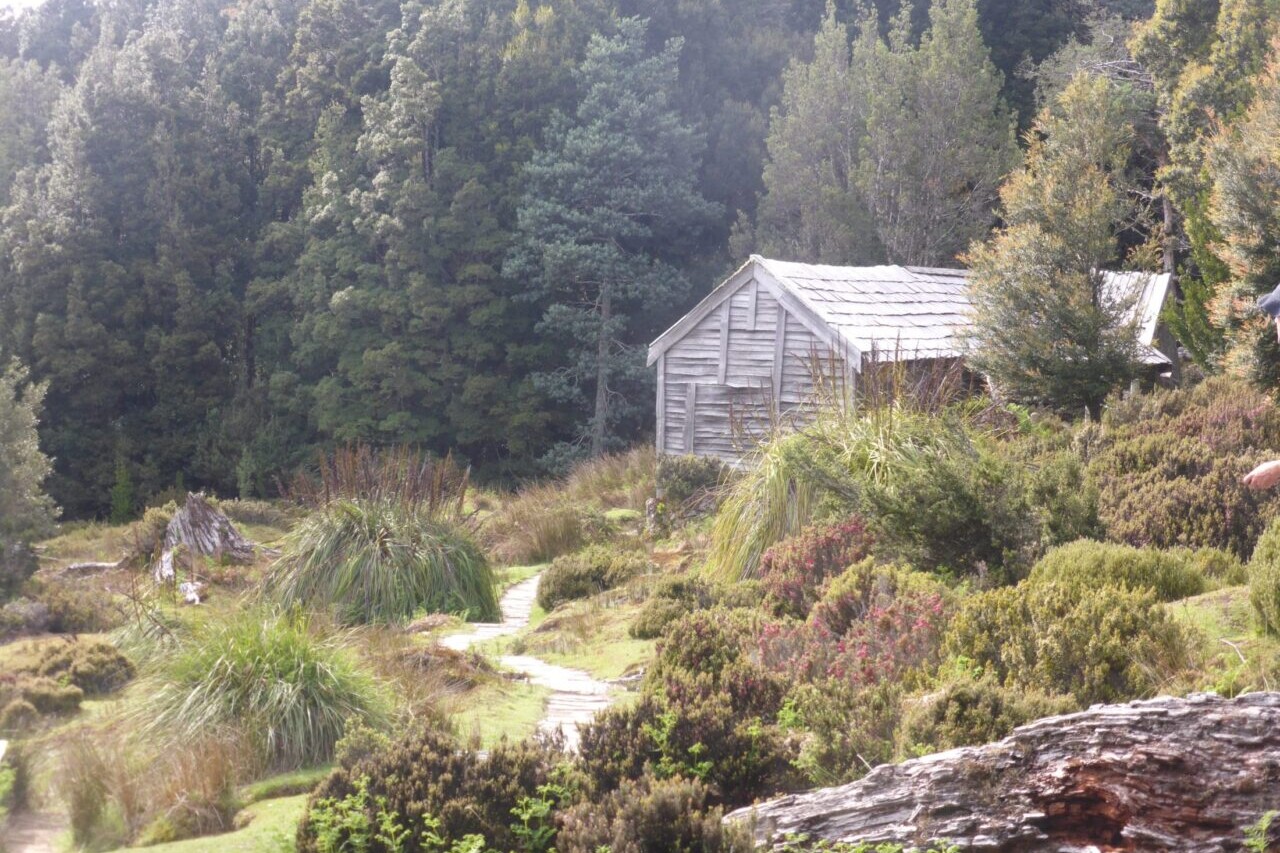
Bibbulmun Track
The Bibbulmun Track showcases ancient old growth karri forests, tingle trees, breathtaking wildflowers, and stunning coastal scenery. A long distance hike that passes through small country towns and peaceful forests, there are well placed shelters with water tanks each night, and tiny birds that sound like bells will wake you up each morning. A journey for the soul not to be missed; just keep watch for snakes!
20% off for our Hiking Season Kick-off SALE! The Australia and New Zealand Hiker Special is now $35.99. Explore the Aus NZ Hiker Special!
20% off for our Boxing Day SALE! The Australia and New Zealand Hiker Special is now $35.99. Explore the Aus NZ Hiker Special!
Western Australia, Bibbulmun Track
Photo courtesy of Active Wayz
4.8 ★★★★★ | 17K+ Reviews
Bibbulmun Track
1000 km / 620 miles • Western Australia
Download our guide to access the Bibbulmun Track map, tracks, waypoints, and comments! The Bibbulmun Track showcases ancient old growth karri forests, tingle trees, breathtaking wildflowers, and stunning coastal scenery. A long distance hike that passes through small country towns and peaceful forests, there are well placed shelters with water tanks each night, and tiny birds that sound like bells will wake you up each morning. A journey for the soul not to be missed; just keep watch for snakes!
AU$22.99/NZ$25.99/US$14.99 full guide
AU$22.99/NZ$25.99/US$14.99 full guide
Bibbulmun Track Map


How can I get it?
Available as an in-app purchase in our Guthook Guides app, a free download from the Apple App Store or the Google Play Store.
Our iOS and Android apps do differ slightly in their appearance. However, the majority of their features remain the same, and they access the same trail guide data.
Hike Australia and New Zealand with a saving of 56% over buying the trails separately. This bundle does not include Te Araroa hikes which are part of the Te Araroa Bundle.
Purchase now and get all future trails added to the bundle for free!
This bundle currently includes: Australian Alps Walking Track, Bibbulmun Track, Cape to Cape, George Bass Coastal Walk, Greenstone and Caples Track, Heysen Trail, Kepler Track, Larapinta Trail, Milford Track, Overland Track, Routeburn Track, Three Capes Track, Walk the Yorke, and Wilsons Promontory Grand Circuit.
AU$69.99 / NZ$77.99 / US$44.99
Australia, 1002km, Mixed country, 2 months approximately
The Bibblumun Track – Ancient old growth karri forests, tingle trees, breathtaking wildflowers and stunning coastal scenery. A long distance hike that passes through small country towns and peaceful forests. There are well placed shelters (with water tanks) each night and not too many hills!
Tiny birds that sound like bells wake you up each morning. A landscape that meanders along as the mind often does the same on a slow hike. A wonderful place to absorb subtle changes. A journey for the soul not to be missed! Just keep alert to the snakes!
AUD$22.99 / NZ$25.99 / US$14.99
Photos of the Bibbulmun Track
Hike more.
Check out some of the other trail guides we offer!
About our partner
Active Wayz
Activewayz is very passionate about the outdoors, whether it be hiking, bushwalking, or tramping. They enjoy mapping new routes and planning new adventures to share in the app. They have incorporated their love for adventure, long-distance hiking, and mapping to create a resourceful guide in Australia and New Zealand.
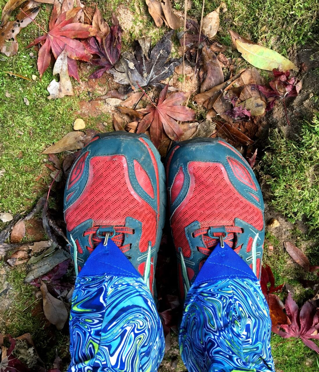
10 Thru-Hiking Gifts for Under $20
Planning an adventure? Check out our popular trail guides! 4.8 stars (17K+ ratings)
Hiking up to a ridge.
Photo by Holly Mandarich
10 Thru-Hiking Gifts for Under $20
Whether you're stuffing stockings or just looking for affordable gifts for the hiker, thru-hiker, backpacker, or outdoorsperson in your life, you're sure to find something on this list.
Zoë Symon Inside Atlas Guides 11/30/2018
Zoë Symon
Inside Atlas Guides
11/30/2018
Prices are listed as they were at the time of writing. No products were donated or given for the purposes of review.
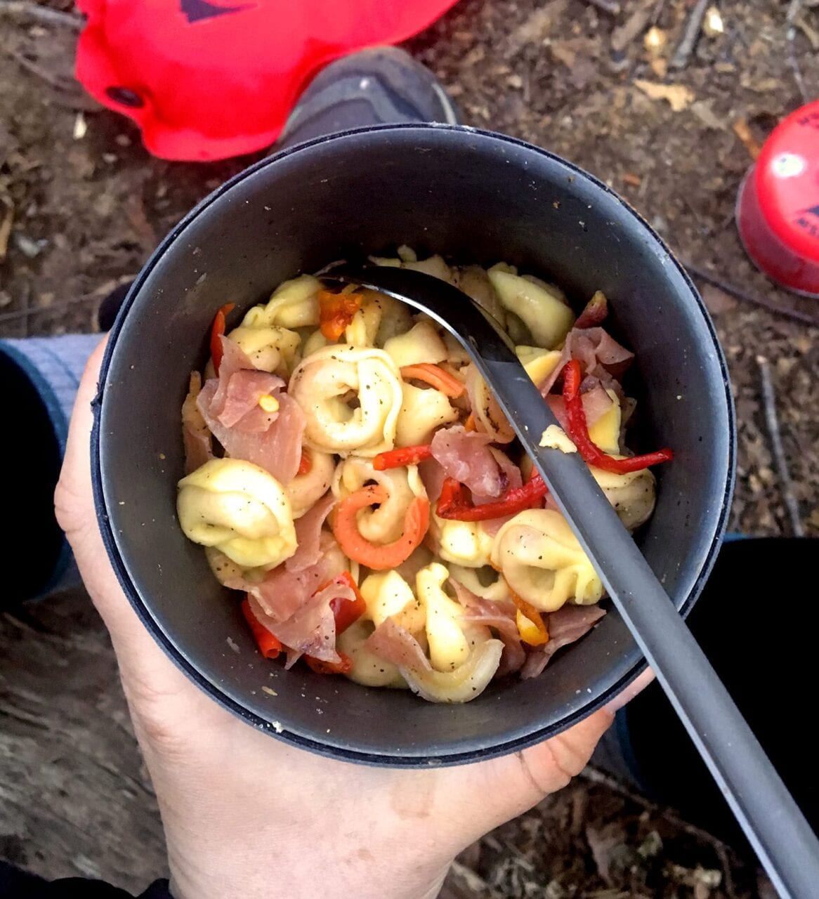
Hiker dinner, featuring a long-handled spoon.
Photo by Zoë Symon
1. Long-handled Spoon
This is a thru-hiking and backpacking necessity, and chances are, most thru-hikers already have one. If not, though, this is the ultimate affordable outdoors gift: able to reach the bottom of a peanut butter jar, and it won’t break. (Can you tell this is my favorite item?)
Most companies offer either a stainless steel or titanium spoon, and most weigh around 0.5 oz or less. Below are a few options.
Sea to Summit Alpha Long Spoon ($8.95, 0.4 oz)
Toaks Titanium Long Handle Spoon ($10.95, 0.65 oz)
MSR Alpine Long Tool Spoon ($9.95, 0.3 oz)
Optimus Titanium Long Spoon ($9.95, 0.67 oz)
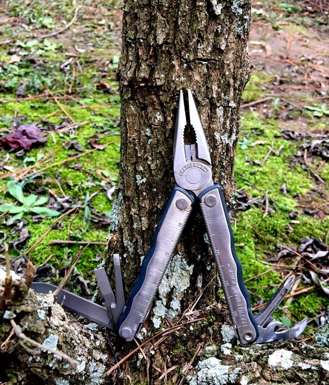
This multi-tool is a little bigger than the ones that most hikers carry, but it was found on the trail, and you can’t beat free for price!
Photo by Zoë Symon
2. Multi-tool
This one may be a little over $20, but it’s so useful it belongs on here. Also, it’s really helpful to have all your tools in one! This is doubly true for thru-hikers and backpackers where space and weight are big issues.
When selecting a multi-tool, keep weight in mind: the smaller and lighter the better, but not so small and light that it’s useless. Also, scissors as part of the multi-tool are a necessity. They are useful for opening food packages, cutting tape to repair gear, cutting someone’s old paracord out of trees, and so much more. Below are a few good options.
Gerber Dime Butterfly-opening Multi-tool ($21, 2.2 oz)
Leatherman Style CS Multi-tool ($29.95, 1.4 oz)
Leatherman Micra Multi-tool ($23.96, 1.8 oz)

Granola bars are another good snack food and have a wide variety.
Photo by Alice Pasqual
3. Snacks
Hiker hunger is a well-known phenomenon, and most thru-hikers do love to eat, but food as a gift is tricky. Consider giving an IOU for snacks for their next hike rather than buying a million Clif Bars now. Also, maybe don’t go for only Clif Bars… other options are below.
ProBar Meal (~$3.50/bar, vegan)
Epic Meat Bar (~$2.50/bar, paleo)
These links will take you to the company websites, where they only sell in bulk. Most health food stores or outdoor retailers will sell single bars.
Trail Butter (prices vary, vegetarian)

A couple of ibuprofen, ready to help with aches and pains.
Photo by Zoë Symon
4. Ibuprofen
This one is kind of a downer, because no one likes to think about being in pain while hiking, but chances are that any thru-hiker will want some “vitamin I” while on a long-distance backpacking trip. When the difference between not being able to get out of your tent and having a great day hiking could be as simple as a couple ibuprofen, it makes sense to carry a few along.
For those hikers who are sensitive to ibuprofen, naproxen can be a good pain relief alternative.
Generic Ibuprofen (~$5 for a 50 pill bottle)
I’ve linked CVS here, but you can find a similar product and price at any pharmacy, grocery, or convenience store.
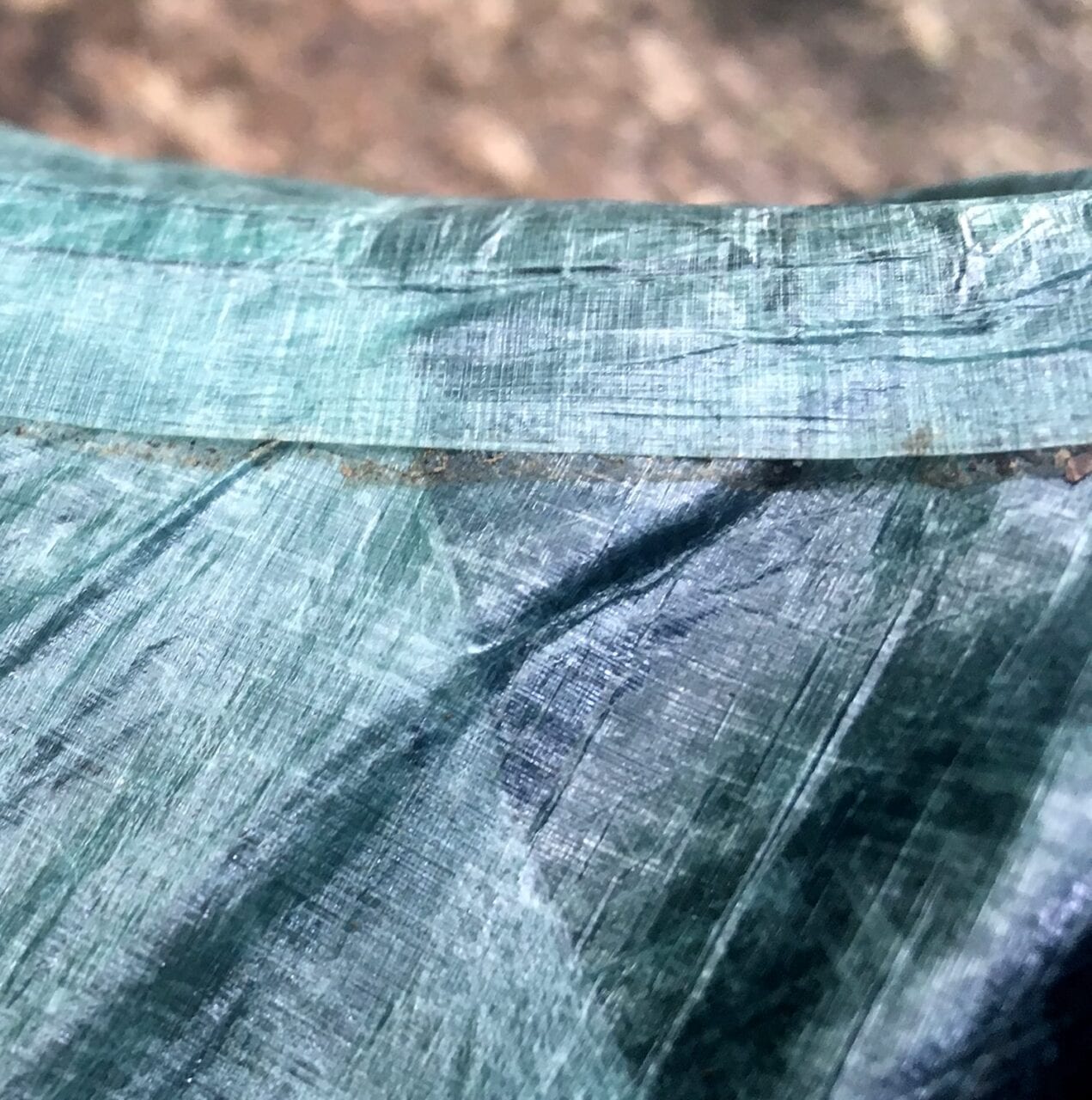
A tent seam waiting for some repair tape.
Photo by Zoë Symon
5. Gear Repair Tape
Frustrating things can happen sometimes, and thru-hikers definitely shouldn’t be stuck out on the trail with no way to repair a tent that has failed. Most gear repair tape is lightweight, strong, and completely worth it on the off chance that a tent, rain jacket, or other piece of gear gets damaged.
Plus, if you carry it, then you’ll never need it, right?! Some good options are below.
Gear Aid Tenacious Tape ($5.25, nylon)
Zpacks Seam Tape/Repair Tape ($3.50, dyneema)
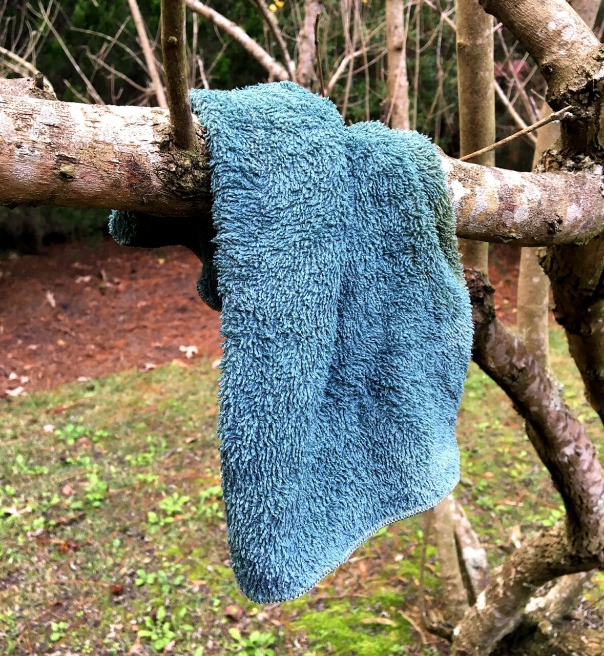
Hanging a small towel to dry after cleaning a cooking pot.
Photo by Zoë Symon
6. Small Towel
Many thru-hikers might consider a small towel an unnecessary luxury item, but it’s so lightweight and multipurpose that it can make it worth its weight.
Most small camp towels are absorbent, quick to dry, and can be used for a variety of purposes, from washing your cooking pot to washing your dusty trail legs before getting in your sleeping bag.
REI Co-op Multi-towel Lite ($9.95, 0.7 oz – Small)
PackTowl Nano ($9.95, 0.9 oz)
PackTowl Luxe ($12.95, 1.1 oz – Face)

Rope and paracord in a pile.
Photo by Emma Louise Comerford
7. Paracord
Talk to any thru-hiker about how they store their food, and you’ll find there’s an intense debate about whether to hang your food. However, in bear-prone areas like much of the Appalachian Trail and other long trails, it’s a good idea to be prepared just in case. Having some paracord in your pack will give you the option to hang your food if necessary, and can be useful in other situations too!
Consider taking your gift a step further and printing instructions for the PCT bear hang method to go with the paracord.
PMI 3mm Utility Cord ($5 for 50ft, 3.8oz)
Gear Aid 550 Paracord Utility Line ($6.50 for 30 ft, 2.6oz)
Dirty Girl Gaiters and trail runners go great together!
Photo by Zoë Symon
8. Gaiters
This is another item that could be just over the $20 mark depending on the brand you get, but gaiters are worth every penny.
Gaiters are so lightweight you won’t even notice you’re wearing them, but your feet will thank you because your shoes won’t fill with abrasive dirt and debris that can cause chafing and lead to other foot issues. The only problem is remembering to put them on before your shoes when you’re still half asleep. Some great options are below!
Altra Trail Gaiter ($20/pair ~1oz)
Dirty Girl Gaiters ($23/pair, ~1oz)
Outdoor Research Surge Running Gaiters ($28/pair, ~1oz)

Out of hand sanitizer! Oh no!
Photo by Zoë Symon
9. Hand Sanitizer
Another must-have for day hikers, section hikers, and thru-hikers. When you haven’t had a shower in a week, it’s probably a good idea to use some hand sanitizer before you eat. When you’re using the bathroom in the woods (or in a privy because, let’s be real, those things can be gross), you’ll probably want some hand sanitizer afterwards. When Grubby Joe Hiker sticks his dirty little fingers into the trail mix bag and then offers you some… well, you’ll probably just want to say no thanks.
Generic Hand Sanitizer (~$1.50 per 2oz bottle)
I’ve linked CVS here, but you can find a similar product and price at any pharmacy, grocery, or convenience store.
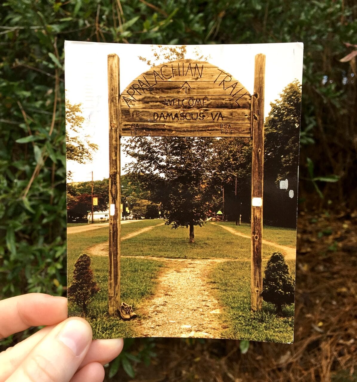
A postcard from the Appalachian Trail.
Photo by Zoë Symon
10. Postcard Stamps
A fun way for thru-hikers to keep in touch with family and friends while on the trail is by sending postcards from all the amazing places they have the opportunity to visit. However, with post office hours, it can be a pain to find stamps for the postcards.
An entire sheet of stamps might last a hiker for their entire trip! Consider gifting a pen as well, as it can be hard to find single pens for sale.
Postcard Stamps ($7 for a sheet of 20)
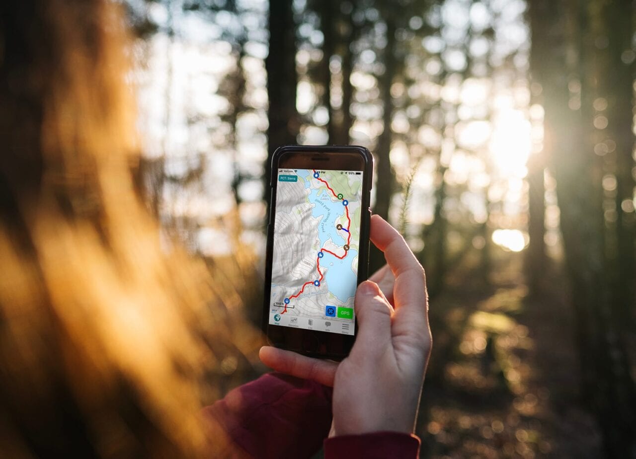
A thru-hiker uses the Guthook Guides app.
Photo by Jonas Jacobsson, screenshot courtesy of Atlas Guides
BONUS. Guthook Guides
Many of our trail guides are under $20. Browse our list of guides and consider giving the gift of Guthook!
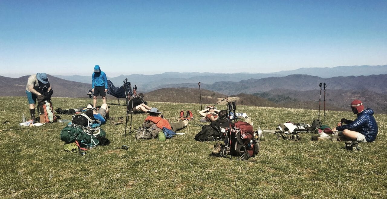
Hikers and their gear.
Photo by Zoë Symon
Want to keep up with all that’s going on at Atlas Guides? Sign up for our newsletter!
Read more!
Check out some of our other blog posts.
Download our popular hiking and biking guides!
Trail guides that get you to places you’ve dreamed of.
As the makers of Guthook Guides, Bikepacking Guides, and Cyclewayz, we help you navigate the most popular trails around the world on your smartphone. Our hiking guides and biking guides work completely offline. Let Guthook guide your next adventure!
Showers Lake Vista, Tahoe Rim Trail
Photo courtesy of the Tahoe Rim Trail Association
Showers Lake Vista, Tahoe Rim Trail
Photo courtesy of the Tahoe Rim Trail Association
Trail guides that get you to places you’ve dreamed of.
As the makers of Guthook Guides, Bikepacking Guides, and Cyclewayz, we help you navigate the most popular trails around the world on your smartphone. Our hiking guides and biking guides work completely offline. Let Guthook guide your next adventure!
Download our popular hiking and biking guides!
About the Author
Zoë Symon
Zoë grew up in North Carolina and first heard of the Appalachian Trail during her time in college. In 2016, she took a leave of absence from her job and thru-hiked the trail. This adventure fostered her love for the outdoors and for hiking. Currently, she explores the public lands of Oregon. In 2017 she joined the team at Atlas Guides as Creative Director. She spends her days improving experiences for all our users.
Pathways to the Future: Rivers and Trails 2018
Planning an adventure? Check out our popular trail guides! 4.8 stars (17K+ ratings)
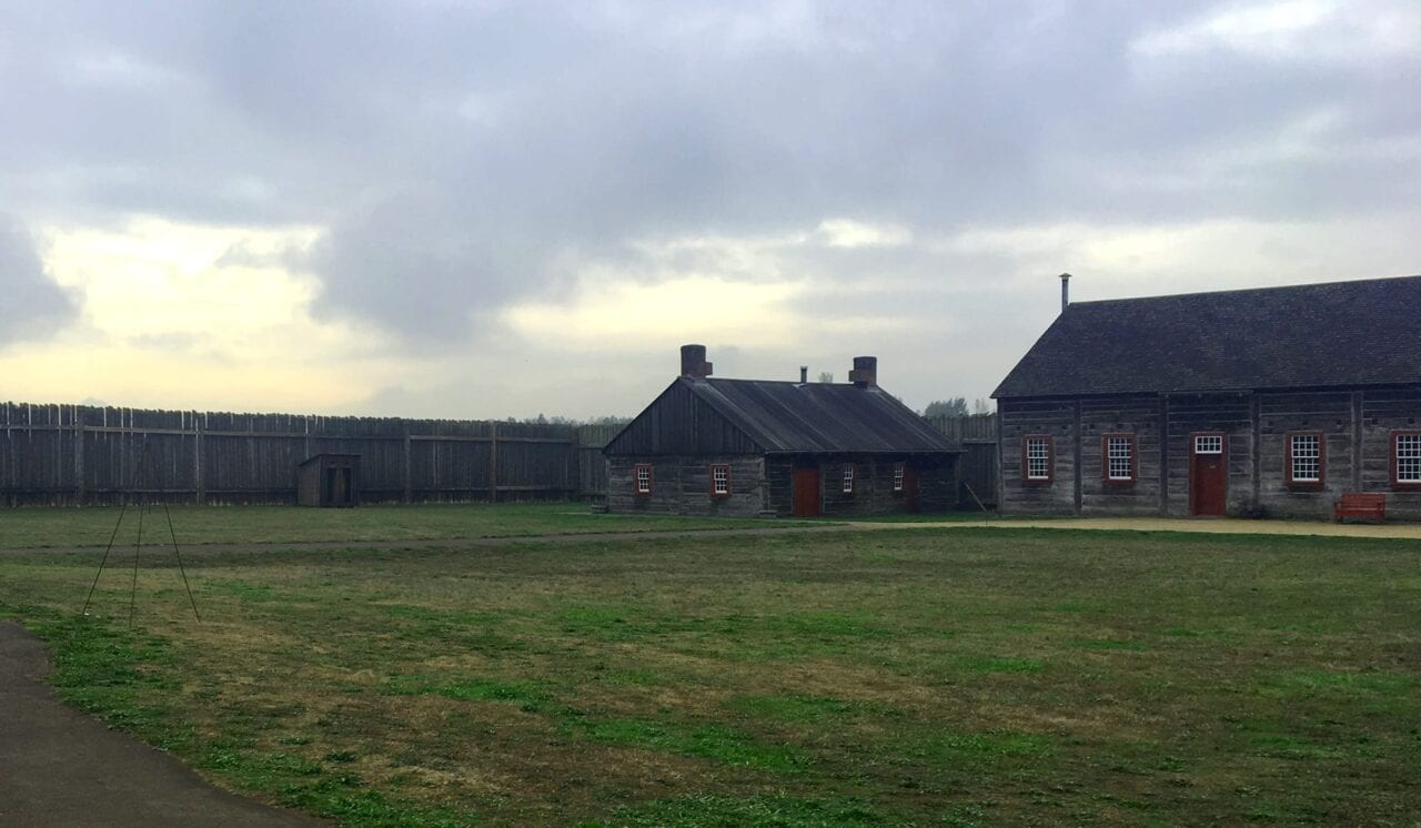
On a tour at Fort Vancouver National Historic Site.
Photo by Zoë Symon
Pathways to the Future: Rivers and Trails 2018
Last week I had the privilege of traveling to Vancouver, Washington for a symposium celebrating the 50th anniversary of both the National Trails System Act and the Wild and Scenic Rivers Act.
Zoë Symon Inside Atlas Guides 10/26/2018
Zoë Symon
Inside Atlas Guides
10/26/2018
Last week I had the privilege of traveling to Vancouver, Washington for a symposium celebrating the 50th anniversary of both the National Trails System Act and the Wild and Scenic Rivers Act. The four-day event, organized by the Partnership for the National Trails System and the River Management Society, celebrated the past 50 years of protecting trails and rivers, and addressed key issues as we look forward to the next 50 years.
It brought together a variety of different individuals and organizations, from federal agencies to non-profit conservation groups to for-profit companies.
Since the signing of the National Trails System Act, the system has grown from two National Scenic Trails to 11. It has also expanded further with the addition of 19 National Historic Trails, almost 1300 National Recreation Trails, and thousands of miles of rail trails.
Day 1
Before the official opening of the trails portion of the conference, I attended a session put on by the Leave No Trace Center for Outdoor Ethics. As an avid hiker and someone who lived religiously by LNT guidelines while thru-hiking the Appalachian Trail, I was eager to learn more and expand my knowledge of LNT best practices.
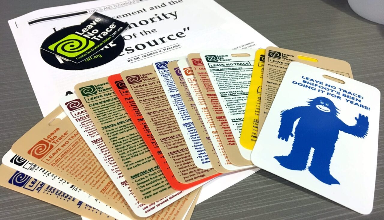
Leave No Trace education materials.
Photo by Zoë Symon
In addition to expanding my own knowledge, I was thrilled to come away with a greater understanding for how to teach and persuade others to follow Leave No Trace best practices.
When educating or persuading others, it really comes down to the why. People are more likely to follow Leave No Trace practices when they understand the impact of their actions.
However, this comes with a huge caveat: an authoritative stance and tone will not help you. Finding common ground and approaching the issue with positivity can influence long-term change in behaviors. In turn, this creates a lasting impact and cultivating intrinsically motivated stewards of the land.
Almost all park or trail visitors want to take care of the land and want to be a part of the solution.
Day 2
Day two of the event opened with a keynote speech by Carolyn Finney, author of Black Faces, White Spaces: Reimagining the Relationship of African Americans to the Great Outdoors. She discussed issues of diversity and inclusion in the outdoors. This set the tone for a major theme of the next few days of talks.
While we were all there to celebrate the work of the past 50 years, it is also important to address issues and conversations that still lie ahead.
To date, public lands recreation and management has been done by a largely homogenous group of people. Dr. Finney opened the door for ongoing conversations about how to engage people from more diverse backgrounds with the outdoors and especially with public lands.

Reading the program for Day 2.
Photo by Zoë Symon
After Dr. Finney’s opening talk, I attended another session about diversity and inclusion. A panel of speakers from the Next 100 Coalition engaged audience members in a discussion about how to begin doing the hard work of bringing diverse perspectives into the conversation.
The discussion covered many topics, but often came back to the idea of stories and narrative. If we, as an entire community, can accept, embrace, and listen to stories from a variety of perspectives, we can discover our shared narrative and common values and start from there.
After the panel, I attended two talks about using technology to help manage outdoor spaces. Specifically, using GIS. The first talk discussed the gaps in adoption of GIS technology among management agencies and conservation groups. The difference in size, funding, and capability of organizations has a huge impact on their ability to implement GIS technology effectively to help manage their piece of public land.
The second talk dealt with using GIS technology. This technology can help create better tools and materials for conservation organizations and the general public. They discussed the use of ArcGIS Online to create a robust database of trail data. This enables individual organizations to more effectively create and share materials, including interactive Story Maps.
The fourth talk of the day was centered around arts on public lands. Arts on National Trails and in National Parks can help engage the community. Artist in Residence programs can help provide opportunities for artists. The last talk of the day discussed technology on the trail and gave advice for using technology to promote National Trails.
In the evening, I attended a film screening for a variety of films about public lands, trails, and wild rivers. They were thought provoking, inspiring, and beautiful!
Day 3
The third day of the symposium was devoted to day-long field trips. The one I chose to attend was Enduring Stories of Tribal Survivance & Collaboration Along the Columbia River.
This session focused on telling stories of native peoples. These stories that have largely been left out of the mainstream narrative of parks and other locations along the Columbia River. This field trip was hosted by the Confluence Project, a group dedicated to telling these stories.
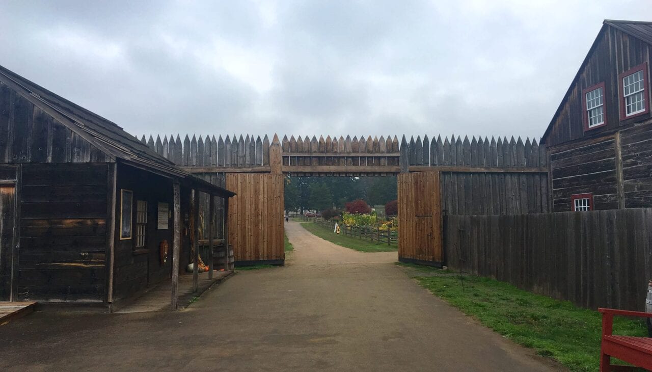
Inside Fort Vancouver National Historic Site.
Photo by Zoë Symon
Our first stop was to Fort Vancouver National Historic Site. Fort Vancouver was originally a main depot for the Hudson’s Bay Company. It was an early center of trade for settlers in the Pacific Northwest. Much of that trade occurred with the Chinook peoples who lived along the Columbia River.
There is a complicated history of diversity, land ownership, and land theft that occurred in this area. This complicated history is often not told from all perspectives.
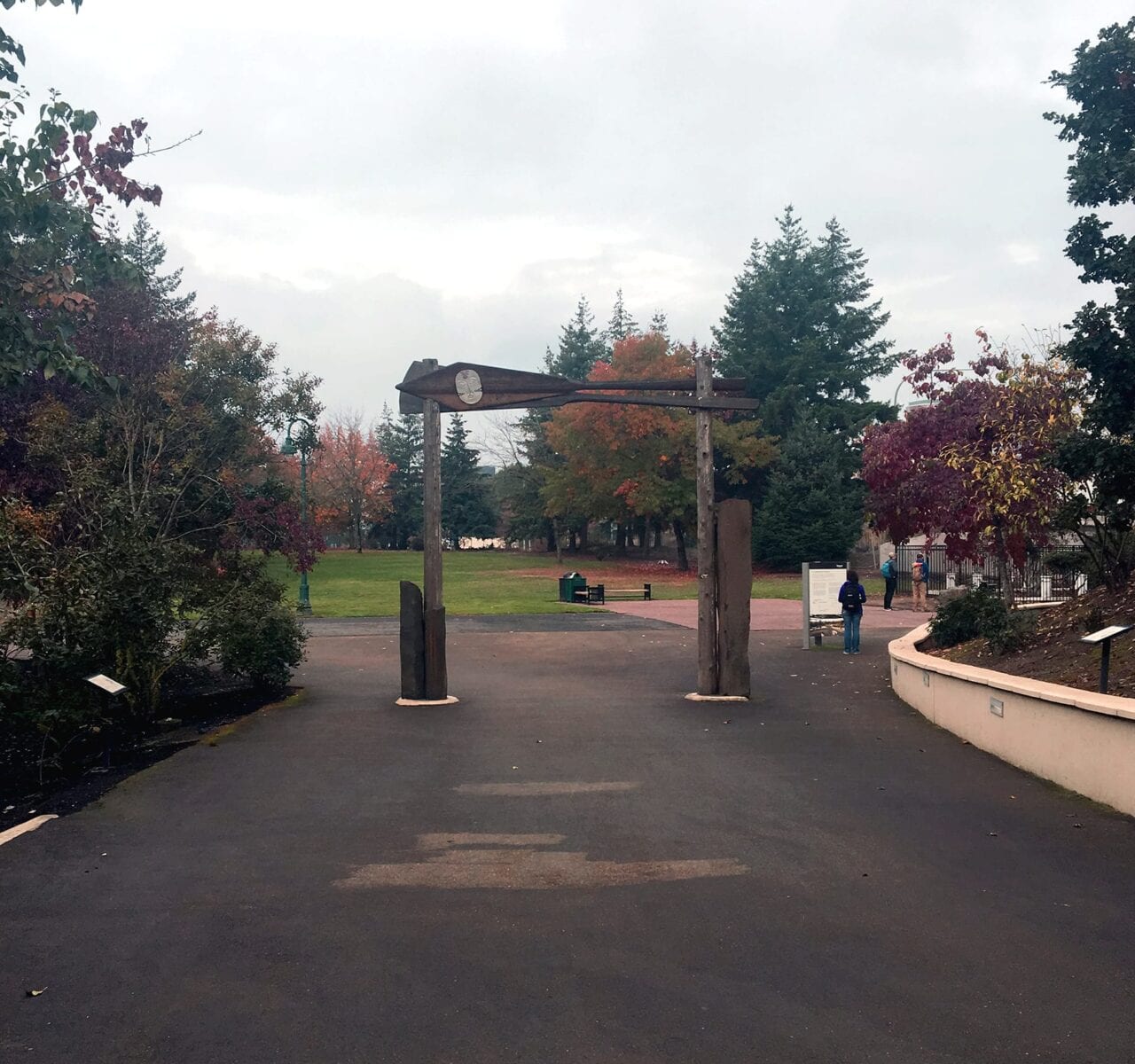
The Welcome Gate on the Vancouver Land Bridge.
Photo by Zoë Symon
Near Fort Vancouver is the Vancouver Land Bridge. It is an earth-covered pedestrian bridge that arcs over State Route 14, reconnecting historic Fort Vancouver with the Columbia River. It was created as part of the Confluence Project.
Confluence describes the project like this:
“Learn about the site’s indigenous plants as you walk along the land bridge, which leads you up to a grand view of the river and the surrounding mountains. From the south, walk under the land bridge’s Welcome Gate, designed by Native American artist Lillian Pitt. Two cedar canoe panels, each adorned with a cast-glass sculpture of a Chinook woman’s face, evoke the site’s role as a historic tribal crossroads as well as a point of contact between European and Native people.”
We spoke with Lillian and learned about her people’s history (as well as other Native tribes) with the Columbia River. Afterwards, we traveled to the Sandy River Delta to visit Maya Lin’s Bird Blind.
A section of Maya Lin’s Bird Blind.
Photo by Zoë Symon
The Bird Blind is a historical record of creatures seen and described by Lewis and Clark. It also acts as a commentary on the environmental destruction that has occurred in the area.
“The vertical wooden slats of the bird blind are inscribed with the name and current status of each of the 134 species Lewis and Clark noted on their westward journey.” (Confluence Project)
Through the efforts of multiple groups, the area around the Sandy River Delta is being restored.
Day 4
Continuing with the theme of diversity, inclusion, and engagement in the outdoors, the opening morning of the 4th day featured two speakers. Marya Skotte from the National Park Foundation discussed a new initiative created to help management agencies and conservation organizations better engage with the communities they serve.
Nicole Browning from REI discussed the company’s approach to equity in the outdoors, specifically focusing on the recent Force of Nature campaign to, among other things, increase the representation and voice that women have when it comes to being in and protecting our outdoor spaces.
The first talk of the day focused on ways to establish, defend, and define the trail corridor for National Scenic and Historic Trails. The speaker, from the BLM office managing the Iditarod National Historic Trail, offered advice for organizations on how to balance protection of the natural space with engagement in recreation opportunities. He also discussed using surveying techniques to determine and protect viewsheds and other features of the natural space.
Two members of the National Park Service gave the second talk of the day, and focused on the innovative ways that the Overmountain Victory National Scenic Trail has created and maintained local partnerships to secure the centerline and trail corridor through Federal, State, and Private Lands.
Their work is ongoing, but has so far been successful and beneficial. Other trail management agencies can adopt the techniques they use for outreach. Agencies facing similar challenges from private landowner and state agency partnerships might especially find these strategies helpful.
The final session of the day focused on the Arizona Trail Association’s innovative approach to training and inspiring trail maintainers. Their goal, to have the best trained volunteer force, is helped by their incredible partnership with American Conservation Experience, an organization that helps them organize in-depth training sessions for their community of Trail Stewards on the Arizona Trail. They have called this the Trail Skills Institute.
In particular, they address the challenges with maintaining a trail that traverses a variety of different landscapes including desert. Different landscapes require different techniques, and the ATA works closely with ACE to develop intensive training programs. These have been wildly popular—a good problem to have.
The closing keynote was an eloquent and moving event with author Philip Connors, author of Fire Season: Field Notes from a Wilderness Lookout and A Song for the River.
Conclusion
My experience at Pathways to the Future was inspiring, motivating, and challenging. It left me excited to do what I can. I hope to help to bring new ideas and energy to the stories around public lands, recreation, and the environment.
Links and Resources
Partnership for the National Trails System
http://pnts.org/
50th Anniversary National Trails System
https://www.trails50.org/
River Management Society
https://www.river-management.org/
Leave No Trace Center for Outdoor Ethics
https://lnt.org/
Next 100 Coalition
http://next100coalition.org/
The Confluence Project
http://www.confluenceproject.org/
National Park Foundation
https://www.nationalparks.org/
REI: Force of Nature
https://www.rei.com/h/force-of-nature
Arizona Trail Association: Trail Skills Institute
https://aztrail.org/get-involved/trail-skills-institute/
American Conservation Experience
http://www.usaconservation.org/
Want to keep up with all that’s going on at Atlas Guides? Sign up for our newsletter!
Read more!
Check out some of our other blog posts!
Download our popular hiking and biking guides!
Trail guides that get you to places you’ve dreamed of.
As the makers of Guthook Guides, Bikepacking Guides, and Cyclewayz, we help you navigate the most popular trails around the world on your smartphone. Our hiking guides and biking guides work completely offline. Let Guthook guide your next adventure!
Showers Lake Vista, Tahoe Rim Trail
Photo courtesy of the Tahoe Rim Trail Association
Showers Lake Vista, Tahoe Rim Trail
Photo courtesy of the Tahoe Rim Trail Association
Trail guides that get you to places you’ve dreamed of.
As the makers of Guthook Guides, Bikepacking Guides, and Cyclewayz, we help you navigate the most popular trails around the world on your smartphone. Our hiking guides and biking guides work completely offline. Let Guthook guide your next adventure!
Download our popular hiking and biking guides!
About the Author
Zoë Symon
Zoë grew up in North Carolina and first heard of the Appalachian Trail during her time in college. In 2016, she took a leave of absence from her job and thru-hiked the trail. This adventure fostered her love for the outdoors and for hiking. Currently, she explores the public lands of Oregon. In 2017 she joined the team at Atlas Guides as Creative Director. She spends her days improving experiences for all our users.

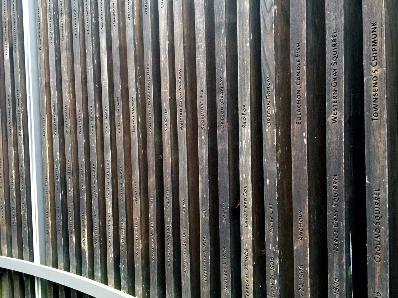
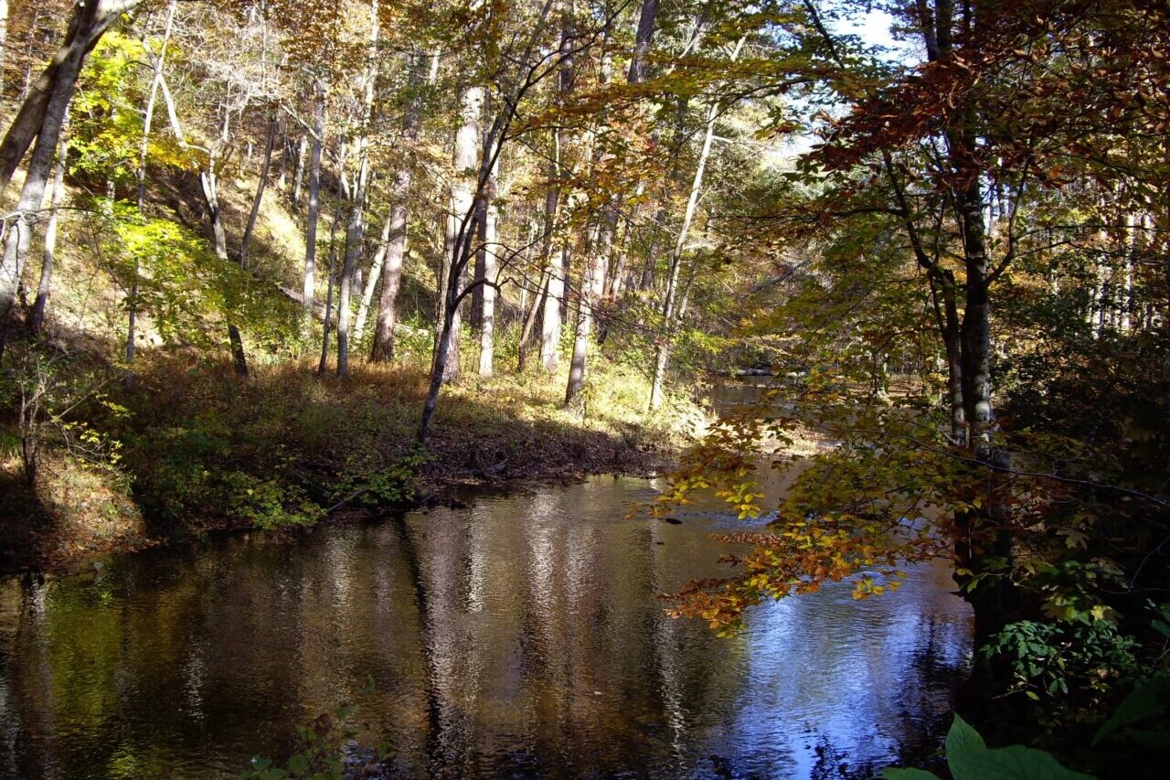
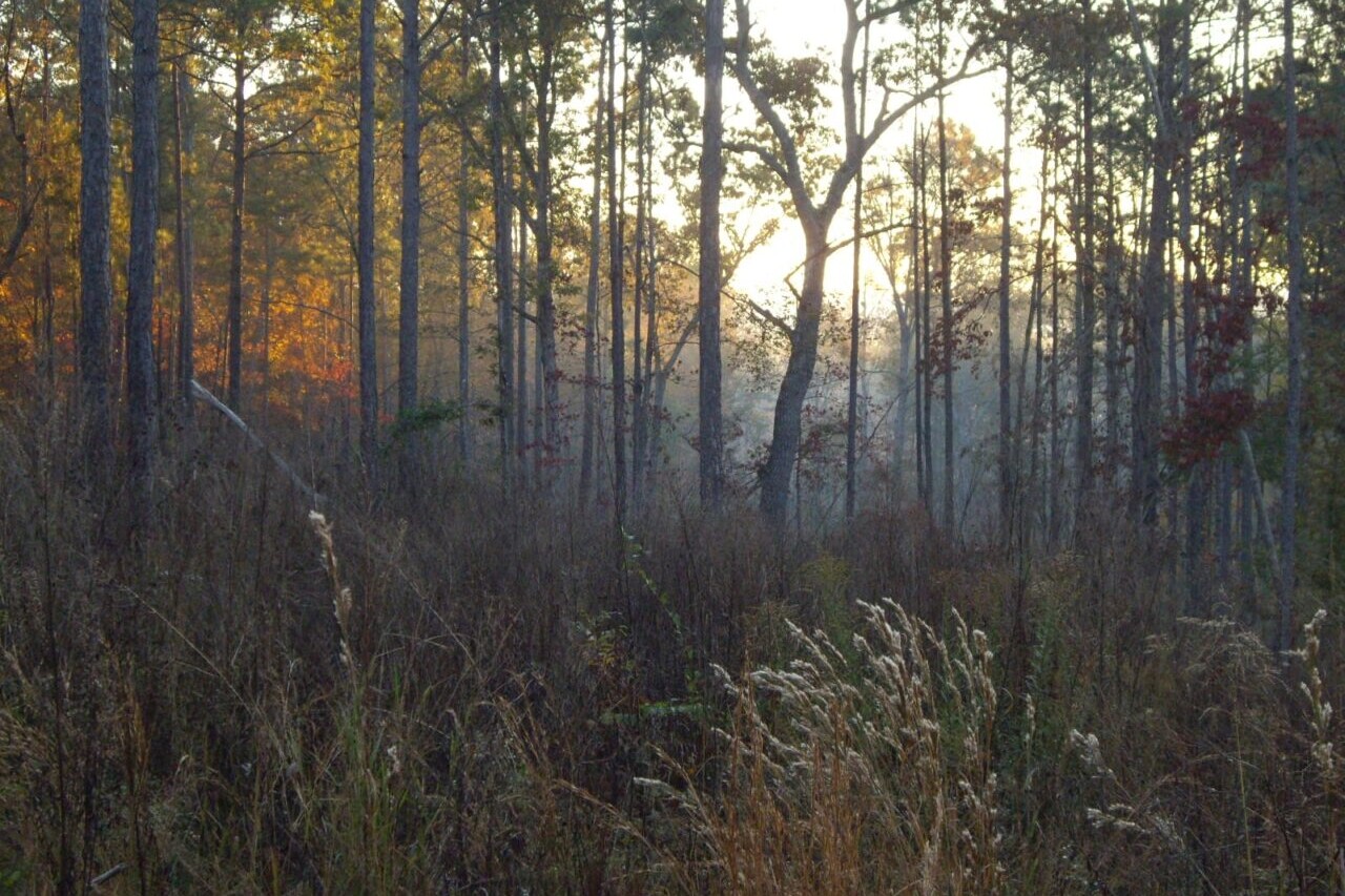
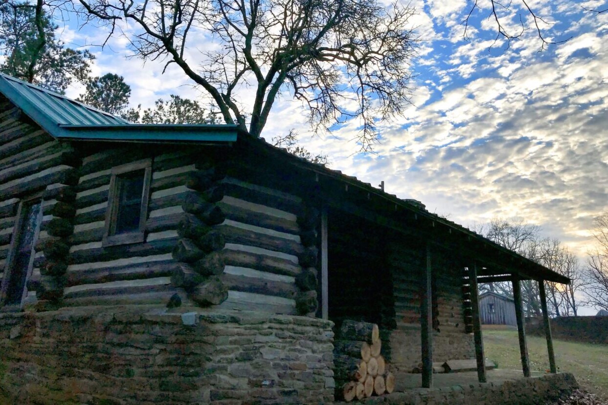
Pinhoti Trail
Walk southern Appalachian forests in Georgia and Alabama on the Pinhoti Trail. The Pinhoti Trail is a journey of over 330 miles (530 km) through the Appalachian Mountains of Alabama and Georgia. The trail runs from Northern Georgia where it meets the Benton Mackaye Trail to Flagg Mountain in Alabama, which holds a special designation as the southernmost peak of the Appalachians to stand at over 1000 ft. The Pinhoti Trail travels for over 150 miles in both states, and passes through some of the most beautiful sections of each, including the Talladega National Forest in Alabama and the Chattahoochee National Forest in Georgia.
20% off for our Hiking Season Kick-off SALE! The Pinhoti Trail is now $8.99.
30% off for our Small Business Saturday SALE! The Pinhoti Trail is now $7.99.
Alabama, Pinhoti Trail
Photo by C.K. Hartman
4.8 ★★★★★ | 17K+ Reviews
Pinhoti Trail
330 miles • Alabama & Georgia
Download our guide to access the Pinhoti Trail map, tracks, waypoints, and comments! Walk southern Appalachian forests in Georgia and Alabama on the Pinhoti Trail. The Pinhoti Trail is a journey of over 330 miles (530 km) through the Appalachian Mountains of Alabama and Georgia. The trail runs from Northern Georgia where it meets the Benton Mackaye Trail to Flagg Mountain in Alabama, which holds a special designation as the southernmost peak of the Appalachians to stand at over 1000 ft. The Pinhoti Trail travels for over 150 miles in both states, and passes through some of the most beautiful sections of each, including the Talladega National Forest in Alabama and the Chattahoochee National Forest in Georgia.
$11.99 full guide
$11.99 full guide
Pinhoti Trail Map


How can I get it?
The Pinhoti Trail map is available as an in-app purchase in our Guthook Guides app, a free download from the Apple App Store or the Google Play Store.
Our iOS and Android apps do differ slightly in their appearance. However, the majority of their features remain the same, and they access the same trail guide data.
The Pinhoti Trail is a journey of over 330 miles (530 km) through the Appalachian Mountains of Alabama and Georgia. The trail runs from Northern Georgia where it meets the Benton Mackaye Trail to Flagg Mountain in Alabama, which holds a special designation as the southernmost peak of the Appalachians to stand at over 1000 ft. The Pinhoti Trail travels for over 150 miles in both states, and passes through some of the most beautiful sections of each, including the Talladega National Forest in Alabama and the Chattahoochee National Forest in Georgia.
$11.99
Photos of the Pinhoti Trail
Hike more.
Check out some of the other trail guides we offer!