My Trail Story - Jeff Garmire Sets the Fastest Known Time (FKT) on the Arizona Trail
Planning an adventure? Check out our popular trail guides! 4.7 stars (14K+ ratings)
Photo provided by Jeff Garmire
My Trail Story - Jeff Garmire Sets the Fastest Known Time (FKT) on the Arizona Trail
Jeff Garmire, a.k.a Legend, established the newest Fastest Known Time (FKT) on the Arizona Trail on April 22, 2019.
Natalie McMillan My Trail Story 05/16/2019
Natalie McMillan
My Trail Story
05/16/2019
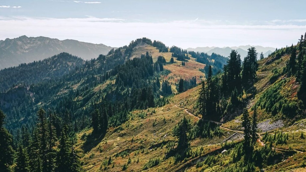
The Fastest Known Time (FKT) on the Arizona Trail
By: Jeff Garmire
Age: 28
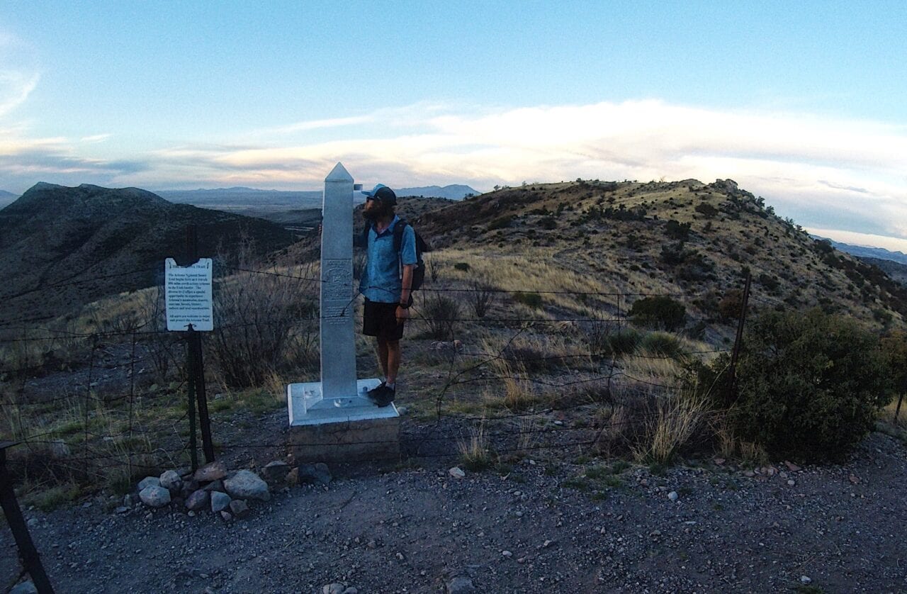
Photo provided by Jeff Garmire
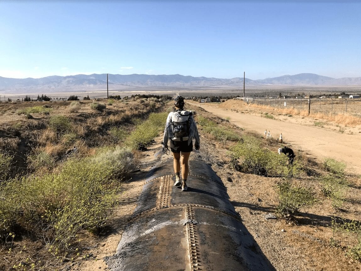
I was always told, with a trail name like Legend (earned from hitching out with Pizza for other hikers on the PCT) I couldn’t quit hiking after one long trail, therefore I didn’t. At 28 years old and after many thousands of miles of hiking, I decided to attempt my first FKT (Fastest Known Time). Here is how the Arizona Trail Self Supported FKT attempt went.
-Before the FKT-
One of the biggest decisions involved in my speed record attempt was made before my first steps were taken. I hiked South on the Arizona Trail for over a week to train and dial in my gear. The night before I would be starting, I was in the Miller Peak Wilderness. I camped at the edge of the wilderness and was ready to begin my Fastest Known Time attempt. Then the wind started. It blew so hard I struggled to sleep, anxiety struck and doubt began to grow. It was not a tough decision with the flexibility I had given myself and I decided to put off starting the FKT for one more day. I hiked down and traveled into Sierra Vista to regroup, resupply and destress. When I was ready, I traveled back to the trail, hiked up the hill and stayed at the first legal camping spot at the edge of the wilderness area. Tomorrow I would actually begin.

Photo provided by Jeff Garmire
-Day 1
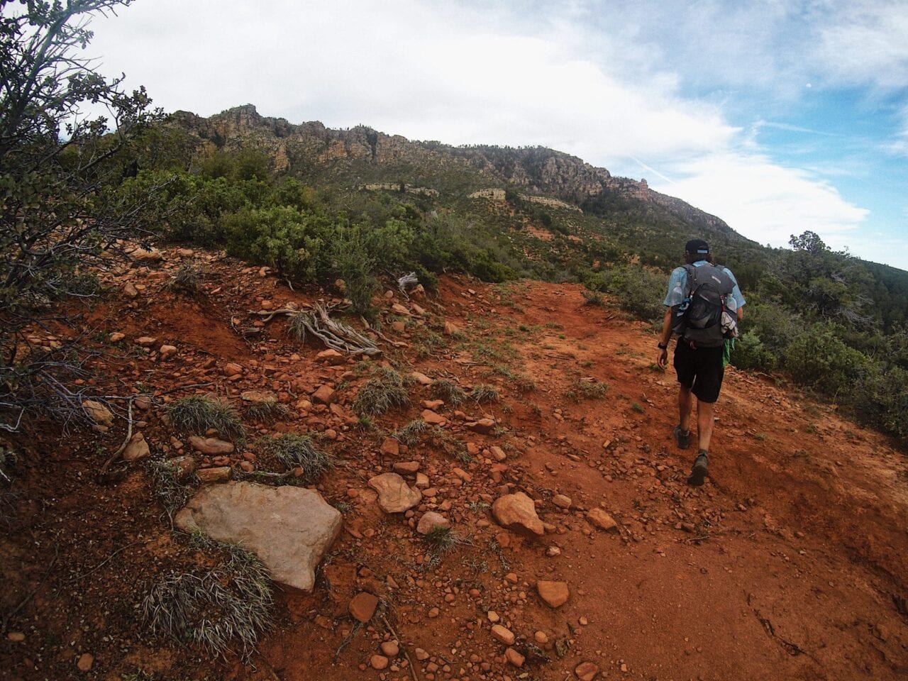
It was 4.1 miles from my campsite to the Terminus (Mexican Border), and I was moving by 5am. It was all downhill, and I covered the miles quickly. I took a quick break, threw away my trash and assured everything was in the right spot at Montezuma Trailhead. At the southern terminus of the trail I snapped a picture, punched my spot tracker and took off, fueled by adrenaline. I moved fast, covering the 6.5 miles and thousands of feet of elevation gain quickly to Miller Peak. From here the trail bounced up and down and I took advantage of my fresh legs and began to run portions of it. I ate while hiking and stowed my food while running. I left the wilderness area and continued to maintain a good pace. Miles flew by like never before. At mile 20 a small hot spot appeared on one foot and I made a quick sock change and the discomfort vanished. The day was fast and easy. I made it all the way to the road into Patagonia. 47 miles down.
100 miles down.
-Day 2
At 4:30am the alarm went off, and I was ready to go. The excitement of the FKT easily outweighed the early hour and I began the walk into Patagonia. I arrived before 6am and went straight to the vending machine I had scouted on my way south. In it there were sandwiches and snacks. I bought enough to supplement my food for the next 130 miles and climbed out of the town. It was a series of old roads and a long climb that eventually led to Mt. Wrightson Wilderness area. I was still feeling great and ran down into the canyon. Everything seemed easy. My body was responding well, my legs felt great, and my mind was at ease. I arrived at Kentucky Camp and took some time to air out my feet, charge my phone and guzzle some water. My goal for the day was mile 100, and I was well ahead of schedule. The trail had some small climbs and descents in the evening, but they went by with relative ease, and I was able to find a nice sandy wash to camp under the stars in. 100 miles down.
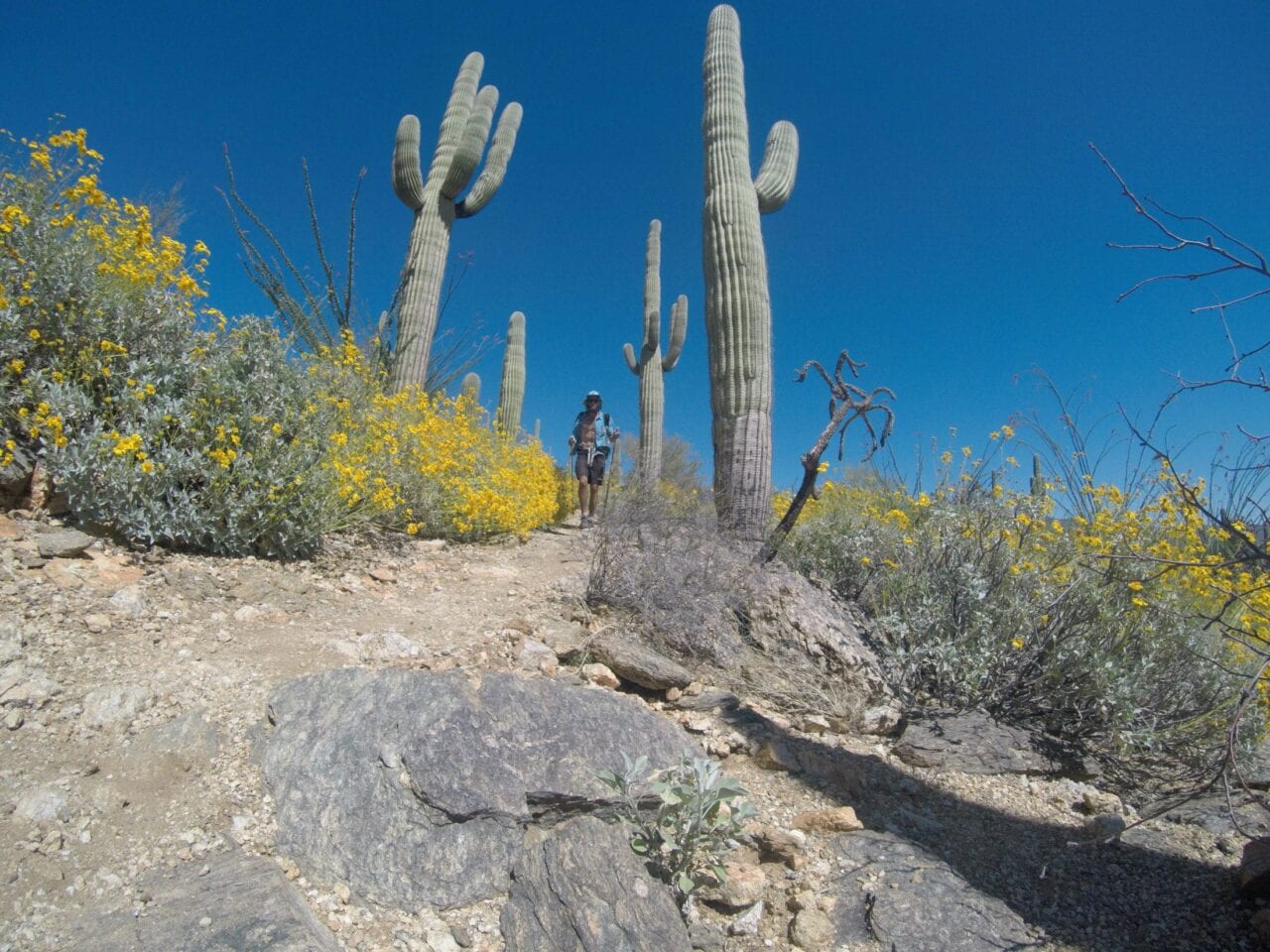
Photo provided by Jeff Garmire
-Day 3
Everything was going too smoothly. I was up again and felt great moving through the flat desert leading up to Saguaro National Park. I crossed under I-10, past the junction to Colossal Cave and took a break at La Selvilla Picnic Area. I aired out my feet quickly and then was back moving north. I had 20 miles done by 11am, but the day would digress quickly. I peacefully walked through the desert, enjoying the unique look of the Saguaro Cacti and then the climb began. From the Quilter Trail and the National Park boundary the trail gains 5,000′ of elevation in 12 miles. I began the climb at 2pm, and it could not have gone worse. The 90-degree heat hit me hard. Within the first 5 miles I drank all my water, had a headache and was struggling. The next mile was spent jumping from shaded spot to shaded spot, resting at each one. Sweat poured off my face and my legs felt empty. I was counting each tenth of a mile, and seeing progress at a painfully slow rate. Finally, I found a small pool of water. I ripped off my pack and laid down in the lukewarm puddle. It felt so nice to not only be in the water, but be able to lay down. It took every ounce of mental toughness to leave the dirty water and continue up the hill. Heat penetrated my being and the headache grew stronger. My pace was laughable, and darkness set in before I finished the climb. But as the sun set and the temperature dropped, my strength returned and I was able to salvage a 45-mile day, making it beyond the northern park boundary. In my first brush with adversity, I had made it out the other side. 145 miles down.
-Day 4
I knew this two-day combo would be difficult climbing through Saguaro National Park and then over Mt. Lemmon. I also knew from my scouting that I would be following a creek up the canyon for quite a while during the Mt. Lemmon climb. It would be much easier to fight off the heat than the previous day. The day began early and my fear of lingering effects from the day prior were unnecessary as I quickly crossed Catalina Highway and began the gradual climb. Today was peaceful in comparison, and everything seemed to move at a more comfortable pace. I powered up the hill and hit Romero pass where the real climb begins. I was already cutting it close for the General Store at Summerhaven, so I picked up the pace and moved quickly up the hill. At the top I began to run the downhills. As time ticked by and my chances of making it to the store (before it closed) grew even slimmer, I started to run all the terrain. I made it to Marshall Gulch Trailhead and had 11 minutes before the closing. With 1.1 miles left, I sprinted up that hill. This was the last day in this pair of shoes and my feet ached running on the pavement. I arrived at 6:01 pm, but they still let me in. The strange thing about the decision to run is that I really didn’t need anything at the store. More than anything I just wanted the morale boost and ability to eat different food. I had a resupply and new shoes at High Jinx Ranch, 11 miles away, so all I purchased was a can of sardines, a bag of chips and a coke. I used the internet at the store for a few minutes, ate the sardines and socialized with other hikers before beginning the 11-mile descent to the ranch. It was so windy and dark that I took out headphones and drowned the piercing elements. It went by quickly and I camped right at the ranch, ready to resupply and get on the trail quickly the next morning. 196 miles down.
-Day 5
I didn’t use an alarm because I didn’t want to be walking through the ranch looking for my resupply too early in the morning since people do live there. But in the end, I couldn’t sleep past 5:30am and saw my resupply box and shoes exactly where the owner had described them. I quickly changed everything out and was ready to go when the caretaker walked up. It was a bit embarrassing at 6am to see him after casually walking into the place, but he was kind and understanding. It was later than normal (6:20am) so I moved with added intensity. It would be a flat and fast day. I ran miles at a time and felt better on this day than any of my previous. It was true desert, and I saw sweeping views, rattlesnakes, cacti, and even other hikers. I often pass people at night, seeing only their tents, but on this day I got to interact with a few people as I passed them. Despite my pack being at its heaviest for the entire route, I was able to cover 51 miles in relative ease. 247 miles down.
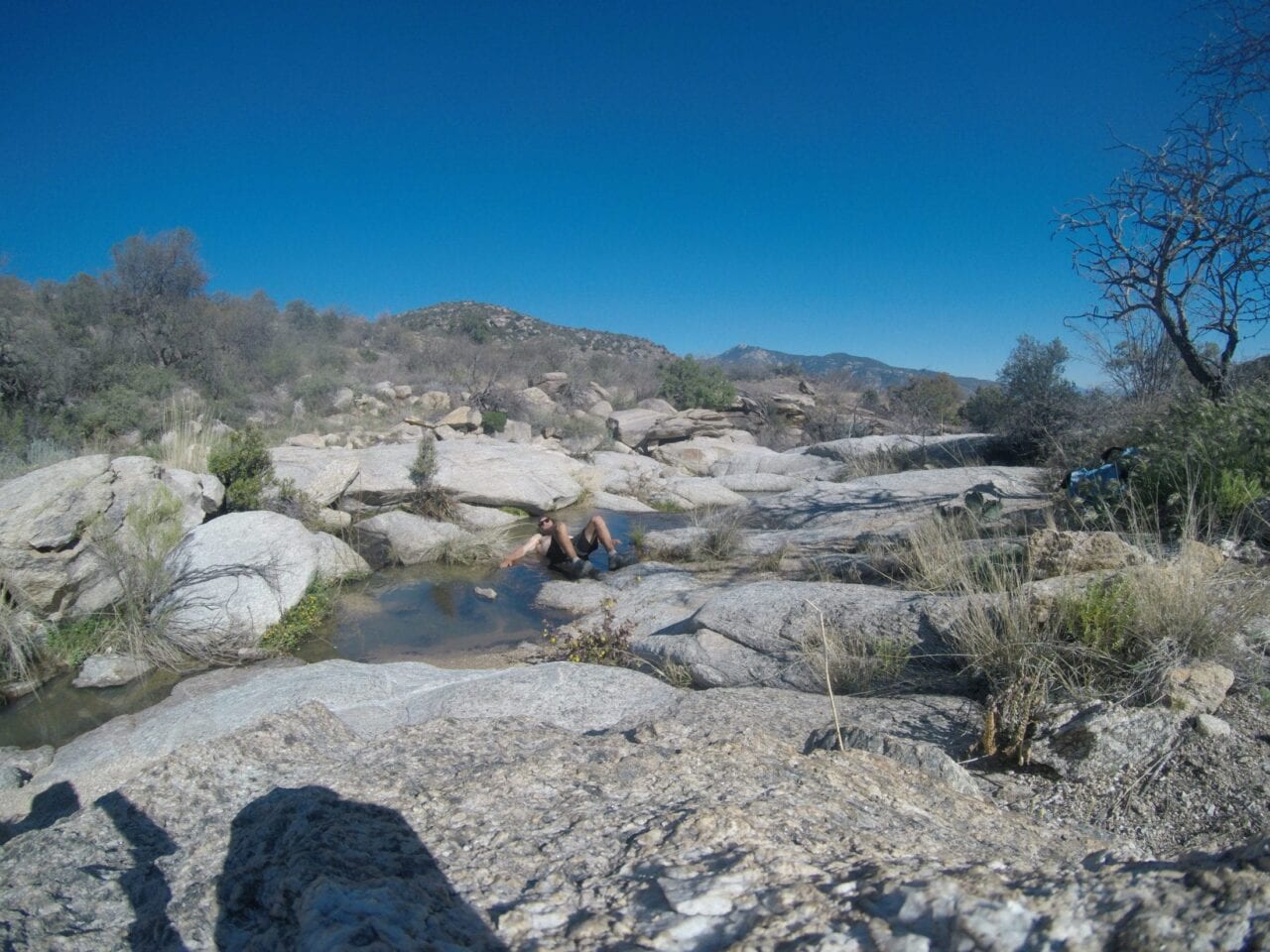
Photo provided by Jeff Garmire
My feet were full of cuts and looked like a used tissue.
-Day 6
I started the day like I was shot out of a canon. I was running everything. After 5 full days everything felt too good and I wanted to use it. I was sprinting down the hills and still maintaining a good pace up them. Miles melted by, and I was soon paralleling the Gila River. I only slowed down when I had to filter muddy water out of the river before a long climb. Soon after leaving the river, though, my energy level plummeted, and I was not feeling like I had much left. The quick start to the day definitely contributed to the crash, but I had a plan. I poured caffeine into one of my waters and began to chug it. I climbed into Tonto National Forest, ascending into the mountains powered by caffeine. I knew I would have to push late because of my resupply the next day so I continued to go all the way to Highway 60. It was the first experience of exhaustion during the FKT and having to push through the urge to close my eyes for hours. 301 miles down.
-Day 7
I went to sleep after midnight and was up by 3am. It was 44 miles to Roosevelt Lake, and I had to make it by 7pm or I could not get my resupply box until the next morning. Being late would cost me half a day. There was no wiggle room and I moved fast. The climb up into the Superstition Wilderness went perfectly in the cool weather and it even rained a bit. But after entering the wilderness my foot problems began. The soles of my feet grew uncomfortable and despite trying to tape them, the problems snowballed. Hotspots turned into rashes and then my skin began to split. I left the wilderness hobbling. I had no spare time to survey the damage, but I should have taken more time to mitigate it. I continued to move as fast as my injured feet could go and eventually passed some hikers I had seen while training on my way south. They all let out a cheer and it added a smile to my face. It was the final push I needed before jogging down the hill to the marina. I made it at 6pm, grabbed my box and walked out onto the patio to look at the damage that was done. My feet were full of cuts and looked like a used tissue. The skin was wrinkled, irritated and slashed in parallel lines as if by a knife. The damage was done, and I bought more duct tape from the store and walked towards the Four Peaks and Matazal Wildernesses. It would be one my hardest and most remote sections and I was starting it injured. 350 miles down.
-Day 8
Upon waking, my feet were no better, and my energy was at a low. My head hurt, and I was groggy. My motivation was gone. I did not feel like moving, let alone pushing towards a goal of 50 miles for the day. But knowing getting up is the hardest part, I rose and began hiking. I was not fast. I couldn’t run, and I couldn’t even walk at 3 mph. Slowly as the sun rose my body loosened up and my feet grew numb with pain, yet the miles were still slow and sluggish. I climbed up, but after only 12 miles in 5 hours, I took a break and laid down, taking time to eat and air out my feet. I coated them in hydrocortisone cream and then tried to duct tape them up. But after packing up and continuing to move north, the duct tape proved more uncomfortable than helpful and I quickly took it off. I entered and climbed through the Four Peaks Wilderness. My pace was not healthy, but I relentlessly continued forward. Downing caffeine no longer helped the way it had in days past and I didn’t have much go right in my day until meeting some hikers that mentioned how much my previous adventures had inspired them. It brought a smile to my face on a day where it was tough to do so and powered me to Highway 87. I tried to push into the evening, but my body and mind rebelled. Sleep felt like the right decision, and my eyes were closed around 10pm. It was a poor day as far as progress goes, but even for a bad day it didn’t ruin my chances. 393 miles down.

Photo provided by Jeff Garmire
-Day 9
My feet were still destroyed, but my mental sharpness had returned. Sleep had paid off, although it had not induced the physical healing I had hoped it would. I moved forward consistently and worked to limit down time and time not spent moving. With my diminished speed I would need to be ever more diligent and efficient each time I removed my pack. I wound through the Matazals, climbing and descending on the rockiest of trail. The loose rocks (about the size of a fist) were not the ideal terrain to be moving over with already bothered feet, but the sweeping views and welcome breeze made up for the terrain. Late in the day I dropped down and crossed the East Verde River. It was a river at which I got to the bank and saw no way of crossing and keeping my feet dry. So, at 8pm I trudged through the water, making the decision my feet would be wet the rest of the evening and for the following morning. As I climbed up Whiterock Mesa the trail became increasingly hard to follow in the dark. I never lost it, but my pace was diminished because it was difficult to spot the pathway on the empty ground. Usually there is a track, rocks, a rut, or some other tell-tale sign of a used trail, but between all the interwoven wildlife and run-off trails it was very difficult to follow. When I felt my pace drop to a level that bordered on unproductive in terms of trading sleep for slow miles, I passed out on a nice bed of pine needles. 444 miles down.
-Day 10
Today was going to be a strange one. I had a box waiting just off the trail at the brewery outside of Pine, but I had come to the decision that I would super glue the bottom of my feet in order to provide both a second skin and to try to close the large cuts that were providing so much discomfort. I arrived at the brewery just after it opened at 11am, ate some quick food, repacked my resupply and hobbled into town. I shopped quickly for the necessities and was soon sitting outside on a bench popping blisters and super gluing my feet. It must have been quite a sight. Each blister shot puss multiple feet into the air, producing a nasty colored liquid, and then I would flex all the muscles in my foot and rub the binding glue on them. When I finally left town in the early afternoon I felt as though I could log some miles. Running was still out of the question but walking felt better. The trail along the Mogollon Rim was also much nicer than the Matazals. Soft clay and dirt were the surface as opposed to rock. I pushed deep into the night, but could barely salvage a 40-mile day. Strangely I was content with the shorter day because I thought I had drastically improved my feet. 487 miles down.
-Day 11
Sleep deprivation was adding up. If the trail was flat for too long or my mind was able to drift for an extended period, my eyes grew heavy. There had been many late nights and early mornings. I was now getting up before 4am and not succumbing to sleep until after 11 and sometimes 12. The route was quite easy, following a litany of roads and pine needle laden trail with only the smallest patches of snow. It was a good situation for logging miles, and my feet felt a little better. With the aid of caffeine, I was able to stay awake as I pushed to Mormon Lake, but in the afternoon when I sat down for a short break my eyes closed. I wasn’t sure how long I was out, but I bolted upright as soon as I felt my hat fall off my head and hit my knee. I scrambled up and kept pushing. I could not risk an unplanned nap. I crossed Lake Mary Road and wound around the tall forest when a gentle rain began to fall. Past Mormon Lake and into more rain. It would be my only wet night and my only night setting up my tent. 539 miles down.
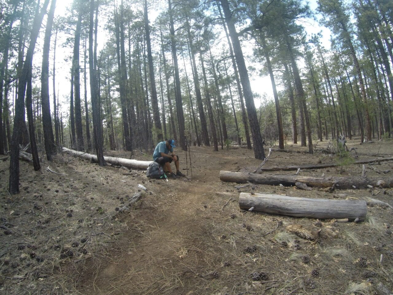
Photo provided by Jeff Garmire
-Day 12
A resupply in the outskirts of Flagstaff was the goal, but staying awake in the morning was especially difficult. It got so difficult I decided to call my dad. Talking on the phone would easily melt away 30 minutes and sharpen my mind for the next hour or two. It was largely flat through the forest and I was able to find a clearing and some sun to quickly dry out my tent after the rain. Then I pushed hard to Skunk Canyon, turned right and began the pathway along the rim of Walnut Canyon. I had never been on this portion of the trail before, and I was quite impressed. The only downside to the great views were the endless mountain bikers I had to share the trail with. On one hand they kept me awake but on the other they always kept me on edge and induced a bit of anxiety that I would be hit by one of them. In the end it all worked out. I made it all the way to Highway 89. Here I had a decision. There was a gas station a hundred yards south, but there was a Dollar General a mile north. Did I want better resupply food or to save some time? I opted for the gas station and had a food bag full of one of my most depressing collections of nutrition. There was little there to buy, so a staple of my diet would be hot dog buns, mayo and mustard packets, with individual cheese sticks and beef jerky in them. Food would obviously not be the main thing occupying my mind in the next section. I pushed deep into the night and camped at altitude, which proved quite cold. The moon had been continually growing brighter, and I now had to plan where I slept or the near-full moon would wake me with its shine. 592 miles down.
-Day 13
I was up early and the chill of the morning at altitude had me donning every layer I owned. Had it been any colder the next step would have been to drape my sleeping bag over my shoulders between my insulated jacket and my rain jacket like a cape. I climbed over the shoulder of Mt. Humphreys and had snow for a good 5 miles as I neared 9,000’ of elevation. It was a sign of what was to come on the North Rim, and it had me scared. This vision of snow would occupy my mind too often until I arrived at the North Rim of the Grand Canyon. After making it through the San Francisco Peaks, the trail dropped quite significantly to flat, arid high plains. This is where the conditions were perfect. The largely flat abandoned roads and soft trail were nice to my feet, the weather was cool and promoted miles, and my resupply food seemed to be doing the job. I was doing great at overcoming exhaustion and the pains that occupied my legs and feet — until night set in. My body would not respond. I slowly trudged toward a 50-mile day at a pace that still makes me cringe. Everything in my body was hurting. My left knee had pain, my quads were empty, and my calves felt tight. My feet had blisters, cuts, internal pains and were in non-stop agony. Even my back had a few spasms on this trying day. At 9pm I sat my pack down and rested my head on it for a quick dirt nap. With no alarm set, I was out for 15 minutes and felt rejuvenated enough to log 4 more miles and hit my target of 50 for the day. With the terrain and weather, I was disappointed I had not been able to get a longer day. I needed to have some breathing room for the snow that awaited me. There was only one day left before whatever was at the North Rim became my reality. 642 miles down.
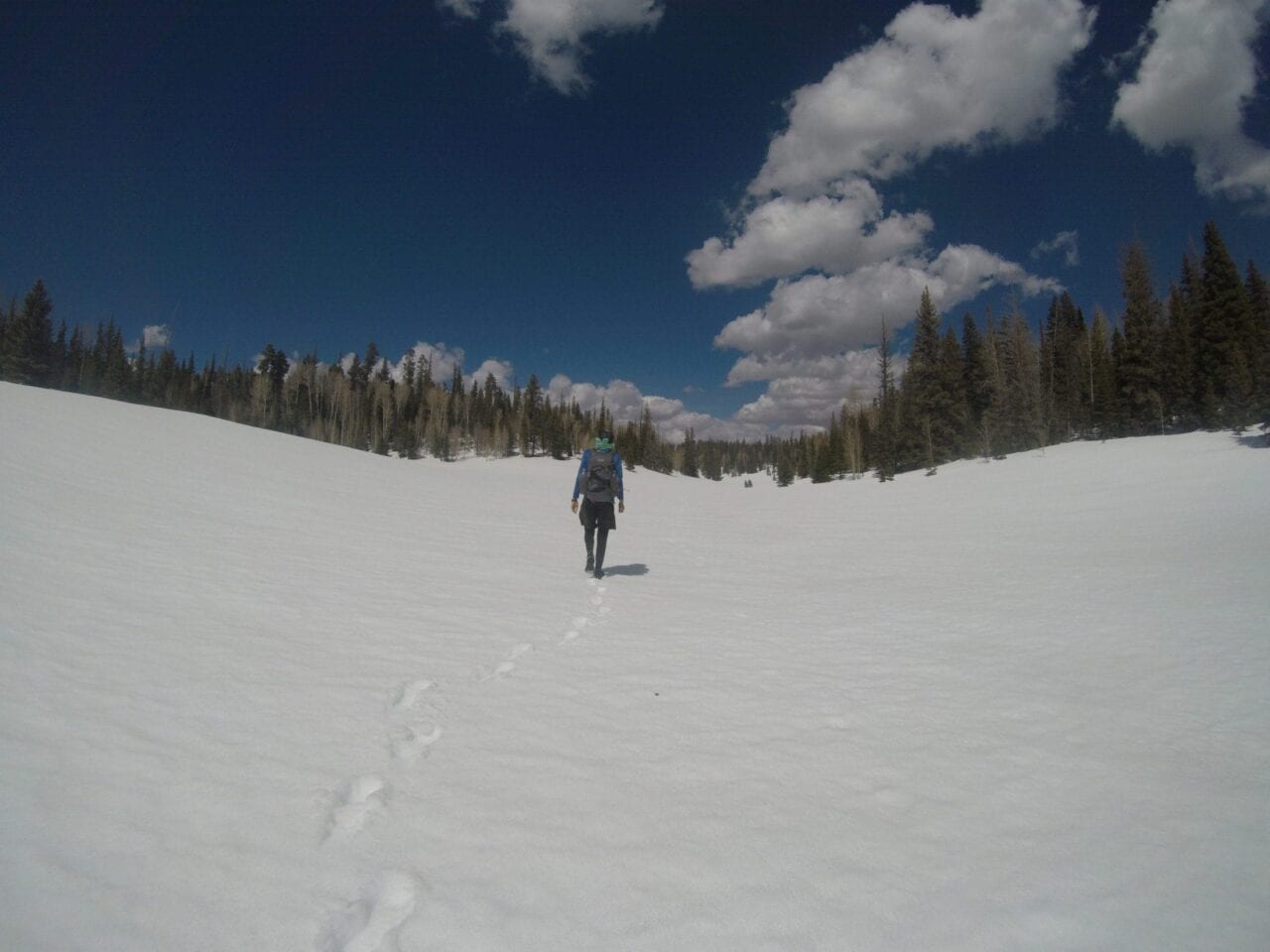
Photo provided by Jeff Garmire
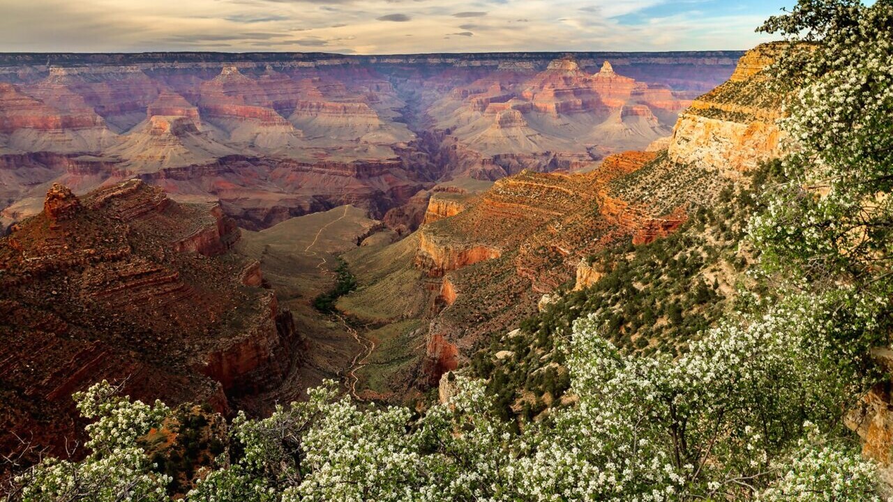
-Day 14
It was not a good morning. I hit snooze on my alarm until I didn’t need a headlamp to see. Mentally, I was out of it and felt like throwing in the towel. My body was wrecked, and I just wanted to sleep. This was not fun. It was brutal, and I questioned why I had put myself through this. But while all these thoughts went through my head, I pushed forward. Miles ticked by quickly as I neared the Grand Canyon. I was able to run again, and it opened up a new world. My psyche improved, and I crushed the day. I made it to Tusayan at 6pm and really needed to turn this day into something special. I did my most expensive (by almost double) resupply at the general store, drank a coffee from Starbucks and packed out a Yerba Mate for even more caffeine and began my assault on the Grand Canyon. I was at its rim late at night, but I followed the Kaibab Trail and kept going. It was magical. The moon shone bright, and I often turned off my headlamp to see the giant canyon bathed in the night light. Moon shadows were everywhere, and it didn’t make me want to stop. I continued to push to Phantom Ranch and then even further on the flat trail. Today turned into tomorrow, and I didn’t even take a dirt nap until after 2am. 700 miles down.
-Day 15
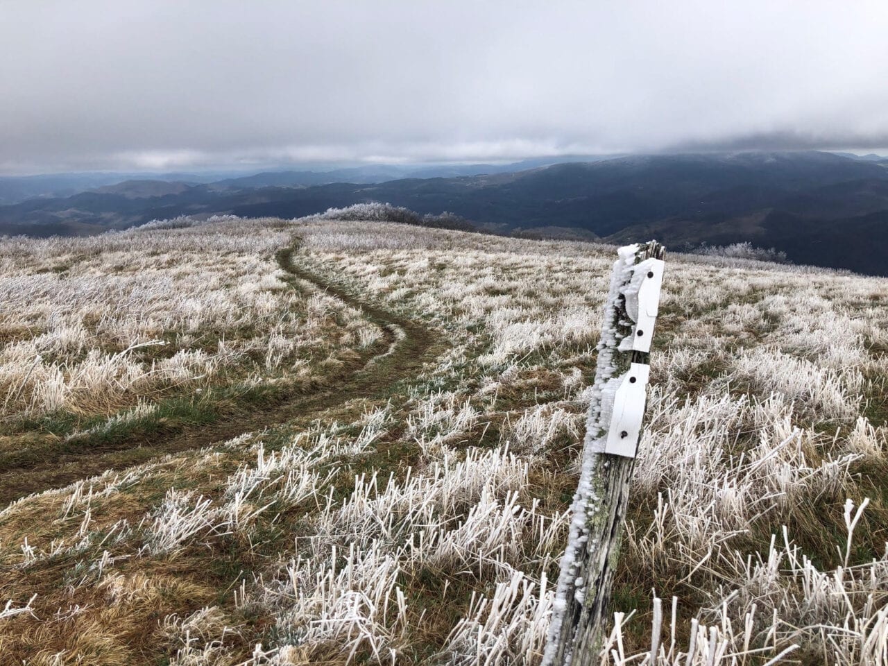
I was re-energized after my 25-minute dirt nap and kept pushing. It was peaceful to have the whole canyon to myself, and I wanted to preserve the feeling as long as I could. The sensory overload of the Grand Canyon was working wonders for my sleep-deprived mind, and I could just continue on. After Cottonwood Camp I decided I better log a few more minutes of sleep before the sun came up, or I would pay for it throughout the day of snow travel ahead. I dozed off for another 30 minutes and awoke as the first shimmers of light illuminated the canyon. From there it was an aggressive climb up the North Rim, and I was done with the canyon by the time most people were done with breakfast. Then the snow began. It was an eerie feeling traveling through the snow-covered forests. There were no footprints and only occasional breaks in the snow to reassure me that I was on the right path. This early in the day the snow was still firm and my pace was good, but that wouldn’t continue. With each slip on the crusty white layer my feet would cry in pain and I would wince. With no one around, some of the winces could have been quite loud, but I was nearing the point where it was tough to tell what was in my head and what was said out loud. The snow to the park boundary was quite navigable, and there were even portions of exposed trail with snow melt to collect water. But once I left the National Park and climbed even higher onto the Kaibab Plateau, the snow became constant. It was no longer solid, either, and with every step I would sink a few inches. It was not post-holing, but it slowed me down considerably. My feet were wet the entire time, and I was frustrated. My pace was slow and sluggish, I was incredibly tired, but I knew I had to push into the night.
The snow changed my plan. Initially I had planned on 50 miles each day, but today that did not seem attainable, so I changed my plan to anything over 40. The thinking behind this was if I cut the miles remaining to under 50 for tomorrow, then I was confident I could make it to the end. Making this decision eased my fears and lifted a layer of anxiety. In my sleep-deprived state, anxiety seemed to be weighing on my body at a much faster and more fear-inducing rate than when sleep was not so much an issue. I passed by the East Rim with sweeping views and even found a picnic table cleared of enough snow that I could eat a tortilla wrap for dinner. Then the slog continued into the night and I started going crazy. I couldn’t stop, but I also couldn’t stop the strange things going through my mind. While walking through a clearing and on the snow with the moon casting shadows down, my mind turned the trees, shadows and landscapes into things they weren’t. I was hallucinating. A shadow looked like two old people hugging; a tree looked like a witch with a broom; a clump of trees looked like a cabin. Another resembled Sasquatch and my mind continued to drift. It was one of the stranger things I have experienced mentally. I knew these things weren’t there, yet my mind was still making them appear. It was like a weird version of Inception. Late in the evening and after 41 brutal miles I laid down to sleep. It was not good sleep. 741 miles down.
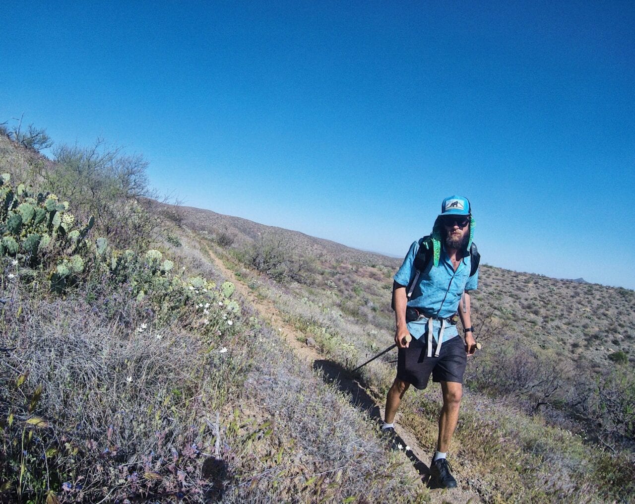
Photo provided by Jeff Garmire
…15 Days 13 Hours and 10 minutes.
-Day 16
I kept waking up. I would wake in a fit of panic, expecting to have slept through my alarm. I had set multiple alarms to combat this fear, but my mind was too panicky to quell my fears. It was not rational, but in the state I was in, nothing seemed to be rational. I had only planned a couple hours of sleep anyways, but they were not productive hours, and I eventually began my final day. Everything I drank had caffeine added to it. There was little else I could do to stay mentally alert, and despite trying to listen to loud music, it would only frustrate my mind and I would push on in silence. The snow was patchy in comparison to yesterday, and the route was much easier to follow. The brisk morning chill aided in my alertness, and I was able move forward with ease. The frustration of having to fight through 48 miles was eased when the number became 38 and then 28. There were moments of reflection and moments of longing. I was ready to be done. I was done caring about food or cravings or even a bed. I just wanted to sleep uninterrupted for hours on end at the first place possible. My feet were as bad as they had ever been after a day of being wet and trudging through the snow, but after a week of intrusive pain, I could move the dull throbbing to the back of my mind and hobble on.
There were periods and waves of adrenaline that caused me to run short sections and power up the hills, but overall it was a day of only consistent forward motion. Breaks were not true breaks, only time to grab food from my pack. I had a mission and much like the last hours of Nolan’s 14, I felt no need to rest. I could rest when I was done but not now. I wanted rest so badly but I did not need rest to accomplish this current goal. The trail eventually hit the gentle downhill and the snow disappeared. I ran out of water and despite knowing exactly where the next source was, my mind lost track of the task and I walked right by it, requiring me to back-track a few minutes. It was a day spent in my own head and as the sun set and darkness engulfed the trail, I felt none of the tiredness of previous night. I continued forward. The final miles frustrated my exhausted body as the gentlest switchbacks ensued with only a couple miles left. But finally, I made it down and heard voices in the campground. It was a weird moment. I hit the monument and not 5 seconds after finishing, someone yelled out with my trail name, “Are you Legend?” I responded and the moment and hours of reflection were over as quick as the trip was.
A rollercoaster like none other, but I was able to set both the self-supported and overall FKT! I learned and found caverns of my mind I have never explored and will one day return to those spots, ready to get more comfortable in the pain cave I lived in for much of the past 15 Days 13 Hours and 10 minutes.
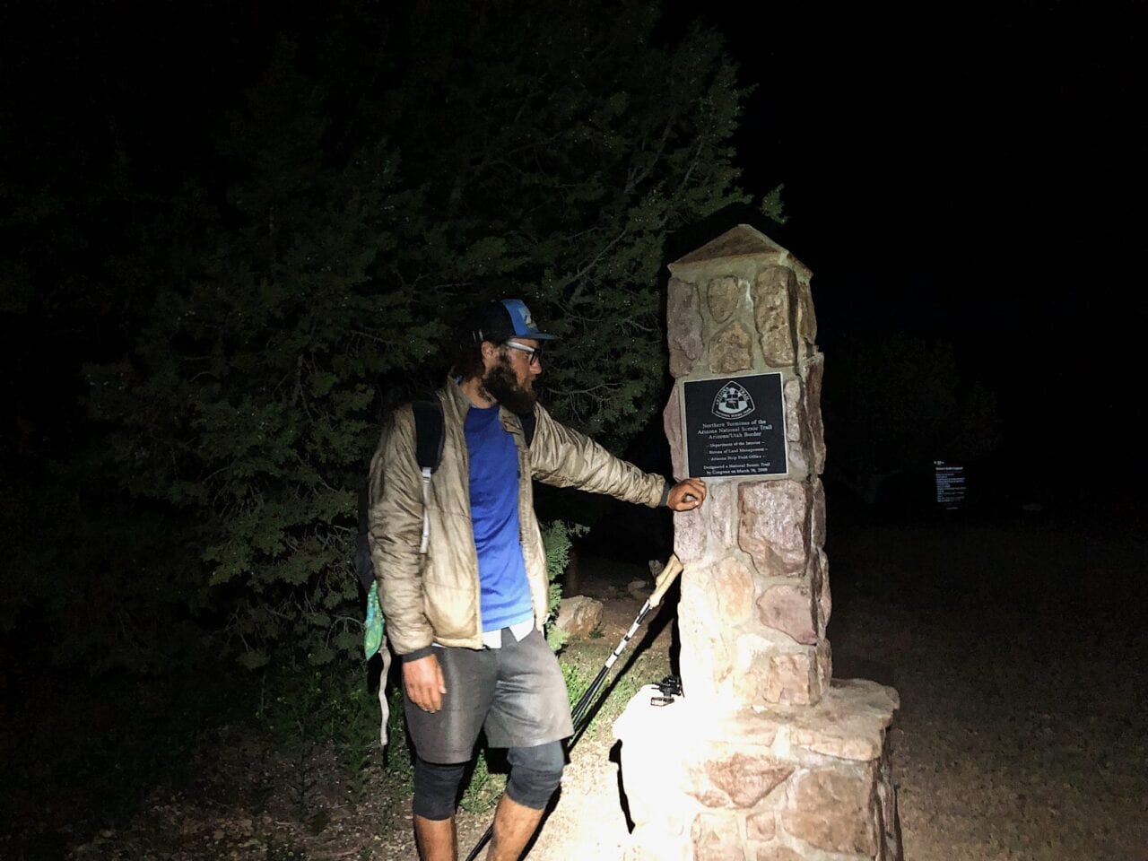
Photo provided by Jeff Garmire
Want to keep up with all that’s going on at Atlas Guides? Sign up for our newsletter!
Read more!
Check out some related blog posts!
Get our trail guide for this area!
Arizona Trail
The Arizona Trail stretches 800 miles across the state of Arizona from Mexico to Utah, passing through some of the most diverse and beautiful landscapes in the state.
800 mi (1280 km) $9.99 full guide
Grand Canyon, Arizona Trail
Photo courtesy of the Arizona Trail Association
Grand Canyon, Arizona Trail
Photo courtesy of the Arizona Trail Association
Arizona Trail
The Arizona Trail stretches 800 miles across the state of Arizona from Mexico to Utah, passing through some of the most diverse and beautiful landscapes in the state.
800 mi (1280 km)
$9.99 full guide
Get our trail guide for this area!
About the Author

Natalie McMillan
Natalie grew up hiking in Arizona where she fell in love with the outdoors. Her favorite hikes are to Havasu Falls in the Grand Canyon and Angel’s Landing in Zion National Park, UT. She loves taking pictures of people, places, and nature, which might explain why she has almost 47,000 photos currently residing on her phone. She takes care of all things related to social media and marketing and recently moved to Denver, CO from Flagstaff, AZ. You may find her frolicking around the trails and mountains of Colorado, or exploring the new city she gets to call home.
My Trail Story by PYT
Planning an adventure? Check out our popular trail guides! 4.7 stars (14K+ ratings)
Photo by Dave Mizelle
My Trail Story featuring PYT
Dave Mizelle, a.k.a. PYT, shares his close call with nature while hiking in the Roan Highlands section of the Appalachian Trail.
Natalie McMillan My Trail Story 05/09/2019
Natalie McMillan
My Trail Story
05/09/2019
Trail Name: PYT
Currently Hiking: Appalachian Trail NoBo
Started hiking March 11, 2019
My Trail Story by Dave Mizelle
We were about to enter the Roan Mountain / Roan Highlands section of our AT thru-hike. The weather was looking very questionable, but we hoped to break camp early enough to beat one of the storms, and hopefully be on the other side of the Highlands when round two came through. They were calling for rain and thunderstorms for both. That night we had been monitoring the weather hourly to get a game plan set.
Waking up at 5am the next morning, you could hear the wind had really picked up, but otherwise looked good. We packed up quickly, and made our way for Roan Mountain, which has an elevation of over 6,200 feet. The climb was strenuous, but the weather worked in our favor, save some rain squalls. No big storm yet — perhaps we dodged a bullet. After a long descent, we exited onto Carver’s Gap. Since the vegetation and forest is so thick on Roan Mountain, we didn’t have to deal with the wind.
Photo by Dave Mizelle
Photo provided by Dave Mizelle
Upon exiting into the Gap, we were nearly knocked off our feet in the middle of the road. Winds 40-50 mph with gusts to over 60 mph welcomed us to the Highlands. The temperature had dropped 15 degrees. At this point, with no thunderstorms, we decided to make a go for it. It was early in the day still, around 1pm, and our goal was to make it six miles to the Overmountain Shelter. The Balds on Roan are well over 5,000 ft, with long stretches of exposure to the elements. Halfway across Round Bald, we were greeted with sleet on top of the pulverizing winds.
At this point we second-guessed our decision. Should we have gotten off the mountain at Carvers Gap? We were well prepared gear-wise, but what would come in the next two hours would absolutely drain us physically and mentally. Sleet felt like knives on our faces. Trekking poles were mandatory, otherwise we’d be knocked over. Visibility was down to about 75 feet. I was worried, and being in front, kept looking back at my hiking partner every few minutes, and saw her flailing at times. At one point we decided to just run — it was our only instinct.
I had never felt so hopeless. The mountain was having its way with us. After what felt like an eternity, we finally descended into the tree line, caught our breath, and tried to put into words what just happened. But cold was starting to set in, so we needed to keep moving. Had thunder and lightning been in play, we would have never, ever attempted to cross those Balds. Was it risky to cross in the conditions we were faced with? Yes. But at the end of the day, it was more of an inconvenience than anything else.
It’s important to stay on top of the weather situation, not once a day, but multiple if possible. The higher elevations are a different beast because things can change so quickly and sometimes for the worst. Had we been ill-prepared, it could have been a very different story. We made it out safely, just cold and wet, but with some good stories to tell. I can say just thinking about that day makes me want to warm up by a fire!
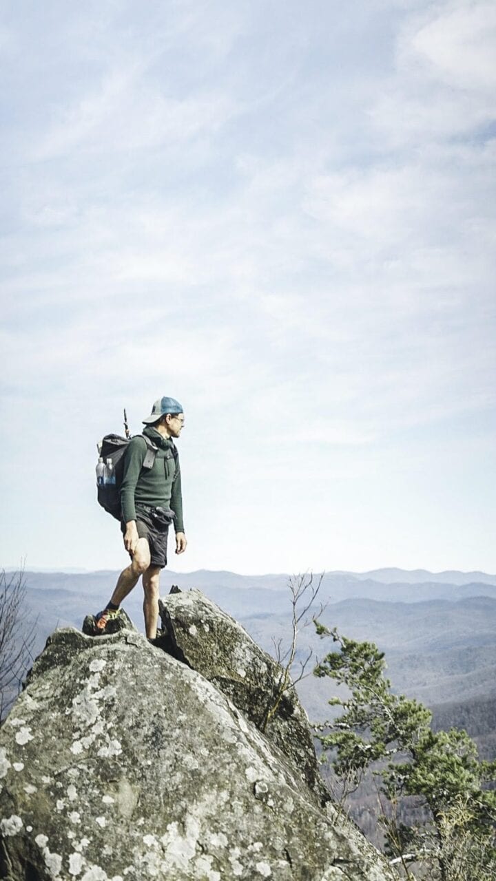
Photo provided by Dave Mizelle
Photo by Dave Mizelle
Want to keep up with all that’s going on at Atlas Guides? Sign up for our newsletter!
Read more!
Check out some related blog posts!
Get our trail guide for this area!
Appalachian Trail
The Appalachian Trail is one of the oldest National Scenic Trails in the US. Its path takes you from Springer Mountain in Georgia to Mt. Katahdin in Maine.
2200 mi (3540 km) $59.99 full guide
Pennsylvania, Appalachian Trail
Photo by Zoë Symon
Pennsylvania, Appalachian Trail
Photo by Zoë Symon
Appalachian Trail
The Appalachian Trail is one of the oldest National Scenic Trails in the US. Its path takes you from Springer Mountain in Georgia to Mt. Katahdin in Maine.
2200 mi (3540 km)
$59.99 full guide
Get our trail guide for this area!
About the Author
Natalie McMillan
Natalie grew up hiking in Arizona where she fell in love with the outdoors. Her favorite hikes are to Havasu Falls in the Grand Canyon and Angel’s Landing in Zion National Park, UT. She loves taking pictures of people, places, and nature, which might explain why she has almost 47,000 photos currently residing on her phone. She takes care of all things related to social media and marketing and recently moved to Denver, CO from Flagstaff, AZ. You may find her frolicking around the trails and mountains of Colorado, or exploring the new city she gets to call home.
My Trail Story by Justin Helmkamp
Planning an adventure? Check out our popular trail guides! 4.8 stars (17K+ ratings)
Photo by Justin Helmkamp
My Trail Story featuring Justin Helmkamp
Justin Helmkamp spent 40 days walking over 800 miles on Te Araroa in New Zealand.
Natalie McMillan My Trail Story 04/25/2019
Natalie McMillan
My Trail Story
04/25/2019
It seemed like the next step in the process of forever chasing this seemingly strange addiction I’ve had over the past three years. First, gain your thru-hiking chops on the Appalachian Trail, learning tips of the trade on the trail that started it all. Next, go west and take those skills to a changing environment of desert, high mountains, and the Pacific Northwest on the Pacific Crest Trail. Continue on to off-trail route-finding on the Oregon Desert Trail. The question then became, “What am I going to do with three months off in the winter?”
The next step turned to taking what I had learned, halfway around the world to New Zealand. I heard about this new trail the Kiwis called the “Te Araroa,” which in the Maori language stands for “The Long Pathway.”. For two years it was the trail that I always wanted to experience but would never be able to make work. Well, fate gave me an opportunity, and on November 10th, 2018, I landed in Auckland. Solo.

Photo by Justin Helmkamp
The big difference with this trail compared to the past was my intention to hike solo. Each of my past hikes, there were always other people — trail family hiking the same way as myself Sometimes groups that I had planned to hike with. Others that happened naturally on trail. But this time it was different. I chose to hike Northbound from the Southern Terminus of the South Island, starting early in the season, something that is not common amongst TA hikers. In doing so, I set my hike on a course that would challenge me to be able to complete the task at hand mostly in my own mind, a far cry from other trips. Having someone else to share the experience has always been a part of my past. Naturally, I was a little concerned with this, but I also realized that for another level of growth in hiking, doing this solo would push me in ways that other hikes had not.
On November 15th, after traveling south and sleeping off the jet-lag, I finally started from Bluff, the Southern Terminus of the TA, intent on completing the South Island section of the trail. By the second day and about 50 miles into my hike, I limped my way to Riverton, a small town directly on the trail. After 70% roadwalk/compacted beach walk, I had messed up my foot to the point of a possible stress fracture. This was my first taste of how hiking by myself could be detrimental. Without other people around, I found myself not taking the time to rest during the day and continually pushing myself too quickly too soon. So I weighed the options. I could quit and go home, or I could wait, rest, and heal up. I chose to go to Queenstown, the “Adrenaline Capital of the World” (bungee jumping was invented there and it is the action sport hub of the Southern Hemisphere), to work in a hostel and heal up. And I loved it!
Photo by Justin Helmkamp
Photo by Justin Helmkamp
Immediately I found a sense of community among other travelers. And since I was staying in the same hostel for four weeks, I met quite a few long-term stays and gained a new friend group of travelers. None of them had done much in the way of long-distance thru-hiking, but their different travel experiences helped me see how there are many other ways to see the world. And when my four weeks were done, I felt bittersweet about leaving my “tramily” in Queenstown. Intentionally pulling myself away from the people I enjoyed to continue on this lonely path was hard, but I also knew that I had come to New Zealand with a purpose. And if I didn’t give the effort I felt I owed myself, then there would be regret.
After a day of bus rides and hitches, I found myself back on the Long Pathway where I had left it a month before. Still, there was no signs that anyone else would be hiking with me. After the first week, I had only met four people on the trail, all heading the other way in section hikes. But those moments in passing would frequently be high points in my days. Those 20-25 miles a day on various levels of track challenged me in ways I hadn’t been before on the AT, PCT or other trails. Plenty of time to be stuck in my own head, no opportunity to free myself from swirling thoughts and questions with another person.
It was tough the first two weeks. I found myself not wanting to leave resupply towns to get back to the trail, stalling as long as I could until I knew I would be hiking in the dark to get to camp unless I got off my butt and started moving. I didn’t want to leave the sense of security found when surrounded by other people because it was my only opportunity to connect outside of myself. But in forcing myself to continue (and as time progressed), finding ways to maneuver through my mind became easier; questions began to find their answers, freeing my mind to be able to experience the beauty of this place with less noise from within.
And was it ever beautiful! Vast fields of tussock blanketing the mountains in a sheet of gold. Cascading waterfalls leading to river valleys of the purest water I had ever tasted. Beautiful birds of multiple neon colors. Huts for shelter with views that only millionaires could pay to have. It was a paradise. And a very muddy paradise at that. I often joke that I didn’t have dry feet for over a month on the trail. But as with the other challenges of the hike, committing the time to accept the new “normal” of my existence found me unphased by spending hours crossing rivers multiple times a day.
Photo by Justin Helmkamp
The further north I traveled, the more people I came into contact with, with nearly all of them still heading the opposite way. I was the weird one to them, this solo American with a tiny backpack heading NoBo. But it did also lend the opportunity to briefly meet others on the trail, even if it was a fleeting passing. Some, I found, were past PCT hikers looking for a winter adventure. Three were Triple Crowners (having completed the AT, PCT, and CDT) reaching out to new places. It was fun to connect with them about their experiences on places I knew and loved, albeit briefly. Onward and Northbound I would go against the grain, eventually leaving the open spaces for the forests in the mountains saved from clear cuts by early Europeans arriving in New Zealand. To places like Arthur’s Pass, Nelson Lakes National Park and the Richmond Ranges. By this time, the trail was home once again, a place that I was comfortable with being alone. The mountains became steep, the trail was tough, but I was ready for this last section before the victory lap finish at Ship Cove.
Having made it through with a few new cuts from some tumbles, I approached my last full day on trail on the Queen Charlotte Track. The track is also a bike path, so I knew I could make good time and I knocked out a 30 mile day, getting to a privately-run campsite about 12 miles from the finish. Borrowing a hammock for the night, I had a restless night looking up and watching the Southern Hemisphere stars gently drift by. My last night on the trail had thoughts racing through my head, as it does on any other trail I suppose. But these were full of questions asking if I had a “fulfilling” experience. Was it worth doing this alone? Would sacrificing some of the freedom I had found, to hike with others, seeking out a group of people on the trail, have been worth it?
The next day’s 12 miles flew by. It was a perfect day; sun shining through the trees as I made my way around the many bays and coves to my end at Ship Cove. And when I got there, I felt relief, happiness, accomplishment; all the things I think many feel upon completing a long hike. But I also knew that I would never do this again.
Photo by Justin Helmkamp
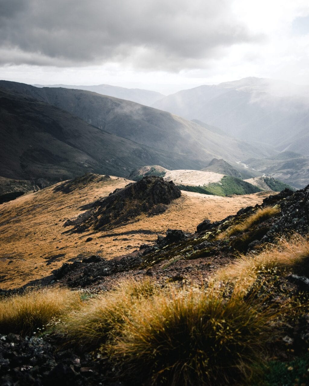
Photo by Justin Helmkamp
Not in the hiking of the Te Araroa again or any other long trail, but rather in the way I had committed to on this hike. For 40 days and 812.5 miles, I had walked all but maybe 30 minutes by myself, never seeing another hiker other than in passing on the whole trail. And while I now know that I can if I need to, it is not something that I will do again. Sure, I had good moments on trail. Many of which I would say are some of the most beautiful experiences in my life. And I am truly grateful to New Zealand and the Te Araroa for them. But in looking back at what truly makes the trail special is those shared moments of beauty. The moments that are remembered best, with more fondness than others, are those where the people you are with help bring a new level of joy to the moment. There is a quote at the end of Into the Wild, “Happiness is only real when shared.”
I offer a small amendment: “Happiness is most real when shared.”
Want to keep up with all that’s going on at Atlas Guides? Sign up for our newsletter!
Read more!
Check out some related blog posts!
Get our trail guide for this area!
Te Araroa
Te Araroa is a long distance hiking trail in New Zealand, stretching 3000 km across the country’s two main islands. The trail travels from Cape Reinga to Bluff.
3000 km (1860 mi) $39.99 full guide
Cape Reinga, North Island, New Zealand, Te Araroa
Photo by T L
Cape Reinga, North Island, New Zealand, Te Araroa
Photo by T L
Te Araroa
Te Araroa is a long distance hiking trail in New Zealand, stretching 3000 km across the country’s two main islands. The trail travels from Cape Reinga to Bluff.
3000 km (1860 mi)
$39.99 full guide
Get our trail guide for this area!
About the Author
Natalie McMillan
Natalie grew up hiking in Arizona where she fell in love with the outdoors. Her favorite hikes are to Havasu Falls in the Grand Canyon and Angel’s Landing in Zion National Park, UT. She loves taking pictures of people, places, and nature, which might explain why she has almost 47,000 photos currently residing on her phone. She takes care of all things related to social media and marketing and recently moved to Denver, CO from Flagstaff, AZ. You may find her frolicking around the trails and mountains of Colorado, or exploring the new city she gets to call home.
My Trail Story by Peanut
Planning an adventure? Check out our popular trail guides! 4.8 stars (17K+ ratings)
Photo provided by Melanie Harsha
My Trail Story featuring Peanut
Peanut, a.k.a. Melanie Harsha, withdrew all of her applications to doctorate programs, adopted a dog, and started planning her first thru-hike of the Appalachian Trail in 2016.
Natalie McMillan My Trail Story 04/04/2019
Natalie McMillan
My Trail Story
04/04/2019
What is your trail name?
Peanut
What trail(s) did you hike?
Appalachian Trail – 2016 NOBO
Pacific Crest Trail – 2018 NOBO
How old are you?
28 years old (27 during PCT, 25 during AT)
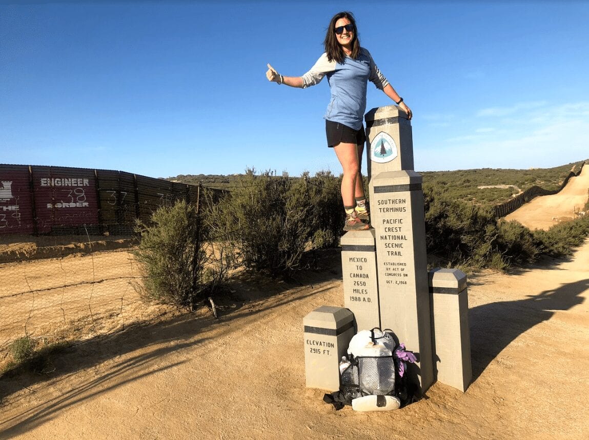
Photo by Melanie Harsha
What was your favorite food on the trail?
If I had a penny for every time a hiker said, “I eat to live, not live to eat,” I could fund all my future thru hikes. I’m sorry to say that I am not one of these people. I get sick of eating the same food really quickly and I cannot stomach some of the typical hiker meals that people come up with. This became more evident on the Pacific Crest Trail, when I decided to go stoveless.
While on the Appalachian Trail, I had tuna on a tortilla for four days straight. On the fourth day, I literally got sick of it, regurgitating my lunch. I haven’t been able to consume tuna since. So, I have to get creative while on trail, and I must mix it up — no more than two of the same meals in a row.
On the Pacific Crest Trail, I decided to challenge myself to cold soak and not use a stove during my whole hike. I accomplished my goal, but I definitely see a stove in my future thru hikes.
My favorite cold soak meal is refried instant beans and rice, seasoned with taco flavor and topped with cheese and Cool Ranch Doritos. When I have a stove, my favorite meal is Annie’s Mac and Cheese (the bunny shapes with white cheddar flavoring) with added cheese and sometimes prosciutto, if I’m feelin’ fancy.
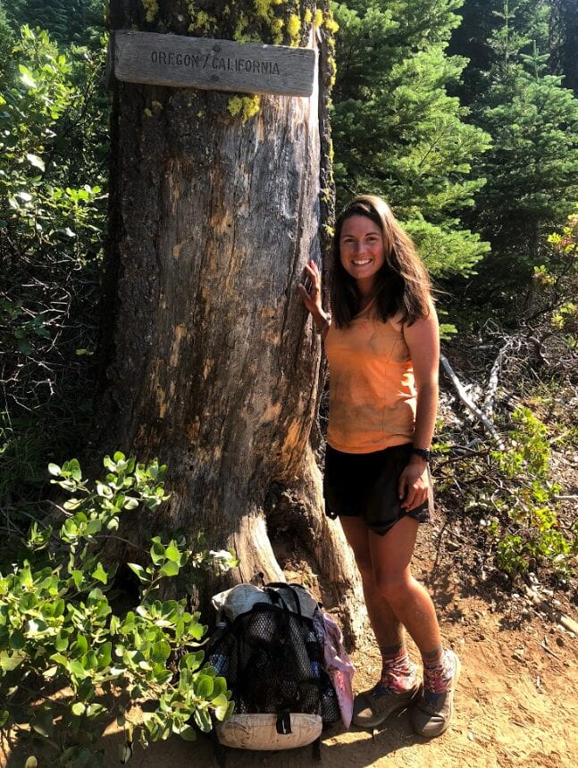
Photo by Melanie Harsha
What advice would you give to someone who has never done a thru-hike before?
A close friend of mine is about to start her thru hike attempt of the Appalachian Trail this April, and I try to answer this question for her everyday. I tell her that as soon as you take your first steps, all of that anxiety and worry instantly goes away. I’ll continue to tell her this every time I speak with her, but she won’t know it’s true until she’s there herself.
Thru hiking takes so much planning, and yes, some people plan way more than others, but it’s not easy leaving your life for half of a year. The best way to thru hike is to just get out there and do it. After your transportation leaves, it’s just you and that trail. Sure, you’ll have many other hikers with you and your gear, but once you take your first steps there’s not much you can control anymore. You just have to try your hardest everyday and realize that things aren’t going to go as planned, like ever.
Thru hiking is all about rolling with the punches and trying to maintain a positive outlook when problems inevitably arise. Unfortunately, you can’t really know all of these pieces of truth before going out on the trail and accepting them yourself. Honestly, you don’t want to know too much before you start the trail or it will ruin the surprise.
Would you do another thru-hike? If yes, which trail is next?
Yes, if I could afford it and my dog could always go with me, all I would do is thru hike. The Continental Divide Trail is definitely in my future, but not for a couple of years. I’m interested in doing some shorter, yet more challenging thru hikes and routes. We have some exciting things on the horizon for this summer. Stay tuned.
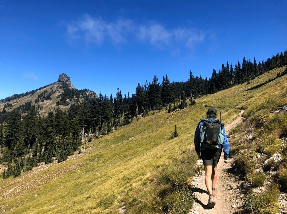
Photo by Melanie Harsha
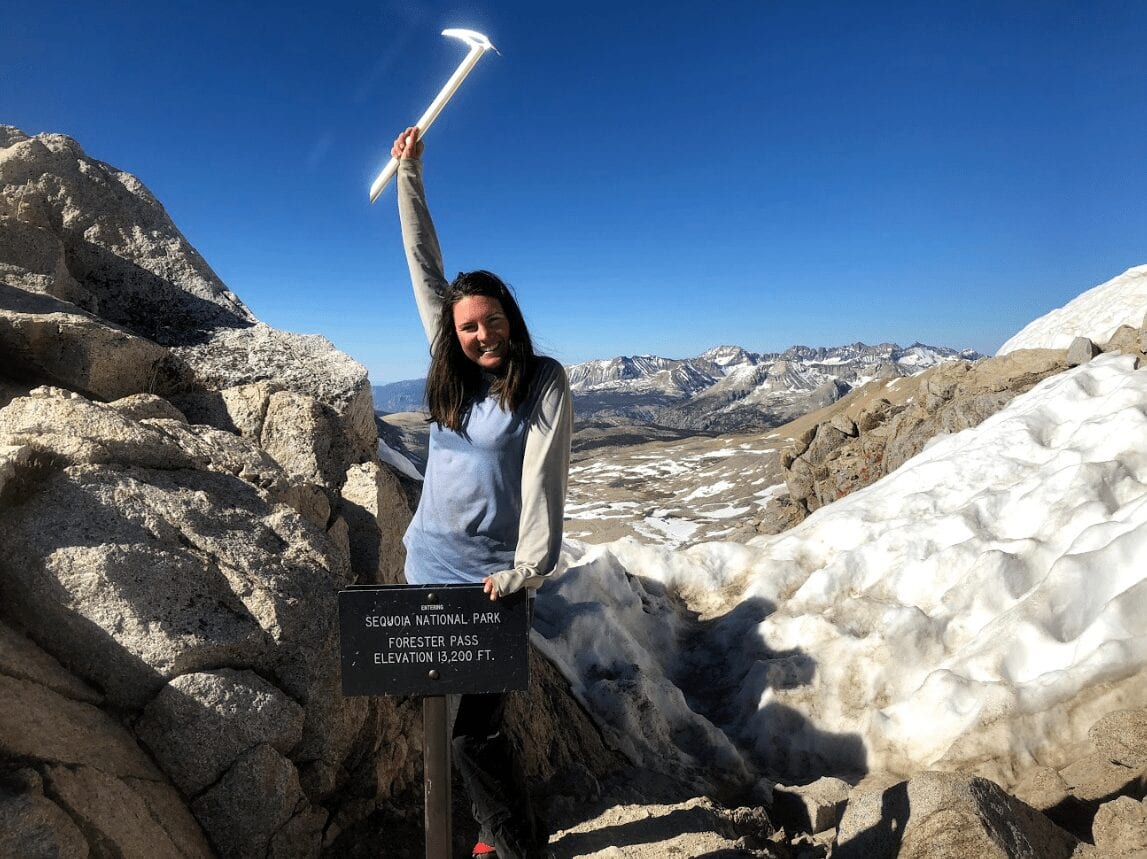
Photo by Melanie Harsha
What do you wish you had done differently?
I would not do one thing differently. Even the time I hiked one thousand miles on a stress fracture in my hip.
During my Appalachian Trail thru hike in 2016, my hip began to hurt around mile 1000, near Harper’s Ferry. My mom picked me up for a day and we went to a massage therapist who had helped many hikers before. I felt great after getting a massage and the therapist gave me some pointers to keep me feeling good. About a mile after my mom dropped me off, my hip started hurting again. About a week and one hundred Advil later, my Uncle Tom came to get me so I could rest for a few days in Pennsylvania.
I went to three different doctors during this break with my family and all of them said the same thing: “Get off trail, this is a stress fracture.” After thinking about it for a couple of days, I decided to “rough” it out and finish the trail.
When I returned to the trail, I did not want to have to slow down too much, because I wanted to be able to reach Katahdin before it closed. I began hiking extremely early in the morning and hiked until dark in order to make the miles, because I was now hiking at a much slower pace. In addition, I was taking 4 Advil every four hours, which added up to almost sixteen ibuprofen per day.
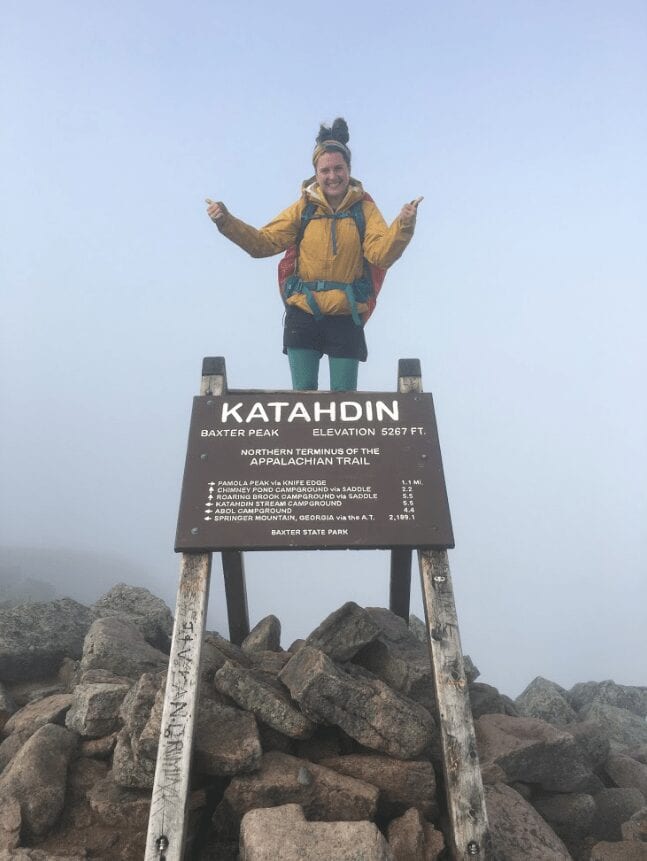
Photo by Melanie Harsha
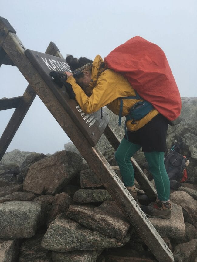
Photo by Melanie Harsha
The Appalachian Trail made me learn so much about my body and made me learn to listen to it. That experience led to my successful thru hike of the Pacific Crest Trail.
On September 27, 2016, I summited Katahdin and returned home to Nashville the next day. I spent the next six weeks in crutches after a scary talk with my doctor. He told me I had made some horrible decisions for my body, and he was right. My post-trail depression was especially bad because I couldn’t exercise, but my choices almost made future thru hikes totally out of the question. The doctor told me I had walked so long on the stress fracture it was mere millimeters from becoming a full-blown fracture. Not to mention what the amount of ibuprofen I had consumed did to my organs.
After having a long conversation with the physician about my habits, I had discovered that some of my initial habits had contributed to the fracture. I was not eating nearly enough calories in the beginning, which was probably the reason I stopped menstruating. I did not menstruate during my entire thru hike. When a woman ceases menstruation, she stops producing Vitamin D and Calcium. When this happens, stress fractures occur more easily.
No, I don’t regret these decisions, because I grew and learned from them. When I hiked the Pacific Crest Trail in 2018, I stopped hiking when something hurt. I took more breaks, I ate more food, and took many vitamins. The Appalachian Trail made me learn so much about my body and made me learn to listen to it. That experience led to my successful thru hike of the Pacific Crest Trail.
What was your favorite feature in our app?
Do I have to pick just one? I only wish I had Guthook on the AT. During the end of my 2016 hike I walked with many people who had the app, and I knew that I needed it for my next adventure. This app was a crucial part of my PCT thru hike. I think the most useful feature of the app was probably the comment section, which was critical during the desert in order to know the water situation.
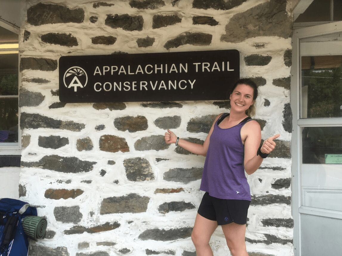
Photo by Melanie Harsha
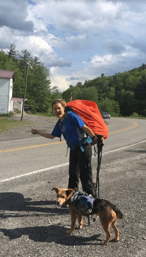
Photo by Melanie Harsha
Why did you decide to go on a thru-hike in the first place?
In 2013, I went on my first backpacking trip with my mom. She section hiked the Appalachian Trail over a period of 12 years. I went on a couple of these trips with her before I decided I wasn’t as patient as her and needed to hike the AT all in one go.
In 2015, I was finishing up my Masters program at Appalachian State University and was applying to PhD programs. I was anxious, stressed, and unsure that more school was the right move at that point in my life. On one section hike, my mom and I were discussing my next steps when she reminded me that I had been going to school since I was 5 without any time off. My mother, Sticks, told me I was allowed to take time off and do something different. I think a part of me needed that permission even though I knew that I had a huge support system that would back me up no matter what I decided to do.
I withdrew all of my applications to doctorate programs, adopted a dog, and started planning my 2016 Appalachian Trail thru hike.
Every thru hiker gets asked throughout their journey, “What’s next?” This question comes before, during, and after a thru hike. I believe most will agree that this is a slightly annoying inquiry, as most of us are just trying to get through the current hike or trying to process one they just completed. I get it. People are eager to know if we are off to another one or if we have to go back to reality. Throughout my AT hike, I would always say that I would never do another hike. I was going to go back to Tennessee and get back to school.
The moment I touched that Katahdin sign, I felt so empty. I was happy to get to the top, because damnit I hate hiking uphill. Other than that, I didn’t want it to end. Hell, I would’ve done another 6,000-foot hike up to make the AT never end. But, it was over. At the Northern Terminus, I turned to my trail sister, Hot Toddy, and said, “What’s next?”
Just a couple of months after my successful thru hike of the AT, I met a man who was about to start his own attempt of completing the trail. Little did I know, just a year and a half later, we’d be doing our own thru hike together. So here we are, three years later, two trails down, and about a million to go.
Photo by Melanie Harsha
Did you hike solo or with other people?
In 2016, I solo hiked the Appalachian Trail. However, I did start my journey with my dog, Radley. She was able to hike, roughly, 900 miles with me. Besides my pup, I completed the AT by myself and with the various friends I made along the way. In 2018, I hiked the Pacific Crest Trail with my partner, Cricket. He completed his thru hike of the AT in 2017.
How many pairs of shoes did you go through?
On my AT thru hike, I went through two pairs of La Sportiva hiking boots. On the PCT, I went through 4.5 pairs of Salomon Odyssey Pros.
What was the scariest part of your hike?
The scariest part of my thru hike wasn’t when three other hikers and I got stuck of Franconia Ridge in 80 mph winds. Although that was a frightening moment, the scariest part of a thru hike is when something occurs that threatens it to end that’s totally out of your control.
When Radley had to get off trail, I took off hiking faster than I ever had in my life. I was sad when she had to leave. She was my best bud on that trail, and it was heartbreaking when she let me know she couldn’t hike anymore. My average mileage went from twelve to twenty. I didn’t think it was that big of a deal when my hip began to hurt — I convinced myself it would go away and that my body would get used to the higher mileage. It didn’t.
My friend, Stubbs, found out she got a stress fracture in her hip about the same time I did. She had to make the difficult decision to get off trail. She healed and went on to complete the trail the following year. I saw many people get off trail due to injury. It’s scary because even though you can’t control it, you feel like you’ve failed.
I decided to complete the AT with the stress fracture, but it was a seriously painful 3 months, and my body will never be the same because of it. I will always be prone to stress fractures, especially in that hip. I will always get a painful twinge in my hip when I’m long distance hiking.
The scariest part of a thru hike is when something arises that gets between you and that finish line.
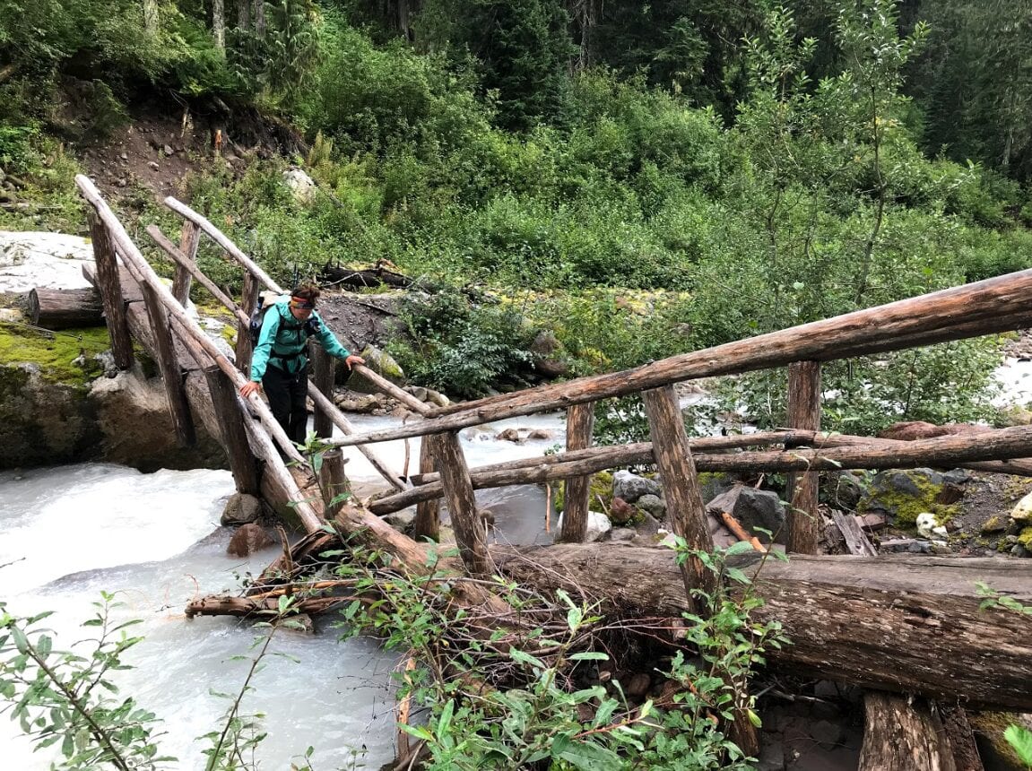
Photo by Melanie Harsha
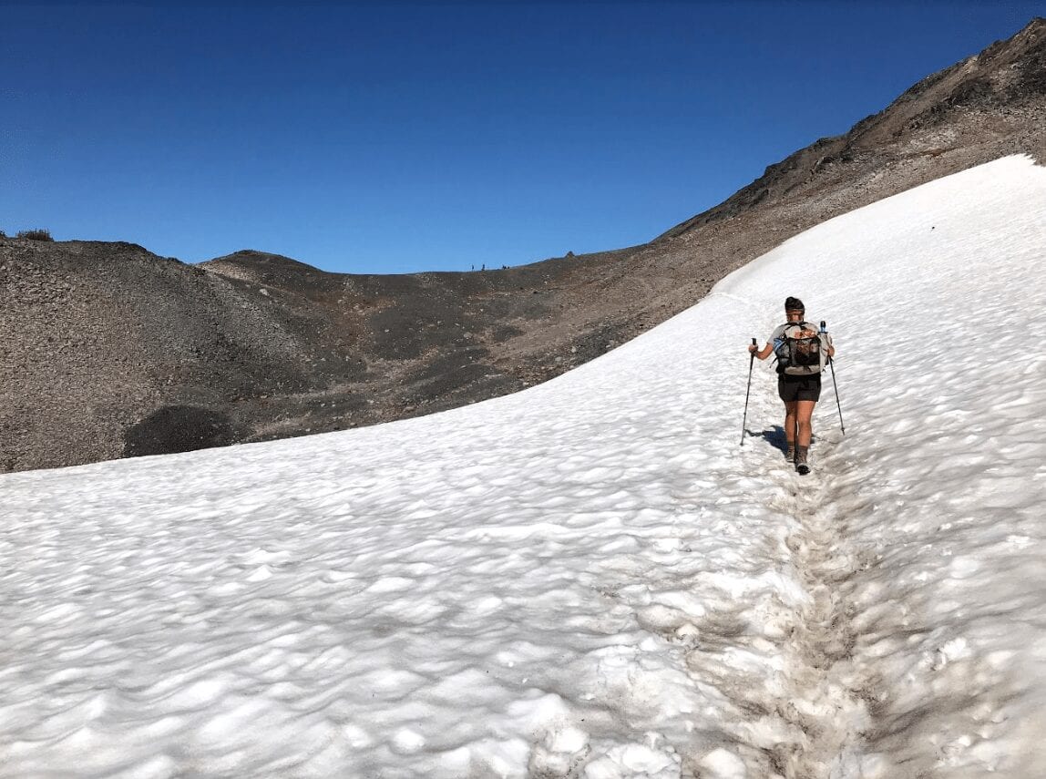
Photo by Melanie Harsha
Did you ever reach a point where you wanted to quit? How did you stay motivated to finish?
Everyone has a couple of moments on trail where they think about the possibility of quitting, I think. The thought definitely crossed my mind on a couple of occasions on both of my hikes. I’ve already gone over my stress fracture in great detail and how that made me think about getting off trail. That was the only time I ever seriously thought about quitting the Appalachian Trail. However, I did have a couple of times on the PCT where I thought about leaving.
They say your first thru hike is the equivalent to your first love, and I am a believer in this. Nothing will ever compare to my thru hike of the Appalachian Trail, and that’s just a fact. I knew this before I started the PCT, but it didn’t really hit me until we were on the other side of the country in the middle of California.
It probably goes without saying that the PCT and the AT are totally different trails in every way possible. The PCT was harder for me in a lot of ways. While the hiking was easier on the PCT, the trail itself was much more difficult mentally. The towns were fewer. The landscape was all new. I was further from my friends and family.
I grew up visiting the mountains in East Tennessee, and fell in love with the landscape of Western North Carolina. The Appalachians are the oldest mountains in the world, and what they lack in height they make up for in history and culture. These are the mountains where I fell in love with hiking.
Everyday on the PCT was a postcard. The views were incredible. I had never seen anything like it. However, there were many moments I felt like I needed to go back home. I had a lot going on with my family back in Tennessee, and sometimes I wanted to go home to be with them and Radley. Every time I felt like this, I tried to remember that everyone in Tennessee supported me and I would be so proud of myself if I reached Canada.
I knew I couldn’t go home until I finished this second thru hike, but it was extremely difficult, and there were many days I didn’t feel like I could do it. I stayed motivated to finish because I had already come too far to quit.
I prepared mentally, which, I believe, is the reason I reached Katahdin.
What was one thing you wish you knew before you started?
I wish I knew that I had it in me to hike 2,189.1 miles from the beginning. I will admit that I was probably a little underprepared for my first thru hike. I had gone on a couple of section hikes with my mom on the AT, but other than her guidance and advice, I had done little research. I left Springer with the gear that had been given to me throughout the years.
Don’t get me wrong, I did not camp at Hawk Mountain Shelter that first night without testing my gear. However, I was surrounded by people who I felt were much better prepared than I was. I do think that most people feel like this in the beginning.
I wish I knew, though, that it was okay I didn’t prepare that much; that it was okay I didn’t read a million blogs and watch hours of YouTube. I prepared mentally, which, I believe, is the reason I reached Katahdin. I was so afraid of not reaching the North Terminus that sometimes I feel like it interfered with my hike. I wish I had let that fear go earlier in my hike. Heck, there were days in Maine I was so anxious about not finishing that I would just fly by beautiful vistas because I was worried I wouldn’t make my mileage.
My advice to hikers is to slow down, enjoy the views, and as long as you follow the blazes and keep trekkin’ at your own pace, you’re going to make it. I know it’s cheesy to say “believe in yourself,” but just do it.
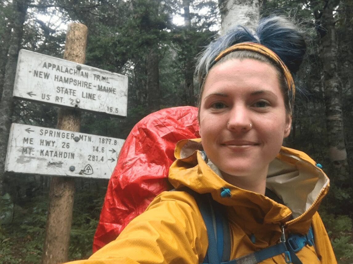
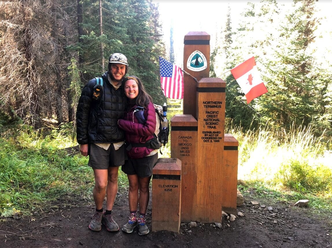
Photo by Melanie Harsha
Want to keep up with all that’s going on at Atlas Guides? Sign up for our newsletter!
Read more!
Check out some related blog posts!
Get our trail guide for this area!
Pacific Crest Trail
The Pacific Crest Trail is an epic journey of three states and over 2600 miles. Its path travels from the US border with Mexico to the northern border with Canada.
2650 mi (4260 km) $29.99 full guide
Washington, Pacific Crest Trail
Photo by Justin Helmkamp
Washington, Pacific Crest Trail
Photo by Justin Helmkamp
Pacific Crest Trail
The Pacific Crest Trail is an epic journey of three states and over 2600 miles. Its path travels from the US border with Mexico to the northern border with Canada.
2650 mi (4260 km)
$29.99 full guide
Get our trail guide for this area!
About the Author
Natalie McMillan
Natalie grew up hiking in Arizona where she fell in love with the outdoors. Her favorite hikes are to Havasu Falls in the Grand Canyon and Angel’s Landing in Zion National Park, UT. She loves taking pictures of people, places, and nature, which might explain why she has almost 47,000 photos currently residing on her phone. She takes care of all things related to social media and marketing and recently moved to Denver, CO from Flagstaff, AZ. You may find her frolicking around the trails and mountains of Colorado, or exploring the new city she gets to call home.
My Trail Story by Puff Puff
Planning an adventure? Check out our popular trail guides! 4.8 stars (17K+ ratings)
Photo by Alex Mason
My Trail Story featuring Puff Puff
Alex Mason, a.k.a. Puff Puff, is a Brit who has made thru-hiking her lifestyle. From hiking the Pacific Crest Trail to Te Araroa to the Appalachian Trail, there's endless possibilities for what's next.
Natalie McMillan My Trail Story 03/28/2019
Natalie McMillan
My Trail Story
03/28/2019
Trail name
Puff Puff
How old are you?
36 years old
What trail(s) did you hike?
- Pacific Crest Trail NOBO 2015
- Pacific Crest trail SOBO 2016
- Te Araroa 2016/2017
- Appalachian Trail 2018
“Puff Puff” Photo by Alex Mason
What was one thing you wish you knew before you started?
I actually wish I knew less. I spent a lot of time researching my first hike on the PCT, and I was happy that I did because it made me less nervous before my hike. But in hindsight, not knowing what’s ahead is pretty exciting and you learn so much as you go along.
How did you get your trail name?
I really don’t like being cold so I carried a puffy vest and a puffy jacket. My puffy jacket was a lot puffier than most peoples and it was a British brand so it stood out from all the Mountain Hardwear ghost whisperers. This lead to me having the trail name Puff Puff. I also get called Puff, Puff Squared, Puff2, Puff Diddy…
What was the funniest thing that happened on your trip?
One of my favorite moments on the Appalachian Trail was in Maine in the 100 Mile Wilderness. We were on high alert for moose and convinced we would see one near a lake as people kept telling us the best chance of seeing one would be near water. We camped quite close to a lake one night and around 2:00 in the morning we were woken up to the sound of splashing in the lake. My first thought was that it was a moose and it would be really stupid to get out of the tent to investigate. My friends on the other had thought it would be a great idea to go down to the lake and check out the moose. I had major FOMO (fear of missing out) and there was no way I was going to just stay in my tent while they saw a moose, so we all put on the red lights on our headlamps and crept down to the edge of the lake. The sound was exactly like an animal walking up and down the lake, splashing about, having a nice time. I was convinced we were about to come face to face with a moose.
When we got there, there was nothing there. Absolutely nothing. Except for the gentle lapping of the small waves onto the shore – which at 2:00 am sounds like a moose in the lake.
It makes me smile every time I think back to the elusive Lake Moose.
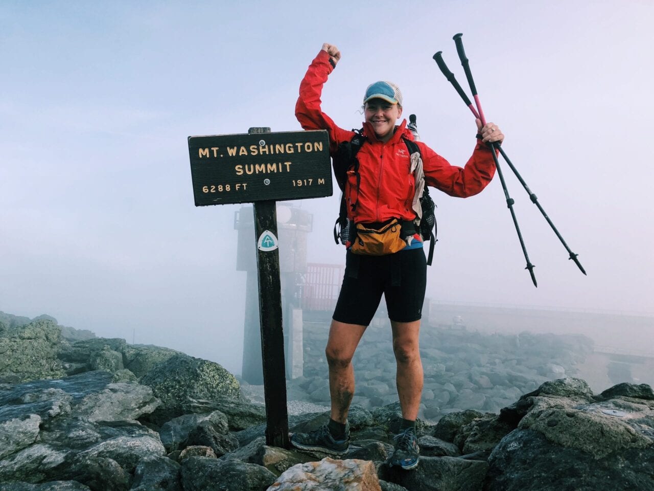
Photo by Alex Mason
Photo by Alex Mason
What was your favorite food on the trail?
I struggle with food on the trail. I don’t like nuts and lots of hiker food has nuts in it. I end up existing on mainly sugar, which seems to be ok while you are hiking because you burn it off straight away, and I always end up losing about 20 pounds by the end of a trail, but it also comes with big crashes in energy. I also get obsessed with some foods and eat them so often I eventually get so sick of them I never want to see them again. Tuna is a good example of foods I don’t think I will ever be able to eat again. So far I have never got bored of chips (crisps) or Twix bars. I think I ate two Twix bars every day on the Appalachian Trail. Normally I would always go for a flavored chip but on the AT I craved really plain but salty food so just plain salted were my go to (always go for ridged / wavy chips because they are more structurally sound). It must have been something to do with how much I was sweating.
I carry a stove, but sometimes I bounce it ahead when I get sick of all the things you can eat in it. I like to eat the dehydrated meals but I only buy them occasionally because they are expensive, and a lot of them aren’t that great. The best one I’ve ever had is the Thai Curry from Good To-Go — I wouldn’t have been disappointed if I have been served it in a restaurant.
What advice would you give to someone who has never done a thru-hike before?
There will be bad days, days you question what you’re doing, days when it feels easier just to give up. Never quit on a bad day. The times you feel like giving up are often when you are cold, wet, tired or hungry, or in the worst situations you will be a combination of, or all of them. But all these things can be fixed, you can warm up, dry out, eat and sleep and you will feel so much better.
Photo by Alex Mason
What does thru-hiking mean to you?
Thru-hiking has become a lifestyle rather than an adventure. Lots of people say “Oh, Alex is off on an ‘adventure’ again,” but I don’t really see it like that anymore. It’s just the way I am choosing to live my life. I would rather be outside than inside. I would rather every day be different than get stuck in the routine of the daily grind. I would rather battle against my own personal challenges than have to deal with battling against other people in an office. Hiking or walking is the purest way of getting from A to B, and the speed of travel allows you to see things that you wouldn’t otherwise get to see. It also has a purpose and I like to travel with a purpose.
Would you do another thru-hike? If yes, which trail is next?
Having ticked off two of the big three trails in America, the Continental Divide trail is high up on the list and is likely to be next. It won’t be this year though unfortunately. This year will be spent planning for a crossing of the Atlantic and Indian Oceans in an ocean rowing boat!
What was the hardest part of your hike?
I guess the hardest part was deciding to do my first hike. I doubted whether I would be able to do it and I put loads of barriers in my way as to why I couldn’t do it. Once you’ve told people you’re kind of committed to doing it then. You have to reassure the people who think it’s too dangerous and you have to deal with the negative people who tell you you won’t be able to do it – but those people, well that one person, only made me want to succeed just to prove them wrong!
What do you wish you had done differently?
I wish I had not gotten so stressed out about time and whether I was going to have enough of it. I wish I had not worried about things that were out of my control. I wish I had not worried about whether other people were going faster than me, or hiking bigger miles than me.
Photo by Alex Mason
Photo by Alex Mason
What do you miss the most?
I miss everything about hiking when I’m not hiking. I miss the simple life, having everything you need on your back. I miss setting up my bed in a new location every day. I miss my biggest worry being where my water is going to come from. I miss my friends and all the incredible people you meet along the way who I wish I could spend more time with.
What was your favorite feature in our app?
I have used the Guthook app on the PCT, AT and TA, and I think I would struggle without it now! I love the ability for users to leave comments. It is especially helpful when you are trying to find water and others are able to let you know if a water source is dry or not.
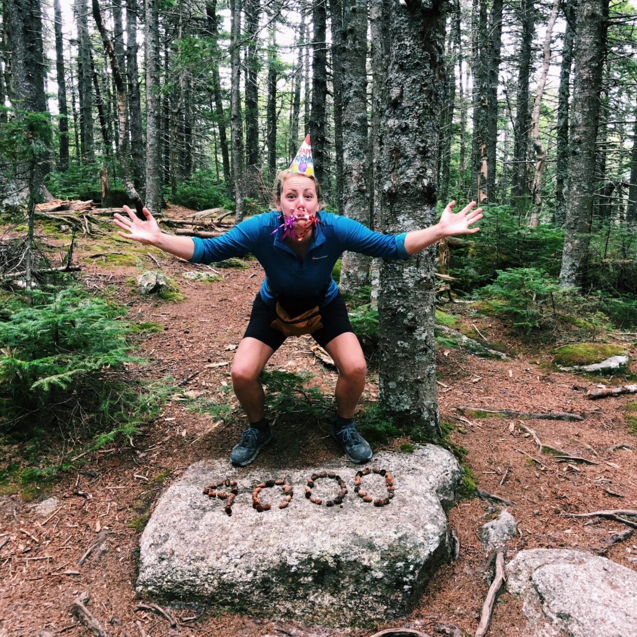
Photo by Alex Mason
What was one thing you had to have with you while you hiked?
A pillow. I started without one and I tried to use my puffy, or a stuff sack full of clothes, or an inflated water bladder. But I wasn’t getting a very good nights sleep and I would dribble on my puffy which wasn’t ideal! So I picked up a really lightweight inflatable pillow and I would be lost without one now. I use my buff as a pillow case because I like having something soft next to my face. I also struggle to sleep if I am a bit dehydrated so I will always carry a lip balm because it tricks your body into thinking you aren’t so dehydrated. Then you don’t have to drink a load of water before you go to sleep and don’t have to get up in the night to pee!
Did you hike solo or with other people?
I have hiked solo, with new friends and existing friends, and with a trail romance. I have had positive and negative experiences with all of them. I have started two of my hikes as a solo hiker and I have never had a problem with meeting people and finding people to hike with.
In general I like to hike alone (unless it’s a road walk) and camp with other people.
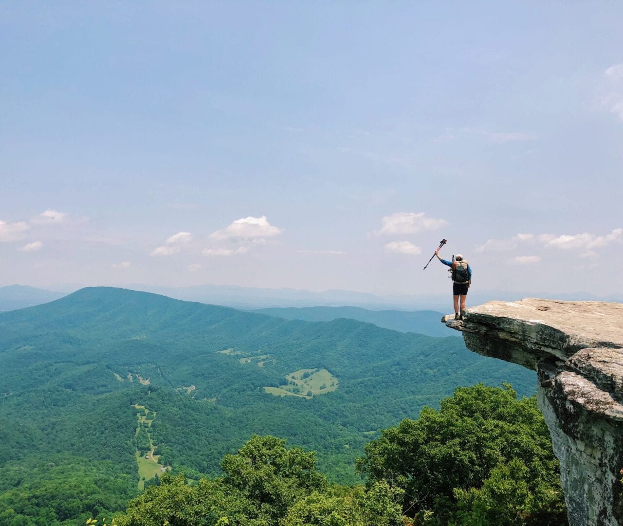
Photo by Alex Mason
Why did you decide to go on a thru-hike in the first place?
I was bored of what I was doing. I was working as a graphic designer in London and people would get so hung up on stupid things like whether to use this shade of grey or this slightly different shade of grey. I would spend a lot of time questioning whether that was really important in the grand scheme of things. I also hated my daily commute.
I wanted to take some time off and do something big, but often big trips have a big price attached to them, and they are over too quickly. When I discovered thru-hiking it was the perfect mix of physical challenge, time, and cost compared to time away from home. Thru-hiking isn’t as cheap as people may think it is, but you can get a 5 month experience for the same as it would cost to spend 3 weeks climbing a mountain for example.
The fact that you could walk across a country, and a country as big as the United States of America, was a notion I just couldn’t get out of my head.
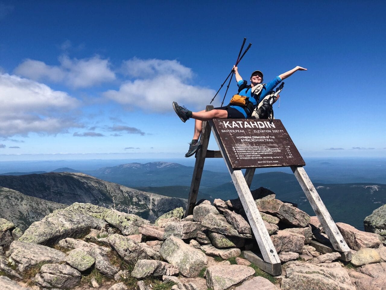
Photo by Alex Mason
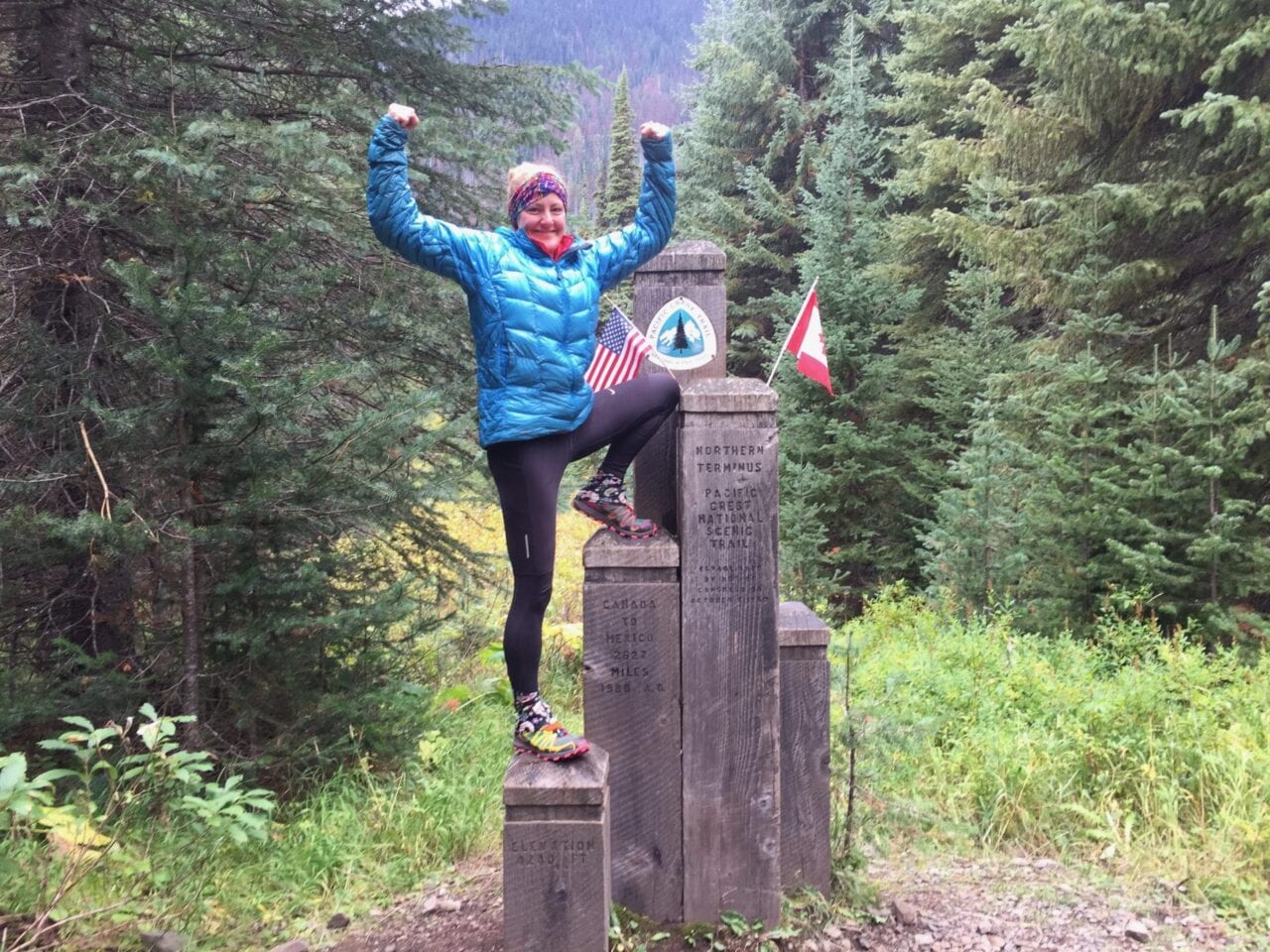
Photo by Alex Mason
What part of the trail was your most/least favorite?
I loved the whole Pacific Crest Trail which is why I hiked it twice, but of course there are some bits that stand out over other bits. The Sierra of course is wonderful (even better if you go southbound and hike when there is no snow), but the whole state of Washington is magical and Northern California isn’t talked about enough.
My least favorite part of the PCT was probably Deep Creek Hot Springs. It was so hyped up before the trail and I was really looking forward to it. What sounds better than a soak in a natural hot spring? But when I got there it was just a bit gross. It is an area which is easily accessible to the general public and in general the general public can be pretty gross. The area is full of trash, but worse than that there is a lot of human poo and used dirty toilet paper lying around. It is such a shame.
My favorite part of the Appalachian Trail is Franconia Ridge. After spending months in the trees you finally get some time above the tree line. The views are wonderful and it is worth waiting for good weather if you have the time and then staying up there for sunset as the sun goes down right behind Mt Washington.
My least favorite part of the AT would have to be ‘the rollercoaster’. You go up and down about 14 times over about 14 miles and when I was there it was just too hot for any part of it to be enjoyable.
It’s really hard to pick a favorite part of the Te Araroa because New Zealand is such beautiful country, there are so many good bits. The TA gets a bad review a lot of the time and a lot of people say don’t bother with the North Island and just do the South Island. I don’t agree with this at all. The trail is still so young and it shouldn’t be compared with other trails which have been maintained and groomed for many more years. The North Island had a lot of great bits – the Tongariro Crossing, the canoe down the Whanganui River, the Maori culture north of Auckland. But if I could only return to one part it would probably be the Richmond Ranges in the north of the South Island, just because I love being in the mountains and above the tree line.
My least favorite part of the TA is probably the very last couple of days which includes a long sketchy road walk down to Bluff. It amazes me that so many people complain about the road walking in the North Island, but the worst road walk is definitely that one right at the end (if you go southbound). You get a lot of logging trucks hurtling by, covering you in bits or spraying you with water.
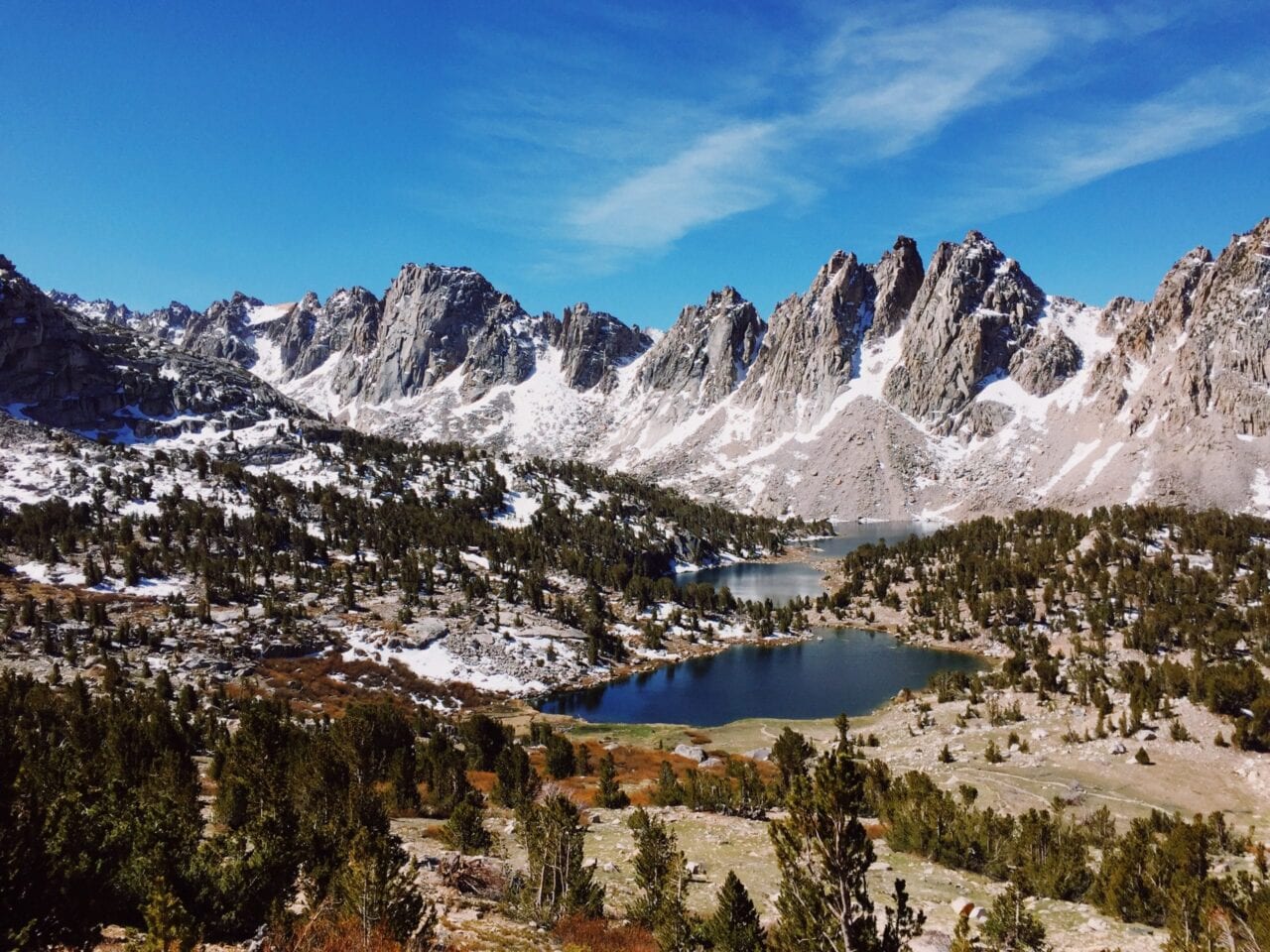
Photo by Alex Mason
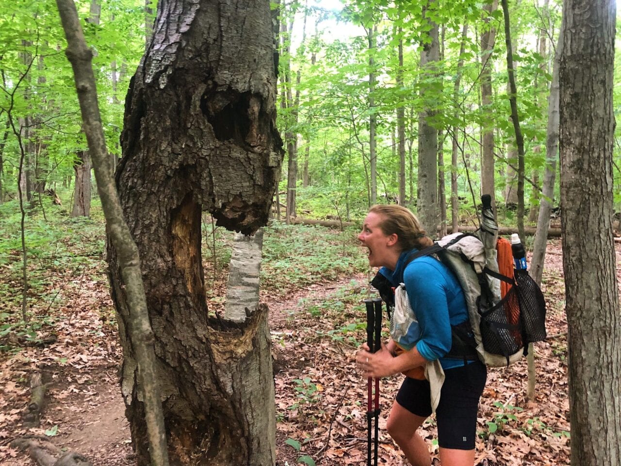
Photo by Alex Mason
How many pairs of shoes did you go through?
Not enough! I tend to wear my shoes for a lot longer than I should, until they are full of holes and they have no grip left on the soles. I used 3 pairs for the PCT NOBO and I only used 2 pairs for the PCT SOBO, the AT and the TA. I would recommend changing your shoes more often and you will be less likely to screw up your knees!
Was there a highlight of your hike?
After hiking 9,400 miles on long distance trails in the last four years it is very, very difficult to pick a highlight from all of that. There have been so many wonderful moments. If I had to pick something though, I would pick the moment Catwater and I reached the Southern terminus of the PCT on my second thru-hike. There are very few people who have hiked the trail in both directions and we just became two of them. We were an unlikely pairing — Catwater was a 62 year old Yank and I was a 34 year old Brit. We were trail friends, having met on the PCT the year before on our northbound hikes, but we didn’t really know each other at all. We are different people, and we did have our moments – which were thankfully few and far between – but ultimately we just worked well together. It is often the way when you are hiking as a partnership that when one is struggling the other isn’t, and we were able to pull each other through the hard times. We started with no other expectations on each other than starting at the border of Canada on the same day, and we ended up hiking around two thirds of the trail together.
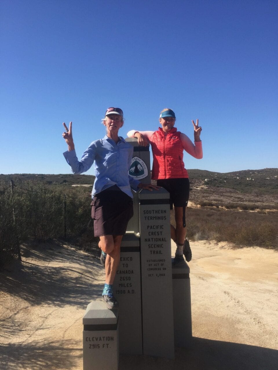
Photo by Alex Mason
What was the scariest part of your hike?
My scariest moment was probably on my first thru-hike of the PCT. I was somewhere near Old Station in Northern California, and just south of there is a big exposed burn area. All the trees are black charred stumps and there is absolutely no shelter. The burn was caused by lightening and I was going through at the same time as a big lightning storm. I totally forgot what I was supposed to do in that situation. I knew I wasn’t supposed to be at the highest point, but was I supposed to shelter by a tree or stay out in the open?!
I could feel the lightning around me and there was definitely a strike which was too close for comfort. The trail was a river and I was soaking wet and just hiking as quick as I could to get out of the exposed area. It wasn’t pure fear, but my heart rate was definitely much faster than it should have been. Thankfully we stayed alive to make it to JJ’s Cafe the next day where they served one of the best burgers on the trail!
Photo by Alex Mason
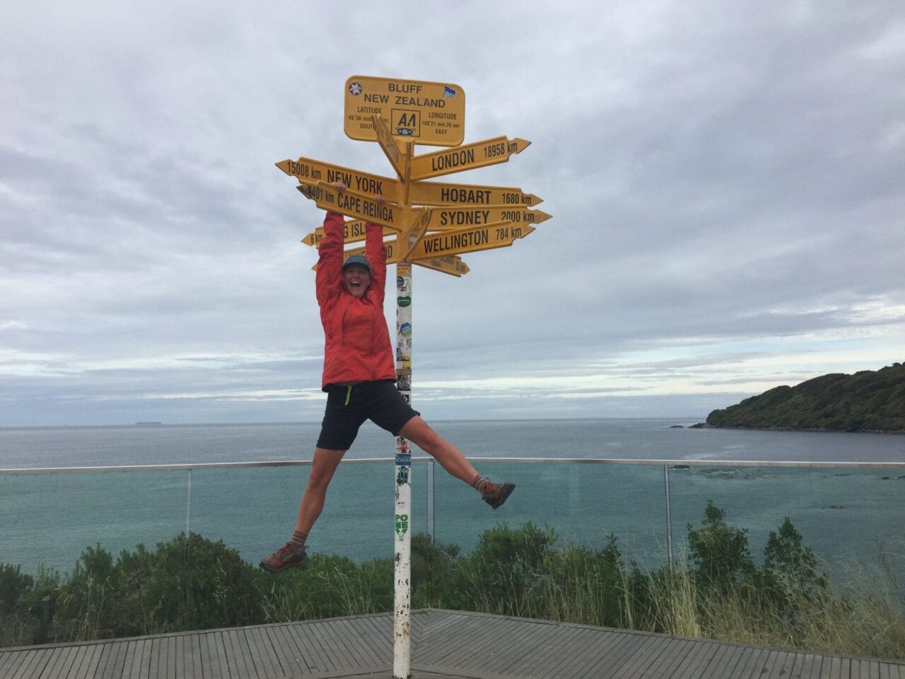
Photo by Alex Mason
Did you ever reach a point where you wanted to quit? How did you stay motivated to finish?
No, I never wanted to quit. I do think that it is an advantage to be an international hiker on long trails because it is harder to quit. Your home is so far away and the logistics of quitting are often harder than actually quitting. But mostly I didn’t want to quit because I loved it so much.
Want to keep up with all that’s going on at Atlas Guides? Sign up for our newsletter!
Read more!
Check out some related blog posts!
Get our trail guide for this area!
Pacific Crest Trail
The Pacific Crest Trail is an epic journey of three states and over 2600 miles. Its path travels from the US border with Mexico to the northern border with Canada.
2650 mi (4260 km) $29.99 full guide
Washington, Pacific Crest Trail
Photo by Justin Helmkamp
Washington, Pacific Crest Trail
Photo by Justin Helmkamp
Pacific Crest Trail
The Pacific Crest Trail is an epic journey of three states and over 2600 miles. Its path travels from the US border with Mexico to the northern border with Canada.
2650 mi (4260 km)
$29.99 full guide
Get our trail guide for this area!
About the Author
Natalie McMillan
Natalie grew up hiking in Arizona where she fell in love with the outdoors. Her favorite hikes are to Havasu Falls in the Grand Canyon and Angel’s Landing in Zion National Park, UT. She loves taking pictures of people, places, and nature, which might explain why she has almost 47,000 photos currently residing on her phone. She takes care of all things related to social media and marketing and recently moved to Denver, CO from Flagstaff, AZ. You may find her frolicking around the trails and mountains of Colorado, or exploring the new city she gets to call home.
My Trail Story by Jim Murphy
Planning an adventure? Check out our popular trail guides! 4.8 stars (17K+ ratings)
Photo by Jim Murphy
My Trail Story featuring Jim Murphy
Jim Murphy took a wrong turn in the Bob Marshall Wilderness, walked straight into a forest fire, and shares the story of how he survived.
Natalie McMillan My Trail Story 03/21/2019
Natalie McMillan
My Trail Story
03/21/2019
The Fastest Three Miles I’ve Ever Hiked
By: Jim Murphy
Age: very late sixties
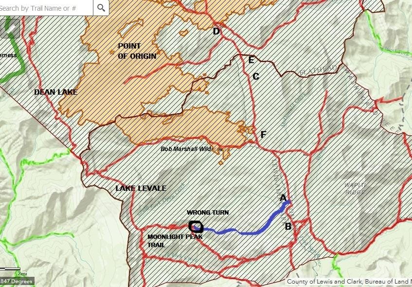
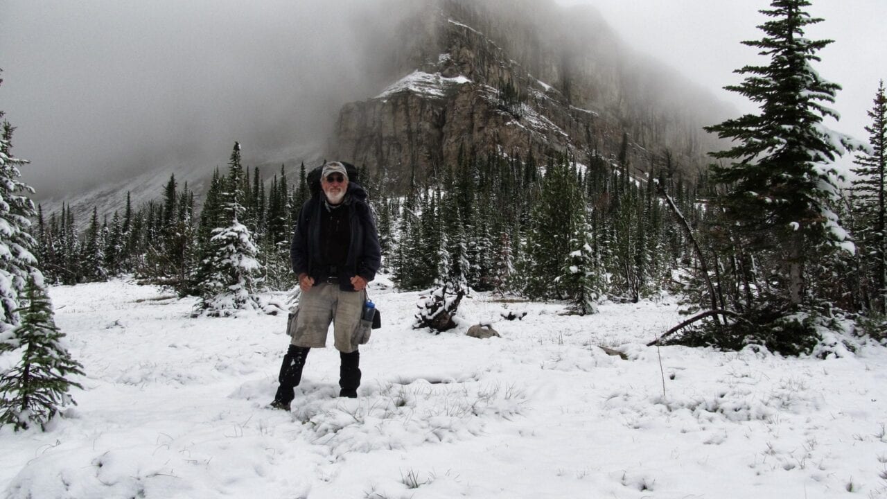
AUGUST 23:
A week or so after leaving the Swift Dam trailhead, I stop by the Gooseberry guard station (a little north of the above map) and check in with a couple of USFS firefighters from New Mexico: Gordo and Brian.
They’re staying at the cabin and hiking up a ridge each day to keep an eye on the Scalp Fire. Started by a lightning strike just a few days earlier, this fire is named after Scalp Creek, the topographical feature nearest to the point of origin. Gordo, the guy on the left in the photo below, with eight years experience, told me, “It’s doing what they want it to do,” and not showing any sign of getting out of control. I told them where I was headed — up Clack Creek to Dean Lake and points south, i.e., the (red) trail on the westerly side of the map, and that I expected to be looping back through in a week or so. They said there was nothing to be concerned about – then. Note that the fire perimeter shown on this map is much more recent, as of a day or so after I got out; at the time of my conversation with the firefighters, it was not much bigger than the star on the map labeled “Point of Origin.”
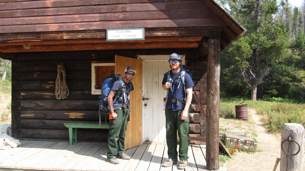
Gordo and Brian.
Photo by Jim Murphy
August 30:
Of course, in the world of forest fires, a week is a lifetime, and things can and do change. After hanging out at a couple of my favorite lakes, Dean and Levale, watching mountain goats, and – this turns out to be important – having encountered no humanoids and therefor having no updated fire info beyond what I got from Gordo and Brian at the cabin a week earlier, I head south on the North Wall Trail, and then east on the Moonlight Peak Trail. This trail is designated by the Forest Service as “Not Regularly Maintained,” which means that they don’t go out and clear all the dead trees that have fallen across it during the winter, and, importantly to this epic, the trail may get a little faint here and there. So I knew what I was buying into when I chose it, but I like these trails nonetheless, as you meet very little foot traffic and virtually never any horses or mules – always a good thing from the backpacker point of view.
Everything is wonderful until I come to a fork in the trail that’s not on the map. After some deliberation, and scouting the right-hand fork for a couple of hundred yards, I decide that the right-hand fork, which seems narrower and just generally of a different character than the left, is probably one of those side trails that go either to a camp used by outfitters, or to a nearby lake (Lake Quiet) that appears on the USFS map (not on the map above). I remember thinking that Yogi Berra, one of my heroes, wrote a book entitled When You Come to a Fork in the Road, Take It!, but that advice didn’t really help me much at that particular point.
I continue along the left fork for what seems in retrospect to have been upwards of an hour. I’m stepping over some deadfall, but as I say, that’s to be expected on a trail that isn’t regularly maintained, so I keep going. Eventually, the deadfall gets ridiculous, the trail goes from faint to non-existent, and I realize that I’ve taken a wrong turn – as I so often have in my life – but this time in the literal rather than figurative sense. Even Robert Frost probably didn’t contemplate the kind of jackpot I’d just gotten myself into when he talked about the road not taken.
I can hear you thinking at this point, “Why didn’t he just backtrack to the fork in the trail?” I would have, except that I’d stayed with this phantom trail for so long, continuing on in the direction that the terrain suggested the trail ought to be, that I couldn’t find the trail when I decided to turn back. Life is hard, but it’s harder when you’re dumb.
So what to do? The creeks and rivers don’t show on the above map, but I was in country that I knew drained in an easterly direction into the North Fork of the Sun River, the trail next to the North Fork being part of my planned route. So, I just find some water and follow the flow down to the North Fork, which was where the Moonlight Peak trail would have taken me if I hadn’t been dumb enough to lose it, right? Easier done on a map than on the ground. I find a very small creek and take off, cross-country, toward the North Fork (Point “A” on the map), not at all clear as to how far away that is. My route, such as it was, is designated on the above map by the blue line; the red line is the actual trail, which I should have still been on. I spend the rest of the day bushwhacking through pretty dense understory, keeping the little creek within hearing, if not always in sight, eventually camping for the night when I run out of daylight.
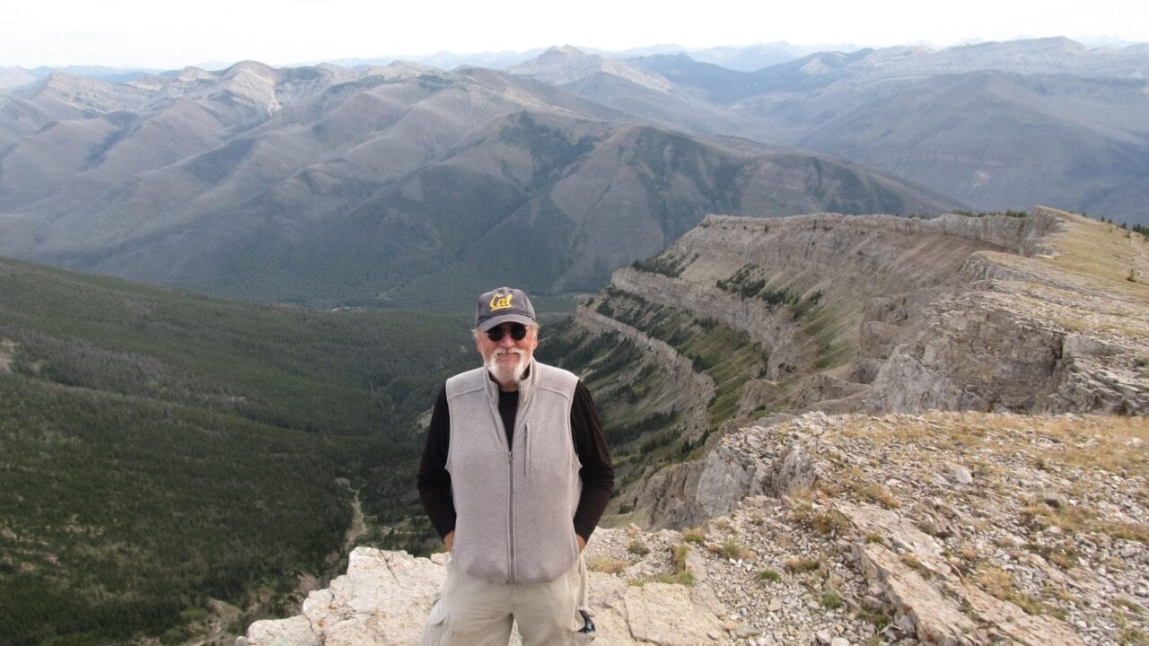
Photo by Jim Murphy
August 31:
I get up and get back at it, thinking how much more of this can there be? I eventually come out of the woods into the old (1988) burn that has left mile upon mile of waist-high deadfall (large trees, often stacked two and three high) stretching out to the horizon. I do about half a day of this and it’s kicking my butt, climbing over this stuff every fifteen or twenty feet – and it still stretches out to the horizon. At this point I think to myself, “I know the North Fork runs due north/south for several miles, and if I just head east, I’ve got to run into it. Enough of this following the water. Whatever the terrain is like between here and the North Fork, it can’t be any worse than this deadfall.” So I turn left, strike out to the east. The terrain is in fact much easier and I hit the river at Point “A” a little before sundown.
September 1:
I spend the whole day flat on my back, recovering from the past couple of days, and thinking that the North Fork Trail is just across the river (it was) and that I’m good to go once I get on it and head north – that my ordeal is over. Sure, there’s smoke everywhere, but during fire season, there is often smoke everywhere in the Bob, often from fires elsewhere in the state, or even from out of state. I don’t see any plumes of smoke, so I figure I’m cool to head north and back toward my car. The thought crosses my mind that maybe I should hike south to the trail junction (Point “B”) that I would have come through had I stayed on the Moonlight Peak Trail, and check for a possible fire closure notice. No way to be sure how far north of that junction I am, but I’m thinking, dead reckoning, we’re probably talking about a mile or so. Just on the chance that a fire nobody seemed panicked about last time I talked to anyone was now closing trails several drainages away from its start.
September 2:
Nahhhh! Too tired to hike that far out of my way just to check. I head out northbound toward Sun River Pass (Point “E”), passing several trail junctions that do not have closure signs posted on the signposts, which tells me that this trail is not in fact closed and that I made the right call in not hiking an unnecessary mile or so south to check. I run out of energy (still tired from the bushwhacking) and daylight at Point “C,” where I camp for the night.
September 3:
After my usual very late start, leisurely breakfast, slow, methodical packing up, I continue north in search of closure signs – or telltale smoke plumes – and finding neither, I come over Sun River Pass (no closure notice) and come to a campsite on the banks of Bowl Creek (Point “D”) that I had visited several years earlier. I drop my pack and hang my food, rather than leave it unattended on the ground while I check the next couple of trail junctions for closure signs. The first was the junction of the Bowl Creek Trail, which would take me east and up over Teton Pass in the event that the route back to my car at Swift Dam was closed. No closure sign at the Bowl Creek junction. I then proceed in a slightly northwesterly direction towards the junction of the Bowl Creek Trail and Trail 479, which heads north and which I’m hoping to follow back to Swift Dam. I hike a couple of hundred yards, come around a bend in the trail and see this about fifty feet out in front of me:
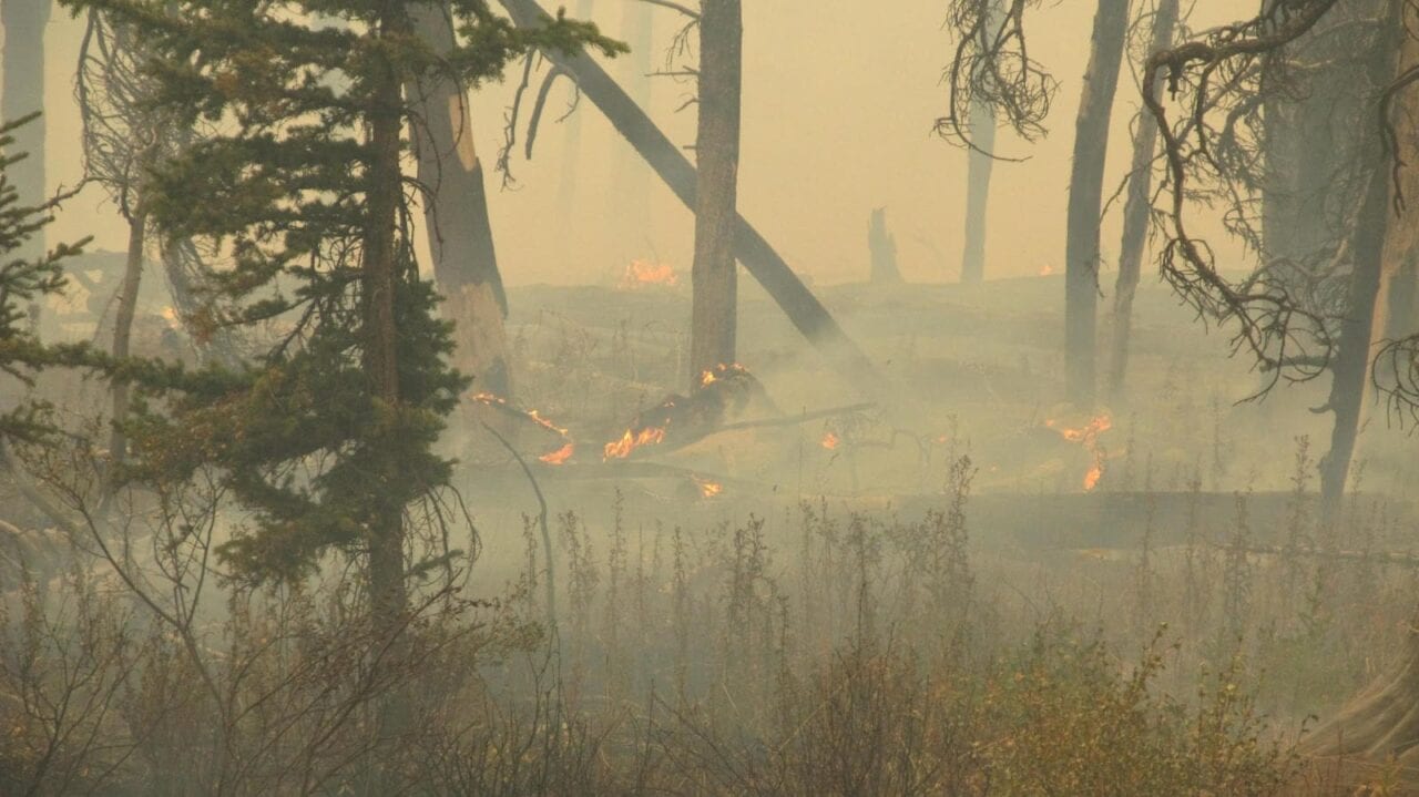
Photo by Jim Murphy
“Well,” I think to myself, “I guess this probably qualifies as a trail closure notice,” even if the Forest Service hasn’t posted one at any of the trail junctions I’ve passed.
I head back to the campsite, pack up and head back up toward Sun River Pass, roughly a mile and a half away, arriving there towards dark. As I said, I got a late start that day and didn’t cover a lot of miles in either direction. I get a few hundred yards past the pass and decide that I’m probably far enough away to safely camp rather than continue hiking in the dark, which is generally considered to be dangerous. I find a flat spot near the trail, set up my tent and try to relax and get to sleep.
I do a few Sudoku puzzles by the light of my headlamp and finally start to feel drowsy. By the time I turn off the headlamp, it’s full dark and I look out the left, i.e., south, side of my tent and the entire southwestern horizon is glowing bright orange. I think to myself, “I sure hope this is just a particularly dramatic sunset.”
No such luck. I get out of the tent, walk a little ways over to a break in the timber and see flames off in the distance. Unfortunately, having very little experience – well, actually none – observing forest fires at night, or in the daytime, for that matter, I am unable to gauge whether these are small flames fairly close by or large flames farther away. In either case, I decide, it looks as if I’m not done hiking for the day after all.
So, for the third time that day, I pack up and hit the trail. The rule against hiking at night suddenly didn’t seem as important as the rule against laying there in your tent doing nothing while a forest fire appears to be surrounding your camp. I strap on the headlamp and head south on the North Fork Trail, which runs pretty much straight north/south. The only problem with this move is that the brightest part of the fire continues to be almost due south, i.e., just a couple of compass points off of straight ahead of me. I’m still unable to judge just how far away it is, but my thinking is that I know I have fire behind me, so my only real option here is to head south as fast as I can in hopes of getting past the fire ahead of me before it burns across the trail. At that point, my only options would be to bushwhack east up a ridge in the dark – not an attractive prospect.
I remind myself that people make very poor, often fatal, decisions when they panic in what they perceive to be survival situations, so, keeping as calm as I can, I continue hiking what was the fastest three miles I’ve ever done with a backpack, I promise you. Knowing that a broken, or even badly sprained, ankle could very possibly be a death sentence, I refrained from running, but I was definitely setting a personal speed record nonetheless. I don’t carry a watch in the wilderness, so I didn’t time it, but I was moving faster than I ever did when I first started hiking the Bob twenty-five years ago.
But, after what seemed, at least an hour on the trail, the fire still looked to be an indeterminable distance away and still almost directly ahead of me. Am I going to be able to head it off and get past it before it burns across the trail and I’m trapped with fire ahead and behind? There doesn’t seem to be any other option than continuing south; either it hasn’t gotten to the trail and I’ll be able to get past it, or it will have gotten to the trail and . . . . I decide to visualize the former rather than the latter, which I’ll try to cope with if and when.
Oh, yeah. Did I mention that the wind was now blowing about 20mph from the west, i.e., from behind the fire and towards the trail? Didn’t help my anxiety level.
I remember thinking, “Hey, I could win a Darwin Award for this.” Then, “Damn, I don’t have a thing to wear to the awards ceremony . . . . No. Wait. The recipients don’t have to worry about that, do they?” I also thought about the possibility of having to head up that ridge to the east and remembered the smokejumpers that Norman Maclean wrote about in Young Men and Fire, all of them forty or forty-five years younger than me, who didn’t make it safely up the ridge. But, hey, I thought, if I do live to write about this, there’s my title, right? Old Men and Fire. Sorry, Mr. Maclean, hope you wouldn’t have minded. No, I quickly realize, that kind of levity would be pretty inappropriate, given the fate of those smokejumpers.
I also remember thinking that I would ultimately like to have my ashes scattered in the Bob Marshall Wilderness, but just maybe not tonight.
At long last, I start coming abreast of the fire, off to my right. For the next quarter mile or so, the ridgeline a few hundred yards away is lit up with sparkly little fires consistent with the main fire having burned past it. Still impossible for a novice to judge, at night, just how far away, but it’s closer than I wanted to be. That I can tell you, to quote a well-known American.
By the time I get up abreast of the intense flames (Point “F”), they appear to be two to three hundred yards away. But, again, this was an uneducated guess, and even if I’d had a tape measure with me . . . . So let’s just say they were close. I was more focused on having actually won the race and now putting as much distance between me and the fire that was finally growing fainter behind me. My little point-and-shoot camera was, of course, not designed for nighttime photography and really couldn’t do justice to what I was actually seeing.
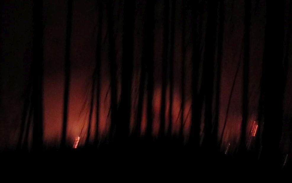
Photo by Jim Murphy
Trust me, it was a lot closer than it looks here. I continued on for another hour or so until there was just a faint glow behind me in the north, and about 3:00AM (checked the time on my camera) collapsed into the first level tentsite I could find. I’ve spent a lot of days in the wilderness that non-hikers might describe as boring and uneventful. This had not been one of those.
I got up very late the next day and continued south to the junction of trail 108, which I had briefly considered checking the previous day, ultimately deciding not to bother. Sure enough:
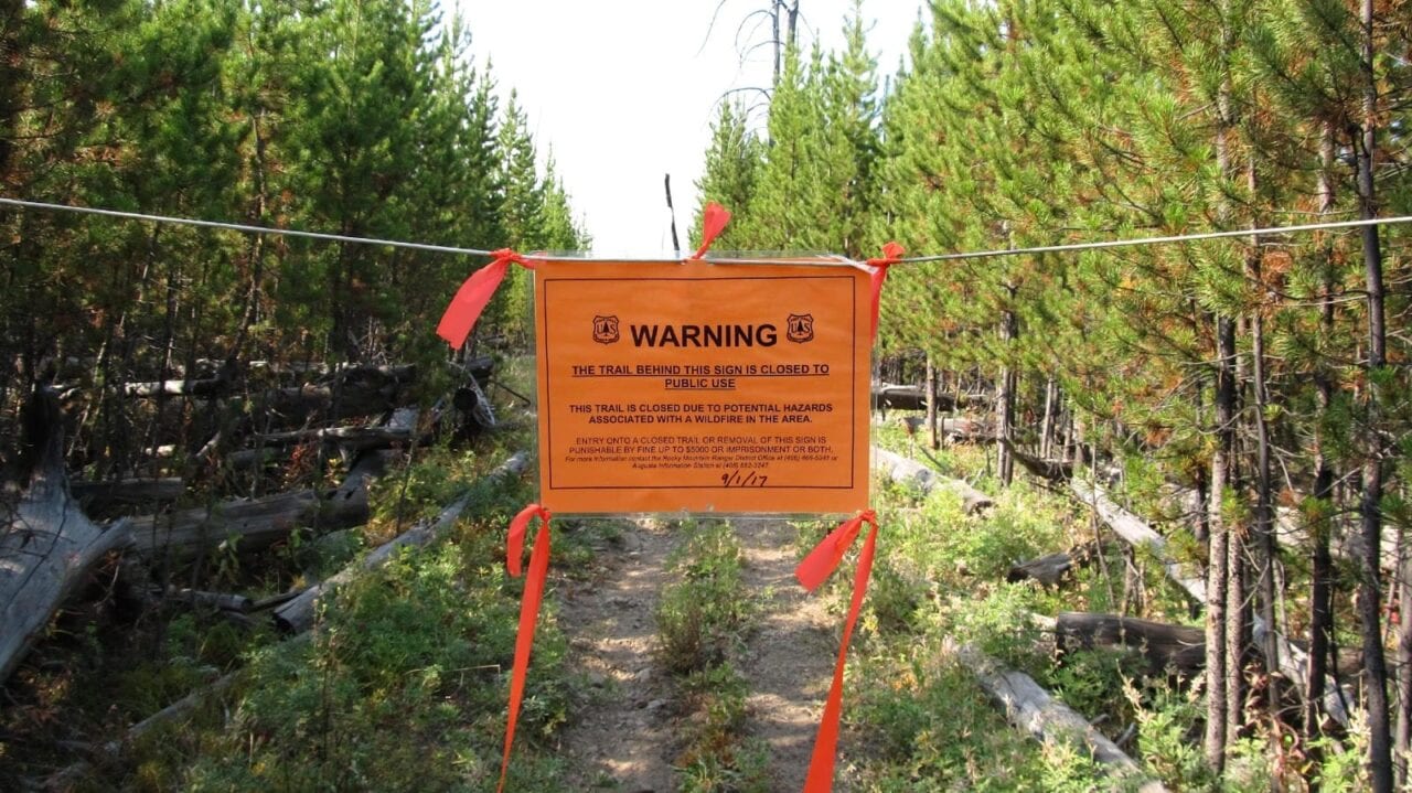
Photo by Jim Murphy
It was dated September 1, when I had been laying up all day a mile or so north, recuperating from my two days of bushwhacking through the dense timber and then climbing over a mile or two of deadfall. It should be noted that, had I not lost the trail, I would very likely have come through this spot on the 31st, possibly even the 30th, and could have very well had this very same adventure anyway. That’s what the Forest Service means when they talk about traveling at your own risk.
Well, this has run a lot longer than the 140 characters that people are used to these days, so I’ll wrap it up here rather than going on to describe: the look on the Forest Service guy’s face when he rode up out the woods and found me camped on Wrong Creek, just a little ways from the closure notice; the bowhunters that offered me a ride on one of their spare horses when they found me at the foot of the pass – the pass that the Forest Service guy said I had to get over ASAP; how the 16-year-old mare they put me on came close to laying down and dying on the way up the pass, so I ended up walking anyway; and how these bowhunters, Andy and Dustin from Ronan, bought me dinner in Choteau (my wallet was in my car) and then drove in excess of a hundred miles out of their way to drop me at my car. I sent Andy a check for the dinner and all the extra diesel he burned, and he refused to cash it. One of the things I love about spending so much time in the wilderness is that the people you meet are (almost) always at their best. These guys really lived up to that.
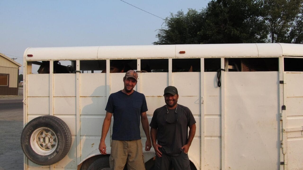
Andy and Dustin.
Photo by Jim Murphy
Final thoughts: In hindsight, some of the choices I made don’t look as good now as they did at the time I made them, but . . . . Woulda, Coulda, Shoulda, If, right? For one thing, it’s probably a good idea to move a little more quickly through the wilderness when there is fire anywhere in the general vicinity, especially if you’re going to be completely out of touch – and uninformed – for a week or more, as I make a point of trying to be. My mantra has always been that the point is to be in the wilderness, not to get through it, and having virtually unlimited time, I tend to dawdle at places like Dean Lake:

Dean Lake.
Photo by Jim Murphy
Needless to say, that philosophy didn’t serve me well on this trip. I wish my mental coin flip at that unmapped fork in the trail had come up the other way, but, based on my extensive hiking experience, I really thought I’d picked the correct fork. Staying with that choice to the point where I couldn’t find it any longer when I finally decided to backtrack, is, of course, entirely on me. Won’t be doing that again.
I also, it is now abundantly clear, should have done that one-mile or so hike in the opposite direction to check for a closure sign at the junction of Trail 108 at Wrong Creek, instead of relying on the presence – or absence – of closure signs at junctions on my way north. As Joe Woodhead, the Forest Service fire guy so patiently explained, once the Forest Service has closed an area, there’s no point in putting up more signs within the closure, because – Duh! – people aren’t supposed to be there to see them in the first place!!!!
Want to keep up with all that’s going on at Atlas Guides? Sign up for our newsletter!
Read more!
Check out some related blog posts!
Get our trail guide for this area!
Continental Divide Trail
Considered by many to be the most remote and challenging of the triple crown trails, the Continental Divide Trail is a 3100 mile adventure through five western states.
3100 mi (4980 km) $39.99 full guide
Colorado, Continental Divide Trail
Photo by David Getchel
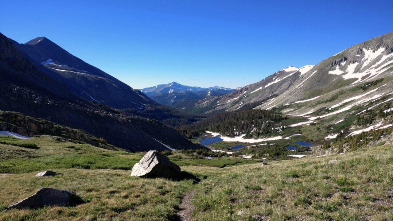
Colorado, Continental Divide Trail
Photo by David Getchel
Continental Divide Trail
Considered by many to be the most remote and challenging of the triple crown trails, the Continental Divide Trail is a 3100 mile adventure through five western states.
3100 mi (4980 km)
$39.99 full guide
Get our trail guide for this area!
About the Author
Natalie McMillan
Natalie grew up hiking in Arizona where she fell in love with the outdoors. Her favorite hikes are to Havasu Falls in the Grand Canyon and Angel’s Landing in Zion National Park, UT. She loves taking pictures of people, places, and nature, which might explain why she has almost 47,000 photos currently residing on her phone. She takes care of all things related to social media and marketing and recently moved to Denver, CO from Flagstaff, AZ. You may find her frolicking around the trails and mountains of Colorado, or exploring the new city she gets to call home.
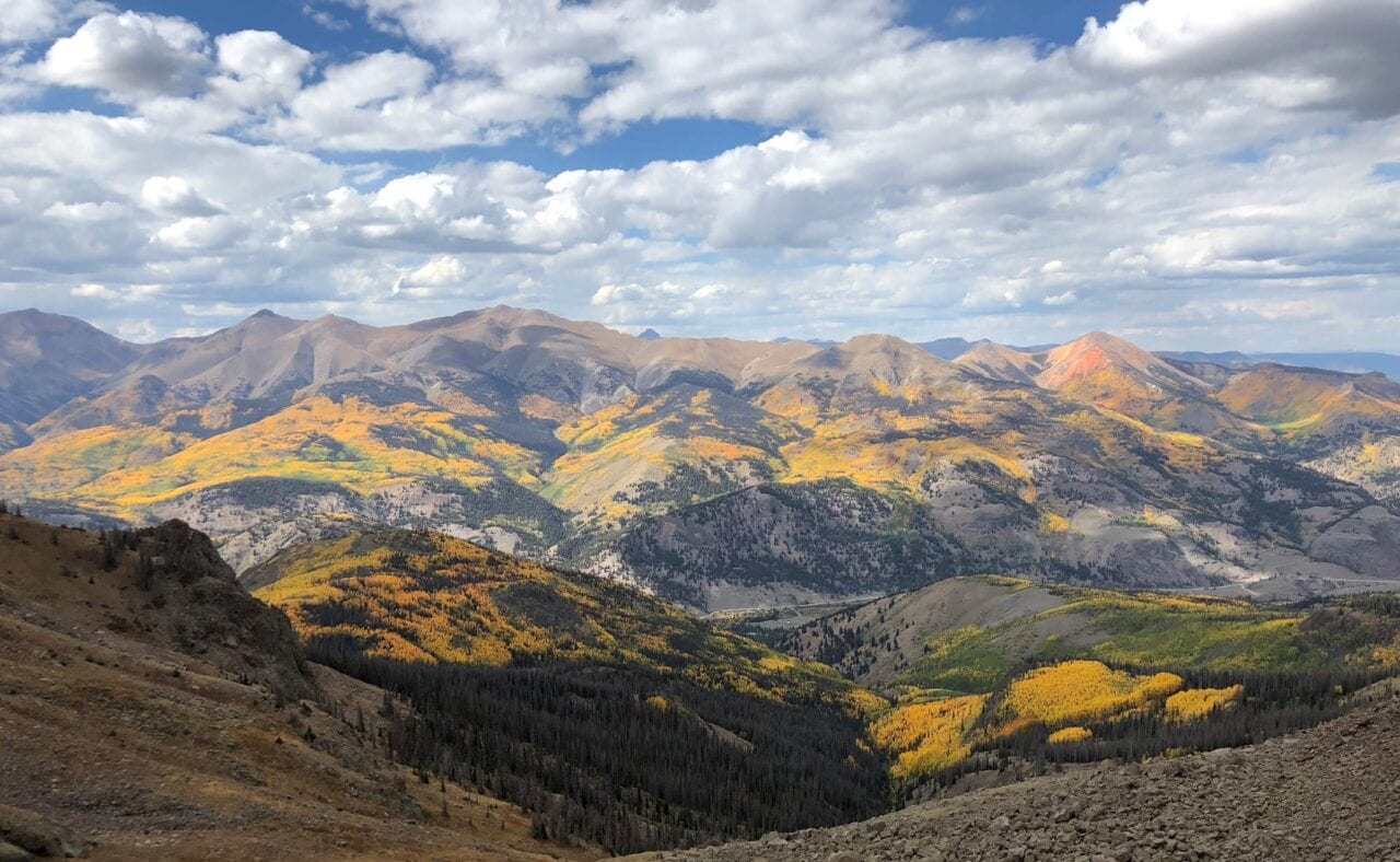
My Trail Story by Lara Handwerker
Planning an adventure? Check out our popular trail guides! 4.8 stars (17K+ ratings)
Photo provided by Lara Handwerker
My Trail Story featuring Lara Handwerker
After meeting on the Appalachian Trail, Lara and her boyfriend Mike got married and decided to hike the Continental Divide Trail for their honeymoon. And they said they wouldn't have it any other way.
Natalie McMillan My Trail Story 03/14/2019
Natalie McMillan
My Trail Story
03/14/2019
Photo by Lara Handwerker
When you hear the word “honeymoon,” you might imagine a tropical vacation, perhaps a cruise or another tranquil location with white, sandy beaches on which to relax and sip sangria. Or maybe the image that comes to mind is posh European jet setting, strolling through the streets of Paris or Munich, indulging in delicious food and soaking in the culture from countries that are not your own. Likely, abandoning your home and vehicle before setting off on a months-long journey with but one set of clothing, walking in a linear fashion from (before) sunup to (after) sundown, dealing with hunger, pain, and extreme temperatures on a daily basis, sharing just a 20 square foot space with your new spouse each night, and striding through rain, snow, lightning, and overflowing rivers until reaching a destination that was nearly 3,000 miles from where you started did not appear on that mental Pinterest board with “honeymoon” at the top.
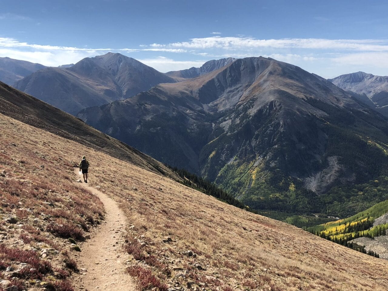
Photo by Lara Handwerker
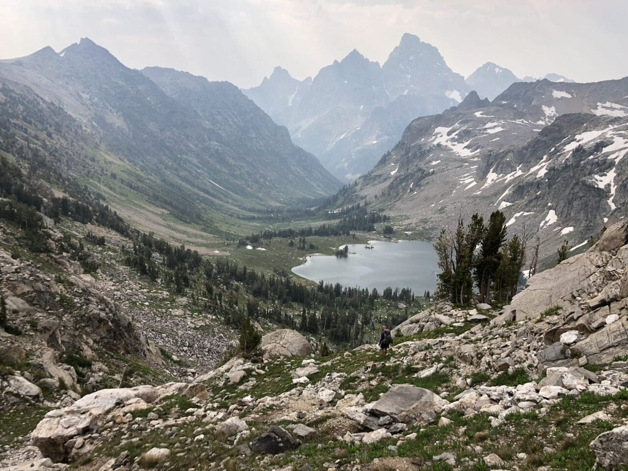
Photo by Lara Handwerker
Nevertheless, that is exactly the celebration of marriage that my husband Mike and I chose to partake in during the summer of 2018. Having met for the first time and beginning our relationship while both thru-hiking the Appalachian Trail in 2015, we determined that another trip along the length of the U.S. would be the perfect way for us to begin our marriage as well. So in June 2018, we moved all of our belongings into storage, left our home in Richmond, Virginia, and started a thru-hike on the Continental Divide Trail. We had hiked the AT northbound and would have likely considered doing the same for our second long trail, but we didn’t complete our Masters degrees in Richmond until late May, so heading southbound on the CDT was our only option. Looking back, we could not have chosen a better direction for this incredibly unique trail and would not have had it any other way.
We were eager to get started, and also unsure of how many miles we’d be able to complete each day since it had been three years since our last thru-hike, so we headed south from the Canadian border with a very early start date of June 15th. Montana had received about 150% of its regular snowpack that winter, so conditions were still very snowy and sketchy at times during our first week on the CDT in Glacier National Park. Like most other early-start SOBOs on the CDT, we had to start from the Chief Mountain Trailhead since the Highline Trail was far too dangerous (and closed) for us without serious winter hiking experience under our (hip)belts. Aside from that, the trail leading from Waterton Lakes to Goat Haunt was closed due to fire damage. We were a bit disappointed to not be able to hike right from Waterton, but it was still such a challenging, breathtaking, and rewarding section. Future SOBOs should truly not feel any regret whatsoever about having to take this route. We’ve never had an experience like that week before, traversing across steep snowfields with microspikes and ice axes, seeing the mountains covered in snow and lakes still frozen over, and having everywhere we went in the park entirely to ourselves—the solitude you can have in one of the most amazing places in the world via an early season thru is unparalleled.
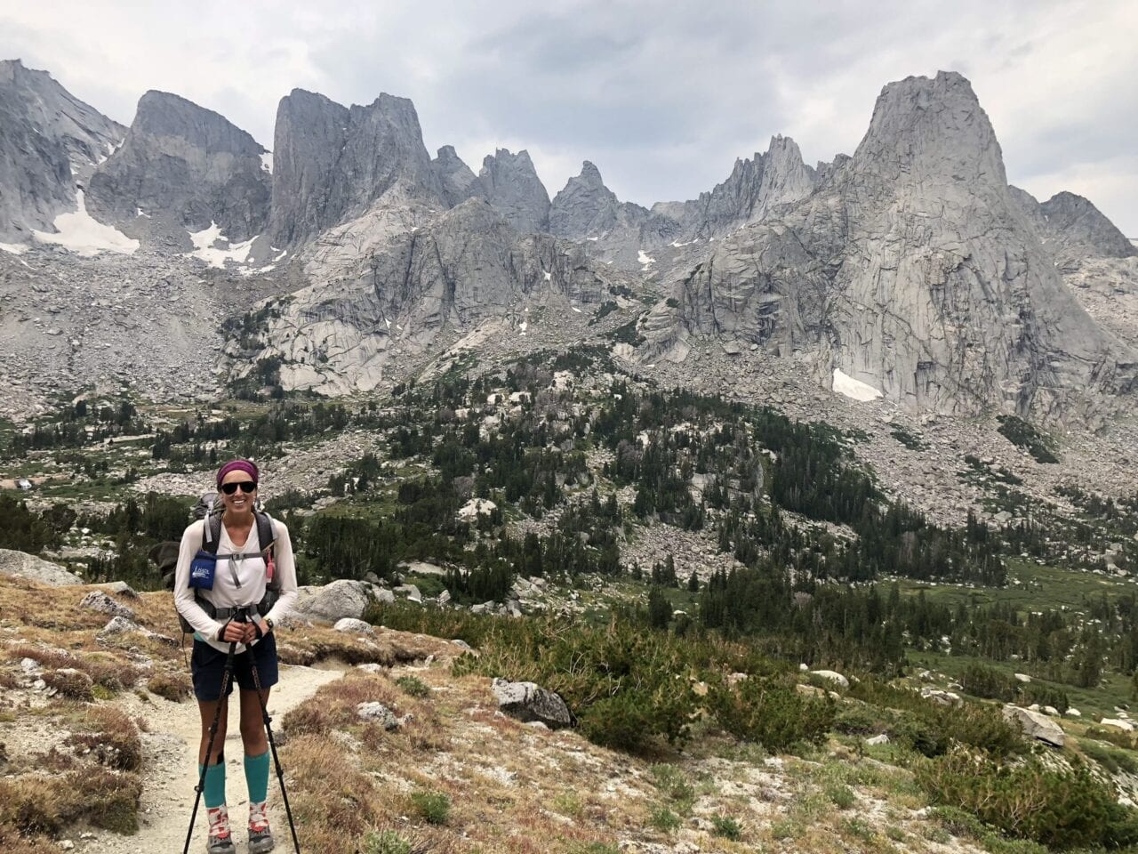
Photo by Lara Handwerker
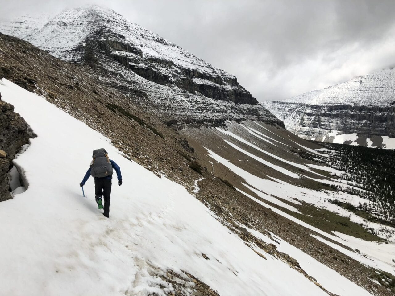
Photo by Lara Handwerker
It was certainly quite the start to our honeymoon—on just our second day out, it rained the entire day with temperatures in the 40s, making for a day of complete misery that culminated with us eating our dinner in the campsite privy. Not exactly the tranquil beach experience that I referenced earlier. But due to the extenuating circumstances the weather presented, we instantly had to practice our teamwork skills to stay safe and get the necessary work done—prepping dinner, getting our tent and sleep system set up without getting everything soaking wet, and securing the bear bag before settling in for the night. I look back on this day as one in particular that I’m not sure I could have gotten through on my own, but being able to work in sync with my new husband, being so uncomfortable without either of us getting short or arguing with the other—that’s an introduction to marriage that I feel so lucky to have had.
As our honeymoon hike progressed, we continued to experience such a variety of rewarding adventures and unrelenting obstacles. The CDT is truly a rollercoaster of a trail, in terms of enjoyment and trail quality. Some days, you’re navigating swollen rivers, getting lost from confusing or nonexistent directions, and climbing over or around miles of blown down trees (see: the Bob Marshall Wilderness). Then the next, you’re strolling up rolling, grassy hills where the trail is perfectly clear, there are incredible views in every single direction, and you have perfect, flat ground on which to set up your tent and watch a wildfire of a sunset streak across the sky while wondering how you got so lucky (see: the Montana/Idaho border).
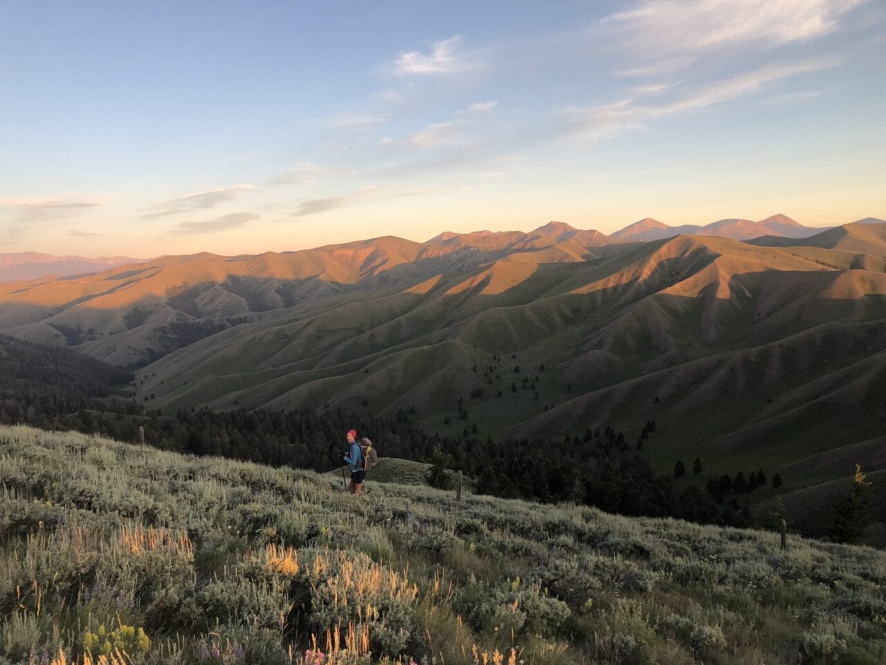
Photo by Lara Handwerker
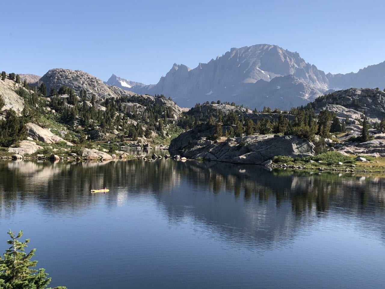
Photo by Lara Handwerker
One of the grand things about the CDT is the variety of landscapes and ecosystems through which you travel. I’m sure most others who have hiked this path would agree that it encompasses some of the most jaw-dropping scenery you could find anywhere: Glacier National Park, the Anaconda-Pintler Wilderness, the section between Leadore, Idaho, and Lima, Montana, that in my opinion, is about the most underrated stretch of the entire trail. Yellowstone, the Tetons—if you can find a way to do them, DO THEM—and oh my breathtaking goodness, the Wind River Range. Rocky Mountain National Park, the shared experience with Colorado Trail hikers through the Collegiates, and obviously the grandeur (and imminent threat of winter) of the San Juans. The bright yellow Aspens of northern New Mexico, the freezing water and towering canyons of the Gila River, and even down to the vibrancy of the desert and the unique sense of life and beauty only found in the Bootheel. There is truly nothing else I’ve found quite like the diversity that this trail offers, and it will forever be a glimmer of awe and wonder as I dream about this part of my past.
That’s not to say we didn’t have our fair share of discomfort and injury—for me, it was almost a different injury for each section. Glacier and the Bob was a pulled Achilles, Wyoming was the shin splints from hell, and Colorado was constant nausea from altitude; New Mexico was where my body finally held up and I felt like a strong, worthy thru-hiker at last. Looking back, it’s a real shame and source of regret for me (though not something that I could have truly changed) that my various injuries prevented me from enjoying some of the most beautiful places in America quite as much as they deserved. I think that’s part of the balance beam that every thru-hiker walks: when you’re pushing your body this much, you’re not giving it a break from exhaustion and any injuries incurred, but you’re making this huge journey and accomplishing the feat of thousands of miles in just a few months. To me, that defines a conflict we experience on the long trails between two different types of enjoyment: that of lingering, of breathing deeply, of soaking it all in, and that of cramming as much as you can into one long path, of feeling how far you can push your body, of learning what your limits are and blowing right past them. And somehow, the act of thru-hiking embraces both sides of this conflict and embodies it all in one glorious package.
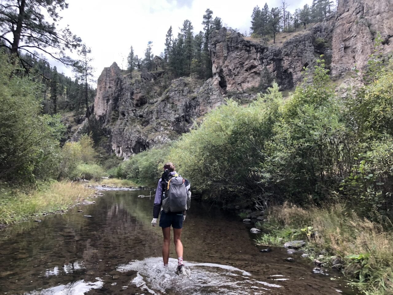
Photo by Lara Handwerker

Photo by Lara Handwerker
In the end, my husband and I got to travel through five states, visit countless parks, forests, and wilderness areas, share trail space with endless unique wildlife (bears! moose! badgers!), spend 24 hours a day 7 days a week (minus, you know, bathroom breaks) together for FOUR straight months, and accomplish this huge, gargantuan feat together that most people don’t even dream of in their lifetimes (disclaimer: the ability to even begin this journey was largely a product of our shared privilege, and I recognize that many people would not have the opportunity for a massive undertaking like this even if they wanted to), all in the first half-year of marriage. I can say with certainty that this unique approach to a honeymoon did nothing but make us stronger as a couple, allow us to share 3,000 hours of teamwork, deep conversation, and belly laughs, and give us a lifetime of incredible memories to look back on for the rest of our days. And truly, what tropical vacation could have brought us that?
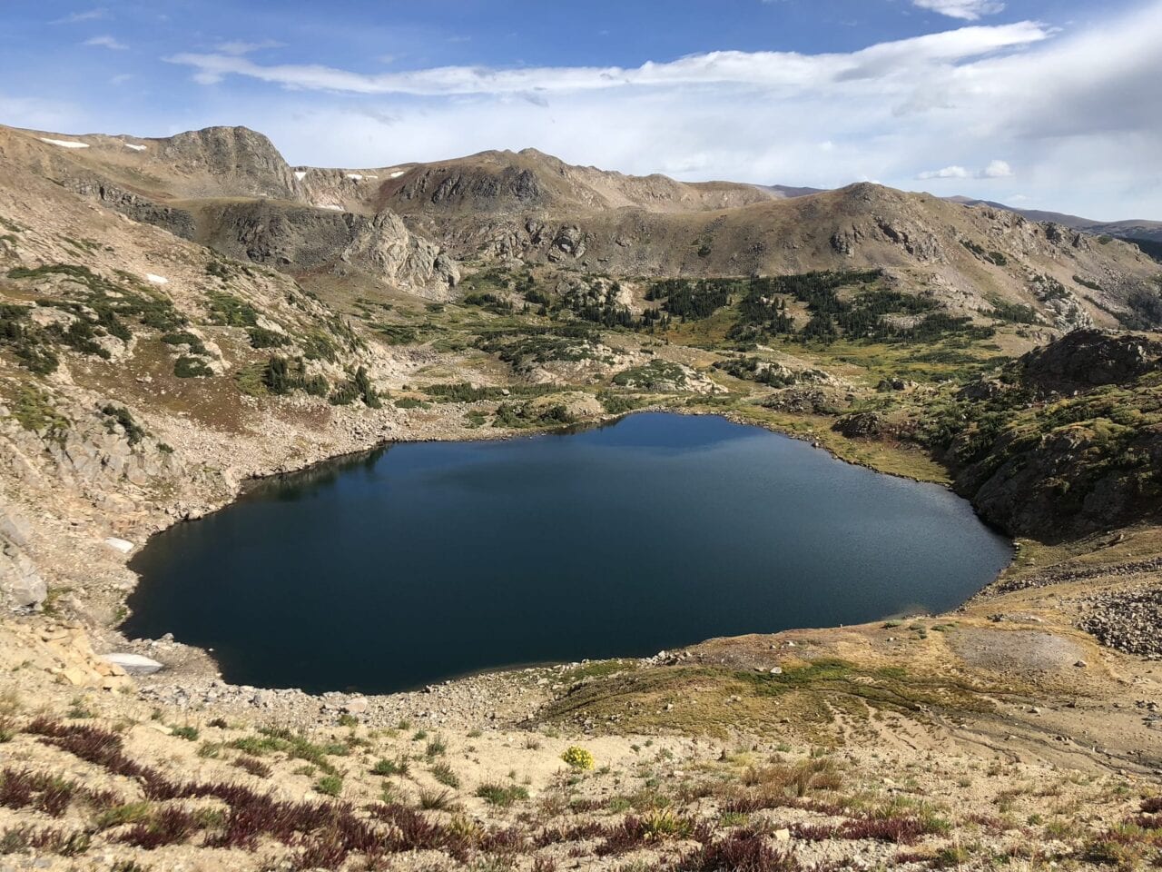
Photo by Lara Handwerker
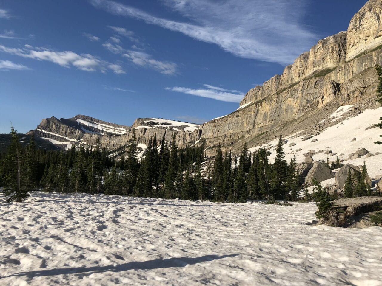
Photo by Lara Handwerker
Want to keep up with all that’s going on at Atlas Guides? Sign up for our newsletter!
Read more!
Check out some related blog posts!
Get our trail guide for this area!
Continental Divide Trail
Considered by many to be the most remote and challenging of the triple crown trails, the Continental Divide Trail is a 3100 mile adventure through five western states.
3100 mi (4980 km) $39.99 full guide
Colorado, Continental Divide Trail
Photo by David Getchel
Colorado, Continental Divide Trail
Photo by David Getchel
Continental Divide Trail
Considered by many to be the most remote and challenging of the triple crown trails, the Continental Divide Trail is a 3100 mile adventure through five western states.
3100 mi (4980 km)
$39.99 full guide
Get our trail guide for this area!
About the Author
Natalie McMillan
Natalie grew up hiking in Arizona where she fell in love with the outdoors. Her favorite hikes are to Havasu Falls in the Grand Canyon and Angel’s Landing in Zion National Park, UT. She loves taking pictures of people, places, and nature, which might explain why she has almost 47,000 photos currently residing on her phone. She takes care of all things related to social media and marketing and recently moved to Denver, CO from Flagstaff, AZ. You may find her frolicking around the trails and mountains of Colorado, or exploring the new city she gets to call home.
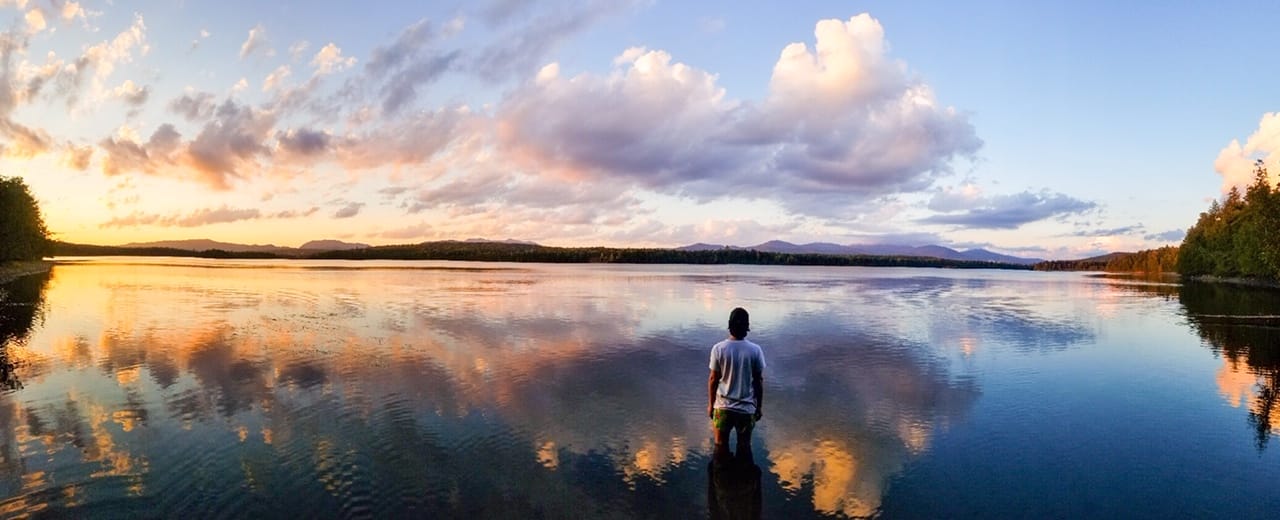
My Trail Story by Golden Girl
Planning an adventure? Check out our popular trail guides! 4.8 stars (17K+ ratings)
Long Pond – 100 Mile Wilderness, The Appalachian Trail
Photo by Alex Patino
My Trail Story featuring Golden Girl
Alex Patino, a.k.a. Golden Girl, explains how he went from working in the fashion industry in NYC for seven years, to hiking the Pacific Crest Trail, Colorado Trail, and Appalachian Trail.
Natalie McMillan My Trail Story 03/14/2019
Natalie McMillan
My Trail Story
03/14/2019
Let me paint a picture: two months before I first stepped foot on the Pacific Crest Trail in 2016, I was busy wrapping up New York Fashion Week, preparing for the onslaught of London Fashion Week, followed by Milan, ending in Paris. I had been living in New York City for nine years at that point, having spent seven of those years working in fashion, at first, as a fashion journalist, and eventually running the social media for a heritage luxury retailer. What I’m about to say next you’ve already said to yourself: that’s about as polar opposite to the thru-hiking experience as one can possibly get. My life and my responsibilities were more about Prada shoes, not trail runners; the accessories I had to focus on were Alexander McQueen handbags, not Osprey lightweight packs; Chanel tweed jackets, definitely not Arc’teryx down jackets; Celine eyewear, not – well, you get the picture by now. It was a severe volte face, and the decision to turn in the one life for a glimpse into the other was fast and furious.
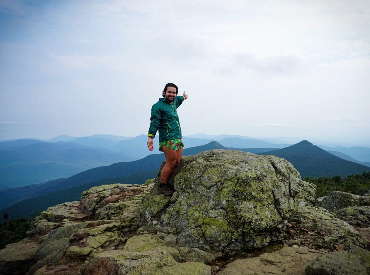
Franconia Ridge, the AT
Photo by Alex Patino
Then one day, I realized that I had given work too much of myself. I stopped swimming my daily laps and quit rock-climbing with friends. I blew up behind my desk, gaining weight by the day and working 70+ hours a week. Every time my phone rang, I worried it was work. When you work in social media, especially in New York City, everything is always NOW! NOW! NOW! And I was a one-man machine, producing at levels that would require four or five employees. I was worn thin. My whole 20s were consumed by work. Considering the competitive nature of the city, you always had to do something to prove your worth, your salary, your viability, in particular in the corporate world. I had jettisoned myself out of Gainesville, Florida, where I had gone to college, and into New York City without entertaining a single thought about maybe going on a grand adventure, or taking some time off between school and work — nothing. I was just desperate to get true adulthood started. And there I was, at the end of my 20s, completely exhausted, moribund from too much Photoshop, too much coding, too many fashion influencers to deal with. Eventually I had to wonder, how the hell did I get to this point?
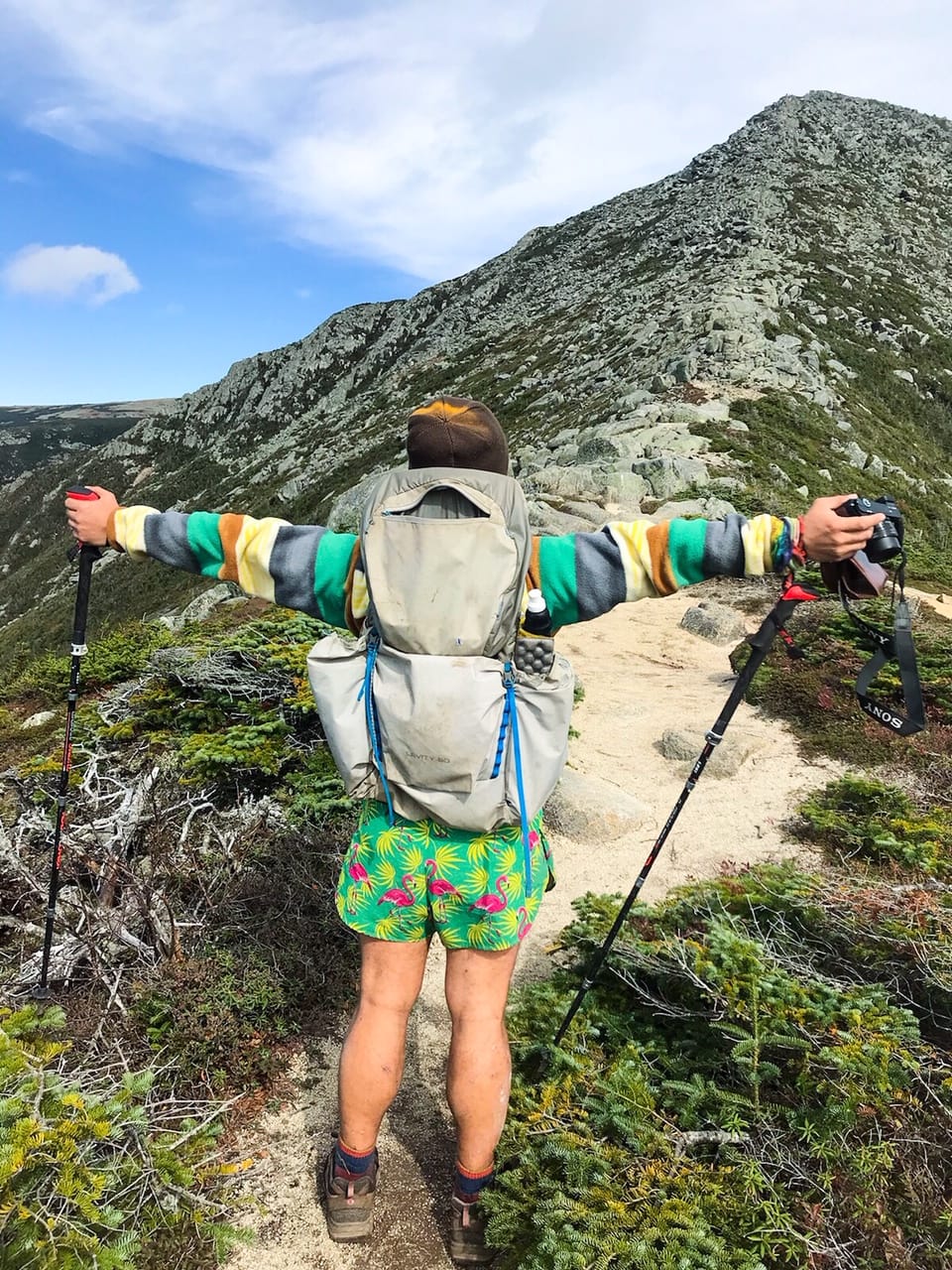
Photo by Alex Patino
The turning point came Christmas 2015, when I was visiting my family down in Florida. I was sitting on my living room couch, fantasizing about a life without all this stress, daydreaming about what I would tell the head honchos when I finally threw in the towel, and how I would reinvent myself so that this kind of crippling depression could never get its hands on me this way again.
At the same time, a close friend mentioned interest in tackling the Continental Divide Trail. I admit, I had never heard of it, and as I dove into YouTube to learn more about it, I could feel my mind churning, formulating ideas, creating images where I would edit out the professional outdoorsman in whatever given video and superimpose myself on top of that mountain. It was me fording those rivers and streams. It was me schlepping up those 14,000ft peaks and carrying my life on my back. That was me standing at the highest summit, facing in the direction of New York City with my middle fingers blazing in the sun. Clearly, the city had done a number on me.
Point is, I was sold. This trail looked amazing, much more so than the Appalachian Trail. Plus, I wanted to go out West. I had never done so before and this is as immersive as you can get! I started asking around online about logistics, how thru-hiking works, the particular difficulties of the CDT, when a very popular thru-hiking personality dissuaded me from tackling the CDT on my first thru-hike. The Pacific Crest Trail is what you need to do, he insisted. Truth is, I didn’t really know much about that one either. But true to my own form, I researched the PCT to death and soon enough, I was a devotee. I wanted to be on that PCT 2600-miler list, even if it killed me. There was just one problem: Hispanics don’t hike.
I was born and raised in Miami, Florida, to Colombian parents. There isn’t anything above 350ft in the entire state. I don’t think my parents had even uttered the words, “camping” in their entire lives, much less “backpacking.” Living in New York, I took frequent trips up the Hudson River to small day-hikes in the Beacon and Cold Springs region, but I was always back on the train, heading back to Grand Central Station before nightfall. I had never spent a night in a tent in my life. To prepare, I went hiking in Beacon with two friends, only I took my weighted pack, just to test the waters. I was hyperventilating, crippled from muscle spasms, falling behind at every turn. I could read my friends’ polite, but tacit misgivings. After that trial, I was saying it myself – I’m so screwed. That was the one and only time I went out and gave it a good go. After that, my training consisted of eating roast beef sandwich melts from the corner deli (God, I miss that deli) and marathoning all five seasons of Felicity in under a month. With a cushiony muffin top to help stave off losing too much weight too soon and plenty of osmosis-gained college angst by way of Keri Russell, I was ready to get eaten by bears, bitten by rattlers and tackled by mountain lions.
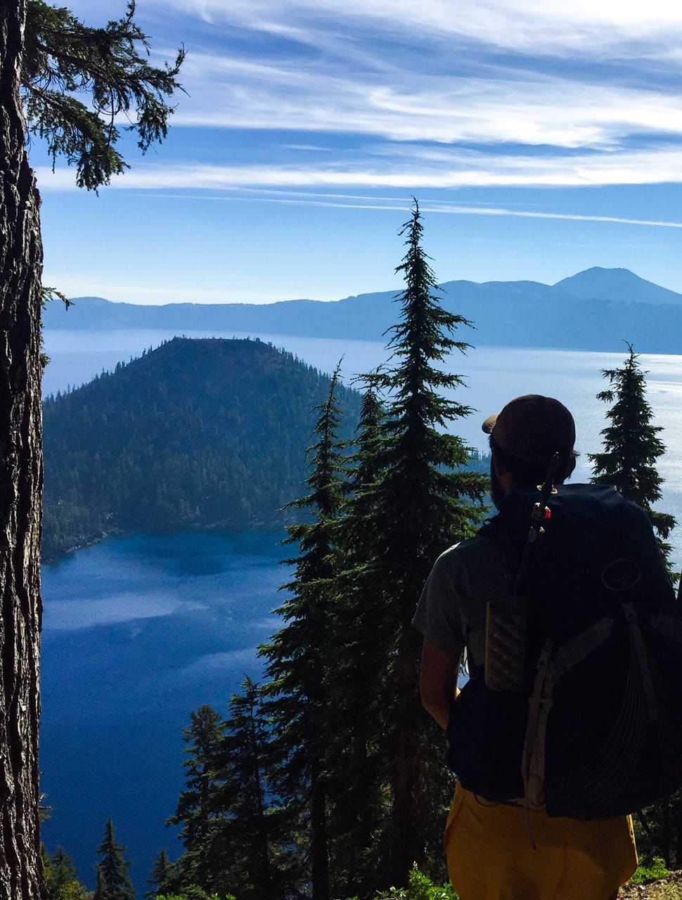
Photo by Alex Patino
My beautiful friends threw me a going away party. Many drinks in, we took a group photo with a Polaroid. The host, Christopher, one of my best friends, handed me the snapshot, but not before he could write “Don’t F*ck It Up” on the Polaroid with a Sharpie. I told him I was terrified. He assured me I was going to make it. “You’re the most hard-headed person I know. You’re going to get to Canada if it kills you.” I carried that picture with me the whole way, as a reminder that I couldn’t go home with my tail between my legs. The following Friday after the party, I left my job for good, said none of the things I fantasized about saying on my way out the door, and left for California.
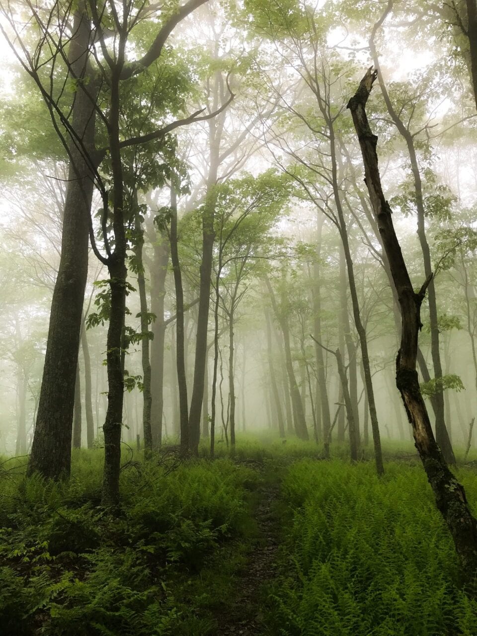
Photo by Alex Patino
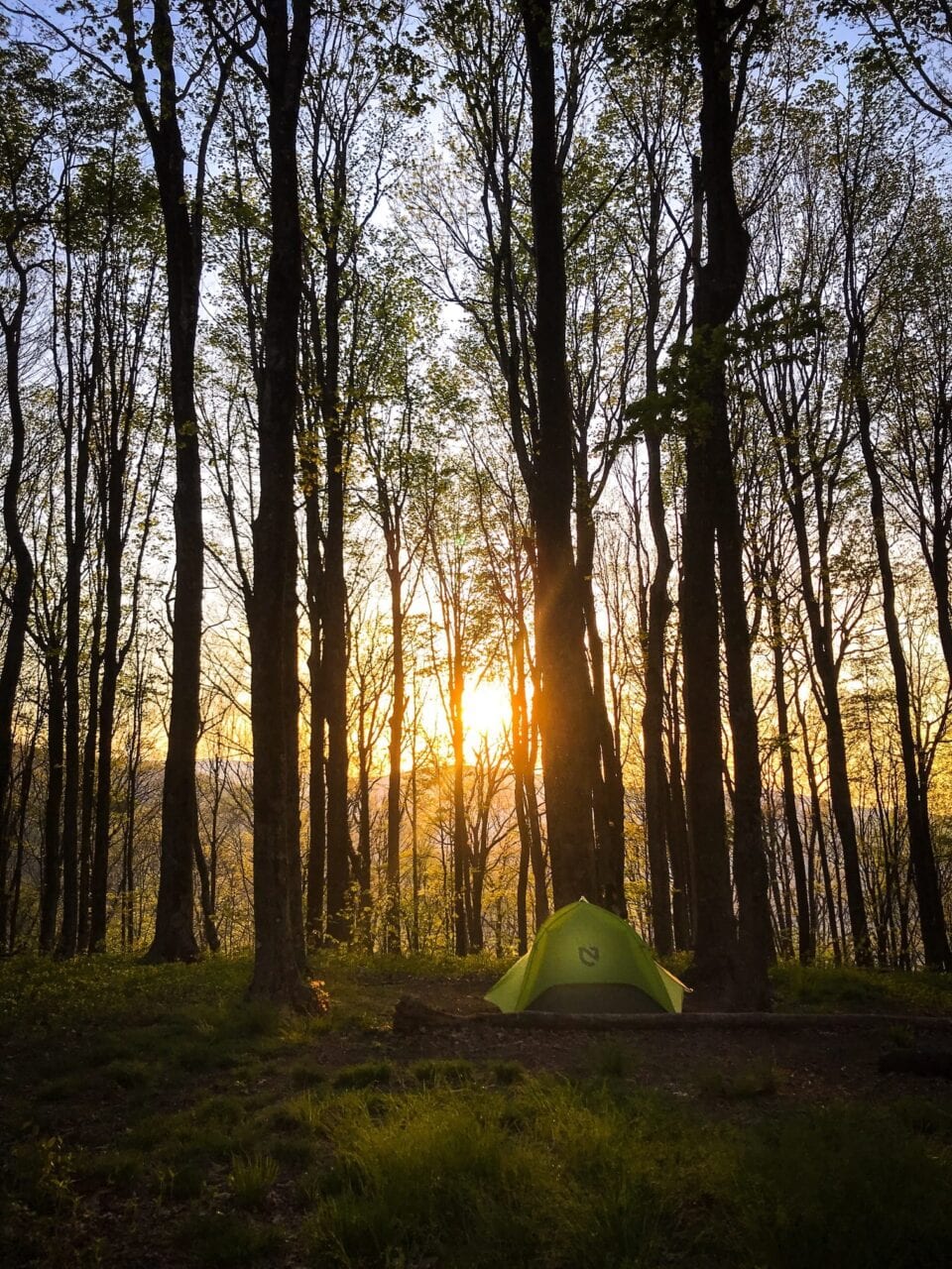
Photo by Alex Patino
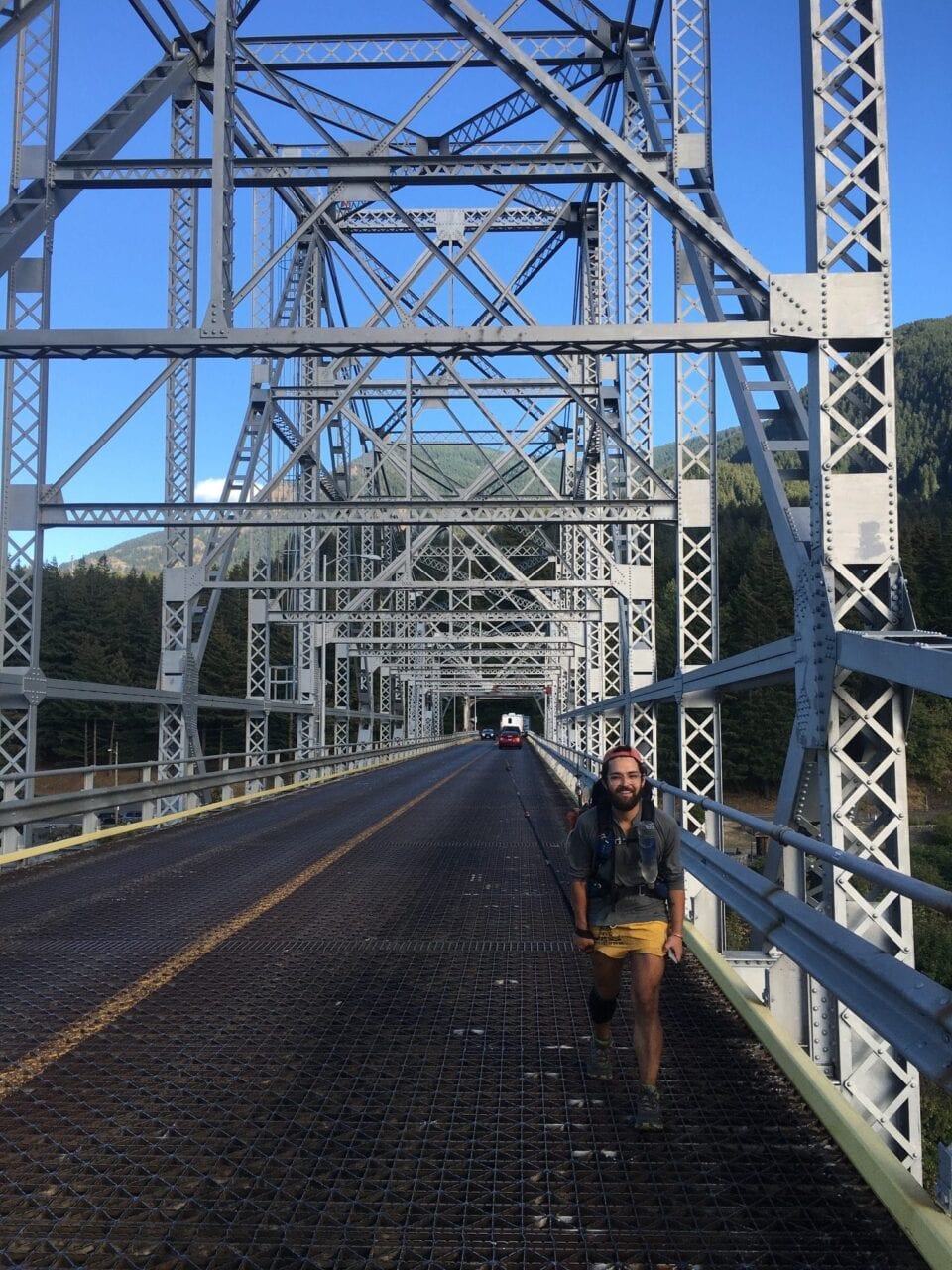
Photo by Alex Patino
At the end of my first night on trail I still had phone signal, so I called my mother to give her my first update. My pack weighed a ton. I had to lean up against boulders in order to properly hoist my backpack onto my hips. The heat was oppressive and my body was broken. I was also just terrified. Every time the wind blew, I was convinced it was a wild animal, coming to feast. My parents didn’t really understand the concept of a thru-hike. I told them I would start at the Mexican border and walk to Canada. But as much as I said it and explained it and rehashed it, what it was never became anything more than an abstraction to them. It wasn’t until I was past Yosemite, making my way up Sonora Pass, when I spoke to my mother another time, that she admitted to me that after that first call, she had hung up the phone, looked at her boyfriend and said, “I give him two weeks. Tops.” By that point the PCT was not an abstraction to her anymore. Through my updates she began to understand what I had taken on. When I finally made it to Canada, my entire family essentially saw me as a superhero. I acted casual.
By my third day on trail my invertebrate nature had all but dissipated. I got a pack shakedown at Lake Morena and lost 12 pounds off my heavy pack. I was ready to fly. I camped for the night at the main campground in town with brand new friends when Jack Haskel, the PCT Trail Information Manager, stopped by to camp with us. That night, they learned that my sleep routine consisted of at least three episodes of The Golden Girls before going to bed. I had brought my iPad along as my one luxury item. I was under the impression that I had downloaded dozens upon dozens of movies onto this thing to watch as I made my way up to Canada. After that first night, I realized that the only things that made it on there were three seasons of The Golden Girls. Thus, with Jack Haskel present, I was dubbed Golden Girl.
On the PCT I refused to blog. I wanted my sole responsibility to be to walk and nothing else. The whole point of getting out there was to eschew responsibility. Did I want to walk the spine of the Sierras and Cascades worried that I was behind on blog posts? That was going to be someone else’s problem, not mine. Knock yourselves out. Two weeks in, I was making my way north when I stopped in my tracks with the realization that I hadn’t felt any anxiety since after that first night. Almost overnight, my mind was so occupied with the obsessive struggle to not get derailed, to make it to Canada, to make it on that 2600-miler list, that all those things I used to worry about in my day-to-day just faded to the periphery. But I was still a newbie to this world, so even though my perseverance was top-notch, my knowledge was bupkis. Before getting on trail, doing research and looking at gear-lists, this one trusted hiker swore by the La Sportiva Wild Cat 2’s. I ended up sporting the same shoes and blew them out, every single time, all the way to Manning Park. Along the way I developed plantar fasciitis on both feet, derailing me for four days in Shasta, where I had to crush my feet and my sciatica with a tennis ball while hippies waxed poetic about the chakras in their throats.
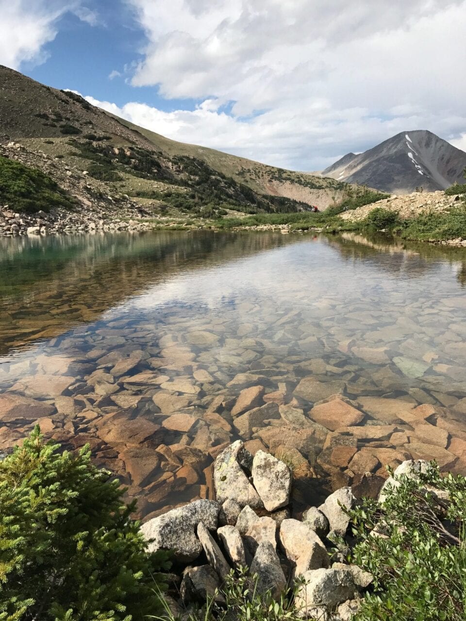
Photo by Alex Patino
When I got back to “the default world”, as we called it (because trail life is every bit as “real” as “the real world” thank you very much) I still had eight months on my lease and a brand-new job offer that promised to pay me more than I had ever earned. And just like that, everything I had learned on the trail about myself and the way I needed my life to go floated to the ether. I suddenly had to relearn the same lessons that had dragged me out to the desert in the first place. I was more depressed than ever and I was furious with myself. All that talking to myself that I had done, how I prided myself on this self-awareness, and then I was behind a cubicle in a dark building, with almost no time to go and enjoy nature? Really? I withstood it for the remainder of my lease and then bid New York City adieu for good. Most of the people that I knew didn’t get it. Meanwhile, a good chunk of the friends I had made on the PCT were going through their own challenges with immersing themselves into the general tedium and the doldrums of everyday life. Talking to one another through our pain was invaluable. They understood what I had gone through; my Prada-clad former colleagues and party-hopping gays? Not so much. The remedy was clear – the only way to get over the past adventure was to dive head first into a new one. So, a week after leaving NYC, I met up with three of my PCT friends in Denver and tackled the Colorado Trail. The following April I jumped on the Appalachian Trail in Georgia and emerged from the clouds at Mount Katahdin in late September. I wore the right shoes this time. I did the entire thing, virtually pain-free.
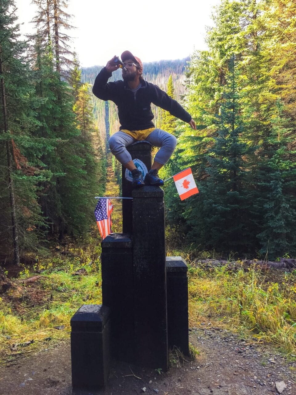
Photo by Alex Patino
The very curious thing about being on a trail like the AT, having previously completed the PCT and the CT, is witnessing that first-timer fever. I was now on the other side of the hiker spectrum. I wasn’t green. I was no spring chicken. If asked, I had solid advice to dole out. I had seen what happens to someone once they’re plucked off the magical path. Moving on from the AT was considerably easier than it was with the PCT, and the enjoyment of one versus the other isn’t the key factor – it’s just experience. I’m at peace after completing the AT; not a veritable post-trail wreck like many of the people I met on my way to Maine. Not even close to the disaster I was when I settled back in Brooklyn after the PCT. The only reason for that, for me at least, is that I realized there were only so many times I could learn the same lesson. The answer to coming out of an overwhelming experience like completing a thru-hike, or even participating in it for a week or two, is knowing that there’s a hell of a lot more world out there to see. And lucky for you, you’ve probably already met someone who is willing to meet you at the next terminus. Wherever that may be.
At Trail Days in Damascus, VA, a man that looked like a buff Richard Attenborough and a flaxen-haired Elizabeth Warren held a sign that read “AT Class of 1975 ROCKS!” They were surrounded by a roiling crowd of pumped-up thru-hikers that had taken on the AT throughout the years. But these two were the OG’s of the huddle and their smiles matched everyone else’s. Had they been coming every year for the past 43 years? What was it like to do the trail back then? I had so many questions. Ultimately, I kept it to myself. What I did know, because their sign said it all, was that the experience will never leave you. I’m still working on figuring out what’s best for my future, but at least I have the trails there to help me work these things out when need be. To quote one of my favorites, Jane Smiley, that knowledge “is the gleaming obsidian shard I safeguard above all the others.”
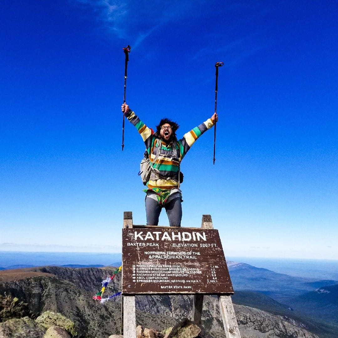
Photo by Alex Patino
Want to keep up with all that’s going on at Atlas Guides? Sign up for our newsletter!
Read more!
Check out some related blog posts!
Get our trail guide for this area!
Pacific Crest Trail
The Pacific Crest Trail is an epic journey of three states and over 2600 miles. Its path travels from the US border with Mexico to the northern border with Canada.
2650 mi (4260 km) $29.99 full guide
Washington, Pacific Crest Trail
Photo by Justin Helmkamp
Washington, Pacific Crest Trail
Photo by Justin Helmkamp
Pacific Crest Trail
The Pacific Crest Trail is an epic journey of three states and over 2600 miles. Its path travels from the US border with Mexico to the northern border with Canada.
2650 mi (4260 km)
$29.99 full guide
Get our trail guide for this area!
About the Author
Natalie McMillan
Natalie grew up hiking in Arizona where she fell in love with the outdoors. Her favorite hikes are to Havasu Falls in the Grand Canyon and Angel’s Landing in Zion National Park, UT. She loves taking pictures of people, places, and nature, which might explain why she has almost 47,000 photos currently residing on her phone. She takes care of all things related to social media and marketing and recently moved to Denver, CO from Flagstaff, AZ. You may find her frolicking around the trails and mountains of Colorado, or exploring the new city she gets to call home.
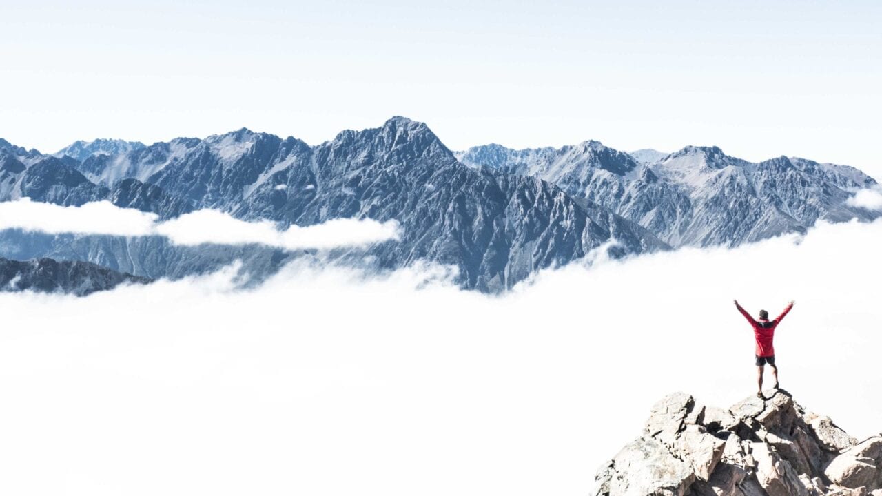
My Trail Story by Sochi
Planning an adventure? Check out our popular trail guides! 4.8 stars (17K+ ratings)
Photo by Ethan Gehl
My Trail Story featuring Sochi
Ethan Gehl, a.k.a. Sochi, has hiked 6,000+ miles all over the world and shares what he's learned from his time in the wilderness.
Natalie McMillan My Trail Story 03/07/2019
Natalie McMillan
My Trail Story
03/07/2019
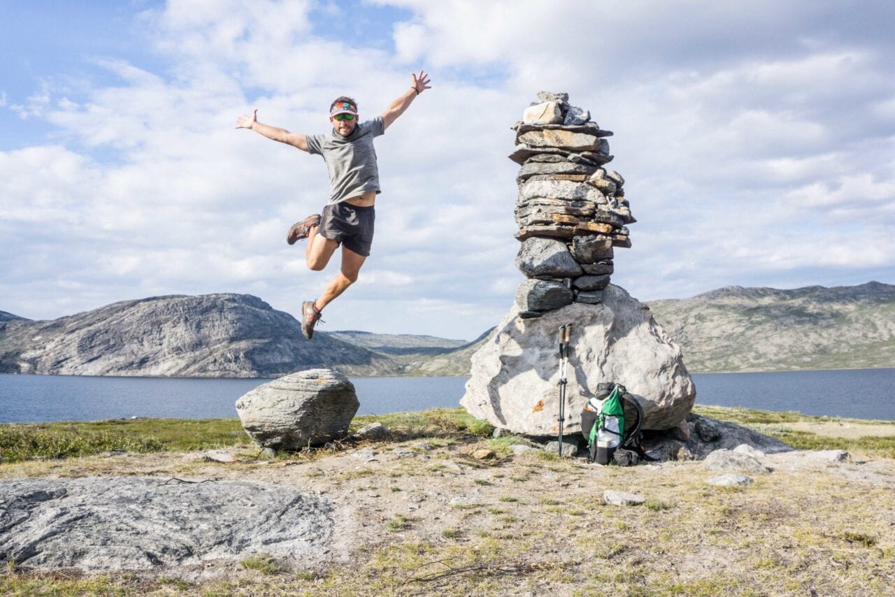
Photo by Ethan Gehl
Reflecting on a Half Decade and 6,000+ Miles of Trails
I wish I had known when I took my first steps on the Pacific Crest Trail back in 2014 that thru-hiking can so easily become an addiction. But even more than that, I wish I had known that the addiction is a mixed bag. I’ve hiked over 6,000 miles since my first long trail back in 2014, including the South Island of New Zealand’s Te Araroa, the Three Passes Trek in Nepal, the Laugavegur in Iceland, and the lesser-known Lowest to Highest route from Badwater Basin to the top of Mount Whitney. I’m also aspiring to trek another 2,500 miles between now and Christmas, including the Hayduke route, the Oregon Coast Trail, the Pacific Northwest Trail, and even an FKT attempt on the Ozark Highlands Trail. Let’s just go ahead and say it: I’m an addict.
I’ve gained so much from my addiction. The wilderness, and the solitude I so readily find in it, has become my sanctuary, my canvas, and my gym. What I mean by that is that the wilderness has supported my mental health by providing a space for personal reflection and introspection; it has supported my emotional health by sharing its inspiring views and once-in-a-lifetime experiences; it has supported my physical health by challenging me with steep grades and high altitudes. But remember what they say about too much of a good thing. I recognize that my time in the wilderness has come at a cost. But then, maybe that’s the nature of every choice we make in life. Nothing is perfect, after all. We can’t have everything.
Photo by Ethan Gehl
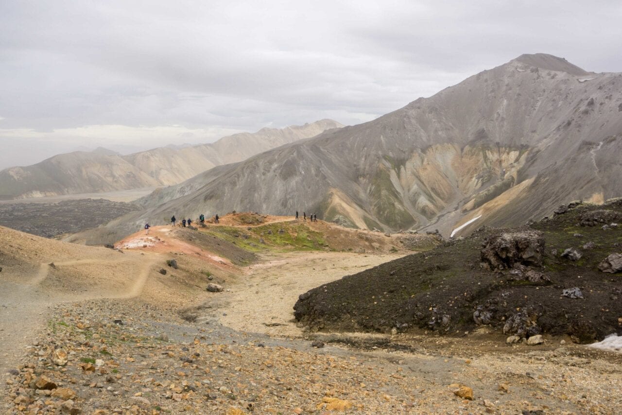
Photo by Ethan Gehl
I have so many thoughts about thru-hiking: what it means to me, how it enriches my life, which lessons I’ve taken from my time in the wild, and the sacrifices I’ve made to live this life. Certainly too many to broach in any depth here with one short post. Still, I’m going to try to synthesize a half decade and 6,000+ miles of lessons and Ah-ha moments. For the full journey, check out my website at sochitreks.com.
My first authentic introduction to the so-called trail community came in the morning on my fifth day on the PCT. I was packing up my gear, and a fellow hiker I’d met in the previous days sparked up a conversation with me. If you’ve thru-hiked, then you know the community small talk: where did you hike from; what’s your trail name; what kind of gear are you carrying. A friend of mine once said that it’s the a/s/l of thru-hiking. (Have any of you even heard of AIM? Did I just date myself? No matter.) Long story, short. I’d walked over 30 miles the day prior. Another hiker asked if I’d just gotten back from competing in the 2014 Winter Olympics in Sochi. That was it; I’ve been Sochi ever since. I already felt like I belonged in the wilderness, that I was in my element, but that was the moment where I first felt like I belonged in the community.

Photo by Ethan Gehl
You see, I’ve come to realize that the thing I love even more than thru-hiking itself is the thru-hiking community. I’ve met some of my dearest friends on the trail. Ten-k and Twinkle on the PCT and later on FAFBAB, The Man, Just Rob Lord, and Hundred Billion Kilometer Kirsten on the Te Araroa. I’ve been on some amazing trails and seen some truly incredible places, but my favorite thru-hikes are the ones where I find my people. Chris McCandless said “Happiness only real when shared.” I don’t subscribe to that idea, but I do agree that happiness is better when shared. The most difficult part about being a thru-hiking junkie, about always aspiring to hit another trail, is that I don’t have that same sense of stable community and of deep understanding when I’m not out there. It can be a painfully lonely life between trails. I don’t feel lonely when I’m alone in the wilderness; I feel lonely when I’m surrounded by a community of which I’m not a part.
I don’t know what that means except that I value both solitude and community, both experience and relationship. I feel torn between my two authentic selves. On the one hand, an accomplished thru-hiker struck by wanderlust and always reaching for more. And on the other, the father-figure and pillar of my community that I intend to be one day. I wonder whether one person can have it all; whether I get to live my best vagabond life, then live my best family life; whether we really ever move past our addictions, especially those which have defined us so deeply.
Photo by Ethan Gehl
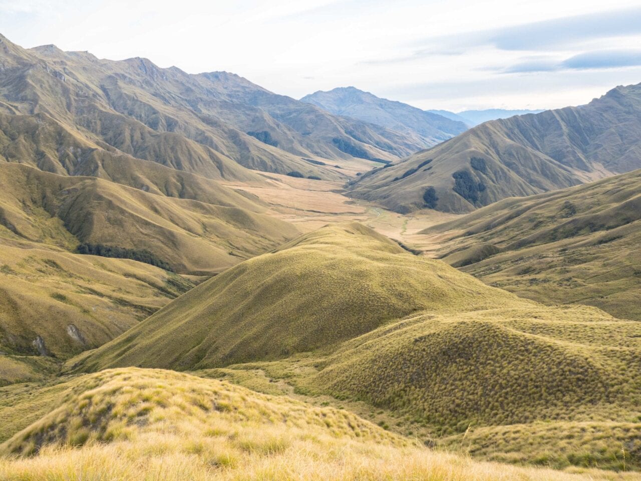
Photo by Ethan Gehl
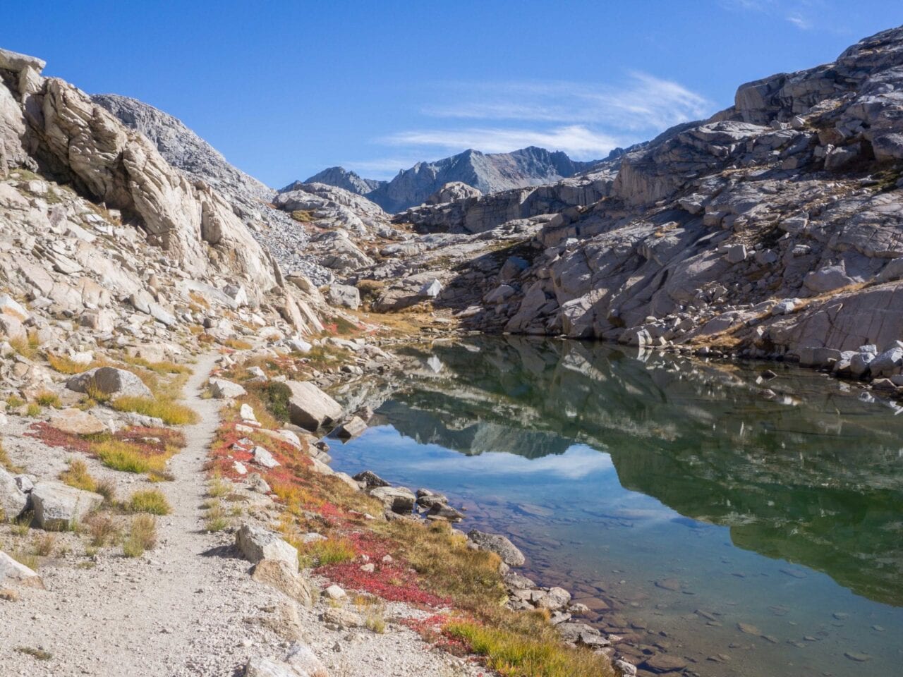
Photo by Ethan Gehl
I’ve come to believe that there are stages of life, that we are one person for a period, but that we constantly grow and change – often without realizing it – and that we can become someone new if we choose to. I believe that pain and discomfort are the catalysts and opportunities to become better versions of ourselves. (And furthermore that growing in physical discomfort, like on a thru-hike, teaches us to grow similarly in emotional discomfort, like in interpersonal relationships.) Do you retreat, avoid, quit, or hide – a slave to the hard things? Or do you rise and face them? Do you work through the negative self-talk, the self-defeating stories, and the demoralizing beliefs that you have about yourself – even when that process is cumbersome and devoid of grace? Can you even hear your own self-talk through the noise and distractions around you? Whether you do or not, trust me when I say that it has a profound influence on the quality of your life. Do you know who you are and what you want independent of outside influences: social pressure, family expectations, and your own sense of mortality?
The silence and tranquility that I find in wilderness has allowed me to discover myself again and again, to challenge outside influences and the story that plays out in my own head. I’ve learned so much about who I am and how I continue to change just by reflecting on how I show up in the wilderness and how my experiences out there affect me. However you choose to reflect, process, and grow, my hope is that you won’t just let life happen to you. That you’ll work to always be better tomorrow than you were today, even if progress feels sluggish. That when things are difficult, you will look first inward at your own heart, remembering that Destiny waits patiently where our hearts lead us. Let your heart guide you, not your fear. That’s what the wilderness has taught me.
I routinely challenge myself in the wilderness, almost always alone. Many times I’ve been terrified, nearly paralyzed by fear. I vividly recall feeling my heart in my throat, feeling my pulse throbbing in my ears, feeling my whole body shake uncontrollably. Those are the moments where I meet myself. I think most of us want to believe that we’d be calm, cool, and collected under extreme pressure and stress, that we could stare into the void, take a breath, think clearly, and will ourselves forward. But we can’t know that until we’re in it. We can’t know until we’re cliffed out on an exposed ridge and the storm is rolling in; can’t know until a cougar stalks us closely for four hours on a solo night hike; can’t know until we’re charged by a wild boar at five o’clock in the morning; can’t know until we’re ab deep in a raging river fighting to keep our feet amidst the swift current.
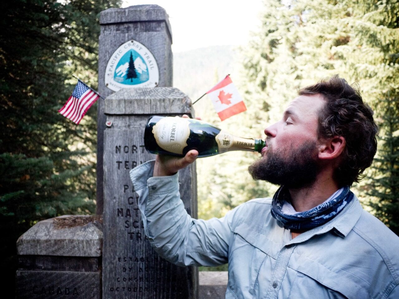
Photo by Ethan Gehl
Meeting myself repeatedly and finding that I am who I always hoped I was has allowed me to bring that same level-headedness and steady courage to my life beyond the wilderness, even when I’m scared and hurt, even when I’m without dignity and grace. I’m not the guy who dances elegantly across an exposed knife edge; I’m the guy who straddles the apex and awkwardly scoots along. It’s not always pretty, but I don’t freeze and I don’t run. I breathe, acknowledge my fear, and will myself forward. The wilderness taught me that too. The wilderness has been my most trusted and valued mentor.
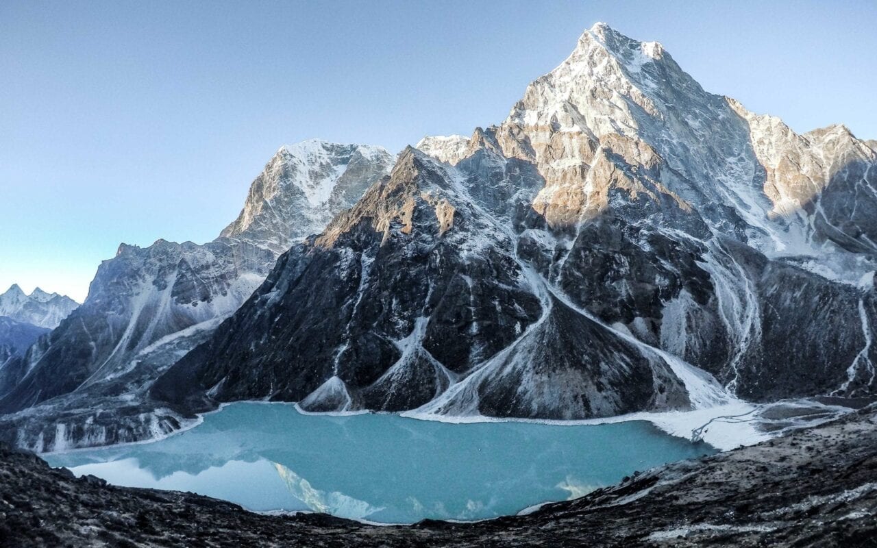
Photo by Ethan Gehl
I’ve been so lucky to live a truly free-spirited life that I love so deeply. And yet being able to do so has meant sacrificing a stable, present community; meant choosing my ambition and lifestyle over the few great loves of my life; meant forgoing comfort and an economic safety net; and even meant front-loading my retirement and setting myself up to work for the rest of my life in order to support myself into old age. These are dues I’ve happily paid.
I have had the incredible privilege to live more in the last decade than most people have the opportunity to live in a century. And yet each day I struggle more and more with the temptation to trade my free-spirit for the comforts and connection that come with a more stable lifestyle. Pros and cons for each, and perhaps also a time and place for each. For me, I think there are a few more trails I’d like to walk and places I’d like to see first, but I feel myself transition more and more with each adventure toward my next stage of life.
I do not know what you have found or what you hope to find in wilderness, but I know that if you listen, the wilderness will speak your truth back to you. I also know that your truth today may not be your truth tomorrow. Love the wilderness. And listen to her, always.
Want to keep up with all that’s going on at Atlas Guides? Sign up for our newsletter!
Read more!
Check out some related blog posts!
Get our trail guide for this area!
Pacific Crest Trail
The Pacific Crest Trail is an epic journey of three states and over 2600 miles. Its path travels from the US border with Mexico to the northern border with Canada.
2650 mi (4260 km) $29.99 full guide
Washington, Pacific Crest Trail
Photo by Justin Helmkamp
Washington, Pacific Crest Trail
Photo by Justin Helmkamp
Pacific Crest Trail
The Pacific Crest Trail is an epic journey of three states and over 2600 miles. Its path travels from the US border with Mexico to the northern border with Canada.
2650 mi (4260 km)
$29.99 full guide
Get our trail guide for this area!
About the Author
Natalie McMillan
Natalie grew up hiking in Arizona where she fell in love with the outdoors. Her favorite hikes are to Havasu Falls in the Grand Canyon and Angel’s Landing in Zion National Park, UT. She loves taking pictures of people, places, and nature, which might explain why she has almost 47,000 photos currently residing on her phone. She takes care of all things related to social media and marketing and recently moved to Denver, CO from Flagstaff, AZ. You may find her frolicking around the trails and mountains of Colorado, or exploring the new city she gets to call home.
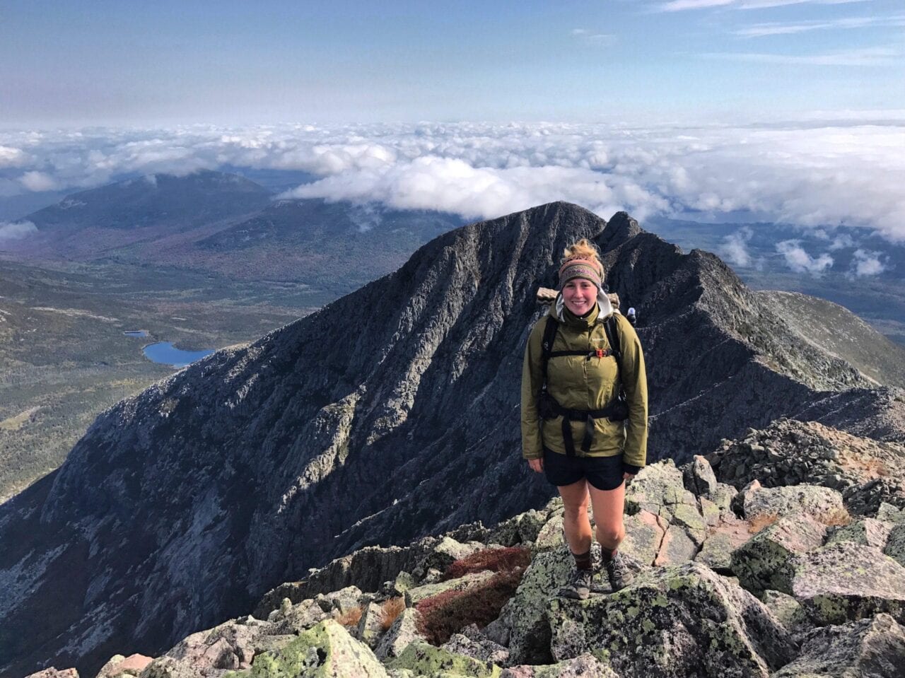
My Trail Story by PCP
Planning an adventure? Check out our popular trail guides! 4.8 stars (17K+ ratings)
Photo by Chelsea Fisher
My Trail Story featuring PCP
Chelsea Fisher, a.k.a. PCP ("Pretty Cool Person") shares her journey of becoming a thru-hiker from the AT to the Long Trail, and now on to hike the PCT in 2019.
Natalie McMillan My Trail Story 03/07/2019
Natalie McMillan
My Trail Story
03/07/2019
Giving The World My Time, As It Shares With Me Its Beauties
I became PCP (“Pretty Cool Person”) on my Appalachian Trail thru hike in 2017, and it stuck with me on the Long Trail in 2018. As I head for the Mexican border in April, I’ll find out if I will continue to be PCP. “PCP on the PCT” is either as catchy as it gets or it’ll be confusing as ever.
Leading up to Thru Hiking
If there’s any room for want in this world, I want to go places. I didn’t always want that. My desire to travel and see the world didn’t develop until after college. I declined the typical post graduation strides and found myself living in Fiji for 8 months, diving with sharks and working with a conservation project. Aside from the new love of scuba diving, I also discovered the concept of backpacking. Since my time in Fiji, I have traveled New Zealand, Myanmar, Thailand, Laos, Costa Rica, Nicaragua, and Puerto Rico and hope to visit many more countries in my lifetime.
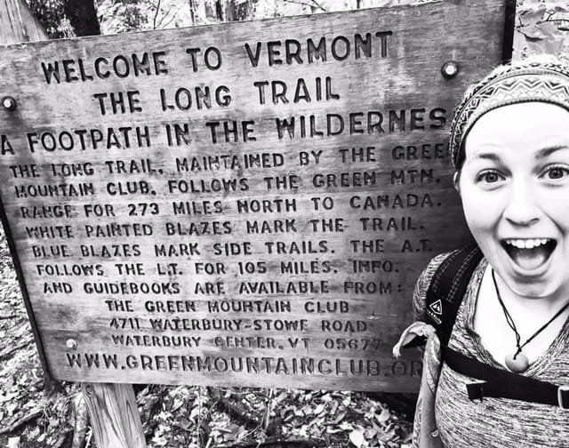
Photo by Chelsea Fisher
During a span that I was at home working to save up funds for more travels, I had met a guy from a neighboring town that had just finished the CDT, the final hike of his Triple Crown! As I asked question after question, he was soon able to convince me that now was the time. The AT was a new adventure and a perfect opportunity for me to really test my love of hiking and the outdoors… all while giving the concept of backpacking a whole new meaning.
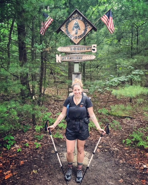
Photo by Chelsea Fisher
Preparing for the Appalachian Trail
I had about 2 months to prepare once I had made the final decision to hike the AT. I asked all the questions I thought I needed to and researched gear thoroughly. I met B Man at REI who set me up with a ride down to Georgia with Geek. Geek is well known for having hiked the AT in 1990 with his cat, Ziggy. Geek and B Man participate in trail magic at Gooch Gap every St. Patrick’s Day. I stayed with them and other trail angels, Herb and Kim, for a few days before heading to take part in their annual gathering. I felt extremely lucky to have been able to take part in the trail magic before even stepping foot on trail myself. I was devouring the information from the hikers as they came through Gooch Gap, only a few days in to their own thru hike. My previous solo travels prepared me for arriving at Amicalola, leaving me with few nerves as I got dropped off on March 19th, 2017.
Hiking the Appalachian Trail
I had started the trail in a pair of Salomon shoes, a brand I was not familiar with. I am convinced that my arch had collapsed so quickly that my foot had widened leading to the blisters on the side of my foot. I was forced off trail for an entire week before the swelling went down and blisters healed enough for me to walk again.
I got back on trail with a pair of Altra Lone Peaks, trail runners that provided me with a wide enough toe box. I watched hikers with their tiny packs whiz by me and it didn’t take me long to realize that I was a walking REI manikin. I listened to them gloat about cutting ounces and became extremely curious about the ultra light backpacking brands that I had never even heard of. With over 30 lbs. on my back, I knew that I needed to make some adjustments.
Before long I ditched the Deuter pack and was carrying a Hyperlite Mountain Gear 2400 Windrider, I swapped my REI Joule sleeping bag for Western Mountaineering, and I sent many unnecessary items home. I was on my way to being one of those tiny pack hikers. It was my big win at Trail Days in Damascus Virginia that solidified my journey to becoming as close to UL as possible. I won the HMG Echo II Shelter and said goodbye to my Big Agnes Fly Creek. I had cut enough pack weight that with food and water, my pack hovered around 20 lbs. for the remainder of the trail.
From start to finish it took me exactly 6 months to hike the entirety of the Appalachian Trail. With nearly 60 zero days, I easily hiked big mile days but had no problem letting those days off rack up.
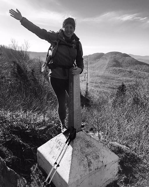
Photo by Chelsea Fisher
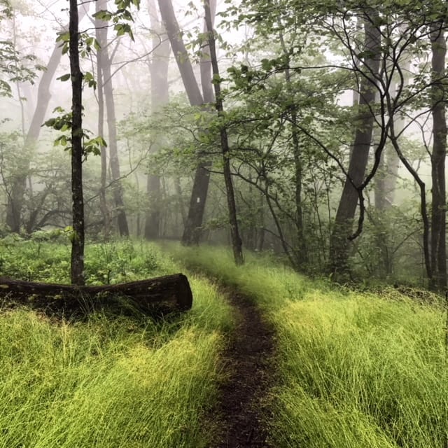
Photo by Chelsea Fisher
Photo by Chelsea Fisher
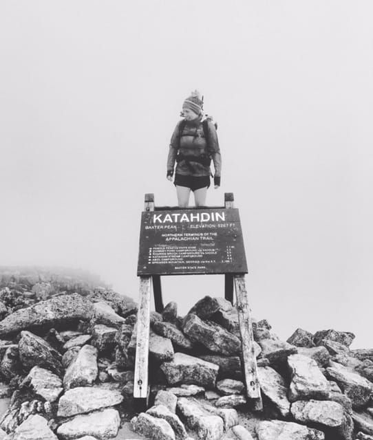
Photo by Chelsea Fisher
Life After the Appalachian Trail
My experience after finishing the AT is similar to that of most. I was missing the people I had just spent 6 months of my life with and I had returned home to people who didn’t understand what those 6 months meant to me. I struggled finding work, which postponed any hopes for another hike or travels. Regardless of healthy eating and trying to maintain a work out routine, I immediately gained weight as my body and metabolism couldn’t adjust to the drastic change in calories burned and consumed. I was back in my to do list life where my days were no longer as simple as waking up and walking. Coming home after a thru hike is a hard adjustment to make.
Hiking the Long Trail
It was an entire year after completing the AT that I was finally able to set out for another thru hike. I started the Long Trail on October 1st, 2018 with high hopes of peak foliage. Little did I know that I would be given 19 days of miserable rain and snow. My time on the LT felt like putting all of my worst weather days of trail on the AT and hiking them one after the other.
I met a girl on the first day of the trail and we went all the way to Journey’s End together. Had it not been for her, I may not have actually completed the trail. The Long Trail was brutal but I have absolutely no regret for having hiked it.
Photo by Chelsea Fisher
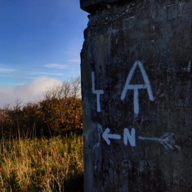
Photo by Chelsea Fisher
Preparing for the Pacific Crest Trail
Because I already have gear that I used for the AT and LT I haven’t needed to make many gear purchases. As much as I would love to splurge and upgrade my gear, I know that it’s not necessary. The few purchases I have had to make are a bear can and microspikes for the Sierras. I also treated myself to an R1 Hoody and Houdini pants, my first ever pieces of Patagonia clothing.
I haven’t put much time or effort into any physical preparation either. My main priority is from a financial standpoint. The majority of my time is spent working and saving to build up my bank account.
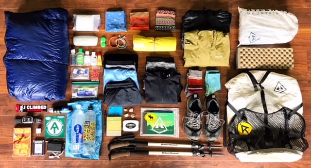
Photo by Chelsea Fisher
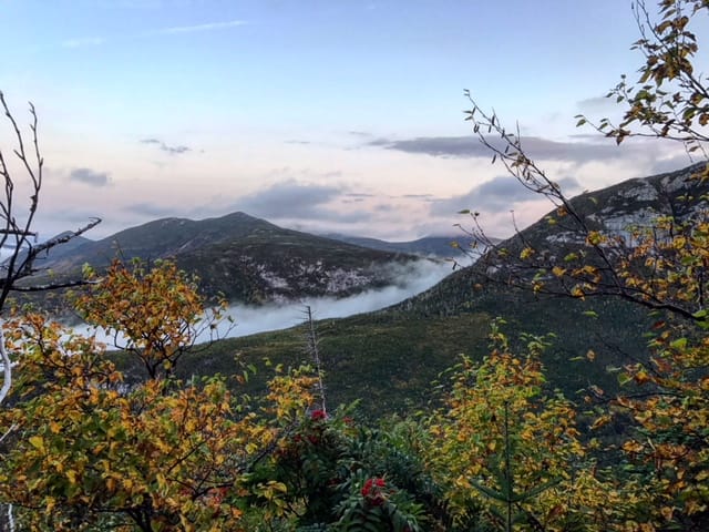
Photo by Chelsea Fisher
Plans after the Pacific Crest Trail
I don’t like to make plans. Plans are limiting. But I do have ideas and I have options. Of those endless possibilities, I could see myself doing a number of different things after the PCT. I could end up out west somewhere working at a ski resort for the winter season. I could travel internationally or quite possibly do an international trail. I could head to Indonesia to pursue my dive master and island hop for a while. I could even take up an entirely new hobby to devote my time to. Nothing is certain in life, but what I do know is that I’m going places. And right now those places include the steps between Mexico and Canada.
Want to keep up with all that’s going on at Atlas Guides? Sign up for our newsletter!
Read more!
Check out some related blog posts!
Get our trail guide for this area!
Appalachian Trail
The Appalachian Trail is one of the oldest National Scenic Trails in the US. Its path takes you from Springer Mountain in Georgia to Mt. Katahdin in Maine.
2200 mi (3540 km) $59.99 full guide
Pennsylvania, Appalachian Trail
Photo by Zoë Symon
Pennsylvania, Appalachian Trail
Photo by Zoë Symon
Appalachian Trail
The Appalachian Trail is one of the oldest National Scenic Trails in the US. Its path takes you from Springer Mountain in Georgia to Mt. Katahdin in Maine.
2200 mi (3540 km)
$59.99 full guide
Get our trail guide for this area!
About the Author
Natalie McMillan
Natalie grew up hiking in Arizona where she fell in love with the outdoors. Her favorite hikes are to Havasu Falls in the Grand Canyon and Angel’s Landing in Zion National Park, UT. She loves taking pictures of people, places, and nature, which might explain why she has almost 47,000 photos currently residing on her phone. She takes care of all things related to social media and marketing and recently moved to Denver, CO from Flagstaff, AZ. You may find her frolicking around the trails and mountains of Colorado, or exploring the new city she gets to call home.