
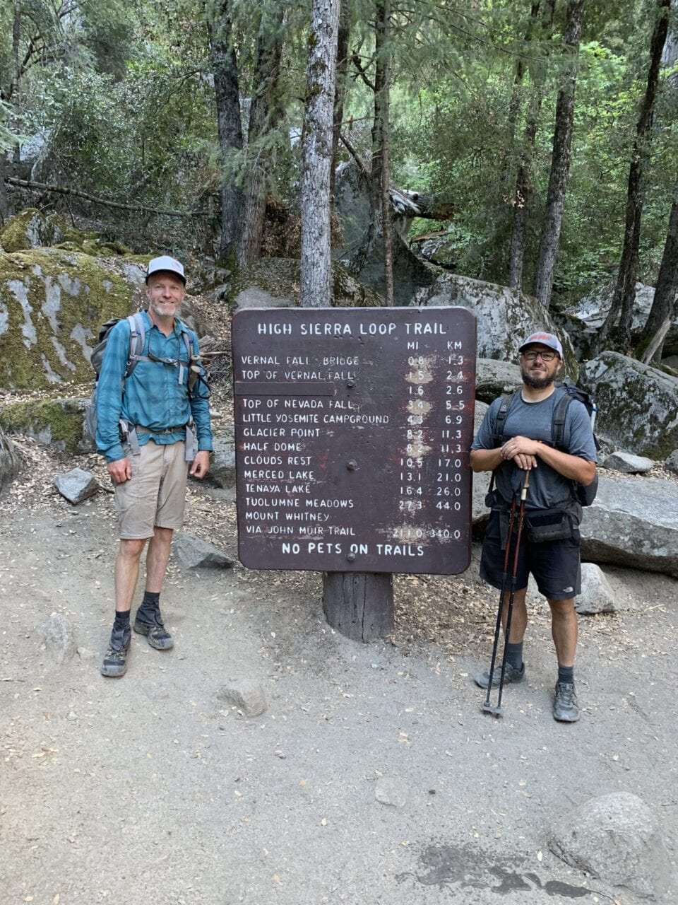
Congrats Featured 2019 Thru-Hikers!
Planning an adventure? Check out our popular trail guides! 4.7 stars (14K+ ratings)
Photo provided by Chelsea Fisher
Congrats Featured 2019 Thru-Hikers!
Each of these hikers contributed to our "My Trail Story" blog series and all have completed thru-hikes this year! We congratulate each of you for accomplishing something so incredible and celebrate how far you have come. Being able to feature hikers of all different ages, backgrounds, and walks of life has been so inspiring. We are so happy with our My Trail Story contributions and encourage those who want to share their story to email us at mytrailstory@atlasguides.com. It doesn't matter if you are a thru-hiker, a section hiker, or a day hiker! We would love to share your trail story and inspire other people to get out and explore this beautiful world.
Natalie McMillan My Trail Story 09/24/2019
Natalie McMillan
My Trail Story
09/24/2019
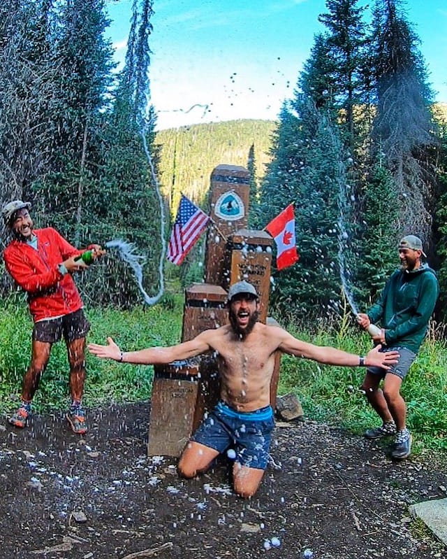
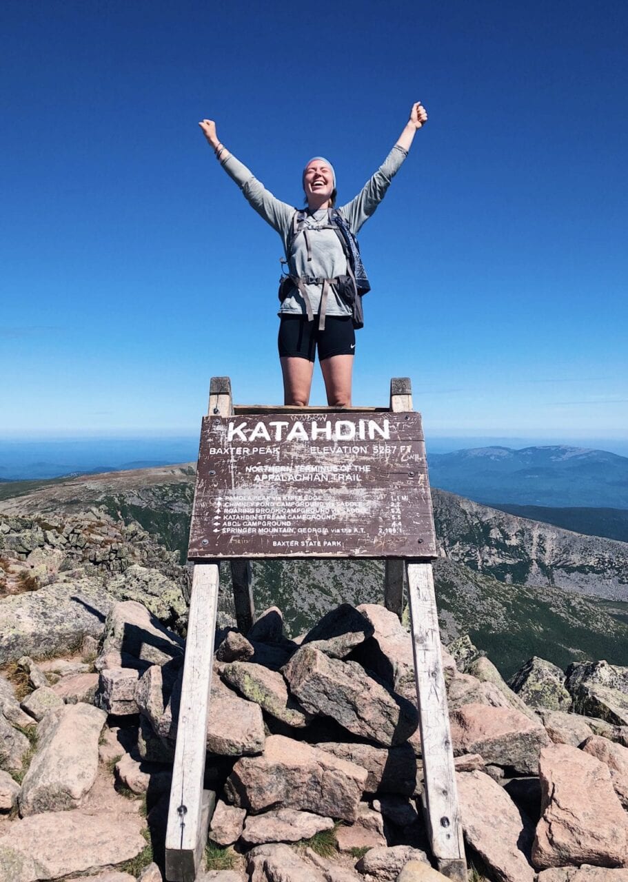
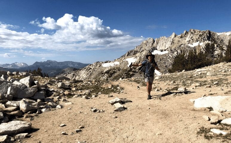
Grizzly
Finished: August 29, 2019
Photo provided by: @grizzly_hikes
Crunchmaster
Finished: September 2, 2019
Photo provided by: @crunchmaster_hikes
Read Crunchmaster’s My Trail Story

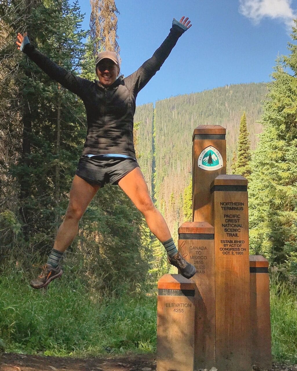
Squishy
July 23 – 29, 2019
Photo provided by: @backcountryemily
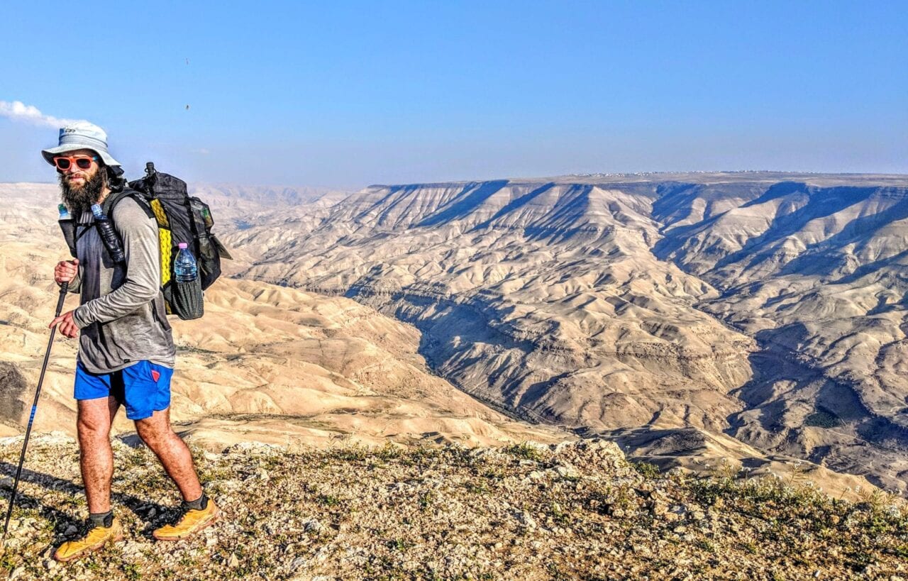
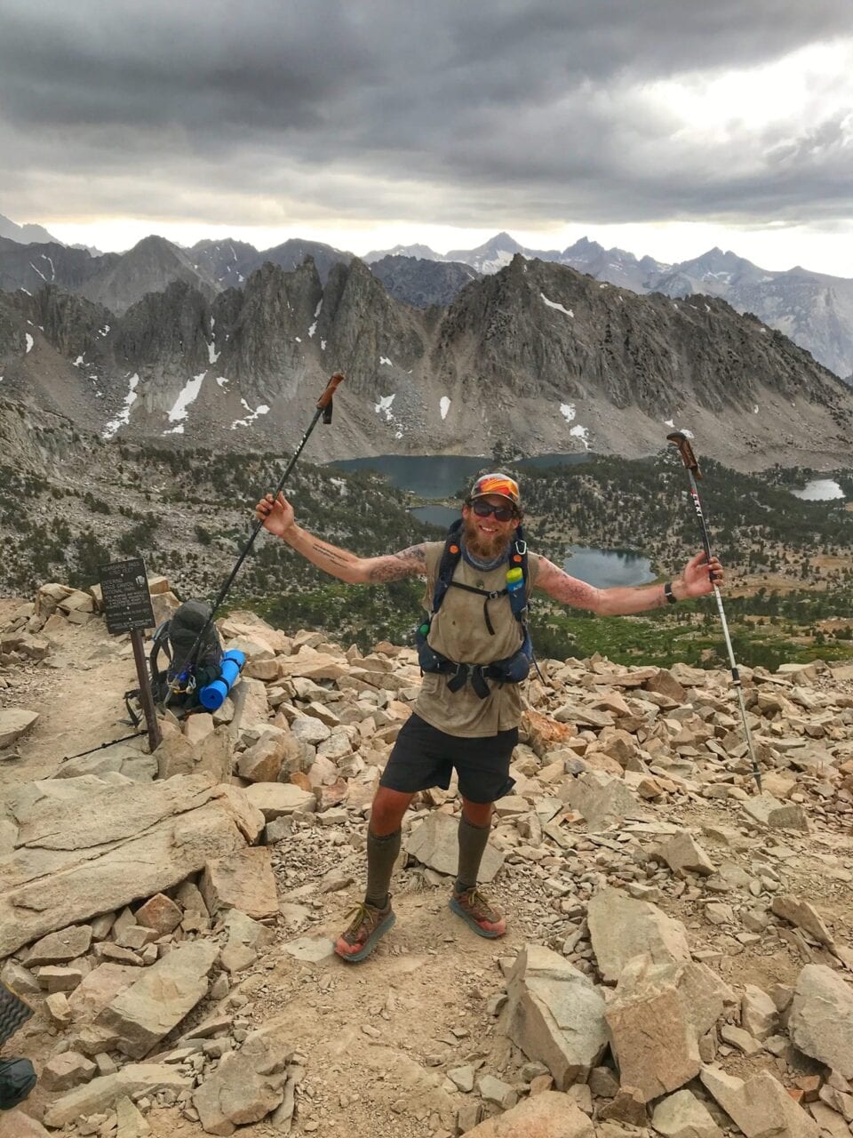
Legend
The Arizona Trail – Fastest Known Time
The Long Trail – Fastest Known Time
Photo provided by: @thefreeoutside
Read Legend’s My Trail Story about his AZT FKT

Craig Fowler and Scott Richardson pictured in the photo below.
Flower Power
August 3 – 12, 2019
Photos provided by: @adventurous_als
Read Flower Power’s My Trail Story
Puff Puff
Finished September 12, 2019
Photos provided by: @masonalexandra
Read Puff Puff’s My Trail Story
Want to keep up with all that’s going on at Atlas Guides? Sign up for our newsletter!
Read more!
Check out some related blog posts!
Download our popular hiking and biking guides!

Trail guides that get you to places you’ve dreamed of.
As the makers of Guthook Guides, Bikepacking Guides, and Cyclewayz, we help you navigate the most popular trails around the world on your smartphone. Our hiking guides and biking guides work completely offline. Let Guthook guide your next adventure!
Showers Lake Vista, Tahoe Rim Trail
Photo courtesy of the Tahoe Rim Trail Association

Showers Lake Vista, Tahoe Rim Trail
Photo courtesy of the Tahoe Rim Trail Association
Trail guides that get you to places you’ve dreamed of.
As the makers of Guthook Guides, Bikepacking Guides, and Cyclewayz, we help you navigate the most popular trails around the world on your smartphone. Our hiking guides and biking guides work completely offline. Let Guthook guide your next adventure!
Download our popular hiking and biking guides!
About the Author

Natalie McMillan
Natalie grew up hiking in Arizona where she fell in love with the outdoors. Her favorite hikes are to Havasu Falls in the Grand Canyon and Angel’s Landing in Zion National Park, UT. She loves taking pictures of people, places, and nature, which might explain why she has almost 47,000 photos currently residing on her phone. She takes care of all things related to social media and marketing and recently moved to Denver, CO from Flagstaff, AZ. You may find her frolicking around the trails and mountains of Colorado, or exploring the new city she gets to call home.
My Trail Story by Beta
Planning an adventure? Check out our popular trail guides! 4.7 stars (14K+ ratings)
Photo provided by Zach Terpstra
My Trail Story featuring Beta
During his John Muir Trail thru-hike, Beta (a.k.a. Zach Terpstra) woke up in the middle of the night by the loudest noise he had ever heard in his life.
Natalie McMillan My Trail Story 09/06/2019
Natalie McMillan
My Trail Story
09/06/2019
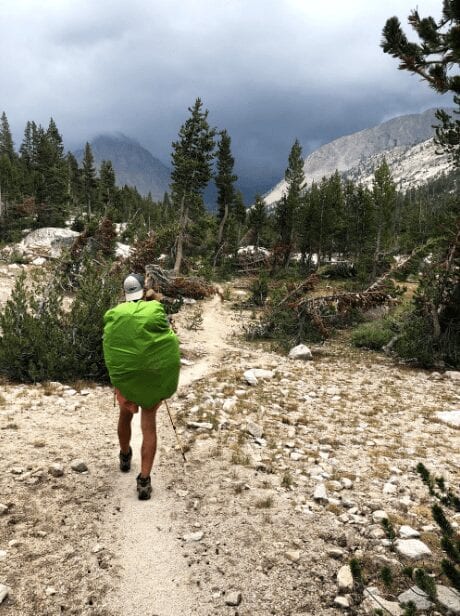
Photo provided by Zach Terpstra
The Rude Awakening
By: Zach Terpstra
Trail Name: Beta
The Michigan Shore to Shore Trail (2016)
The John Muir Trail (2018)
Currently planning a Calendar Year Triple Crown for 2020!
Age: 22 years old
What is one thing treasured amongst all backpackers who log hard, difficult mileage during the day? The answer is definitely: sleeping. While at first, sleep comes in light and small episodes during a lengthy hike, by the end the slumber is deep and restful. It would take an unimaginable noise in order to wake a tired hiker in the middle of the night. But that’s exactly what happened.
To demonstrate just how tired my group of friends and I were, I’ll give you a little background. While on the John Muir Trail, we were pushing for miles as we decided we’d allotted ourselves too much time to actually do this trail, plenty more than we actually needed. For that reason, we were consistently pushing around 20 miles a day, despite the fact that for some of us, this was their first multi-week trip. However, we had perfect hiking weather to log miles until day eight on the trail.
For those that are unfamiliar with the Sierra Nevada Range, rain typically falls in the afternoons for a very brief time during the summer months. Maybe a scattered shower here or there lasting no more than thirty minutes at a time. However, on day eight we experienced such a torrential downpour, in addition to the temperatures dropping to near hypothermic levels, that we as a group decided to set up shelter in the middle of the day and then grind out some miles the next morning.
Morning comes around and we do just that. Before noon, we are over the next pass and soon we are climbing toward the next. A man came sprinting down the mountain warning us of the horrific weather (lightning, large hail, the usual…) going over Forester Pass. At the next open view, sure enough, we see dark, formidable clouds standing in our path.
We took shelter again, but the prophesied storm never arrived! After waiting around for about an hour, we made our way toward the base of Forester, and found ourselves in an unimaginable scene as the storm trailed behind some interesting clouds that stuck around well into the dusk. It created somewhat of an eerie lighting that was an incredible purple (which of course we took advantage of for a photo or two).
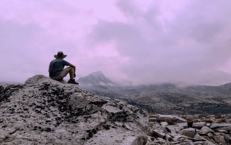
Photo provided by Zach Terpstra
So taking into account the last 24 hours we had, the crew and I were pretty darn tired. We ate and set up our tents for the night, and I’m fairly certain three out of four of us were snoring before the sun had even fully set. Not a creature was stirring, not even a mouse nor a marmot…
Then all of a sudden, I was whipped awake by one of the loudest noises I had ever heard. I was sharing a shelter with a friend, and he instantly sat up at the same time as I did. The immediate thought was an avalanche… but it was July in a pretty low snow year? Then it dawned on me. The only other thing aside from snow that falls down mountainside regularly? ROCKS. I was hearing a rockslide.
We hastily left our tent and tried to figure out where the noise was coming from and find the nearest large boulder to hide behind. The noise went on for what seemed like ages until it eventually subsided. Let’s just say, it took us a while to fall asleep after that wonderful experience.
Once dawn cracked, we were beginning to gather our gear when we witnessed the culprit. On the other side of the valley, we watched as rocks (the size of cars) fell down the steep face of the mountain. It was the most beautifully destructive thing I had ever seen. At that moment, I decided I would never again spend the night just below a pass where the terrain was pretty steep. I’d rather hike into the night than have to be woken by that deafening roar again!
Want to keep up with all that’s going on at Atlas Guides? Sign up for our newsletter!
Read more!
Check out some related blog posts!
Get our trail guide for this area!
John Muir Trail
Named after the environmentalist, the John Muir Trail travels over 200 miles through the Sierra Nevada Mountains and is one of the most popular trails in the country.
210 mi (338 km) $14.99 full guide
East Vidette, Southern Sierra, John Muir Trail
Photo by Alice Bodnar
East Vidette, Southern Sierra, John Muir Trail
Photo by Alice Bodnar
John Muir Trail
Named after the environmentalist, the John Muir Trail travels over 200 miles through the Sierra Nevada Mountains and is one of the most popular trails in the country.
210 mi (338 km)
$14.99 full guide
Get our trail guide for this area!
About the Author
Natalie McMillan
Natalie grew up hiking in Arizona where she fell in love with the outdoors. Her favorite hikes are to Havasu Falls in the Grand Canyon and Angel’s Landing in Zion National Park, UT. She loves taking pictures of people, places, and nature, which might explain why she has almost 47,000 photos currently residing on her phone. She takes care of all things related to social media and marketing and recently moved to Denver, CO from Flagstaff, AZ. You may find her frolicking around the trails and mountains of Colorado, or exploring the new city she gets to call home.

My Trail Story by Furiosa
Planning an adventure? Check out our popular trail guides! 4.7 stars (14K+ ratings)
Photo provided by Amber Redfield
My Trail Story featuring Furiosa
Amber Redfield, a.k.a. Furiosa, shares the lessons she learned after injuring herself on her Appalachian Trail thru-hike.
Natalie McMillan My Trail Story 08/06/2019
Natalie McMillan
My Trail Story
08/06/2019
What is your trail name?
Furiosa (or Fury for short). My trail name came to be for a few reasons. I have a buzzcut, I do all the work on my Jeep, and I exchanged mechanic services at hostels for beer and stay when vehicles break down. The name Furiosa comes from Charlize Theron’s character in the film “Mad Max: Fury Road”. I’m very much like the character, but nowhere near as cool as Charlize haha!
Photo provided by Amber Redfield

Photo provided by Amber Redfield
What trail(s) did you hike/are you hiking?
I’ve been hiking for many years, ever since I was a kid. Little hikes, of course, but my first long distance hike was in 2017 when I attempted to hike the AT. A severe knee injury ended my hike early (which is what my story is about), but I plan to finish it over the next year, as well as plan for other hikes in the future.
2017: Appalachian Trail (700+ mi)
2019: Mid State Trail, Appalachian Trail (sections)
2020: Appalachian Trail, Long Trail
2021/22: PCT? Ice Age Trail? We shall see!
Photo provided by Amber Redfield
Photo by Amber Redfield
When did you hike/are you hiking?
I’m completing LASHes (LASH = long-ass section hiker) of the AT this year to complete the trail (see above). I am also planning to try and thru-hike the AT within the next 5+ years, but there are so many other trails to hike too!
How old are you?
Just turned 30 in July.
Photo provided by Amber Redfield
Trail Story
Like so many who hike the Appalachian Trail, we learn only through experience: what is needed and what is not… what’s tough and what’s tougher. You learn from your mistakes, you celebrate your successes. But in the end, it’s what you take away from your hike that helps you grow as a person, as well as a long distance backpacker.
For me, it was learning that my stubborn Norwegian blood would ultimately end my hike. Why, you ask? Because I ignored severe knee injuries and continued to hike for 500 miles before admitting I needed to get off trail to seek medical attention.
We learn only through experience: what is needed and what is not… what’s tough and what’s tougher.

Photo provided by Amber Redfield
Photo by Amber Redfield
Photo by Amber Redfield
Photo by Amber Redfield
Let’s rewind back to Newfound Gap in 2017. I was 200 miles into my thru-hike attempt and feeling great. A shuttle picked us up in Gatlinburg to head back to the trailhead after spending a night in the town (vortexes, am I right?!). Tater Tot, Bags, and I all unloaded and took our photos at the Newfound Gap sign. We were so excited because it also had the first “Miles to Katahdin” on it!
A little into being back on trail, a huge storm hit the area, so we waited it out in a shelter. It was mid-afternoon, and some hikers were already in their sleeping bags; they decided to call it a day there due to the storms.
We were pumped on the other hand, as our desire to get going was in overdrive. Thus, it was decided to battle through the scattered storms throughout the day to get to the next shelter/site about 10 miles away.
This is where it gets dicey.

Photo by Amber Redfield
The trail had become a fast flowing creek. Rocks were uprooted, debris collecting in deep cuts in the trail due to water erosion. Yet, we were singing and laughing, calling out to each other, and chanting to keep the adrenaline flowing.
A little while later, after taking some nice videos for my blog, we were hiking down a mountain right around mile marker 210. This particular part of the trail was very eroded from the heavy rainfall, so we watched our steps as we descended. All I remember is balancing on a rock that came uprooted and leaning backwards to keep upright. My left leg was in mid-step and I heard a huge snap/crack.
You can guess what versatile word came bursting out of my mouth as this moment.
The pain that shot through my left knee was something I’d never felt before: it was a deep, searing burn. Hot knives stabbing under my patella (kneecap), and between my femur and tibia. My pain threshold is very high, but I’ll admit… this got me.
I stumbled to a log to take a seat while my mind flooded with fear. The fear wasn’t about the injury, it was about knowing this was it. This injury would kill my thru-hike attempt.
About 45 mins passed while Bags and Tater watched with concern on how to deal with this situation. They stayed by my side while I let the pain rush over me and start to dull. I was now in pure adrenaline-fight mode. I masked the pain and told them it wasn’t that bad and that we just continue to the next shelter (which was 8 miles away).
See what I just said? Read it again.
Do NOT do that. Ever.
Photo by Amber Redfield
Photo provided by Amber Redfield
After some convincing, we pressed on and skirted pass Charlie’s Bunion, focused on getting to the next shelter. I booked it as best I could, just wanting to get safely to a place – any place – to rest for the night. I just wanted to eat my pasta side, laugh with friends, and enjoy the scenery.
Before we continue on reading “The Idiot’s Guide to ‘Let’s Bust This Knee Further’”, I would like to reveal the injury for you all. Maybe you guessed it from my description: torn meniscus, ACL, and shredded femur & patella cartilage.
At that time, I definitely knew I’d torn the meniscus and pulled the ACL. My dad dealt with the same injury and had surgery for it… so I knew the signs. I’m also a scientist who studies bones, soooooo I was pretty spot on with knowing what I had just done to my leg.
This is where my stubbornness overpowered my scientific mind/common sense: “Get. To. The. Doctor.”
Photo by Amber Redfield
Photo by Amber Redfield
Days passed, and my knee was not better. I pretended it was to ease my friends, but I was only doing more damage to it. I knew it too. Why did I do this? Pure stubbornness and drive to get to Katahdin. I would crawl up that mountain if I had to!
To everyone reading. Please listen to these words: never ignore an injury just because you want to finish the trail. You will only do yourself in. If you’re an aspiring thru-hiker, PLEASE make sure you never do what I did in this story. Thru-hikers are a hardy group of people, but sometimes we put our trail destination before our own health/bodies. We’re too proud of call it quits; we don’t want to look like failures. But after a few close calls of almost falling off cliffs because my knee gave out, I couldn’t ignore it anymore. I was putting the safety of my tramily and myself at risk.
I tore my knee April 18, 2017 (near Charlie’s Bunion). I didn’t get off trail until June 12, 2017 (Daleville, VA).

Photo by Amber Redfield
The depression that hit after getting off trail was horrific.
The time between these two dates was pure suffering. I was in horrible, constant pain. My knee would give out due to the injuries. I’d take days — even a week off at a hostel — to try and rest. None of this worked. I took the maximum ibuprofen I could, I’d try and ice it in the creek. It would lock on me, burn all day and night, blow up to the size of a grapefruit. I endured all this because I had one thing on my mind: Katahdin.
In the end, you know what worked? Getting knee surgery, intense PT, and a year of recovery.
I bet y’all didn’t see that coming! *rolls eyes and slams head on desk*
The depression that hit after getting off trail was horrific. I already deal with mental illness, even before I hit the AT. I’m on multiple meds for it, and getting off trail just threw me into a very bad state of mind. My friends went on without me, I sat there in my bed and cried. I couldn’t walk or move my knee without the burn. After resting for a few weeks, I realized how badly I screwed up. This caused months of spiritual pain and regret.
Photo by Amber Redfield
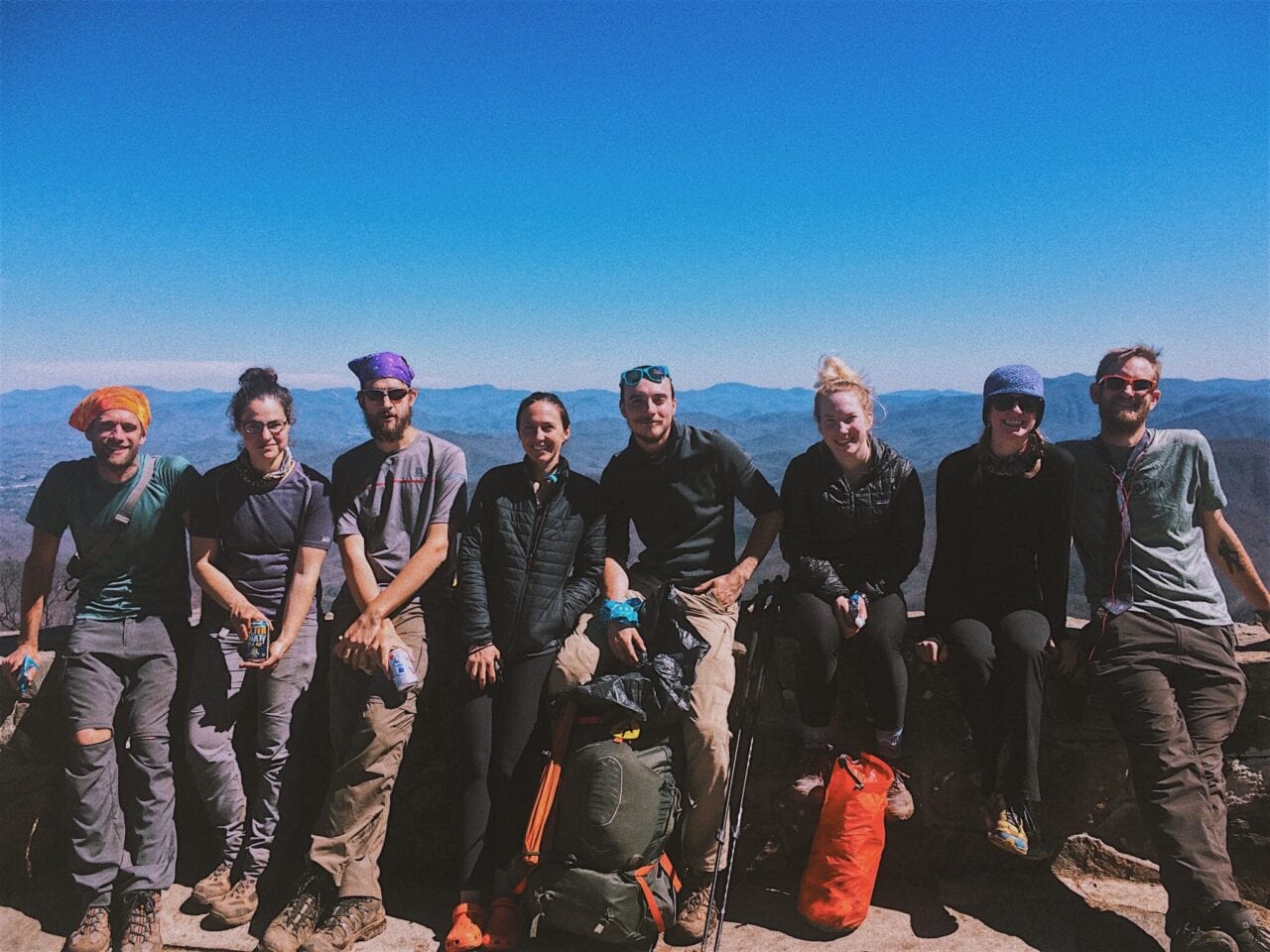
Photo by Amber Redfield
“If only I’d went to the hospital in Gatlinburg or at the next road walk… maybe I’d be on the trail…”
All of the “what ifs” began. I felt like a failure. I didn’t want to tell anyone I was home, off trail, due to a knee injury; it was a hard reality to swallow. My thru-hike attempt for 2017 had ended, and I could not come to terms with it.
I don’t think enough people shine a light on injuries, leaving the trail due to an injury, and the depression that follows it. It’s hard to adapt back to the non-thru-hiker life, and I don’t think many people truly do adapt back.
For anyone who ever experiences these events, know you are NOT alone. It happens to so many people, and you should find support within the community to help get through those tough times.

Photo by Amber Redfield
Photo by Amber Redfield
My advice for folks attempting these hikes:
- Don’t be stubborn.
- LISTEN to you body.
- Don’t let your pride get in the way of your health.
- If you get hurt or sick, seek help immediately.
- Rest. Rest, rest, rest. Don’t push yourself to the brink of a worse outcome.
- Make sure you are careful hiking. Accidents happen, but try to reduce that risk by being aware of your surroundings and weather forecasts.
- Listen to friends, family, and tramily. If they feel you’re in some sort of trouble with a sickness or injury, just get to the next town and go to an Urgent Clinic.
- It. Is. Not. Worth. Permanently. Damaging. Yourself. Due. To. Terminuses.
I am more than happy to discuss this further with folks who have questions about my experiences. I’m glad I’m able to hike again, but I could have prevented a lot of this headache and heartache if I’d just gone to the doctor right away.
That’s my trail story. It isn’t a “I made it to Katahdin!”, but more a “Lessons learned only from the trail.”
If you would like to follow my future hikes, check out my Trek account, Instagram, and Facebook.
Photo by Amber Redfield

Photo by Amber Redfield
Photo by Amber Redfield

Photo by Amber Redfield
Photo by Amber Redfield
Photo by Amber Redfield
Want to keep up with all that’s going on at Atlas Guides? Sign up for our newsletter!
Read more!
Check out some related blog posts!
Get our trail guide for this area!
Appalachian Trail
The Appalachian Trail is one of the oldest National Scenic Trails in the US. Its path takes you from Springer Mountain in Georgia to Mt. Katahdin in Maine.
2200 mi (3540 km) $59.99 full guide
Pennsylvania, Appalachian Trail
Photo by Zoë Symon
Pennsylvania, Appalachian Trail
Photo by Zoë Symon
Appalachian Trail
The Appalachian Trail is one of the oldest National Scenic Trails in the US. Its path takes you from Springer Mountain in Georgia to Mt. Katahdin in Maine.
2200 mi (3540 km)
$59.99 full guide
Get our trail guide for this area!
About the Author
Natalie McMillan
Natalie grew up hiking in Arizona where she fell in love with the outdoors. Her favorite hikes are to Havasu Falls in the Grand Canyon and Angel’s Landing in Zion National Park, UT. She loves taking pictures of people, places, and nature, which might explain why she has almost 47,000 photos currently residing on her phone. She takes care of all things related to social media and marketing and recently moved to Denver, CO from Flagstaff, AZ. You may find her frolicking around the trails and mountains of Colorado, or exploring the new city she gets to call home.
My Trail Story by Adam & Leigh
Planning an adventure? Check out our popular trail guides! 4.7 stars (14K+ ratings)
Photo by Justin Helmkamp
My Trail Story featuring Adam & Leigh
Adam and Leigh share their story of thru-hiking the Te Araroa and then deciding to thru-hike Pacific Crest Trail the following year.
Natalie McMillan My Trail Story 07/19/2019
Natalie McMillan
My Trail Story
07/19/2019
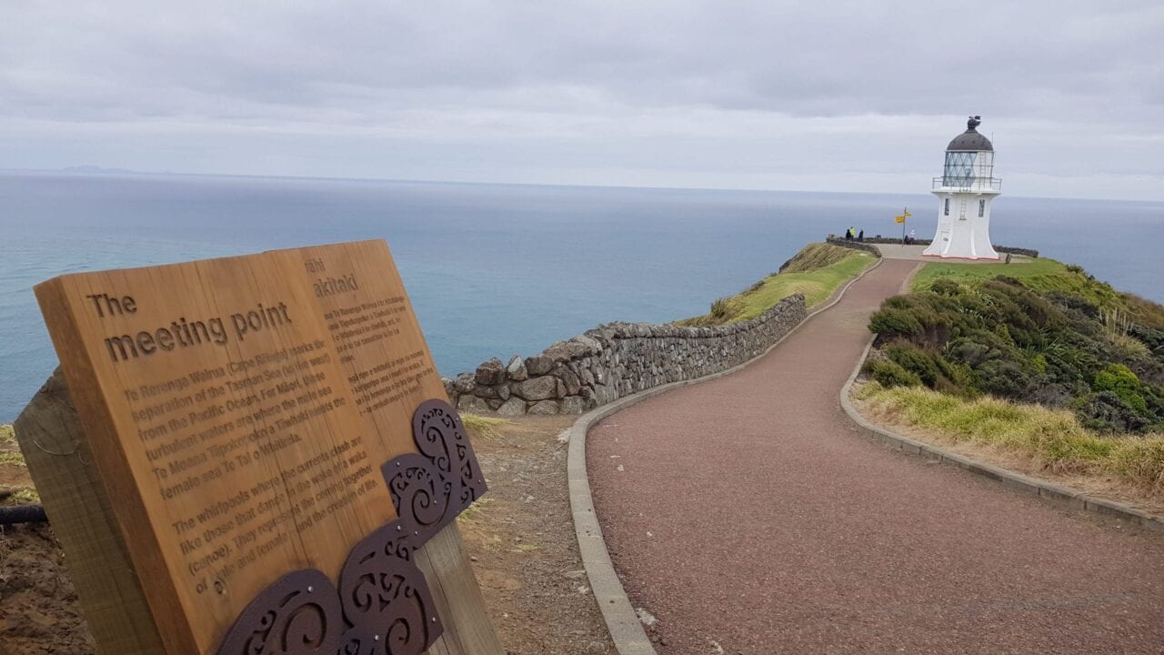
Photo provided by Adam Carter and Leigh Foster
Day 1
My anxious mind was going into overdrive. In less than 24 hours, my partner, Leigh, and I were due to begin our journey from Auckland to Cape Reinga to start the epic 3,000km Te Araroa trail, which runs from the top of New Zealand’s North Island all the way down to the bottom of the South Island.
In the chaos of packing up our lives, finishing jobs and organizing our hiking gear in the many weeks leading up to this day, I’d conveniently been able to quiet my mind, failing to come up with an answer to what was probably the biggest question of all… “How the hell was I going to walk 3,000km?” And by that I mean, is it even possible for someone who spends half their life sitting at a desk in front of a computer screen to do something like this?
After Leigh and I had committed a few months earlier to hiking the Te Araroa trail, it felt like there was a never-ending list of things fighting for our attention, which meant that I didn’t really give this question any serious thought prior to arriving in New Zealand… as strange as that may sound. Now that there was nothing left to do other than start walking though, the scale of what we were about to attempt seemed so unimaginably huge that I really began to seriously doubt whether I would be able to do this.
All those questions that I’d conveniently been able to push out of my mind came flooding back in… what if I get injured, what if I’ve packed the wrong gear, what if we haven’t done enough training and prep, what if doing the trail as a couple is too much and we end up not being able to stand each other, and what if we’ve been completely delusional and quickly discover once we get out there that we don’t enjoy trail life at all and need to quit, going home with our tails between our legs? Leigh and I had talked about doing a big adventure for a while now, but what if it just doesn’t work out?
So many unanswered questions, and no real way to answer any of them other than to just dive headfirst into this epic adventure and see what happens. So that’s what we did… and we definitely had challenges along the way, but ultimately we lived to tell the tale, despite my endless list of fears and concerns heading into it. Take that, internal doubts.
Photo provided by Adam Carter and Leigh Foster
Photo provided by Adam Carter and Leigh Foster
How did we end up on the TA?
Let’s take a step back though. How did we get to a point where we decided to walk 3,000km across New Zealand, you may ask? The short answer is a mixture of persistence, dumb luck, and compromise.
Leigh had first floated the idea of walking the PCT together about 5 years ago after reading an article in a magazine about long distance hiking. The adventure and challenge spoke to her straight away and was something that she was really keen to experience.
I, on the other hand, initially struggled to get my head around the idea of walking the length of the US. Mostly, I just didn’t really get what the point was. The whole thing seemed very arbitrary to me in walking from Point A to Point B just because someone had built a monument at those two places. Growing up around a lot of risk-averseness, also meant that stepping outside of the lane is not something that comes naturally to me, so it can take me awhile to make big decisions that go against these instincts.
While I wasn’t originally super motivated to attempt something on the scale of the PCT, I did still enjoy hiking and being outdoors so we decided to try something much shorter, but still longer than our previous experiences which were limited almost exclusively to overnight hikes.
In July 2015, Leigh and I spent about 2.5 weeks on Australia’s iconic 223km Larapinta Trail through the Northern Territory. It was a beautiful walk through some of the most amazing mountain ranges and desert terrain in central Australia, and our first taste of life on the trail.
As much as I am able to look back on the Larapinta experience fondly now, it was definitely Type 2 fun for me in the moment. I’m generally pretty calm and collected in normal day-to-day life, but the Larapinta Trail brought out a part of my personality that I didn’t really know existed beforehand. The combination of carrying a heavier than necessary pack, the uneasiness of having very little control over my day-to-day existence and dealing with constant pain in my feet and achilles (probably due to having the wrong shoes) had me in an agitated state for most of the hike and really prevented me from getting as much as possible out of the experience. Looking back, it definitely got the better of me. I was overly worried about things not being perfect and not going to plan – all things which came up for me again on the TA (but luckily the length of TA meant that I had more time to actually be able to work through them). I actually remember making a list before we started the Larapinta Trail of everything that could possibly go wrong, just so I could come up with a high level plan to be able to deal with any possible scenario that we might face. It sounds ridiculous but I’d thought of just about everything, including “what do we do if a dingo steals our hiking boots from outside the tent while we are sleeping”. It was out of control.
Photo provided by Adam Carter and Leigh Foster
Photo provided by Adam Carter and Leigh Foster
Fast forward to August 2017, when Leigh had organized a short trip to New Zealand to try and get me out of a funk, after going through a particularly grueling patch at work. We spent a couple of nights on the absolutely stunning Coromandel Peninsula, in this amazing wilderness cabin. We couldn’t help but notice a book laid out on the coffee table, A Walking Guide to New Zealand’s Long Trail: Te Araroa, written by Geoff Chapple.
The picture on the cover immediately piqued my interest. This was the first time I had even realised that there was a long distance hiking trail right on our doorstep in New Zealand. The New Zealand hiking season also ran from October to March, which would fit in better with my current work commitments. New Zealand had been on both of our travel bucket lists for awhile, but most of our annual leave up to that point had been spent travelling through warmer climates and pursuing scuba diving adventures, so we had not yet gotten around to spending any time in New Zealand.
Despite my earlier struggles on the Larapinta Trail, the idea of attempting a long distance hike in New Zealand did have an immediate appeal, as it seemed to be a low-risk high-reward decision. I was dealing with workplace burnout at that point in time and really felt like an extended break out of the office would be good for me. I hoped that some time away would allow me to find a better headspace, and what better way to do that than by taking on such an absurdly huge adventure which would put me way, way, way outside of my comfort zone! Even if we ended up finding that trail life wasn’t for us, we could always just jump on a plane and we’d be home within a day or so and we wouldn’t have to sell a kidney to pay for the flights. We decided to put the PCT on hold in favour of the Te Araroa trail to see if we would like this long distance hiking thing…
As we did more research on the TA and long distance hiking in general, the pieces started to fall into place. Not only was a long distance hike an incredibly cheap way to see a country, the timing worked out where we could do it after I had reached my ten year work anniversary, when I would have some additional leave to take. It wasn’t only the logistical aspects that started making sense though. The fact that New Zealand had no dangerous animals to worry about was also a big tick in my books – one less thing my risk-averse brain would have to worry about.
It became pretty apparent through all of our TA research that long distance hiking wasn’t about just starting at random Point A and finishing at random Point B, as I had originally thought when Leigh first pitched the idea of the PCT to me all those years ago. It was about everything that happens in between. It was about doing something that would almost certainly be a rollercoaster of ups and downs (and often many times within the same day). It was about giving up comfort in favour of experiences, challenges, and personal growth. It is stepping into the unknown that is the true appeal for many long distance hikers… having no idea what the next hour or day will bring, but knowing that whatever is thrown at you, you have what it takes to get through it and come out the other side a stronger person. It’s about stripping back everything from your life and doing something that truly makes you feel alive.
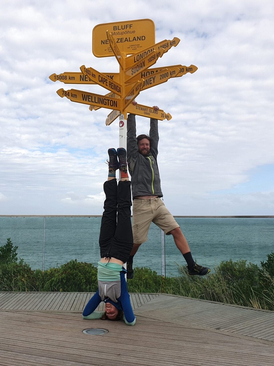
Photo provided by Adam Carter and Leigh Foster
Our TA Journey
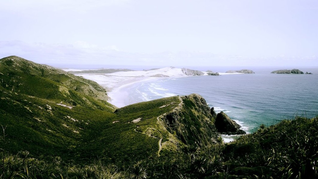
We left Auckland headed for Cape Reinga on 16 October 2018 and arrived at the official start of the Te Araroa trail around lunchtime on 17 October 2018, after getting four separate hitches from the town of Kaitaia over the course of two days (there’s no official transport to get you to the start of the trail, so you pretty much have to hitchhike). It was the first time hitchhiking for both of us, but getting us out of our comfort zones so early in the trip, upon reflection, was the best way to kick off this amazing adventure.
On 13 March 2019, 148 days later, we got handsy with the monument at Bluff, pinching ourselves at how we had both managed to make it all the way to the end of the trail. We certainly weren’t the fastest, or the most lightweight, and we didn’t force ourselves to walk on highway sections pretending to be part of the trail if we didn’t feel like it, but we made it our own way. We couldn’t have been prouder of what we had achieved and what we learned about ourselves and working together as a team. There were a lot of ups and downs along the way but we loved every minute of it and feel very lucky to have been able to experience New Zealand the way were we able to.
For everything that came between our first and last day on the trail, feel free to check out our Te Araroa blog, where we have posted daily blogs and will eventually be posting some final thoughts about our overall TA experience – adamleighandthetrees.com/what-is-the-te-araroa/blog-posts/
Anyone familiar with the TA will no doubt already have a good idea of the many highlights and (not so many) lowlights of the trail. While I could regale you with one or two of our favourite stories, it really is too difficult to choose only one or two stories to highlight in this post… so I’m not going to do that. Instead, what I want to do is to highlight a handful of the biggest lessons we learned during our time on the trail.
Photo provided by Adam Carter and Leigh Foster
So, in no particular order, here we go:
1. The hardest part is starting (just take one step at a time)
It is easy to get overwhelmed before you start a journey that is going to take you 4-6 months to complete. It’s such a big undertaking and there are so many unknowns before you actually start that it’s hard to get your head around the enormity of it.
Despite my pre-hike mini internal freakout where I doubted whether I had it in me to walk 3,000km, once we actually started walking, I have to say that I never really experienced the same feelings again for the duration of our time on trail. If you take the big goal of walking 3,000km and break it down into 30x 5-7 day adventures of 100km each (which you can do on the TA for the most part as most towns are about this far apart on the trail), you would be amazed at how quickly the kms fly by. Once we got past Auckland (about 500km in) and got into a groove with our daily hiking routine, everything seemed to go by in the blink of an eye.
Photo provided by Adam Carter and Leigh Foster
Photo provided by Adam Carter and Leigh Foster
2. Growth comes from getting out of your comfort zone
There were a couple of quotes that kept coming up for me in our research before starting the TA, “the only thing that is stopping you from getting where you are to where you want to go is your comfort zone”, and “if it doesn’t challenge you, it won’t change you”. Having now had the experience of hiking the TA, and being challenged in more ways than I could have possibly imagined, both physically and mentally, I couldn’t agree more.
Being put in uncomfortable situations while on the trail, gives you the opportunity to hold a mirror up and see how you respond in the many different situations that the trail can throw at you. Whether it be weather-related, gear-related, injury-related, insect-related or people-related, you’re going to have to work through some stuff at some point between the start and the end of your hike. One of the major learnings for me was that instead of pretending that I wasn’t struggling with certain things, I really tried to lean into it as much as possible, and dig around for a better understanding as to why I was responding in a particular way so that I could try to address issues as they came up for me.
3. All bad times come to an end if you wait long enough
Even during the heaviest rain or the worst weather, the sun will come out again… eventually. I lost count of the number of times we found ourselves in objectively shitty situations only to have something happen to us that completely changed our day, whether it was the unexpected hospitality of strangers, the sheer beauty of the trail, or finding ourselves in a spot where we could have a hot shower and a roof over our head at the end of a hard day. It was pretty much impossible to have a completely horrible day on the trail from start to end without having something really amazing happen that would completely change your whole perspective and mood.
Once I learned this lesson, this knowledge really helped me when I was struggling with different things at different times, as I knew that it was only a matter of time before something amazing would happen.
Photos provided by Adam Carter and Leigh Foster
4. Enjoy the moment and don’t stress about what you can’t control
This was a big one for me. The TA is a bit different than other long distance hiking trails in the world, in that, the trail on the North Island, at least, passes through a lot of towns and you can’t exactly pitch your tent in the local park (for the most part). To begin with, I was constantly stressing about whether we were going to make it to the next accommodation option each night and whether it would be full when we got there. I worried about crossing rivers and tidal streams and getting caught out in bad weather.
I’m a slow learner sometimes, so it took me almost 3.5 months to learn this lesson, but it eventually hit me that all this worry I was carrying around with me about what might happen in the future wasn’t productive in any way and just left me feeling mentally exhausted. There’s no such thing as the “perfect” hike. You’ve just got to roll with the punches – try to make the best of every moment and accept that your experience is going to be different from every other person’s experience out there, which is ultimately what makes it truly special.
My mindset was preventing me from enjoying the moment because I was too focused on reaching these never-ending daily goals that I was setting in my head. We met people along the way that had probably put less than 10% of the time that we had into planning and researching and they all managed just fine on the trail. So for my own mental state I had to decide to let go of the things that I couldn’t control and just accept that we would be okay and be able to deal with any situation that we found ourselves in.
5. Don’t rush it
“What date did you start?”, “where did you stay last night?”, “where are you going tonight?” – all common forms of typical hiking small talk, but we found that these sorts of questions can also mask a level of competitiveness that can creep into the experience for some people. For a variety of reasons, whether it be ego, budget, or visa time limits, a significant portion of people aim to finish the trail as quickly as they possibly can.
Fortunately, we were not in this position, but I know how powerful the pull can be, as I initially had a real problem with admitting that I couldn’t hike as fast as many others on the trail. Before I was able to let go of this baggage and accept things for what they were, I would often intentionally pick up my pace whenever I saw someone catching up to us on the trail to try and stay ahead of them for as long as possible. Stupid, I know. It was as if I needed to consistently prove to myself that I was good enough to be out there doing the hike and calling myself a TA hiker.
It’s a cliche, but you really just need to hike your own hike. If, as an example, you want to hike a certain distance each day to stay with your trail family, that’s fine, but you shouldn’t be forcing yourself to do this at the expense of your overall experience and enjoyment of your time on the trail. If you are making yourself suffer every day in the name of big miles, you probably need to ask yourself whether this is the experience that you want for yourself.
The reality is that it’s not every day that you get to step out of your life for 6 months to do something like this, so my perspective on this is that you want to take your time and enjoy it as much as possible, instead of rushing to finish it as quickly as possible. No one is going to care whether it takes you 100 days, 120 days, 150 days or 180 days to finish the trail. Don’t get caught up in defining yourself based on comparisons to other people.That is always going to be a losing battle.
Photo provided by Adam Carter and Leigh Foster
Photo provided by Adam Carter and Leigh Foster
6. Walking as a couple can be hard, but so is walking solo
It seemed to us that the vast majority of people on the TA were solo hikers. We had read beforehand that one of the major challenges for solo hikers is just maintaining your motivation levels for the duration of the hike. Apparently, solo hikers are more likely to quit the trail as they don’t always have the support network they need on trail to get them through the tough times.
Having said that, walking as a couple or in a group, is not necessarily a walk in the park either. While you are certainly able to support each other and keep each other company, it is inevitable that given the amount of time you are going to spend together (say, 24/7 for 4-6 months, for example), stuff is going to come up. Unless you both have the temperament of a monk, you are almost certainly going to grate on each other’s nerves at some point and probably in ways that you never could have anticipated (just ask Leigh about my habit of twirling the end of my trail mustache with my fingers).
We had our fair share of challenges as a couple, but all things considered, I do think that it was easier hiking as a couple than it would be hiking solo. You need to be willing to make small compromises every day when hiking as a couple, but I still feel like in the scheme of things this is a small sacrifice to make in order to be able to share the experience with someone that is an important part of your life. As they say, ”Happiness is only real when shared”. If you remember to be kind, respectful, and honest with your hiking partner (or partners) even when you are in a stinker of a mood, you’ll be alright.
7. The trail is for everyone
Before hiking the TA, I had assumed that long distance hiking was a young person’s game… I could not have been more wrong. We met people on the trail from the age of six all the way up to about 75, all of whom were hiking the entire 3,000km length of the Te Araroa trail.
Obviously, the experience you get from the trail will depend on what stage of your life you are at, but the main thing I learned from meeting so many different people on the trail is that there really is no such thing as being “too young” or “too old” to do something like this. If you want the experience bad enough you will find a way to give it a go. Besides, what have you got to lose?
Photo provided by Adam Carter and Leigh Foster
Photo provided by Adam Carter and Leigh Foster
What’s next for us?
As we got closer to the end of the TA, Leigh and I started giving some serious thought to whether the PCT was something that we would ever want to do post-TA.
After hearing so many positive comments about the PCT from other hikers on the TA, both of us were keen to attempt it, but the TA had taken a higher toll on my body than I would have liked. After losing around 12kgs over the course of five months on trail, I was already lighter than I’d ever been as an adult and didn’t want to walk the PCT back to back with the TA unless I felt like I would be physically up to finishing it. We contemplated whether we could wait another year or two but the idea of tackling it while our fitness was already up and our lives had already been turned upside down seemed like the best option.
To give myself the best possible chance of reaching the Canadian border, I decided that I would go back to work in Sydney for two months to fatten up and top up the bank account for this next adventure. Leigh, on the other hand, was ready and raring to go and after spending less than a month back in Australia post-TA. She took her first steps toward living her dream of walking the PCT from all those years ago, leaving from Campo on 29 April 2019. I will be joining her at the Sierras later in June 2019 and we will walk the rest of the way together to the Canadian border.
We hope you have enjoyed reading this blog. It was a real honour to be asked to contribute and we hope that all of you who are currently considering a first time thru-hike know that you can do it and you should do it! Happy trails everyone!
If you are interested in following our PCT journey, you can check us out at Adam, Leigh and the Trees on Instagram or Wordpress.
For those of you contemplating hiking the TA in the future, please feel free to reach out to us directly on either platform if you want to pick our brains. We’re more than happy to share our experiences, thoughts and advice with you!
Photos provided by Adam Carter and Leigh Foster
Want to keep up with all that’s going on at Atlas Guides? Sign up for our newsletter!
Read more!
Check out some related blog posts!
Get our trail guide for this area!
Te Araroa
Te Araroa is a long distance hiking trail in New Zealand, stretching 3000 km across the country’s two main islands. The trail travels from Cape Reinga to Bluff.
3000 km (1860 mi) $39.99 full guide
Cape Reinga, North Island, New Zealand, Te Araroa
Photo by T L
Cape Reinga, North Island, New Zealand, Te Araroa
Photo by T L
Te Araroa
Te Araroa is a long distance hiking trail in New Zealand, stretching 3000 km across the country’s two main islands. The trail travels from Cape Reinga to Bluff.
3000 km (1860 mi)
$39.99 full guide
Get our trail guide for this area!
About the Author
Natalie McMillan
Natalie grew up hiking in Arizona where she fell in love with the outdoors. Her favorite hikes are to Havasu Falls in the Grand Canyon and Angel’s Landing in Zion National Park, UT. She loves taking pictures of people, places, and nature, which might explain why she has almost 47,000 photos currently residing on her phone. She takes care of all things related to social media and marketing and recently moved to Denver, CO from Flagstaff, AZ. You may find her frolicking around the trails and mountains of Colorado, or exploring the new city she gets to call home.
My Trail Story by Starburst
Planning an adventure? Check out our popular trail guides! 4.8 stars (17K+ ratings)
Photo by Jennifer Mabus
My Trail Story featuring Starburst
Jennifer Mabus, a.k.a. Starburst, shares why she decided to thru-hike the Pacific Crest Trail and how it changed her life.
Natalie McMillan My Trail Story 07/11/2019
Natalie McMillan
My Trail Story
07/11/2019
My trail name is Starburst and I hiked the Pacific Crest Trail in 2018. I hiked when I was 28 years old and am currently 29.
One of the most common questions I got asked while preparing for my PCT thru-hike is “Why?” Why did I take 6 months off of work to go hiking alone in the woods? Why did I become “homeless” and sell many of my possessions just to live in dirt and sweat soaked clothes for months? Why would I leave my comfortable life just to make myself so extremely uncomfortable? Why am I giving up Seattle summers with friends and lakes and road trips and constant happy hour? Why wasn’t I more scared? Rarely was I asked about the logistics of my hike, or greeted with excitement about my upcoming adventure. Most of the questions were rooted with confusion. People just couldn’t wrap their minds around what I planned on doing. And to be honest, I caught myself at times being confused of my decision as well.
Photo by Jennifer Mabus
See, I almost felt like a poser in a way. I loved the outdoors and I hiked and backpacked often, but it wasn’t what I chose to do every weekend. I was an ambassador for a hiking group and met some incredible friends who enjoyed the outdoors like I did, but I also loved to stay indoors and be lazy while watching movies or reading. I didn’t know a ton about gear or how to expertly help an injured hiker or anything like that. So me choosing to walk from Mexico to Canada wasn’t really because I loved the outdoors so much (which I did and still do, just to be clear), but it was more of the achievement of completing this entire continuous footpath. The outdoors has always provided emotional healing for me as it does to most people I imagine, and I loved feeling strong and accomplished whenever I made it to the top of a mountain, but I also loved how extreme this decision was.
Photo by Jennifer Mabus
Photo by Jennifer Mabus
I recognize that this isn’t necessarily a prized quality to possess at times, but I am an intense human being and love to be metaphorically hot or cold (but not literally as I realized hiking in the Mojave Desert and then getting hit by a snow storm in Northern Washington). I’m either in or out! And something like a 2,650 mile hiking path like the Pacific Crest Trail made my mind go wild. But was I being TOO overboard? I asked myself this a lot, if I was in too deep. So it was safe to say that, especially as the time drew near for me to set foot on the PCT, I was confused with my decision if this truly was the right thing for me to be doing.
And guess what? It so incredibly and overwhelmingly was.
Photo by Jennifer Mabus
The thing is, is that I turn 30 years old this year and life seems to be moving more quickly the older I get. But feeling proud of myself hasn’t happened as often as it used to growing up. And as I continue to reflect on my journey from Mexico to Canada, I think about it more and more and how I really wanted to make myself proud in a way I haven’t felt in years. Thru-hiking was one of the hardest things I have ever done. No kidding, folks. It was down right miserable at times. But what made it hard was that it didn’t really matter to the universe if I quit or not. I was literally only doing this for myself which made the temptation to quit that much easier.
Photo by Jennifer Mabus
Photo by Jennifer Mabus
Why was I making myself uncomfortable and exposed to so much pain when I could be at home in a warm, dry bed with a movie playing in the background? I was absolutely terrified at times!! Like about to pee my pants terrified, particularly when I had a mountain lion making nightly visits to my tent in the Desolation Wilderness. I missed my friends in Seattle and wondered what lake they were swimming in or what cool happy hour they were attending. I felt like I really wasn’t cut out for being “hiker trash” when I saw how experienced others were and how knowledgeable they were with gear. But then I kept thinking that the best reason to do anything is for yourself! That the reason should mean more than any other reason that could possibly exist on this earth.
I couldn’t quit or give up just because in the big scheme of things no one really cared about my hike. It didn’t matter. I wasn’t saving lives. But I was saving mine. Many people thought I was running away from life, from something. Pain? Regret, maybe? But they were wrong. I was running TOWARD life. I was scared but ready to face the exhilaration and pride I have been missing for years. I got to fall in love again. Twice to be exact. Once with the trail and all over again with myself.
Photo by Jennifer Mabus
Thru-hiking may not be your forte, but the principal of it can be. It all sounds cheesy at times, but thru-hikers know what I mean. This experience changes you, whether you were expecting it or not. It exposes ugly parts of yourself and hidden hurt you didn’t know that was still holed up in your heart. It forces you to face those insecurities. But it also gives back to you in abundance. Beautiful emotions that you may have not felt for a while, pride and security with yourself that you may so desperately need, and a respect for this planet, others, and your life in a way that can honestly change the course of your life. The point is to find YOUR thru-hike. What makes you feel alive? And what makes you want to change for the better? It’s going to be hard and it’s going to be intimidating, but it’s going to be worth it.
With love and happy trails,
Jennifer “Starbust” Mabus
Photo by Jennifer Mabus
Want to keep up with all that’s going on at Atlas Guides? Sign up for our newsletter!
Read more!
Check out some related blog posts!
Get our trail guide for this area!
Pacific Crest Trail
The Pacific Crest Trail is an epic journey of three states and over 2600 miles. Its path travels from the US border with Mexico to the northern border with Canada.
2650 mi (4260 km) $29.99 full guide
Washington, Pacific Crest Trail
Photo by Justin Helmkamp
Washington, Pacific Crest Trail
Photo by Justin Helmkamp
Pacific Crest Trail
The Pacific Crest Trail is an epic journey of three states and over 2600 miles. Its path travels from the US border with Mexico to the northern border with Canada.
2650 mi (4260 km)
$29.99 full guide
Get our trail guide for this area!
About the Author
Natalie McMillan
Natalie grew up hiking in Arizona where she fell in love with the outdoors. Her favorite hikes are to Havasu Falls in the Grand Canyon and Angel’s Landing in Zion National Park, UT. She loves taking pictures of people, places, and nature, which might explain why she has almost 47,000 photos currently residing on her phone. She takes care of all things related to social media and marketing and recently moved to Denver, CO from Flagstaff, AZ. You may find her frolicking around the trails and mountains of Colorado, or exploring the new city she gets to call home.

Thru-Hiking Lingo 101
Planning an adventure? Check out our popular trail guides! 4.8 stars (17K+ ratings)
Photo by Holly Mandarich
Thru-Hiking Lingo 101
New to the hiking world? Don't worry! Check out these terms to learn the "thru-hiking lingo" and you'll be a part of the hiker trash family in no time.
Natalie McMillan Inside Atlas Guides 07/01/2019
Natalie McMillan
Inside Atlas Guides
07/01/2019
AYCE: All You Can Eat at the glorious buffets in town
Bear Bagging: a method to hang your food away from bears
Blow-down: a tree that has fallen across the trail
Blue-blazer: a hiker who substitutes alternate routes for the official trail
Bounce box: a resupply box that has sometimes-used necessities and can be repeatedly mailed ahead of you on the trail
Bushwhack: to hike where there is no trail or where the trail is overgrown
Cache: a supply of food, water, or other supplies hidden for later retrieval
Cairn: an obviously person-made marker, such as a pile of stacked rocks used to mark the trail
Camel Up (Tank Up): to drink a lot of water at a water source before continuing to hike
Cat Hole: a small hole dug in the ground for human waste
Cowboy Camping: sleeping under the stars without a tent
FKT: Fastest Known Time – the fastest “official” time that anyone has completed a trail
Flip-flop: walking the trail in a non-continuous line, usually with the intention of completing the entire trail
FSO: From Skin Out – usually in reference to weight of total gear
Gear Head: a hiker whose main focus is on backpacking gear
GORP: “good ole raisins & peanuts” – but can be any type of trail mix
Gray Water: usually dirty dishwater or water from washing clothes
Ground Control: a person who handles the “real world” concerns for the hiker on the trail
Hiker Box: a cabinet or box at hostels or places of business where hikers donate unwanted food and gear for other hikers to use
Hiker Hunger: a continuous, deep hunger that allows you to eat amazing amounts of food in town
Hiker Trash: This is a nuanced term. But once you become hiker trash you will know it and you will be proud.
Iceberg: a large rock in the middle of the campsite that discourages camping in the area
LNT: Leave No Trace is a set of outdoor ethics promoting conservation in the outdoors (https://lnt.org/)
Mail Drop: a resupply package
Mountain Money: toilet paper
Nero: hiking almost zero miles in a day, often associated with staying one night in town
Nobo: Northbound – hiking the trail from south to north
Posthole: to sink deep into snow, usually up to your knees or even your waist
Power Hiker: a hiker who habitually makes big mile days
Privy: a trailside outhouse
PUDS: Pointless Ups And Downs
Purist: a hiker who wants to hike the official route of the trail at all times
Register: a log book found along the trail that hikers sign into, and can be used for communication with other hikers
Resupply: refilling food supply once you have run out of food on the trail; can be done from a grocery store, convenience store, or a package mailed to you
Ridge Runner: a person paid by the government or trail club that educates hikers along the trail
Section Hiker: a person who hikes a portion or section of a long trail
Sobo: Southbound – hiking from north to south
Switchback: a sharp turn in the trail, found when ascending or descending a steep portion of the trail
Thru-Hike: hiking an entire long trail in one season (See our other blog post, What is thru-hiking?)
Trail Angel: a person who treats hikers nicely and offers food, drinks, or other helpful resources to them while they hike
Trail family: the people that you meet on the trail and hike with
Trail Magic: unexpected food or help on the trail from someone
Triple Crowner: a hiker who has completed the Appalachian Trail, Continental Divide Trail, and Pacific Crest Trail
Vitamin I: Ibuprofen
Waterbar: a rock barrier or log that diverts water off the trail to reduce erosion during rains
White blaze: white marks on the trees along the Appalachian Trail
Yellow Blazer: someone who gets a car ride and skips a section of the trail
Yogi-ing: when a hiker attempts to get free food, drinks or assistance from a stranger without asking directly
Zero: hiking zero miles in a day, usually when you go into town and stay 2 nights
Want to keep up with all that’s going on at Atlas Guides? Sign up for our newsletter!
Photo by Ian Liberry
Read more!
Check out some related blog posts!
Download our popular hiking and biking guides!
Trail guides that get you to places you’ve dreamed of.
As the makers of Guthook Guides, Bikepacking Guides, and Cyclewayz, we help you navigate the most popular trails around the world on your smartphone. Our hiking guides and biking guides work completely offline. Let Guthook guide your next adventure!
Showers Lake Vista, Tahoe Rim Trail
Photo courtesy of the Tahoe Rim Trail Association
Showers Lake Vista, Tahoe Rim Trail
Photo courtesy of the Tahoe Rim Trail Association
Trail guides that get you to places you’ve dreamed of.
As the makers of Guthook Guides, Bikepacking Guides, and Cyclewayz, we help you navigate the most popular trails around the world on your smartphone. Our hiking guides and biking guides work completely offline. Let Guthook guide your next adventure!
Download our popular hiking and biking guides!
About the Author
Natalie McMillan
Natalie grew up hiking in Arizona where she fell in love with the outdoors. Her favorite hikes are to Havasu Falls in the Grand Canyon and Angel’s Landing in Zion National Park, UT. She loves taking pictures of people, places, and nature, which might explain why she has almost 47,000 photos currently residing on her phone. She takes care of all things related to social media and marketing and recently moved to Denver, CO from Flagstaff, AZ. You may find her frolicking around the trails and mountains of Colorado, or exploring the new city she gets to call home.
My Trail Story by Tiny Slice
Planning an adventure? Check out our popular trail guides! 4.8 stars (17K+ ratings)
Photo by Justin Kernes
My Trail Story featuring Tiny Slice
Justin Kernes, a.k.a. Tiny Slice, shares about his Pacific Crest Trail thru-hiking experience from before he started his hike to where he is now.
Natalie McMillan My Trail Story 06/26/2019
Natalie McMillan
My Trail Story
06/26/2019
Before, Then, Now
Hey there, the name’s “Tiny Slice” and I NoBo thru-hiked the Pacific Crest Trail in 2018 with my brother “Shocks.” Aside from various three-day weekend trips and very rare two-week-long Boy Scout backpacking trips, this was my first long-distance hike. On trail, at Goat Rocks no less, I celebrated my 30th birthday and camped out on Old Snowy (mile 2,277).
Photo by Justin Kernes
It’s hard to provide a story which, I feel, speaks to my entire experience. Perhaps the goal isn’t to wrap everything up in a succinct little essay, to condense 130 days of boundless freedom into black and white Times New Roman. But sharing just one snippet or lesson seems like describing only one color in a painting. To call the trail a life-changing experience seems cliché but to call it anything less seems callously insincere.
For those lucky enough to have any thru-hiking experience, any story I share will, inevitably, bring up memories of your own from a different time with different people, but in a similar location. Like that one time everyone somehow crammed into that hotel room. Or that insane trail magic in the middle of the Mojave desert you swore was a mirage, complete with beer and soda and sandwiches. The sublimity of the High Sierra and being above 10,000 feet, dancing around tree line. You will replace my words with your own memories. You’ve discovered the Room of Requirement, you will want to return; the pull of trail life is powerful.
And for those who haven’t, any story will just be an odd melange of city names and trail names, slang and lingo, and quotes of “pushing for another 10” and “I’ll take your extra bars.” Knowledge and wisdom don’t come with completion or days hiked in a row in solitude, but with time spent hiking, miles covered, and people talked to.
If any part of you connects while reading this, resoundingly, do it. Go hike. Get out there. The time is Now.
I “bought the ticket and took the ride.” Here are a few glimpses at how it changed me—before, then, and now.
Photo by Justin Kernes
December, 2017
I’m an outside cat kinda person — living in the great outdoors always has genuinely appealed to me. As an adolescent I was heavily involved in Boy Scouts, reaching the rank of Eagle, and participated in a slew of overnight backpacking trips during my tenure. It taught me to love the outdoors in an unconditional, freeing way, so much so that I just finished my eighth summer season at Philmont Scout Ranch, a high adventure backpacking youth camp. After living in log cabins for three-month summers, I have been pushed to look for alternative lifestyles. Surely there must be other people like me? I’m so tired of waking up in the pitch black for work.
Over the years I have watched friends set off on the PCT and AT and post their progress online. I’m ashamed to admit jealousy courses through me. I want that. I’m missing out. How do they do it? Where do you start?
A few months ago, Adam told me his intentions to hike the trail. There isn’t anyway in hell I am going to allow myself to be jealous of my brother. I don’t want to find a way to be proud of him from home like a mature adult. It’s time to realize my dormant dream and take the leap as well.
He welcomed me in, I owe him everything.
During my summer employment (with free room and board), I hiked a lot more instead of spending time at the St. James (local bar). This winter, I worked many six-day weeks for overtime pay. I went out even less than I normally do. I made and brought my lunch. I shared an apartment with Adam, cooking and splitting as many cheap meals as possible. With each passing day I have grown more familiar with frugality.
All I need is a permit, some gear, a little money saved, and a way to get to the terminus.
May is almost here.

Photo by Justin Kernes
August, 2018
My tent glows pink with pre-dawn light—is sleep over already? I hear a hiker roll over near me, their crinkling Therm-A-Rest filling the still air. Even though I’m on a quarter-inch of foam, every muscle from my butt north feels refreshed from a solid, uninterrupted night of sleep. Hip, quads, knees, calves, and toes are all sore after an initial wiggling, but I’m sure they’ll warm up and loosen in the first few miles just like they have the past few weeks.
Judging by the stains on my shirt and pants it has been nearly a month since I’ve washed anything by machine. Oh well. I whip off my quilt and pull them on anyways. I unwrap a cherry Pop-Tart from my half-full food sack which is at my feet. There are a few tablespoons of butter leftover from resupply, and I lather my pastry profusely, taking care not to spill on my quilt. It’s time to pack up.
On the to-do list: get to Canada. There’s still more than a thousand miles, but I think if everyone in my trail family, myself included, got our hydration and calories correct, with good pace, we can make it by tonight. That joke hasn’t gotten old. My favorite is responding to bewildered townsfolk who ask, “How long have you been hiking?” by telling them that our group of scummy hiker trash started in Mexico more than three months ago.
I throw everything into my backpack, each item finding its respectful home with casual ease. My tent comes down just as quick as it went up. Shoes are laced tight, pack is clipped and cinched down, sunglasses are donned. When I was in Scouts, this would have taken an hour. Now, I’m a pro—thirteen minutes.
As I roll up my ground tarp, “Trashbath” lifts his leg high into the air, letting out a massive, undulating fart. A large, breathless smile overtakes his face. Everyone laughs. It’s not even 6 A.M.
“See ya at the river,” he says, then bolts. “Combo” leaves not long after.
Today’s goal is to push for 30 miles. It seems like only yesterday that I was breaking down days by the mile and half-mile. Now it’s games like 10 before 10 A.M., three segments of eight, or “just another five”. “Shocks” (never thought I’d call my brother by two names) told me we’ve averaged over 90 miles in the last three days. I was stunned. My arches think it’s more.
Miles tick off like a daily calendar from a montage scene in a romantic comedy. Soon, it’s lunch time. The gang stopped under a particularly nice patch of pines by a nearby stream. Shoes were off, snacks were out, feet were being taped. I could take lunch forever, sleepily basking in the infinite sun and calm propped against my half-full pack under the shade of an ancient oak.
But at some point, probably, I’d run out of food and get restless.
There was only one major hill climb in the afternoon and honestly, it wasn’t as bad as it looked on the map. Six miles came and went while I binged-listened the newest episode of Joe Rogan which I had been saving for several towns.
I arrived at camp and found the gang in the midst of setup. It was still light out, plus there’s no fire ban, so we sat and ate dinner around a rare campfire. I inhaled a divine tuna taco with more Flamin Hot Cheetos than usual. Felt frisky and made a desert taco with peanut butter, nutella, bacon bits, and banana chips.
After shimmying into sleep clothes and saying my requisite good-nights, I peed one last time and hopped into my tent, instantly warm and sleepy beneath a few inches of down. Hopefully sleep feels longer tonight.
Photo by Justin Kernes
January, 2019
Most people aren’t even familiar with the name, “PCT”. They’ll act polite, nod their head, noting it was probably something they overheard on Dr. Phil. “Oh, nice. Cool”, they’ll say, pulling out their phone and checking the lock screen for any shiny new notification. Few will venture on to ask what it is, usually, they’re the inquisitive sort who are genuinely nice people worth talking with. An even rarer subset seem to know it’s a hike and will ask how long it took or what I did for food. Still, it feels like I’m describing a Sunday morning dream I had when I was seven to my family circled around the kitchen table, all quietly nodding while I tried to recount what being a talking dolphin felt like.
“More than four months—130 days”, I’ll say to widened eyes and furrowed brows.
And as I stand there, answering the usual questions—“no gun, sir”—I drift away to vividly hot memories: gorging myself at Harrah’s buffet on endless plates of meat, veggies, and fine cheeses; eight of us hitching from Sonora Pass at dusk in a Sprinter van which purposely u-turned to learn more and help out; standing in an inch of sewage, watching YouTube videos on how to snake our trail angel’s toilet.
“Buy food in towns…four or five days…20 miles a day…zeros are days you don’t hike”, I’ll say, feeling my eyes glaze over.
Everyone seems to be broken into two categories: those who have hiked and those who haven’t. I’ve gotten better at recognizing people who care and people who don’t.
Today’s high was 12 degrees, the sun broke through the clouds for only four minutes. My coworker was hungover and let me do most of the shoveling. Fortunately I got to skip the morning meeting where, for the twelfth week in a row, undoubtedly they told us to “watch every chair.” I sure watched a fair bit more than Ryan did today.
I made my two connecting buses and came home to find my roommates, one completely passed out, on the couch with COPS blaring on the television. After removing a few layers of winter clothes and kicking off wet boots, I stumbled to the kitchen and opened the fridge with the same look of disgust I’ve had for the past week. Nothing looks good.
I settle for an IPA and sequester myself in my room. I fire up YouTube and click through my recommendations. My phone beeps and lights up. Apparently my credit bill is ready for payment. I close all the windows on my desktop and open up my photos folder—the one with all the PCT photos. Scrolling through I relive each pixelated memory hoping that somehow, just maybe, I’ll wake up and be back on trail, in my tent, with a breeze rustling through the rainfly, waiting to be greeted by sunrise.
~ ~ ~
Whatever it is you want to do, now will never be a better time. If you even remotely think something like the PCT might be for you, it is. You are capable of more than you realize. Go now or something is bound to come up. It always does.
Get the buffet. Hike that six-pack. Do the sunrise summit. Say yes to strangers. Drive your flesh spaceship flat out.
The time is now.
~ ~ ~
Follow along for my daily photos and journals from the PCT
Instagram: @photogjman
Want to keep up with all that’s going on at Atlas Guides? Sign up for our newsletter!
Read more!
Check out some related blog posts!
Get our trail guide for this area!
Pacific Crest Trail
The Pacific Crest Trail is an epic journey of three states and over 2600 miles. Its path travels from the US border with Mexico to the northern border with Canada.
2650 mi (4260 km) $29.99 full guide
Washington, Pacific Crest Trail
Photo by Justin Helmkamp
Washington, Pacific Crest Trail
Photo by Justin Helmkamp
Pacific Crest Trail
The Pacific Crest Trail is an epic journey of three states and over 2600 miles. Its path travels from the US border with Mexico to the northern border with Canada.
2650 mi (4260 km)
$29.99 full guide
Get our trail guide for this area!
About the Author
Natalie McMillan
Natalie grew up hiking in Arizona where she fell in love with the outdoors. Her favorite hikes are to Havasu Falls in the Grand Canyon and Angel’s Landing in Zion National Park, UT. She loves taking pictures of people, places, and nature, which might explain why she has almost 47,000 photos currently residing on her phone. She takes care of all things related to social media and marketing and recently moved to Denver, CO from Flagstaff, AZ. You may find her frolicking around the trails and mountains of Colorado, or exploring the new city she gets to call home.
My Trail Story by Nav
Planning an adventure? Check out our popular trail guides! 4.8 stars (17K+ ratings)
Photo by Rachel Boice
My Trail Story featuring Nav
Nav and her pup, Arrow, found the best trail family ("tramily") while hiking the Appalachian Trail.
Natalie McMillan My Trail Story 06/07/2019
Natalie McMillan
My Trail Story
06/07/2019
Hi! I’m Nav (real name is Rachel), I’m 25, and I am currently thru-hiking the Appalachian Trail with my Sheltie pup, Arrow! I started the trail on March 17th, so I’ve officially been on trail for a little over two months!
I’m absolutely loving the trail, and something I wanted to share about is my trail family.
Photo by Rachel Boice
Photo by Rachel Boice
Nothing beats the community of the trail… people are so accepting, supportive, and it feels like everyone is looking out for each other. For a while, I was with a couple people, but we didn’t really have a “tramily.” Right around the Grayson Highlands, we linked up with some really great people, and we have been having the BEST time!
It’s fun during the day. You always have people in front or behind you, and you have the opportunity to hike with different people throughout the day. Getting to camp is the best, though. It feels like a grand welcoming every time you get there, and you see all the familiar faces that make you smile. We’ve had so many fun times around the fire, making jokes, playing games and just chatting.
My favorite moment so far was when we all decided to hike to McAfee Knob for sunrise. The night before, we all crammed in a shelter so we could just get up and go, but unfortunately none of us slept. Our alarms went off at 4:15 a.m., so we quickly packed up and scrambled to the top. We all were tired and already sweating (thanks, Virginia humidity!!!), but when we got to the top, oh, my gosh, it was worth every bit. We all hung out, ate breakfast, took tons of pictures, and just had a great time that morning. I wish I could stay in that moment forever… the most beautiful place with my favorite people. There’s truly nothing like it!
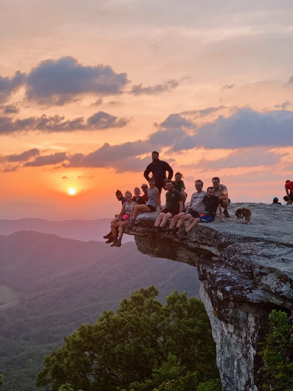
Photo by Rachel Boice
Want to keep up with all that’s going on at Atlas Guides? Sign up for our newsletter!
Read more!
Check out some related blog posts!
Get our trail guide for this area!
Appalachian Trail
The Appalachian Trail is one of the oldest National Scenic Trails in the US. Its path takes you from Springer Mountain in Georgia to Mt. Katahdin in Maine.
2200 mi (3540 km) $59.99 full guide
Pennsylvania, Appalachian Trail
Photo by Zoë Symon
Pennsylvania, Appalachian Trail
Photo by Zoë Symon
Appalachian Trail
The Appalachian Trail is one of the oldest National Scenic Trails in the US. Its path takes you from Springer Mountain in Georgia to Mt. Katahdin in Maine.
2200 mi (3540 km)
$59.99 full guide
Get our trail guide for this area!
About the Author
Natalie McMillan
Natalie grew up hiking in Arizona where she fell in love with the outdoors. Her favorite hikes are to Havasu Falls in the Grand Canyon and Angel’s Landing in Zion National Park, UT. She loves taking pictures of people, places, and nature, which might explain why she has almost 47,000 photos currently residing on her phone. She takes care of all things related to social media and marketing and recently moved to Denver, CO from Flagstaff, AZ. You may find her frolicking around the trails and mountains of Colorado, or exploring the new city she gets to call home.
My Trail Story by The Purple People
Planning an adventure? Check out our popular trail guides! 4.8 stars (17K+ ratings)
Photo provided by Jillian Ivey
My Trail Story featuring The Purple People
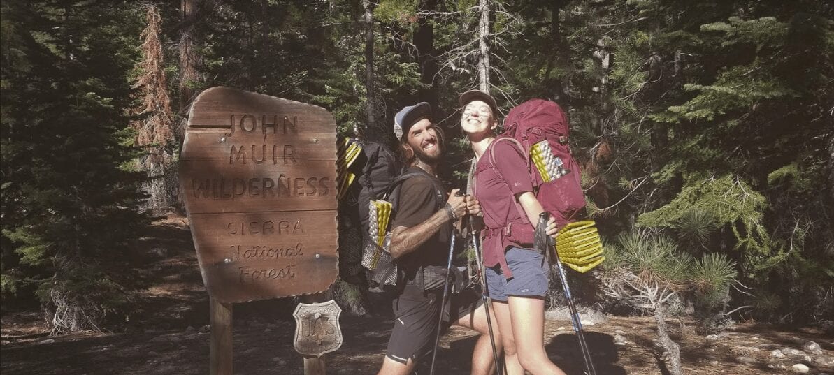
Jillian and Logan Ivey, a.k.a The Purple People or The Mailboxes, experienced some serious "hiker hunger" on their thru-hike of the John Muir Trail in 2018.
Natalie McMillan My Trail Story 06/05/2019
Natalie McMillan
My Trail Story
06/05/2019
Trail Names
Collectively: The Purple People
Jillian Ivey: Gully
Logan Ivey: Mudslide
Trails
John Muir Trail NOBO August 2018
Appalachian Trail NOBO 2019 (Current)
Ages
Jillian 28
Logan 29
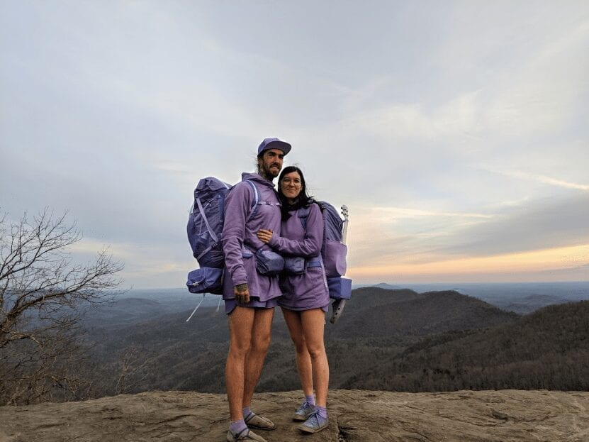
Photo provided by Jillian Ivey
My name is Jillian Ivey and I am currently hiking the Appalachian Trail with my partner and bandmate, Logan. We just started thru-hiking in 2018 and fell in love with it and the hiking community. We are also in a band together called The Mailboxes so we are playing music for fellow hikers on the trail, and one of our dreams is to be Triple Crowners!
One of our favorite thru-hiking stories to tell is about our second to last day on the John Muir Trail. It was our first thru-hike ever and we decided to go utilitarian and eat meal bars for lunch and dinner, which was a big mistake. After a few days I didn’t want to see another meal bar ever again, and the JMT doesn’t have many resupply points where you can switch out food. Logan expected we’d be so hungry we would eat anything, but turns out I’m still picky even when starving. Now that I’m on my second thru-hike I know variety is key when it comes to food on a thru-hike.
To get the variety we craved and avoid eating meal bars we relied on other hikers giving us food they didn’t want anymore – which was surprisingly often. We were NOBO hikers so we started at Mt. Whitney and ended in Yosemite. Most hikers hike the John Muir Trail SOBO, so at the beginning of our hike they were at the end of theirs, and they had extra food they didn’t want to carry anymore. Despite the gifts of other hikers we had a real bad case of hiker “hanger” – Logan especially – by the end of our trip. We both lost a considerable amount of weight for an 18 day hike.
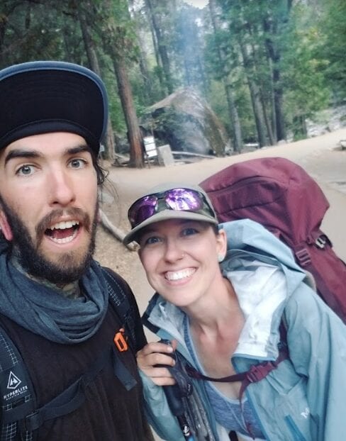
Photo by Jillian Ivey
The closer we got to Yosemite and the end of our hike the more opportunities we had to go to restaurants and resupply points. On our second to last day, Logan, who was particularly hangry, noticed on our Guthook Guides app that there was a restaurant coming up in Tuolomne Meadows. We had been taking it pretty slow and easy all day. It was a relatively flat stretch compared to most days on the JMT. We went over our last pass of the whole trail that morning and were on track to finish in Yosemite the next day. Fifteen miles into our day, Logan asked me if I wanted to go to this restaurant he saw was coming up on Guthook. At first I hesitated. I asked if it was far off trail. I didn’t want to get off track since we were close to finishing the hike. Logan looked at me and replied, “IT’S A RESTAURANT.” As if to say he didn’t care because real food sounded too good to pass up. After remembering how hangry I was, I finally was on board.
Town food did sound pretty amazing – but I asked him to check what time it closed to make sure we would make it in time. He looked at the Guthook app which told us the restaurant closed at 6pm and was five and a half miles away. We checked the clock and saw it was already 4:30pm! We would have to book it to make it on time. We looked at each other and then just started running. We kept passing other hikers who I’m sure we’re confused why thru-hikers with enormous packs we’re running as fast as they could. Some knew the restaurant was coming up and cheered us on. It was mostly crazy because only 16 days prior, five miles was a hard day for me and now I had just hiked 15 miles and was about to run five and a half miles to a restaurant. It’s amazing what you can do when you have something you really want in front of you. In our case the dangling carrot was a hot meal!
Thankfully most of the hike wasn’t too steep. We hustled and hustled until we finally got to a road that was supposed to take us to the restaurant. We asked a park ranger where the restaurant was because we were a little lost on where to go next. She said it was a short walk up the road, so we started to walk on the road in the direction she pointed. We kept going but saw no restaurant in sight. The park ranger even passed us on the road in her truck after we’d been walking a few minutes and we were sad (and maybe a little bitter) that she didn’t just give us a hitch in the back of her truck to the restaurant.

Photo provided by Jillian Ivey
We were tired and time was running out. I was worried we were lost and was feeling desperate for town food. We got off the main road to a gravel road that Logan thought was the right way. We kept going for what felt like forever on that road. I was exhausted and the gap between Logan and I was widening. I was feeling pathetic, and I could tell Logan was stressed and concerned about us making it on time. I yelled out to him pathetically “Where are we?!” to which he responded in his hangriest voice “I DON’T F***ING KNOW.” I wanted to burst into tears, but I knew we wouldn’t get there if I didn’t pick up pace, so I started running again to catch up. We were just going to have to keep going. This was the most upset and defeated we had felt thus far on the trail but we pushed through until we finally saw what we were so desperately looking for up ahead.
We walked grumpily to the restaurant we saw down the road. We were both in horrible moods and dragged our bodies inside the tiny restaurant that looked like it used to be a gas station. I’m sure we looked totally drained of life to the woman who took our order. We had made it with only 15 minutes until closing time so I’m sure she was anxious for us to order so she could close up shop. We ordered two veggie burgers, veggie chili, fries, and two soft serve ice cream cones from the counter. There were no chairs, just a bar you could stand up at to eat, so once they gave me my ice cream I sank down and sat on the concrete floor trying to remember what it meant to be human.
With each bite it felt like life was coming back into my body. The rest of our food arrived and it was so delicious, especially compared to what we had been eating on trail. I have never enjoyed a meal more in my life. I went from feeling like crying to complete joy in a matter of minutes – all over a veggie burger. We ate all our food then even went next door to the general store and bought snacks there and ate those too. We laughed at how upset we were just a few minutes before and were so glad we had made it on time. Hiker hunger is so real and on the AT we’ve definitely learned to indulge and bring all the yummy treats and foods on trail. I’m proud to say after three months on the AT we haven’t lost any weight and I haven’t eaten a single meal bar. I’ll never forget that day and what it taught me about how far my body can go when it wants to and how good a warm meal is after a long hike.
Want to keep up with all that’s going on at Atlas Guides? Sign up for our newsletter!
Read more!
Check out some related blog posts!
Get our trail guide for this area!
John Muir Trail
Named after the environmentalist, the John Muir Trail travels over 200 miles through the Sierra Nevada Mountains and is one of the most popular trails in the country.
210 mi (338 km) $14.99 full guide
East Vidette, Southern Sierra, John Muir Trail
Photo by Alice Bodnar
East Vidette, Southern Sierra, John Muir Trail
Photo by Alice Bodnar
John Muir Trail
Named after the environmentalist, the John Muir Trail travels over 200 miles through the Sierra Nevada Mountains and is one of the most popular trails in the country.
210 mi (338 km)
$14.99 full guide
Get our trail guide for this area!
About the Author
Natalie McMillan
Natalie grew up hiking in Arizona where she fell in love with the outdoors. Her favorite hikes are to Havasu Falls in the Grand Canyon and Angel’s Landing in Zion National Park, UT. She loves taking pictures of people, places, and nature, which might explain why she has almost 47,000 photos currently residing on her phone. She takes care of all things related to social media and marketing and recently moved to Denver, CO from Flagstaff, AZ. You may find her frolicking around the trails and mountains of Colorado, or exploring the new city she gets to call home.
My Trail Story by KP
Planning an adventure? Check out our popular trail guides! 4.8 stars (17K+ ratings)
Photo by Scott Siler
My Trail Story featuring KP
The incredible trail magic that Scott Siler, a.k.a KP, experienced on the Appalachian Trail resulted in a wedding invitation and a restored faith in humanity.
Natalie McMillan My Trail Story 05/23/2019
Natalie McMillan
My Trail Story
05/23/2019
My trail name is Kenny Powers – a fictional character from the HBO series “Eastbound & Down” for those of you who don’t know who that is. I go by “KP” for short. When people ask what KP stands for it really depends on the day. It could be “Kickapoo” or it could be “Kitchen Patrol”. I was given this name in Warner Springs, CA while hiking the Pacific Crest Trail in 2018.
I hiked the Appalachian Trail in 2016. Growing up in Appalachia mere miles away from Harpers Ferry, it was always a dream to do it. In 2018 I hiked the PCT and the Long Trail end to end. I plan to hike the Colorado Trail this summer and the Lowest to Highest in November. I hope to complete the triple crown in 2020 with a thru-hike of the Continental Divide Trail.
Photo provided by Scott Siler
I am 28 years old and I started long distance hiking when I was 25. I grew up in a very outdoorsy family and have hiked and backpacked most of my life. We were never much of a theme park or hotel kind of family so to speak. My parents introduced me and my siblings to the wonderful powers of nature at a young age. I feel more at home sleeping on the ground than in a house.
My Story is about some remarkable Trail Magic on the AT in and around the Whites.
Photo by Scott Siler
As many of you know the White Mountains are a pinnacle of the AT experience. You hear about them from the day you set foot at Springer Mountain: the unforgivable difficult hiking of the Northeast that you are seemingly preparing for your entire hike mentally and physically.
After a long and wet descent down the backside of Mt. Moosilauke, we realized this would be no cake walk. The weather was absolutely terrible. It was pouring rain and we had zero visibility until we got below tree line. We managed to get to the highway fairly early and hitched a ride into Lincoln, NH, to wait it out and make some alternate plans. As most of us starving hikers tend to do, we naturally gravitated toward the McDonald’s in town to make a game plan. The rain was still relentless at this point.
Later in the day, my hiking partner and I decided to head over to the local brewery to try and find somewhere to stay in town. For hours we looked, called, and just about everything was full. The local hostel, Chet’s, didn’t even have floor space, and all the hotels were full and unreasonably priced. Every other hostel was completely full as well. We decided to grab a few drinks and see where we ended up. As the rain continued, the weather got increasingly worse and the temperature dropped significantly. As we were sitting at the bar we mentioned to the hostess/bartender our predicament. She, being an avid hiker and local peakbagger, gave us an incredible option that would save our butts that night plus a few nights after.
As fate would have it, she lived in a apartment complex right across the street from the brewery. She said she and the landlord/owner were quite close and the apartment across from hers was vacant. She said she’d give him a call ASAP. Meanwhile two older women who heard our predicament approached us at the bar, and were also both avid local hikers. They immediately recognized us a thru-hikers. We started talking and they told us that both of their kids were getting married in town the next day. And the wedding reception was happening right across the street in a local bed and breakfast.
Photo by Scott Siler
Without hesitation, they invited us over to meet everyone. We didn’t want to impose, but at the same time we couldn’t say no. We met a lot of really cool people that night including the bride and groom-to-be. Just about every conversation we had revolved around our thru-hike. As the night went on and things winded down, they invited us to their wedding the next day but not before sending us off with five large pizzas and multiple cases of beer. When we walked across the street back to the brewery the hostess was in mid process of calling us to let us know that we could in fact stay in the vacant apartment. Things really couldn’t have gotten much better at this point. We had food, shelter, and most importantly a shower. We didn’t actually attend the wedding the next day, but it literally happened within eyeshot of where we were staying. We made sure to stop by and thank the couple that really helped us out. We ended up staying for a few extra days to wait out the weather before heading back onto the trail.
Photo by Scott Siler
Another instance where this occurred was also in the Whites/Presidential Range. When we left Lincoln we made it just around the base of tree line on Franconia Ridge. When we woke up the next morning, the skies were clear and the weather was fine. Within about an hour it quickly turned south and was pouring rain. In this region there are a series of huts run by the AMC (Appalachian Mountain Club) being that there are no shelters specifically for thru-hikers. Most do work-for-stay, but the times in which you must show up are pretty unrealistic for long days and normally the spots are taken pretty quickly. If you choose to purchase a bunk for the night, that’s an option, but it’s very expensive. At the same time it makes sense because all of the supplies are walked in by AMC volunteers.
Anyways, by the time we reached Zealand Hut we were completely soaked and very cold, like dangerously cold. The winds had picked up as well. I can best compare it to someone pouring buckets of water on you in front of a fan. When we reached the hut we saw several other hikers that we had been leapfrogging for the past few months. All of them had to unfortunately tell us that the hut was full. I remember being so incredibly mad at this point, but there was nothing I could do. I felt like it was almost dangerous for us to be out there. The caretakers wouldn’t even let us set up on the porch and then started to be pretty rude about us loitering. They told us there was a tent flat about two miles down the ridge and that it was in cover.
After some harsh words were exchanged we carried on and headed down the mountain. When we got to the “tent flat” it was a puddle — more like a river — and everything but a flat. We dug trenches and threw a tarp over both of our tents but the weather just didn’t quit. The winds really picked up through the night. At one point I noticed there was so much water in my tent I was literally floating on my sleeping pad. After maybe an hour of combined sleep morning finally came and the rain subsided slightly.
Photo by Scott Siler
The next day was one of the hardest, most mentally demanding days I’ve ever had on trail. So much rain had fallen in the last few days that we were basically walking in a bog on wooden boards, ankle to waist deep at times. This was a day that the “suck” nearly broke me. We finally made it to Crawford Notch and managed to hitch a ride to a campground. The weather was still pretty bad so we decided to hitch to a campground with some cabins. We dished out some cash and got a cabin with heat, beer, and lots of snacks. We knew the next day would be pretty rough as well so we relished our sleep and downtime. When the morning came we had to hitch a ride back to the trailhead. No one was picking us up, like no one.
After a few hours, a young couple pulled over in a station wagon and scooped us up. We told them how stoked we were to be heading into the Presidentials. We had been waiting to get here for months! They told us they were heading up to Madison Spring Hut. We didn’t think much of it at the time – just some cool people going for an outing as well. They dropped us at the trailhead and we proceeded to hike nearly the entire Presidential Range in one day, making the summit of Mt. Washington at nearly 4:30 pm. We had pretty much zerovisibility. At times my partner and I were holding onto each other’s packs so we didn’t get lost. Just around sunset we finally broke cloud cover and were in view of Madison Spring Hut in the saddle down below us.
We both looked at each other and were like “Okay, are you ready to be disappointed again?” We decided to at least stop by and see what was up. And wouldn’t you know it, the couple that we hitched a ride from earlier in the day were in fact the caretakers of the hut! They greeted us with warm tea and cake! The told us they had plenty of food and we were welcome to stay! Let’s just say our faith in the AMC was greatly restored.
Trail magic comes in many forms. Whether it’s a cooler on the side of the trail, or water, or an incredible story such as this. Never underestimate the goodwill of people helping out other people. This greatly restored my faith in humanity as did almost every other long distance trail I’ve embarked on.
Photo by Scott Siler
Want to keep up with all that’s going on at Atlas Guides? Sign up for our newsletter!
Read more!
Check out some related blog posts!
Get our trail guide for this area!
Appalachian Trail
The Appalachian Trail is one of the oldest National Scenic Trails in the US. Its path takes you from Springer Mountain in Georgia to Mt. Katahdin in Maine.
2200 mi (3540 km) $59.99 full guide
Pennsylvania, Appalachian Trail
Photo by Zoë Symon
Pennsylvania, Appalachian Trail
Photo by Zoë Symon
Appalachian Trail
The Appalachian Trail is one of the oldest National Scenic Trails in the US. Its path takes you from Springer Mountain in Georgia to Mt. Katahdin in Maine.
2200 mi (3540 km)
$59.99 full guide
Get our trail guide for this area!
About the Author
Natalie McMillan
Natalie grew up hiking in Arizona where she fell in love with the outdoors. Her favorite hikes are to Havasu Falls in the Grand Canyon and Angel’s Landing in Zion National Park, UT. She loves taking pictures of people, places, and nature, which might explain why she has almost 47,000 photos currently residing on her phone. She takes care of all things related to social media and marketing and recently moved to Denver, CO from Flagstaff, AZ. You may find her frolicking around the trails and mountains of Colorado, or exploring the new city she gets to call home.