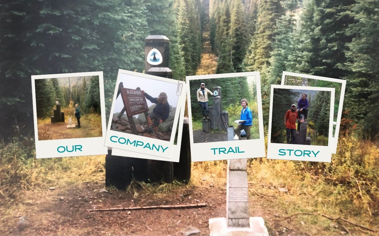
Our Company Trail Story: How Guthook Got Started
Planning an adventure? Check out our popular trail guides! 4.7 stars (14K+ ratings)
Our Company Trail Story: How Guthook Got Started
We decided that it was time we shared OUR Trail Story with you all. From 1997 until now, here is the story of how our company was started and the journey we took to get to where we are today.
Natalie McMillan Inside Atlas Guides 5/27/2020
Natalie McMillan
Inside Atlas Guides
5/27/2020

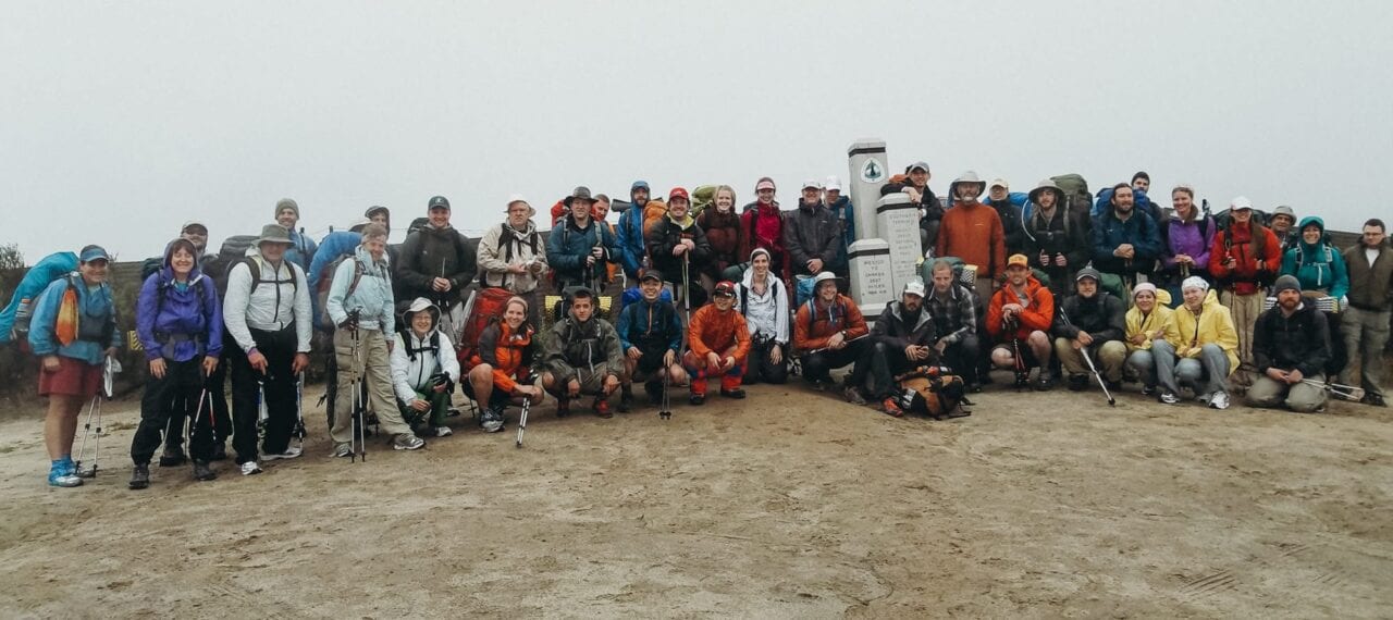
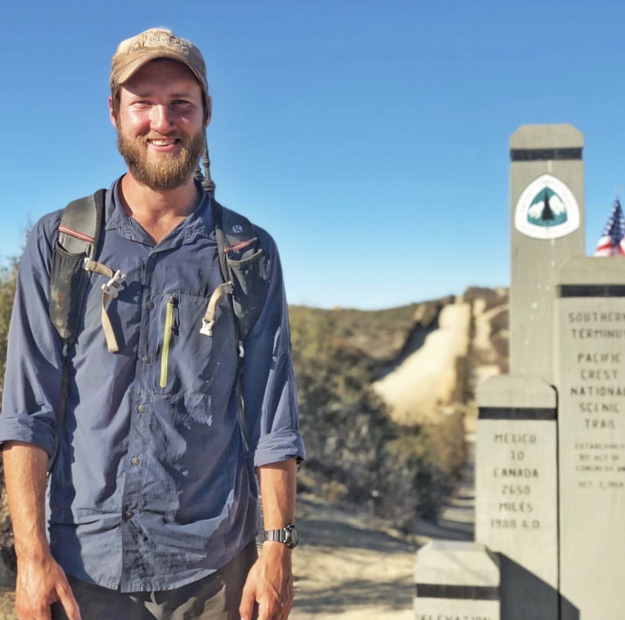
Paul standing in front of Crater Lake on his PCT thru-hike in 1997. Photo provided by Paul Bodnar
Twenty-three years ago, one of our founders, Paul Bodnar, made a decision that changed his life.
In 1997 he decided to hike the Pacific Crest Trail (PCT) after he graduated from the University of California Irvine with a MS in organic chemistry. Paul grew up spending summers at his grandparents’ cabin in Lake Arrowhead, just a mile or so away from the PCT. His grandfather often took him and his brothers out to the PCT, and he was always fascinated by the continuity of a trail going from Mexico to Canada. So before hitting the interview circuit to find a job as a chemist, he fulfilled his dream of thru-hiking the PCT.


Paul finished his first PCT thru-hike in October 1997. Photos provided by Paul Bodnar
At about the same time that Paul finished his hike, Alice Presley (Paul’s girlfriend at the time, now wife) also graduated from UC Irvine with a MS in organic chemistry and they both started working as medicinal chemists for Pharmacia, a big pharmaceutical company in Kalamazoo, Michigan. They worked there for five years before Pfizer took over their company and eliminated all drug discovery jobs at their job site. They were invited to move to other Pfizer locations to continue their work, but Paul already had the bug to start his own business and Alice wanted to go to law school.
So they decided to take some time to travel around the U.S. and embark on new careers.
In 2005, Alice started law school at UC Berkeley. She thought that a law degree would give her a chance to reinvent herself and give her a broad set of tools for the next step in her career. The work of Earthjustice and the Natural Resources Defense Council were two of her biggest inspirations for going to law school, and her initial goal was to become an environmental lawyer. But after an internship with the Sierra Club, she realized that litigation was not for her. She switched her focus to energy law and ended up working on large-scale renewable energy projects at a law firm in Los Angeles after she graduated in 2008. In fact, she worked on the giant Alta wind farm in the Tehachapi/Mojave area on the PCT.

Guthook thru-hiking the AT in 2007. Photo provided by Ryan Linn a.k.a. Guthook
Around the same time, across the country in Poughkeepsie, New York, our other founder, Ryan Linn (better known as “Guthook”), was dreaming of his own adventures.
In 2006, Ryan graduated from Vassar College and decided that he was going to thru-hike the Appalachian Trail (AT). He had been backpacking ever since his high school introduced him to the White Mountains and Mahoosuc Range in New Hampshire and Maine. After spending a semester of college in the Rockies with NOLS (National Outdoor Leadership School), he went on a week-long solo hike on the AT as a “bit of a crash course on long-distance hiking.”
He met an older hiker on Saddleback Mountain in Maine who was “just so high on life.” He told Ryan about recently reconnecting with a guy he hiked the AT with in the 1970s.
Ryan decided that he wanted to hike the Appalachian Trail too, and a year and half later, he was on the AT! He started his AT hike in February 2007 and ended in June 2007.

Guthook finished his AT thru-hike in June 2007. Photo provided by Ryan Linn a.k.a. Guthook
The following year, Ryan worked as a Wilderness Trail Crew Leader for the Vermont Youth Conservation Corps. He led two crews for four and three weeks each, focusing on trail maintenance on the Appalachian Trail.
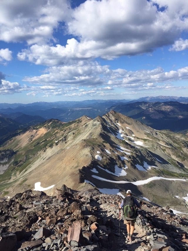
The next year (2009) he thru-hiked the New England Trail and decided that the next step to keep himself going on a “thru-hiker’s life trajectory” was to thru-hike the Pacific Crest Trail.
While Ryan was planning his next big hike, Paul was back in Berkeley, California, working on the first edition of the “Pocket PCT,” a lightweight data guide to the Pacific Crest Trail. After releasing the first edition, Paul decided that he was going to thru-hike the PCT again to verify and add more data to his new lightweight guidebook.

The first edition of the Pocket PCT guide book. Photo provided by Natalie McMillan

The OG “Guthook Guides app” before apps were a thing. Photo provided by Natalie McMillan

Four editions of the Pocket PCT guide book from 2009-2016. Photo provided by Natalie McMillan
Paul began his second thru-hike of the PCT on April 18, 2010. And only a few days later on April 22, Ryan began his.
It wasn’t until around the halfway point in Belden, California, that these destined business partners finally met on their hike. They ended up hiking around 700 miles together and talked a lot about this new phenomenon of hikers carrying smartphones on the trail.
By the time they reached the northern terminus in Canada on September 25, the idea of a smartphone app was born.
After their hike, Paul went to work updating the Pocket PCT as quickly as possible. With the hiking season starting in April, he wanted to get all of the data updated for the next group of thru-hikers. Ryan began working at Eastern Mountain Sports in Keene, New Hampshire, and started learning about iOS development at night. He and Paul kept in touch and began working on the first ever “Guthook’s PCT Guide” iPhone app. Ryan took over the coding responsibility and Paul processed the data.

Paul and Ryan (Guthook) finished hiking the PCT together in September 2010. Photo provided by Paul Bodnar

The very first iPhone PCT app. Screenshot by Ryan Linn
They barely finished everything in time for the April 2012 hiking season and ended up launching sections of the app as hikers progressed up the trail. To test the new app and collect more data, Paul decided to hike the PCT for a third time. But this time, he wasn’t going to hike solo. Alice had recently left her very stressful job as an attorney.
Over dinner one night, Alice said that she would like to hike the PCT too since it was such a big part of Paul’s life, and she wanted to see what she was missing.
They began their PCT thru-hike on April 26, 2012 and finished five months later. And after five months of testing and talking to other hikers who were using the app, they saw that the app had a lot of potential to become a useful and popular tool for long-distance hikers.

Alice and Paul started their PCT thru-hike in April 2012. Photo provided by Alice and Paul Bodnar

Alice and Paul finished their PCT thru-hike in September 2012. Photo provided by Alice and Paul Bodnar
After their thru-hike, Paul and Alice moved to a tiny cabin in Idyllwild, California, near the PCT, and Alice taught herself Android programming.
She developed the first “Guthook’s PCT Guide” Android app and released it to the Google Play Store in 2013.
She thought she would return to the practice of law as soon as she caught up on her Android work, but she never caught up, and officially joined the Atlas Guides team.

The first Guthook’s PCT app for Android. Screenshots provided by Ryan Linn
The following year Ryan started getting a lot of requests to replicate the PCT app for the Appalachian Trail. So he started gathering and processing AT data. In 2014, the team launched apps for the Appalachian Trail, John Muir Trail, and Tahoe Rim Trail. Jerry Brown, of Bear Creek Survey Service, took a chance on the new company, and partnered with the team to create a guide for the Continental Divide Trail. They also teamed up with The Colorado Trail Foundation to create the Official App for the Colorado Trail, which was their first official trail organization partner. They also partnered with Trailblazer Guides in the UK. The South Downs Way was their first trail guide outside of the United States.

The first Guthook’s AT app for iPhone. Screenshot provided by Ryan Linn

The elevation profile in the first Guthook’s AT app for iPhone. Screenshot provided by Ryan Linn
Over the next few years, Ryan, Paul, and Alice worked like mad to improve the app and release over ten new guides for trails all over the world. They developed more and more partnerships with trail organizations and added a lot of new features to the app.

Our individual Guthook trail app icons. Screenshot provided by Ryan Linn
In 2017, Paul and Alice decided to leave California and move Atlas Guides headquarters to Flagstaff, Arizona, where they posted their first ever job listing in search of a marketing intern. They hired me (Natalie McMillan) in July 2017 and I took over everything social media and marketing related. I was in the MBA program at Northern Arizona University and worked part-time as an intern while I went to school. When I graduated with my MBA in May 2018, they extended me a full-time offer as Marketing Director and I happily accepted – best decision I’ve ever made!

Natalie, Alice, and Paul at Arizona Trail Day in Flagstaff, AZ. Photo provided by Natalie McMillan

Natalie’s MBA graduation at NAU. Photo provided by Natalie McMillan
Since that time we have worked with many talented people who have contributed invaluably to the growth of Atlas Guides, in particular Zoë Symon in Oregon, Alexander Gavrikov in Ukraine, and Robert and Angela Mosley in Australia. Zoë overhauled our website and app user interface, and Alexander has worked closely with Alice to improve and update the Android app. The Mosleys have collected a ton of cycling and hiking data for Australia, and are responsible for all of the content in the Cyclewayz app and the Australia hikes in the Guthook app.

Angela and Robert Mosley biking in Australia. Photo provided by Robert Mosley
Today we have more than 60 guides to trails and trail networks, over ten official trail organization partnerships, and recently released our “Social Check-in Feature.” We just moved our headquarters to Denver, Colorado, and we are excited to be a part of the Colorado outdoors scene. We will keep you up to date as Our Trail Story evolves!
Want to keep up with all that’s going on at Atlas Guides? Sign up for our newsletter!
Read more!
Check out some of our other blog posts.

Pocket PCT Guide Book
Your paper guidebook companion on the PCT.
The Pocket PCT is a paper guidebook that offers a complete guide to hiking the Pacific Crest Trail. It contains an elevation profile for the entire trail that is broken into ten-mile segments, showing the trail’s elevation in feet. It also lists important landmarks along the PCT with each chapter beginning and ending at a common resupply location. Additional important town information is also provided. Mileage is compatible with the Guthook Guides Pacific Crest Trail Guide (found on the iPhone & Android apps). For those hikers concerned about weight and space in their packs, the book is lightweight (4.9 ounces) and compact (5 by 8 inches and a quarter inch thick).
About the Author

Natalie McMillan
Natalie grew up hiking in Arizona where she fell in love with the outdoors. Her favorite hikes are to Havasu Falls in the Grand Canyon and Angel’s Landing in Zion National Park, UT. She loves taking pictures of people, places, and nature, which might explain why she has almost 47,000 photos currently residing on her phone. She takes care of all things related to social media and marketing and recently moved to Denver, CO from Flagstaff, AZ. You may find her frolicking around the trails and mountains of Colorado, or exploring the new city she gets to call home.

Bringing Leave No Trace to Life Off-Trail
Planning an adventure? Check out our popular trail guides! 4.8 stars (17K+ ratings)
My backyard container garden.
Photo by Zoë Symon
Bringing Leave No Trace to Life Off-Trail
This post was originally written for The Trek after my Appalachian Trail thru-hike. Leave No Trace is a moral code and daily practice for any thru hiker, section hiker, or day hiker. It teaches us to respect the ground we walk on, the plants that grow from it, the animals who share our space, and the other hikers. When we get off-trail and go home to our apartment or house, how do we bring the lessons of the trail back home with us? This led me to research and think about a variety of topics including self-sufficiency and zero waste.
Zoë Symon Inside Atlas Guides 10/10/2019
Zoë Symon
Inside Atlas Guides
10/10/2019
Originally written for The Trek. See the original post here.
Leave No Trace is a moral code and daily practice for any thru hiker, section hiker, or day hiker. It teaches us to respect the ground we walk on, the plants that grow from it, the animals who share our space, and the other hikers.
Why is it that, as soon as we return to “the real world” we forget about the ways we lived kindly withe the natural world around us? We buy pre-packaged food and throw all the wrappers and scraps into the trash, we buy a iced coffee in a plastic cup and chuck it in the nearest trash can when we are done, we buy the cheapest things we can with no thought to how they came to be there or how they were made.
While I was on the Appalachian Trail, Leave No Trace was an ethos that I did my best to follow every day. Over the past year or so, I’ve started to think more about how Leave No Trace principles can extend to my off-trail life as well. What is the impact I have on this planet? How can I tread more lightly on this place we call home?
Not all of us are able to live trail life, or a more minimalist, nomadic lifestyle, for the entire year. When we get off-trail and go home to our apartment or house, how do we bring the lessons of the trail back home with us?
This led me to research and think about a variety of topics including self-sufficiency and zero waste.The Zero Waste International Alliance defines Zero Waste as:
A goal that is ethical, economical, efficient and visionary, to guide people in changing their lifestyles and practices to emulate sustainable natural cycles, where all discarded materials are designed to become resources for others to use. Zero Waste means designing and managing products and processes to systematically avoid and eliminate the volume and toxicity of waste and materials, conserve and recover all resources, and not burn or bury them. Implementing Zero Waste will eliminate all discharges to land, water or air that are a threat to planetary, human, animal or plant health.
I believe that, as people who love the trail – love a part of the natural world – we have a responsibility to see that it continues to exist and thrive for future years and generations. We have a responsibility to check and examine our own consumption and disposal habits and practices. We also have a responsibility to bring the power of our community to bear on the forces that would seek to undermine, destroy, or disregard these natural spaces that we care about.
A few ways you can start thinking about zero waste, self-sufficiency, and off-trail Leave No Trace:
- Set goals for yourself. Can’t put plants in the ground because you live in an apartment? Try setting a goal to grow a few herbs on your kitchen countertop. Do you clean your house (if not, gross.)? Think about turning your last cleaning spray bottle into a reusable bottle. Mix up your own cleaning solution, and get to work! Set goals for 1 month, 1 year, and 5 years. Track your progress!
- Engage in your community. Are you passionate about environmental policy? Write a letter to your representatives, or research the grassroots movements are happening in your area. Are you interested in eating local? Buy your produce at a farmer’s market or go visit a farm!
- Advocate for Zero Waste and sustainable practices. Talk about this with your friends and family. Start a meetup! Research and share blog posts and recipes (you could start with this one!).
- Be conscientious and deliberate. Research the companies and products that you purchase. Support companies and organizations that are transparent, sustainable, and considerate with their sourcing and production practices.
It seems like a daunting task to climb these mountains and implement these changes in my life, but as I well know, all hikes have to start with a first step.
So what am I doing?
My first baby steps down this journey are to be more deliberate about the cleaning products I use, how and where I get my food, and attempting a garden of my own.
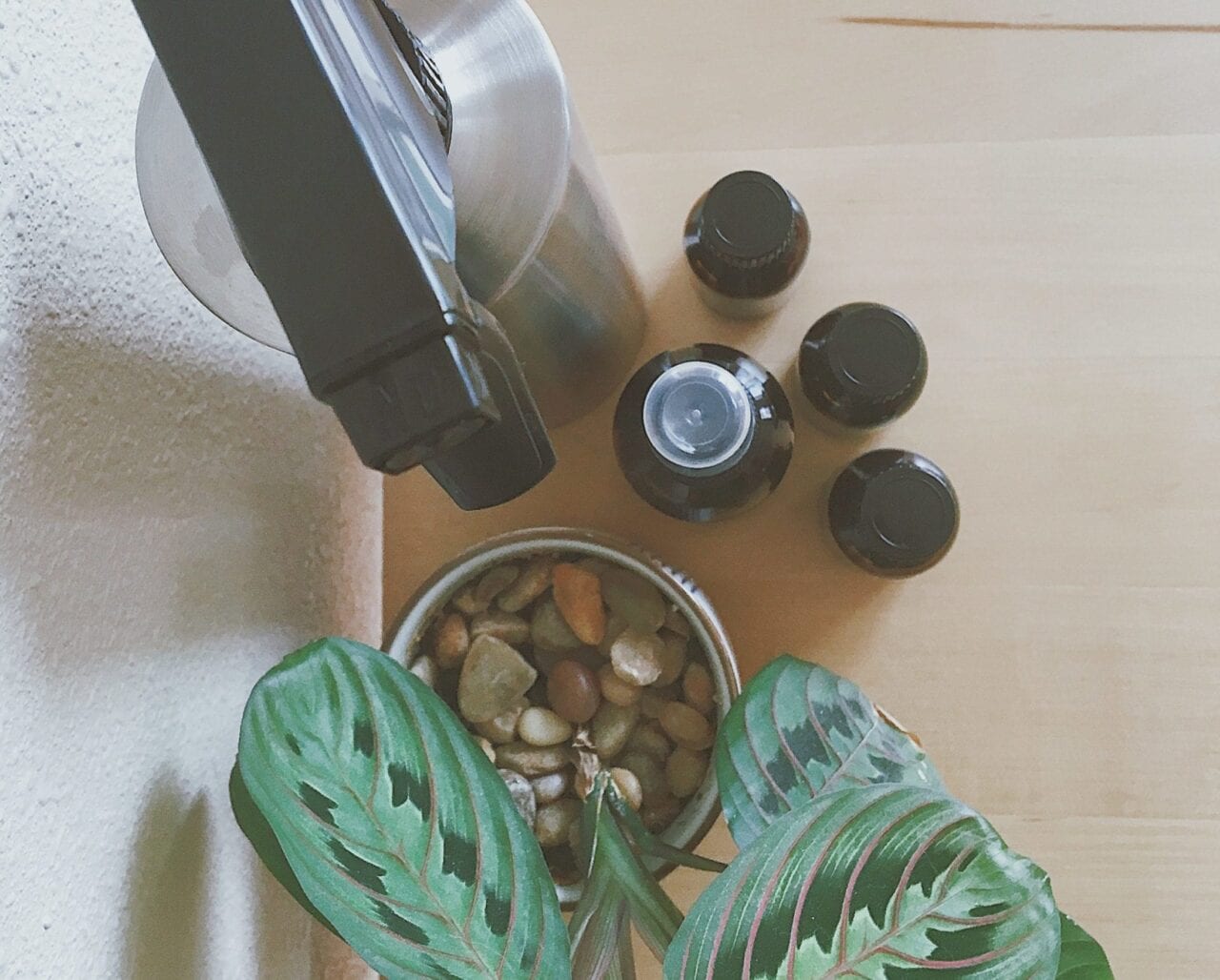
Homemade cleaning supplies.
Photo by Zoë Symon
Cleaning Supplies
I find cleaning to be a meditative and satisfying activity (I’m probably the only one), but when looking at the amount of paper towels, plastic bottles of cleaning products, and Swiffer sheets that I go through, I cringe. Time to make a change. Pictured here with my prayer plant is homemade all-purpose cleanser and homemade air freshener.
All-Purpose Cleaner
Any aspiring zero-waster should invest in a good reusable spray bottle (or multiple!). A great mixture is 50/50 water and white vinegar. I’ve added drops of essential oil – rosemary and lemon – because I’m a sucker for good-smelling cleaners.
Air Freshener
You can also make DIY air fresheners using essential oils. I borrowed a recipe from Jill at The Prairie Homestead. Combine 3/4 cup of water with 2 tbsp of alcohol (vodka, rubbing alcohol, and vanilla extract all work, according to Jill. I used rubbing alcohol because it’s what I had on hand) and add your desired essential oil scents. I used lavender, rosemary, and lemon, for a refreshing and clean smell.

Vegetables in reusable vegetable bags.
Photo by Zoë Symon
Buying Food
Another change I’ve made is to frequent my local farmer’s market more often. By supporting local growers, I can rest easy knowing what processes, techniques, and chemicals they’ve used to grow their food.
One of the seven Leave No Trace principles is to Plan Ahead and Prepare. Leave No Trace adds a sub-component of that principle by asking hikers to repackage food to minimize waste. This idea can easily be applied to off-trail life. Whenever you go grocery shopping, whether it’s at your local farmer’s market or a big box store, remember to minimize the packaging waste of the food you are purchasing. I’ve extended the zero waste impact of my shopping by using reusable bags.
Produce Bags
We’re all used to those flimsy plastic bags at grocery stores. What are they good for once you get home? I’ve used them in the past to pick up dog poop or line small trash cans, but that’s really their only use, and then they go in the trash. Why not invest $10 and get some cotton mesh bags that you can reuse again and again? There are a variety of options out there, but I bought these on Amazon.
Grocery Bags
Reusable grocery bags are even more common than reusable produce bags. Your grocery store probably even sells them. Find yourself a couple of tote bags, and don’t let the cashier ever give you a plastic bag again!
Buying in Bulk
In addition to having your own bags, consider finding a store where you can buy in bulk. Why buy pre-packaged goods when you could buy exactly how much you need for the next day, week, month, or year – without the excess packaging.
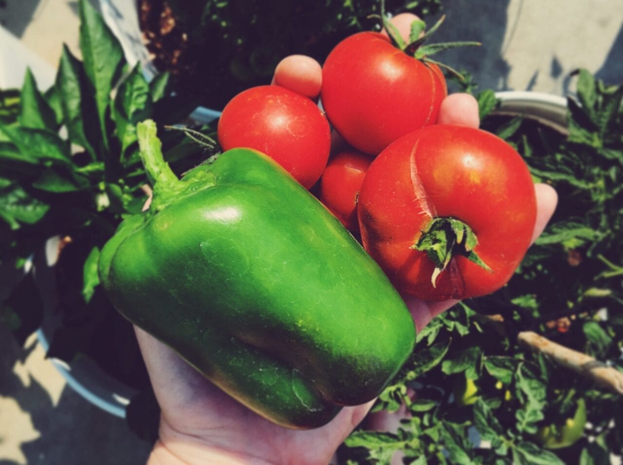
Vegetables from my garden.
Photo by Zoë Symon
Growing Food
Another way to minimize your waste impact is to grow your own food. This sounds daunting, but it’s really not! I was surprised how easy this was to do, even with my lack of a green thumb. If I can do it, you can too!
Container Garden
This season, I attempted to grow a container garden. We gathered some 5-gallon buckets, drilled a few holes in the bottom, and planted some seedlings purchased from our local nursery. We have 5 tomato plants, a few okra plants, 4 bell pepper plants (all varieties), herbs, and some strawberries (these didn’t fare as well as the rest).
Next year, I’ll probably try a few more varieties of vegetables, and I might even be a little more scientific about it by looking up a growing schedule for my region. I also hope to invest in canning supplies so that I can store my vegetables for less bountiful months.
Composting
I haven’t yet built my own compost pile, but most cities have opportunities for composting. Some have businesses that offer composting services (think of it as a utility, like garbage, water, or electric), some have local farmers who would be happy to add your food scraps to their piles, and some offer a variety of composting as a part of standard yard waste disposal.
Another of the seven Leave No Trace principles is to Dispose of Waste Properly. On the trail, this includes not leaving your food scraps around for people or animals to find. Why shouldn’t we continue this practice off-trail? Landfills keep trash for years, and organic matter can get buried and sealed under non-organic trash. This creates a vacuum where the organic matter breaks down anaerobically and creates methane, which is a very environmentally damaging greenhouse gas. If you want your favorite trail to be here in the future, compost!
Want to keep up with all that’s going on at Atlas Guides? Sign up for our newsletter!
Read more!
Check out some related blog posts!
Download our popular hiking and biking guides!

Trail guides that get you to places you’ve dreamed of.
As the makers of Guthook Guides, Bikepacking Guides, and Cyclewayz, we help you navigate the most popular trails around the world on your smartphone. Our hiking guides and biking guides work completely offline. Let Guthook guide your next adventure!
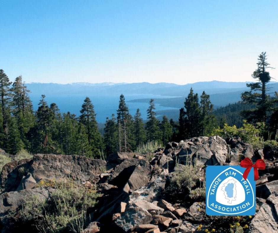
Showers Lake Vista, Tahoe Rim Trail
Photo courtesy of the Tahoe Rim Trail Association

Showers Lake Vista, Tahoe Rim Trail
Photo courtesy of the Tahoe Rim Trail Association
Trail guides that get you to places you’ve dreamed of.
As the makers of Guthook Guides, Bikepacking Guides, and Cyclewayz, we help you navigate the most popular trails around the world on your smartphone. Our hiking guides and biking guides work completely offline. Let Guthook guide your next adventure!
Download our popular hiking and biking guides!
About the Author

Zoë Symon
Zoë grew up in North Carolina and first heard of the Appalachian Trail during her time in college. In 2016, she took a leave of absence from her job and thru-hiked the trail. This adventure fostered her love for the outdoors and for hiking. Currently, she explores the public lands of Oregon. In 2017 she joined the team at Atlas Guides as Creative Director. She spends her days improving experiences for all our users.
Guthook's New Year's Hiking Goals
Planning an adventure? Check out our popular trail guides! 4.8 stars (17K+ ratings)
Hiking in nasty weather isn’t always optional when you need to get the miles in!
Photo by Ryan Linn
Guthook's New Year's Hiking Goals
2019 is almost here! Have you made your New Year’s Resolutions yet? Or are you going to forget them within minutes of making them? Check out how Guthook manages his New Years Resolutions— maybe his obsession can help you with yours.
Ryan Linn Inside Atlas Guides 12/28/2018
Ryan Linn
Inside Atlas Guides
12/28/2018
Back when I was thru-hiking every few years, it was so easy to stay in shape for hiking. Whatever I was doing for work at the time, I could take one day a week to go on a twenty-mile hike and feel just fine. These days I spend too much time in the office, so I can’t take this kind of thing for granted. A few years ago I decided I needed a good way to keep myself motivated and stay in constant motion.
Being the nerd that I am, I needed a combination of tools to keep myself motivated. iOS had recently added HealthKit, which automatically counts your steps as you walk around with your phone. Pair that with some SMART goal setting and a spreadsheet, and I had a plan!
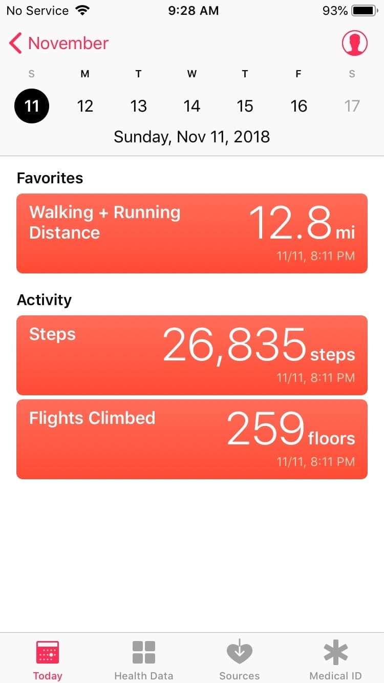
iOS’s Health app is a pretty simple way to track your steps, mileage, and so on.
SMART goals are something I learned about when I was a student at NOLS, and are fairly common in work environments as well. The idea is to create goals for yourself that are:
- Specific
- Measurable
- Achievable
- Relevant
- Time Constrained
Rather than saying “I want to hike more next year”, which is vague and easily ignored, the SMART system encourages you to go into great detail. By being more specific, you can turn the accomplishment into a sort of competition with yourself.
To set up my annual goal, I started with the easy parts. The Time constraint was the calendar year, and the Measurement would be done with my Health app’s mileage measurement. I decided to use the mileage rather than step count because, even if it’s less accurate, it’s a more meaningful number for me. Finally, the Relevant criteria comes from the fact that my goal would involve walking, hiking, and backpacking. Staying in shape for hiking by getting myself out on the trail more often seems pretty relevant to me!
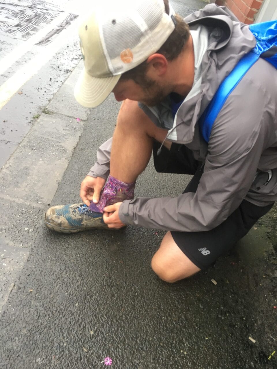
Getting ready for a day on the trail.
Next up was the fun part: what Specific goals do I set, and how do I decide if they’re Achievable? Since it’s hard to say what is achievable, I decided to err on the side of extreme specificity. That way I could modify my goals for the following year based on the current year’s performance. For example, here are my 2018 goals:
- Walk, hike, or run a total of 2018 miles.
- Spend 40 nights out on overnight hiking trips.
- Hike a total of 80 days. (in this case, a day of hiking must be at least 4 hours, so I could spend a night out on a hiking trip without counting either day as hiking).
- Hike a minimum of 4 days per month.
That may sound unachievable to you, but it sounded right to me at the end of 2017. The idea was to be very difficult, but possible. Turns out, I failed at all those goals for 2018, but that will help me set new goals for 2019.
To measure my progress, I set up a pretty detailed spreadsheet. If you’ve read any of my previous posts, you’ll know I love a good (and frivolous) spreadsheet. Keeping track of progress as I went along helped keep me motivated, and gave me some daily or monthly mini-goals to add on. As I write this post (about a week before year’s end), it’s obvious that I won’t hit my overall goal, but it did serve its purpose of keeping me in hiking shape. Maybe next year I’ll be able to tailor my goal to something a little more reasonable.
You can get a copy of the spreadsheet here. Feel free to either use it as is for your own goals, or modify it for your own crazy goals. If you’re using it as is, the only fields you need to enter text into are the highlighted ones. Dates and averages are all taken care of. Good luck sticking with your 2019 goals. Let’s compare notes in a year!
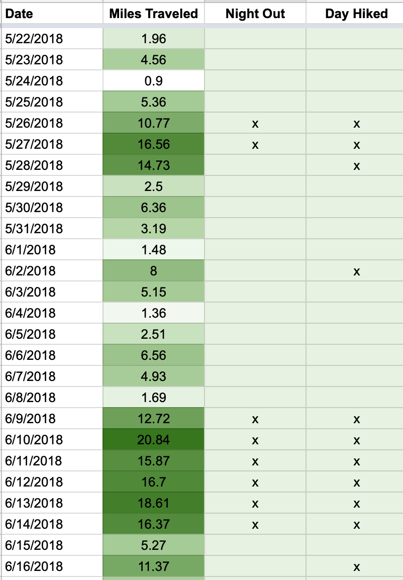
The main part of the spreadsheet keeps track of daily accomplishments.
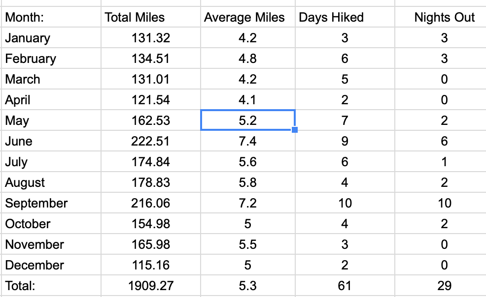
And a monthly overview shows what’s been done so far this year.
Want to keep up with all that’s going on at Atlas Guides? Sign up for our newsletter!
Read more!
Check out some related blog posts!
Download our popular hiking and biking guides!
Trail guides that get you to places you’ve dreamed of.
As the makers of Guthook Guides, Bikepacking Guides, and Cyclewayz, we help you navigate the most popular trails around the world on your smartphone. Our hiking guides and biking guides work completely offline. Let Guthook guide your next adventure!
Showers Lake Vista, Tahoe Rim Trail
Photo courtesy of the Tahoe Rim Trail Association
Showers Lake Vista, Tahoe Rim Trail
Photo courtesy of the Tahoe Rim Trail Association
Trail guides that get you to places you’ve dreamed of.
As the makers of Guthook Guides, Bikepacking Guides, and Cyclewayz, we help you navigate the most popular trails around the world on your smartphone. Our hiking guides and biking guides work completely offline. Let Guthook guide your next adventure!
Download our popular hiking and biking guides!
About the Author

Ryan Linn
Ryan is also known as “Guthook”, which is where our apps get their name. Already an avid hiker, he hiked the Appalachian Trail, New England Trail, and Pacific Crest Trail before joining forces with Paul to create the Guthook Guides apps. Ryan handles iOS development for our apps from his office in Maine, and usually runs away to the forests and mountains throughout New England. He also volunteers with the Maine Appalachian Trail Club and the Natural Resources Council of Maine. Baxter State Park in Maine is his happy place.

How Long Does it Take to Hike Each Trail?
Planning an adventure? Check out our popular trail guides! 4.7 stars (14K+ ratings)
Photo by Holly Mandarich
How Long Does it Take to Hike Each Trail?
Would you like to hike for 5-6 months? A few weeks? A few days? We've got you covered.
Natalie McMillan Inside Atlas Guides 12/20/2018
Natalie McMillan
Inside Atlas Guides
12/20/2018
Find the trail that’s right for you
The trails are listed here by the average time it takes to walk the entire trail. Some people hike faster, some slower, and some only hike a section. In other words, these time periods only provide a rough estimate of how long it might take to walk the trail.
5-6 months
- Pacific Crest Trail (2650 miles)
- Appalachian Trail (2180 miles)
- Continental Divide Trail (3100 miles)
4 months
- Te Araroa (1860 miles/3000 km)
2-3 months
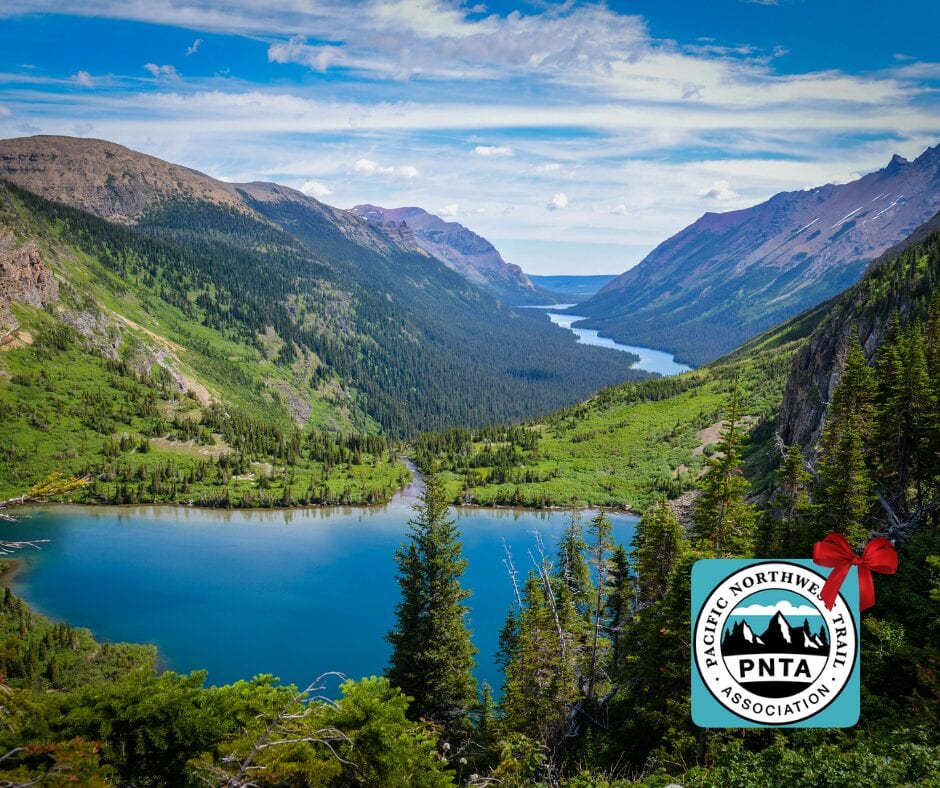
- Pacific Northwest Trail (1200 miles)
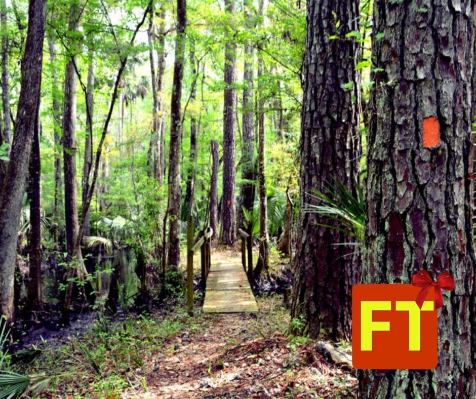
- Florida Trail (1400 miles)
- Great Divide Trail (680 miles/1100 km)
- The Bibbulmun Track (622 miles/ 1002 km)
7-12 weeks
- Ice Age Trail (1200 miles)
4-8 weeks
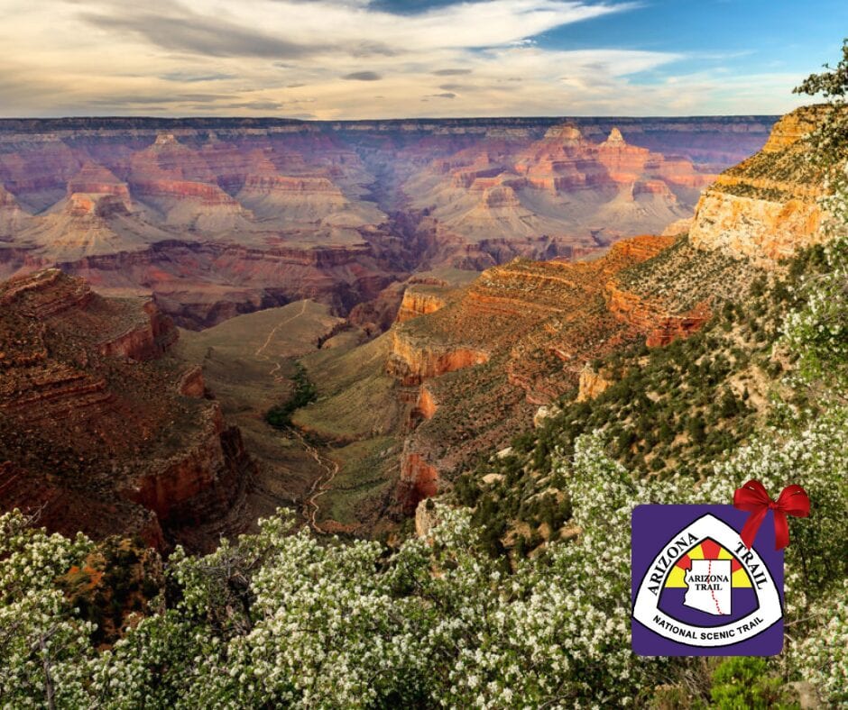
- Arizona Trail (800 miles)
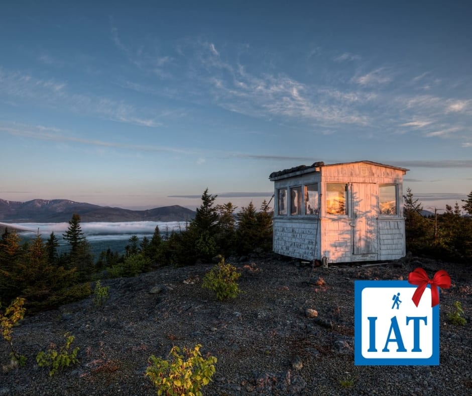
- International Appalachian Trail (724 miles)
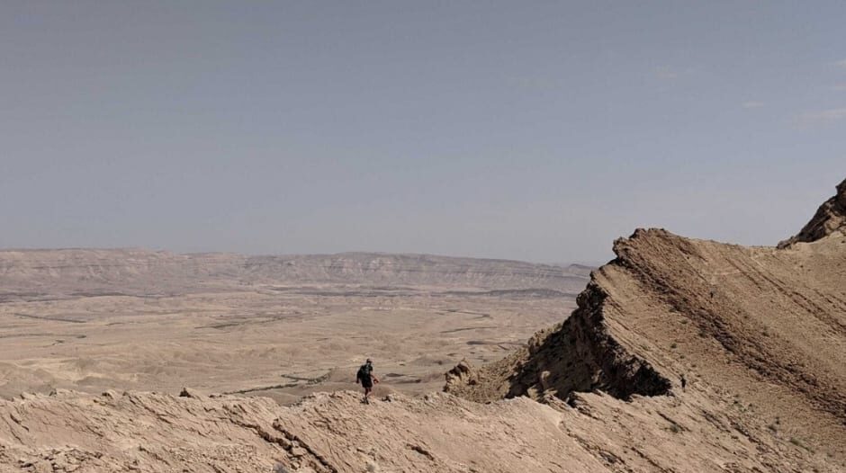
- Israel National Trail (664 miles)
4-6 weeks
- Colorado Trail (485 miles)
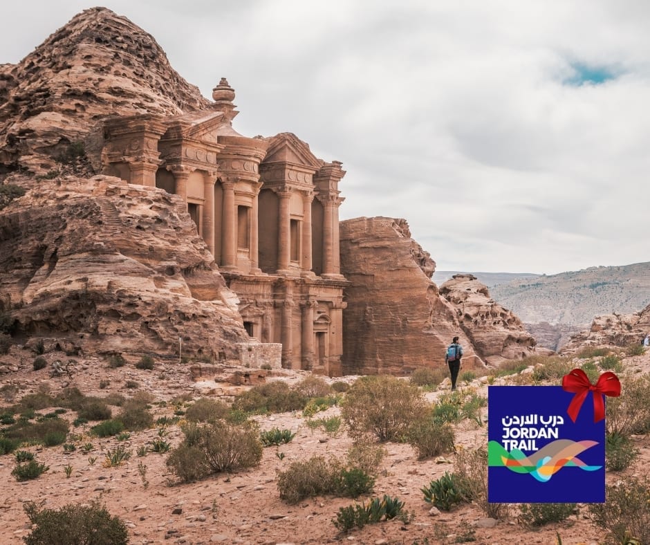
- Jordan Trail (400 miles)
4 weeks
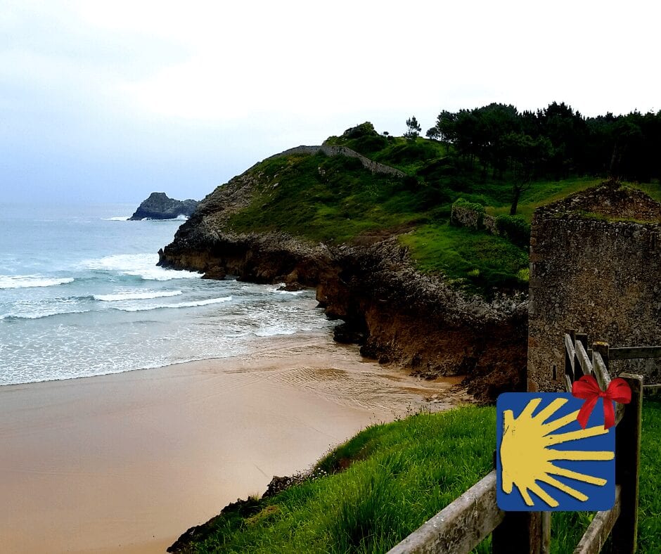
- Camino de Santiago (460 miles/750 km)
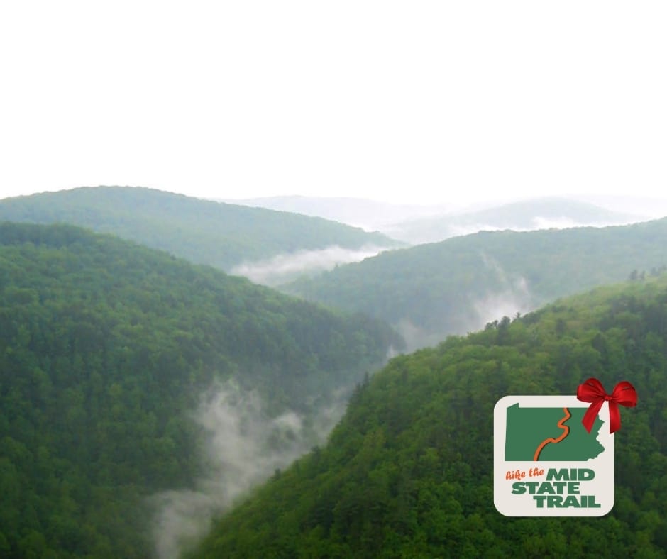
- Mid State Trail (321.2 miles/530 km)
3 weeks
- Benton Mackaye Trail (300 miles)
- John Muir Trail (210 miles)
- The Long Trail (270 miles)
- Ouachita Trail (223 miles)
2 weeks
- Tahoe Rim Trail (170 miles)
- Coast to Coast (200 miles)
- Ozark Highlands Trail (164 miles)
- Larapinta Trail (143 miles/231 km)
10 days
- Wonderland Trail (95 miles)
- South Downs Way (100 miles)
- Cotswold Way (100 miles)
7-10 days
- Tour du Mont Blanc (105 miles)
- Torres del Paine – “O” Circuit (75 miles)
1 week
- Ridgeway (87 miles)
- West Highland Way (96 miles)
- Hadrian’s Wall Path (84 miles)
- Cape to Cape (84 miles/135 km)
3-5 days
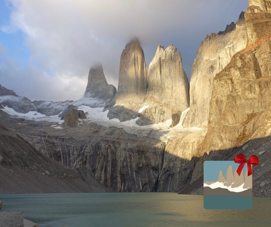
- Torres del Paine – “W” Circuit (39 miles)
3-4 days
- Wilsons Promontory Grand Circuit (33 miles/54 km)
- Greenstone and Caples Track (38 miles/61 km)
- Kepler Track (37 miles/60 km)
- Milford Track (32 miles/53 km)
2-4 days
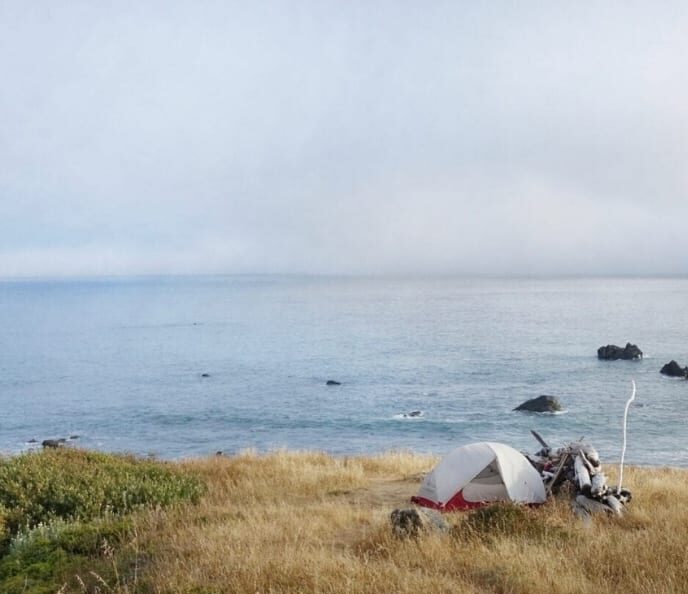
- Lost Coast Trail (24 miles)
2-3 days
- Eagle Rock Loop (26.8 miles)
- Buffalo River Trail (37.1 miles)
- Three Capes Track (30 miles/48 km)
- Routeburn Track (20 miles/32 km)
- Mt Whitney Trail (10.4 miles, 20.8 round-trip)
1 day
- Mt Whitney Trail (10.4 miles, 20.8 round-trip, 1 day is difficult!)
- George Bass Coast Trail (5 miles/8 km)
Want to keep up with all that’s going on at Atlas Guides? Sign up for our newsletter!
Photo by Holly Mandarich
Read more!
Check out some related blog posts!
Download our popular hiking and biking guides!
Trail guides that get you to places you’ve dreamed of.
As the makers of Guthook Guides, Bikepacking Guides, and Cyclewayz, we help you navigate the most popular trails around the world on your smartphone. Our hiking guides and biking guides work completely offline. Let Guthook guide your next adventure!
Showers Lake Vista, Tahoe Rim Trail
Photo courtesy of the Tahoe Rim Trail Association
Showers Lake Vista, Tahoe Rim Trail
Photo courtesy of the Tahoe Rim Trail Association
Trail guides that get you to places you’ve dreamed of.
As the makers of Guthook Guides, Bikepacking Guides, and Cyclewayz, we help you navigate the most popular trails around the world on your smartphone. Our hiking guides and biking guides work completely offline. Let Guthook guide your next adventure!
Download our popular hiking and biking guides!
About the Author
Natalie McMillan
Natalie grew up hiking in Arizona where she fell in love with the outdoors. Her favorite hikes are to Havasu Falls in the Grand Canyon and Angel’s Landing in Zion National Park, UT. She loves taking pictures of people, places, and nature, which might explain why she has almost 47,000 photos currently residing on her phone. She takes care of all things related to social media and marketing and recently moved to Denver, CO from Flagstaff, AZ. You may find her frolicking around the trails and mountains of Colorado, or exploring the new city she gets to call home.
Guthook's Holiday Gift Guide
Planning an adventure? Check out our popular trail guides! 4.7 stars (14K+ ratings)
A winter wonderland
Photo by Ian Schneider
Guthook's Holiday Gift Guide
Give the Gift of Guthook! We have a trail guide for every type of hiker on your list. Whether you know a thru-hiker, section hiker, day hiker, or international hiker, we have something for everyone.
Natalie McMillan Inside Atlas Guides 12/03/2019
Natalie McMillan
Inside Atlas Guides
12/03/2019
How to Give the Gift of Guthook
For the ULTIMATE THRU-HIKER
For the INTERNATIONAL HIKER
For the WEST COAST HIKER
For the EAST COAST/CENTRAL US HIKER
Or shop based on the LENGTH OF EACH HIKE…
The trails are listed here by the average time it takes to walk the entire trail. Some people hike faster, some slower, and some only hike a section. In other words, these time periods only provide a rough estimate of how long it might take to walk the trail.
5-6 months
- Pacific Crest Trail (2650 miles)
- Appalachian Trail (2180 miles)
- Continental Divide Trail (3100 miles)
4 months
- Te Araroa (1860 miles/3000 km)
2-3 months
- Pacific Northwest Trail (1200 miles)
- Florida Trail (1400 miles)
- Great Divide Trail (680 miles/1100 km)
- The Bibbulmun Track (622 miles/ 1002 km)
7-12 weeks
- Ice Age Trail (1200 miles)
4-8 weeks
- Arizona Trail (800 miles)
- International Appalachian Trail (724 miles)
- Israel National Trail (664 miles)
4-6 weeks
- Colorado Trail (485 miles)
- Jordan Trail (400 miles)
4 weeks
- Camino de Santiago (460 miles/750 km)
- Mid State Trail (321.2 miles/530 km)
3 weeks
- Benton Mackaye Trail (300 miles)
- John Muir Trail (210 miles)
- The Long Trail (270 miles)
- Ouachita Trail (223 miles)
2 weeks
- Tahoe Rim Trail (170 miles)
- Coast to Coast (200 miles)
- Ozark Highlands Trail (164 miles)
- Larapinta Trail (143 miles/231 km)
10 days
- Wonderland Trail (95 miles)
- South Downs Way (100 miles)
- Cotswold Way (100 miles)
7-10 days
- Tour du Mont Blanc (105 miles)
- Torres del Paine – “O” Circuit (75 miles)
1 week
- Ridgeway (87 miles)
- West Highland Way (96 miles)
- Hadrian’s Wall Path (84 miles)
- Cape to Cape (84 miles/135 km)
3-5 days
- Torres del Paine – “W” Circuit (39 miles)
3-4 days
- Wilsons Promontory Grand Circuit (33 miles/54 km)
- Greenstone and Caples Track (38 miles/61 km)
- Kepler Track (37 miles/60 km)
- Milford Track (32 miles/53 km)
2-4 days
- Lost Coast Trail (24 miles)
2-3 days
- Eagle Rock Loop (26.8 miles)
- Buffalo River Trail (37.1 miles)
- Three Capes Track (30 miles/48 km)
- Routeburn Track (20 miles/32 km)
- Mt Whitney Trail (10.4 miles, 20.8 round-trip)
1 day
- Mt Whitney Trail (10.4 miles, 20.8 round-trip, 1 day is difficult!)
- George Bass Coast Trail (5 miles/8 km)
Want to keep up with all that’s going on at Atlas Guides? Sign up for our newsletter!
Read more!
Check out some related blog posts!
Download our popular hiking and biking guides!
Trail guides that get you to places you’ve dreamed of.
As the makers of Guthook Guides, Bikepacking Guides, and Cyclewayz, we help you navigate the most popular trails around the world on your smartphone. Our hiking guides and biking guides work completely offline. Let Guthook guide your next adventure!
Showers Lake Vista, Tahoe Rim Trail
Photo courtesy of the Tahoe Rim Trail Association
Showers Lake Vista, Tahoe Rim Trail
Photo courtesy of the Tahoe Rim Trail Association
Trail guides that get you to places you’ve dreamed of.
As the makers of Guthook Guides, Bikepacking Guides, and Cyclewayz, we help you navigate the most popular trails around the world on your smartphone. Our hiking guides and biking guides work completely offline. Let Guthook guide your next adventure!
Download our popular hiking and biking guides!
About the Author
Natalie McMillan
Natalie grew up hiking in Arizona where she fell in love with the outdoors. Her favorite hikes are to Havasu Falls in the Grand Canyon and Angel’s Landing in Zion National Park, UT. She loves taking pictures of people, places, and nature, which might explain why she has almost 47,000 photos currently residing on her phone. She takes care of all things related to social media and marketing and recently moved to Denver, CO from Flagstaff, AZ. You may find her frolicking around the trails and mountains of Colorado, or exploring the new city she gets to call home.
10 Thru-Hiking Gifts for Under $20
Planning an adventure? Check out our popular trail guides! 4.8 stars (17K+ ratings)
Hiking up to a ridge.
Photo by Holly Mandarich
10 Thru-Hiking Gifts for Under $20
Whether you're stuffing stockings or just looking for affordable gifts for the hiker, thru-hiker, backpacker, or outdoorsperson in your life, you're sure to find something on this list.
Zoë Symon Inside Atlas Guides 11/30/2018
Zoë Symon
Inside Atlas Guides
11/30/2018
Prices are listed as they were at the time of writing. No products were donated or given for the purposes of review.
Hiker dinner, featuring a long-handled spoon.
Photo by Zoë Symon
1. Long-handled Spoon
This is a thru-hiking and backpacking necessity, and chances are, most thru-hikers already have one. If not, though, this is the ultimate affordable outdoors gift: able to reach the bottom of a peanut butter jar, and it won’t break. (Can you tell this is my favorite item?)
Most companies offer either a stainless steel or titanium spoon, and most weigh around 0.5 oz or less. Below are a few options.
Sea to Summit Alpha Long Spoon ($8.95, 0.4 oz)
Toaks Titanium Long Handle Spoon ($10.95, 0.65 oz)
MSR Alpine Long Tool Spoon ($9.95, 0.3 oz)
Optimus Titanium Long Spoon ($9.95, 0.67 oz)
This multi-tool is a little bigger than the ones that most hikers carry, but it was found on the trail, and you can’t beat free for price!
Photo by Zoë Symon
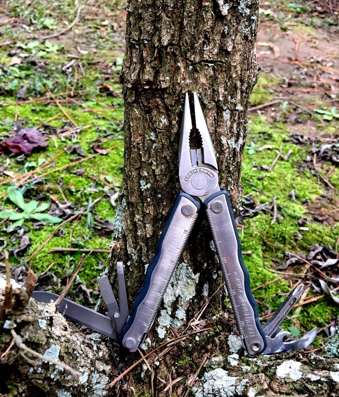
2. Multi-tool
This one may be a little over $20, but it’s so useful it belongs on here. Also, it’s really helpful to have all your tools in one! This is doubly true for thru-hikers and backpackers where space and weight are big issues.
When selecting a multi-tool, keep weight in mind: the smaller and lighter the better, but not so small and light that it’s useless. Also, scissors as part of the multi-tool are a necessity. They are useful for opening food packages, cutting tape to repair gear, cutting someone’s old paracord out of trees, and so much more. Below are a few good options.
Gerber Dime Butterfly-opening Multi-tool ($21, 2.2 oz)
Leatherman Style CS Multi-tool ($29.95, 1.4 oz)
Leatherman Micra Multi-tool ($23.96, 1.8 oz)

Granola bars are another good snack food and have a wide variety.
Photo by Alice Pasqual
3. Snacks
Hiker hunger is a well-known phenomenon, and most thru-hikers do love to eat, but food as a gift is tricky. Consider giving an IOU for snacks for their next hike rather than buying a million Clif Bars now. Also, maybe don’t go for only Clif Bars… other options are below.
ProBar Meal (~$3.50/bar, vegan)
Epic Meat Bar (~$2.50/bar, paleo)
These links will take you to the company websites, where they only sell in bulk. Most health food stores or outdoor retailers will sell single bars.
Trail Butter (prices vary, vegetarian)
A couple of ibuprofen, ready to help with aches and pains.
Photo by Zoë Symon
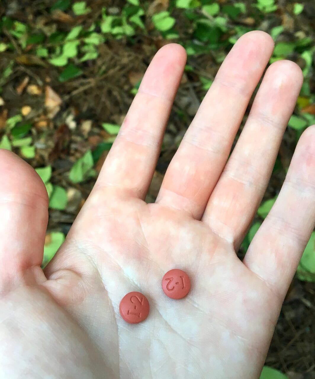
4. Ibuprofen
This one is kind of a downer, because no one likes to think about being in pain while hiking, but chances are that any thru-hiker will want some “vitamin I” while on a long-distance backpacking trip. When the difference between not being able to get out of your tent and having a great day hiking could be as simple as a couple ibuprofen, it makes sense to carry a few along.
For those hikers who are sensitive to ibuprofen, naproxen can be a good pain relief alternative.
Generic Ibuprofen (~$5 for a 50 pill bottle)
I’ve linked CVS here, but you can find a similar product and price at any pharmacy, grocery, or convenience store.
A tent seam waiting for some repair tape.
Photo by Zoë Symon
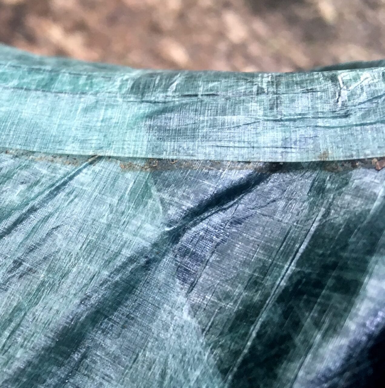
5. Gear Repair Tape
Frustrating things can happen sometimes, and thru-hikers definitely shouldn’t be stuck out on the trail with no way to repair a tent that has failed. Most gear repair tape is lightweight, strong, and completely worth it on the off chance that a tent, rain jacket, or other piece of gear gets damaged.
Plus, if you carry it, then you’ll never need it, right?! Some good options are below.
Gear Aid Tenacious Tape ($5.25, nylon)
Zpacks Seam Tape/Repair Tape ($3.50, dyneema)
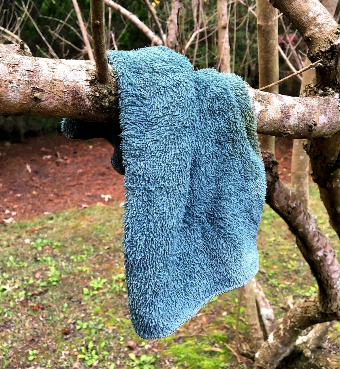
Hanging a small towel to dry after cleaning a cooking pot.
Photo by Zoë Symon
6. Small Towel
Many thru-hikers might consider a small towel an unnecessary luxury item, but it’s so lightweight and multipurpose that it can make it worth its weight.
Most small camp towels are absorbent, quick to dry, and can be used for a variety of purposes, from washing your cooking pot to washing your dusty trail legs before getting in your sleeping bag.
REI Co-op Multi-towel Lite ($9.95, 0.7 oz – Small)
PackTowl Nano ($9.95, 0.9 oz)
PackTowl Luxe ($12.95, 1.1 oz – Face)

Rope and paracord in a pile.
Photo by Emma Louise Comerford
7. Paracord
Talk to any thru-hiker about how they store their food, and you’ll find there’s an intense debate about whether to hang your food. However, in bear-prone areas like much of the Appalachian Trail and other long trails, it’s a good idea to be prepared just in case. Having some paracord in your pack will give you the option to hang your food if necessary, and can be useful in other situations too!
Consider taking your gift a step further and printing instructions for the PCT bear hang method to go with the paracord.
PMI 3mm Utility Cord ($5 for 50ft, 3.8oz)
Gear Aid 550 Paracord Utility Line ($6.50 for 30 ft, 2.6oz)
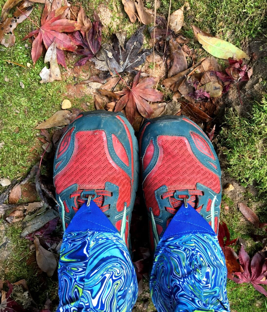
Dirty Girl Gaiters and trail runners go great together!
Photo by Zoë Symon
8. Gaiters
This is another item that could be just over the $20 mark depending on the brand you get, but gaiters are worth every penny.
Gaiters are so lightweight you won’t even notice you’re wearing them, but your feet will thank you because your shoes won’t fill with abrasive dirt and debris that can cause chafing and lead to other foot issues. The only problem is remembering to put them on before your shoes when you’re still half asleep. Some great options are below!
Altra Trail Gaiter ($20/pair ~1oz)
Dirty Girl Gaiters ($23/pair, ~1oz)
Outdoor Research Surge Running Gaiters ($28/pair, ~1oz)
Out of hand sanitizer! Oh no!
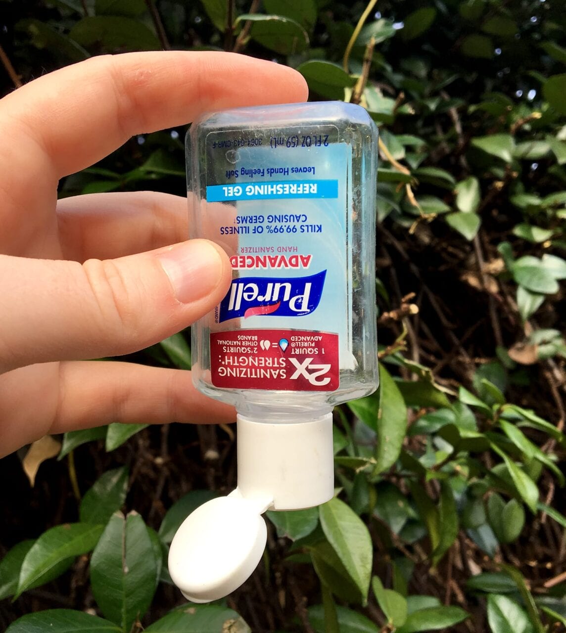
Photo by Zoë Symon
9. Hand Sanitizer
Another must-have for day hikers, section hikers, and thru-hikers. When you haven’t had a shower in a week, it’s probably a good idea to use some hand sanitizer before you eat. When you’re using the bathroom in the woods (or in a privy because, let’s be real, those things can be gross), you’ll probably want some hand sanitizer afterwards. When Grubby Joe Hiker sticks his dirty little fingers into the trail mix bag and then offers you some… well, you’ll probably just want to say no thanks.
Generic Hand Sanitizer (~$1.50 per 2oz bottle)
I’ve linked CVS here, but you can find a similar product and price at any pharmacy, grocery, or convenience store.
A postcard from the Appalachian Trail.
Photo by Zoë Symon
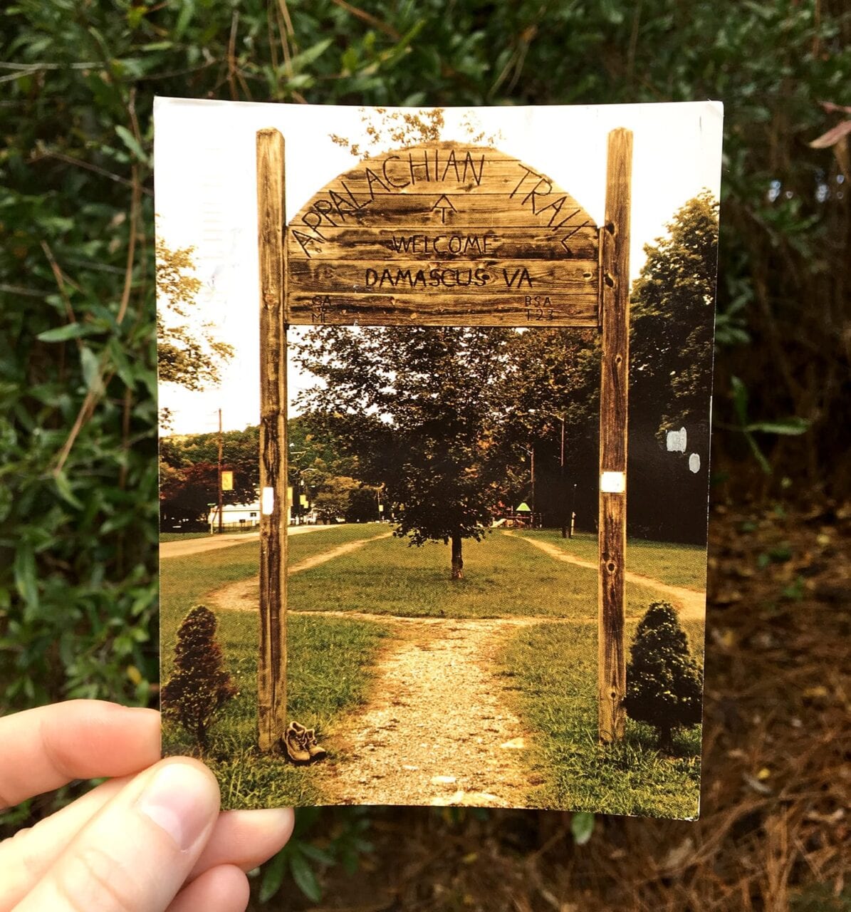
10. Postcard Stamps
A fun way for thru-hikers to keep in touch with family and friends while on the trail is by sending postcards from all the amazing places they have the opportunity to visit. However, with post office hours, it can be a pain to find stamps for the postcards.
An entire sheet of stamps might last a hiker for their entire trip! Consider gifting a pen as well, as it can be hard to find single pens for sale.
Postcard Stamps ($7 for a sheet of 20)
A thru-hiker uses the Guthook Guides app.
Photo by Jonas Jacobsson, screenshot courtesy of Atlas Guides
BONUS. Guthook Guides
Many of our trail guides are under $20. Browse our list of guides and consider giving the gift of Guthook!
Hikers and their gear.
Photo by Zoë Symon
Want to keep up with all that’s going on at Atlas Guides? Sign up for our newsletter!
Read more!
Check out some of our other blog posts.
Download our popular hiking and biking guides!
Trail guides that get you to places you’ve dreamed of.
As the makers of Guthook Guides, Bikepacking Guides, and Cyclewayz, we help you navigate the most popular trails around the world on your smartphone. Our hiking guides and biking guides work completely offline. Let Guthook guide your next adventure!
Showers Lake Vista, Tahoe Rim Trail
Photo courtesy of the Tahoe Rim Trail Association
Showers Lake Vista, Tahoe Rim Trail
Photo courtesy of the Tahoe Rim Trail Association
Trail guides that get you to places you’ve dreamed of.
As the makers of Guthook Guides, Bikepacking Guides, and Cyclewayz, we help you navigate the most popular trails around the world on your smartphone. Our hiking guides and biking guides work completely offline. Let Guthook guide your next adventure!
Download our popular hiking and biking guides!
About the Author
Zoë Symon
Zoë grew up in North Carolina and first heard of the Appalachian Trail during her time in college. In 2016, she took a leave of absence from her job and thru-hiked the trail. This adventure fostered her love for the outdoors and for hiking. Currently, she explores the public lands of Oregon. In 2017 she joined the team at Atlas Guides as Creative Director. She spends her days improving experiences for all our users.

Katahdin Woods & Waters Monument Planning
Planning an adventure? Check out our popular trail guides! 4.8 stars (17K+ ratings)
Wassataquoik Stream in Katahdin Woods & Waters National Monument.
Photo by Ryan Linn
Katahdin Woods & Waters National Monument Management Planning
So much of our outdoor recreation happens on public land, but what happens when a new land is added to the public trust? Here’s a taste of the National Park planning process from a recent public meeting for Katahdin Woods & Waters National Monument.
Ryan Linn Inside Atlas Guides 11/23/2018
Ryan Linn
Inside Atlas Guides
11/23/2018
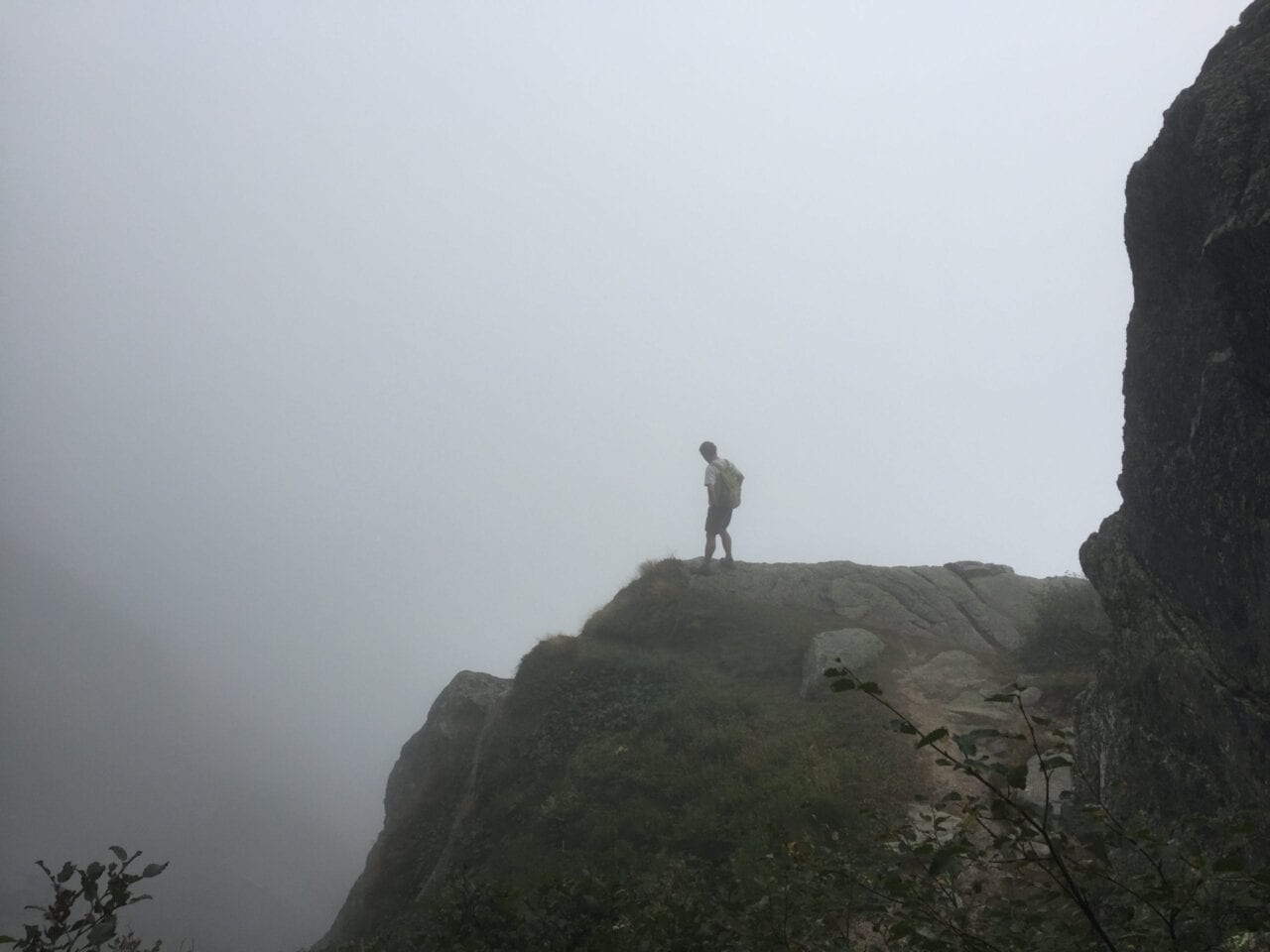
In 2016, Katahdin Woods & Waters National Monument became the newest addition to our National Parks system. This bit of forest in northern Maine is a great place to cross-country ski, mountain bike, canoe, and hike. You can also begin a longer trip on the International Appalachian Trail and hike to Canada. For now, there’s little in the Monument besides some trails, old logging roads, and campsites, so it feels especially wild. But I was curious about the plans for the future. Would there be a visitor’s center? Would the roads be paved? And would the Park Service build more shelters and campsites, or even trails? It’s been two years since the Monument’s designation, and it still seems as remote and quiet as ever.
I’ve found great solitude in the Monument in my past trips there, which is something I treasure about it. But I also hope for more visitors to enjoy the wilderness there, which leads to a dilemma. As more visitors came to see the Monument, could some of that wildness be lost? Now that the campaign to create the Monument was over, I figured I’d just have to wait and see.
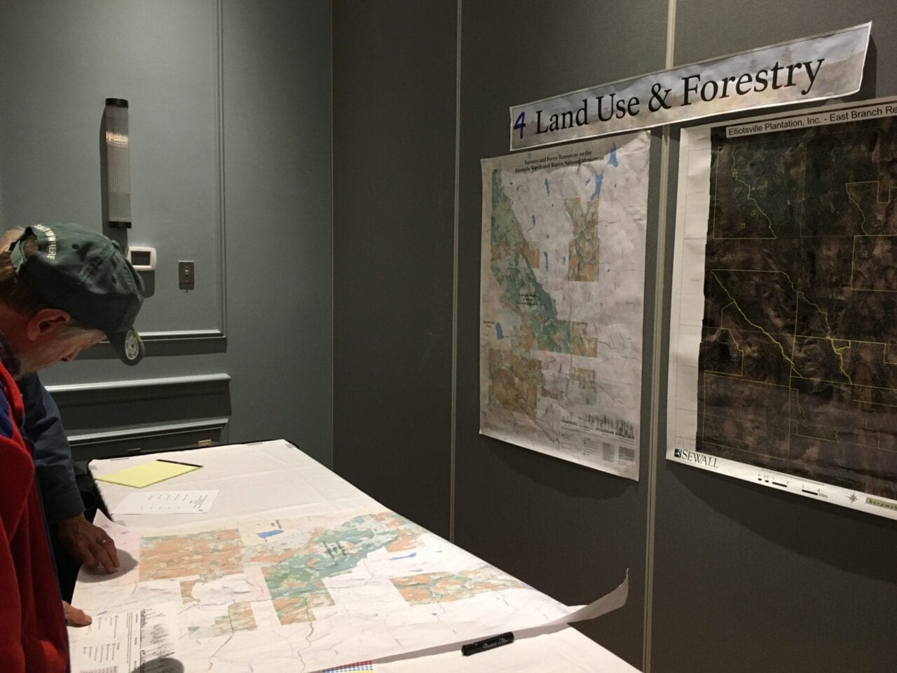
Land use maps showing forest cover and access points for Katahdin Woods & Waters.
Photo by Ryan Linn
Earlier this year the Park Service sent several emails announcing public meetings all throughout the state. A few months later, more emails arrived, announcing more public meetings. I saw town names like Stacyville, Presque Isle, Bangor— all over the state but far from me. Each notice mentioned that the meetings would be used to help draft the management plan for the Monument, so I hoped I could make it to one. In November I finally got my chance: the next meeting would be held in South Portland.
At the meeting, I found a friendly crowd of curious members of the public already looking over displays that highlighted aspects of Monument management needs. I looked through displays about Natural Resources, Land Use & Forestry, Scenic & Cultural Resources, Recreation, and Other Unique Qualities. A planning team, consisting of a local consulting firm, National Park Service employees, and volunteers, had set up the meeting. With public meetings like this one, they would listen to the public, then use what they’d learned to create a management plan for the future of the Monument.
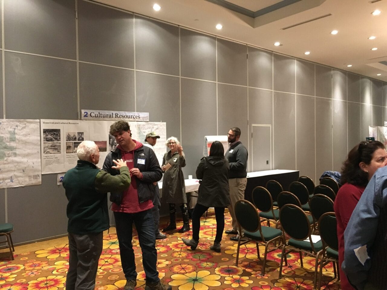
Members of the public discussing hiking, history, and paddling in Katahdin Woods & Waters.
Photo by Ryan Linn
As we wandered about, visiting the displays, volunteers explained some of the necessities of the Monument’s management. Mostly, they answered our questions and took notes about what we wanted from the Monument. Many of us went for the “Recreation” station, but I saw plenty of interest in history and conservation as well. I was excited to see all this enthusiasm for just the possibilities of what could come. The few suggestions I made were pretty obscure, but the volunteers seemed eager to hear about them anyway. Some day, maybe I’ll go to the Monument again to backpack on some of the trails that I suggested. Until then, it’s just nice to know that the management plan will take opinions like mine into account.
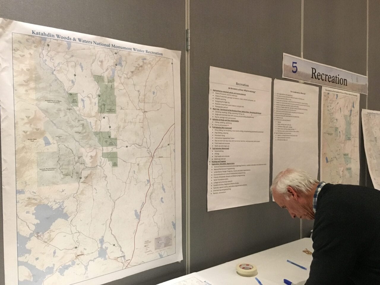
Past and current public comments for recreational use in Katahdin Woods & Waters.
Photo by Ryan Linn
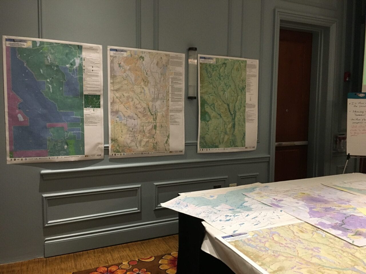
Maps of several types of natural resources in the National Monument.
Photo by Ryan Linn
There will be more public meetings for Katahdin Woods & Waters’s planning phase, and comments can sent online if you can’t make it to the meetings. And if you’re not interested in being a part of planning for this particular Monument, I encourage you to keep an eye out for opportunities to get involved in your local public lands. Especially with new parks, it’s well worth the time to weigh in on what you’d like to do and see during your future visits.
Want to keep up with all that’s going on at Atlas Guides? Sign up for our newsletter!
Read more!
Check out some related blog posts!
Download our popular hiking and biking guides!
Trail guides that get you to places you’ve dreamed of.
As the makers of Guthook Guides, Bikepacking Guides, and Cyclewayz, we help you navigate the most popular trails around the world on your smartphone. Our hiking guides and biking guides work completely offline. Let Guthook guide your next adventure!
Showers Lake Vista, Tahoe Rim Trail
Photo courtesy of the Tahoe Rim Trail Association
Showers Lake Vista, Tahoe Rim Trail
Photo courtesy of the Tahoe Rim Trail Association
Trail guides that get you to places you’ve dreamed of.
As the makers of Guthook Guides, Bikepacking Guides, and Cyclewayz, we help you navigate the most popular trails around the world on your smartphone. Our hiking guides and biking guides work completely offline. Let Guthook guide your next adventure!
Download our popular hiking and biking guides!
About the Author
Ryan Linn
Ryan’s trail name, “Guthook”, is where our apps get their name. Already an avid hiker, he hiked the Appalachian Trail, New England Trail, and Pacific Crest Trail before joining forces with Paul to create the Guthook Guides apps. Ryan handles iOS development for our apps from his office in Maine, and usually runs away to the forests and mountains throughout New England. He also volunteers with the Maine Appalachian Trail Club and the Natural Resources Council of Maine. Baxter State Park in Maine is his happy place.
What is thru-hiking?
Planning an adventure? Check out our popular trail guides! 4.8 stars (17K+ ratings)
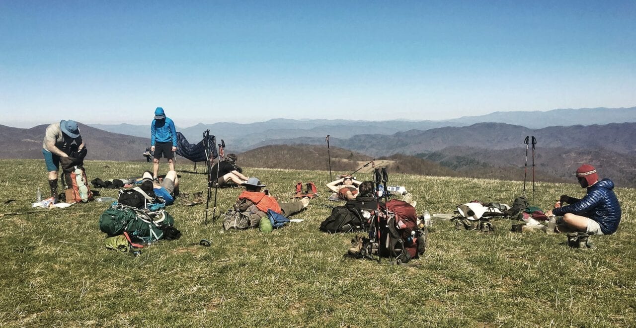
A group of thru-hikers starting at the southern PCT terminus.
What is thru-hiking?
The definition of "thru-hiking" cannot be found in a dictionary. That's why I asked these thru-hikers to share what thru-hiking means to them.
Natalie McMillan Inside Atlas Guides 11/9/2018
Natalie McMillan
Inside Atlas Guides
11/9/2018
I’m going to be honest… before I started working here at Atlas Guides, I had no idea what thru-hiking was. I love to hike, but for some reason (probably having to do with me being in a college bubble in this small town of Flagstaff for the past five years), I had never heard of thru-hiking. So I googled it… and this is what I found:
Good ol’ Wikipedia: Thru-hiking, or through-hiking, is hiking a long-distance trail end-to-end within one hiking season. In the United States, the term is most commonly associated with the Appalachian Trail (AT), the Pacific Crest Trail (PCT), and the Continental Divide Trail (CDT), but also refers to other end-to-end hikes.
The Appalachian Trail Conservancy defines a thru-hike as: “a hike of the entire A.T. in 12 months or less.”
Working at Atlas Guides for almost a year and a half now, I have been completely immersed in the thru-hiking culture and the community that surrounds it. Yet, I still can’t explain what thru-hiking means to me because I have never done one. Yes, it’s possible that I may do one sometime in the future, but right now I’ve just developed my ideas off of the countless articles I’ve read and all of the stories I’ve followed from hikers on Instagram.
I wanted to capture the perspective of people who have actually been out on the trail and experienced thru-hiking themselves. So that’s what I did and this is what they had to say:
“What does thru-hiking mean to you?”
Trail name: Portabella, PCT 2017
Photo by Isabel Reeb
“Thru hiking means the home and a family I never knew I was missing. It means the experiences I never knew I needed. It means the confidence I never knew I had. It means the pain I never knew I could handle. It means the love I will never forget. It means all the emotions I cannot put into words. Thru hiking means everything to me.” – Portabella, PCT 2017
“Solace.” – Nikki Hughes
Trail name: BarefootHiker, AT 2017
Photo by BarefootHiker
“Intoxicating. Fresh air, nice and uplifting people, more of the best people Earth has to offer, all for one crazy destination. You’re left filled and emptied all at once. You’re left craving more. It’s such a powerful feeling.” – BarefootHiker, AT 2017
“Start to finish.” – @bfdtcb
Trail name: Freeball, AT 2015, CT 2016
Photo by Zoë
“Thru hiking means so many things. I’m Freeball and my first thru was the AT in 2015. I consequently caught the trail-bug and hiked the CT in 2016 and did 1000 miles on the PCT this past summer. For me, thru hiking means finding yourself one trail at a time when stripping your life to the minimal. It means being free and being in motion.” – Freeball, AT 2015, CT 2016
“#endlesssummer” – Grouchy, CDT 2018
Trail name: Relish, PCT 2018
Photo by Relish
“I wanted to live simply, to find space, and to see upon reflection, what it taught about how to live. I wanted to live far away, unfettered by the clutter modern life. I wanted to find rest in the quiet ways of nature, to be present there from sunrise to sunset to star filled night. I wanted to find healing for an over busied life, and relish in the soothing touch of a life outdoors. I wanted to see for myself if life couldn’t be improved by reducing it to only the most fundamental of things. I wanted to learn the lands of the American West, not by way of academia but by my feet. I wanted to witness the full display of grandeur nature had to offer, from the smallest spec of sand to the most majestic mountain pass. I wanted to experience hardship, hunger, pain and loneliness and discover what lessons these had to offer. I hoped to live boldly. To test the human spirit and attempt a truly awesome feat. I wanted to be a model, to myself my friends, family and strangers alike, to live a life daring enough to attempt a great dream.”- Relish, PCT 2018
“Fueled by gummy candy. Lots of it.” – Flip, AT 2017
Trail name: Earthcake, PCT 2016
Photo by Earthcake
“Being part of a community.” – Earthcake, PCT 2016
Trail name: Thumbs, PNT 2017
Photo by Thumbs
“It means everything… freedom, peace, strength, resilience, overcoming all obstacles. It means so much to my mental health, physical health, and is always at the forefront of my mind. It’s the place you can just be and only have to worry about walking from resupply to resupply.” -Thumbs, PNT 2017
Trail name: DeadPoet87
Photo by DeadPoet87
“Utopia!” – DeadPoet87
Trail name: White Cheddar, AT 2017
Photo by Ginger
“Freedom.” – White Cheddar

Trail name: Sprout, AT 2018
Photo by Sprout
“Hmmm… FRITOS!!” – Sprout, AT 2018
Want to keep up with all that’s going on at Atlas Guides? Sign up for our newsletter!
Read more!
Check out other blog posts!
Download our popular hiking and biking guides!
Trail guides that get you to places you’ve dreamed of.
As the makers of Guthook Guides, Bikepacking Guides, and Cyclewayz, we help you navigate the most popular trails around the world on your smartphone. Our hiking guides and biking guides work completely offline. Let Guthook guide your next adventure!
Showers Lake Vista, Tahoe Rim Trail
Photo courtesy of the Tahoe Rim Trail Association
Showers Lake Vista, Tahoe Rim Trail
Photo courtesy of the Tahoe Rim Trail Association
Trail guides that get you to places you’ve dreamed of.
As the makers of Guthook Guides, Bikepacking Guides, and Cyclewayz, we help you navigate the most popular trails around the world on your smartphone. Our hiking guides and biking guides work completely offline. Let Guthook guide your next adventure!
Download our popular hiking and biking guides!
About the Author
Natalie McMillan
Natalie grew up hiking in Arizona where she fell in love with the outdoors. Her favorite hikes are to Havasu Falls in the Grand Canyon and Angel’s Landing in Zion National Park, UT. She loves taking pictures of people, places, and nature, which might explain why she has almost 47,000 photos currently residing on her phone. She takes care of all things related to social media and marketing and recently moved to Denver, CO from Flagstaff, AZ. You may find her frolicking around the trails and mountains of Colorado, or exploring the new city she gets to call home.
Pathways to the Future: Rivers and Trails 2018
Planning an adventure? Check out our popular trail guides! 4.8 stars (17K+ ratings)
On a tour at Fort Vancouver National Historic Site.
Photo by Zoë Symon
Pathways to the Future: Rivers and Trails 2018
Last week I had the privilege of traveling to Vancouver, Washington for a symposium celebrating the 50th anniversary of both the National Trails System Act and the Wild and Scenic Rivers Act.
Zoë Symon Inside Atlas Guides 10/26/2018
Zoë Symon
Inside Atlas Guides
10/26/2018
Last week I had the privilege of traveling to Vancouver, Washington for a symposium celebrating the 50th anniversary of both the National Trails System Act and the Wild and Scenic Rivers Act. The four-day event, organized by the Partnership for the National Trails System and the River Management Society, celebrated the past 50 years of protecting trails and rivers, and addressed key issues as we look forward to the next 50 years.
It brought together a variety of different individuals and organizations, from federal agencies to non-profit conservation groups to for-profit companies.
Since the signing of the National Trails System Act, the system has grown from two National Scenic Trails to 11. It has also expanded further with the addition of 19 National Historic Trails, almost 1300 National Recreation Trails, and thousands of miles of rail trails.
Day 1
Before the official opening of the trails portion of the conference, I attended a session put on by the Leave No Trace Center for Outdoor Ethics. As an avid hiker and someone who lived religiously by LNT guidelines while thru-hiking the Appalachian Trail, I was eager to learn more and expand my knowledge of LNT best practices.
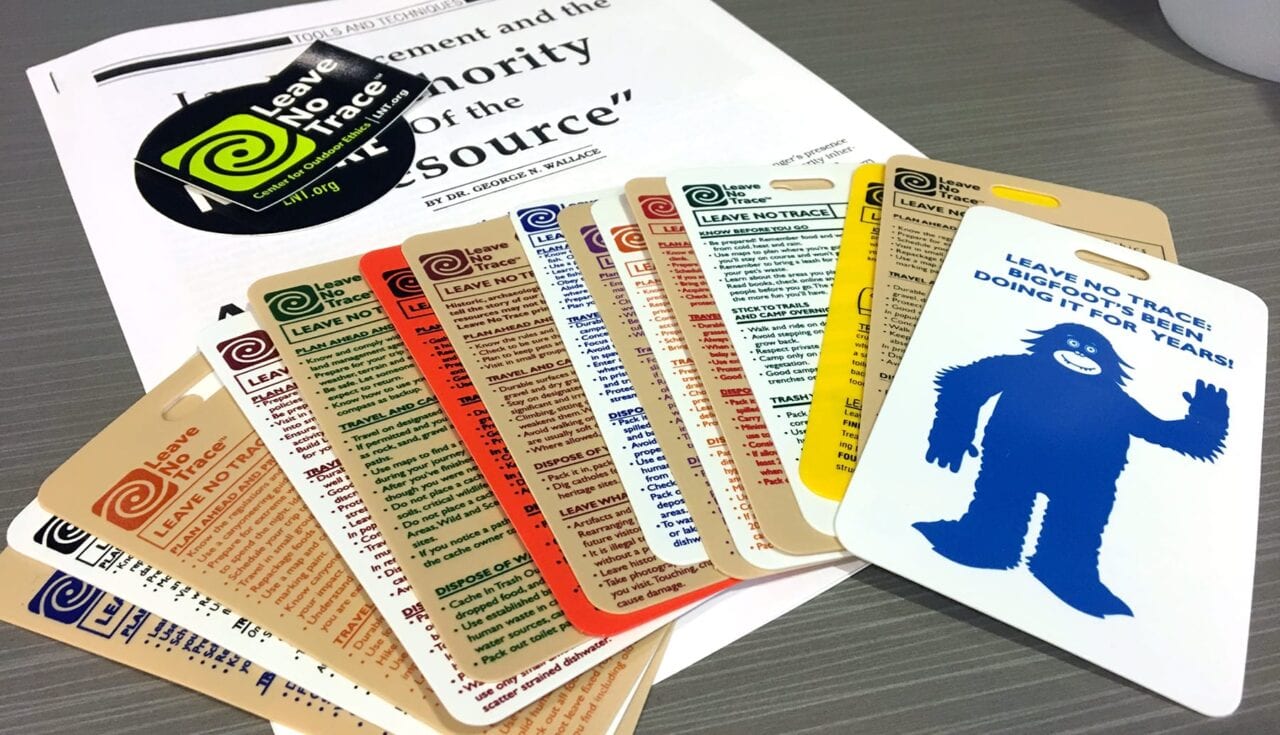
Leave No Trace education materials.
Photo by Zoë Symon
In addition to expanding my own knowledge, I was thrilled to come away with a greater understanding for how to teach and persuade others to follow Leave No Trace best practices.
When educating or persuading others, it really comes down to the why. People are more likely to follow Leave No Trace practices when they understand the impact of their actions.
However, this comes with a huge caveat: an authoritative stance and tone will not help you. Finding common ground and approaching the issue with positivity can influence long-term change in behaviors. In turn, this creates a lasting impact and cultivating intrinsically motivated stewards of the land.
Almost all park or trail visitors want to take care of the land and want to be a part of the solution.
Day 2
Day two of the event opened with a keynote speech by Carolyn Finney, author of Black Faces, White Spaces: Reimagining the Relationship of African Americans to the Great Outdoors. She discussed issues of diversity and inclusion in the outdoors. This set the tone for a major theme of the next few days of talks.
While we were all there to celebrate the work of the past 50 years, it is also important to address issues and conversations that still lie ahead.
To date, public lands recreation and management has been done by a largely homogenous group of people. Dr. Finney opened the door for ongoing conversations about how to engage people from more diverse backgrounds with the outdoors and especially with public lands.
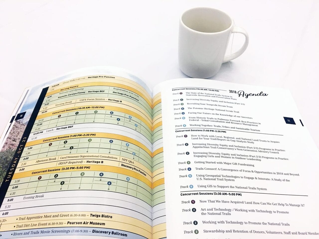
Reading the program for Day 2.
Photo by Zoë Symon
After Dr. Finney’s opening talk, I attended another session about diversity and inclusion. A panel of speakers from the Next 100 Coalition engaged audience members in a discussion about how to begin doing the hard work of bringing diverse perspectives into the conversation.
The discussion covered many topics, but often came back to the idea of stories and narrative. If we, as an entire community, can accept, embrace, and listen to stories from a variety of perspectives, we can discover our shared narrative and common values and start from there.
After the panel, I attended two talks about using technology to help manage outdoor spaces. Specifically, using GIS. The first talk discussed the gaps in adoption of GIS technology among management agencies and conservation groups. The difference in size, funding, and capability of organizations has a huge impact on their ability to implement GIS technology effectively to help manage their piece of public land.
The second talk dealt with using GIS technology. This technology can help create better tools and materials for conservation organizations and the general public. They discussed the use of ArcGIS Online to create a robust database of trail data. This enables individual organizations to more effectively create and share materials, including interactive Story Maps.
The fourth talk of the day was centered around arts on public lands. Arts on National Trails and in National Parks can help engage the community. Artist in Residence programs can help provide opportunities for artists. The last talk of the day discussed technology on the trail and gave advice for using technology to promote National Trails.
In the evening, I attended a film screening for a variety of films about public lands, trails, and wild rivers. They were thought provoking, inspiring, and beautiful!
Day 3
The third day of the symposium was devoted to day-long field trips. The one I chose to attend was Enduring Stories of Tribal Survivance & Collaboration Along the Columbia River.
This session focused on telling stories of native peoples. These stories that have largely been left out of the mainstream narrative of parks and other locations along the Columbia River. This field trip was hosted by the Confluence Project, a group dedicated to telling these stories.
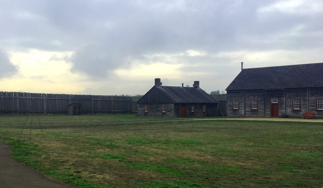
Inside Fort Vancouver National Historic Site.
Photo by Zoë Symon
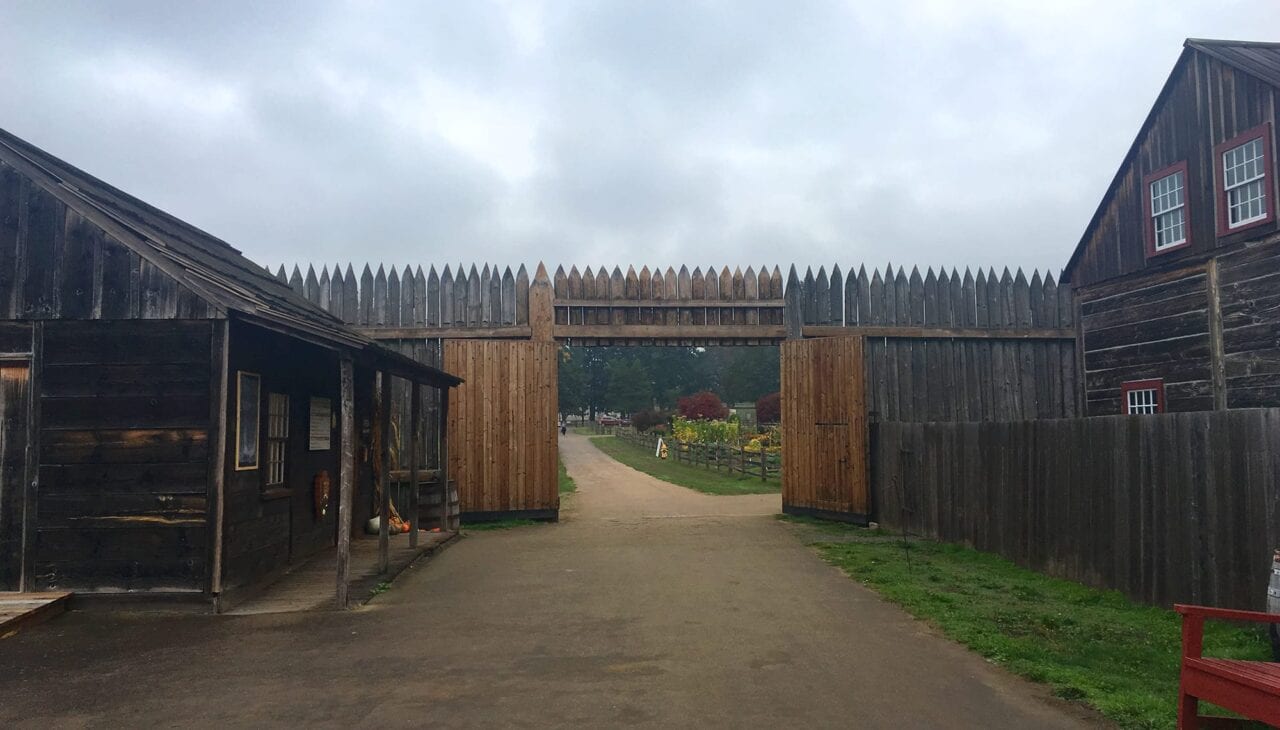
Our first stop was to Fort Vancouver National Historic Site. Fort Vancouver was originally a main depot for the Hudson’s Bay Company. It was an early center of trade for settlers in the Pacific Northwest. Much of that trade occurred with the Chinook peoples who lived along the Columbia River.
There is a complicated history of diversity, land ownership, and land theft that occurred in this area. This complicated history is often not told from all perspectives.
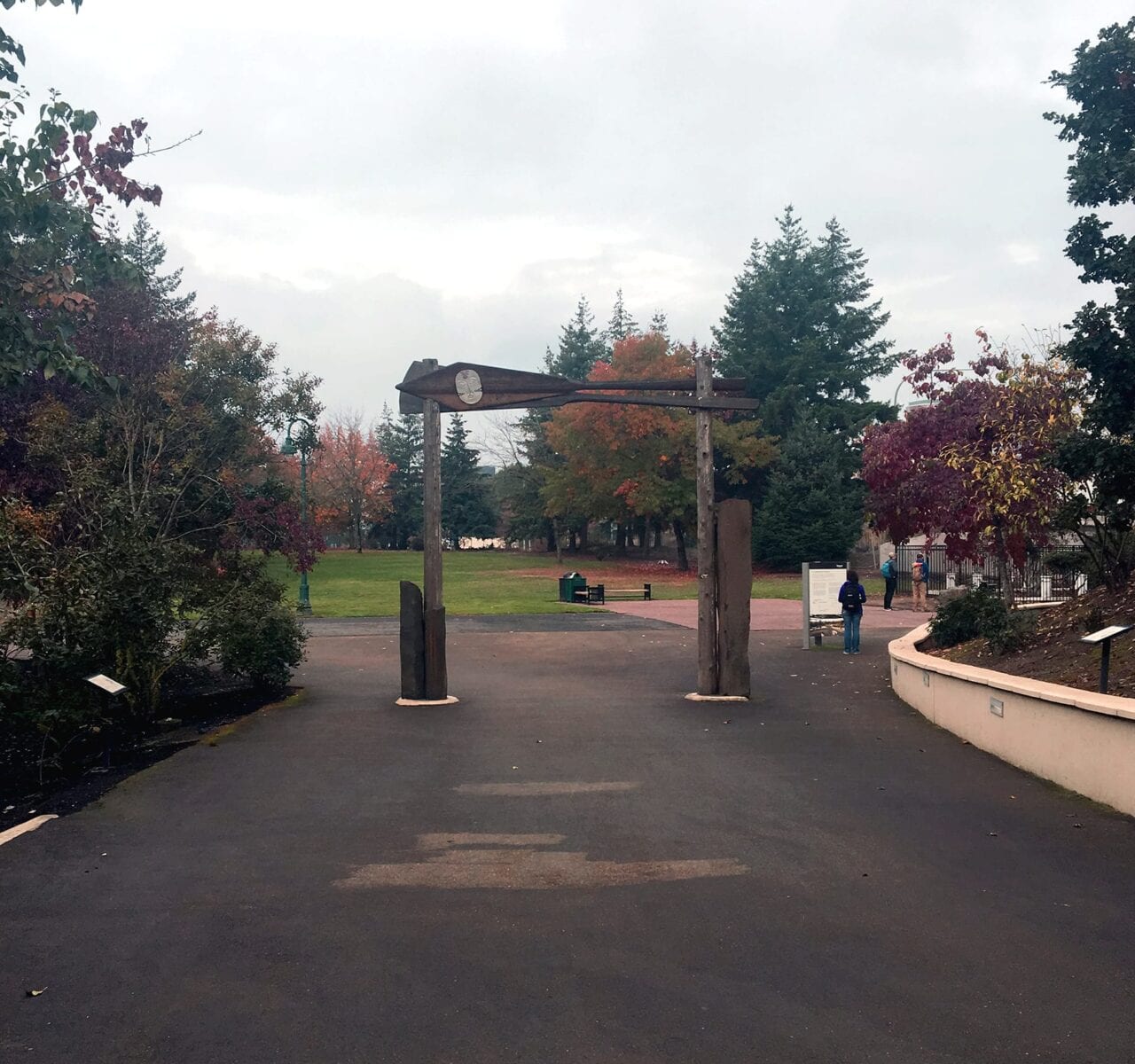
The Welcome Gate on the Vancouver Land Bridge.
Photo by Zoë Symon
Near Fort Vancouver is the Vancouver Land Bridge. It is an earth-covered pedestrian bridge that arcs over State Route 14, reconnecting historic Fort Vancouver with the Columbia River. It was created as part of the Confluence Project.
Confluence describes the project like this:
“Learn about the site’s indigenous plants as you walk along the land bridge, which leads you up to a grand view of the river and the surrounding mountains. From the south, walk under the land bridge’s Welcome Gate, designed by Native American artist Lillian Pitt. Two cedar canoe panels, each adorned with a cast-glass sculpture of a Chinook woman’s face, evoke the site’s role as a historic tribal crossroads as well as a point of contact between European and Native people.”
We spoke with Lillian and learned about her people’s history (as well as other Native tribes) with the Columbia River. Afterwards, we traveled to the Sandy River Delta to visit Maya Lin’s Bird Blind.
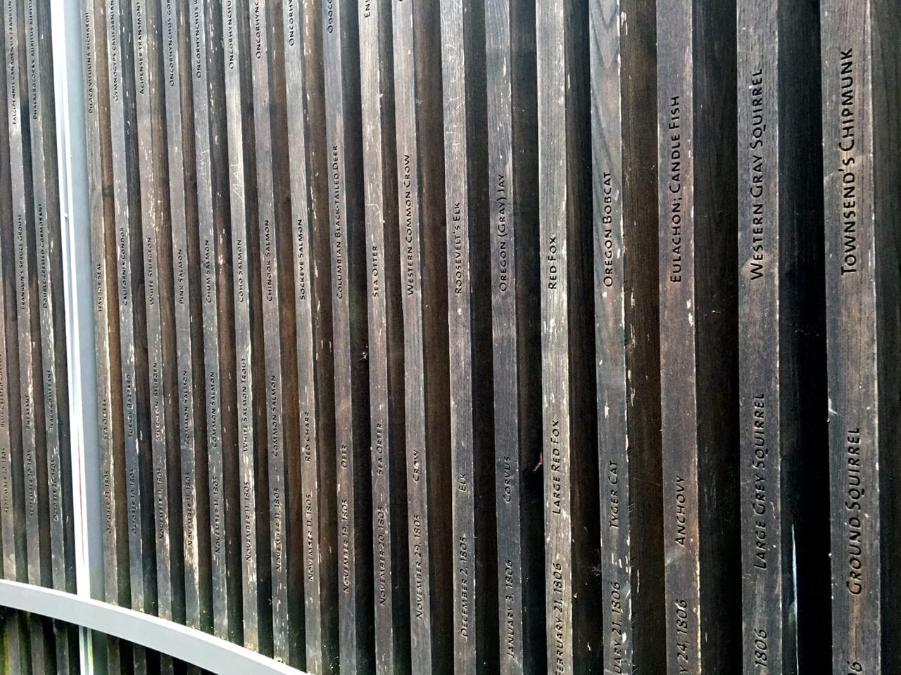
A section of Maya Lin’s Bird Blind.
Photo by Zoë Symon
The Bird Blind is a historical record of creatures seen and described by Lewis and Clark. It also acts as a commentary on the environmental destruction that has occurred in the area.
“The vertical wooden slats of the bird blind are inscribed with the name and current status of each of the 134 species Lewis and Clark noted on their westward journey.” (Confluence Project)
Through the efforts of multiple groups, the area around the Sandy River Delta is being restored.
Day 4
Continuing with the theme of diversity, inclusion, and engagement in the outdoors, the opening morning of the 4th day featured two speakers. Marya Skotte from the National Park Foundation discussed a new initiative created to help management agencies and conservation organizations better engage with the communities they serve.
Nicole Browning from REI discussed the company’s approach to equity in the outdoors, specifically focusing on the recent Force of Nature campaign to, among other things, increase the representation and voice that women have when it comes to being in and protecting our outdoor spaces.
The first talk of the day focused on ways to establish, defend, and define the trail corridor for National Scenic and Historic Trails. The speaker, from the BLM office managing the Iditarod National Historic Trail, offered advice for organizations on how to balance protection of the natural space with engagement in recreation opportunities. He also discussed using surveying techniques to determine and protect viewsheds and other features of the natural space.
Two members of the National Park Service gave the second talk of the day, and focused on the innovative ways that the Overmountain Victory National Scenic Trail has created and maintained local partnerships to secure the centerline and trail corridor through Federal, State, and Private Lands.
Their work is ongoing, but has so far been successful and beneficial. Other trail management agencies can adopt the techniques they use for outreach. Agencies facing similar challenges from private landowner and state agency partnerships might especially find these strategies helpful.
The final session of the day focused on the Arizona Trail Association’s innovative approach to training and inspiring trail maintainers. Their goal, to have the best trained volunteer force, is helped by their incredible partnership with American Conservation Experience, an organization that helps them organize in-depth training sessions for their community of Trail Stewards on the Arizona Trail. They have called this the Trail Skills Institute.
In particular, they address the challenges with maintaining a trail that traverses a variety of different landscapes including desert. Different landscapes require different techniques, and the ATA works closely with ACE to develop intensive training programs. These have been wildly popular—a good problem to have.
The closing keynote was an eloquent and moving event with author Philip Connors, author of Fire Season: Field Notes from a Wilderness Lookout and A Song for the River.
Conclusion
My experience at Pathways to the Future was inspiring, motivating, and challenging. It left me excited to do what I can. I hope to help to bring new ideas and energy to the stories around public lands, recreation, and the environment.
Links and Resources
Partnership for the National Trails System
http://pnts.org/
50th Anniversary National Trails System
https://www.trails50.org/
River Management Society
https://www.river-management.org/
Leave No Trace Center for Outdoor Ethics
https://lnt.org/
Next 100 Coalition
http://next100coalition.org/
The Confluence Project
http://www.confluenceproject.org/
National Park Foundation
https://www.nationalparks.org/
REI: Force of Nature
https://www.rei.com/h/force-of-nature
Arizona Trail Association: Trail Skills Institute
https://aztrail.org/get-involved/trail-skills-institute/
American Conservation Experience
http://www.usaconservation.org/
Want to keep up with all that’s going on at Atlas Guides? Sign up for our newsletter!
Read more!
Check out some of our other blog posts!
Download our popular hiking and biking guides!
Trail guides that get you to places you’ve dreamed of.
As the makers of Guthook Guides, Bikepacking Guides, and Cyclewayz, we help you navigate the most popular trails around the world on your smartphone. Our hiking guides and biking guides work completely offline. Let Guthook guide your next adventure!
Showers Lake Vista, Tahoe Rim Trail
Photo courtesy of the Tahoe Rim Trail Association
Showers Lake Vista, Tahoe Rim Trail
Photo courtesy of the Tahoe Rim Trail Association
Trail guides that get you to places you’ve dreamed of.
As the makers of Guthook Guides, Bikepacking Guides, and Cyclewayz, we help you navigate the most popular trails around the world on your smartphone. Our hiking guides and biking guides work completely offline. Let Guthook guide your next adventure!
Download our popular hiking and biking guides!
About the Author
Zoë Symon
Zoë grew up in North Carolina and first heard of the Appalachian Trail during her time in college. In 2016, she took a leave of absence from her job and thru-hiked the trail. This adventure fostered her love for the outdoors and for hiking. Currently, she explores the public lands of Oregon. In 2017 she joined the team at Atlas Guides as Creative Director. She spends her days improving experiences for all our users.
Guthook's Backpacking Food Planner
Planning an adventure? Check out our popular trail guides! 4.8 stars (17K+ ratings)
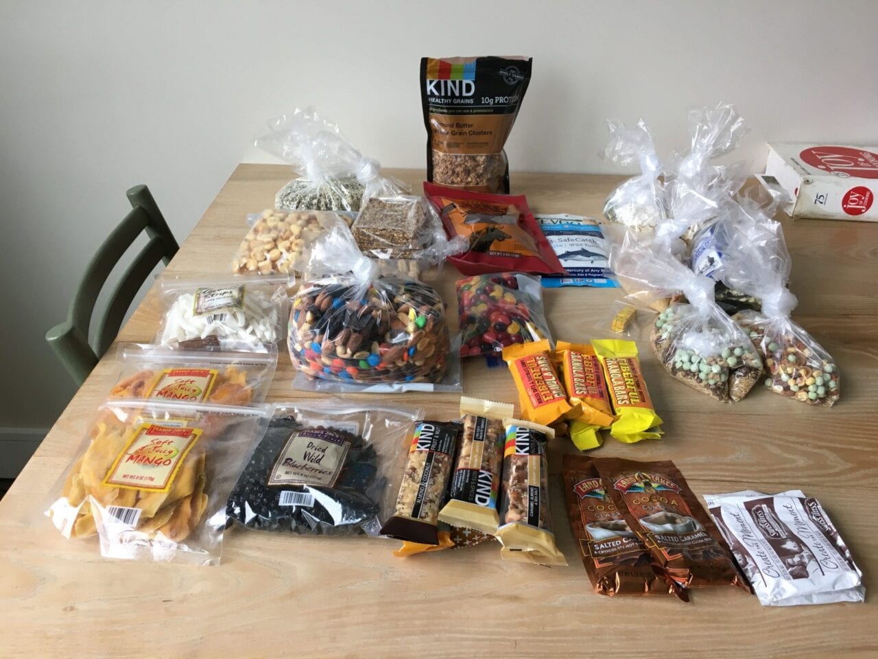
Food to bring on a week-long backpacking trip. Yum!
Photo by Ryan Linn
Guthook's Backpacking Food Planner
How much food do you pack for a backpacking trip? Why do you pack that much? How much SHOULD you pack? Everybody has different strategies, so pull up a chair and see what Guthook does to determine just the right amount to bring.
Ryan Linn Inside Atlas Guides 10/19/2018
Ryan Linn
Inside Atlas Guides
10/19/2018
You can check out my Backpacking Meal Planning spreadsheet in Google Sheets or Apple Numbers.
If you download in Google Sheets, go to “File → Make a copy” and make a copy of the excel sheet so you can edit your own.
It’s been a while since I was last on a thru-hike, so all of my backpacking trips these days require advance planning when it comes to food. If a backpacking trip is five days long, there’s no time to resupply in the middle, as I would on a months-long trip. Instead, I have to decide on everything I’m going to bring with me right from the start.
Over the past few years, I’ve developed a system that works well for me. This system, rather than counting calories, assumes that the food I pack is sufficiently calorie-dense, and focuses instead on the weight of food I bring, as well as the amount I don’t end up eating on the trip. This helps me decide just how much bring on the next trip, and hopefully increase efficiency.
The plan involves one of a backpacking nerd’s favorite tools: a spreadsheet! You may have used spreadsheets to plan what gear you take in your pack. This is basically the same, but for counting ounces of food rather than gear. Start by deciding on how many pounds of food you’ll bring per day— 1.5 to 2 pounds is pretty standard. Then decide how a day’s food weight will be divided between breakfast, lunch/snacks, and dinner. After returning home, you can see just how well you did, and how much food comes back.

On the trail, it’s time to dig in.
Photo by Ryan Linn
Here’s how my food planning went on a recent 5-day backpacking trip in the Elk Range of Colorado. Since 2 pounds per day has been my standard food weight in the past, I started with that. The previous year, on a trip in the Wind River Range of Wyoming, I’d easily finished 2.25 pounds per day. I figured the Colorado trip would be similar enough to the Wyoming trip, so I decided on 2.25. The terrain on the Colorado trip would be easier, and the mileage shorter, but temperatures would be colder. That’s two factors pointing toward bringing less food, and one for more. In retrospect, I could have packed less, like 2 pounds per day, but the higher number seemed fine anyway.
Once I decided on the 2.25 pounds per day (36 ounces), I split that into 7 ounces for each breakfast, 8 for each dinner, and 21 for the rest. I chose the breakfast and dinner weights based on some meals I had put together earlier, so that was easy. A big trip to Trader Joe’s and the local grocery store settled the rest.

Food plan for 4.5 days in the Maroon Bells Wilderness
Photo by Ryan Linn
Skipping ahead to the end of the story, I returned home from the trip with 28 ounces of food leftover. It wasn’t my best work in terms of planning, but still useful for future reference. It seems the lower mileage counted for more than the cooler temperatures, so I can take that into account on future trip planning. And since I plugged all of the remaining food weights into my spreadsheet, I find that I actually ate 1.75 pounds of food per day on average, and ate about 81% of my packed food. That spreadsheet will factor into next summer’s big trips, and I can adjust my targets accordingly in the future.

Post-hike analysis of the food brought on the trip.
Photo by Ryan Linn
You can check out my backpacking meal planning spreadsheet in Google Sheets or Apple Numbers.
When you click on Google Sheets, go to “File → Make a copy” and make a copy of the excel sheet so you can edit your own.
Want to keep up with all that’s going on at Atlas Guides? Sign up for our newsletter!
Read more!
Check out some related blog posts!
Download our popular hiking and biking guides!
Trail guides that get you to places you’ve dreamed of.
As the makers of Guthook Guides, Bikepacking Guides, and Cyclewayz, we help you navigate the most popular trails around the world on your smartphone. Our hiking guides and biking guides work completely offline. Let Guthook guide your next adventure!
Showers Lake Vista, Tahoe Rim Trail
Photo courtesy of the Tahoe Rim Trail Association
Showers Lake Vista, Tahoe Rim Trail
Photo courtesy of the Tahoe Rim Trail Association
Trail guides that get you to places you’ve dreamed of.
As the makers of Guthook Guides, Bikepacking Guides, and Cyclewayz, we help you navigate the most popular trails around the world on your smartphone. Our hiking guides and biking guides work completely offline. Let Guthook guide your next adventure!
Download our popular hiking and biking guides!
About the Author
Ryan Linn
Ryan is also known as “Guthook”, which is where our apps get their name. Already an avid hiker, he hiked the Appalachian Trail, New England Trail, and Pacific Crest Trail before joining forces with Paul to create the Guthook Guides apps. Ryan handles iOS development for our apps from his office in Maine, and usually runs away to the forests and mountains throughout New England. He also volunteers with the Maine Appalachian Trail Club and the Natural Resources Council of Maine. Baxter State Park in Maine is his happy place.